Items Similar to Vue de la Bastille, Old Masters Hand-Colored Engraving after Hyacinthe Rigaud
Want more images or videos?
Request additional images or videos from the seller
1 of 8
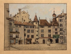
Vue de la Bastille, Old Masters Hand-Colored Engraving after Hyacinthe Rigaudof original: 1750
of original: 1750
$450
£344.29
€393.74
CA$640.76
A$694.02
CHF 367.58
MX$8,396.61
NOK 4,621.10
SEK 4,307.85
DKK 2,940.66
About the Item
Hyacinthe Rigaud, After, French (1659 -1743) - Vue de la Bastille, Year: of original: 1750, Medium: Hand-Colored Engraving, signed in the plate, Edition: ~1000, Image Size: 8.5 x 18.5 inches, Size: 14.5 x 22 in. (36.83 x 55.88 cm), Publisher: Musee Louvre Chalcographie (blindstamp), Description: From the collection of the late Larry Saphire
- Creation Year:of original: 1750
- Dimensions:Height: 14.5 in (36.83 cm)Width: 22 in (55.88 cm)
- Medium:
- Movement & Style:
- After:Hyacinthe Rigaud (1659 - 1743, French)
- Period:1750-1759
- Framing:Framing Options Available
- Condition:
- Gallery Location:Long Island City, NY
- Reference Number:Seller: RO840311stDibs: LU46616270982
About the Seller
4.9
Platinum Seller
Premium sellers with a 4.7+ rating and 24-hour response times
Established in 1979
1stDibs seller since 2014
3,190 sales on 1stDibs
Typical response time: 1 hour
- ShippingRetrieving quote...Shipping from: Long Island City, NY
- Return Policy
More From This Seller
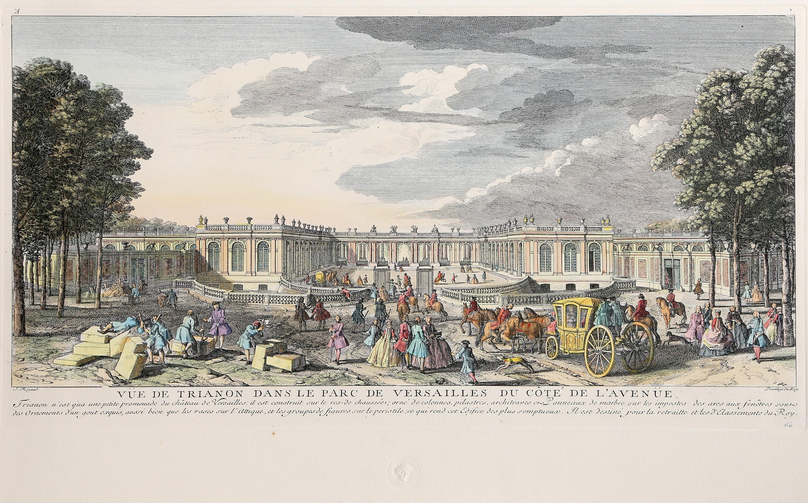
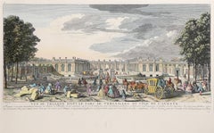
View AllVie de Trianon, Hand-Colored Baroque Engraving by Hyacinthe Rigaud
By Hyacinthe Rigaud
Located in Long Island City, NY
Vie de Trianon
Hyacinthe Rigaud (After), Catalan/French (1659–1743)
Date: of original: 1750
Hand-Colored Engraving, signed in the plate
Edition of ~1000
Image Size: 8.75 x 18.5 inche...
Category
1970s Baroque Landscape Prints
Materials
Engraving
Vue de Boston, American Realist Hand colored engraving by Franz Xavier Habermann
Located in Long Island City, NY
Franz Xavier Habermann, German (1721 - 1796) - Vue de Boston, Year: circa 1750, Medium: Hand colored engraving on laid paper, Image Size: 9.75 x 15.5 inches, Size: 13 x 17.5 in. (3...
Category
1750s American Realist Landscape Prints
Materials
Engraving
Arcade du Molard, Old Masters Hand colored etching by Charles Bastard
Located in Long Island City, NY
Charles Bastard, Swiss (1854 - 1924) - Arcade du Molard, Year: 1890, Medium: Hand colored etching on Arches, signed, titled and dated in the plate, Image Size: 6 x 8 inches, Size: ...
Category
1890s Old Masters Landscape Prints
Materials
Etching
La porte de femmes blanches a Utrecht, Etching by Herman Saftleven
By Herman Saftleven
Located in Long Island City, NY
Artist: Herman Saftleven, After by Amand Durand, Dutch (1580 - 1670) - La porte de femmes blanches a Utrecht, Medium: Heliogravure, Size: 11.5 x 9.5 in. (29.21 x 24.13 cm), Printer...
Category
Late 19th Century Old Masters More Prints
Materials
Etching
Les Grandes Misères de la Guerre, Old Masters Etching by Jacques Callot
By Jacques Callot
Located in Long Island City, NY
Jacques Callot, French (1592 - 1635) - Les Grandes Miseres de la Guerre (The Miseries of War), Medium: 2 Etchings on paper from Les Grandes Miseres de La Guerre portfolio, Image Size...
Category
Early 17th Century Baroque Prints and Multiples
Materials
Etching
Le Paysage a la Tour Carree Bartsch (B218), Heliogravure by Rembrandt van Rijn
By Rembrandt van Rijn
Located in Long Island City, NY
Rembrandt van Rijn, After by Amand Durand, Dutch (1606 - 1669) - Le Paysage a la Tour Carree Bartsch (B218), Year: 1878 (of original 1650), Medium: Heliogravure, Size: 3.5 x 6.25 i...
Category
Late 18th Century Prints and Multiples
Materials
Etching
You May Also Like
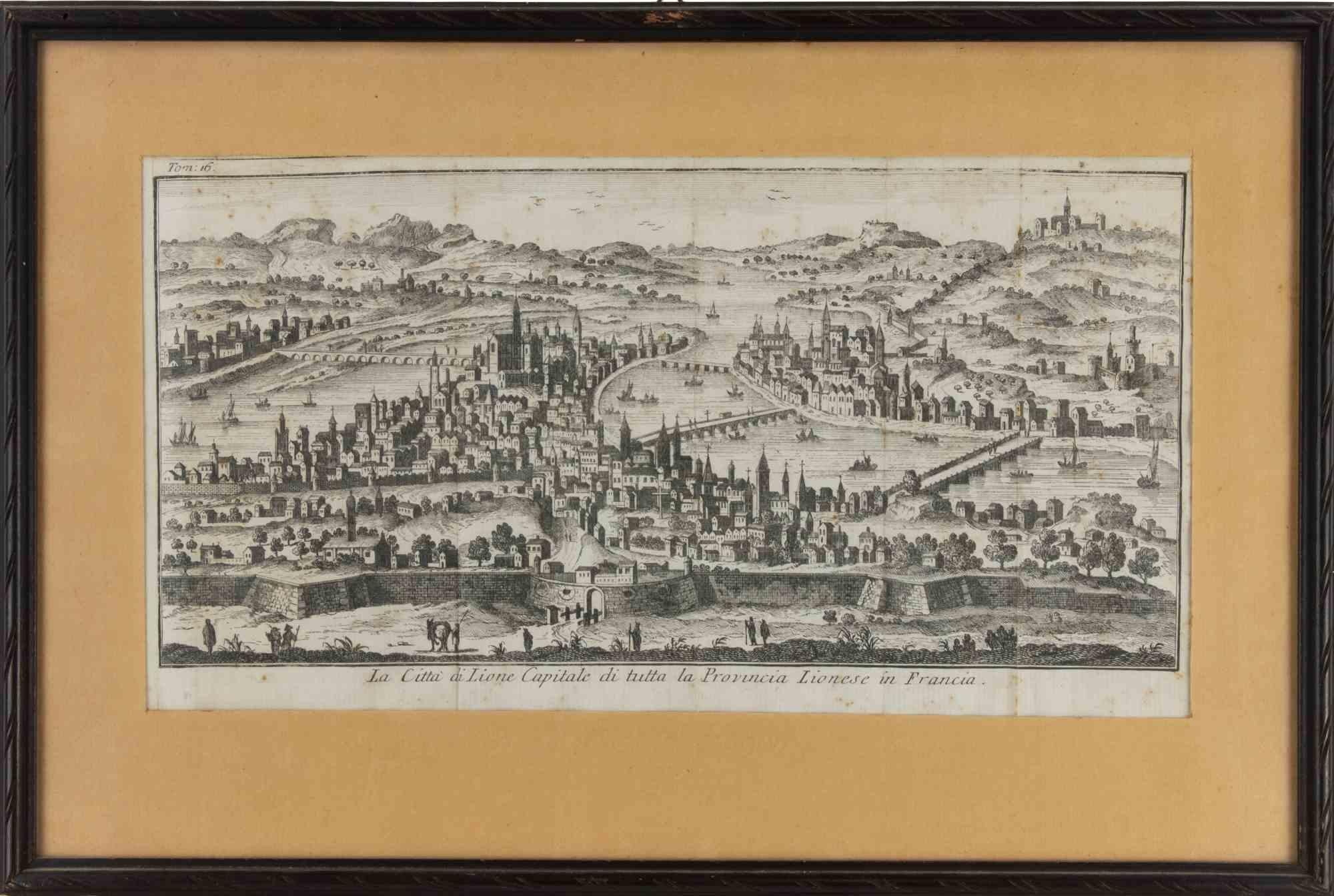
Ancient View of Lyon - Etching - 1748
Located in Roma, IT
Etching on paper realized in 1748.
Very good condition except for some minor foxing.
Includes a wooden frame cm. 27.5x41.5
Category
1740s Modern Figurative Prints
Materials
Etching

$178 Sale Price
25% Off
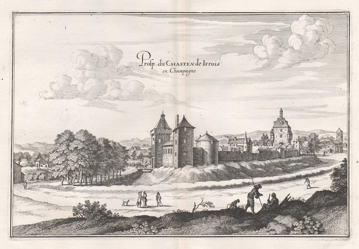
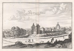
Castle of Irrois in Champagne, French architecture, mid 17th century engraving
By Matthaeus Merian
Located in Melbourne, Victoria
'Prosp. du Chasteau de Irrois en Champagne'
Copper-line engraving by Matthaeus Merian.
From 'Topographia Galliae', a fine series of engravings of 17th-century French landscapes, g...
Category
Mid-18th Century Rococo Landscape Prints
Materials
Engraving
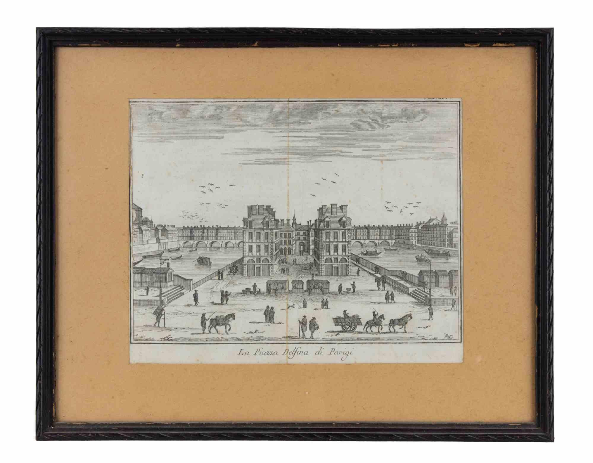
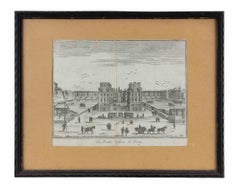
The Place Dauphine in Paris - Etching by Giambattista Albrizzi - 1745 ca
By Giambattista Albrizzi
Located in Roma, IT
Etching realized by Giambattista Albrizzi (1698-1777) for Thomas Salmon's Lo Stato presente di tutti i Paesi e Popoli do Mondo. Regno di Spagna.
Includes a contemporary wooden frame...
Category
1740s Modern Figurative Prints
Materials
Etching
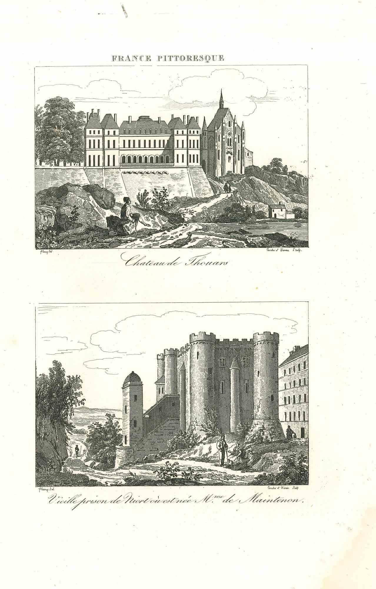
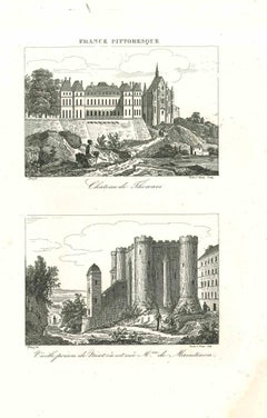
Ancient View of Chateau de Touars - Original Lithograph - 19th Century
Located in Roma, IT
Ancient View of Chateau de Touars is an original lithograph artwork realized by an Anonymous engraver of the 19th Century.
Printed in the series of "France Pittoresque".
Titled "...
Category
19th Century Modern Figurative Prints
Materials
Lithograph
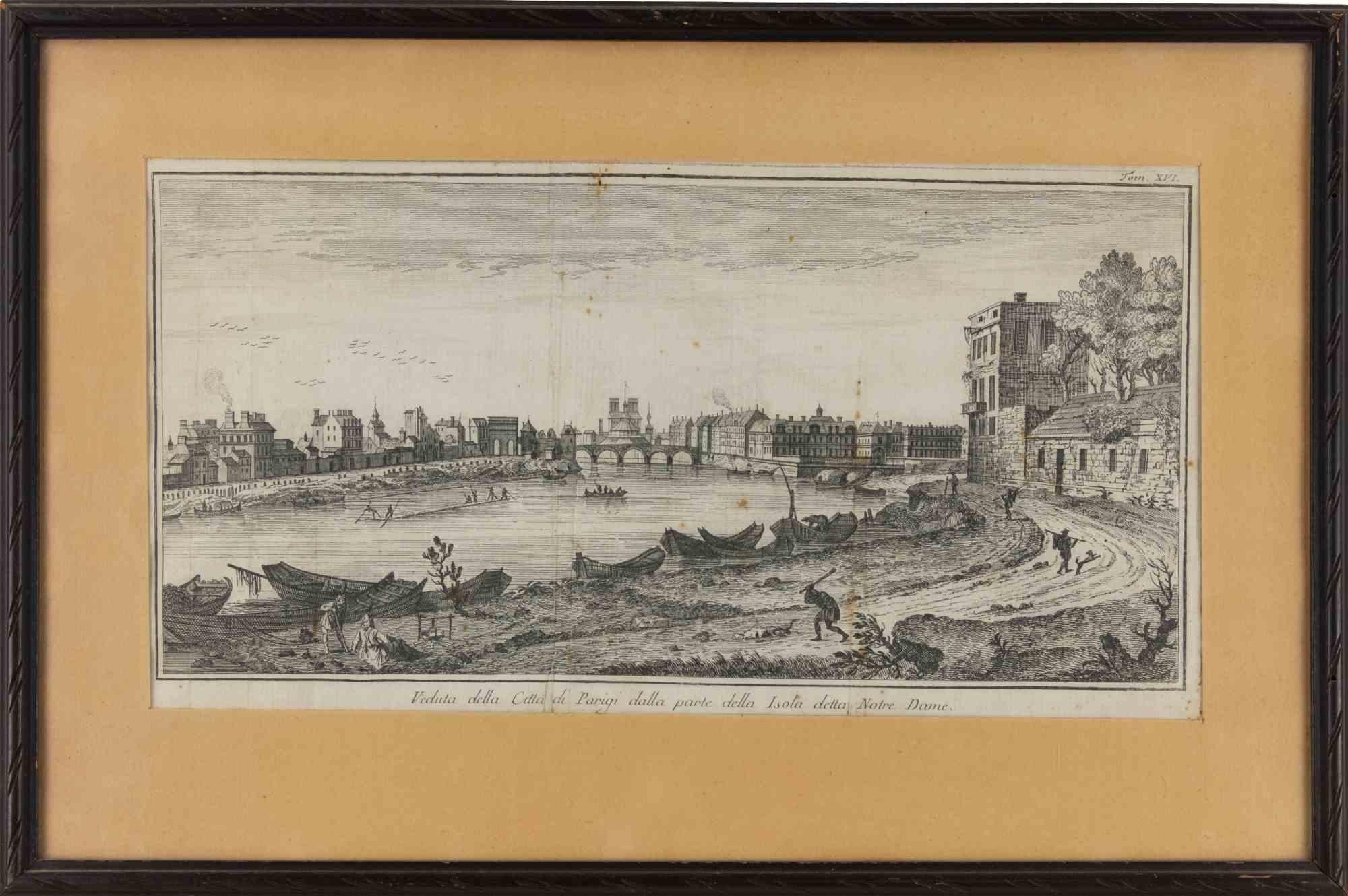
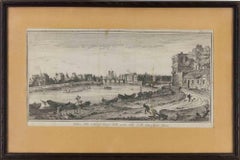
View of the City of Paris from the side of the island called... - Etching - 1748
Located in Roma, IT
Etching on paper realized in 1748.
Very good condition except for some minor foxing.
Includes a wooden frame cm. 27.5x41.5
Category
1740s Modern Abstract Prints
Materials
Etching
$249 Sale Price
25% Off
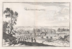
Castle and Town of Tanlay, French architecture, mid 17th century engraving
By Matthaeus Merian
Located in Melbourne, Victoria
'Prosp du Chasteau et Bourg de Tanlay'
Copper-line engraving by Matthaeus Merian.
From 'Topographia Galliae', a fine series of engravings of 17th-century French landscapes, garden...
Category
Mid-18th Century Rococo Landscape Prints
Materials
Engraving
More Ways To Browse
Antique Colored Engravings
Louvre Antique
Hand Colored Engraving
Antique Hand Colored Engraving
Antique Engraving Plates
Ben Sakoguchi
Bertha Landers
Bruno Zupan On Sale
Carroll Thayer Berry
Central Park Dali
Charles H Wells
Chauncey Ryder Etching
Christian Riese Lassen
Christo Valley Curtain
Claes Oldenburg Clothespin Kiss
Corwin Chase
Cradling Wheat
Dali Biological Garden