Items Similar to Huntingdonshire, English County Antique map, 1847
Want more images or videos?
Request additional images or videos from the seller
1 of 2
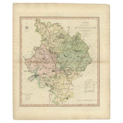
Isaac SlaterHuntingdonshire, English County Antique map, 18471847
1847
$195
£148.95
€171.16
CA$278.36
A$305.20
CHF 159.38
MX$3,672.75
NOK 2,008.67
SEK 1,888.67
DKK 1,278.25
About the Item
Steel-engraved map with original outline colouring by Isaac Slater. A detailed engraved map of the English county with title, scale, and key. Decorated with an uncoloured engraved view of 'Godmanchester Church'.
370mm by 240mm (platemark)
The map is loose and unframed.
- Creator:
- Creation Year:1847
- Dimensions:Height: 14.57 in (37 cm)Width: 9.45 in (24 cm)
- Medium:
- Movement & Style:
- Period:
- Condition:
- Gallery Location:Melbourne, AU
- Reference Number:Seller: MP96881stDibs: LU124426194762
About the Seller
5.0
Platinum Seller
Premium sellers with a 4.7+ rating and 24-hour response times
Established in 2005
1stDibs seller since 2019
616 sales on 1stDibs
Typical response time: <1 hour
- ShippingRetrieving quote...Shipping from: Melbourne, Australia
- Return Policy
Authenticity Guarantee
In the unlikely event there’s an issue with an item’s authenticity, contact us within 1 year for a full refund. DetailsMoney-Back Guarantee
If your item is not as described, is damaged in transit, or does not arrive, contact us within 7 days for a full refund. Details24-Hour Cancellation
You have a 24-hour grace period in which to reconsider your purchase, with no questions asked.Vetted Professional Sellers
Our world-class sellers must adhere to strict standards for service and quality, maintaining the integrity of our listings.Price-Match Guarantee
If you find that a seller listed the same item for a lower price elsewhere, we’ll match it.Trusted Global Delivery
Our best-in-class carrier network provides specialized shipping options worldwide, including custom delivery.More From This Seller
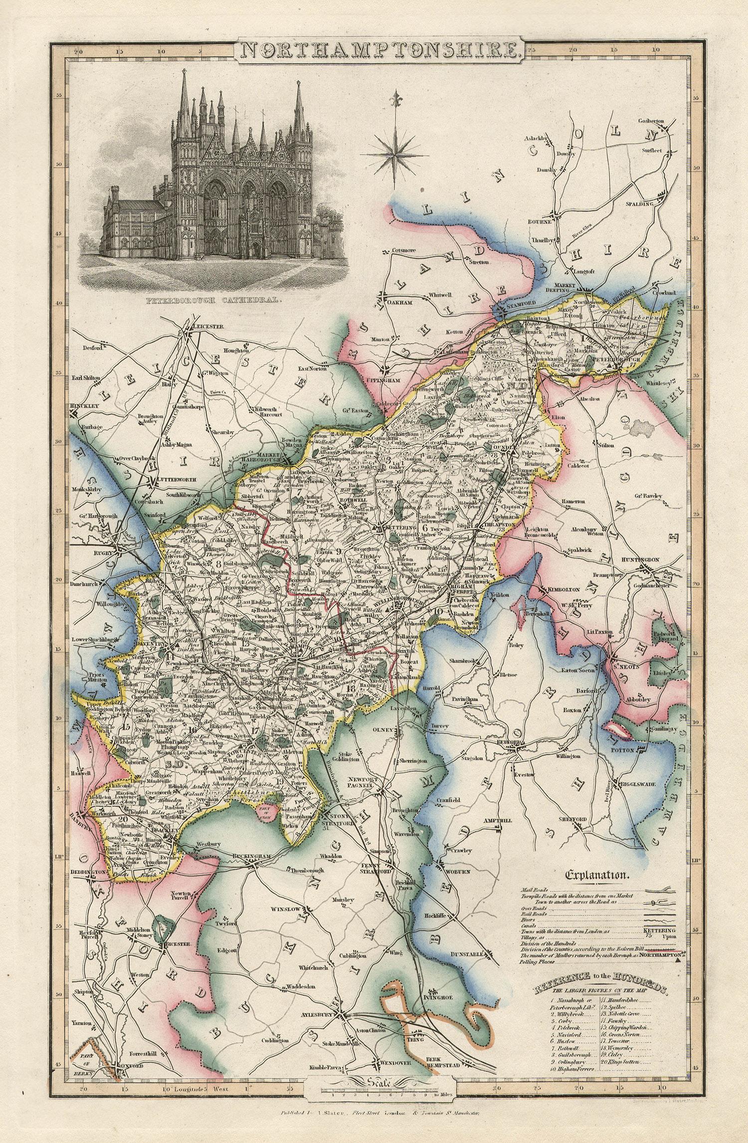
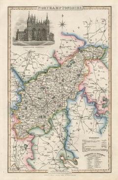
View AllNorthamptonshire, English County Antique map, 1847
By Isaac Slater
Located in Melbourne, Victoria
Steel-engraved map with original outline colouring by Isaac Slater. A detailed engraved map of the English county with title, scale, and key. Decorated with an uncoloured engraved view of 'Peterborough...
Category
19th Century Naturalistic Landscape Prints
Materials
Engraving
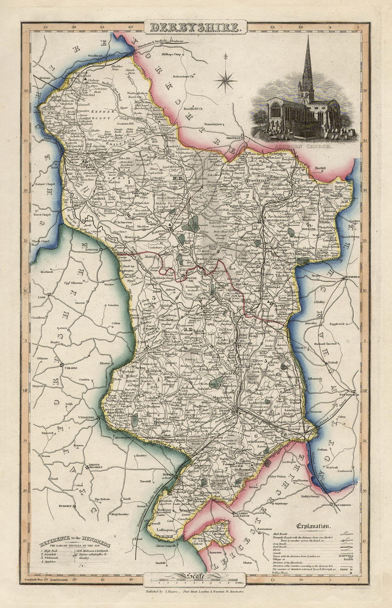
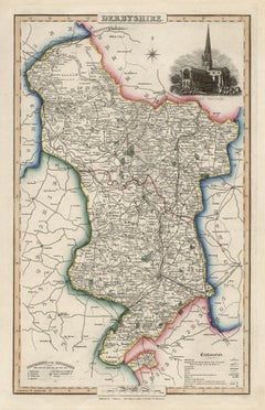
Derbyshire, English County Antique map, 1847
By Isaac Slater
Located in Melbourne, Victoria
Steel-engraved map with original outline colouring by Isaac Slater. A detailed engraved map of the English county with title, scale, and key. Decorated with an uncoloured engraved vi...
Category
19th Century Naturalistic Landscape Prints
Materials
Engraving
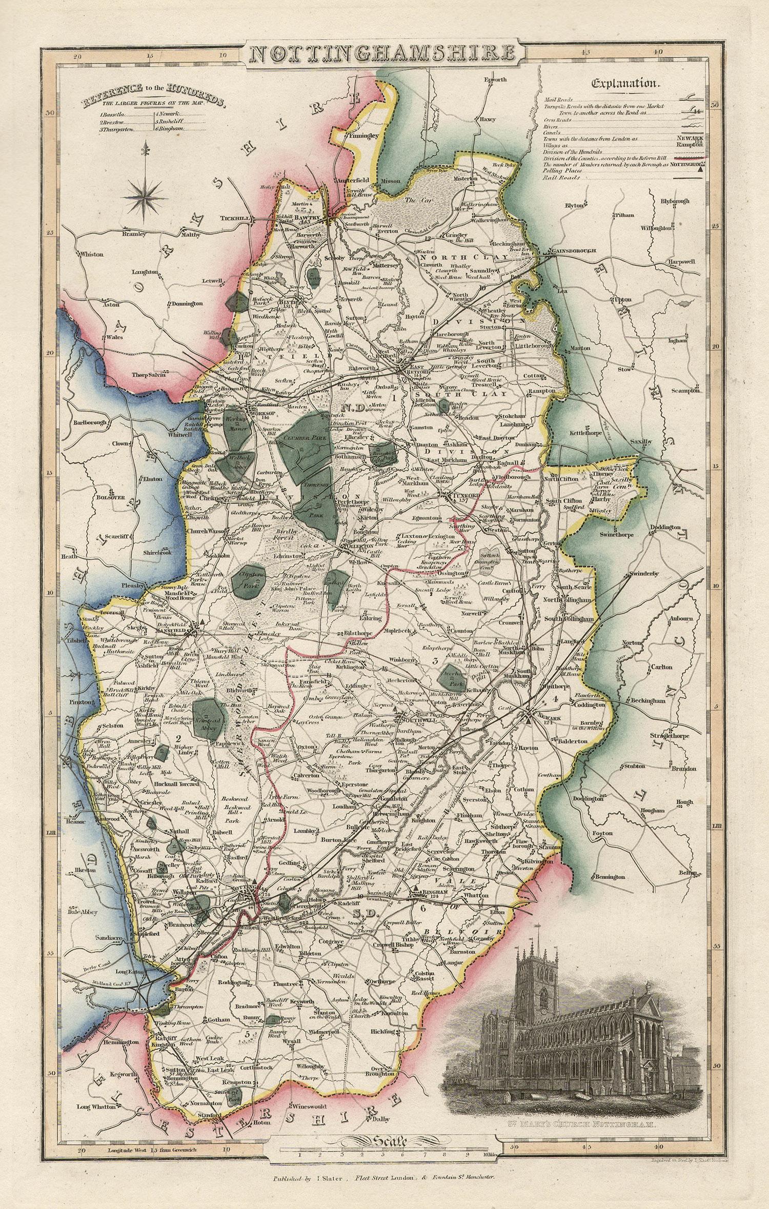
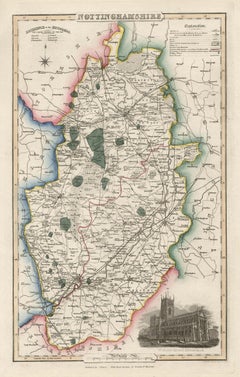
Nottinghamshire, English County Antique map, 1847
By Isaac Slater
Located in Melbourne, Victoria
Steel-engraved map with original outline colouring by Isaac Slater. A detailed engraved map of the English county with title, scale, and key. Decorated with an uncoloured engraved vi...
Category
19th Century Naturalistic Landscape Prints
Materials
Engraving
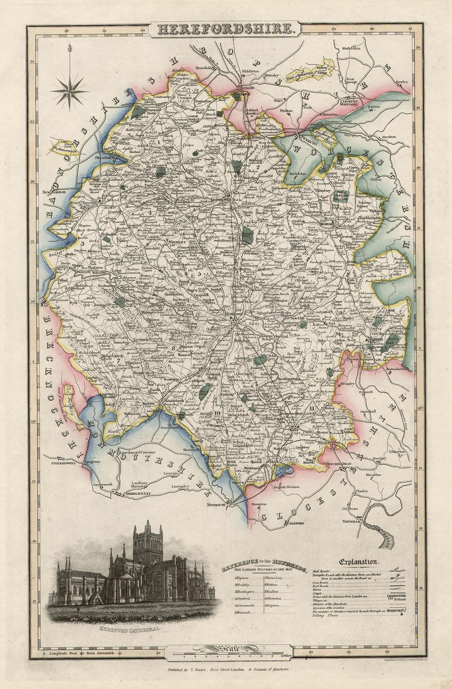
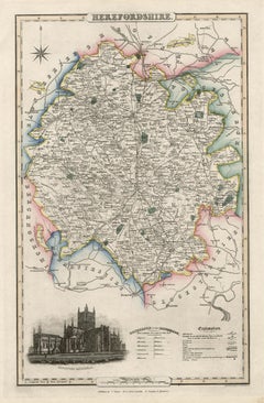
Herefordshire, English County Antique map, 1847
By Isaac Slater
Located in Melbourne, Victoria
Steel-engraved map with original outline colouring by Isaac Slater. A detailed engraved map of the English county with title, scale, and key. Decorated with an uncoloured engraved vi...
Category
19th Century Naturalistic Landscape Prints
Materials
Engraving
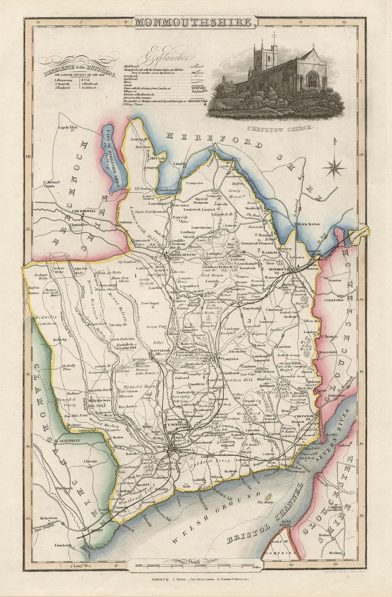
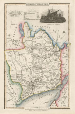
Monmouthshire, English County Antique map, 1847
By Isaac Slater
Located in Melbourne, Victoria
Steel-engraved map with original outline colouring by Isaac Slater. A detailed engraved map of the English county with title, scale, and key. Decorated with an uncoloured engraved vi...
Category
19th Century Naturalistic Landscape Prints
Materials
Engraving
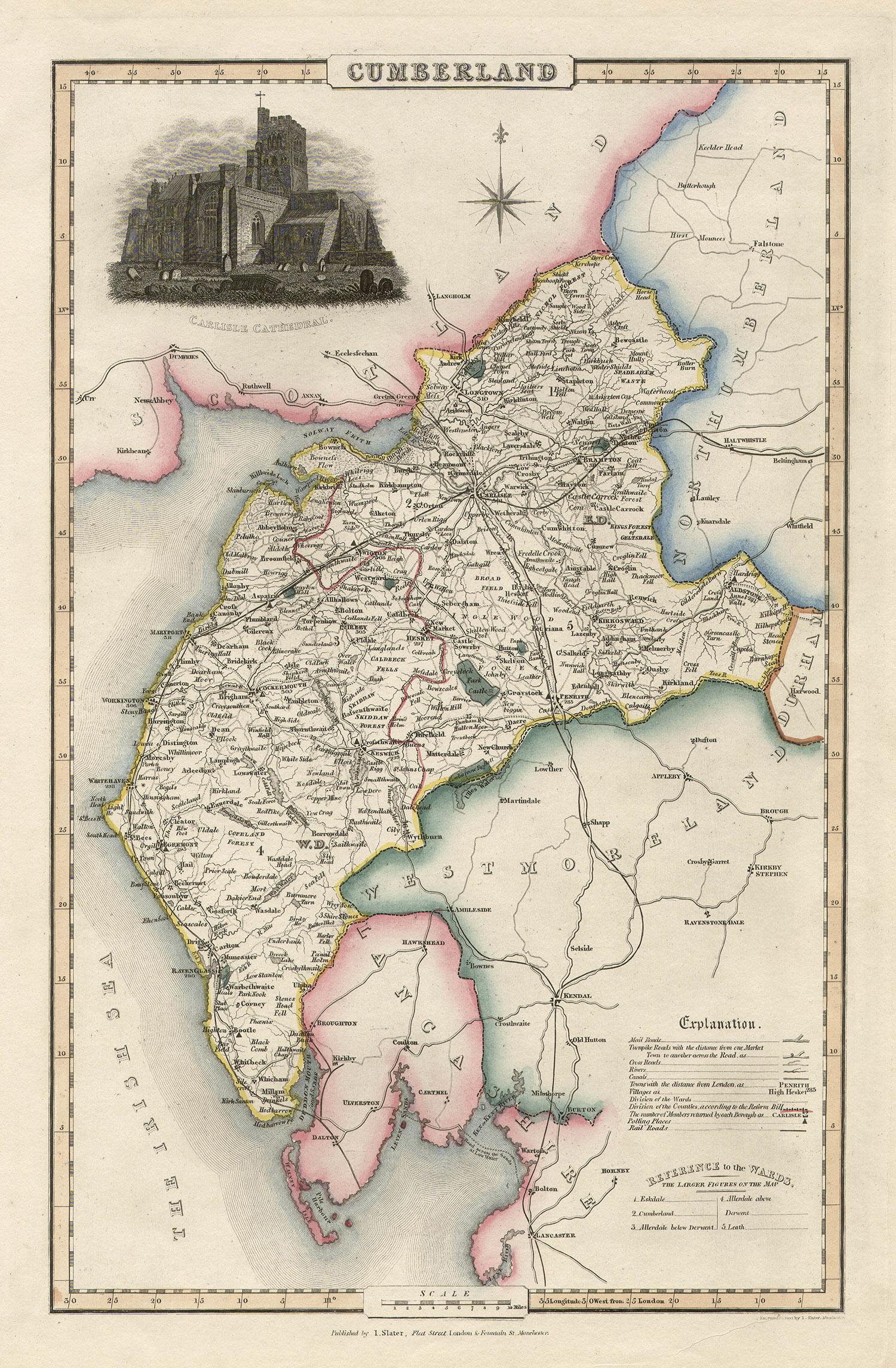
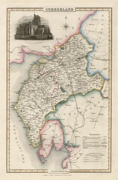
Cumberland, English County Antique map, 1847
By Isaac Slater
Located in Melbourne, Victoria
Steel-engraved map with original outline colouring by Isaac Slater. A detailed engraved map of the English county with title, scale, and key. Decorated with an uncoloured engraved vi...
Category
19th Century Naturalistic Landscape Prints
Materials
Engraving
You May Also Like
Original Antique English County Map, Huntingdonshire, J & C Walker, 1851
Located in St Annes, Lancashire
Great map of Huntingdonshire
Original colour
By J & C Walker
Published by Longman, Rees, Orme, Brown & Co. 1851
Unframed.
Category
Antique 1850s English Other Maps
Materials
Paper

Antique Decorative County Map of Lincolnshire, England, 1804
Located in Langweer, NL
Antique county map of Lincolnshire first published circa 1800 Cities illustrated include Grantham, Spalding, Boston, and Market Raisin.
Charles Smith was a cartographer working in...
Category
Antique Early 1800s Maps
Materials
Paper

$308 Sale Price
20% Off
Original Antique English County Map, Cambridgeshire, J & C Walker, 1851
Located in St Annes, Lancashire
Great map of Cambridgeshire
Original colour
By J & C Walker
Published by Longman, Rees, Orme, Brown & Co. 1851
Unframed.
Category
Antique 1850s English Other Maps
Materials
Paper

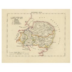
Antique Decorative County Map of Huntingdonshire, England, 1804
Located in Langweer, NL
Antique county map of Huntingdonshire first published c.1800. Cities illustrated include Kimbolton, Chesterton, Folkesworth, and Great Stewkeley.
Charles Smith was a cartographer ...
Category
Antique Early 1800s Maps
Materials
Paper
$308 Sale Price
20% Off
Antique 1830 Map of Eastern England with Suffolk, Norfolk Cambridge, Huntingdon
Located in Langweer, NL
Title: Antique 1830 Map of Eastern England with Suffolk, Norfolk, Cambridge, and Huntingdon
Description: This 1830 German-language map, titled Britisches Reich – A. Kon: England,...
Category
Antique 1830s Maps
Materials
Paper
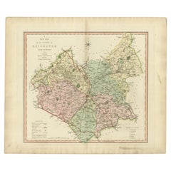
Antique County Map of Leicestershire, England, 1804
Located in Langweer, NL
Antique county map of Leicestershire first published c.1800. Villages, towns, and cities illustrated include Lutterworth, Ashby, Hinkley, and Marke...
Category
Antique Early 1800s Maps
Materials
Paper
$308 Sale Price
20% Off