Items Similar to The Abbey Church of St Albans (1810), engraving by James Basire
Want more images or videos?
Request additional images or videos from the seller
1 of 8
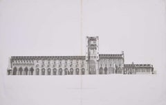
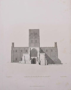
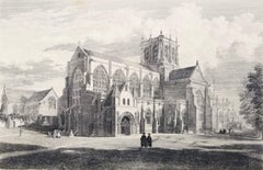
John BasireThe Abbey Church of St Albans (1810), engraving by James Basire1810
1810
$467.38
£340
€398.03
CA$652.77
A$707.94
CHF 371.84
MX$8,599.18
NOK 4,652.98
SEK 4,381.04
DKK 2,972.81
About the Item
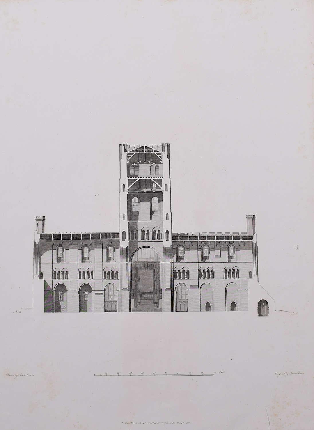
James Basire & John Carter
The Abbey Church of St Albans
Engraving
62 x 46 cm
This engraving was originally published by the Society of Antiquaries of London, an organisation dedicated to studying and preserving historical monuments. Recognising St Albans Cathedral as one of England's most significant medieval structures, the society commissioned a series of engravings in 1810 by James Basire--based on drawings by the architectural draughtsman John Carter. In doing so, the Antiquaries hoped to preserve and disseminate knowledge of England’s architectural heritage.
About the Seller
4.8
Vetted Professional Seller
Every seller passes strict standards for authenticity and reliability
Established in 2014
1stDibs seller since 2017
359 sales on 1stDibs
Typical response time: 6 hours
- ShippingRetrieving quote...Shipping from: London, United Kingdom
- Return Policy
Authenticity Guarantee
In the unlikely event there’s an issue with an item’s authenticity, contact us within 1 year for a full refund. DetailsMoney-Back Guarantee
If your item is not as described, is damaged in transit, or does not arrive, contact us within 7 days for a full refund. Details24-Hour Cancellation
You have a 24-hour grace period in which to reconsider your purchase, with no questions asked.Vetted Professional Sellers
Our world-class sellers must adhere to strict standards for service and quality, maintaining the integrity of our listings.Price-Match Guarantee
If you find that a seller listed the same item for a lower price elsewhere, we’ll match it.Trusted Global Delivery
Our best-in-class carrier network provides specialized shipping options worldwide, including custom delivery.More From This Seller
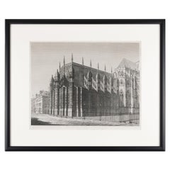
View AllSt Albans Cathedral (1810), engraving by James Basire
Located in London, GB
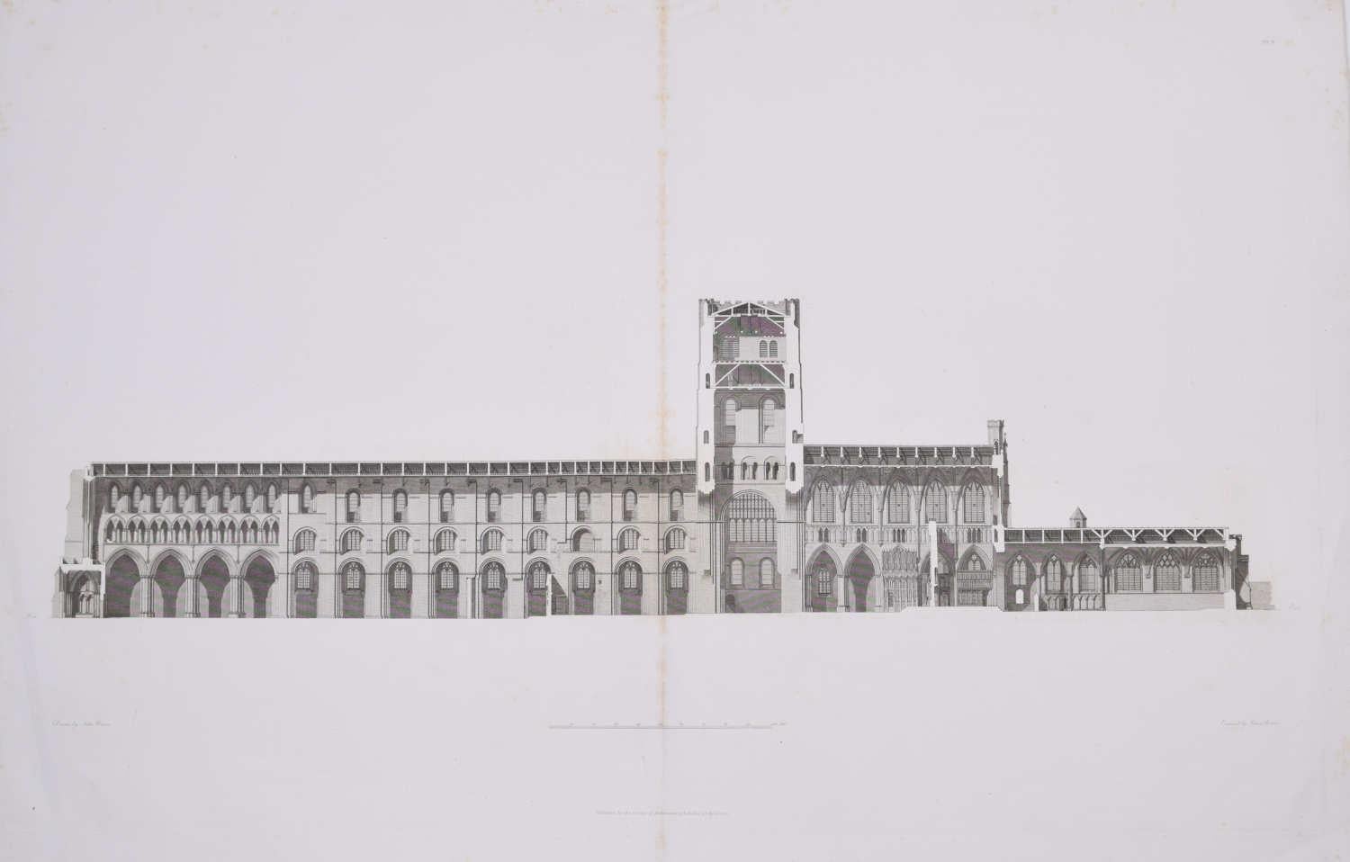
James Basire & John Carter
St Albans Cathedral
Engraving
62 x 46 cm
This engraving was originally published by the Society of Antiquaries of London, an organisation dedicated to ...
Category
1810s Realist Landscape Prints
Materials
Engraving

St Albans Cathedral (1810), engraving by James Basire
Located in London, GB
James Basire & John Carter
Floor plan of St Albans Cathedral
Engraving
61 x 95 cm
This engraving was originally published by the Society of Antiquaries of London, an organisation ...
Category
1810s Realist Landscape Prints
Materials
Engraving
St Albans Cathedral (1810), engraving by James Basire
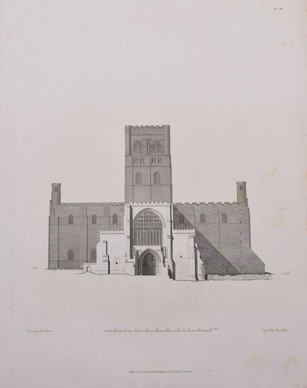
Located in London, GB
John Basire & John Carter
St Albans Cathedral
Engraving
62 x 46 cm
This engraving was originally published by the Society of Antiquaries of London, an organisation dedicated to st...
Category
1810s Realist Landscape Prints
Materials
Engraving
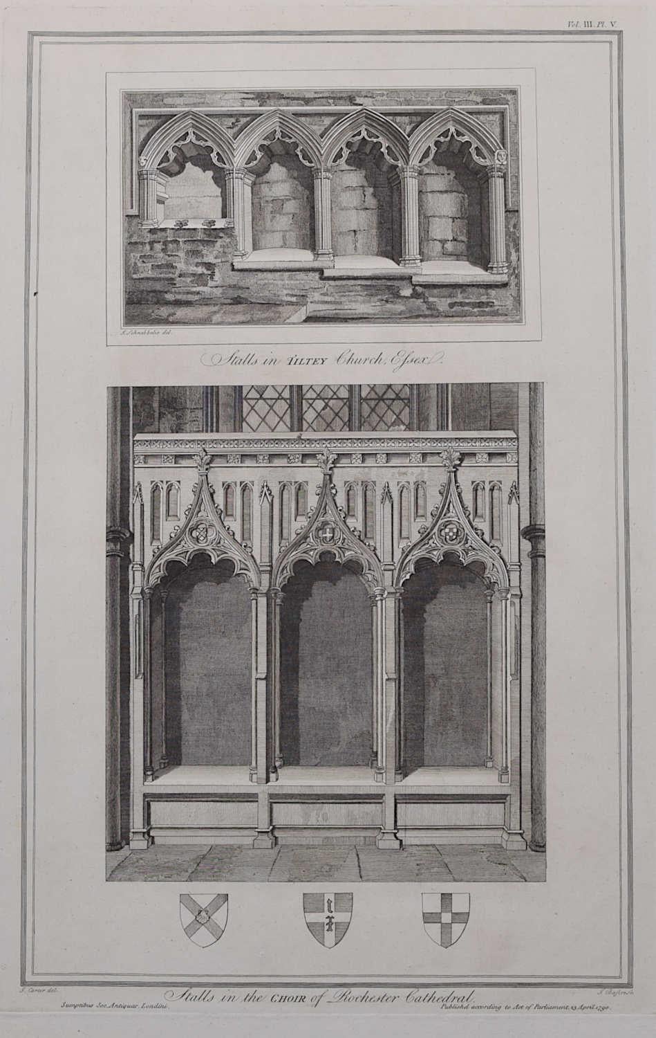
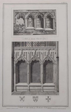
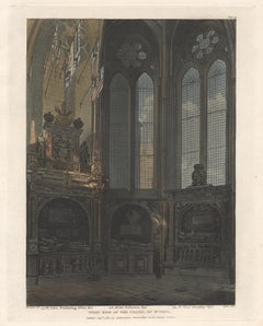
Tiltey Church, Essex & Rochester Cathedral (1790), engraving by James Basire
Located in London, GB
James Basire & John Carter
Stalls in Tiltey Church Essex & Stalls in the Choir of Rochester Cathedral
Engraving
50 x 32 cm
This engraving was originally published by the Society ...
Category
1790s Realist Landscape Prints
Materials
Engraving
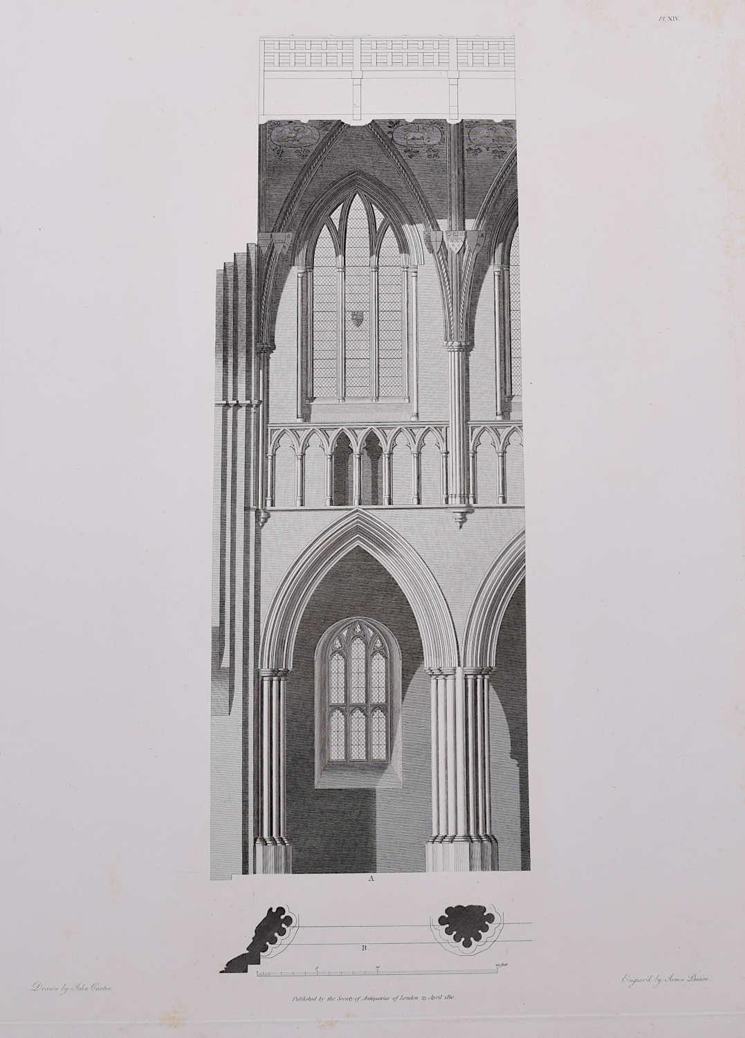
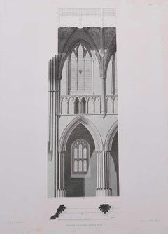
Architectural Details of St Albans Cathedral (1810), engraving by James Basire
Located in London, GB
James Basire & John Carter
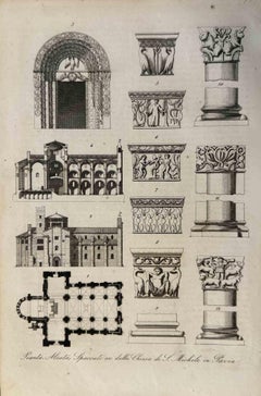
Architectural details of St Albans Cathedral
Engraving
62 x 46 cm
This engraving was originally published by the Society of Antiquaries of London, an ...
Category
1810s Realist Landscape Prints
Materials
Engraving
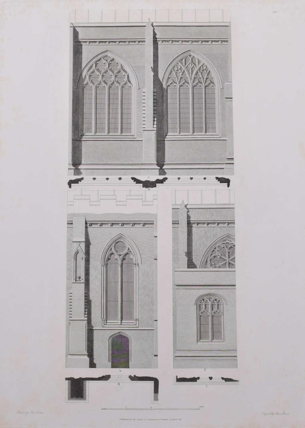
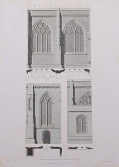
Design Fragment of St Albans Cathedral (1810), engraving by James Basire
Located in London, GB
James Basire & John Carter
Architectural Fragments of St Albans Cathedral
Engraving
62 x 46 cm
This engraving was originally published by the Society of Antiquaries of London, an...
Category
1810s Realist Landscape Prints
Materials
Engraving
You May Also Like
Southwest View of Sherborne Abbey Church /// History of Dorset English Engraving
Located in Saint Augustine, FL
Artist: John Hutchins (English, 1698-1773)
Title: "Southwest View of Sherborne Abbey Church" (Plate 15)
Portfolio: The History and Antiquities of the County of Dorset
Year: 1861-1870...
Category
1860s Victorian Landscape Prints
Materials
Engraving
Engraving of the Abbey Church of Westminster by John Coney, 1820
Located in Kenilworth, IL
Copperplate engraving, printed on laid paper of the exterior of the Henry VII Lady Chapel at Westminster Abbey in London, England. Engraved and printed in 1820. Faint handwriting in ...
Category
Antique 1820s British Prints
Materials
Paper
West View of St Nicholas Chapel, Westminster Abbey, architecture aquatint
Located in Melbourne, Victoria
Colour aquatint by John Bluck (active 1791-1819) after Auguste Pugin (1762-1832).
Architectural interior with superb original colour. From 'Westminster Abbey', published by Rudolf A...
Category
Early 19th Century Naturalistic Landscape Prints
Materials
Engraving, Etching, Aquatint

West Side of the Chapel of St Paul, Westminster Abbey, architecture aquatint
By John Bluck (active 1791-1819) after Frederick Mackenzie (1788-1854)
Located in Melbourne, Victoria
Colour aquatint by John Bluck (active 1791-1819) after Frederick Mackenzie (1788-1854).
Architectural interior with superb original colour. From 'Westminster Abbey', published by Ru...
Category
Early 19th Century Naturalistic Landscape Prints
Materials
Engraving, Etching, Aquatint
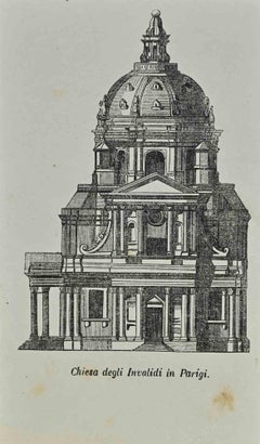
Church of the Invalids in Paris - Lithograph by Auguste Wahlen - 1844
Located in Roma, IT
Church of the Invalids in Paris is a lithograph made by Auguste Wahlen in 1844.
Good condition.
Drawing in black and white.
At the center of the artwork is the original title "Chi...
Category
1840s Modern Figurative Prints
Materials
Lithograph
Uses and Customs - St. Michele Church in Pavia - Lithograph - 1862
Located in Roma, IT
Uses and Customs - St. Michele Church in Pavia is a lithograph on paper realized in 1862.
The artwork belongs to the Suite Uses and customs of all the peoples of the universe: " His...
Category
1860s Modern Figurative Prints
Materials
Lithograph