Items Similar to Ceremony for the King's Son, Tonga: 18th C. Engraving, Captain Cook's 3rd Voyage
Want more images or videos?
Request additional images or videos from the seller
1 of 5
John WebberCeremony for the King's Son, Tonga: 18th C. Engraving, Captain Cook's 3rd Voyage1785
1785
About the Item
"The Natche, a Ceremony in Honor of the King's Son in Tongataboo" is an original 18th century engraving from a drawing by John Webber (1751-1793), who was the artist who accompanied Captain Cook on his third voyage of discovery, 1776-1780. The engraving appeared in Alexander Hogg's publication "A New, Authentic, and Complete Collection of Voyages Round the World" published in London in 1785.
This engraving depicts a large outdoor ceremony in Tonga to honor the coming of age of the king's son. There are large groups of Tongans taking part in the ceremony as well as others observing it. The event took place on July 8th and 9th, 1777, during the visit by Captain Cook and his crew. Cook wrote in his journal that the ceremony celebrated the first occasion upon which the father and son ate together, with food playing a central role in the celebrations; the line of figures depicted carry sticks from which smaller sticks are tied, symbolically representing yams which are presented to the chieftain and his son who sit inside the thatched hut at right. The ceremony was witnessed by John Webber, the artist who accompanied Cook on his 3rd voyage of discovery. He made the drawing that was used for this 18th century engraving.
The engraving is printed on laid chain-linked paper. The sheet measures 9.63" in height and 15.25" in width. There is a short crease in the upper left and right corners, a faint smudge in the upper right margin and what appears to be a tiny spot of residual ink in the right margin, most like occurring at the time the engraving was printed in the 1780's, all of which would be obscured by frame mat. The print is otherwise in excellent condition.
Alexander Hogg was an 18th and early 19th century publisher of illustrated books of architectural and historical prints, as well as maps. His publishing house was located in London at the Kings Arms on Paternoster Row.
- Creator:John Webber (1751 - 1793, British)
- Creation Year:1785
- Dimensions:Height: 9.63 in (24.47 cm)Width: 15.25 in (38.74 cm)
- Medium:
- Period:1780-1789
- Framing:Framing Options Available
- Condition:
- Gallery Location:Alamo, CA
- Reference Number:Seller: # 8261stDibs: LU1173216422022
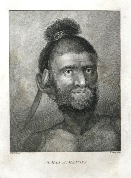
John Webber
John Webber (1751-1793) was recommended to the Admiralty for appointment as artist for the Captain Cook's 3rd voyage by the Swedish botanist Daniel Carlsson Solander (1733-1782) who had accompanied Cook on his first voyage. Just 24 years old when he joined the Captain Cook’s ship the Resolution at Plymouth one week prior to departure, Webber's skill in both portraiture and landscape resulted in a visual record of Cook's third voyage that is unsurpassed in the annals of 18th century exploration.
About the Seller
5.0
Platinum Seller
Premium sellers with a 4.7+ rating and 24-hour response times
Established in 2011
1stDibs seller since 2019
283 sales on 1stDibs
Typical response time: 2 hours
- ShippingRetrieving quote...Shipping from: Alamo, CA
- Return Policy
Authenticity Guarantee
In the unlikely event there’s an issue with an item’s authenticity, contact us within 1 year for a full refund. DetailsMoney-Back Guarantee
If your item is not as described, is damaged in transit, or does not arrive, contact us within 7 days for a full refund. Details24-Hour Cancellation
You have a 24-hour grace period in which to reconsider your purchase, with no questions asked.Vetted Professional Sellers
Our world-class sellers must adhere to strict standards for service and quality, maintaining the integrity of our listings.Price-Match Guarantee
If you find that a seller listed the same item for a lower price elsewhere, we’ll match it.Trusted Global Delivery
Our best-in-class carrier network provides specialized shipping options worldwide, including custom delivery.More From This Seller
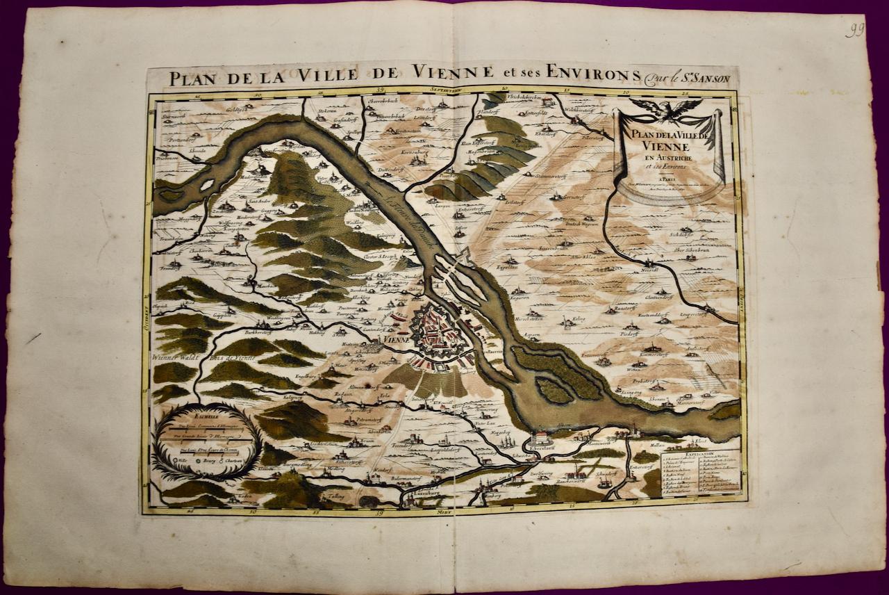
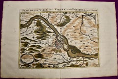
View AllVienna, Austria: A Large 17th Century Hand-colored Map by Sanson and Jaillot
By Nicholas Sanson d'Abbeville
Located in Alamo, CA
This large 17th century hand-colored map of Vienna, Austria and the surrounding countryside and villages entitled "Plan de la Ville de Vienne en Austrich...
Category
1690s Landscape Prints
Materials
Engraving
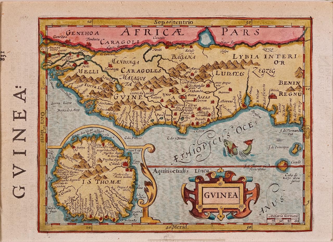
West Africa: A 17th Century Hand-Colored Map by Mercator/Hondius
By Gerard Mercator
Located in Alamo, CA
A 17th century hand-colored map entitled "Guineae Nova Descriptio" by Gerard Mercator and Jodocus Hondius, published in their 'Atlas Minor' in Amsterdam in 1635. It is focused on the...
Category
1630s Landscape Prints
Materials
Engraving

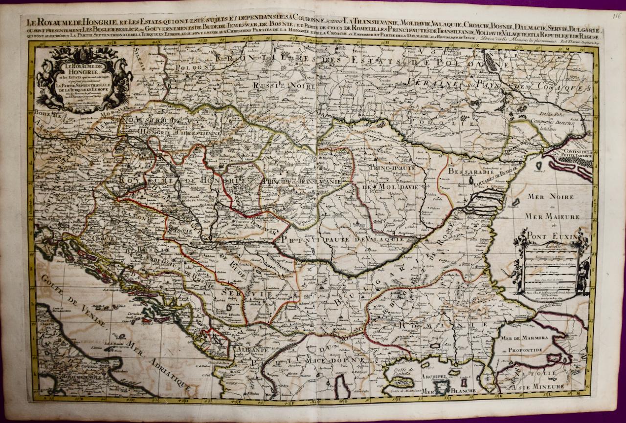
Hungary & Eastern Europe: A Large 17th C. Hand-colored Map by Sanson & Jaillot
By Nicholas Sanson d'Abbeville
Located in Alamo, CA
This large hand-colored map entitled "Le Royaume De Hongrie et les Estats qui en ont este sujets et qui font presentement La Partie Septentrionale de la Turquie en Europe" was origin...
Category
1690s Landscape Prints
Materials
Engraving

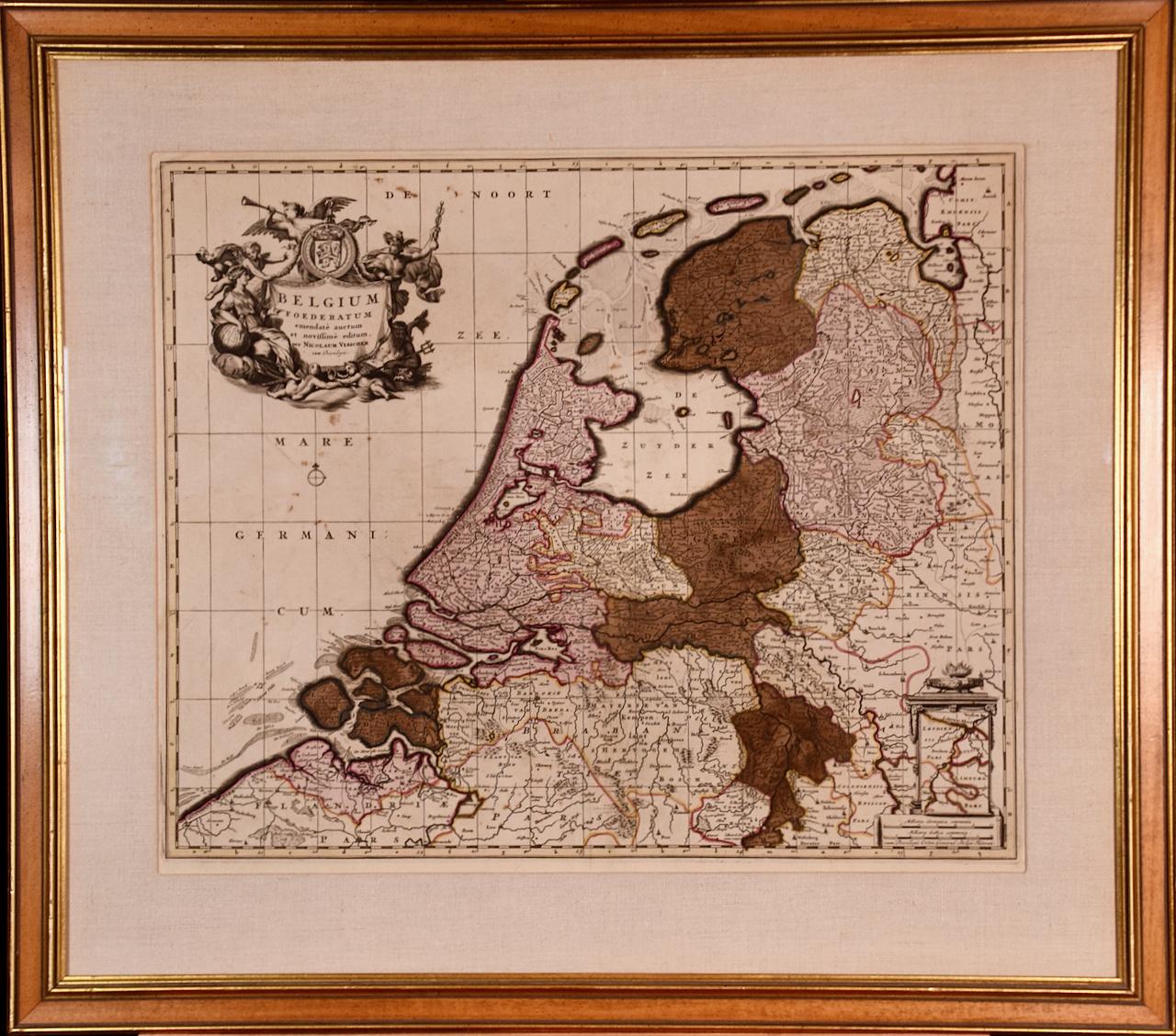
Belgium and the Netherlands: A Hand-colored 17th Century Map by Visscher
By Nicolaus Visscher
Located in Alamo, CA
This is an original hand-colored 17th century map of Belgium by Nicolaus (Nicolas) Visscher II entitled "Belgium Foederatum emendate auctum et novissime editum", published in Amsterdam in 1678. The map shows the seven provinces comprising the Belgium federation or the Republic of the Seven United Netherlands or the Dutch Republic as it was also known. The republic was formed when an alliance of seven Dutch provinces in the Spanish Netherlands revolted against rule by Spain in 1579 (the Union of Utrecht) and declared their independence in 1581 (the Act of Abjuration). The seven provinces were Groningen, Frisia, Overijssel, Guelders, Utrecht, Holland and Zeeland. This was a predecessor state to the Netherlands and the first fully independent Dutch nation state. Amsterdam, Delft, Rouen, Utrecht, Brugge, Ghent, and Antwerp are all included on the map. A small inset map in the lower right depicts the course of the Maas River from Maastricht to Wessem. There is a decorative cartouche in the upper left corner and a distance scale cartouche in the lower right corner.
The map is presented in an attractive antiqued medium brown-colored wood frame with gold-colored inner and outer trim and a light tan-colored fabric mat. The frame measures 26.63" high by 30" wide by 0.75" deep. There is some darkening of the red areas in the map, presumably related to oxidation of the original iron containing pigment over time. There are also a few scattered spots. The map is otherwise in very good condition.
The Visscher family were one of the great cartographic families of the 17th century. Begun by Claes Jansz Visscher...
Category
Late 17th Century Other Art Style Landscape Prints
Materials
Engraving

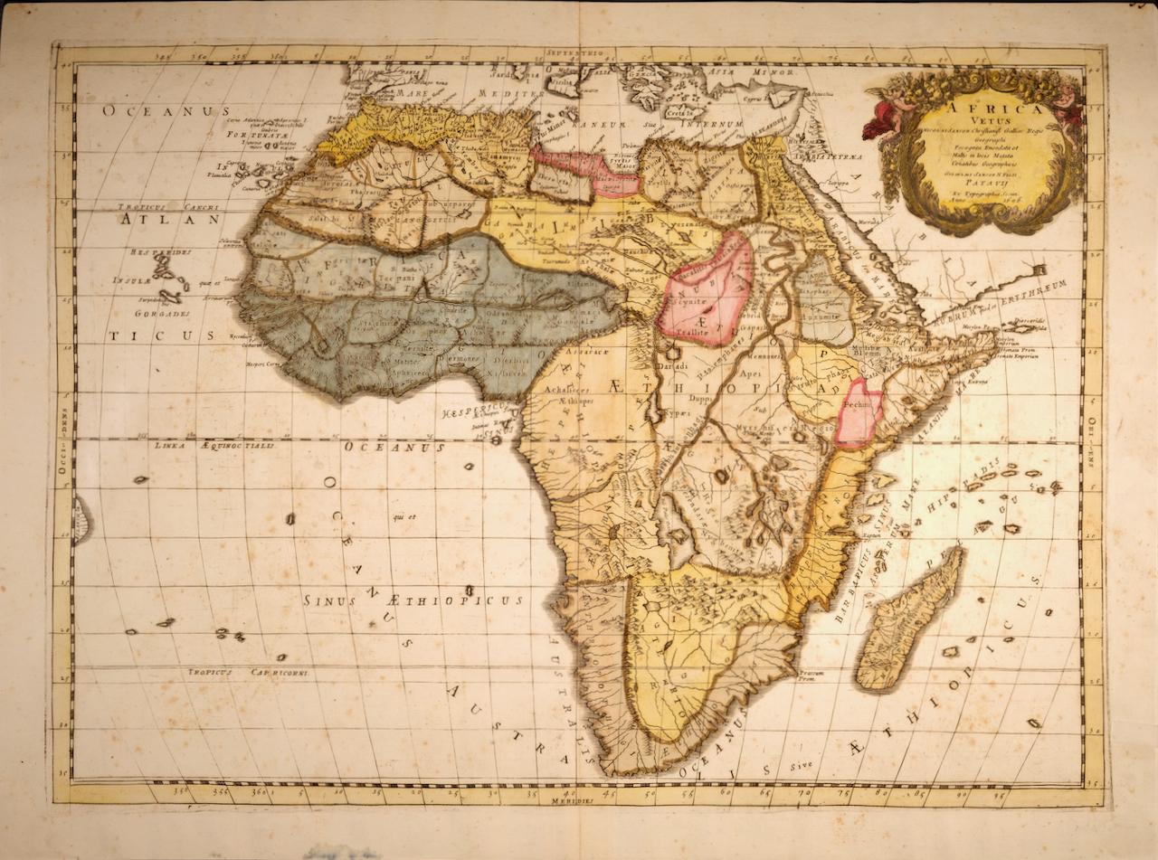
"Africa Vetus": A 17th Century Hand-colored Map By Sanson
By Nicholas Sanson d'Abbeville
Located in Alamo, CA
This original hand-colored copperplate engraved map of Africa entitled "Africa Vetus, Nicolai Sanson Christianiss Galliar Regis Geographi" was originally created by Nicholas Sanson d...
Category
1690s Landscape Prints
Materials
Engraving

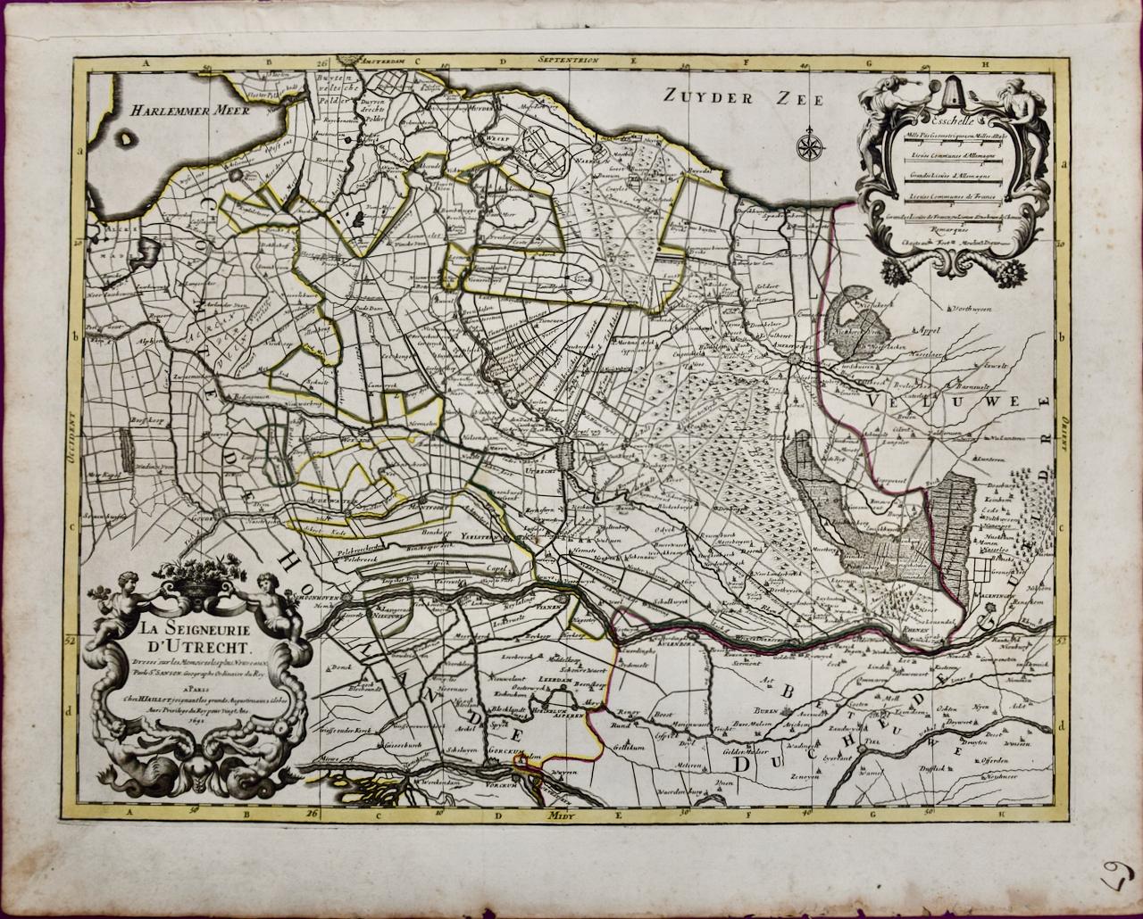
Utrecht, Netherlands: A Large 17th Century Hand-colored Map by Sanson & Jaillot
By Nicholas Sanson d'Abbeville
Located in Alamo, CA
This large hand-colored map entitled "La Seigneurie d'Utrecht. Dressé sur les memoires les plus nouveaux par le Sr. Sanson" was originally created by Nicholas Sanson d'Abbeville. Thi...
Category
1690s Landscape Prints
Materials
Engraving

You May Also Like
Plan of the Park, Garden and Plantations of Goodwood, 18th century engraving
By Colen Campbell
Located in Melbourne, Victoria
Plan of the Park, Garden and Plantations of Goodwood in Sussex the Seat of his Grace the Duke of Richmond and Lenox &c
Copper-line engraving with later hand-colouring by Hendrik Hul...
Category
18th Century English School Landscape Prints
Materials
Engraving
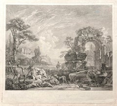
Les Bergers Romains, landscape with Roman ruins, 18th century engraving
Located in Melbourne, Victoria
Les Bergers Romains
Copper-line engraving by Jean Jacques Leveau (1729-1786) after Pierre Mettay (1728-1759). C1755.
Proof, before lettering. Laid, watermarked paper.
A landscap...
Category
18th Century French School Landscape Prints
Materials
Engraving
Carte Particuliere Des Coste De Bretagne qui Comprend Morlaix
By Pierre Mortier
Located in Paonia, CO
Carte Particuliere Des Costes De Bretagne qui Comprend Morlaix, Saint Paul de Leon, les Sept Isles, et L’Isle. Faite par ordre Exprez Du Roy de France is from the collection of ch...
Category
1690s Landscape Prints
Materials
Engraving

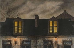
Lafitte's Blacksmith House (a bar named for a pirate on Bourbon St, New Orleans)
By Frederick Mershimer
Located in New Orleans, LA
Lafitte's Blacksmith Shop is a New Orleans landmark at 941 Bourbon St. Like most New Orleans legends, history of Lafitte's Blacksmith Shop is a gumbo of tru...
Category
Early 2000s Contemporary Landscape Prints
Materials
Mezzotint, Aquatint
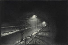
Foggy Night (the way home or a Stephen King setting)
By Carol Wax
Located in New Orleans, LA
This impression is #22
Carol Wax originally trained to be a classical musician at the Manhattan School of Music but fell in love with printmaking. Soon after she began engraving mezzotints she was asked by the renowned print dealer Sylvan Cole to exhibit at Associated American Artists Gallery, launching her career as a professional artist/printmaker. With the publication of her book, The Mezzotint: History and Technique, published by Abrams, 1990 and 1996, Carol added author and teacher to her credits. In the ensuing years she has expanded her repertoire of mediums beyond printmaking into other works on paper and painting.
In compositions reflecting an appreciation for antiquated machinery and vintage textiles, Wax creates imagery that, in her own words, “… speaks to an inner life perceived in inanimate objects.” She uses stylization and imagination to reinvent subjects, transforming an ordinary typewriter into a monumental icon...
Category
2010s American Modern Landscape Prints
Materials
Engraving, Mezzotint
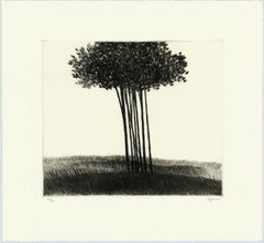
A small copse in a field.
By Robert Kipniss
Located in New York, NY
The drypoint engraving entitled "A small copse in a field" was created by Robert Kipniss in 2016. Printed in an edition of 16 - this impression is signed in pencil and inscribed “12...
Category
21st Century and Contemporary Modern Landscape Prints
Materials
Engraving, Drypoint