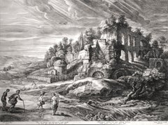
Items Similar to St. Jerome in the Desert

Want more images or videos?
Request additional images or videos from the seller
1 of 5
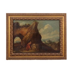
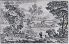
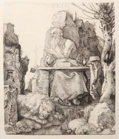
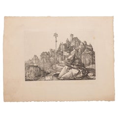
Manner of Pieter Bruegel the ElderSt. Jerome in the Desert1555-56
1555-56
$20,000
£15,309.04
€17,572.38
CA$28,574.75
A$31,356.51
CHF 16,235.14
MX$375,363.06
NOK 203,686.08
SEK 191,629.40
DKK 131,257.68
About the Item
Engraving by Joannes and Lucas van Doetecum (Deventer active by 1551 - circa 1569 Haarlem) in the manner of Peter Bruegel the Elder
- Creator:Manner of Pieter Bruegel the Elder (1525 - 1569)
- Creation Year:1555-56
- Dimensions:Height: 12.5 in (31.75 cm)Width: 16.75 in (42.55 cm)
- Medium:
- Movement & Style:
- Period:
- Condition:
- Gallery Location:Chicago, IL
- Reference Number:1stDibs: LU36535746442
About the Seller
5.0
Recognized Seller
These prestigious sellers are industry leaders and represent the highest echelon for item quality and design.
Established in 1955
1stDibs seller since 2016
14 sales on 1stDibs
Associations
International Fine Print Dealers Association
- ShippingRetrieving quote...Shipping from: Chicago, IL
- Return Policy
Authenticity Guarantee
In the unlikely event there’s an issue with an item’s authenticity, contact us within 1 year for a full refund. DetailsMoney-Back Guarantee
If your item is not as described, is damaged in transit, or does not arrive, contact us within 7 days for a full refund. Details24-Hour Cancellation
You have a 24-hour grace period in which to reconsider your purchase, with no questions asked.Vetted Professional Sellers
Our world-class sellers must adhere to strict standards for service and quality, maintaining the integrity of our listings.Price-Match Guarantee
If you find that a seller listed the same item for a lower price elsewhere, we’ll match it.Trusted Global Delivery
Our best-in-class carrier network provides specialized shipping options worldwide, including custom delivery.More From This Seller
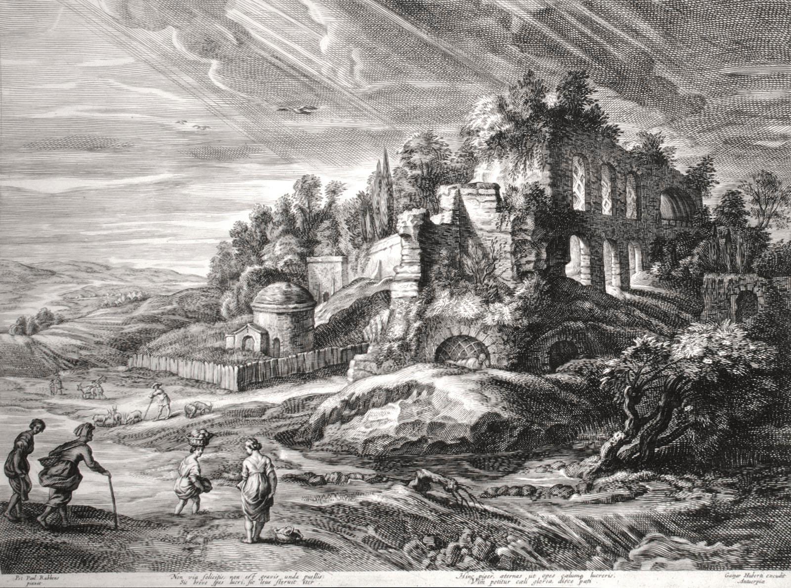
View AllLandscape with Roman Ruins
By (After) Peter Paul Rubens
Located in Chicago, IL
Engraving after Peter Paul Rubens (Siegen 1577 - 1640 Antwerp), executed by Schelte Adams Bolswert (Bolsward c. 1586 -1659 Antwerp).
Bolswert was one of the major printmakers in the ...
Category
17th Century Old Masters Landscape Prints
Materials
Engraving
Landscape with the Prophets Ahias and Jerobeam
Located in Chicago, IL
Engraving after David Vinckboons (Malines 1576-1629 Amsterdam), executed by James Van Londerseel (Antwerp c. 1570 - 1624/25 Rotterdam)
Category
17th Century Old Masters Prints and Multiples
Materials
Engraving
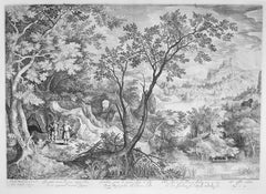
Landscape with a Maiden and her Dog
By Adriaen van der Cabel
Located in Chicago, IL
A very fine impression
Category
Mid-17th Century Landscape Prints
Materials
Etching
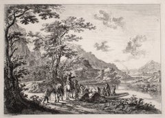
Shepherd Leading his Herd
Located in Chicago, IL
A very fine impression
Category
Mid-17th Century Landscape Prints
Materials
Etching
Christ and His Disciples Harvesting on the Sabbath
Located in Chicago, IL
Engraving after David Vinckboons (Malines 1576-1629 Amsterdam), executed by Jan van Londerseel (Antwerp c. 1570-1624/25 Rotterdam)
Category
17th Century Old Masters Prints and Multiples
Materials
Engraving
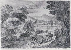
View of the Tiber with Country Landscape
By Jan Dirksz Both
Located in Chicago, IL
Etching on paper with Schriftband watermark.
Reference: Bartsch 7 III/IV (from VI).
A very fine, early impression. Printed with the name of the artist, but before the addition...
Category
15th Century and Earlier Old Masters Landscape Prints
Materials
Etching
You May Also Like
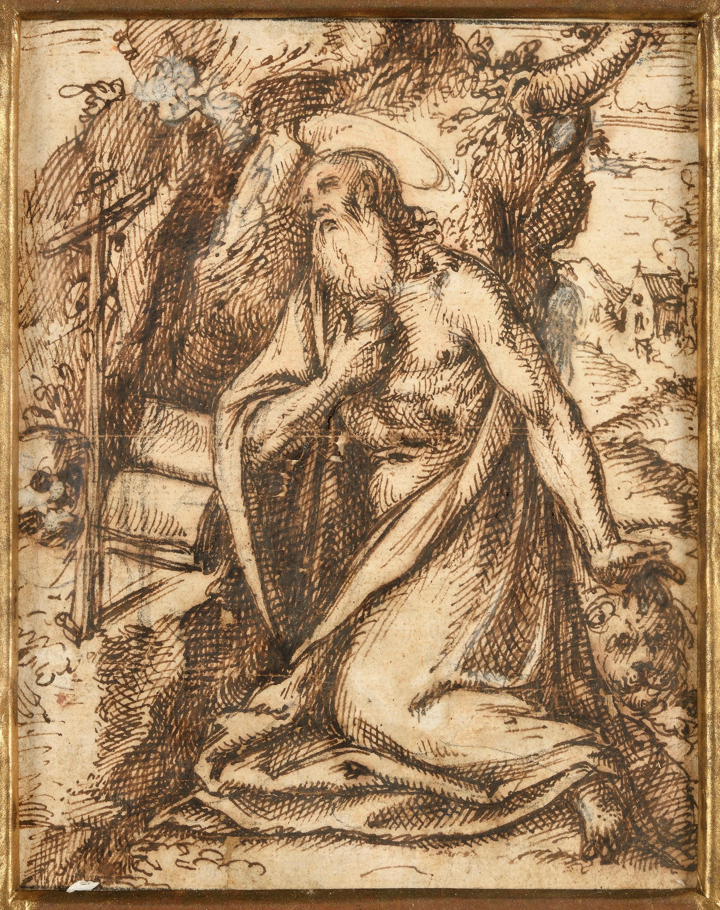
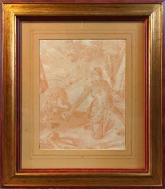
Saint Jerome Praying, with a Landscape in the Background
Located in Paris, Île-de-France
STEFANO DALL’ARZERE
(Padua, circa 1520 – 1570)
Saint Jerome Praying, with a Landscape in the Background
Pen and brown ink, heightened with white over black chalk lines
15.5 x 12 cm...
Category
16th Century Old Masters Landscape Drawings and Watercolors
Materials
Ink
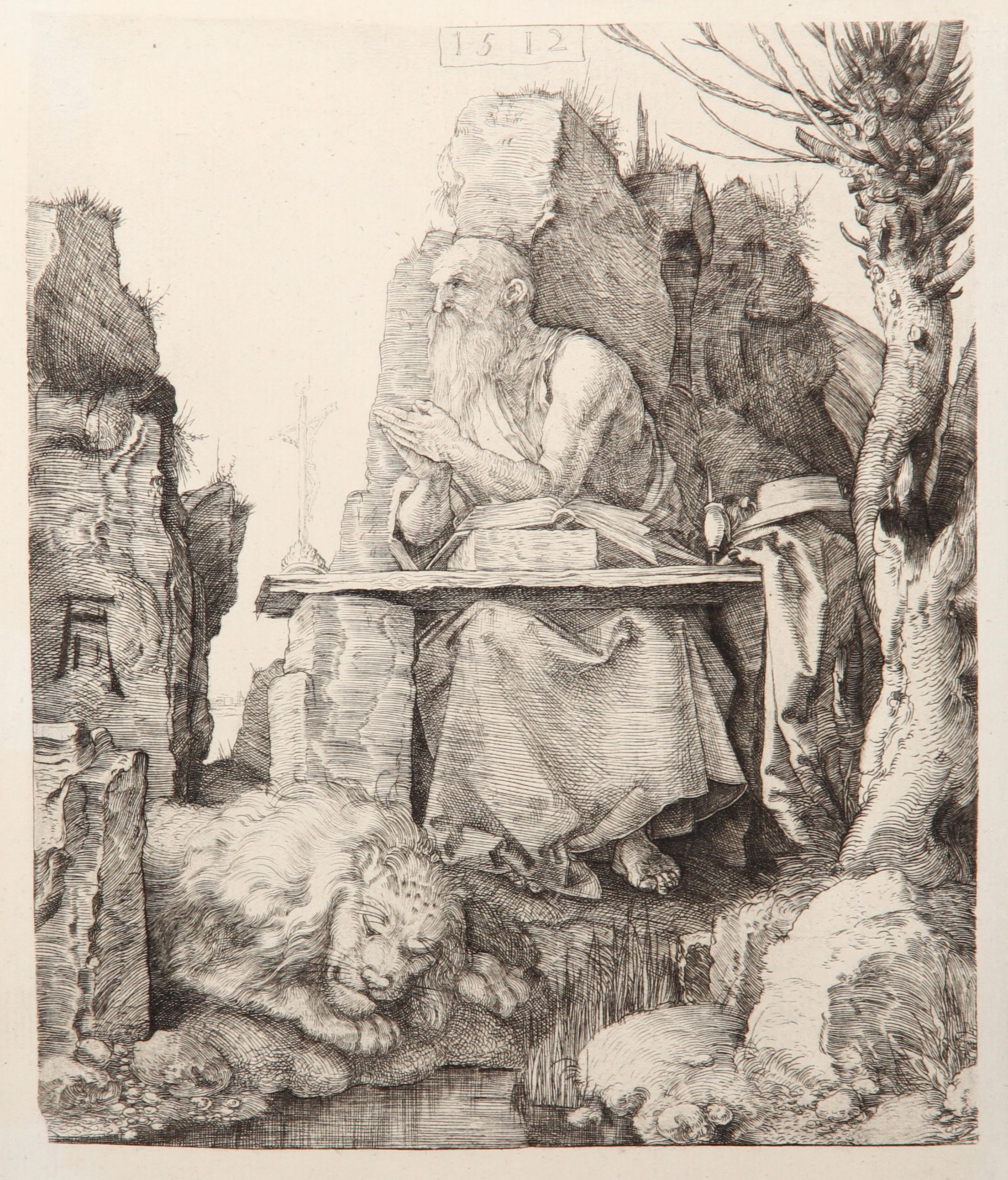
Saint Jerome, Heliogravure by Lucas van Leyden
By Lucas van Leyden
Located in Long Island City, NY
Artist: Lucas van Leyden, After by Amand Durand, Dutch (1494 - 1533) - Saint Jerome, Year: 1873, Medium: Heliogravure, Size: 4.5 x 6 in. (11.43 x 15.24 cm), Printer: Amand Durand, ...
Category
Late 19th Century More Prints
Materials
Etching
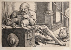
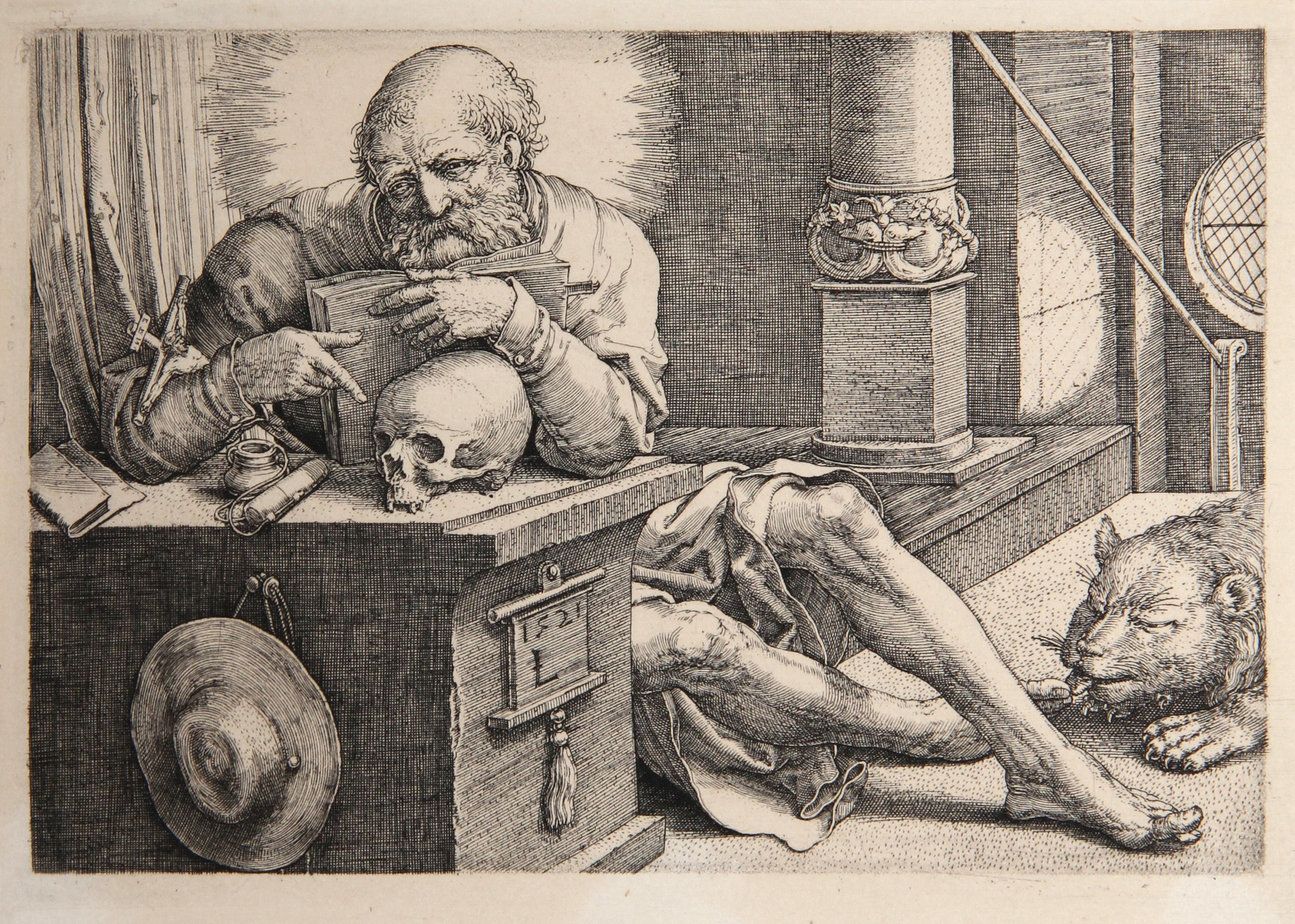
Saint Jerome, Old Masters Engraving by Amand-Durand after Albrecht Durer
By Charles Amand Durand
Located in Long Island City, NY
Artist: Albrecht Dürer, After by Amand Durand, German (1471 - 1528)
Title: Saint Jerome
Year: 1873
Medium: Heliogravure
Size: 9 x 7.25 in. (22.86 x 18.42 ...
Category
1870s Old Masters Figurative Prints
Materials
Engraving
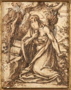
Saint Jerome in the Desert, Prague school sanguine drawing
Located in New York, NY
Saint Jerome in the Desert Prague school sanguine drawing.
Category
Early 17th Century Old Masters Figurative Drawings and Watercolors
Materials
Chalk, Paper
Saint Anthony Reading at a City Gate. Engraving. Dürer, Albert. Later date.
By Albrecht Dürer
Located in Madrid, ES
Saint Anthony Reading at a City Gate. Engraving. Dürer, Albert (Nuremberg, 1471-1528). Later print, possibly 19th century.
Signed and dated on plate.
Engraving depicting the holy...
Category
Antique 19th Century European Other Religious Items
Materials
Other
Landscape with the penitent St. Jerome, XVIIth - XVIIIth century
Located in Milan, IT
Oil painting on canvas. Northern Italian school of the 17th-18th century. In a large, rather barren hilly landscape, which widens and fades to the right, there is a high rock, shaped...
Category
Late 17th Century Other Art Style Landscape Paintings
Materials
Oil