Want more images or videos?
Request additional images or videos from the seller
1 of 10
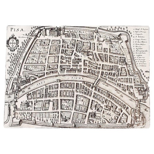
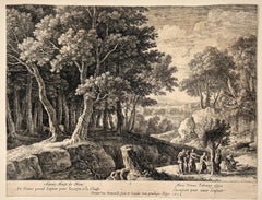
Matthäus Merian the ElderSt. Peter's Square in Basel: 17th Century Engraving by Matthäus Merian1654
1654
$775List Price
About the Item
- Creator:Matthäus Merian the Elder (1593 - 1650, German)
- Creation Year:1654
- Dimensions:Height: 15.25 in (38.74 cm)Width: 19.94 in (50.65 cm)Depth: 0.63 in (1.61 cm)
- Medium:
- Movement & Style:
- Period:1650-1659
- Condition:
- Gallery Location:Alamo, CA
- Reference Number:Seller: #36131stDibs: LU117325384721
Matthäus Merian the Elder
Matthäus Merian is one of the most respected Swiss/German artists and engravers of the 17th century. In addition to creating a large number of illustrations and maps, he passed his knowledge and skill to his children, who followed in the family tradition. His son Matthäus Merian, the Younger was an accomplished engraver. His daughter Maria Sybella Merian in addition to becoming a prominent artist, became one of the greatest woman scientists of the 18th century as an entomologist. Her engravings of insects in their natural habitats are as sought after by collectors as are her father's illustrations.
About the Seller
5.0
Platinum Seller
Premium sellers with a 4.7+ rating and 24-hour response times
Established in 2011
1stDibs seller since 2019
298 sales on 1stDibs
Typical response time: 1 hour
Authenticity Guarantee
In the unlikely event there’s an issue with an item’s authenticity, contact us within 1 year for a full refund. DetailsMoney-Back Guarantee
If your item is not as described, is damaged in transit, or does not arrive, contact us within 7 days for a full refund. Details24-Hour Cancellation
You have a 24-hour grace period in which to reconsider your purchase, with no questions asked.Vetted Professional Sellers
Our world-class sellers must adhere to strict standards for service and quality, maintaining the integrity of our listings.Price-Match Guarantee
If you find that a seller listed the same item for a lower price elsewhere, we’ll match it.Trusted Global Delivery
Our best-in-class carrier network provides specialized shipping options worldwide, including custom delivery.You May Also Like
"Cockersand Abbey" from "Buck's Antiquities" /// British Old Master Engraving
By Samuel & Nathaniel Buck
Located in Saint Augustine, FL
Artist: Samuel and Nathaniel Buck (English, 1696-1779) and (?-1759/1774)
Title: "Cockersand Abbey" (Plate 148)
Portfolio: Buck's Antiquities or Venerable Remains of Above 400 Castles...
Category
1720s Old Masters Landscape Prints
Materials
Laid Paper, Engraving, Intaglio

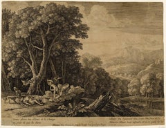
Veduta del Tempio della Fortuna Virile, from Raccolta delle più belle Vedute ...
By Giuseppe Vasi
Located in Middletown, NY
By Giuseppe Vasi after Giovanni Piranesi: Etching and engraving with hand coloring in watercolor on laid paper with an E and R watermark, full margins. Minor...
Category
Late 18th Century Old Masters Landscape Prints
Materials
Watercolor, Laid Paper, Engraving, Etching
The Last Supper, from The Passion of Christ
By Hendrick Goltzius
Located in Middletown, NY
Engraving on cream laid paper, 8 x 5 3/8 inches (203 x 137 mm), trimmed at the platemark. A fine impression with a Coat of Arms watermark. Second state, after the addition of the Frederick de Witt...
Category
16th Century Old Masters Figurative Prints
Materials
Laid Paper, Engraving
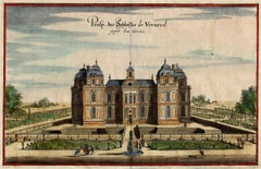
Chateau de Verneuil
By Matthäus Merian the Elder
Located in Middletown, NY
Engraving with hand coloring and heightening in watercolor on two leaves of expertly conjoined handmade laid paper, one leaf with a large watermark a feathered dragon, 7 1/4 x 11 1/4...
Category
Mid-17th Century Old Masters Landscape Prints
Materials
Watercolor, Handmade Paper, Engraving
Venus Lamenting over the Death of Adonis
By Herman van Swanevelt
Located in Middletown, NY
c. 1654. Etching with engraving on thin laid paper with an early and large unidentified watermark with a sundial and a many-pointed star, and an unidentified collector's stamp in the...
Category
Mid-17th Century Old Masters Landscape Prints
Materials
Handmade Paper, Engraving, Etching
Christ Crowned with Thorns, from The Passion of Christ
By Hendrick Goltzius
Located in Middletown, NY
Engraving on cream wove paper, 8 x 5 3/8 inches (203 x 137 mm), narrow to thread margins. First state (of 2). A fine impression with archival paper adhered at left top and bottom cor...
Category
Early 17th Century Old Masters Figurative Prints
Materials
Engraving
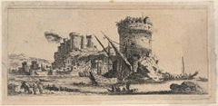
Porto Vecchio, Corsica
By Israel Silvestre
Located in Middletown, NY
Paris: Israël Henriet, c1680.
Etching with engraving on cream laid paper, laid down to a cream laid paper matrix, 3 1/8 x 7 1/8 inches (78 x 180 mm), the full sheet with thread marg...
Category
17th Century Old Masters Landscape Prints
Materials
Handmade Paper, Laid Paper, Etching, Engraving
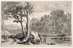
The Anglers
By Herman van Swanevelt
Located in Middletown, NY
Etching with engraving on cream laid paper with a large unidentified alphabetic watermark, 6 1/2 x 9 7/8 inches (165 x 251 mm), the full sheet. In good condition with handling wear a...
Category
Early 17th Century Old Masters Landscape Prints
Materials
Laid Paper, Engraving, Etching
The Birth of Adonis; Plate 1 from The Story of Adonis
By Herman van Swanevelt
Located in Middletown, NY
Etching with engraving on thin laid paper with an early and large unidentified heraldic watermark with a windmill, and the collector's stamp of Count F. J. von Enzenberg (1802-1879),...
Category
Early 17th Century Old Masters Landscape Prints
Materials
Laid Paper, Engraving, Etching
$500
H 9.73 in W 12.84 in
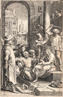
The Beheading of the King of England; Enthauptung des Königs in England
By Matthäus Merian the Elder
Located in Middletown, NY
The execution of Charles I (1600-1649) at Whitehall, January 30th 1649, in front of the Banqueting House. The executioner holding the head of Charles up to the crowd below.
Engravin...
Category
Mid-17th Century Old Masters Landscape Prints
Materials
Laid Paper, Engraving
More From This Seller
View AllView of Emden, Germany: A 16th Century Hand-colored Map by Braun & Hogenberg
By Franz Hogenberg
Located in Alamo, CA
This is a 16th century original hand-colored copperplate engraved map of a bird's-eye View of Embden, Germany entitled " Emuda, vulgo Embden vrbs Frisia orientalis primaria" by Georg Braun & Franz Hogenberg, in volume II of their famous city atlas "Civitates Orbis Terrarum", published in Cologne, Germany in 1575.
This is a beautifully colored and detailed map of Emden, a seaport in northwestern Germany, along the Ems River and perhaps portions of over Dollart Bay, near the border with the Netherland. The map depicts a bird's-eye view of the city from the southwest, as well as a view of the harbor and an extensive system of canals. Numerous ships of various sizes, as well as two rowboats containing numerous occupants are seen in the main waterway in the foreground and additional boats line two canals in the center of the city. Two men and two women are shown on a hill in the foreground on the right, dressed in the 16th century style of nobility. Two ornate crests are included in each corner. A title strap-work cartouche is in the upper center with the title in Latin. The crest on the right including Engelke up de Muer (The Little Angel on the Wall) was granted by Emperor Maximilian I in 1495.
This is an English translation of an excerpt of Braun's description of Embden: "In Emden, the capital of East Frisia, rich merchants live in very fine houses. The city has a broad and well-situated harbour, which in my opinion is unique in Holland. Frisia and the whole of the Netherlands, for the ships can anchor here right under the city walls. They have also extended the harbour as far as the New Town, so that up to 400 ships can now find shelter here when the sea is rough."
The emphasis on the harbor and waterways within the city highlights the importance of Emden's place as a seaport at this time. Embden developed from a Dutch/Flemish trading settlement in the 7th-8th centuries into a city as late as late 14th century. In 1494 it was granted staple rights, and in 1536 the harbour was extended. In the mid-16th century Emden's port was thought to have the most ships in Europe. Its population then was about 5,000, rising to 15,000 by the end of the 16th century. The Ems River flowed directly under the city walls, but its course was changed in the 17th century by the construction of a canal. Emden has canals within its city limits, a typical feature of Dutch towns, which also enabled the extension of the harbor. In 1744 Emden was annexed by Prussia and is now part of Germany. It was captured by French forces in 1757 during the Seven Years' War, but recaptured by Anglo-German forces in 1758. During the Napoleonic French era, Emden and the surrounding lands of East Frisia were part of the short-lived Kingdom of Holland.
References:Van der Krogt 4, 1230, State 2; Taschen, Braun and Hogenberg...
Category
16th Century Old Masters Landscape Prints
Materials
Engraving

View of Meissen, Germany: A 16th Century Hand-colored Map by Braun & Hogenberg
By Franz Hogenberg
Located in Alamo, CA
This is a 16th century original hand-colored copperplate engraved map of View of View of Meissen, Germany entitled "Misena Hermun Duvorum Urbs" by Georg Braun & Franz Hogenberg, from their famous city atlas "Civitates Orbis Terrarum", published in Cologne, Germany in 1575.
The map depicts a side view and bird's-eye view, looking across the Elbe River (labelled Albis Fluvius on the map; White River in Latin) from the northeast. In the foreground are three women in conversation on a hill above the city, along with a man and a woman in conversation by a road, all dressed in contemporary costumes of the upper class. A coat-of-arms is present in each upper corner. A great castle sits atop a hill in the background on the left. Meissen grew up around Albrechtsburg castle, built by Emperor Henry I around AD 929, and was granted a municipal charter at the end of the 12th century. From 1471 onwards, the castle complex was reconstructed as the residence of the Saxon electors on the northeast corner of the Domberg (Cathedral Hill). Meissen cathedral is a Gothic hall church begun c. 1270; in 1413 a bolt of lightning destroyed its west towers, which were replaced only in the 20th century. Meissen lies to the northwest of Dresden, Germany in Saxony. Meissen is famous for its Meissen porcelain and the Albrechtsburg castle
The following is an English translation of an excerpt from Braun's description of the city: "This city is surrounded by very many rivers, to the east flows the Elbe, to the south the Triebisch, to the west are the mountains, to the north the Meisse, after which the city is said to be named. The city is well-situated in its surroundings, the navigable rivers, the mountains and the healthy air. Around the city there is a good land to grow grain, fertile vineyards on the hillsides and without doubt the mountains are not without ore, for one mile away, up the Elbe, is Scharfenberg, where silver and lead ore are mined.."
References: Van der Krogt 4, 2684; Taschen, Braun and Hogenberg...
Category
16th Century Old Masters Landscape Prints
Materials
Engraving

View of Seravalle, Italy: A 16th Century Hand-colored Map by Braun & Hogenberg
By Franz Hogenberg
Located in Alamo, CA
This is an original 16th century copperplate originally hand-colored engraved map of View of Seravalle, Italy entitled "Seravallum Celeberrimum Marchiae Tarvisiniae in Agro Foro Juliensi Opp. - Seravalli, quam vides, Spectator, iconem, operi huic nostro suis sumptib. . . ." by Georg Braun & Franz Hogenberg, from their famous city atlas "Civitates Orbis Terrarum", published in Augsberg, Germany in 1575.
The map depicts a view of Seravalle, now Vittorio Veneto, in San Marino, Italy, north of Venice, in a topographically accurate bird's-eye view from the south. A water-filled moat is seen to the south of the city walls and farmland to the east. Two men are depicted standing on a hill in the lower right in conversation next to grain sacks and a grazing horse, while a younger man behind them to the right herds a mule carrying presumably pigs. A very colorful and ornate title cartouche is in the upper center and coat-of-arms are in the right and left upper corners. Serravalle lies in an idyllic setting in the foothills and surrounded by orchards. St Mary's Cathedral with its tall bell tower is prominent in the center of the town. The marketplace and town hall with a bell tower in the square are depicted. Houses and shops are around the main square. Serravalle's importance as an agricultural centre is emphasized by the figures in the foreground. In 1337 Serravalle was conquered by the Republic of Venice. In 1866 the town was united with neighbouring Ceneda to form the town of Vittorio Veneto.
The following is an English translation of an excerpt from the French description of the city on the back of the map: "Serravalle, a market town renowned for cloth, wine and grain, is in such a beautiful situation that the number of its inhabitants, attracted by the loveliness of the place, has grown so much at times that the wall encircling it has had to be enlarged for the third time. The city with the surrounding town once belonged to the Church in Ceneda as an imperial fief. It subsequently became the seat of the Da Camino family (a princely house that at that time was one of the five most noble in all Italy). Now the city is under the sway of the Venetians but is prudently governed by them. For they send only one city councillor with instructions to ensure that justice prevails and to collect duties. In all else, power lies in the hands of the noble families."
This is a translation of the Latin in the title cartouche on the front: "The picture of the town of Serravalle, which you see, viewer, has been contributed to our work entirely at his own expense by Minutius, son of Hieronymus Minutius, a noble gentleman and one renowned for the far-reaching competence of his jurisdiction. We saw him sojourning in Cologne, where he was on business for Gregory XIII; while our good wishes accompany him, we should also like to accompany him on his way with this remembrance, even though it might be against his will, so that even those who have not seen him may learn of his excellence. However, those who do not yet know him will also see his excellence if God the Almighthy does not summon erring souls too soon back to the eternal seat of the Blessed."
References: Van der Krogt 4, 4728, State 1; Taschen, Braun and Hogenberg, p.331; Fauser, #14960
This striking hand-colored city view is printed on laid, chain-linked paper with wide margins. The sheet measures 16" high by 21" wide. There is a central vertical fold as issued and French text on the verso, with Latin on the front. There is some discoloration in the upper and right margins which may represent some watercolor paint from the time of the original hand-coloring of the map. There is a small hole to the right of the upper portion of the vertical fold, which is only visible when held up to light and an area of reinforcement on the verso of the lower vertical fold. The map is otherwise in very good to excellent condition.
Braun and Hogenberg's 'The Civitates Orbis Terrarum' was the second atlas of maps ever published and the first atlas of cities and towns of the world. It is one of the most important books published in the 16th century. Most of the maps in the atlas were engraved by Franz Hogenberg and the text, with its descriptions of the history and additional factual information of the cities, was written by a team of writers and edited by Georg Braun. The work contained 546 bird-eye views and map views of cities and towns from all over the world. It gave graphic representation of the main features of the illustrated cities and towns, including the buildings and streets. Although the ordinary buildings are stylized, the principal buildings are reproduced from actual drawings created on location. The principal landmarks and streets can still be recognized today. In addition, the maps often include the heraldic arms of the city, the nature of the surrounding countryside, the important rivers, streams and harbors, even depicting stone bridges, wooden pontoons, flat-bottomed ferries, ships and working boats, wharves and jetties, as well as land-based activities, including horsemen, pedestrians, wagons, coaches, and palanquins. Small vignettes are often included which illustrate the trade, occupations and habits of the local inhabitants, such as agriculture, paper-making and textiles, as well as local forms of punishment, such as gibbets, wheels, floggings etc. Large figures dressed in their local costume are often presented out of proportion in the foreground. The aim of the authors was to give as much information as possible in a pleasing visual form. They succeeded in creating maps that were both informative and decorative works of art. The atlas is a wonderful glimpse of life in medieval Europe.
Georg Braun (1541-1622) was German Catholic...
Category
16th Century Old Masters Landscape Prints
Materials
Engraving

Tournai (Tournay), Belgium: A 16th Century Hand-colored Map by Braun & Hogenberg
By Franz Hogenberg
Located in Alamo, CA
This is a 16th century original hand-colored copperplate engraved map of Tournai, Belgium, entitled "Tornacum" by Georg Braun & Franz Hogenberg, in volume IV of their famous city atlas "Civitates Orbis Terrarum", published in Cologne or Augsberg, Germany in 1575. The map provides a bird's-eye view of the walled city of Tournai, the second oldest city in Belgium. It lies approximately one hour by car southwest of Brussels or from Ghent. The names of thirty of its streets, prominent buildings, churches and squares are listed in a key within a strap-work cartouche in the lower left. These locations are numbered in the key corresponding to their locations on the map.
This colorful map of Tournai (Tornacum or Tournay as it was called in the 16th century) includes the title in Latin in a cartouche in the upper center. Three crests are present across the upper map. A man and two woman are standing on a hill in the foreground in the lower right dressed in the style of 16th century upper class residents of the town.
This is an English translation of an excerpt of Braun's description of Tornai: “Tornacum or Turnacum is a city in Gallia Belgica, situated on the Schelde in the territory of the Nervii, called Tournai by its French inhabitants, but Dorneck by the Germans. Tournai has always been a large and powerful city, with an abundance of goods and commercial activities and wonderfully resourceful craftsmen, who invent new articles every day, and although some of these go out of use they constantly conceive of other new things, both useful and delightful, so that they have at all times something that provides work and a means of livelihood for the poor."
ReferencesVan der Krogt 4, 4435, State 1; Taschen, Braun and Hogenberg...
Category
16th Century Old Masters Landscape Prints
Materials
Engraving

Canterbury: An Original 16th C. Framed Hand-colored Map by Braun & Hogenberg
By Franz Hogenberg
Located in Alamo, CA
This is a framed 16th century map and city view of Canterbury, England entitled "Cantuarbury" by Braun & Hogenburg, from their famous landmark atlas of city views 'Civitates Orbis Terrarum' (Atlas of the Cities of the World), which was first published in Cologne, Germany in 1572. The map of Canterbury was first published in 1588. It depicts a detailed birdseye view of the completely walled and fortified city of Canterbury, with its cathedral the most prominent feature. The coat of arms of England, Canterbury, and the Archbishop of Canterbury are included.
This beautifully hand-colored map is presented in a gold-colored wood frame with a beaded inner trim and a paprika-colored mat that highlights details in the map. The frame measures 18.75" high by 22.25" wide by 0.875" deep. There is a central vertical fold, as issued. The map is in excellent condition.
Braun and Hogenberg's 'The Civitates Orbis Terrarum' was the second atlas of maps ever published and the first atlas of cities and towns of the world. It is one of the most important books published in the 16th century. Most of the maps in the atlas were engraved by Franz Hogenberg and the text, with its descriptions of the history and additional factual information of the cities, was written by a team of writers and edited by Georg Braun. The work contained 546 bird-eye views and map views of cities and towns from all over the world. It gave graphic representation of the main features of the illustrated cities and towns, including the buildings and streets. Although the ordinary buildings are stylized, the principal buildings are reproduced from actual drawings created on location. The principal landmarks and streets can still be recognized today. In addition, the maps often include the heraldic arms of the city, the nature of the surrounding countryside, the important rivers, streams and harbors, even depicting stone bridges, wooden pontoons, flat-bottomed ferries, ships and working boats, wharves and jetties, as well as land-based activities, including horsemen, pedestrians, wagons, coaches, and palanquins. Small vignettes are often included which illustrate the trade, occupations and habits of the local inhabitants, such as agriculture, paper-making and textiles, as well as local forms of punishment, such as gibbets, wheels, floggings etc. Large figures dressed in their local costume are often presented out of proportion in the foreground. The aim of the authors was to give as much information as possible in a pleasing visual form. They succeeded in creating maps that were both informative and decorative works of art. The atlas is a wonderful glimpse of life in medieval Europe.
Georg Braun (1541-1622) was German Catholic...
Category
16th Century Old Masters Landscape Prints
Materials
Engraving

Frankfort, Germany: A 16th Century Hand-colored Map by Braun & Hogenberg
By Franz Hogenberg
Located in Alamo, CA
This is a 16th century original hand-colored copperplate engraved map of Frankfort, Germany entitled "Francenbergum, vel ut alij Francoburgum Hassiae Opp" by Georg Braun & Franz Hogenberg, from their famous city atlas "Civitates Orbis Terrarum", published in Cologne, Germany in 1595.
This is an English translation of an excerpt from the original text in the atlas:
"Frankenberg or, according to others, Francoburgum, a town in Hesse. Charlemagne vested the town of Frankenberg with many freedoms and privileges, which it still enjoys to this day, and on account of its valiant and victorious soldiers awarded a signet, upon which there formerly appeared a golden castle with a tower, together with the letter F and a golden crown.
Frankenberg, seen here from the northeast, lies on a hill above the River Eder. The hillside is covered with fields neatly separated by bushes and fences. Soaring above the town is the massive Liebfrauenkirche, which was modelled on St Elizabeth's church in Marburg. The New Town was founded in 1335 at the foot of the hill (right) and merged with the Old Town as late as 1556. Frankenberg was founded by Conrad of Thuringia in 1233/34 to prevent the archbishops of Mainz from expanding their sphere of influence...
Category
16th Century Old Masters Landscape Prints
Materials
Engraving

Recently Viewed
View AllMore Ways To Browse
Matthaus Merian The Elder
Used Watch Lot
Van Gogh Signed
Vanderbilt Collection
Victorian Birds Painting
Vintage Hillman
Vintage Pool Signs
Virgin And Child Painting
Wayang Golek
19th Century Chinese School
Altarpiece Painting
Antique Wayang Golek Puppets
Betsy Brown
Bronze Balloon
Cinque Terre
Clay Sculpture Nude
Contemporary Bronze Bust
Cupid Oil On Canvas