Items Similar to Louisiana: A Framed 19th Century Map by O.W. Gray

Want more images or videos?
Request additional images or videos from the seller
1 of 10
Ormando Wyllis GrayLouisiana: A Framed 19th Century Map by O.W. Gray1873
1873
$780
$97520% Off
£596.40
£745.5020% Off
€683.18
€853.9820% Off
CA$1,100.12
CA$1,375.1420% Off
A$1,197.35
A$1,496.6820% Off
CHF 639.82
CHF 799.7720% Off
MX$14,459.39
MX$18,074.2420% Off
NOK 8,040.97
NOK 10,051.2120% Off
SEK 7,479.04
SEK 9,348.8020% Off
DKK 5,103.69
DKK 6,379.6220% Off
About the Item
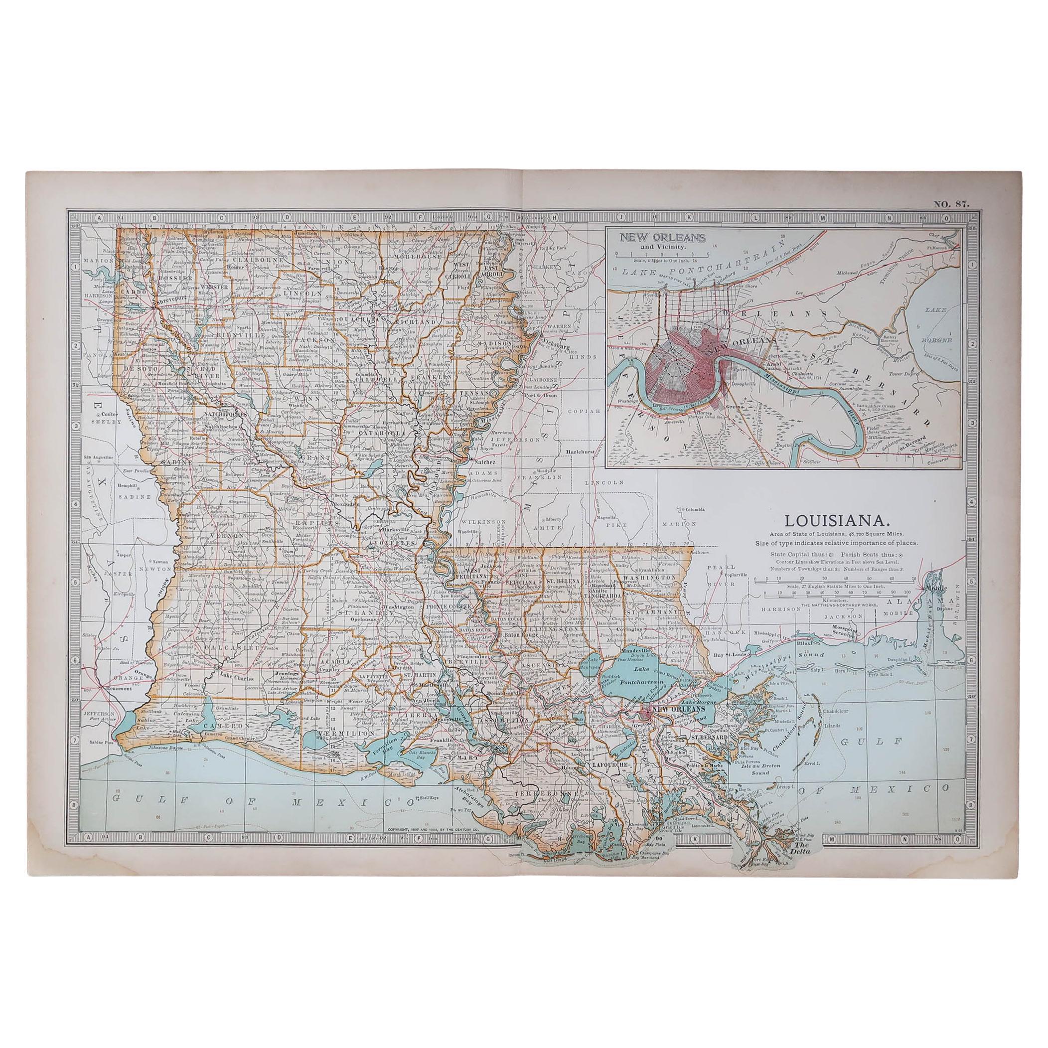
This framed 19th century map of the Louisiana territory was published in "Gray's Atlas of the United States with General Maps of the World, accompanied by Descriptions Geographical, Historical, Scientific and Statistica" published in 1873 in Philadelphia by O.W. Gray and Son and Stedman, Brown and Lyon. It is a highly detailed map of Louisiana and adjacent portions of Mississippi to the east and Texas to the west, as the borders existed in the late 19th century. It includes portions of the Gulf of Mexico and towns and cities, such as New Orleans, Baton Rouge and Lafayette. Ormando Wyllis (O.W.) Gray (1829-1912) was a Civil and Topographical Engineer who became a cartographer and map atlas publisher.
The map is presented in a light brown distressed bleached wood frame with a cream mat. The frame measures 22.63" wide x 20" high x 0.88" deep. The map is somewhat toned, although the appearance appears in part to be related to its tinting. It is otherwise in very good condition.
There are two other mid-19th century maps of North America in identical style frames and maps that are listed on 1stdibs. They would make for an attractive and interesting display grouping. There is a discount available for multiple purchases. These additional maps may be viewed by entering their reference numbers in the search field: LU5206221574212 or LU5206221506302.
About the Seller
5.0
Platinum Seller
Premium sellers with a 4.7+ rating and 24-hour response times
Established in 2011
1stDibs seller since 2019
298 sales on 1stDibs
Typical response time: 1 hour
- ShippingRetrieving quote...Shipping from: Alamo, CA
- Return Policy
More From This Seller
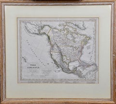
View AllNorth America: A Framed Hand-colored 19th Century German Map by Adolph Stieler
By Adolf Stieler
Located in Alamo, CA
This framed early 19th century map of North America entitled "Nord-Amerika" is plate No. LIV (No. 46) from Adolph Stieler's Hand-Atlas, published in Gotha, Germany by Justus Perthes ...
Category
1830s Landscape Prints
Materials
Engraving
A Hand Colored 18th Century Framed Map of South America by Thomas Jefferys
Located in Alamo, CA
This detailed hand colored map of South America by Thomas Jefferys was published in London in 1750. The map shows countries, early colonial possessions, towns, rivers, mountains, and...
Category
Mid-18th Century Other Art Style Landscape Prints
Materials
Engraving

Persia & Afghanistan: A Framed Hand-colored 17th Century Map by John Cary
By John Cary
Located in Alamo, CA
This colorful and detailed early 18th century copperplate map by John Cary entitled "A New Map of Persia from the Latest Authorities" was published in London in 1801. It depicts Persia, the region of modern day Afghanistan, the Caspian Sea, the Sea of Aral, the Persian Gulf...
Category
Early 19th Century Old Masters More Prints
Materials
Engraving

$940 Sale Price
20% Off
L'Isle de France: A Hand-colored 17th Century Map by De Wit
By Frederick de Wit
Located in Alamo, CA
This colorful and detailed 17th century hand-colored copperplate map by Frederick De Wit was published in Amsterdam between 1666 and 1760. The map depicts the Île-de-France, which is one of the ancient provinces of France. Paris is located in the center of the map, with Versailles to the southwest The map extends from Rouen in the west to Reims in the east. The area around Paris, the Véxin Français, was the original domain of the king of France. Other areas were ruled by French feudal lords. For example, the Véxin Normand area was the domain of the Duke of Normandy...
Category
Early 18th Century Old Masters More Prints
Materials
Engraving

$940 Sale Price
20% Off
California: 18th Century Hand-colored Map by de Vaugondy
By Didier Robert de Vaugondy
Located in Alamo, CA
This is an 18th century hand-colored map of the western portions of North America entitled "Carte de la Californie et des Pays Nord-Ouest separés de l'Asie par le détroit d'Anian, ex...
Category
1770s Landscape Prints
Materials
Engraving

$700 Sale Price
20% Off
Cadiz Island: A Framed 17th Century Hand-colored Map from Blaeu's Atlas Major
By Joan (Johannes) Blaeu
Located in Alamo, CA
This is a 17th century hand-colored map entitled "Insula Gaditana Isla de Cadiz" from Johannes (Joan) Blaeu's Atlas Maior, published in Amsterdam in 1662.
The map provides an excellent plan of Cadiz Island on the southwest coast of Spain, with its harbor, fortifications, agricultural fields and several surrounding salt processing areas. Numerous sailing ships of various sizes are included in and around the harbor and bay, including five large sailing ships, as well as twenty-four smaller ships. There is a small compass rose overlying the bay. The bridge to the mainland from the island is shown on the right. There is an extremely ornate and colorful title cartouche in the lower left, with its mythological figures reminiscent of Raphael’s Galatea fresco at the Villa Farnesina in Rome. The vibrant colors are vividly preserved. The master colorist tried to emulate a painting by using various tones to create a three-dimensional effect.
Blaeu's name is present in the plate in the lower right. Blaeu stated in his description of Cadiz: “The main wealth of the islanders consists of salt, which they harvest, and
the tuna fisheries.”
This 17th century hand-colored map is framed in an ornate, partially textured bronze-colored wood frame and glazed with UV protected conservation glass. There is a vertical center fold, as issued. There is a faint crease in the lower right and faint color offset on the left from the right side of the map, resulting from having been in an atlas for hundreds of years. Small foci of paint are present in the upper portion of the left margin and in the left corner margin. The map is otherwise in very good condition.
Due in large part to their powerful trade empire, the Dutch became known for cartography in the seventeenth century. This period is considered the Golden Age of Dutch cartography. Their publishing houses produced the highest quality work in Europe, particularly those maps and charts of foreign lands, and Dutch map-making set the bar for cartographic accuracy and artistry into the early-eighteenth century. Some of the most well-known cartographers worked in Amsterdam during this period. Perhaps the most famous of these was the Blaeu family. Willem Janszoon Blaeu, set up shop in Amsterdam. His son, Johannes (Joan), succeeded him upon his death in 1638, continuing in his father’s position as Hydrographer to the Dutch East India Company and selling maps to the public. The Blaeu map presses, located near Amsterdam’s Dam Square...
Category
Mid-17th Century Old Masters Landscape Prints
Materials
Engraving

You May Also Like
Original Antique Map of the American State of Louisiana, 1903
Located in St Annes, Lancashire
Antique map of Louisiana
Published By A & C Black. 1903
Original colour
Good condition
Unframed.
Free shipping
Category
Antique Early 1900s English Maps
Materials
Paper

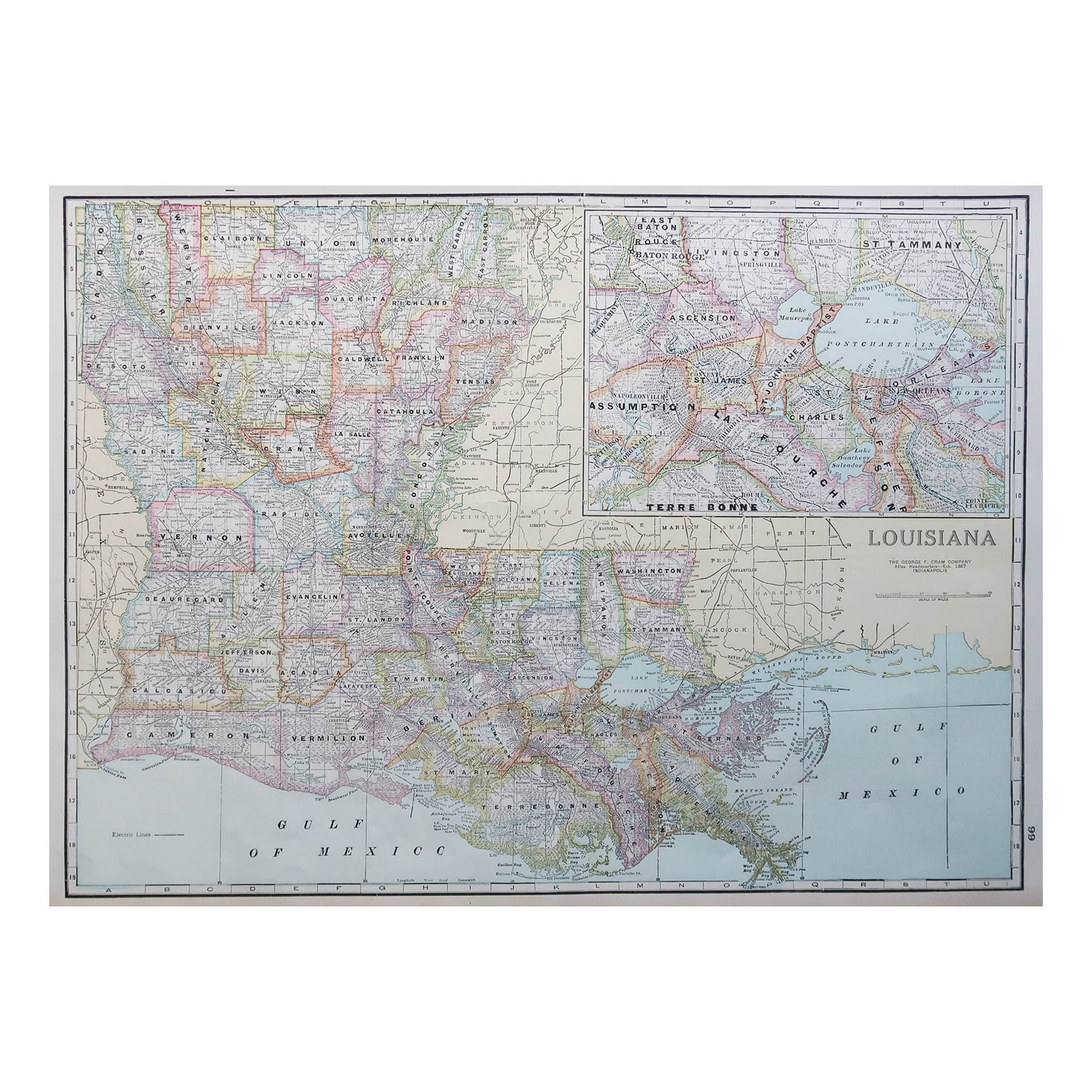
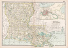
Large Original Antique Map of Louisiana, USA, C.1900
Located in St Annes, Lancashire
Fabulous map of Louisiana.
Original color.
Engraved and printed by the George F. Cram Company, Indianapolis.
Published, c.1900.
Unframed.
Repair ...
Category
Antique 1890s American Maps
Materials
Paper
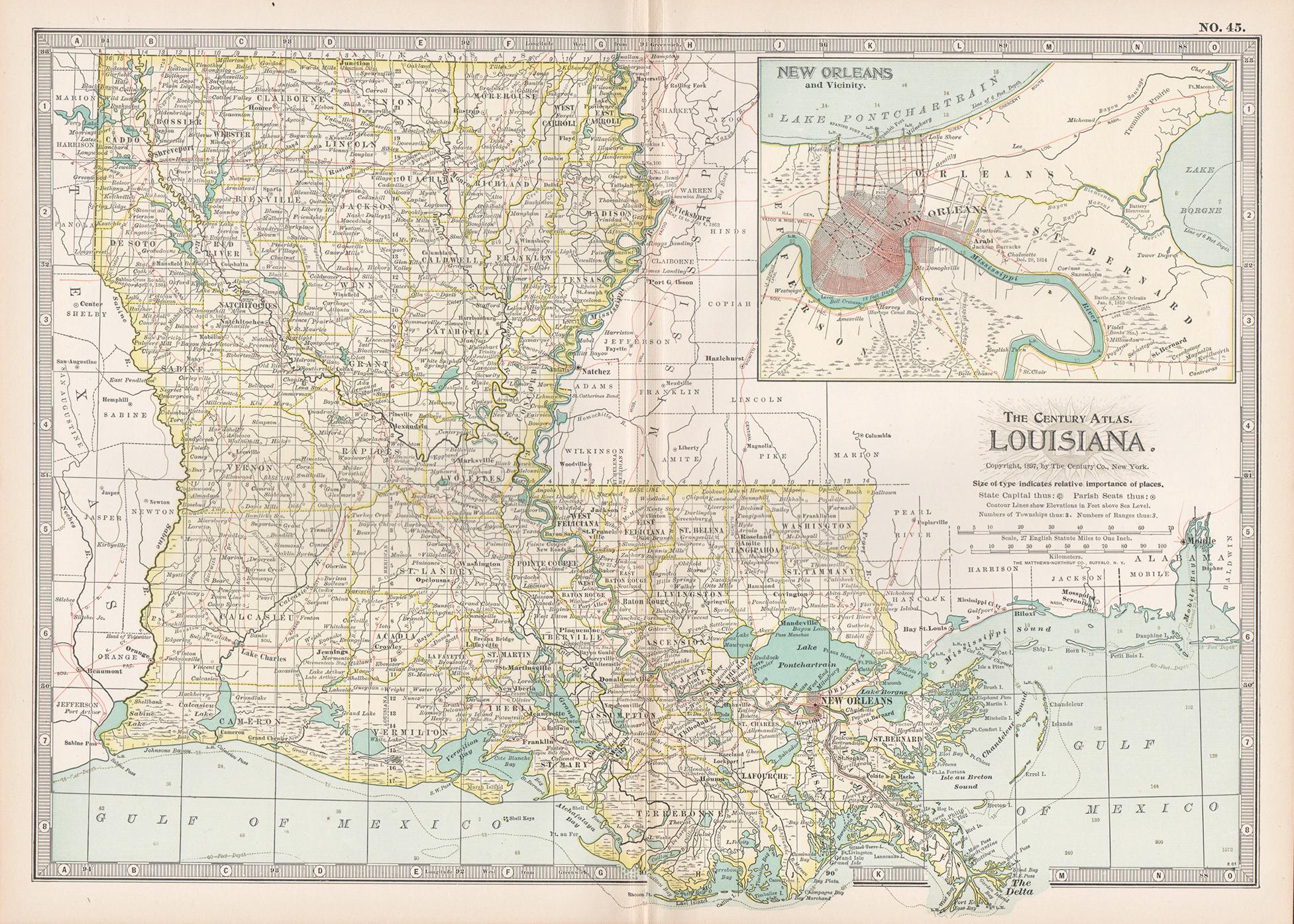
Louisiana. USA Century Atlas state antique vintage map
Located in Melbourne, Victoria
'The Century Atlas. Louisiana'
Inset map of 'New Orleans and Vicinity'.
Original antique map, 1903.
Central fold as issued. Map name and number printed on the reverse corners.
Shee...
Category
Early 20th Century Victorian More Prints
Materials
Lithograph
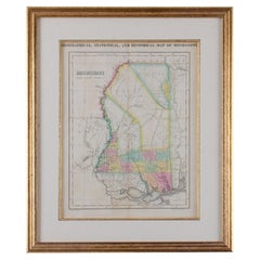
Map of Mississippi Carey & Lea, 1822
Located in Savannah, GA
Published in Philadelphia for the “Complete Historical, Chronological and Geographical American Atlas” by Henry Carey and Issac Lea, the map depicts Mississippi as it existed in 1822...
Category
Antique 1820s American Other Prints
Materials
Glass, Wood, Paper
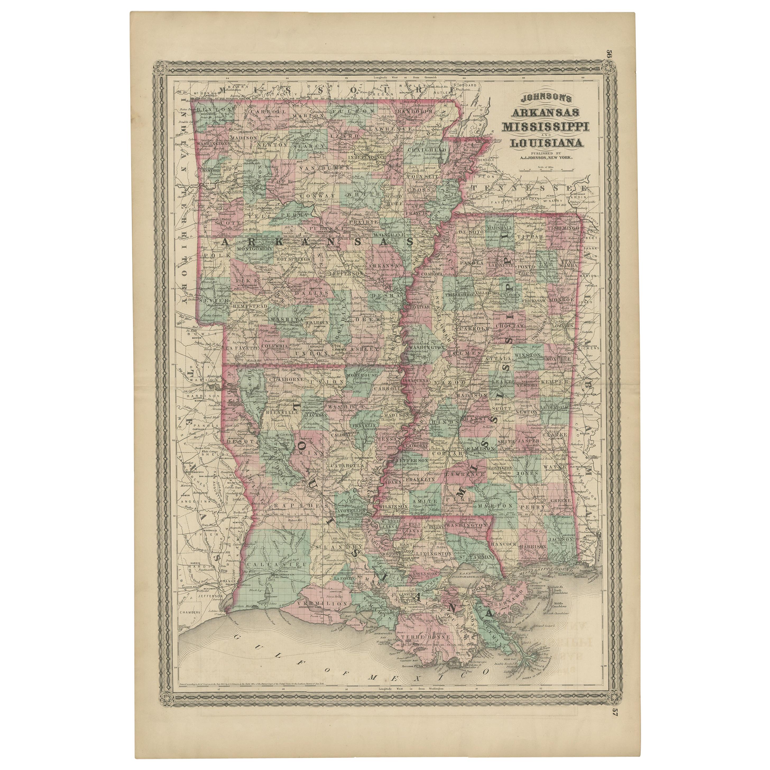
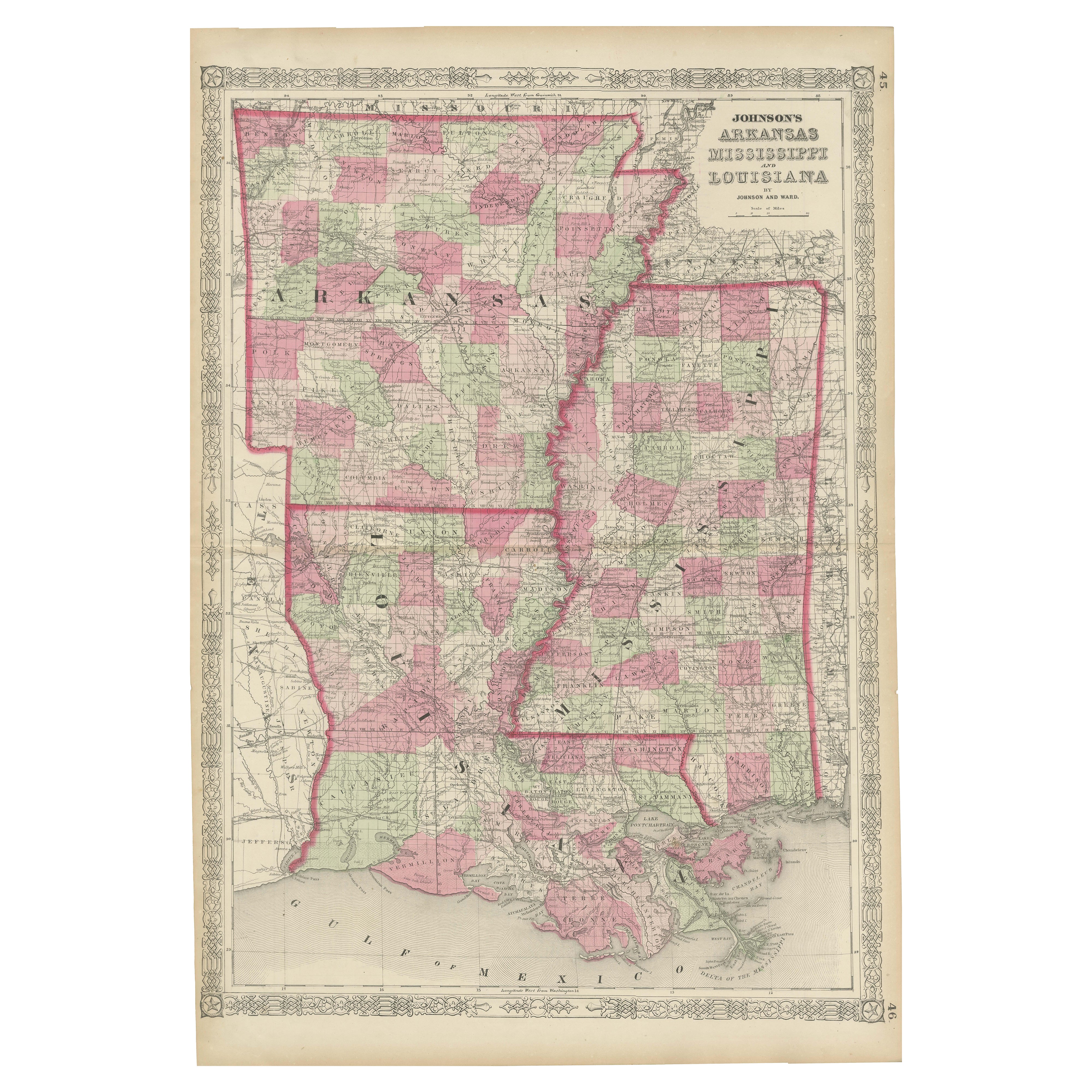
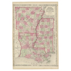
Antique Map of Arkansas, Mississippi and Louisiana by Johnson, 1872
Located in Langweer, NL
Antique map titled 'Johnson's Arkansas (..)'. Original map of Arkansas, Mississippi and Louisiana. This map originates from 'Johnson's New Illustrated ...
Category
Antique Late 19th Century Maps
Materials
Paper

$237 Sale Price
20% Off
Rare 1864 Civil War Era Map of Arkansas, Mississippi, and Louisiana
Located in Langweer, NL
Title: Rare 1864 Civil War Era Map of Arkansas, Mississippi, and Louisiana
Description: This captivating antique map, titled "Johnson's Arkansas, Mississippi, and Louisiana," was pu...
Category
Antique 1860s Maps
Materials
Paper
More Ways To Browse
Framed 19th Century Prints
19th Century Engraving Framed
Antique Maps Of North America
Antique Louisiana Map
Eileen Agar
Eric Valat
Examination Table
Free Standing Art Sculptures
Goldfish Sculpture
Granite Outdoor Sculptures
Halim Flowers
Hand Painted Mandala
Harvey Dinnerstein
Heart Sculpture Resin
Hopi Indian
Ibis Prints
Ice Cream Sculpture
Kaws Gold