Items Similar to Paysage à Asquins by Paulémile Pissarro - Wood Engraving Print
Want more images or videos?
Request additional images or videos from the seller
1 of 4
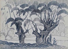
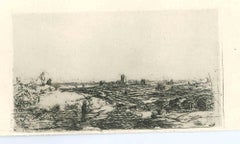
Paulémile PissarroPaysage à Asquins by Paulémile Pissarro - Wood Engraving Print
$482.78
£350
€412.34
CA$663.14
A$737.38
CHF 386.03
MX$9,007.21
NOK 4,850.85
SEK 4,563.20
DKK 3,078.08
About the Item
SOLD UNFRAMED
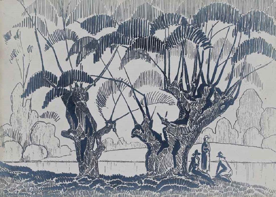
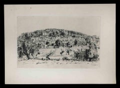
Paysage à Asquins by Paulémile Pissarro (1884 - 1972)
Wood engraving
9.7 x 15.5 cm (3 ⁷/₈ x 6 ¹/₈ inches)
Signed lower right, Paulémile-Pissarro, titled and numbered lower left, 2/5 No 14
Artist's Biography
Paulémile Pissarro, Camille Pissarro’s youngest son, was born in Éragny in 1884 where he was brought up within the creatively fertile environment of his family home and, encouraged by his father, began drawing at an early age. Paulémile’s godfather was Claude Monet, who became his teacher and legal guardian after Camille’s death in 1903.
In 1905 Paulémile exhibited at the Salon des Indépendants for the first time. Although his father had supported Paulémile’s desire to be an artist, his mother was eager for him to learn a more practical trade. Therefore in 1908 he put aside his artistic pursuits to work as an automobile mechanic and test-driver, then later as a lace and textile designer, allowing him only a limited time to paint. Paulémile only fully dedicated himself to painting following a letter from his brother Lucien in London, who wrote to invite him to take part in an exhibition held in London. Subsequent to the successful sale of a number of watercolours he had sent over, the young artist became inspired to leave the textile factory and pursue a career in art.
By the 1920s Paulémile had become an established Post-Impressionist artist in his own right, spending the summer months escaping from Paris on painting trips with fellow artists Kees Van Dongen, Raoul Dufy, Maurice de Vlaminck and André Dunoyer de Segonzac. In 1922 Paulémile purchased a house in Lyons-la-Forêt, a small village within the region of his hometown of Éragny and Giverny, where he moved in with his first wife Berthe Bennaiche. During this time, he developed a form of Cubism inspired by Paul Cézanne whom he dearly admired, creating some wonderful paintings of the river Eure and its surrounding villages. There he formed a close friendship with his neighbour, the famous Art Deco designer Émile-Jacques Ruhlmann, who designed a stunning Art Deco studio for Paulémile adjacent to his house.
In 1930 he visited and fell in love with the Swiss Normandy area in the Calvados region, in particular the River Orne which runs through the valley adjacent to the villages of Clécy and St. Remy. The combination of rolling hills, bold meadows and the calm river weaving its way through the landscape offered Paulémile a new burst of inspiration. With his second wife Yvonne Beaupel, Paulémile eventually moved to Clécy in 1935, where he would remain for the rest of his life. Of their three children, both H. Claude and Yvon also became artists.
With his house backing on to the river Orne, Paulémile developed a new way of working using a boat as a floating studio, where he spent countless days painting the calm waters from between the riverbanks. Here the influence of his godfather Claude Monet became apparent, particularly in Paulémile’s depiction of water, which was revolutionised by the Impressionist icon. He also applied Monet’s lessons in horticulture to the creation of an abundant garden, offering him many more motifs for his new paintings. Alongside these river landscapes, he also painted the neighbouring hay fields, various snow scenes, some interiors and still lives. The most ambitious work in his oeuvre was a fresco painted on all four walls of his own dining room, depicting the adjacent river in which he includes family members, neighbours and friends.
In 1967 Paulémile had his first one-man show in the United States at Wally Findlay Galleries in New York. This led to widespread recognition and a degree of professional success that few Pissarro artists knew during their lifetime. Since his death in 1972, Paulémile remains one of the best known of Camille’s sons.
- Creator:Paulémile Pissarro (1884 - 1972, French)
- Dimensions:Height: 3.82 in (9.7 cm)Width: 6.11 in (15.5 cm)
- Medium:
- Period:
- Condition:
- Gallery Location:London, GB
- Reference Number:1stDibs: LU261212622882
About the Seller
5.0
Recognized Seller
These prestigious sellers are industry leaders and represent the highest echelon for item quality and design.
Established in 1964
1stDibs seller since 2015
104 sales on 1stDibs
Typical response time: 2 hours
Associations
Society Of London Art Dealers
- ShippingRetrieving quote...Shipping from: London, United Kingdom
- Return Policy
Authenticity Guarantee
In the unlikely event there’s an issue with an item’s authenticity, contact us within 1 year for a full refund. DetailsMoney-Back Guarantee
If your item is not as described, is damaged in transit, or does not arrive, contact us within 7 days for a full refund. Details24-Hour Cancellation
You have a 24-hour grace period in which to reconsider your purchase, with no questions asked.Vetted Professional Sellers
Our world-class sellers must adhere to strict standards for service and quality, maintaining the integrity of our listings.Price-Match Guarantee
If you find that a seller listed the same item for a lower price elsewhere, we’ll match it.Trusted Global Delivery
Our best-in-class carrier network provides specialized shipping options worldwide, including custom delivery.More From This Seller
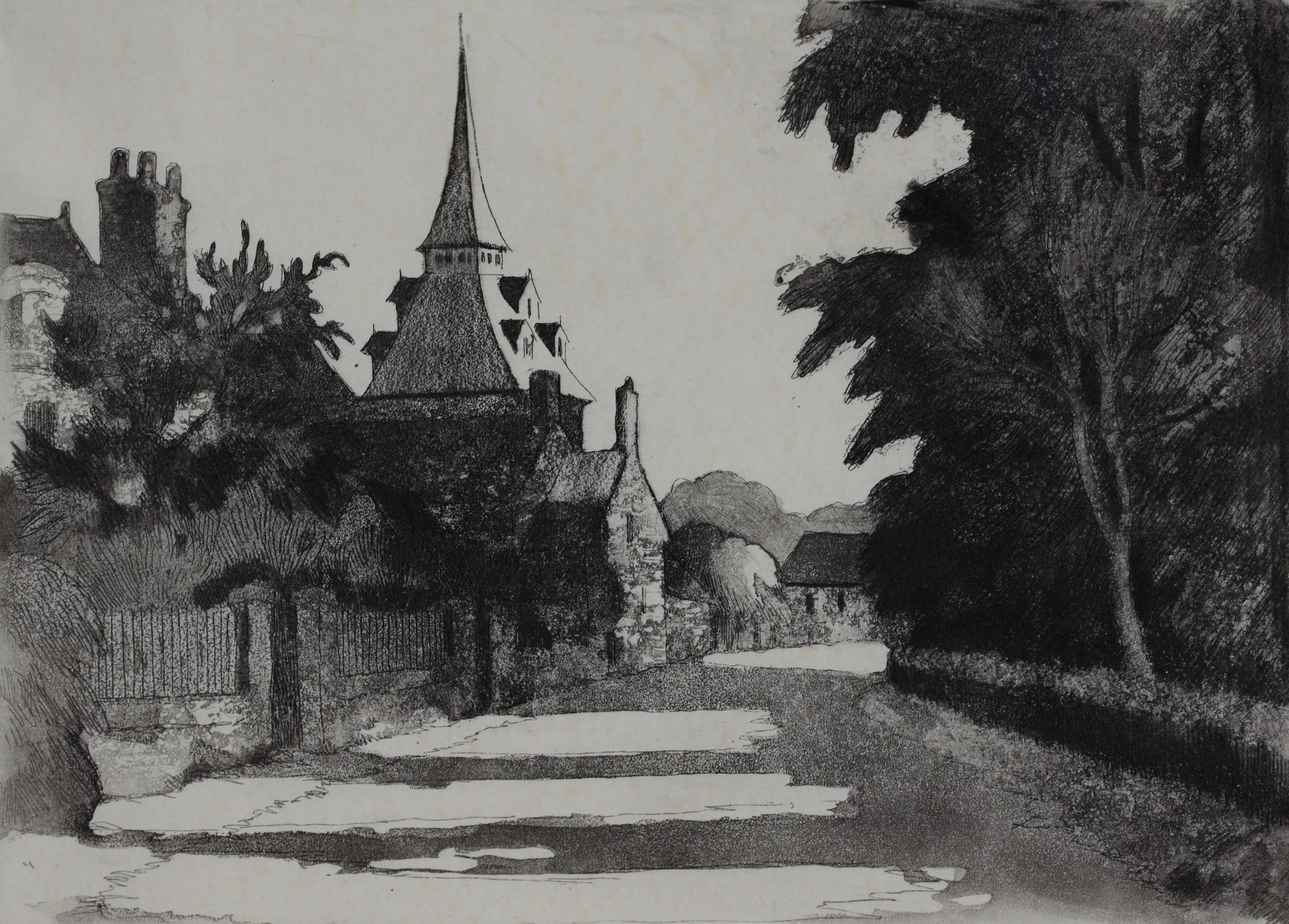
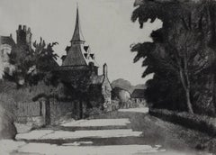
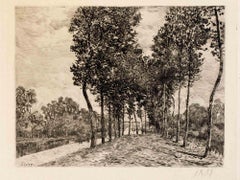
View AllLe Village de Landel by Paulémile Pissarro - etching
Located in London, GB
SOLD UNFRAMED
Le Village de Landel by Paulémile Pissarro (1884 - 1972)
Etching
17.2 x 23.7 cm (6 ¾ x 9 ⅜ inches)
Signed lower right, Paulémile-Pissarro and numbered lower left, 2e e...
Category
20th Century Post-Impressionist Landscape Prints
Materials
Etching
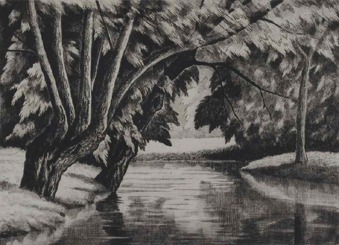
Jardin de la Villa à Brantôme by Paulémile Pissarro - Etching Print
Located in London, GB
Jardin de la Villa à Brantôme by Paulémile Pissarro (1884 - 1972)
Etching
20.5 x 28.5 cm (8 ⅛ x 11 ¼ inches)
Signed lower right, Paulémile Pissarro and numbered lower left, 6e etat N...
Category
20th Century Landscape Prints
Materials
Etching
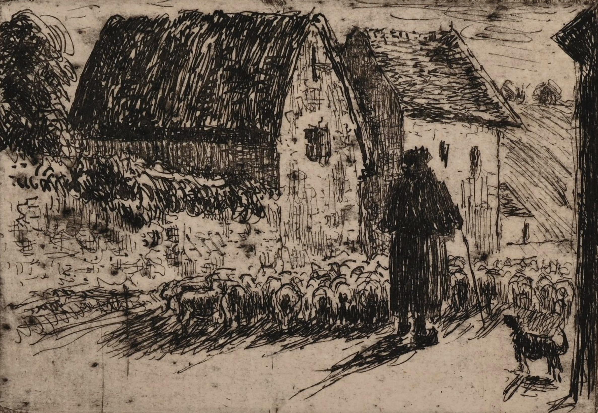
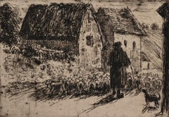
La rentrée du Berger by Camille Pissarro - Etching
By Camille Pissarro
Located in London, GB
La rentrée du Berger by Camille Pissarro (1830-1903)
Etching
7.6 x 10.9 cm (3 x 4 ¹/₄ inches)
Stamped with initials C.P. lower left, and numbered 13/18 lower right
This work was crea...
Category
1880s Impressionist Landscape Prints
Materials
Etching
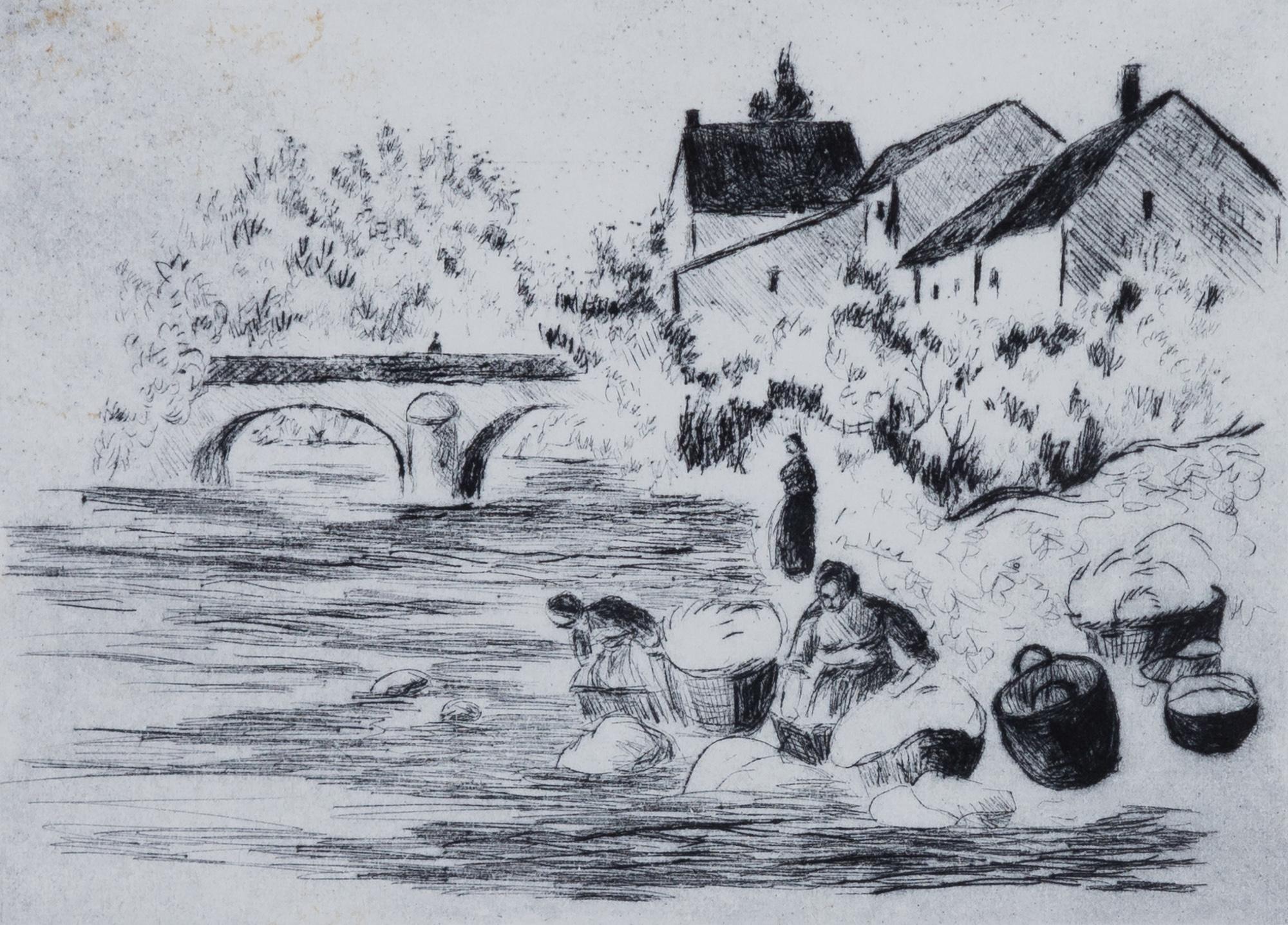
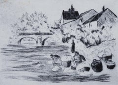
Lavandières by Lélia Pissarro - Figurative etching
By Lelia Pissarro
Located in London, GB
Lavandières by Lélia Pissarro (b. 1963)
Etching
12 x 15.5 cm (4 ³/₄ x 6 ¹/₈ inches)
Signed lower left, Lélia Pissarro.
Numbered lower right, 14/15
Artist biography:
Born in Paris i...
Category
1990s Figurative Prints
Materials
Etching
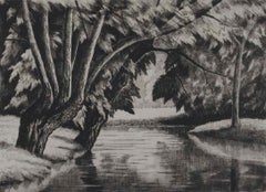
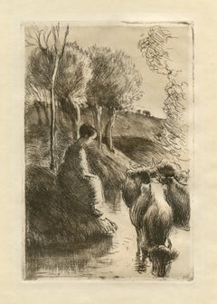
Two Women by a River by Paulémile Pissarro - Wood Engraving
Located in London, GB
SOLD UNFRAMED
Two Women by a River by Paulémile Pissarro (1884 - 1972)
Wood engraving
12.5 x 17.3 cm (4 ⅞ x 6 ¾ inches)
Signed lower left, Paulémile - Pissarro and numbered lower r...
Category
20th Century Impressionist Landscape Prints
Materials
Wood, Engraving
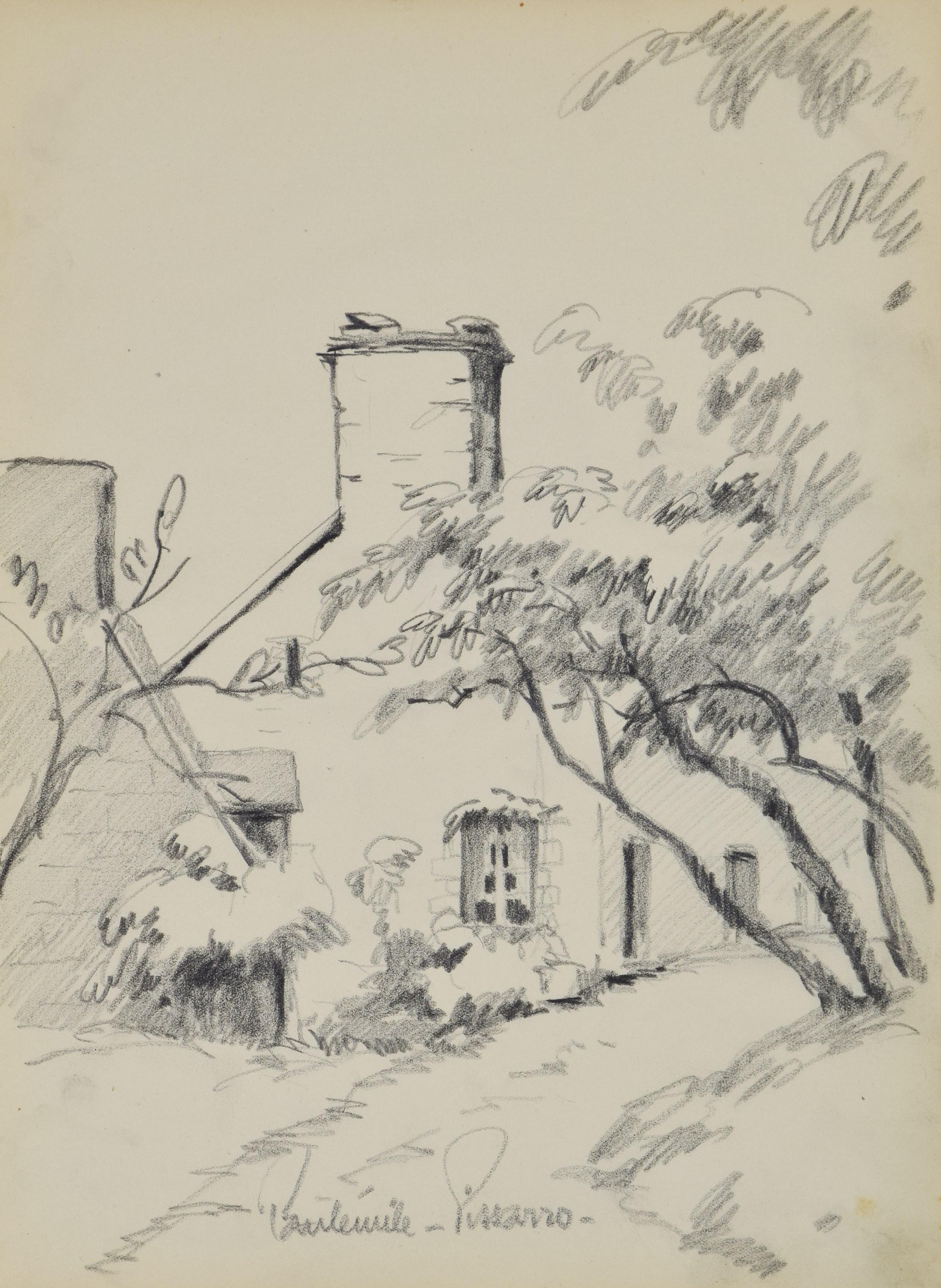
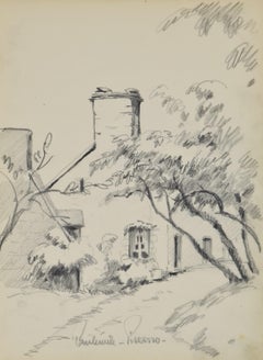
Paysage by Paulémile Pissarro, circa 1934 - graphite on paper
Located in London, GB
ARTWORK SOLD UNFRAMED
Paysage by Paulémile Pissarro (1884 - 1972)
Graphite on paper
32 x 23.5 cm (12 ⁵/₈ x 9 ¹/₄ inches)
Signed lower middle, Paulémile-Pissarro-
Executed circa 1934...
Category
1930s Post-Impressionist Drawings and Watercolor Paintings
Materials
Paper, Graphite
You May Also Like
"Vachere au Bord de l'Eau" original etching on japon paper
By Camille Pissarro
Located in Henderson, NV
Medium: original etching and drypoint. This rare and beautiful impression on japon paper is one of 50 printed for the deluxe edition of the Gazette des Beaux Arts. Published in Paris...
Category
1890s Impressionist Prints and Multiples
Materials
Etching
Landscape with Figures - Original Etching by M. Asselin - Early 20th Century
By Maurice Asselin
Located in Roma, IT
Landscape with Figures is a beautiful engraving, realized by the French painter and engraver Maurice Asselin, datable to the first half of the 20th century. The plate was engraved as...
Category
Early 20th Century Modern Figurative Prints
Materials
Etching

Landscape - Etching after Alfred Sisley - 19th Century
Located in Roma, IT
Landscape is an old master artwork realized in 19th Century after Alfred Sisley.
The artwork was realized after an original painting by Alfred Sisley
Black and white etching engrav...
Category
19th Century Modern Figurative Prints
Materials
Etching
$812 Sale Price
20% Off
The Landscape - Engraving after Rembrandt - 19th Century
By Charles Amand Durand
Located in Roma, IT
The landscape is an engraving on ivory-colored paper realized by Charles Amand Durand after an etching by Rembrandt. This wonderful piece of art belongs t...
Category
19th Century Old Masters Figurative Prints
Materials
Engraving
Small Gray Landscape - Engraving after Rembrandt - 19th Century
By Charles Amand Durand
Located in Roma, IT
Small Gray Landscape: a House and Trees beside a Pool is an engraving on ivory-colored paper realized by Charles Amand Durand (1831-1905) after an etching by Rembrandt. This piece of...
Category
19th Century Old Masters Figurative Prints
Materials
Engraving
French Landscape - Etching by Henry Verger-Sarrat - 20th Century
By Henry Verger-Sarrat
Located in Roma, IT
The French Landscape is an original etching realized by Henry Verger-Sarrat in the 20th Century.
Good conditions except for some foxings.
The artwork is depicted through strong str...
Category
1810s Modern Figurative Prints
Materials
Etching
More Ways To Browse
Art Deco Engraving
Color Palette Tiffany Blue
Elmer Schooley
Mcknight Serigraphs
Petra Antique
Sncf Dali
Donald Sultan Orange
John Frederick Lewis
Thomas Mcknight Serigraph
Yoshida Hiroshi
Canaletto Engraving
Ernest Roth Etching
Hawaiian Prints Webber
Lebanon Poster
Mma Metropolitan Museum Of Art
Peter Max Flag With Heart
Trowbridge Prints
Vintage Poster Colorado