Items Similar to Les Bergers Romains, landscape with Roman ruins, 18th century engraving
Want more images or videos?
Request additional images or videos from the seller
1 of 6
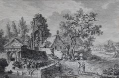
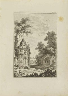
Les Bergers Romains, landscape with Roman ruins, 18th century engraving1755
1755
$980
£740.17
€855.42
CA$1,374.60
A$1,528.69
CHF 800.20
MX$18,648.14
NOK 10,054.78
SEK 9,457.82
DKK 6,385.14
About the Item
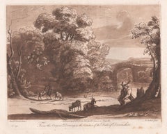
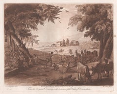
Les Bergers Romains
Copper-line engraving by Jean Jacques Leveau (1729-1786) after Pierre Mettay (1728-1759). C1755.
Proof, before lettering. Laid, watermarked paper.
A landscape with Roman shepherds. Classical ruins include a fountain decorated with a lion, a triumphal arch and sarcophagus. Pierre Mettay was a French painter who attended the French Academy in Rome.
410mm by 455mm (platemark) 440mm by 490mm (sheet).
- Creation Year:1755
- Dimensions:Height: 17.33 in (44 cm)Width: 19.3 in (49 cm)
- Medium:
- Movement & Style:
- After:Pierre Mettay (1728 - 1759, French)
- Period:
- Condition:One small area of abrasion in the centre of the image. A couple of small breaks in the paper at the edges of the sheet. One short repaired break in the paper at the top of the sheet which goes into the image 2cms but barely visible.
- Gallery Location:Melbourne, AU
- Reference Number:Seller: CL34401stDibs: LU1244215550722
About the Seller
5.0
Platinum Seller
Premium sellers with a 4.7+ rating and 24-hour response times
Established in 2005
1stDibs seller since 2019
593 sales on 1stDibs
Typical response time: <1 hour
- ShippingRetrieving quote...Shipping from: Melbourne, Australia
- Return Policy
Authenticity Guarantee
In the unlikely event there’s an issue with an item’s authenticity, contact us within 1 year for a full refund. DetailsMoney-Back Guarantee
If your item is not as described, is damaged in transit, or does not arrive, contact us within 7 days for a full refund. Details24-Hour Cancellation
You have a 24-hour grace period in which to reconsider your purchase, with no questions asked.Vetted Professional Sellers
Our world-class sellers must adhere to strict standards for service and quality, maintaining the integrity of our listings.Price-Match Guarantee
If you find that a seller listed the same item for a lower price elsewhere, we’ll match it.Trusted Global Delivery
Our best-in-class carrier network provides specialized shipping options worldwide, including custom delivery.More From This Seller
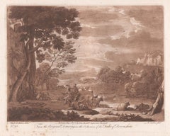
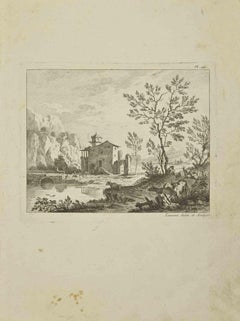
View AllItalianate Landscape, mezzotint by Richard Earlom after Claude le Lorrain
By (after) Claude Lorrain (Claude Gellée)
Located in Melbourne, Victoria
Sepia mezzotint by Richard Earlom (1743-1822) After Claude Gellee ('Claude Lorrain') (1600-82).
From 'Liber Veritatis; or A Collection of Prints after ...
Category
Late 18th Century Italian School Landscape Prints
Materials
Engraving, Mezzotint, Etching
Italianate Landscape, mezzotint by Richard Earlom after Claude le Lorrain
By (after) Claude Lorrain (Claude Gellée)
Located in Melbourne, Victoria
Sepia mezzotint by Richard Earlom (1743-1822) After Claude Gellee ('Claude Lorrain') (1600-82).
From 'Liber Veritatis; or A Collection of Prints after the original designs of Claude le Lorrain...
Category
Late 18th Century Italian School Landscape Prints
Materials
Engraving, Mezzotint, Etching
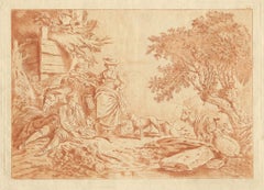
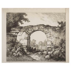
French 18th century bucolic scene, soft ground etching, style of Boucher, c1770,
Located in Melbourne, Victoria
Fine soft ground etching printed in a orange / red ink on laid paper. A French etching in the manner of Boucher. A shepherd and shepherdess rest by water among sheep, goats a donkey ...
Category
Late 18th Century Romantic Landscape Prints
Materials
Etching
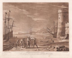
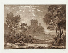
Representation Generale de la Voute de La Galerie du President, French engraving
By Charles Dibdin
Located in Melbourne, Victoria
Copper-line engraving by Mathys Pool (1676-1732) after Picart and Charles Le Brun (1619-1690). 1718.
Depicts a ceiling design commissioned for the Hot...
Category
Early 19th Century Naturalistic Landscape Prints
Materials
Engraving
You May Also Like
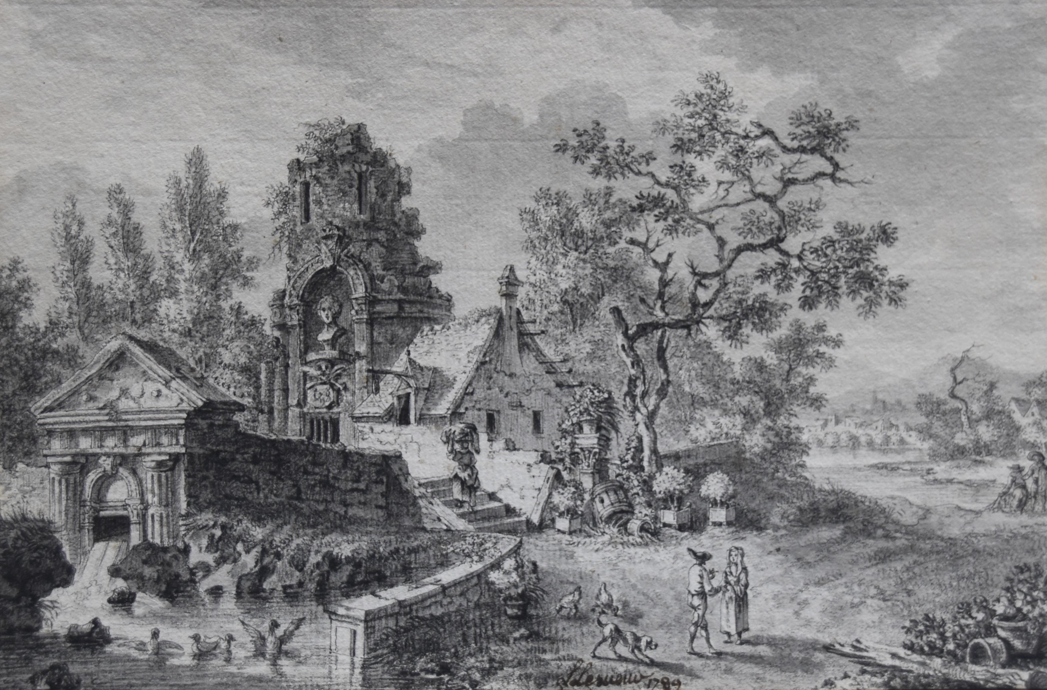
Louis Lesueur (1746-1803) Landscape with ruins, 1789, drawing signed and dated
Located in Paris, FR
Louis Lesueur (1746-1803)
A Fantasy Landscape with ancient ruins, 1789,
signed and dated "L Lesueur 1789" in the bottom centre
Pen and ink and ink wash on paper
14.8 x 22 cm
In goo...
Category
1780s Old Masters Landscape Drawings and Watercolors
Materials
Ink
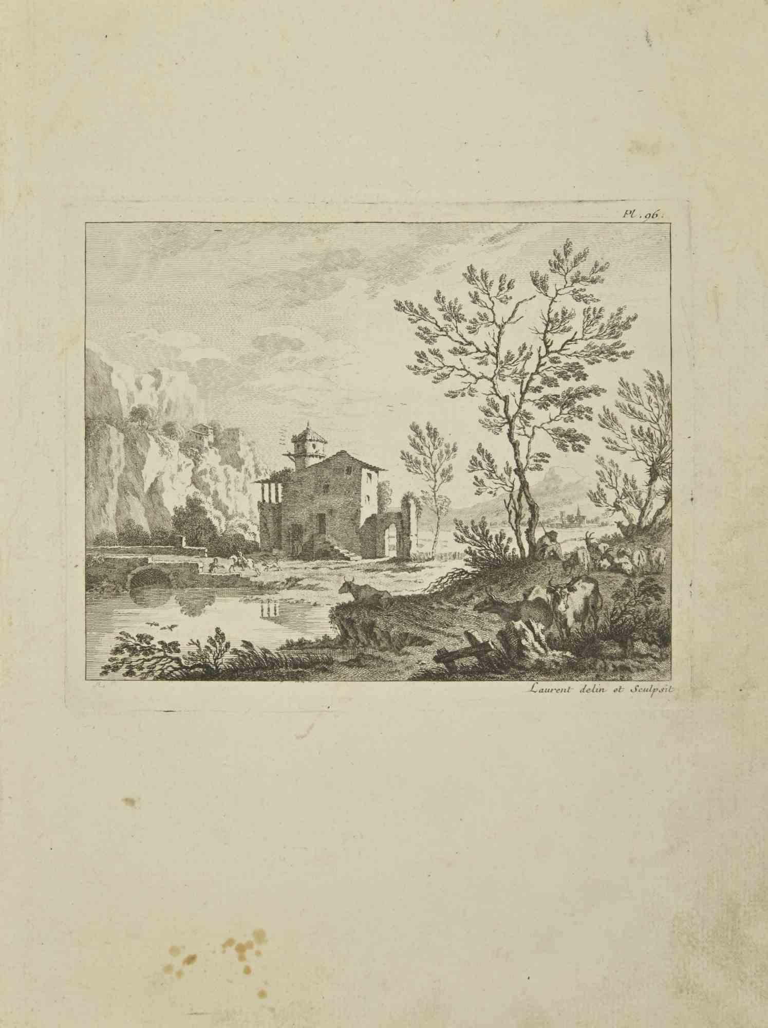
Landscape - Etching by Pierre-François Laurent - 1755
Located in Roma, IT
Landscape is an etching realized by Pierre-François Laurent in 1755.
Good condition.
Signed on Plate.
The artwork is depicted through confident strokes.
The etching was realized ...
Category
1750s Modern Figurative Prints
Materials
Etching
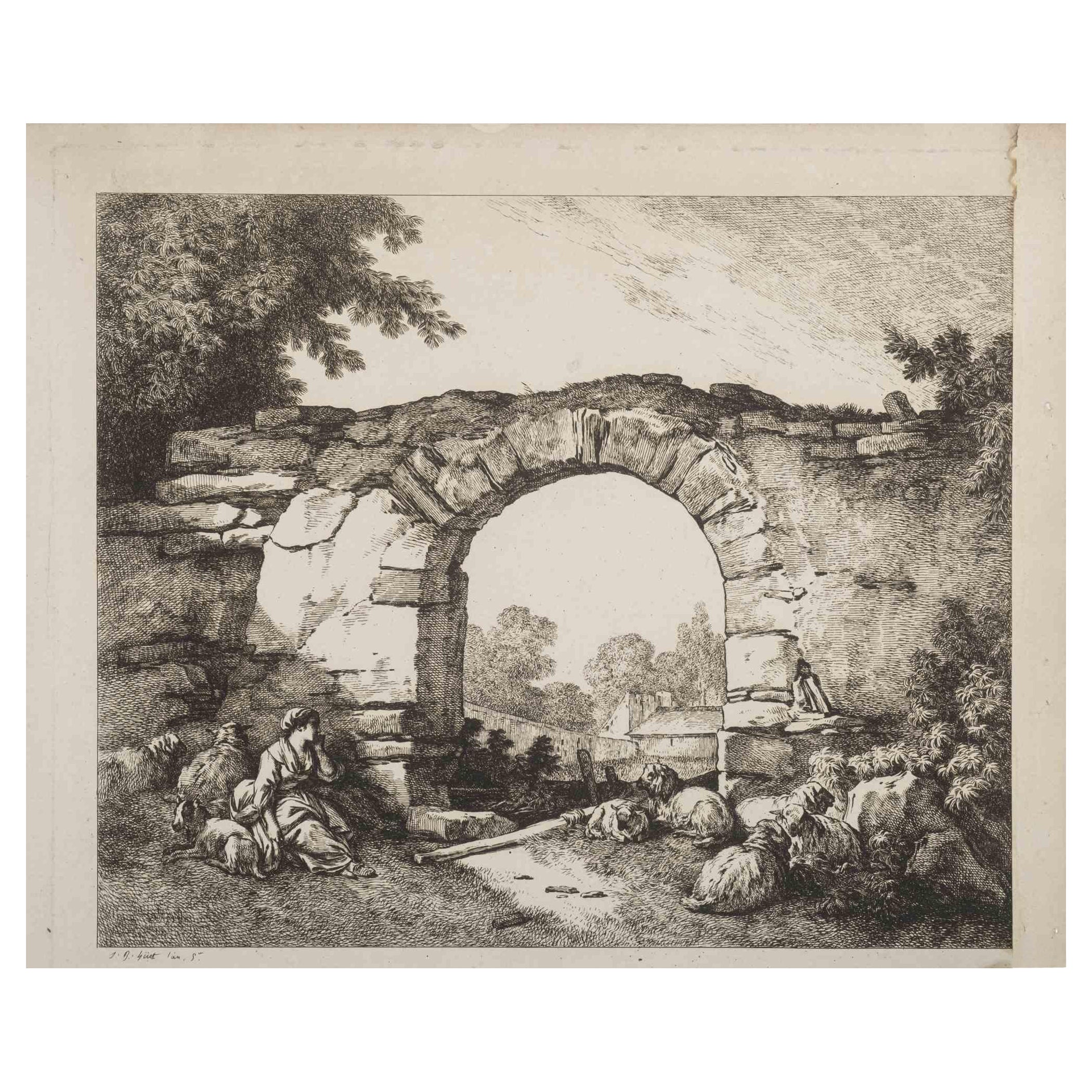
Landscape with Ruins - Original Etching by J.B. Huet - 19th Century
Located in Roma, IT
Landscape with Ruins is an original artwork realized by Jean-Baptiste Huet in the Late 19th Century.
Etching print.
Good conditions.
Signed on the plate.
The artwork is depicted ...
Category
19th Century Modern Figurative Prints
Materials
Etching
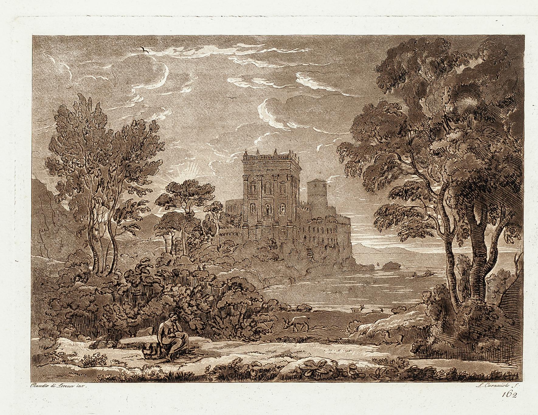
Landscape fromLiber Veritatis - Original B/W Etching after Claude Lorrain - 1815
By Ludovico Caracciolo
Located in Roma, IT
Image dimensions: 21 x 27 cm.
Liber Veritatis - Plate 162 is a beautiful black and white etching and aquatint on paper realized by the Italian artist Ludovico Caracciolo, after Clau...
Category
1810s Old Masters Figurative Prints
Materials
Etching, Aquatint
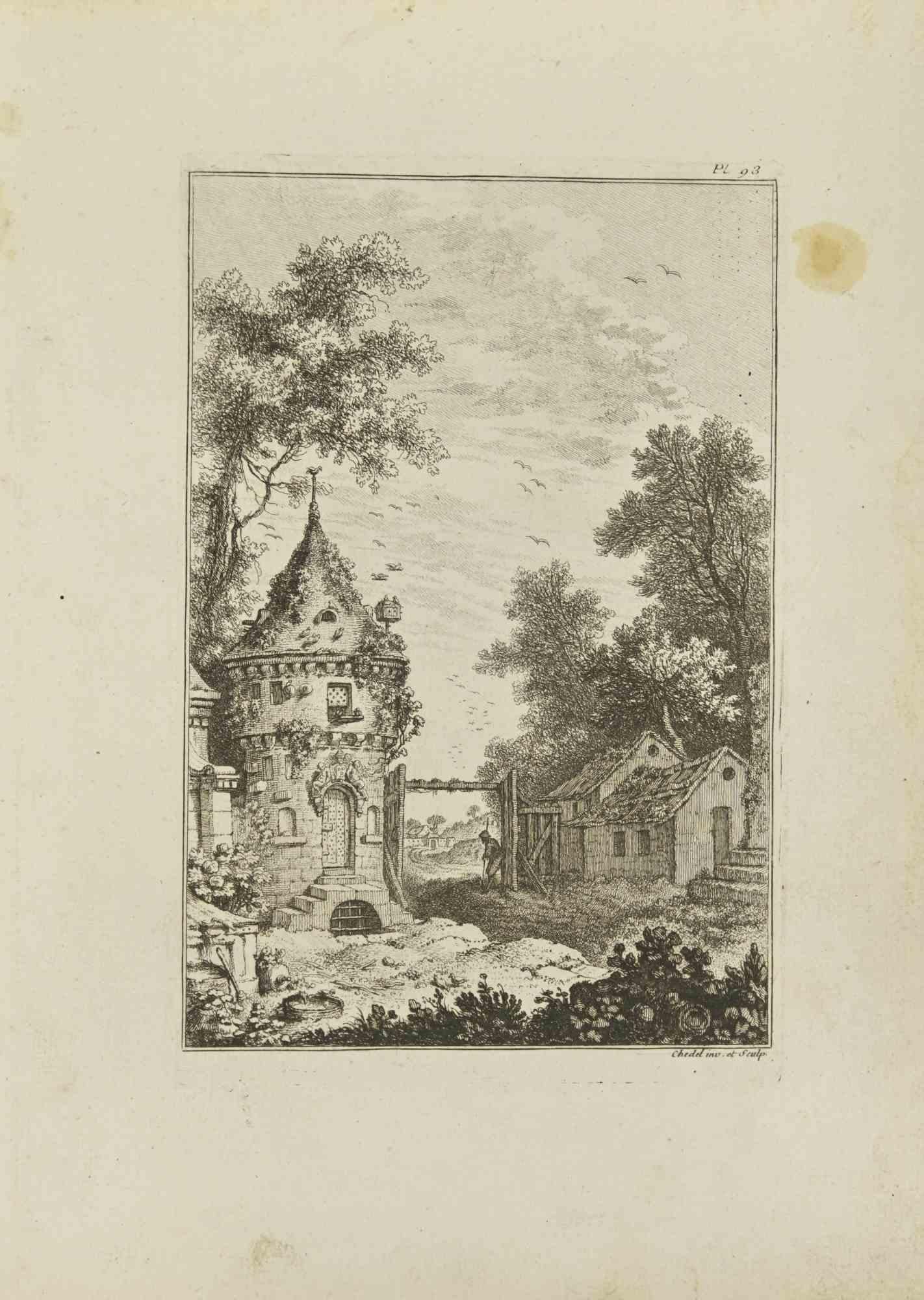
Landscape - Etching by Pierre Quentin Chedel - 1755
By Pierre Quentin Chedel
Located in Roma, IT
Landscape is an etching realized by Pierre Quentin Chedel in 1755.
Good conditions.
Signed on Plate.
The artwork is depicted through confident strokes.
The etching was realized f...
Category
1750s Figurative Prints
Materials
Etching
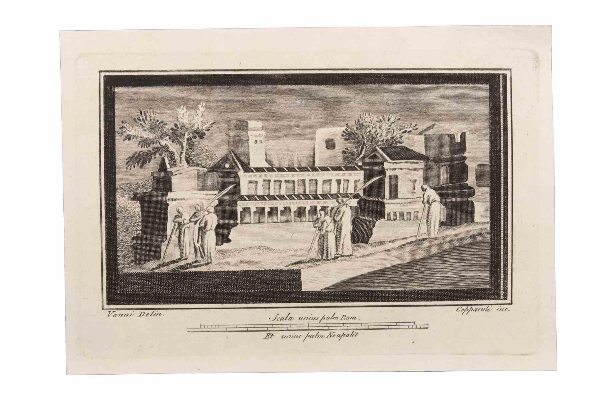
Landscape with Monuments and Figures - Etching by F. Cepparuli - 18th Century
By Francesco Cepparuli
Located in Roma, IT
Landscape With Monuments and Figures is an Etching realized by Francesco Cepparuli (1750-1767).
The etching belongs to the print suite “Antiquities of Herculaneum Exposed” (origina...
Category
Late 18th Century Old Masters Figurative Prints
Materials
Etching
More Ways To Browse
18th Century French Engraving
18th Century French Landscape
18th Century French Copper
Roman Lion
Lion Engraving
Pierre Berger
Alain Moulis
Alicia Rhett
Bernard Buffet Place De La Concorde
Bernard Gantner Lithograph
Bernard Gantner On Sale
Childe Hassam On Sale
Claughton Pellew
David Stier
Ed Ruscha History Kids
Eileen Seitz Beyond Earth Beauty
Ellison Hoover On Sale
Frances Palmer