Items Similar to Downing College, Cambridge engraving by Samuel Sparrow after Henry Barker
Want more images or videos?
Request additional images or videos from the seller
1 of 10
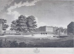
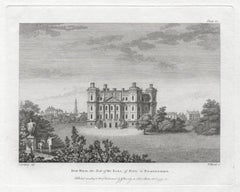
Samuel SparrowDowning College, Cambridge engraving by Samuel Sparrow after Henry Barker1812
1812
$472.37
£350
€405.78
CA$659.86
A$717.86
CHF 378.80
MX$8,633.52
NOK 4,778.47
SEK 4,447.13
DKK 3,030.48
About the Item
To see our other original maps, scroll down to "More from this Seller" and below it click on "See all from this Seller" - or send us a message if you cannot find the poster you want.
Samuel Sparrow (active 1770 - 1806) after Henry Barker (1774 - 1856)
Downing College, Cambridge (1812)
Engraving
31 x 43 cm
A copy of this engraving is held by the British Museum.
An early nineteenth-century engraving of Downing College, with building materials in the foreground and elegantly dressed figures, including two scholars, strolling in the College's grounds.
The Cambridge University Almanack was an annual almanac published by the Cambridge University Press. It traditionally included engravings or lithographs of the University and information about the upcoming year.
- Creator:Samuel Sparrow (British, English)
- Creation Year:1812
- Dimensions:Height: 12.21 in (31 cm)Width: 16.93 in (43 cm)
- Medium:
- Period:
- Framing:Framing Options Available
- Condition:Generally good, except loss to left hand side.
- Gallery Location:London, GB
- Reference Number:1stDibs: LU795313474202
About the Seller
4.8
Vetted Professional Seller
Every seller passes strict standards for authenticity and reliability
Established in 2014
1stDibs seller since 2017
361 sales on 1stDibs
Typical response time: 13 hours
- ShippingRetrieving quote...Shipping from: London, United Kingdom
- Return Policy
More From This Seller
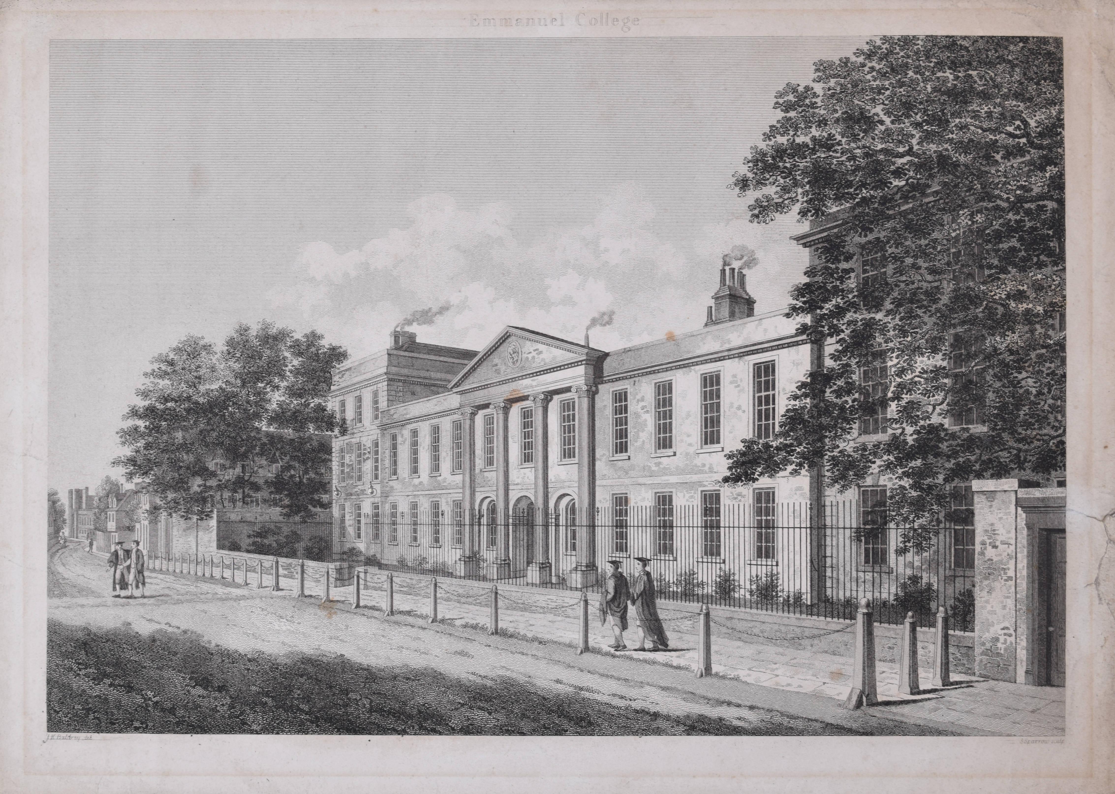
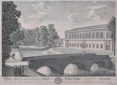
View AllEmmanuel College, Cambridge engraving by Samuel Sparrow after John Baldrey
Located in London, GB
To see our other views of Oxford and Cambridge, scroll down to "More from this Seller" and below it click on "See all from this Seller" - or send us a message if you cannot find the view you want.
Samuel Sparrow (active 1800) after John Kirby Baldrey (1750 - 1823)
Emmanuel College...
Category
19th Century Landscape Prints
Materials
Engraving
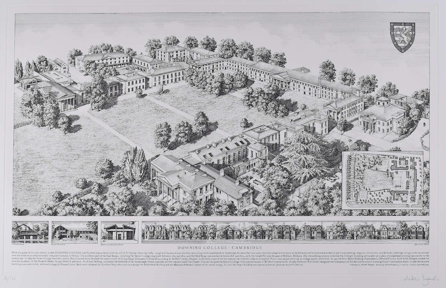
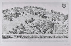
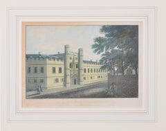
Downing College, Cambridge, engraving by Andrew Ingamells
By Andrew Ingamells
Located in London, GB
To see our other views of Oxford and Cambridge, scroll down to "More from this Seller" and below it click on "See all from this Seller" - or send us a message if you cannot find the view you want.
Andrew Ingamells
Downing College
Engraving
40 x 63 cm
Signed to lower right and numbered 86/175
This meticulously detailed gravure etching by Andrew Ingamells is the first etching or engraving to depict Downing College Cambridge...
Category
Early 2000s Realist Landscape Prints
Materials
Engraving
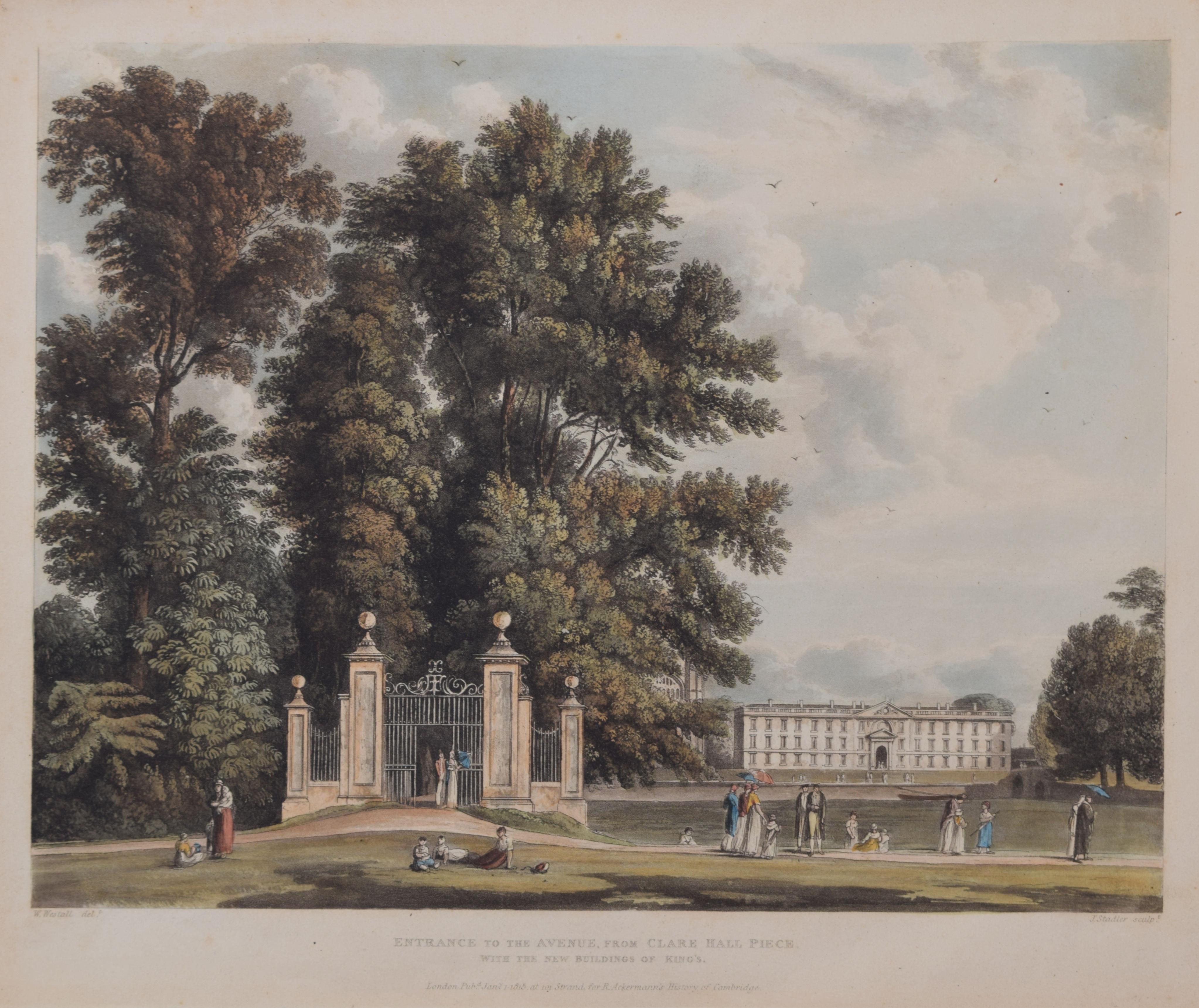
Clare College, Cambridge / Clare Hall / King's College engraving by Stadler
Located in London, GB
To see our other Oxford and Cambridge pictures, including an extensive collection of works by Ackermann, scroll down to "More from this Seller" and below it click on "See all from th...
Category
1810s Realist Prints and Multiples
Materials
Aquatint

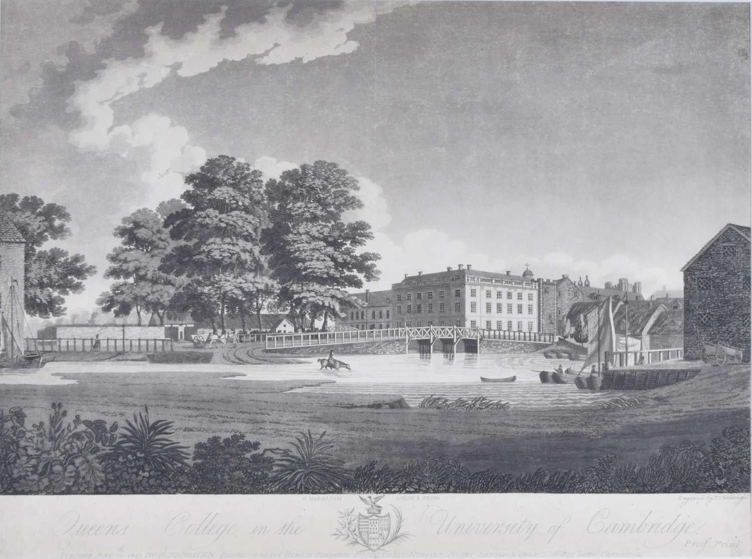
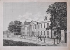
Queen's College, Cambridge, engraving by Richard Bankes Harraden
Located in London, GB
Richard Bankes Harraden
Queen's College, Cambridge
Engraving
40 x 54 cm
Inscribed to the bottom: 'Published June 16th 1798 by R. Harraden.'
A late eighteenth-century view of Queens'...
Category
1790s Landscape Prints
Materials
Engraving
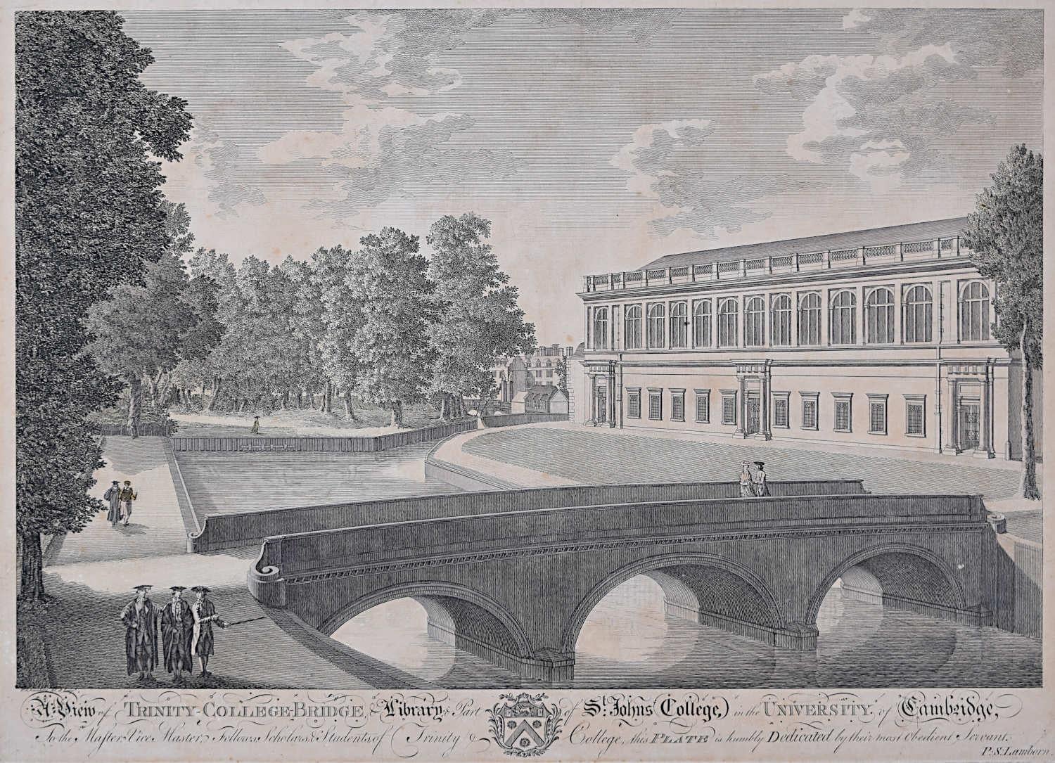
Trinity College and John's College, Cambridge engraving by P S Lamborn
Located in London, GB
To see our other views of Oxford and Cambridge, scroll down to "More from this Seller" and below it click on "See all from this Seller" - or send us a message if you cannot find the ...
Category
18th Century Landscape Prints
Materials
Engraving
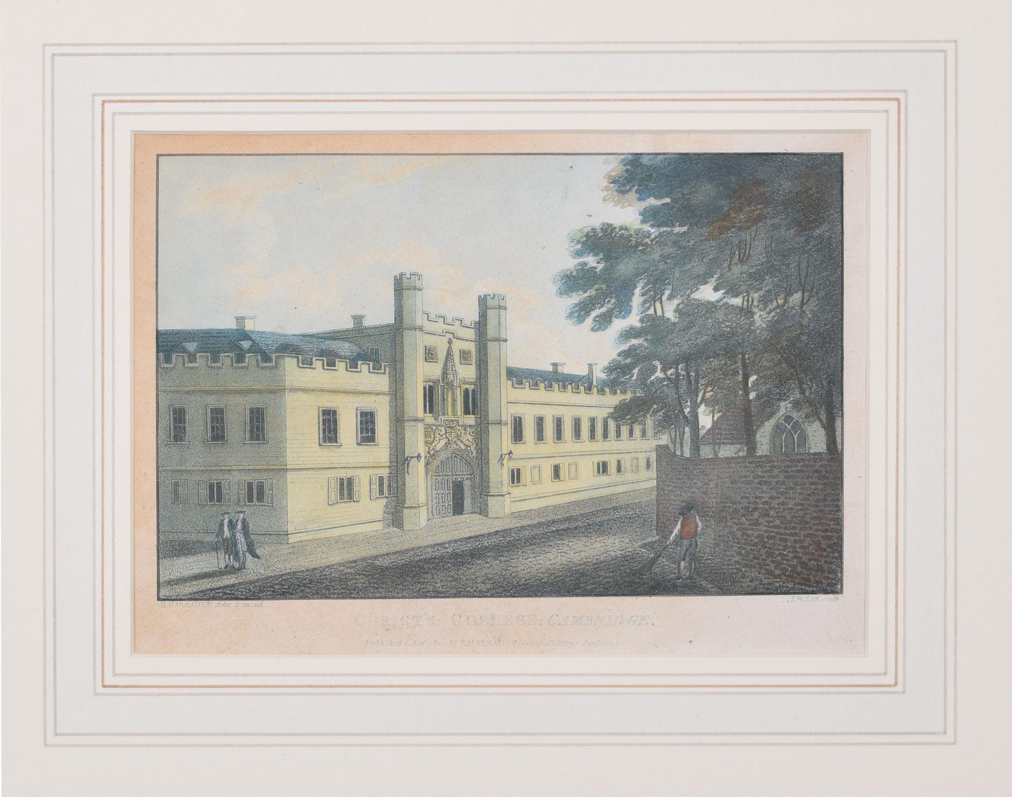
Christ's College, Cambridge engraving by Richard Bankes Harraden
Located in London, GB
To see our other views of Oxford and Cambridge, scroll down to "More from this Seller" and below it click on "See all from this Seller" - or send us a message if you cannot find the view you want.
Richard Bankes...
Category
1830s Realist Prints and Multiples
Materials
Engraving
You May Also Like
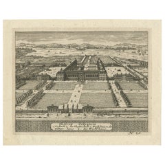
Antique Engraving of Chelsea College – View with Formal Gardens, ca.1705
Located in Langweer, NL
Antique Engraving of Chelsea College – Early 18th Century View with Formal Gardens
This finely detailed antique engraving presents a bird’s-eye view of Chelsea College (now the Roya...
Category
Antique Early 18th Century German Prints
Materials
Paper
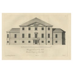
Antique Engraving of Kirby Hall Near Gretton, Northamptonshire, England c.1770
Located in Langweer, NL
Antique print titled 'Principal Front of Kirby Hall'.
Kirby Hall is an Elizabethan country house, located near Gretton, Northamptonshire, England. The nearest main town is Corby. One of the great Elizabethan houses of England, Kirby Hall was built for Sir Humphrey Stafford of Blatherwick, beginning in 1570. In 1575 the property was purchased by Sir Christopher Hatton of Holdenby,[1] Lord Chancellor to Queen Elizabeth I. It is a leading and early example of the Elizabethan prodigy house. Construction on the building began in 1570, based on the designs in French architectural pattern books and expanded in the Classical style over the course of the following decades. The house is now in a semi-ruined state with many parts roof-less although the Great Hall and state rooms remain intact. The gardens, with their elaborate "cutwork" design, complete with statues and urns, have been recently restored.
Anne of Denmark stayed at Kirby on 9 August 1605 while King James stayed at Rockingham Castle. King James stayed for three days in August 1616. During a royal progress Esmé Stewart, 3rd Duke of Lennox died at Kirby of the "spotted ague" on 30 July 1624.
The building and gardens are owned by the Earl of Winchilsea and are managed by English Heritage.
Kirby Hall has been used as a filming location in many productions. These include the following; an episode (6. Protest and Communication) of Kenneth Clark...
Category
Antique 18th Century Prints
Materials
Paper
$522 Sale Price
20% Off
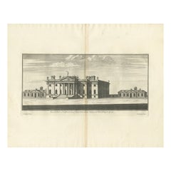
Antique Print of Duncombe Park by Campbell, 1725
Located in Langweer, NL
Antique print titled 'Duncomb Park in Yorkshire (..)'. Old engraving of Duncombe Park, Yorkshire. Duncombe Park is the seat of the Duncombe family whose senior members assumed the ti...
Category
Antique 18th Century Prints
Materials
Paper
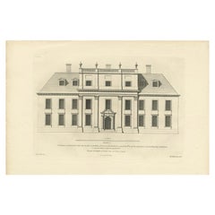
Antique Architectural Print of Cobham Hall in Kent, England, 1717
Located in Langweer, NL
Antique print titled 'The Elevation of Cobham Hall in Kent (..)'.
Elevation of the entrance facade of Cobham Hall, Kent. This print originates from 'Vitruvius Britannicus' by Colen...
Category
Antique 18th Century Prints
Materials
Paper
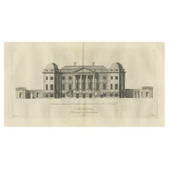
Old Engraving of Foremarke Hall, a Manor House in Derbyshire, England, ca.1770
Located in Langweer, NL
Description: Antique print titled 'North Front of Foremark (..)'.
Old engraving of Foremarke Hall, a Georgian-Palladian country house and manor house. This print originates from 'V...
Category
Antique 1770s English Prints
Materials
Paper
Duff House, Bamffshire, Scotland. Cordinier C18th landscape engraving
Located in Melbourne, Victoria
‘Duff House, the Seat of the Earl of Fife, in Bamffshire’
Engraving by P Mazell After C Cordiner,
From Paul Sandby's 'The Virtuosi's Museum, Containing Select Views in England, Sco...
Category
18th Century Naturalistic Landscape Prints
Materials
Engraving
More Ways To Browse
R Marsh
Richard Devonshire
Rowland Langmaid
Sncf Dali
Spring Song Vintage Print
Thomas Moran Etching
Used Porta John
Valerie Thornton
Vintage United Airlines Travel Posters
William Stafford
Adolphe Beaufrere
African American Poster
Altman Luxembourg Lithograph
Ana Popescu
Aquatint India
Bernard Buffet Canal
Bernard Cathelin On Sale
Camilla Vintage Prints