Items Similar to Sutton Nicholls - Framed 18th Century Engraving, Devonshire Square
Want more images or videos?
Request additional images or videos from the seller
1 of 9
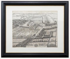
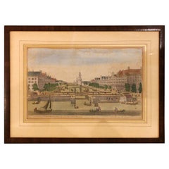
Sutton NichollsSutton Nicholls - Framed 18th Century Engraving, Devonshire SquareEarly 18th Century
Early 18th Century
$346.40
$43320% Off
£268.89
£336.1120% Off
€305.01
€381.2620% Off
CA$494.60
CA$618.2520% Off
A$545.01
A$681.2720% Off
CHF 282.69
CHF 353.3620% Off
MX$6,482.20
MX$8,102.7620% Off
NOK 3,575.94
NOK 4,469.9320% Off
SEK 3,349.90
SEK 4,187.3720% Off
DKK 2,277.93
DKK 2,847.4220% Off
About the Item
A bird's eye view of Devonshire Square, engraved by British master Sutton Nicholls. Published according to the act of Parliament in 1754 for Stow's Survey of London. This detailed engraving has been finished with hand colouring. Signed in plate to the lower right corner. Beautifully presented in a contemporary black frame with a double card mount. On laid.
- Creator:Sutton Nicholls (1680 - 1760, English)
- Creation Year:Early 18th Century
- Dimensions:Height: 22.45 in (57 cm)Width: 26.38 in (67 cm)
- Medium:
- Period:
- Condition:The condition is typical for a picture of this age including some discolouration.
- Gallery Location:Corsham, GB
- Reference Number:Seller: rx3551stDibs: LU881313141832
About the Seller
4.9
Platinum Seller
Premium sellers with a 4.7+ rating and 24-hour response times
Established in 2010
1stDibs seller since 2018
1,425 sales on 1stDibs
Typical response time: 4 hours
- ShippingRetrieving quote...Shipping from: Corsham, United Kingdom
- Return Policy
More From This Seller
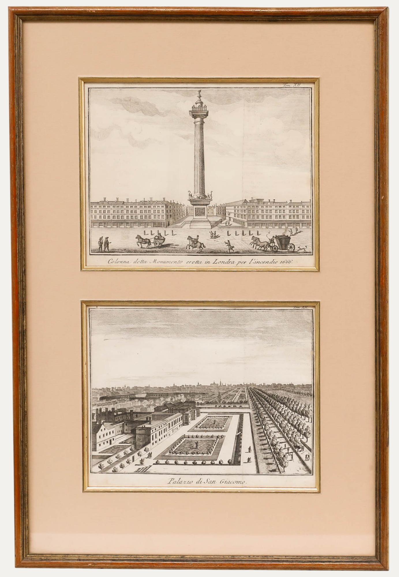
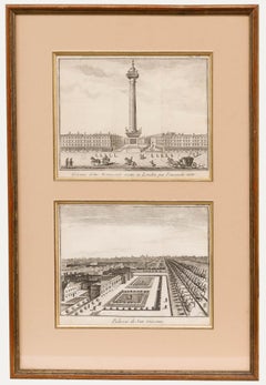
View AllFramed 18th Century Engravings - The Monument & St. James's Palace
Located in Corsham, GB
A pair of 18th-century engravings of London, framed as one. The Monument to the Great Fire of London (top). St James's Palace (bottom). Inscribed i...
Category
Early 18th Century Landscape Prints
Materials
Engraving
Framed 20th Century Watercolour - Berkeley Square, London
Located in Corsham, GB
Located in heart of Mayfair, this fine watercolour captures the hustle and bustle of Berkeley Square. Well-presented in a large gilt-effect frame with a wash-line mount. The artist h...
Category
20th Century Landscape Drawings and Watercolors
Materials
Watercolor
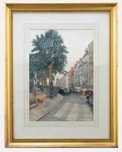
$280 Sale Price
20% Off
John Harris After Thomas Badeslade - 18th Century Engraving, Deane House
By John Harris (painter)
Located in Corsham, GB
A delightful bird's eye view of Deane House Kent, engraved by John Harris after an original drawing by British illustrator Thomas Badeslade. The engraving shows a detailed view of th...
Category
Early 18th Century Landscape Prints
Materials
Engraving
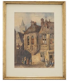
Framed 19th Century Watercolour, City of Rouen
Located in Corsham, GB
A fine 19th century watercolour showing figures in the French streets of Rouen. The artist has included many architectural features within the composition, such as a medieval turret and church spire...
Category
19th Century Landscape Drawings and Watercolors
Materials
Watercolor
$324 Sale Price
20% Off
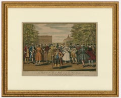
Evan Davis (fl.1735-1745) - 18th Century Engraving, Taste A-La Mode 1735
Located in Corsham, GB
A hand coloured engraving depicting the fashions of 1735. Well presented in a gilt effect frame. Signed in plate. On laid paper.
Category
Early 18th Century Figurative Prints
Materials
Engraving
$268 Sale Price
20% Off
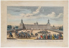
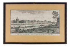
Robert Sayer (1725-1794) - 18th Century Engraving, A View of the Royal Palace
Located in Corsham, GB
This finely detailed etching captures an expansive view of the Royal Palace in Madrid, Spain. Colourfully dressed spectators observe soldiers on horseback parading around the grand s...
Category
Early 18th Century Landscape Prints
Materials
Engraving
You May Also Like
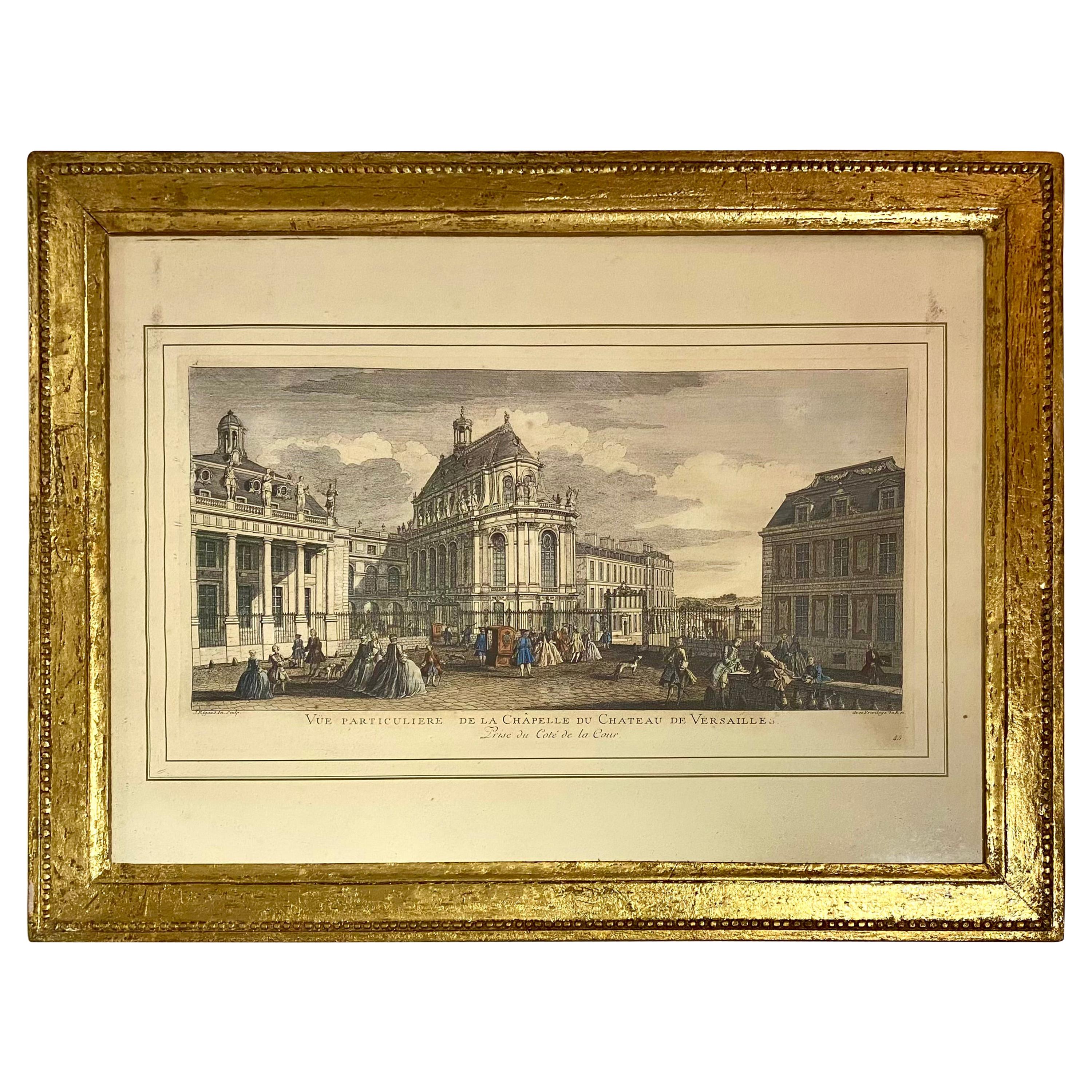
Large Framed Etching of Versailles – Vue Particulière de la Chapelle du Château
Located in Montreal, Quebec
Large framed French Etching of Versailles – Vue Particulière de la Chapelle du Château de Versailles
Pair available on the Versailles Theme. From Mis en Demeure, Paris.
Category
Late 20th Century French Louis XVI Prints
Materials
Wood, Paper
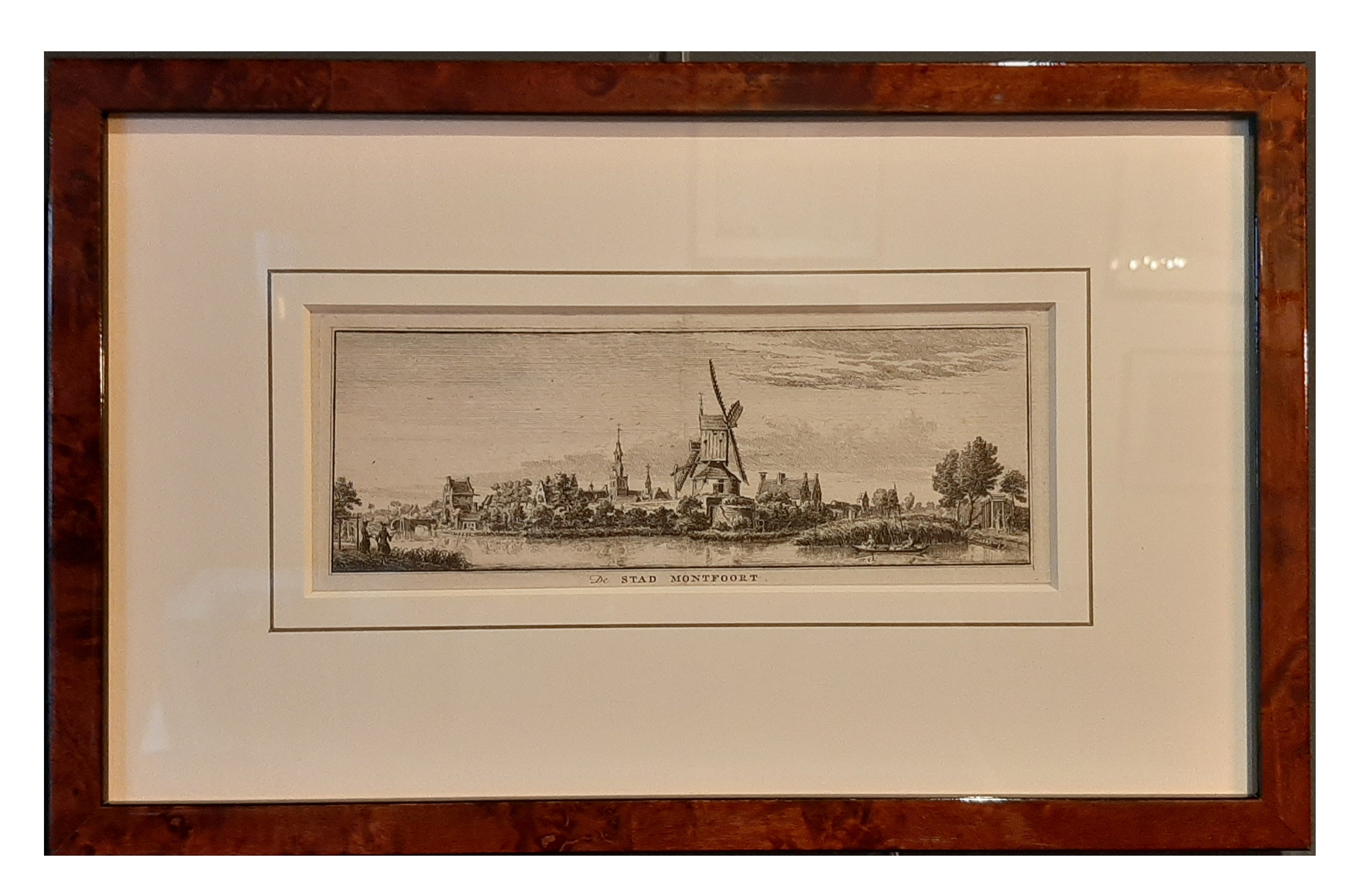
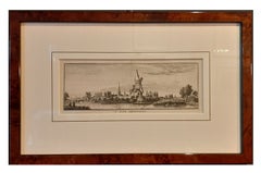
Framed Antique Print of the City of Montfoort in The Netherlands, circa 1750
Located in Langweer, NL
Antique print titled 'De Stad Montfoort'. View on the city of Montfoort, the Netherlands.
Artists and Engravers: Engraved by H. Spilman.
Condition: Good, general age-related to...
Category
Antique 18th Century Prints
Materials
Paper
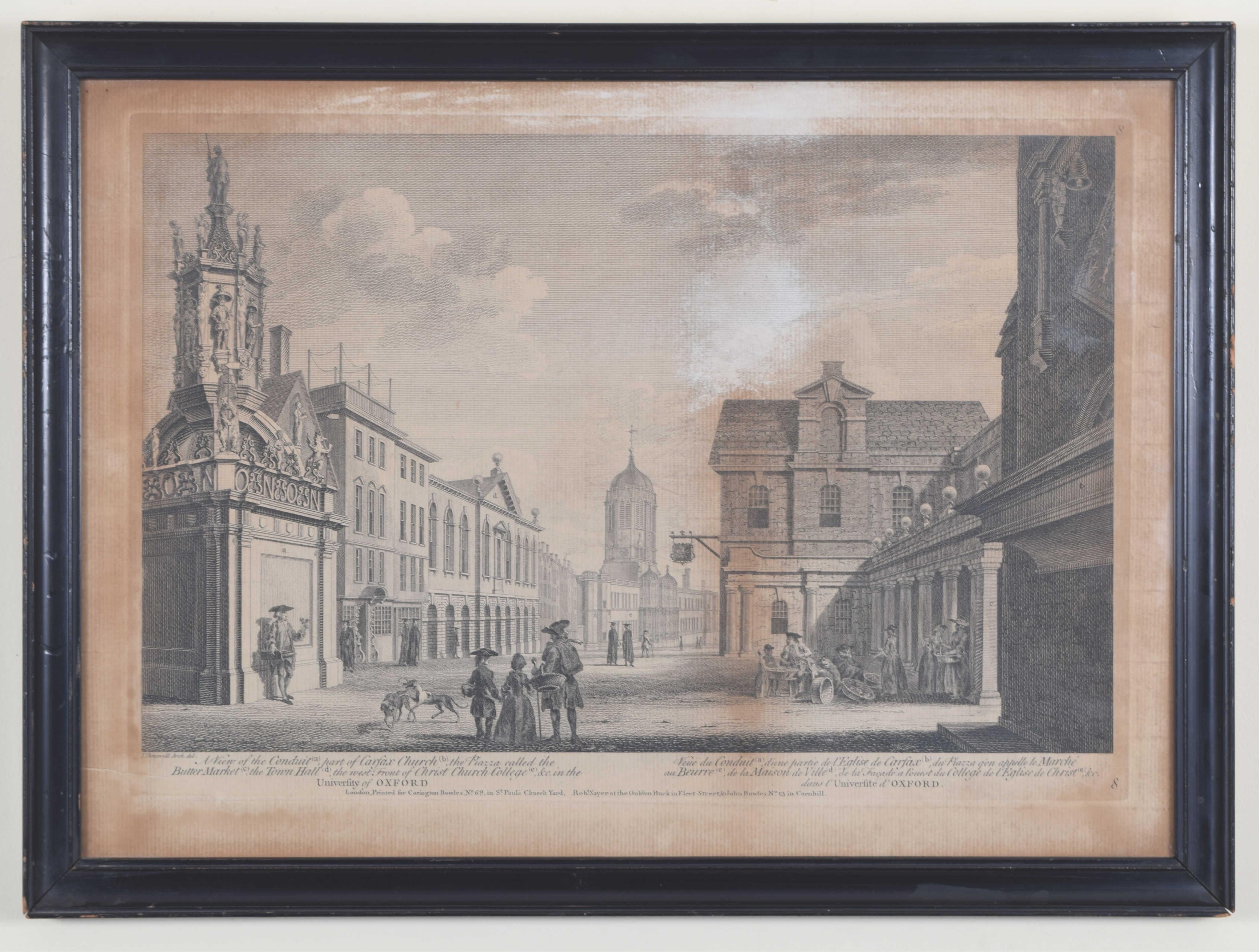
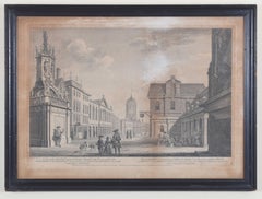
Oxford Christ Church and Carfax 18th century engraving by John Donowell
Located in London, GB
To see our other views of Oxford and Cambridge, scroll down to "More from this Seller" and below it click on "See all from this Seller" - or send us a message if you cannot find the ...
Category
1750s Landscape Prints
Materials
Engraving
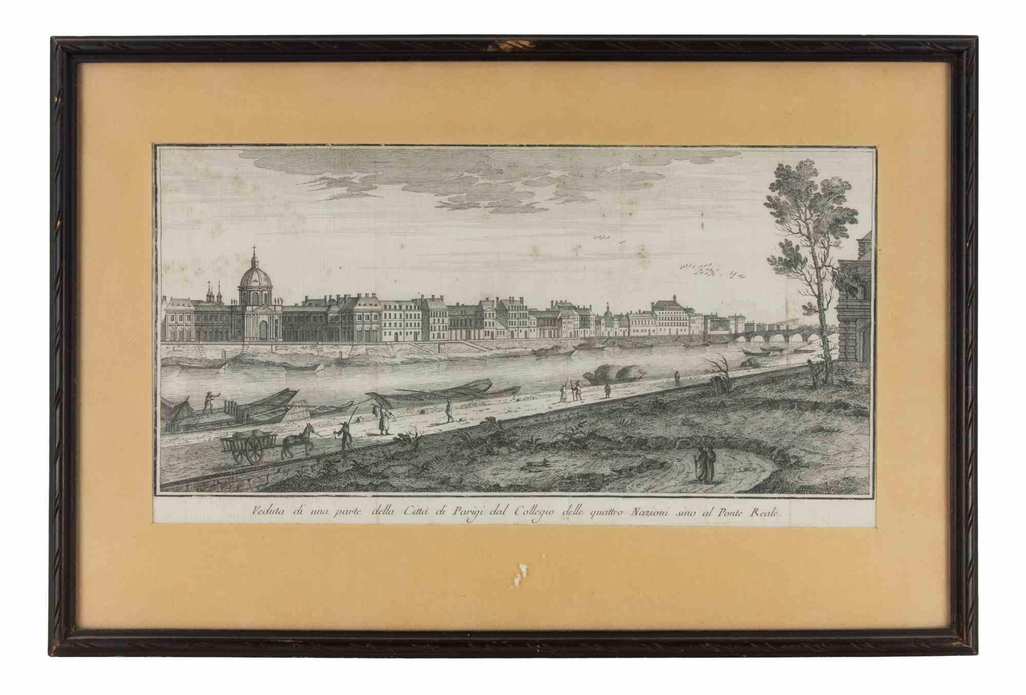
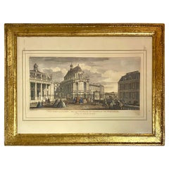
View of a Part of the City of Paris from the College of the... - Etching - 1748
Located in Roma, IT
Etching realized in 1748.
Very good condition except for some minor foxing.
Includes a wooden frame cm. 27.5x41.5
Category
1740s Modern Abstract Prints
Materials
Etching
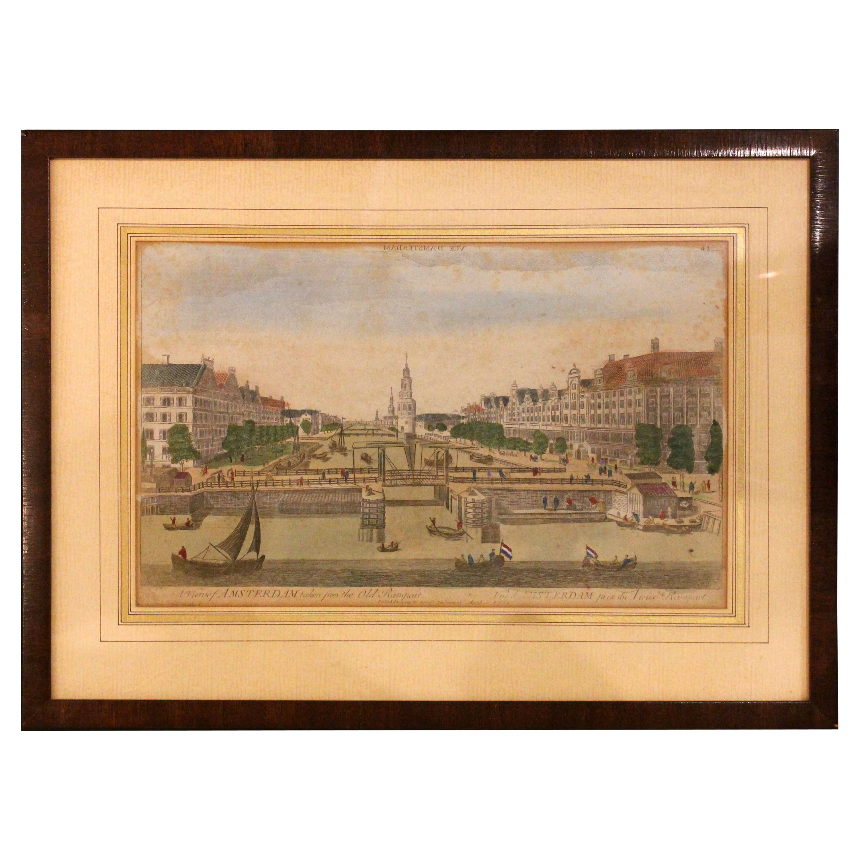
1752 "A View of Amsterdam" Print From George Balthasar Probst Lithograph
By Georg Balthasar Probst
Located in Chapel Hill, NC
A View of Amsterdam taken from the Old Rampart print published April 10, 1752, English. Published according to Act of Parliament. Old hand coloring. From the George Balthasar Probst ...
Category
Antique Mid-18th Century English Neoclassical Prints
Materials
Paper
$236 Sale Price
20% Off
The Place Dauphine in Paris - Etching by Giambattista Albrizzi - 1745 ca
By Giambattista Albrizzi
Located in Roma, IT
Etching realized by Giambattista Albrizzi (1698-1777) for Thomas Salmon's Lo Stato presente di tutti i Paesi e Popoli do Mondo. Regno di Spagna.
Includes a contemporary wooden frame...
Category
1740s Modern Figurative Prints
Materials
Etching
More Ways To Browse
Antique Framing Square
Antique Engravings London
California Wine Country Art
Chanel Lithograph
Dali French Railway
David Roberts Jerusalem
Ella Fort On Sale
Etchings Brooklyn Bridge
Foll Art
Giovanni Battista Piranesi On Sale
Gonville Caius
Hockney Sun
James Swann
Jules Cavailles On Sale
Lichtenstein Haystack
Lightning Plane
Michael Schofield On Sale
Monet Signed Prints