Items Similar to Hautes Pyrenees, France. Antique map of a French department, 1856
Want more images or videos?
Request additional images or videos from the seller
1 of 5
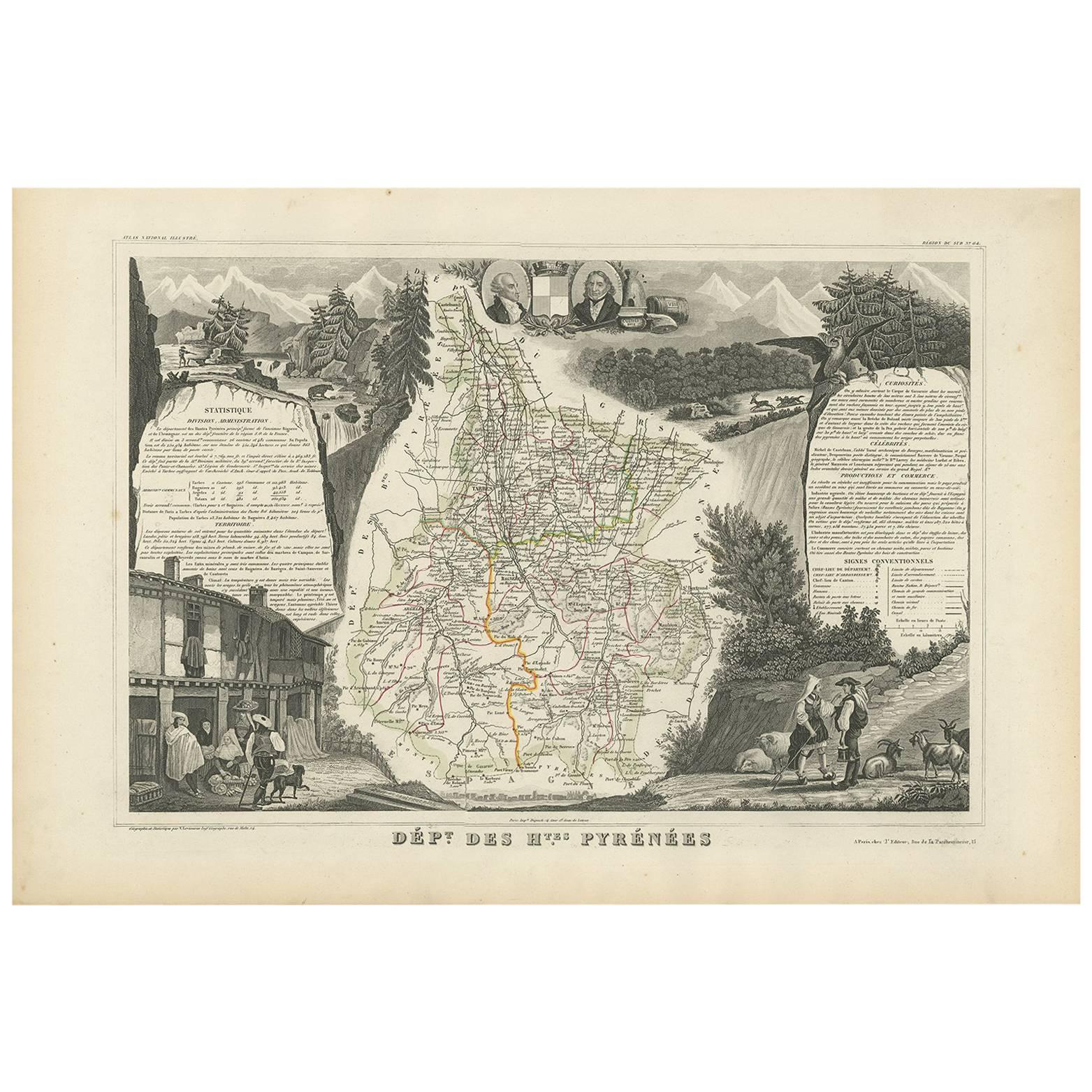
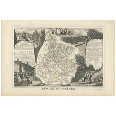
Victor LevasseurHautes Pyrenees, France. Antique map of a French department, 18561856
1856
$165
£124.43
€143.91
CA$231.49
A$257.32
CHF 134.88
MX$3,142.50
NOK 1,683.92
SEK 1,584.25
DKK 1,074.07
About the Item
'Dept. des Hautes Pyrenees', steel engraving with original outline hand-colouring., 1856, from Levasseur's Atlas National Illustre.
This area is home to the wine producing region, Madiran. Madrian is best known for producing a powerful red wine made from the Tannat grape. This area also makes a number of cheeses, including Tomme Noire des Pyrenees and Roquefort cheese. The map proper is surrounded by elaborate decorative engravings designed to illustrate both the natural beauty and trade richness of the land. There is a short textual history of the regions depicted on both the left and right sides of the map.
Levasseur was an important French engineer, cartographer, and engraver of the mid 19th century.
330mm by 470mm (sheet)
The map is loose and unframed.
- Creator:Victor Levasseur (1795)
- Creation Year:1856
- Dimensions:Height: 13 in (33 cm)Width: 18.51 in (47 cm)
- Medium:
- Movement & Style:
- Period:
- Condition:
- Gallery Location:Melbourne, AU
- Reference Number:Seller: MP31171stDibs: LU124426184672
Victor Levasseur
Victor Jules Levasseur (1795–1862) was a French cartographer widely known for his distinctive decorative style. He produced numerous maps more admired for the artistic content of the scenes and data surrounding the map than for the detail of the map. Victor Levasseur was born in 1795 in France. Little is known about his early life and education, but he emerged as one of the most prominent French cartographers of the 19th century. Levasseur lived during a time of significant political and geographical changes in France and Europe, which greatly influenced his work as a mapmaker.
About the Seller
5.0
Platinum Seller
Premium sellers with a 4.7+ rating and 24-hour response times
Established in 2005
1stDibs seller since 2019
593 sales on 1stDibs
Typical response time: <1 hour
- ShippingRetrieving quote...Shipping from: Melbourne, Australia
- Return Policy
Authenticity Guarantee
In the unlikely event there’s an issue with an item’s authenticity, contact us within 1 year for a full refund. DetailsMoney-Back Guarantee
If your item is not as described, is damaged in transit, or does not arrive, contact us within 7 days for a full refund. Details24-Hour Cancellation
You have a 24-hour grace period in which to reconsider your purchase, with no questions asked.Vetted Professional Sellers
Our world-class sellers must adhere to strict standards for service and quality, maintaining the integrity of our listings.Price-Match Guarantee
If you find that a seller listed the same item for a lower price elsewhere, we’ll match it.Trusted Global Delivery
Our best-in-class carrier network provides specialized shipping options worldwide, including custom delivery.More From This Seller
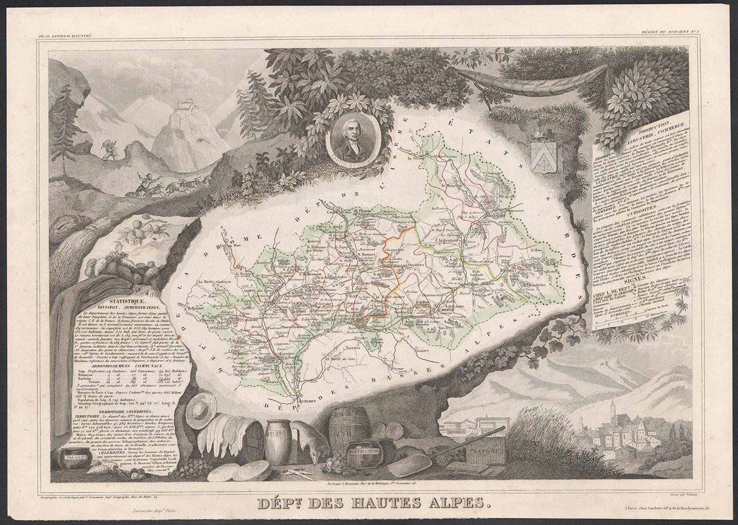
View AllHautes Alpes, France. Antique map of a French department, 1856
By Victor Levasseur
Located in Melbourne, Victoria
'Dept. des Hautes Alpes', steel engraving with original outline hand-colouring., 1856, from Levasseur's 'Atlas National Illustre'.
This area of France i...
Category
19th Century Naturalistic Landscape Prints
Materials
Engraving

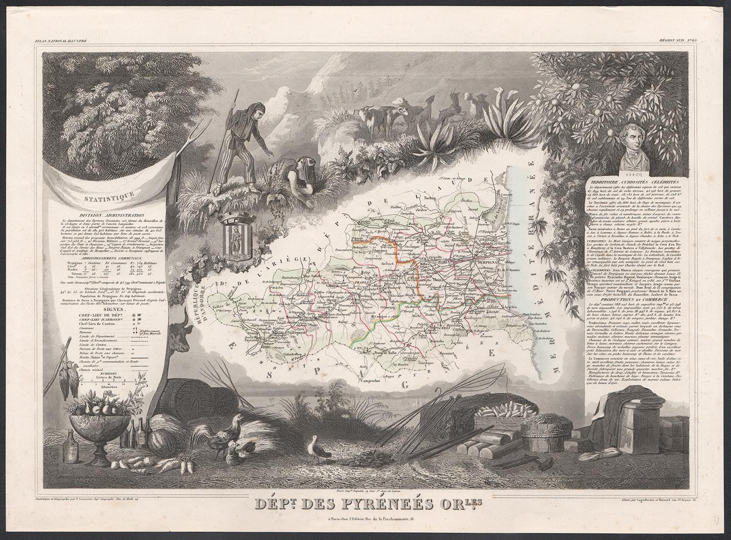
Pyrenees Orientales, France. Antique map of a French department, 1856
By Victor Levasseur
Located in Melbourne, Victoria
'Dept. des Pyrenees Orientales', steel engraving with original outline hand-colouring., 1856, from Levasseur's 'Atlas National Illustre'.
This area is well-known wine producing reg...
Category
19th Century Naturalistic Landscape Prints
Materials
Engraving

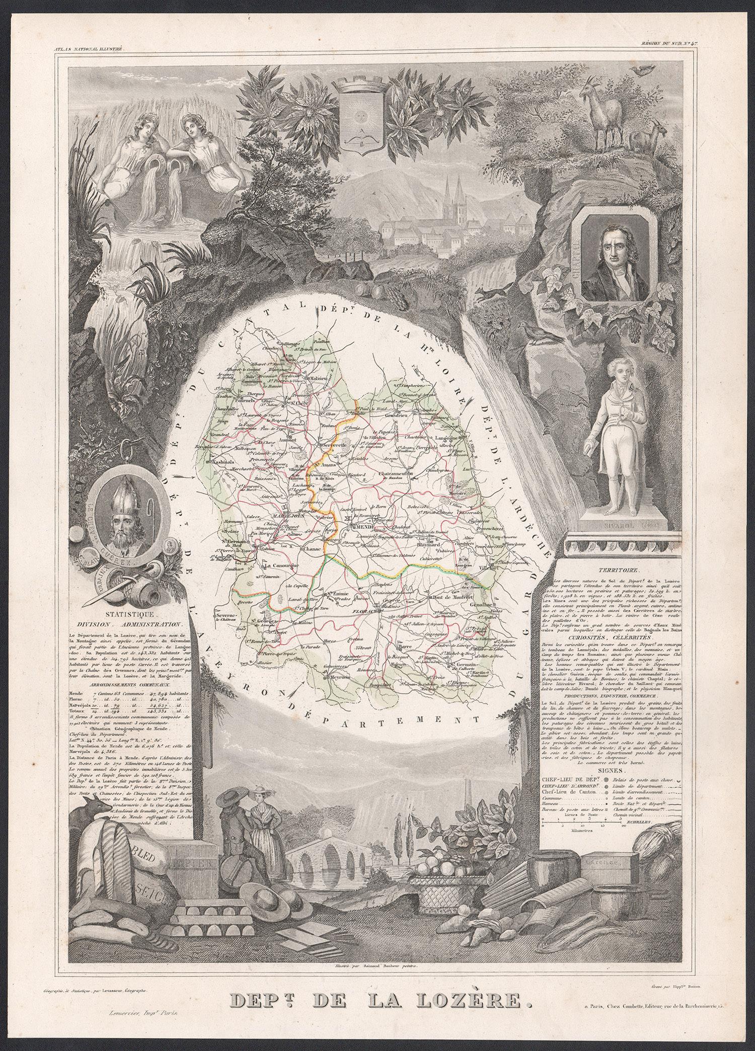
Lozere, France. Antique map of a French department, 1856
By Victor Levasseur
Located in Melbourne, Victoria
'Dept. de La Lozere', steel engraving with original outline hand-colouring., 1856, from Levasseur's 'Atlas National Illustre'.
This remote mountainous part of Languedoc is rural, s...
Category
19th Century Naturalistic Landscape Prints
Materials
Engraving

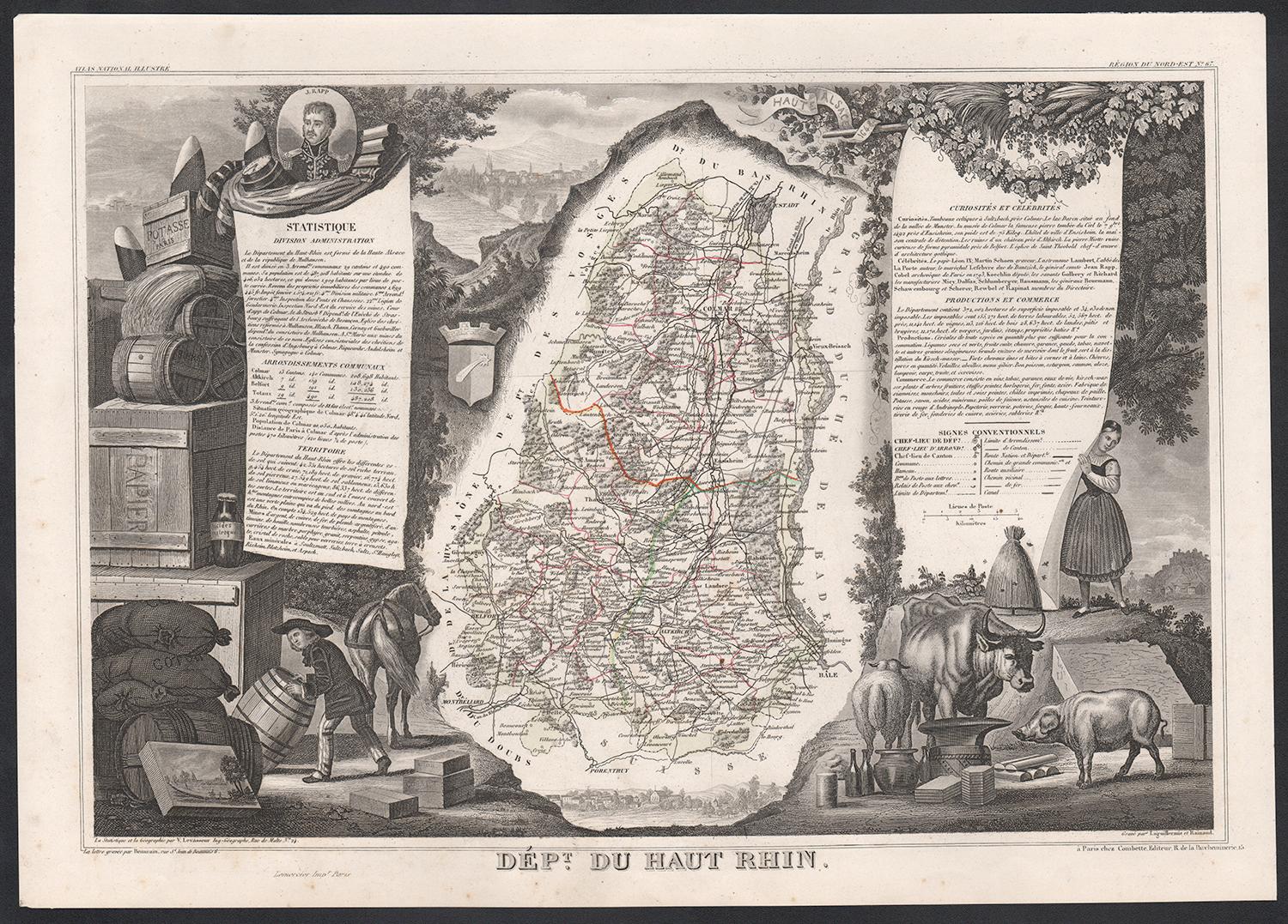
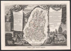
Haut Rhin, France. Antique map of a French department, 1856
By Victor Levasseur
Located in Melbourne, Victoria
'Dept. du Bas Rhin', steel engraving with original outline hand-colouring., 1856, from Levasseur's Atlas National Illustre.
This mountainous area is part of the Alsace wine region ...
Category
19th Century Naturalistic Landscape Prints
Materials
Engraving
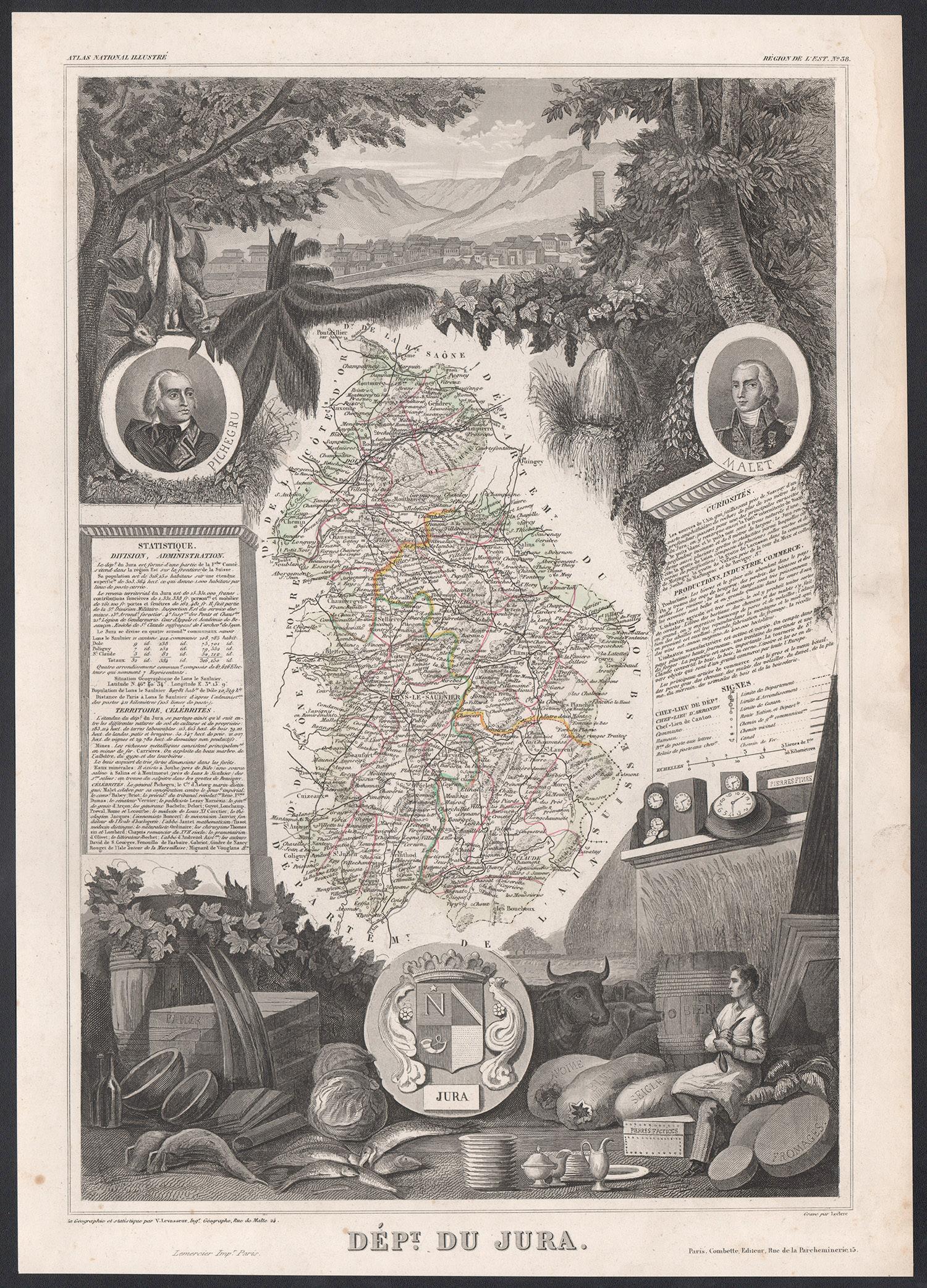
Jura, France. Antique map of a French department, 1856
By Victor Levasseur
Located in Melbourne, Victoria
'Dept. du Jura', steel engraving with original outline hand-colouring., 1856, from Levasseur's 'Atlas National Illustre'.
The Jura wines are very distinctive and unusual, such as V...
Category
19th Century Naturalistic Landscape Prints
Materials
Engraving

Bas Rhin, France. Antique map of a French department, 1856
By Victor Levasseur
Located in Melbourne, Victoria
'Dept. du Bas Rhin', steel engraving with original outline hand-colouring., 1856, from Levasseur's Atlas National Illustre.
Part of the Alsace wine region surrounding Strasbourg. T...
Category
19th Century Naturalistic Landscape Prints
Materials
Engraving

You May Also Like
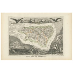
Antique Map of the Hautes Pyrenees 'France' by V. Levasseur, 1854
By Victor Levasseur
Located in Langweer, NL
Antique map titled 'Dépt. des Htes. Pyrénées'. Map of the French department of Hautes Pyrenees, France. This area is home to the wine producing region, Madiran. Madrian is best known...
Category
Antique Mid-19th Century Maps
Materials
Paper
$190 Sale Price
20% Off
Hautes-Pyrénées Map - Original Lithograph - 19th Century
Located in Roma, IT
Hautes-Pyrénées Map is an original lithograph realized by an Anonymous engraver of the 19th Century.
Printed in series of "France Pittoresque" at the top center.
The state of prese...
Category
19th Century Modern Figurative Prints
Materials
Paper, Lithograph

Map of Hautes-Alpes France with Gap and Alpine Scenery by Vuillemin, c.1850
Located in Langweer, NL
Map of Hautes-Alpes France with Gap and Alpine Scenery by Vuillemin
Description:
This elegant 19th-century map of the Hautes-Alpes department in southeastern France was created by A...
Category
Antique Mid-19th Century French Maps
Materials
Paper

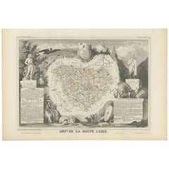
Antique Map of Haute Loire ‘France’ by V. Levasseur, 1854
Located in Langweer, NL
Antique map titled 'Dépt. de la Haute Loire'. Map of the French department of Haute Loire, France. This area of France is part of the Loire Valley wine gro...
Category
Antique Mid-19th Century Maps
Materials
Paper
$190 Sale Price
20% Off
Antique Map of Basses Pyrénées ‘France’ by V. Levasseur, 1854
By Victor Levasseur
Located in Langweer, NL
Antique map titled 'Dépt. des Bses. Pyrénées'. Map of the French department of Basses Pyrenees, France. This department includes the Jurancon wine region, famous for its production d...
Category
Antique Mid-19th Century Maps
Materials
Paper
$171 Sale Price
20% Off
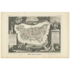
Antique Map of Vosges ‘France’ by V. Levasseur, 1854
By Victor Levasseur
Located in Langweer, NL
Antique map titled 'Dépt. des Vosges'. Map of the Vosges region in France, centred on Epinal. This map originates from ‘Atlas National de la France Illustré’. Published by A. Combett...
Category
Antique Mid-19th Century Maps
Materials
Paper
$162 Sale Price
20% Off
More Ways To Browse
Romanesque Sculpture
Shona Stone Sculpture
Walking Man Sculpture
African Woman Bust
Arman Bronze
Japanese Art Octopus
Nude Woman Sculpture Life Size
Reclining Woman Sculpture
Shona Zimbabwe Sculpture
50 American Flag
Boy With Fish
Charpentier Georges
Coach Panel
Illuminated Miniature
Jesus Baby Painting
Large Rocking Horse
Lowbrow Art
Octopus Sign