Items Similar to Monastery of St. Augustine, Canterbury /// William Dugdale Monasticon Anglicanum
Want more images or videos?
Request additional images or videos from the seller
1 of 15
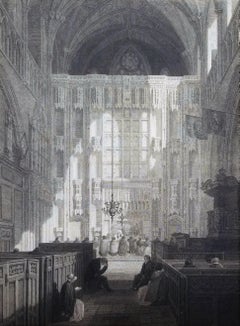
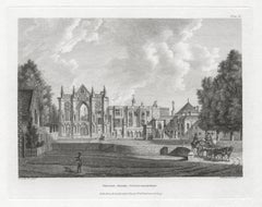
William DugdaleMonastery of St. Augustine, Canterbury /// William Dugdale Monasticon Anglicanum1817-1830
1817-1830
$600
£459.75
€528.82
CA$857.78
A$931.71
CHF 493.26
MX$11,249.78
NOK 6,157.86
SEK 5,833.60
DKK 3,948.67
About the Item
Artist: Sir William Dugdale (English, 1605-1686)
Title: "Monastery of St. Augustine, Canterbury"
Portfolio: Monasticon Anglicanum: A History of the Abbies and Other Monasteries, Hospitals, Frieries, and Cathedral and Collegiate Churches with their Dependencies in England and Wales
Year: 1817-1830 (New edition)
Medium: Original Engraving on wove paper
Limited edition: Unknown
Printer: Thomas Davison of Whitefriars, London, UK
Publisher: Longman, Hurst, Rees, Orme & Brown, Lackington, Hughes, Harding, Mavor & Jones, and Joseph Harding, London, UK
Reference: Lowndes I, No. 8, page 685
Sheet size: 14.63" x 9.38"
Image size: 11.32" x 7.38"
Condition: A few light foxmarks upper left. Has been professionally stored away for decades. In excellent condition
Very rare
Notes:
Provenance: private collection - Aspen, CO. Engraved by English artist George Hollis (1793-1842) after an watercolor painting by English artist Charles Wild (1781-1835). Comes from Dugdale's six volume "Monasticon Anglicanum: A History of the Abbies and Other Monasteries, Hospitals, Frieries, and Cathedral and Collegiate Churches with their Dependencies in England and Wales", (1817-1830) (New edition), which consists of 243 engravings. Printed from one copper plate in one color: black.
Biography:
Sir William Dugdale (born Sept. 12, 1605, Shustoke, Warwickshire, Eng.—died Feb. 10, 1686, Blythe Hall, Warwickshire) was an English antiquary who was preeminent among the medievalist scholars in his time. An authority on genealogy and charters, he displayed accurate scholarship and insight unusual for his period. Dugdale married early and settled as a small landowner at Blythe Hall, Warwickshire. Gradually he became the centre of a scholarly circle, and, following an introduction to the antiquary Sir Henry Spelman in London, he compiled, with the help of Roger Dodsworth, "Monasticon Anglicanum", 3 vol. (1655–73), a collection of records relating to medieval English religious houses. Among his other important works are the "Antiquities of Warwickshire" (1656), which became a model for large-scale county histories, and "The Baronage of England" (1675–76). He was knighted in 1667.
- Creator:William Dugdale (1605 - 1686, English)
- Creation Year:1817-1830
- Dimensions:Height: 14.63 in (37.17 cm)Width: 9.38 in (23.83 cm)
- Medium:
- Movement & Style:
- Period:
- Condition:
- Gallery Location:Saint Augustine, FL
- Reference Number:1stDibs: LU121214752122
About the Seller
5.0
Platinum Seller
Premium sellers with a 4.7+ rating and 24-hour response times
Established in 1978
1stDibs seller since 2015
1,350 sales on 1stDibs
Typical response time: <1 hour
- ShippingRetrieving quote...Shipping from: Saint Augustine, FL
- Return Policy
Authenticity Guarantee
In the unlikely event there’s an issue with an item’s authenticity, contact us within 1 year for a full refund. DetailsMoney-Back Guarantee
If your item is not as described, is damaged in transit, or does not arrive, contact us within 7 days for a full refund. Details24-Hour Cancellation
You have a 24-hour grace period in which to reconsider your purchase, with no questions asked.Vetted Professional Sellers
Our world-class sellers must adhere to strict standards for service and quality, maintaining the integrity of our listings.Price-Match Guarantee
If you find that a seller listed the same item for a lower price elsewhere, we’ll match it.Trusted Global Delivery
Our best-in-class carrier network provides specialized shipping options worldwide, including custom delivery.More From This Seller
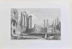
View AllSouthwest View of Sherborne Abbey Church /// History of Dorset English Engraving
Located in Saint Augustine, FL
Artist: John Hutchins (English, 1698-1773)
Title: "Southwest View of Sherborne Abbey Church" (Plate 15)
Portfolio: The History and Antiquities of the County of Dorset
Year: 1861-1870...
Category
1860s Victorian Landscape Prints
Materials
Engraving
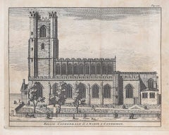
St. Alban's Abbey Church, High Altar screen /// Robert Clutterbuck Hertford Art
Located in Saint Augustine, FL
Artist: Robert Clutterbuck (English, 1772-1831)
Title: "St. Alban's Abbey Church, High Altar screen"
Portfolio: The History and Antiquities of the County of Hertford
Year: 1815-1827 (First edition)
Medium: Original Engraving on wove paper
Limited edition: Unknown
Printer: Nichols, Son, and Bentley, London, UK
Publisher: Nichols, Son, and Bentley, London, UK
Reference: Brunet II, No. 112; Lowndes No. 483; BAL RIBA No. 666; Upcott I, page 623
Sheet size: 17.63" x 11.38"
Image size: 11.57" x 8.57"
Condition: Scattered foxing throughout sheet; it doesn't show much within the image. Creasing to upper left and right corners. Has been professionally stored away for decades. It is otherwise a strong impression in good condition
Notes:
Provenance: private collection - Aspen, CO. Engraved by English artist John Henry Le Keux (1812-1896) after a drawing by English artist Frederick Nash (1782-1856). Comes from Clutterbuck's three volume "The History and Antiquities of the County of Hertford", (1815-1827) (First edition), which consists of 54 engravings. Printed from one copper plate on one color: black. "Vol. I. p. 65" printed upper right in margin. "Proof" printed lower right in margin.
St Albans Cathedral, officially the Cathedral and Abbey Church of St Alban, also known as "the Abbey", is a Church of England cathedral...
Category
1810s Old Masters Interior Prints
Materials
Engraving, Intaglio
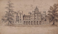
Loseley House, The Seat of James More Molyneux Esq. /// English Landscape Surrey
Located in Saint Augustine, FL
Artist: Owen Manning (English, 1721-1801)
Title: "Loseley House, The Seat of James More Molyneux Esq."
Portfolio: The History and Antiquities of the County of Surrey
Year: 1804-1814 ...
Category
Early 1800s Victorian Landscape Prints
Materials
Engraving
Cathedral Church of Notre Dame, at Séez /// John Sell Cotman Architectural Print
By John Sell Cotman
Located in Saint Augustine, FL
Artist: John Sell Cotman (English, 1782-1842)
Title: "Cathedral Church of Notre Dame, at Séez (West Front)" (Vol. 2, Plate 99)
Portfolio: Architectural Antiquities of Normandy
Year: ...
Category
1820s Victorian Landscape Prints
Materials
Etching, Intaglio
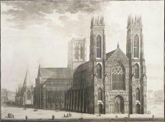
The West Prospect of the Cathedral of York /// "Britannia Illustrata" Engraving
By Johannes Kip
Located in Saint Augustine, FL
Artist: Johannes "Jan" Kip (Dutch, 1652/3-1722)
Title: "The West Prospect of the Cathedral of York" (Vol. 3, Plate 31)
Portfolio: Britannia Illustrata / Le Nouveau Théâtre de la Grande Bretagne
Year: 1715-1724 (Third edition)
Medium: Original Engraving and Etching on cream laid paper
Limited edition: Unknown
Printer: Joseph Smith, London, UK
Publisher: Joseph Smith, London, UK
Reference: "London Illustrated 1604-1850" - Adams No. 22; Crace No. 201; Brunet IV No. 114; Lowndes No. 1277; Lewine page 263-264
Sheet size: 19.25" x 24.19"
Image size: 16.75" x 22.5"
Condition: With centerfold as issued. Some light toning and foxing mainly in margins, and some light edgewear. Has been professionally stored away for decades. It is otherwise a strong impression in very good condition
Rare
Notes:
Provenance: private collection - Ross-on-Wye, UK. Engraved by Dutch artist Johannes "Jan" Kip (1652/3-1722) after a drawing by Dutch artist Leonard Knyff or Leendert Knijff (1650-1722). Comes from Kip's six volume (including Supplement and 'Atlas Anglois') "Britannia Illustrata" / Le Nouveau Théâtre de la Grande Bretagne", (1724-1728) (Third edition), which consists of 394 engravings and etchings. Printed in one color from one copper plate: black.
Biography:
Johannes "Jan" Kip (1652/53 in Amsterdam - 1722 in Westminster) was a Dutch draftsman, engraver and print dealer. Together with Leonard Knyff, he made a speciality of engraved views of English country houses.
Kip was a pupil of Bastiaen Stopendaal (1636–1707), from 1668 to 1670, before setting up on his own; his earliest dated engravings are from 1672. In April 1680, at the age of 27, he married Elisabeth Breda in Amsterdam. After producing works for the court of William of Orange in Amsterdam, Kip followed William and Mary to London and settled in St. John Street in Farringdon, where he conducted a thriving printselling business. He also worked for various London publishers producing engravings after such artists as Francis Barlow (c. 1626–1704) and Caius Gabriel Cibber (1630–1700), largely for book illustrations. He made several engraved plates for Awnsham & John Churchill's "A Collection of Voyages & Travels" (first published 1704). He signed the African scenes in volume V of the 1732 edition as "J. Kip".
His most important works were the large fold-out folio illustrations for "Britannia Illustrata", 1708; for the 65 folio plates he engraved for the antiquary Sir Robert Atkyns, "The Ancient and Present State of Glostershire", 1712 (1st edition); and for "Le Nouveau Théâtre de la Grande Bretagne ou description exacte des palais de la Reine, et des Maisons les plus considerables des des Seigneurs & des Gentilshommes de la Grande Bretagne", 1715, an extended reprint in collaboration with other artists.
The linked careers of Jan Kip and Leonard Knyff made a specialty of engraved views of English country houses, represented in detail from the bird's-eye view, a pictorial convention for topography. Their major work was "Britannia Illustrata: Or Views of Several of the Queens Palaces, as Also of the Principal seats of the Nobility and Gentry of Great Britain, Curiously Engraven on 80 Copper Plates", London (1707, published in the winter of 1708–9). The volume is among the most important English topographical publications of the 18th century. Architecture is rendered with care, and the settings of parterres and radiating avenues driven through woods or planted across fields, garden paths, gates and toolsheds are illustrated in detail. The images are staffed with figures and horses, coaches pulling into forecourts, water...
Category
1720s Old Masters Landscape Prints
Materials
Laid Paper, Engraving, Etching, Intaglio
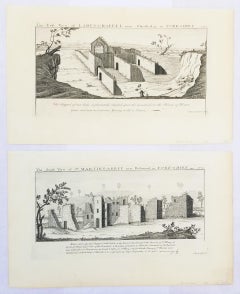
"St. Martin's Abbey" and "Lady's Chappel" from "Buck's Antiquities" /// British
By Samuel & Nathaniel Buck
Located in Saint Augustine, FL
Artist: Samuel and Nathaniel Buck (English, 1696-1779) and (?-1759/1774)
Title: "St. Martin's Abbey" (Plate 333) and "Lady's Chappel" (Plate 331)
Portfolio: Buck's Antiquities or Venerable Remains of Above 400 Castles, Monasteries, Palaces in England and Wales
Year: 1726-1739
Medium: Set of Two Original Engravings on watermarked laid paper
Limited edition: Unknown
Printer: Unknown
Publisher: Robert Sayer, London, UK
Reference: Lowndes page 303-304; Upcott page 33
Sheet size (each): approx. 11.13" x 18.25"
Image size (platemark) (each): approx. 7.5" x 14.5"
Condition: "St. Martin's Abbey" has a minor crease to upper left corner and repaired edge wear to lower right corner. "Lady's Chappel" has faint toning to sheet and minor soiling in margins. They are both otherwise strong impressions in excellent condition
Notes:
Comes from Samuel and Nathaniel Buck's three volume portfolio "Buck's Antiquities" or "Venerable Remains of Above 400 Castles, Monasteries, Palaces in England and Wales" (1726-1739), which consists of 428 engravings. Both "St. Martin's Abbey" and "Lady's Chappel" have unidentified watermarks in the center of their sheets. They both also have "Liverpool Free Public Library" chop mark/blind stamps at bottom center of their sheets. Old price pencil inscribed in margins.
Saint Martin's Abbey is a community of Roman Catholic Benedictine monks who follow the Rule of St Benedict...
Category
1720s Old Masters Landscape Prints
Materials
Laid Paper, Engraving, Intaglio
You May Also Like
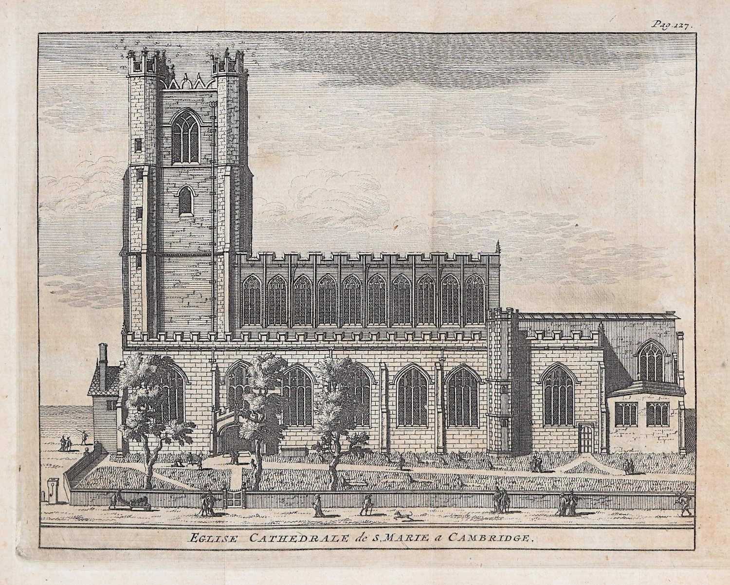
Great St Mary's, Cambridge engraving Pieter van der Aa after David Loggan
By Pieter Van Der Aa
Located in London, GB
Pieter van der Aa (1659 - 1733), after David Loggan (1634 - 1692)
Great St Mary's, Cambridge
Engraving
12 x 16 cm
An eighteenth-century view of Great St Mary's, Cambridge, engraved ...
Category
Early 18th Century Realist Prints and Multiples
Materials
Engraving
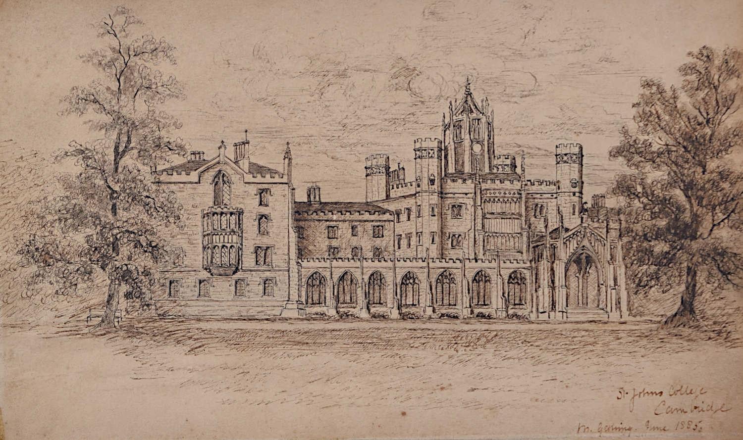
St John's College, Cambridge 19th century pen and ink drawing by Gerling
Located in London, GB
To see our other views of Oxford and Cambridge, scroll down to "More from this Seller" and below it click on "See all from this Seller" - or send us a message if you cannot find the ...
Category
1880s Drawings and Watercolor Paintings
Materials
Ink, Pen
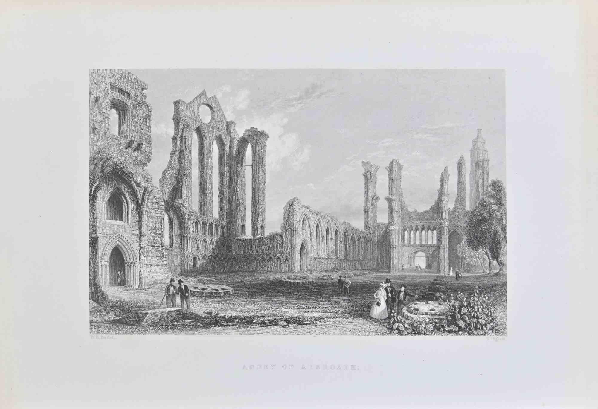
Abbey of Arbroath - Lithograph By W.H. Bartlett - 19th Century
Located in Roma, IT
Abbey of Arbroath is a lithograph artwork on paper realized by the artist W.H. Bartlett .
Signed on the plate on the lower left. Titled on the lower center.
The state of preservati...
Category
19th Century Modern Figurative Prints
Materials
Lithograph
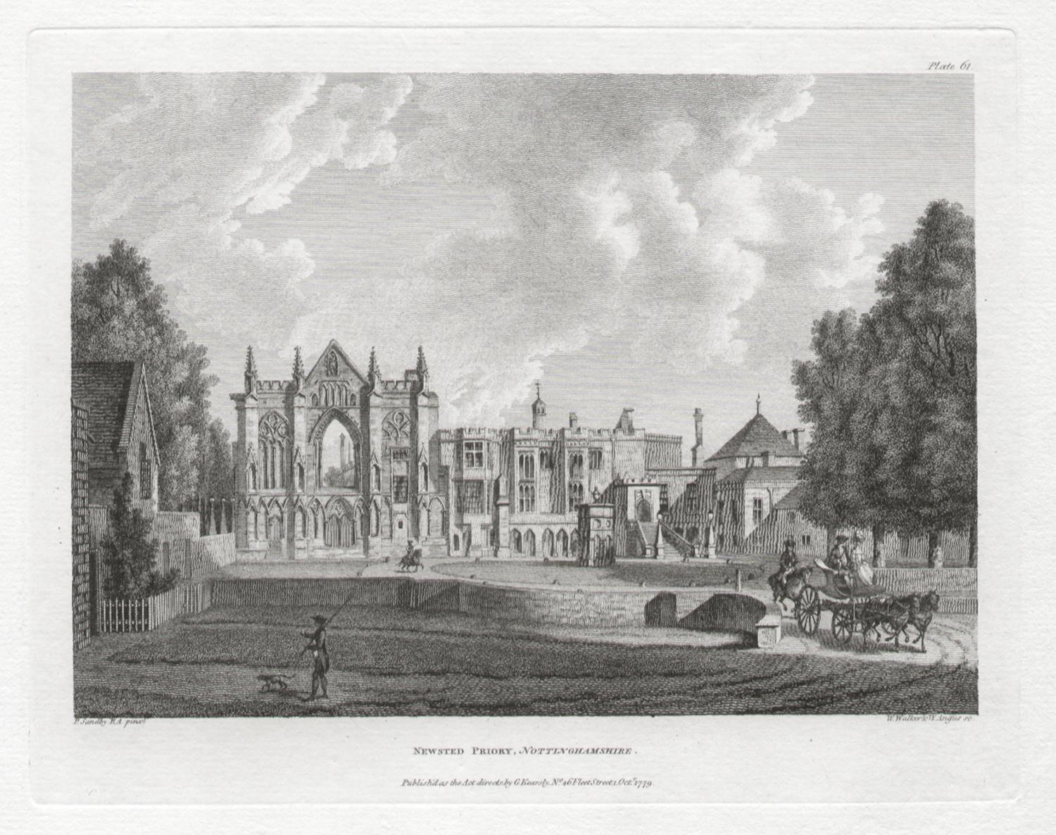
Newstead Priory, Nottinghamshire. Paul Sandby C18th English landscape engraving
By Paul Sandby
Located in Melbourne, Victoria
'Newsted Priory, Nottinghamshire'
Engraving by W Walker And W Angus After Paul Sandby (1731-1809).
From Paul Sandby's 'The Virtuosi's Museum, Containing Select Views in England, Sc...
Category
18th Century Naturalistic Landscape Prints
Materials
Engraving
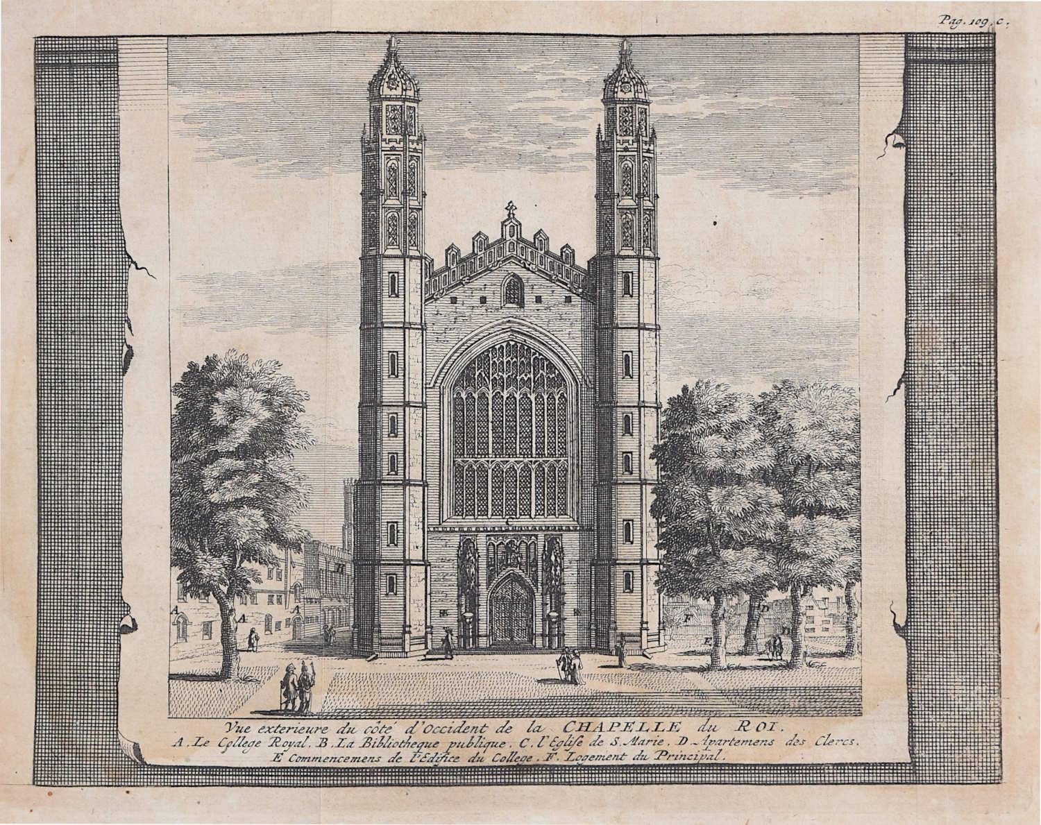
King's College, Cambridge engraving Pieter van der Aa after David Loggan iii
By Pieter Van Der Aa
Located in London, GB
Pieter van der Aa (1659 - 1733), after David Loggan (1634 - 1692)
King's College, Cambridge
Engraving
12 x 16 cm
An eighteenth-century view King's College, Cambridge, engraved by Pi...
Category
Early 18th Century Realist Prints and Multiples
Materials
Engraving
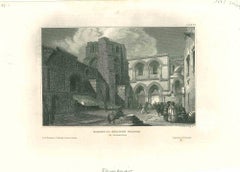
The Church of the Holy Grave - Original Lithograph - Mid-19th Century
Located in Roma, IT
Ancient View of the Church of the Holy Grave is an original modern artwork realized in the mid 19th Century.
Original B/W Lithograph on Ivory Paper.
Ins...
Category
Early 19th Century Figurative Prints
Materials
Paper, Lithograph