Items Similar to Set of Two Leaves from "Missale Frisingense" /// German Catholic Incunabula 15th
Want more images or videos?
Request additional images or videos from the seller
1 of 14
Erhard RatdoltSet of Two Leaves from "Missale Frisingense" /// German Catholic Incunabula 15th1492
1492
$450
£339.60
€388.79
CA$634.65
A$696.77
CHF 363.50
MX$8,431.83
NOK 4,555.96
SEK 4,292.91
DKK 2,902.24
About the Item
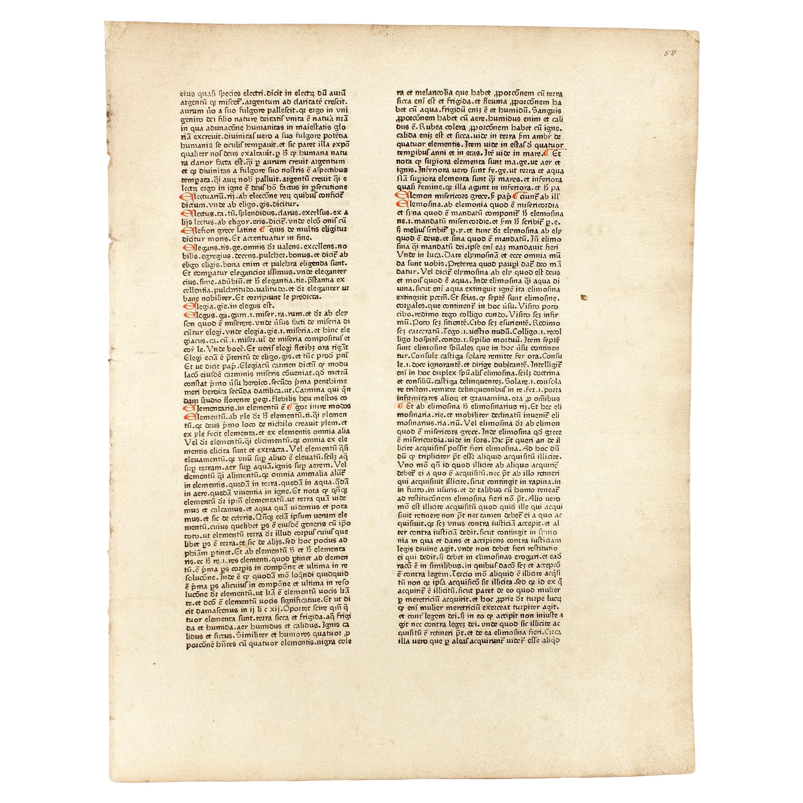
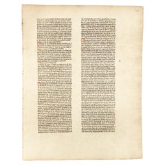
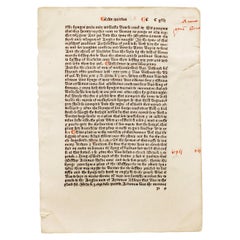
Artist: Erhard Ratdolt (German, 1442-1528)
Title: "Preface Page" and "Page CVI - 106"
Portfolio: Missale Frisingense
Year: 1492 (First edition)
Medium: Set of Two Original Incunabula Leaves on watermarked laid paper
Limited edition: Unknown
Printer: Erhard Ratdolt, Ausburg, Germany
Publisher: Sixtus of Tannberg, Freising, Germany
Reference: Hain No. 11303; Weale/Bohatta No. 396; Schreiber No. 4699; Pell No. 7944
Sheet size (each): approx. 11.94" x 8.13"
Condition: "Preface Page" has the occasional wormhole. Remnants of tape, a tape and a paper clip stain along its edge. Minor foxing and soiling mainly in margins. "Page CVI - 106" has remnants of tape and a small stain along its left edge. Light foxing and soiling about its sheet with some general edge wear. Have been professionally stored away for decades. They are both otherwise strong impressions in good condition with strong colors
Very rare
Notes:
Comes from Ratdolt's one volume "Missale Frisingense", (1492) (First edition), which consists of 576 pages of Gothic texts in Latin with red rubricated initials, music, and woodcut engraved illustrations. Printed in Augsburg by Erhard Ratdolt on March 17, 1492. "Preface Page" has a bull's head and cross watermark in the upper center of its sheet. Some information and old prices inscribed in pencil to their sheets.
A missal is a book that contains the prayers, chants, biblical readings, and rubrics for celebrating Mass. The first missals were found in monasteries in the 12th and 13th centuries. The term missale is Latin for "Mass book".
Biography:
Erhard Ratdolt (1442–1528) was an early German printer from Augsburg. He was active as a printer in Venice from 1476 to 1486, and afterwards in Augsburg. From 1475 to 1478 he was in partnership with two other German printers. The first book the partnership produced was the Calendarium (1476), written and previously published by Regiomontanus, which offered one of the earliest examples of a modern title page. Other noteworthy publications are the "Historia Romana of Appianus" (1477), and the first edition of "Euclid's Elements" (1482), where he solved the problem of printing geometric diagrams, the "Poeticon astronomicon", also from 1482, "Haly Abenragel" (1485), and "Alchabitius" (1503). Ratdolt is also famous for having produced the first known printer's type specimen book (in this instance a broadsheet displaying the fonts with which he might print). His innovations of layout and typography, mixing type and woodcuts, have subsequently been much admired. His graphic choices and technical solutions influenced also those of William Morris.
- Creator:Erhard Ratdolt (1442 - 1527, German)
- Creation Year:1492
- Dimensions:Height: 11.94 in (30.33 cm)Width: 8.13 in (20.66 cm)
- Medium:
- Movement & Style:
- Period:
- Condition:
- Gallery Location:Saint Augustine, FL
- Reference Number:1stDibs: LU121215198432
About the Seller
5.0
Platinum Seller
Premium sellers with a 4.7+ rating and 24-hour response times
Established in 1978
1stDibs seller since 2015
1,349 sales on 1stDibs
Typical response time: <1 hour
- ShippingRetrieving quote...Shipping from: Saint Augustine, FL
- Return Policy
Authenticity Guarantee
In the unlikely event there’s an issue with an item’s authenticity, contact us within 1 year for a full refund. DetailsMoney-Back Guarantee
If your item is not as described, is damaged in transit, or does not arrive, contact us within 7 days for a full refund. Details24-Hour Cancellation
You have a 24-hour grace period in which to reconsider your purchase, with no questions asked.Vetted Professional Sellers
Our world-class sellers must adhere to strict standards for service and quality, maintaining the integrity of our listings.Price-Match Guarantee
If you find that a seller listed the same item for a lower price elsewhere, we’ll match it.Trusted Global Delivery
Our best-in-class carrier network provides specialized shipping options worldwide, including custom delivery.More From This Seller
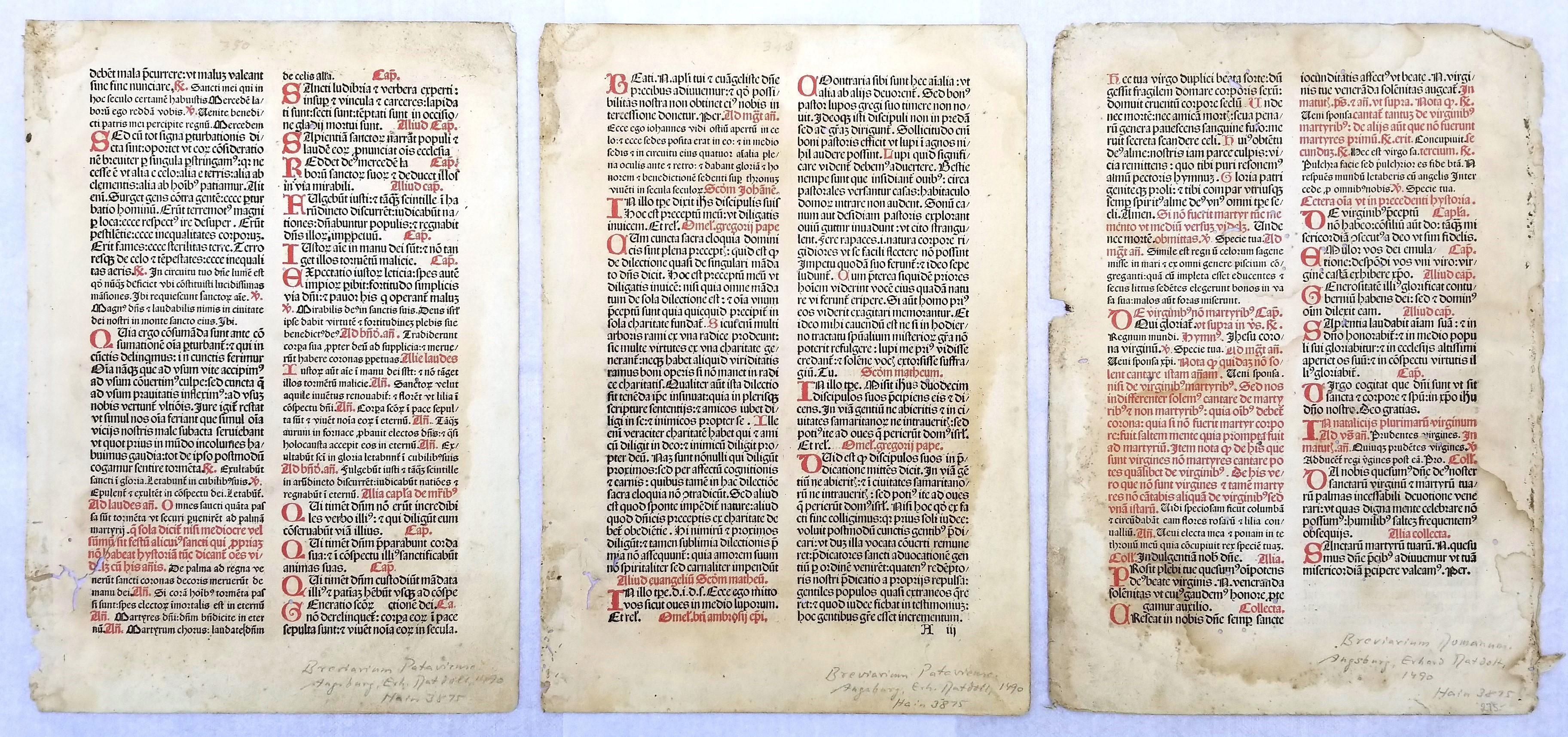
View AllSet of Three Leaves from "Breviarium Pataviense" /// German Catholic Incunabula
Located in Saint Augustine, FL
Artist: Erhard Ratdolt (German, 1442-1528)
Title: "Vol. 6, page 10-11", "Vol. 6, page 6-7", and "Vol. 6, 28-29"
Portfolio: Breviarium Pataviense
Year: 1490 (First edition)
Medium: Set of Three Original Incunabula Leaves on watermarked laid paper
Limited edition: Unknown
Printer: Erhard Ratdolt, Ausburg, Germany
Publisher: Friedrich von Öttingen and Christoph von Schachner, Passau, Germany
Reference: Hain No. 3875; Bod-Inc No. B-542; GW No. 5426; Weale/Bohatta No. 335; Schreiber No. 3615
Sheet size (each): approx. 12.5" x 8.88"
Condition: "Vol. 6, page 10-11", "Vol. 6, page 6-7", and "Vol. 6, 28-29" all have scattered wormholes, staining, foxing, and soiling about their sheets. The latter two have remnants of tape at their edges. "Vol. 6, 28-29" has heavier staining to its sheet and edge wear about. Have been professionally stored away for decades. They are all otherwise strong impressions in overall fair condition with strong colors
Extremely rare
Notes:
Comes from Ratdolt's six volume "Breviarium Pataviense", (1490) (First edition), which consists of 378 pages of Gothic texts in Latin with red rubricated initials, psalms, readings, hymns, and woodcut engraved illustrations. Printed in Augsburg by Erhard Ratdolt on May 12, 1490. There was a subsequent printing on November 27, 1490. Both "Vol. 6, page 10-11" and "Vol. 6, 28-29" have a bow and arrow watermark in the center of their sheets. Some information and old prices inscribed in pencil to their sheets.
Breviary is a liturgical book in the Roman Catholic Church that contains the daily service for the divine office, the official prayer of the church consisting of psalms, readings, and hymns that are recited at stated hours of the day.
Biography:
Erhard Ratdolt (1442–1528) was an early German printer from Augsburg. He was active as a printer in Venice from 1476 to 1486, and afterwards in Augsburg. From 1475 to 1478 he was in partnership with two other German printers. The first book the partnership produced was the Calendarium (1476), written and previously published by Regiomontanus, which offered one of the earliest examples of a modern title page. Other noteworthy publications are the "Historia Romana of Appianus" (1477), and the first edition of "Euclid's Elements" (1482), where he solved the problem of printing geometric diagrams, the "Poeticon astronomicon", also from 1482, "Haly Abenragel" (1485), and "Alchabitius" (1503). Ratdolt is also famous for having produced the first known printer's type specimen...
Category
15th Century and Earlier Old Masters More Prints
Materials
Laid Paper, Woodcut
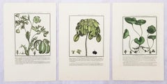
Set of Four Color Engravings from "Herbier de la France" by Pierre Bulliard
Located in Saint Augustine, FL
Artist: Pierre Bulliard (French, 1742-1793)
Title: "La Gratiole Officinale (Grace of God)", "La Digitale Jaune (Yellow Foxglove)", "La Renoncule Acre (Acre Buttercup)", and "La Cheli...
Category
1780s Old Masters Still-life Prints
Materials
Laid Paper, Engraving, Intaglio
Set of Three Color Engravings from "Herbier de la France" by Pierre Bulliard
Located in Saint Augustine, FL
Artist: Pierre Bulliard (French, 1742-1793)
Title: "Le Pied de Griffon (Griffin's Foot)", "La Laureole (The Laurel)", and "Le Cabaret d'Europe (The European Cabaret)"
Portfolio: Herb...
Category
1780s Old Masters Still-life Prints
Materials
Laid Paper, Engraving, Intaglio
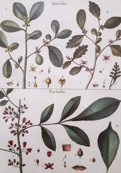
Quivisia; Portesia /// Antique Botanical Botany Plants Science Engraving Buffon
By Georges-Louis Leclerc, Comte de Buffon
Located in Saint Augustine, FL
Artist: Georges-Louis Leclerc, Comte de Buffon (French, 1707-1788)
Title: "Quivisia; Portesia" (Octandreie, Monogynie, Plate 302)
Portfolio: Histoire Naturelle
Year: 1749-1789
Medium: Original Hand-Colored Engraving on laid paper
Limited edition: Unknown
Printer: Imprimerie Nationale, Paris, France
Publisher: Georges-Louis Leclerc, Comte de Buffon, Paris, France
Framing: Not framed, but beautifully double matted with hand decorated archival French matting...
Category
2010s Naturalistic Still-life Prints
Materials
Watercolor, Engraving, Laid Paper, Intaglio
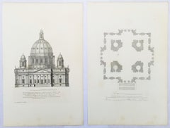
Set of Two Engravings from Campbell's "Vitruvius Britannicus" /// Architecture
By Colen Campbell
Located in Saint Augustine, FL
Artist: Colen Campbell (Scottish, 1676-1729)
Titles: "The Plan of Lindsey House in Lincolns Inn Fields" (Vol. 1, Plate 49) and "Lindsey House in Lincolns Inn Fields" (Vol. 1, Plate 5...
Category
1710s Old Masters Landscape Prints
Materials
Laid Paper, Engraving, Etching, Intaglio
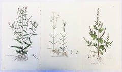
Set of Three Engravings from Curtis's "Flora Londinensis" /// Botanical Flowers
By William Curtis
Located in Saint Augustine, FL
Artist: William Curtis (English, 1746-1799)
Titles: "Epilobium Tetragonum (Square Stalked Willow Herb)" (Vol. 2, Plate 131), "Stellaria Holostea (The Greater Stitchwort)" Vol. 2, Pla...
Category
1770s Old Masters Still-life Prints
Materials
Watercolor, Laid Paper, Engraving, Intaglio
You May Also Like
Johannes Balbus. Catholicon, 1469, Original Leaf Printed by PETER SCHOEFFER
Located in Hillsborough, NJ
Author:: Balbus, Johannes.
Title: Catholicon. (An original leaf).
Publisher: Mainz: [Peter Schoeffer], 1469.
Description: An Original Catholicon Leaf Printed By Peter Schoeffer. 36.5 cm x 28.5 cm, printed in double columns with 66 lines to the page, rubricated 15 on recto and 38 on verso, printed on Galliziani paper, the half of the sheet without the watermark, but with the characteristic shadows at wire-line intervals of ca. 5 mm..
Condition: Mild toning to edges of leaf, otherwise invery good condition
Additional Information.: The first nonreligious book ever printed by the first printer. Below is an interesting translation mentioning Africa from Verso: column 2: 11th item: line 34 - "Heliotrope: A green colored stone having blood red veins. If placed in a silver dish filled with water and exposed to the rays of the sun, the water will turn blood red, and the sun will go dark. It is most brilliant when at the rising and setting of the sun it changes color. It is found in Africa."
Aside from a leaf from the Gutenberg bible this is one of the earliest possible obtainable pieces of printing associated with Johann Gutenberg.
Provenance: 1) Sir Hans Sloane...
Category
Antique 15th Century and Earlier German Books
Materials
Paper
William Caxton, an Original Leaf from the Polycronicon 'Polychronicon', 1482
Located in Hillsborough, NJ
Author: Caxton, William - Higden, Ranulf (Ranulphus).
Title: Polycronicon. (Polychronicon).
Publisher: [Westminster]: William Caxton, 1482.
De...
Category
Antique 15th Century and Earlier British Books
Materials
Paper
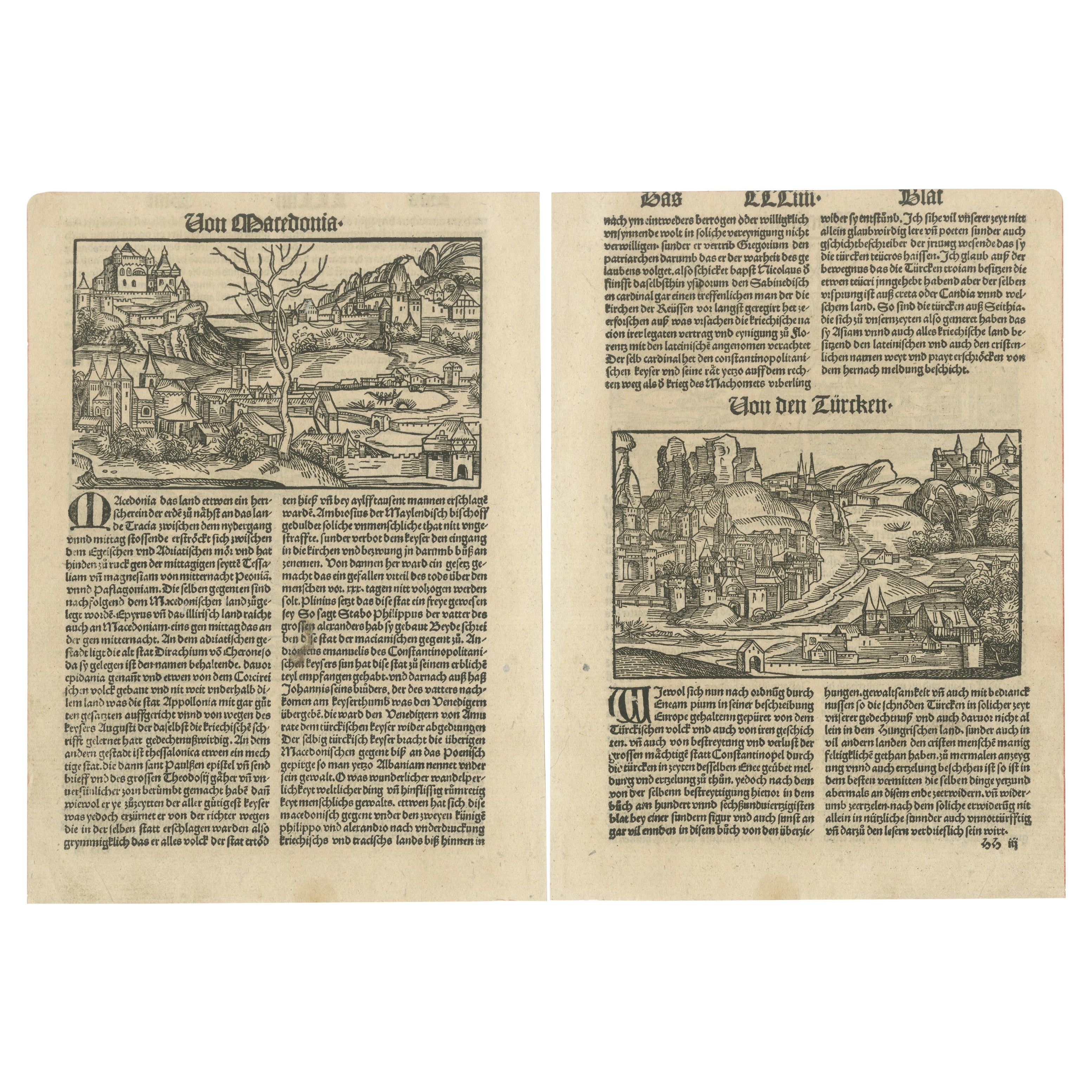
Rare Woodcuts of Macedonia and the Turks from the Nuremberg Chronicle, 1493
Located in Langweer, NL
Title: Woodcuts Depicting Macedonia and the Turks from the Nuremberg Chronicle, Published in 1493
Description: This pair of 15th-century woodcut engravings originates from the Nurem...
Category
Antique 15th Century and Earlier German Prints
Materials
Paper
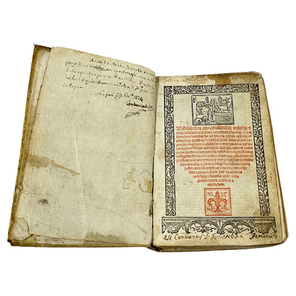
Biblia Cum Concordantijs Veteris & Novi Testamenti & Sacrorum Canonum, 1519
Located in Delft, NL
Biblia cum concordantijs veteris & novi testamenti & sacrorum canonum, 1519
A Bible by auteur Alberto da Castello, printed by Luca-Antonio Giunta, Latin Anno 1519, Venice
27-532-55 pages
First alphabetical list- Tabula Tertia, after that comes the 1st full page woodblock plate.
This title page in red and black with a surrounded frame in woodcut. Above the page “San Jerome” illustrated and below the page the printers mark “ Giunti’s Mark” from the family of printers in Florentine. The initials L A of Luca-Antonio Giunta.
After this page starts a full-page woodcut illustration after that are 3 pages not numbered and then starts numbered page 2 – 532
On page 401 is also a full-page woodcut plate
There are ca 345 small woodcuts...
Category
Antique 16th Century Italian Books
Materials
Paper

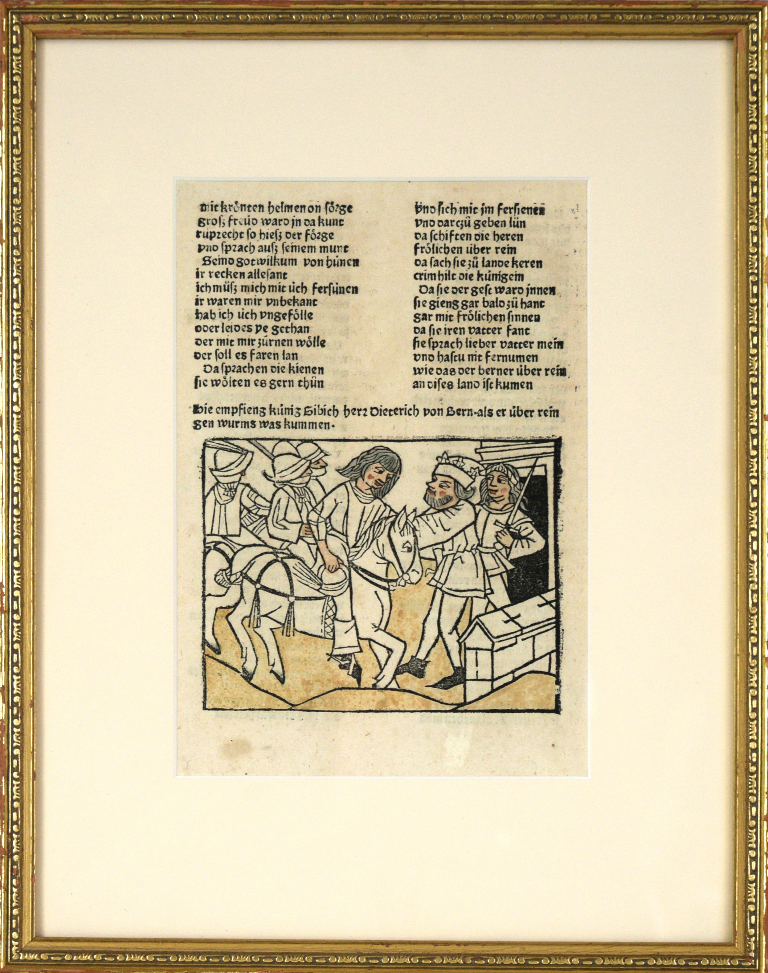
Wolfdietrich - Original leaflet from Johann Prüss' Das Heldenbuch
Located in Soquel, CA
Original leaflet from Johann Prüss' 1479 printing of "Das Heldenbuch."
The Heldenbücher is the title given to a group of late medieval/early renaissance Germanic manuscripts primari...
Category
15th Century and Earlier Medieval Figurative Prints
Materials
Paint, Laid Paper, Woodcut
$1,200 Sale Price
20% Off
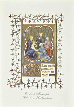
Ex Libris - Manuscriptis - Woodcut - Mid 20th Century
Located in Roma, IT
Ex Libris - Manuscriptis is an Artwork realized in Mid 20th Century.
Woodcut.
Good conditions.
The artist wants to define a well-balanced composition, through preciseness.
Category
Mid-20th Century Modern Figurative Prints
Materials
Woodcut
More Ways To Browse
Antique Catholic
Bull Head
Catholic Art
Antique German Book
Antique Catholic Art
Antique Paper Clips
Antique Catholic Prints
Banksy Dirty Funker
Blue Dog Original Prints
Boac Caribbean
Cadiz Poster
Claes Oldenburg Notes
Cote De Azur Poster
Damien Hirst Skateboard
Ddr Poster
Deborah Kass Oy
Dig For Victory Poster
Dirty Funker