Items Similar to Map of Ingolstadt - Etching by George Braun- Late 16th Century
Want more images or videos?
Request additional images or videos from the seller
1 of 2
George BraunMap of Ingolstadt - Etching by George Braun- Late 16th Century16th Century
16th Century
$352.50
£269.06
€300
CA$497.11
A$546.17
CHF 285.43
MX$6,513.51
NOK 3,614.33
SEK 3,367.05
DKK 2,286.58
About the Item
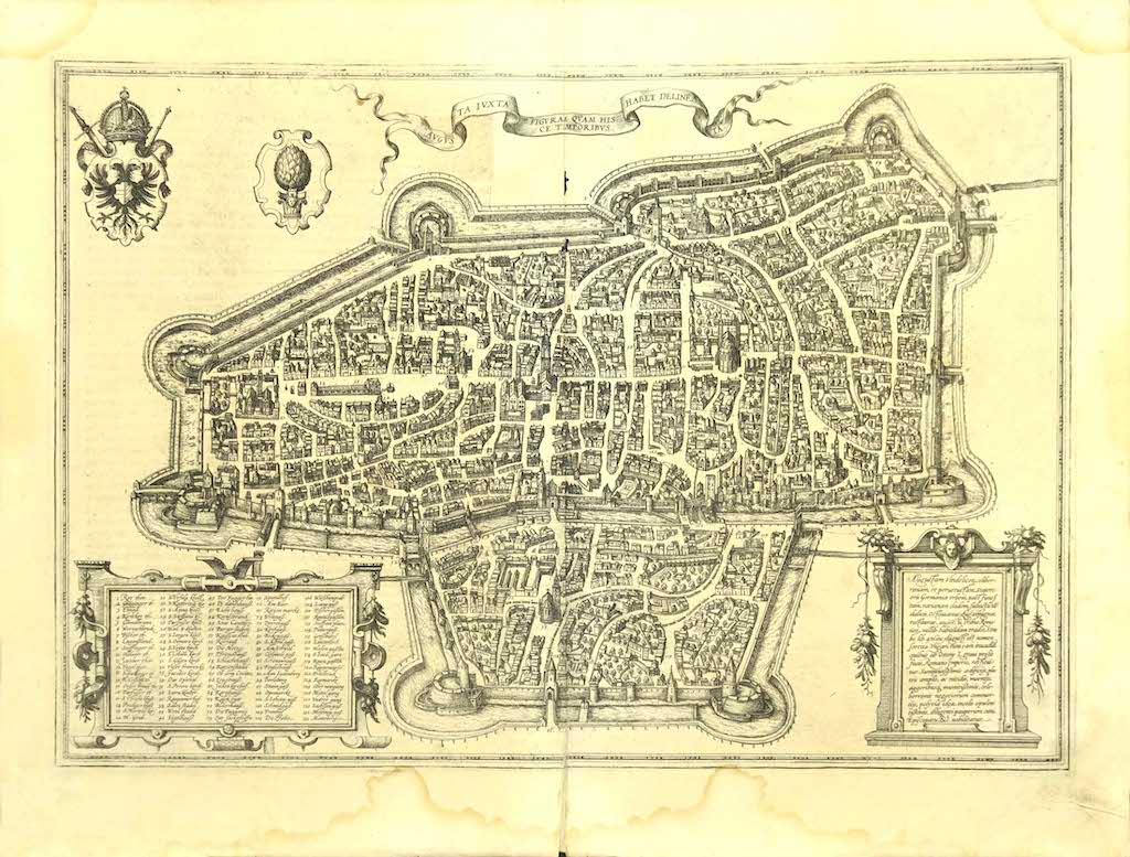
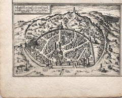
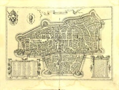
This Ingolstadium is an original etching realized by George Braun and Franz Hogenberg.
The state of preservation of the artwork is good but aged and at the top on the right angle you see the. trace of humidity that doesn't affect n the image.
Interesting B/W etching on coeval paper, this artwork represents skilfully a detailed view of the city of Safi through confident strokes. At the top on the right, the title " INGOLSTADIVM" is printed.
The etching belongs to the collection "Civitates Orbis Terrarurm" realized by Georg Braun and Frans Hogenberg.
The Civitates Orbis Terrarum (Atlas of the Cities of the World) was the second oldest printed atlas in the history of world cartography and the first atlas totally dedicated to topographical views. The first volume of this collection was published in Cologne in 1572; the following in 1575, 1581, 1588, and 1598. The sixth and final volume appeared in 1617, shortly before the extensive devastation wreaked by the Thirty Years’ War.
This artwork is shipped from Italy. Under existing legislation, any artwork in Italy created over 70 years ago by an artist who has died requires a licence for export regardless of the work’s market price. The shipping may require additional handling days to require the licence according to the final destination of the artwork.
- Creator:George Braun
- Creation Year:16th Century
- Dimensions:Height: 3.94 in (10 cm)Width: 9.06 in (23 cm)Depth: 0.04 in (1 mm)
- Medium:
- Period:
- Framing:Framing Options Available
- Condition:Insurance may be requested by customers as additional service, contact us for more information.
- Gallery Location:Roma, IT
- Reference Number:Seller: M-1087771stDibs: LU65036931142
About the Seller
4.9
Platinum Seller
Premium sellers with a 4.7+ rating and 24-hour response times
1stDibs seller since 2017
7,817 sales on 1stDibs
Typical response time: 1 hour
- ShippingRetrieving quote...Shipping from: Roma, Italy
- Return Policy
More From This Seller
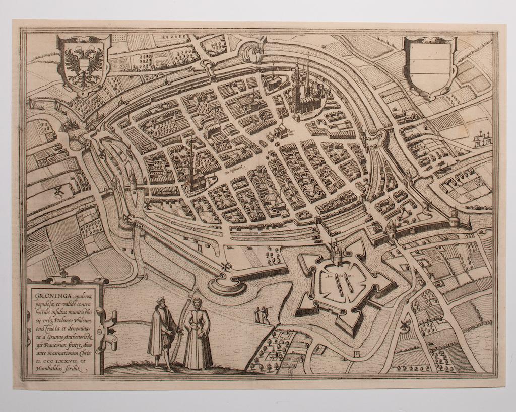
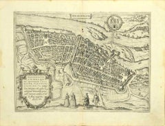
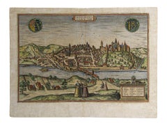
View AllMap of Groningen - Etching by George Braun - Late 16th Century
Located in Roma, IT
This map of Groninga is an original etching realized by George Braun and Franz Hogenberg, and part of the series "Civitates Orbis Terrarum".
The state of preservation of the artwork...
Category
16th Century Figurative Prints
Materials
Etching

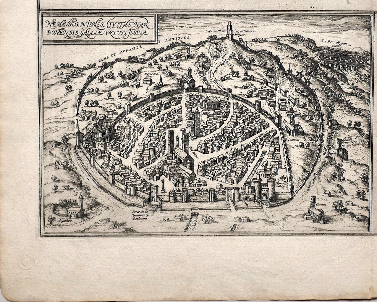
Map of Nemavsus - Etching by George Braun - Late 16th Century
Located in Roma, IT
This Map of Nemavsus is an original etching realized by George Braun (1541 – 1622)
The state of preservation of the artwork is good and aged on the edges of the sheet with a few sm...
Category
16th Century More Prints
Materials
Etching
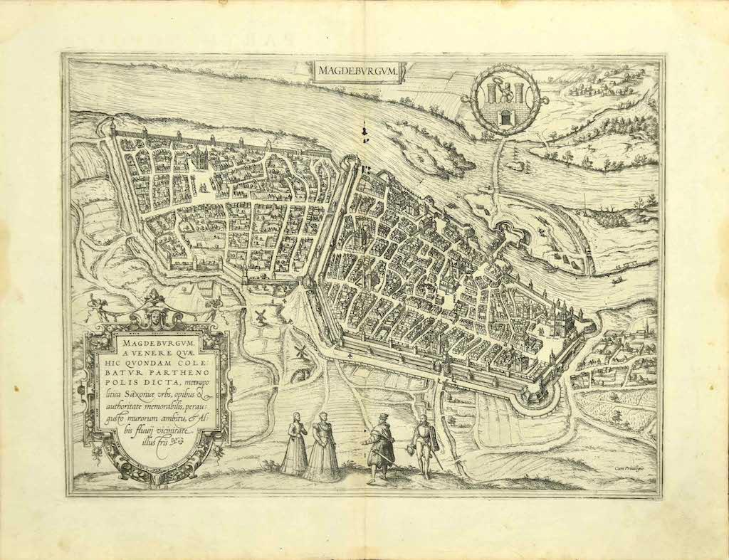
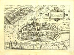
Map of Magdeburg - Etching by G. Braun e F. Hogenberg - Late 16th Century
By Franz Hogenberg
Located in Roma, IT
This map of Magdebvrgvm is an original etching realized by George Braun and Frans Hogenberg, as part of the famous series "Civitates Orbis Terrarum" (Atlas of the Cities of the Worl...
Category
16th Century Figurative Prints
Materials
Etching
Map of Augsburg - Etching by G. Braun e F. Hogenberg - Late 16th Century
By Franz Hogenberg
Located in Roma, IT
This map of Avgvsta is an original etching realized by George Braun and Franz Hogenberg, as part of the famous series "Civitates Orbis Terrarum (Atlas of the Cities of the World).
...
Category
16th Century Figurative Prints
Materials
Etching
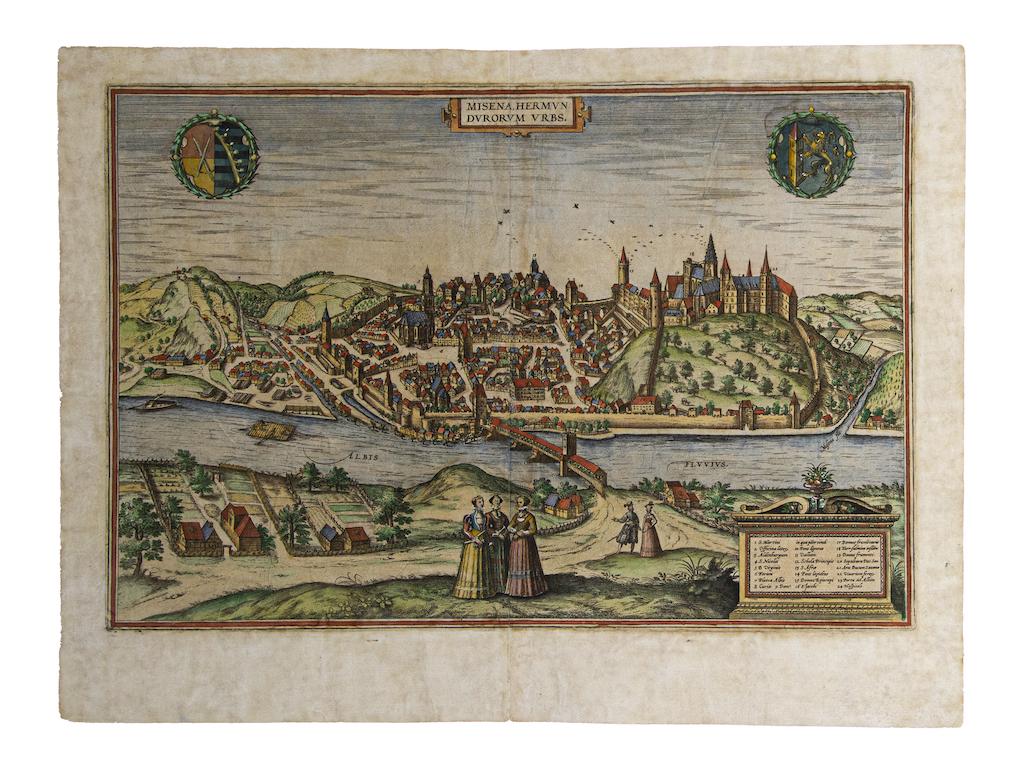
Map of Meissen - Etching by George Braun - Late 16th Century
By Franz Hogenberg
Located in Roma, IT
This map of Meissen is an original etching realized by George Braun and Franz Hogenberg as part of the famous Atlas "Civitates Orbis Terrarum".
The s...
Category
16th Century Old Masters Figurative Prints
Materials
Etching
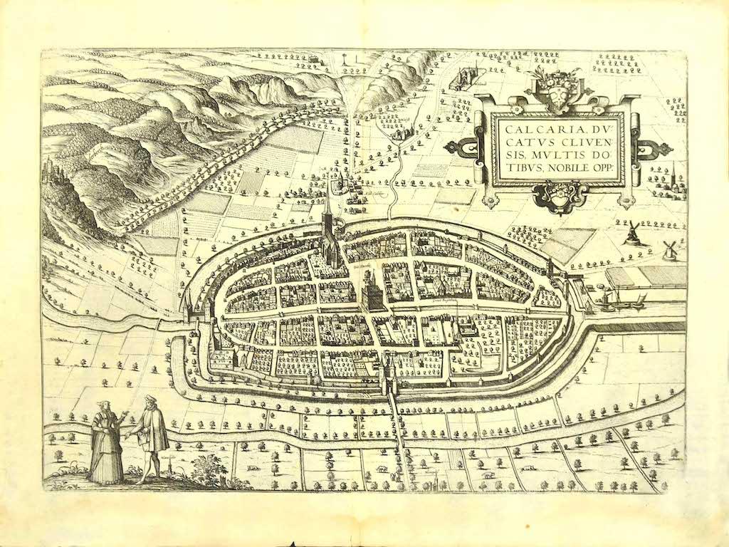
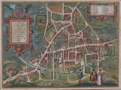
Map of Kalkar - Etching by G. Braun and F. Hogenberg - Late 16th Century
By Franz Hogenberg
Located in Roma, IT
This map of Calcaria is an original etching realized by George Braun and Franz Hogenberg, as part of the famous Series "Civitates Orbis Terrarum" (Atlas of the Cities of the World)....
Category
16th Century Figurative Prints
Materials
Etching
You May Also Like
Map of Cambridge, c.1572 engraving by Braun & Hogenberg
Located in London, GB
To see our other views of Oxford and Cambridge, scroll down to "More from this Seller" and below it click on "See all from this Seller" - or send us a message if you cannot find the ...
Category
16th Century Realist Landscape Prints
Materials
Engraving
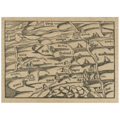
Rare 16th Century Woodcut Map of Brabant and the Rhine Valley, circa 1549
Located in Langweer, NL
Title: Rare 16th Century Woodcut Map of Brabant and the Rhine Valley, circa 1550
Description:
This rare and highly decorative early woodcut map depicts the region of Brabant and the...
Category
Antique 16th Century German Maps
Materials
Paper
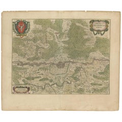
Antique Map of the Frankfurt Region by Johannes Janssonius, Hand-Colored, C.1650
Located in Langweer, NL
Antique Map of the Frankfurt Region by Johannes Janssonius circa 1650 Hand-Colored
This rare and beautifully detailed antique map titled Territorium Francofurtense depicts the reg...
Category
Antique 1650s Maps
Materials
Paper
Limburg Cityscape 1580: Historical Copper Engraving by Braun and Hogenberg
Located in Langweer, NL
Title: Limburgum Oppidum Galliae Belgicae, vulgo Lympurch, gallicè, Lembor Dr.
Type: Print (Copper Engraving)
Circa 1580
Technique: Colored Copper Engraving
Medium: Handmade Paper
S...
Category
Antique 16th Century German Maps
Materials
Paper

Map of Cambridge, engraving Pieter van der Aa after David Loggan
By Pieter Van Der Aa
Located in London, GB
Pieter van der Aa (1659 - 1733), after David Loggan (1634 - 1692)
Map of Cambridge
Engraving
12 x 16 cm
An eighteenth-century view of Cambridge, engraved by Pieter van der Aa after ...
Category
Early 18th Century Realist Prints and Multiples
Materials
Engraving

Antique Map of Douai 'France' by Braun & Hogenberg, circa 1575
Located in Langweer, NL
Beautiful map in excellent condition. This map depicts the city of Douai (France) and originates from 'Civitates Orbis Terrarum'.
Category
Antique 16th Century Maps
Materials
Paper
