Items Similar to "Moqui Dancers, Moqui Pipe, Navajo Cradle & Headdress" Engraving by Seth Eastman


Want more images or videos?
Request additional images or videos from the seller
1 of 10
Seth Eastman"Moqui Dancers, Moqui Pipe, Navajo Cradle & Headdress" Engraving by Seth Eastman1847
1847
About the Item
"Moqui Dancers, Moqui Pipe, Navajo Cradle & Headdress" is a hand-colored engraving by Seth Eastman. It depicts encyclopedic depictions of Native American culture. It was published by Lippincott, Grambo & Co., Philadelphia.
10 1/4" x 6 3/4" art
19 7/8" x 15 1/2" frame
Painter Seth Eastman is known primarily for his depictions of daily life among the Dakota and Ojibwa tribes in Minnesota. He was born to Robert and Sarah Lee Eastman on January 24, 1808, in Brunswick, Maine. Eastman attended the United States Military Academy at West Point, New York, where he received training in sketching and topography. While at West Point, he began to paint scenes featuring the daily life of local Native American tribes.
In 1830 Eastman was assigned to topography duty on the frontier and spent a short time at Fort Snelling before returning to West Point to teach. While at Fort Snelling, Eastman married Wakaninajinwin (Stands Sacred), the fifteen-year-old daughter of Cloud Man, a Dakota chief. Eastman left in 1832 for another military assignment soon after the birth of their baby girl, Winona, and declared his marriage ended when he left. Winona was also known as Mary Nancy Eastman and was the mother of Charles Alexander Eastman, author of Indian Boyhood.
From 1833 to 1840, Eastman taught drawing at West Point. In 1835 he married his second wife, Mary Henderson, the daughter of a West Point surgeon. In 1841 he returned to Fort Snelling as a military commander and remained there with Mary and their five children for the next seven years. It was during this time that Eastman began visually recording the everyday way of life of the Dakota and Ojibwa people. His wife Mary also became involved in preserving Indian culture by writing books on local tales and legends, which he would illustrate for her. The most important of these books was entitled Dacotah, or Life and Legends of the Sioux Around Fort Snelling.
The Prairie Opposite Nauvoo, 1848. Location No. AV1988.45.277, Negative No. 21167In 1847 Henry R. Schoolcraft, a former Indian agent, was chosen to conduct a study of the American Indian people. Eastman illustrated the six-volume set, published between 1851 and 1857 as Historical and Statistical Information Respecting the History, Condition, and Prospects of the Indian Tribes of the United States. The U.S. House of Representatives Committee on Military Affairs also commissioned Eastman to paint images of seventeen important military forts, which he completed between 1870 and 1875. These paintings are now housed in the Capitol Building in Washington, D.C.
Eastman died of a stroke while painting at his home in Washington, D.C., on August 31, 1875. Eastman's works are significant for Minnesota history because art historians believe that Eastman based many of his paintings and sketches on his observations in the Sioux villages of Kaposia and Little Crow, as well as in Scott, Wabasha, and Winona counties.
- Creator:Seth Eastman (1808 - 1875, American)
- Creation Year:1847
- Dimensions:Height: 19.875 in (50.49 cm)Width: 15.5 in (39.37 cm)
- Medium:
- Period:
- Condition:
- Gallery Location:Milwaukee, WI
- Reference Number:
About the Seller
4.9
Platinum Seller
These expertly vetted sellers are 1stDibs' most experienced sellers and are rated highest by our customers.
Established in 1966
1stDibs seller since 2017
391 sales on 1stDibs
Typical response time: 1 hour
- ShippingRetrieving quote...Ships From: Milwaukee, WI
- Return PolicyA return for this item may be initiated within 14 days of delivery.
More From This SellerView All
- Derriere Le MiroirBy Saul SteinbergLocated in Milwaukee, WI"Derriere Le Miroir" is an original color lithograph created by the artist Saul Steinberg. Edition: 53/150 Artwork Size: 14"x 20" Frame Size: 33 1/8"x 25 5/8" From the Saul Steinb...Category
1970s Contemporary Figurative Prints
MaterialsInk, Lithograph
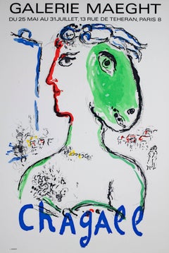
- "L'Artist Phoenix Poster, " an Original Colored Lithograph Poster by Marc ChagallBy Marc ChagallLocated in Milwaukee, WIMarc Chagall "L'Artist Phoenix Poster" for Galerie Maeght from 1972. It is from the edition of 5000. 30 1/2" x 20" art 40 1/2" x 32 1/4" frame Marc Ch...Category
1970s Expressionist More Prints
MaterialsLithograph
- "Graceful Touch, " original lithograph signed abstract floral peaceful vibrantBy Michael KniginLocated in Milwaukee, WI"Graceful Touch" is an original color lithograph by Michael Knigin. The artist signed the piece in the lower center, and wrote the title and "AP 1" (artist's proof #1). It features a...Category
1980s Abstract Abstract Prints
MaterialsLithograph, Ink
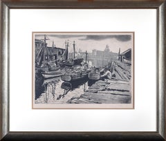
- Black and White Etching Travel 1930's Realism Water Industrial Outdoors SignedBy Joseph MarguliesLocated in Milwaukee, WI"Fishing Boats Gloucester" is a soft ground etching created by Joseph Margulies. The artist signed this piece in the lower right margin with graphite. This piece depicts several fish...Category
1930s American Realist Landscape Prints
MaterialsInk, Etching, Aquatint
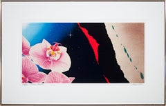
- Original Lithograph Signed Pop Art Floral Abstract Galaxy Space Celestial BrightBy Michael KniginLocated in Milwaukee, WI"Romeo's Paradise" is an original color lithograph by Michael Knigin. The artist signed the piece in the lower right then titled/editioned 130/300 in the lower left with graphite. It...Category
1980s Pop Art More Prints
MaterialsLithograph, Ink
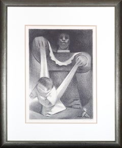
- Original Lithograph Baby Life Moments Family Female Figure Mother Black SignedBy Jean CharlotLocated in Milwaukee, WI"First Steps" is an original lithograph created by Jean Charlot. This is a wonderful piece with hispanic styling, showing a mother teaching her child how to walk. The mother is shown...Category
1930s Other Art Style Figurative Prints
MaterialsPaper, Ink, Lithograph
You May Also Like
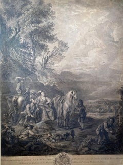
- Chasseur Fortune, Engraving, Van Falenz / Le Bas, Hunter, Decorative PieceLocated in Greven, DELe Chasseur Fortune Engraving framed Bez.: C. Van Falenz pinixit // Jac. Ph. Le Bas Sculp. // a Paris chez Le Bas graveur du Cabinet du Roy au bas de la rue de la Harpe...Category
18th Century Rococo Animal Prints
MaterialsEngraving
- L'Isle de France: A Hand-colored 17th Century Map by De WitBy Frederick de WitLocated in Alamo, CAThis colorful and detailed 17th century hand-colored copperplate map by Frederick De Wit was published in Amsterdam between 1666 and 1760. The map depicts the Île-de-France, which is one of the ancient provinces of France. Paris is located in the center of the map, with Versailles to the southwest The map extends from Rouen in the west to Reims in the east. The area around Paris, the Véxin Français, was the original domain of the king of France. Other areas were ruled by French feudal lords. For example, the Véxin Normand area was the domain of the Duke of Normandy...Category
Early 18th Century Old Masters More Prints
MaterialsEngraving
- Map of the Russian Empire: An Original 18th Century Hand-colored Map by E. BowenLocated in Alamo, CAThis is an original 18th century hand-colored map entitled "A New & Accurate Map of The Whole Russian Empire, As Contain'd Both In Europe and Asia, Drawn from Authentic Journals, Sur...Category
Mid-18th Century Old Masters Landscape Prints
MaterialsEngraving
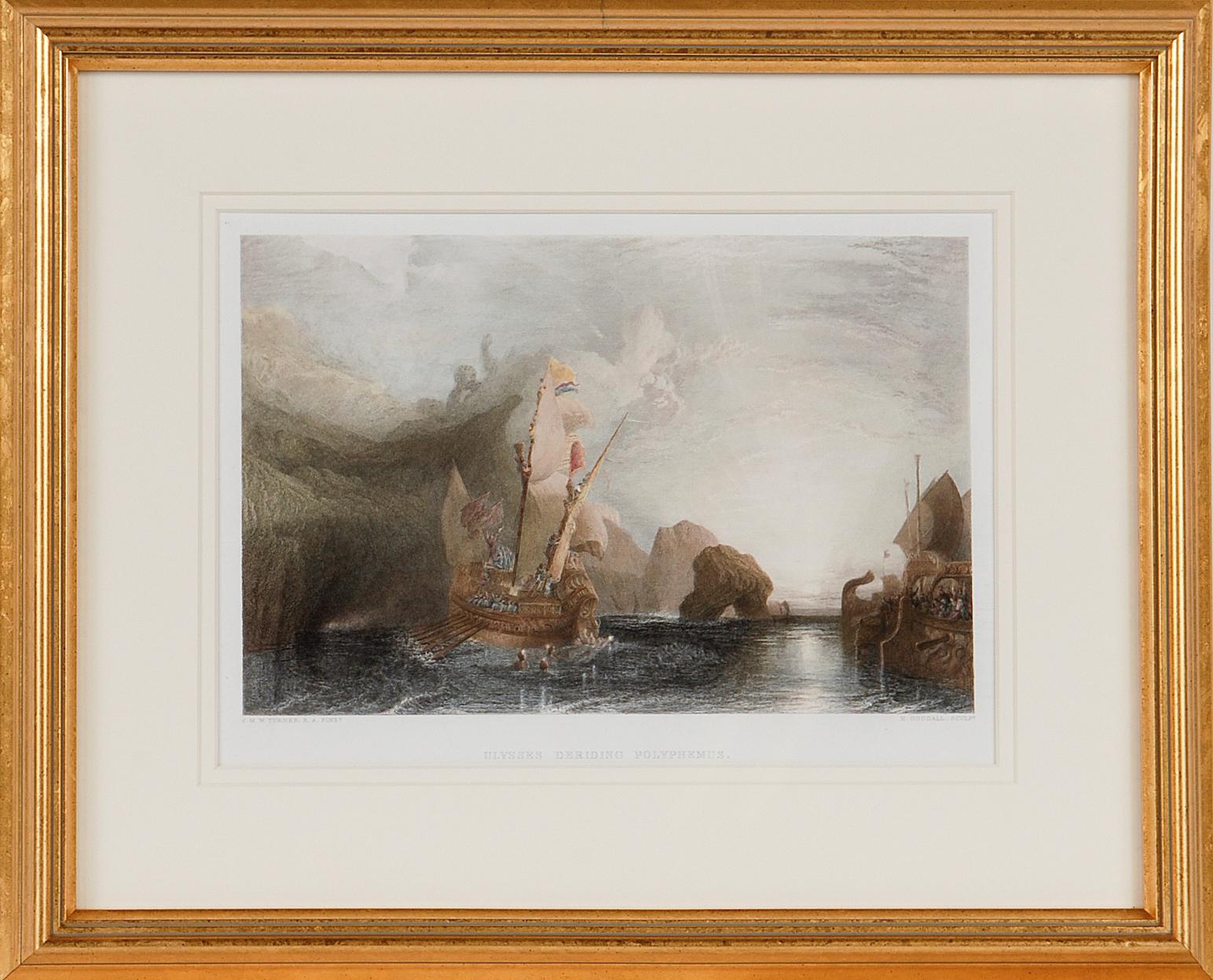
- Ulysses Deriding Polyphemus: A Framed 19th C. Engraving After J. M. W. TurnerBy J.M.W. TurnerLocated in Alamo, CAThis beautiful 19th century framed hand-colored engraving/etching entitled "Ullyses Deriding Polyphemus" by Edward Goodall is based on an original 1829 painting by the renowned Briti...Category
Mid-19th Century Romantic Landscape Prints
MaterialsEngraving, Etching
- View of Emden, Germany: A 16th Century Hand-colored Map by Braun & HogenbergBy Franz HogenbergLocated in Alamo, CAThis is a 16th century original hand-colored copperplate engraved map of a bird's-eye View of Embden, Germany entitled " Emuda, vulgo Embden vrbs Frisia orientalis primaria" by Georg Braun & Franz Hogenberg, in volume II of their famous city atlas "Civitates Orbis Terrarum", published in Cologne, Germany in 1575. This is a beautifully colored and detailed map of Emden, a seaport in northwestern Germany, along the Ems River and perhaps portions of over Dollart Bay, near the border with the Netherland. The map depicts a bird's-eye view of the city from the southwest, as well as a view of the harbor and an extensive system of canals. Numerous ships of various sizes, as well as two rowboats containing numerous occupants are seen in the main waterway in the foreground and additional boats line two canals in the center of the city. Two men and two women are shown on a hill in the foreground on the right, dressed in the 16th century style of nobility. Two ornate crests are included in each corner. A title strap-work cartouche is in the upper center with the title in Latin. The crest on the right including Engelke up de Muer (The Little Angel on the Wall) was granted by Emperor Maximilian I in 1495. This is an English translation of an excerpt of Braun's description of Embden: "In Emden, the capital of East Frisia, rich merchants live in very fine houses. The city has a broad and well-situated harbour, which in my opinion is unique in Holland. Frisia and the whole of the Netherlands, for the ships can anchor here right under the city walls. They have also extended the harbour as far as the New Town, so that up to 400 ships can now find shelter here when the sea is rough." The emphasis on the harbor and waterways within the city highlights the importance of Emden's place as a seaport at this time. Embden developed from a Dutch/Flemish trading settlement in the 7th-8th centuries into a city as late as late 14th century. In 1494 it was granted staple rights, and in 1536 the harbour was extended. In the mid-16th century Emden's port was thought to have the most ships in Europe. Its population then was about 5,000, rising to 15,000 by the end of the 16th century. The Ems River flowed directly under the city walls, but its course was changed in the 17th century by the construction of a canal. Emden has canals within its city limits, a typical feature of Dutch towns, which also enabled the extension of the harbor. In 1744 Emden was annexed by Prussia and is now part of Germany. It was captured by French forces in 1757 during the Seven Years' War, but recaptured by Anglo-German forces in 1758. During the Napoleonic French era, Emden and the surrounding lands of East Frisia were part of the short-lived Kingdom of Holland. References:Van der Krogt 4, 1230, State 2; Taschen, Braun and Hogenberg...Category
16th Century Old Masters Landscape Prints
MaterialsEngraving
- Ireland: A Framed 17th Century Hand-colored Map by Jan JannsonBy Johannes JanssoniusLocated in Alamo, CAThis is a 17th century hand-colored map entitled "Hibernia Regnum Vulgo Ireland" by Johannes Janssonius's (Jan Jansson), published in Amsterdam in 1640. This highly detailed map depicts the Emerald Isle with an extensive display of towns, roads, mountains, rivers, lakes and county borders, etc. It includes two decorative cartouches on the left. The title cartouche includes the Irish harp and the second, in the upper left, includes a lion wearing a crown on the left, a unicorn on the right and a coat-of-arms in the middle, which includes another Irish harp. A distance scale is seen in the lower right, augmented with two putti. The map is embellished with three sailing ships and a sea monster. Western portions of Scotland and England...Category
Mid-17th Century Old Masters Landscape Prints
MaterialsEngraving


Recently Viewed
View AllMore Ways To Browse
Pipe Antique
Engraving 19
Set 4 Engravings
Engravings Set Of 4
Antique Headdresses
Antique Headdress
Set Of 8 Engravings
Framed 8 Engravings
Engravings Set Of 6
Antique Cradles
Antique Cradle
Sets Of Colored Engravings
Engraving Print Children
Hand Colored Engraving Set
Set Of Six Engravings
Set Of Hand Colored Engravings
Brunswick Antique
7 Navajos