Items Similar to Map of Europe, 1844


Want more images or videos?
Request additional images or videos from the seller
1 of 7
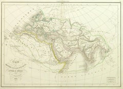
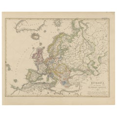
UnknownMap of Europe, 18441844
1844
$375
£285.81
€326.70
CA$527.60
A$577.97
CHF 304.22
MX$6,898.23
NOK 3,878.05
SEK 3,545.12
DKK 2,440.39
About the Item
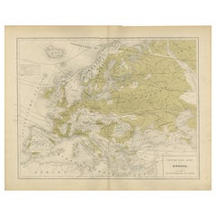
Over 150 year old engraved map of Europe by Olney from 1844. Original hand color. Shows Northern Europe, Prussia and Germany.
Original antique map on paper displayed on a white mat with a gold border. Mat fits a standard-size frame. Archival plastic sleeve and Certificate of Authenticity included. Artwork, 17.75”L x 70.75”H; mat, 24”L x 18”H.
- Creation Year:1844
- Dimensions:Height: 18 in (45.72 cm)Width: 24 in (60.96 cm)Depth: 0.1 in (2.54 mm)
- Medium:
- Period:
- Condition:Center fold as issued.
- Gallery Location:Houston, TX
- Reference Number:Seller: 8567K-31stDibs: LU10422397513
About the Seller
5.0
Platinum Seller
Premium sellers with a 4.7+ rating and 24-hour response times
Established in 2001
1stDibs seller since 2015
1,073 sales on 1stDibs
Typical response time: 1 hour
- ShippingRetrieving quote...Shipping from: Houston, TX
- Return Policy
More From This Seller
View AllAncient World Map
Located in Houston, TX
Over 150 year old engraved map of the world as it was known during the antiquities by cartographer Delamarche from 1838. Original hand color. Shows African, European and Asian cont...
Category
1830s More Prints
Materials
Ink, Watercolor, Handmade Paper
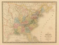
United States, 1844
Located in Houston, TX
Over 150 year old map of early United States of America with Western Districts from 1844. Original hand color. Districts shown include Hurons, Sioux, Mandans, Osages, and Ozark. Note independent Republic of Texas...
Category
1840s More Prints
Materials
Ink, Watercolor, Handmade Paper
Map of Denmark, 1724
Located in Houston, TX
Extraordinary copper engraved map of Denmark by cartographer Christoph Weigel from 1724. Shows counties, rivers and towns. Ornate title cartouche. Original hand-color. Over 250 years old.
Original antique map displayed...
Category
17th Century Other Art Style More Prints
Materials
Paper, Ink, Watercolor

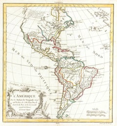
Map of Americas
Located in Houston, TX
Over 200 year old engraved map of Americas by Robert de Vaugondy from 1783. Original hand color. Shows North, Central and South Americas. Note the po...
Category
1780s More Prints
Materials
Ink, Watercolor, Handmade Paper
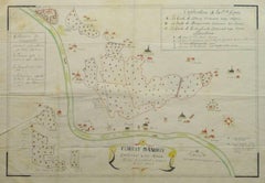
Antique Manuscript Map - Forest of Andely
Located in Houston, TX
Charming hand drawn ink and watercolor map of the Forest of Andely, in the Normandy area, France, circa 1890.
Original artwork on paper displayed on...
Category
1890s More Art
Materials
Ink, Paper, Watercolor
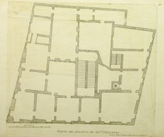
Antique Italian Engraving - Crescenzi Palace
By Giovanni Giacomo de Rossi
Located in Houston, TX
Antique copper engraving of the floor plan to Crescenzi Palace in Rome, Italy by Italian Giovanni Giacomo de' Rossi, 1650.
Original artwork on paper displayed on a white mat with a...
Category
15th Century and Earlier Interior Prints
Materials
Ink, Paper
$250 Sale Price
50% Off
You May Also Like
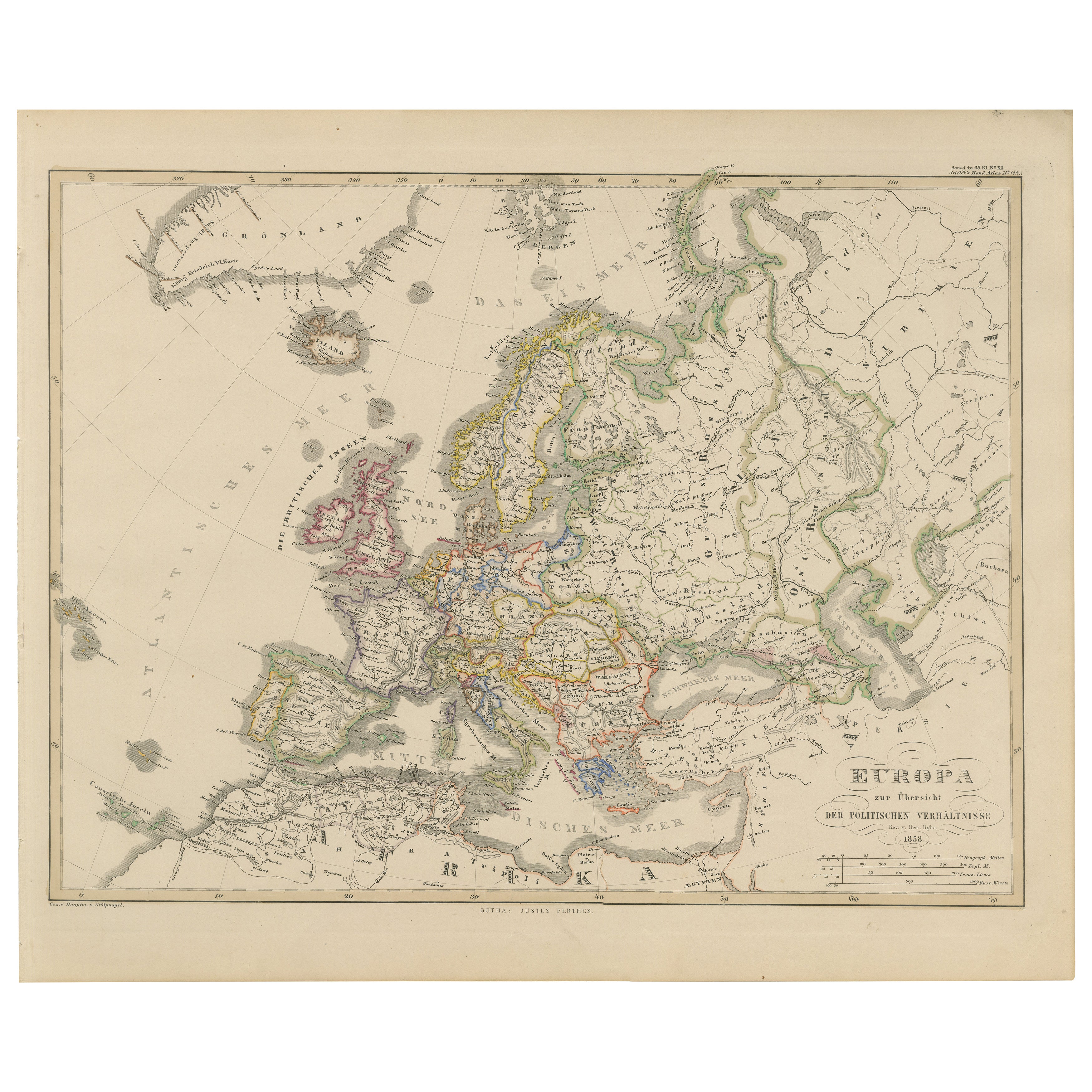
Europe Map – Political Divisions and Borders, Published in 1858
Located in Langweer, NL
Europe Map – Political Divisions and Borders 1858
This fine antique print shows Europe with its political divisions titled “Europa zur Übersicht der politischen Verhältnisse” meanin...
Category
Antique Mid-19th Century German Maps
Materials
Paper
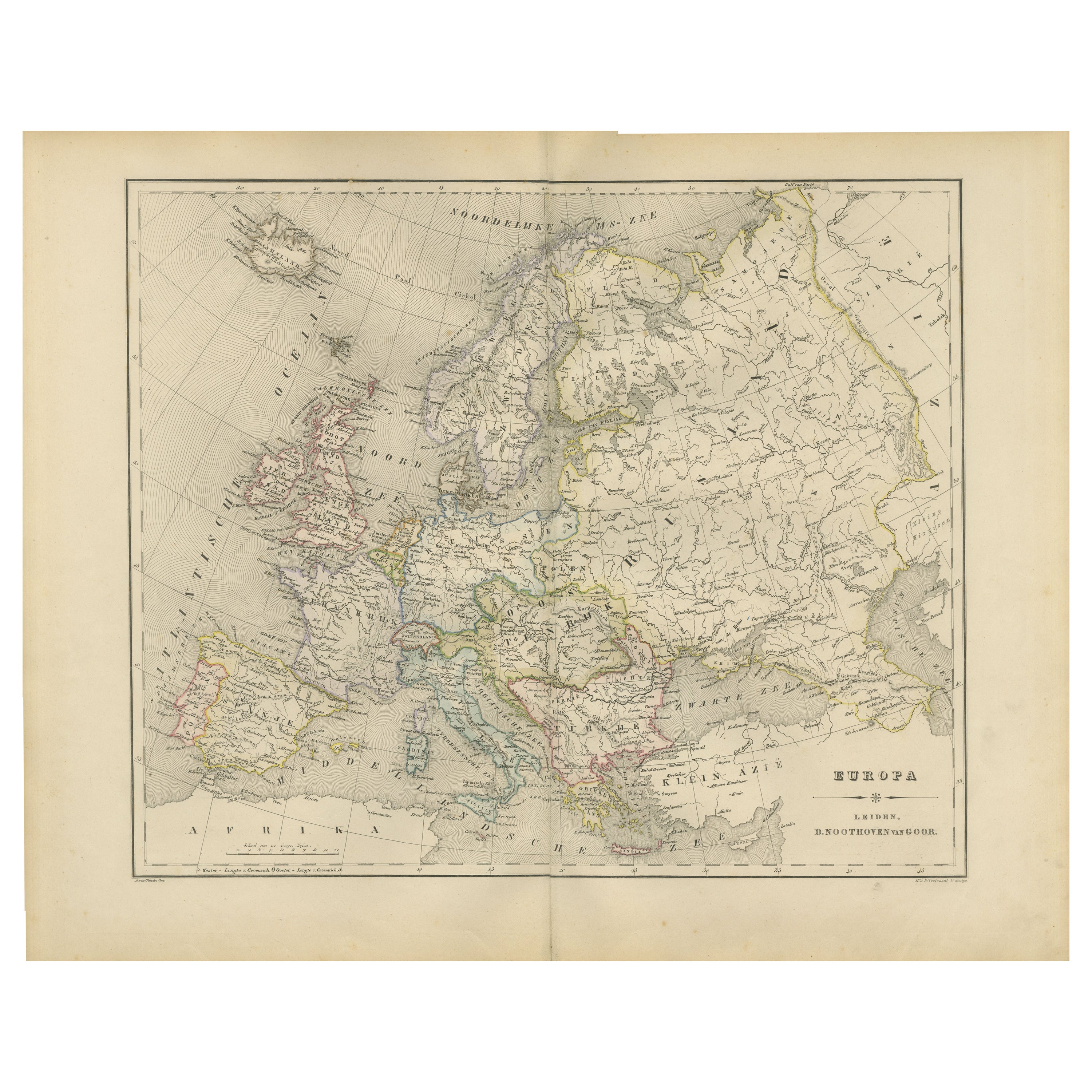
Political Map of Europe – Nieuwe Hand-Atlas by Frijlink & van Otterloo, 1876
Located in Langweer, NL
Title: Political Map of Europe – Nieuwe Hand-Atlas by Frijlink & van Otterloo, 1876
Description:
This 19th-century Dutch map titled “Europa” was published in 1876 in the Nieuwe Hand...
Category
Antique 1870s Dutch Maps
Materials
Paper
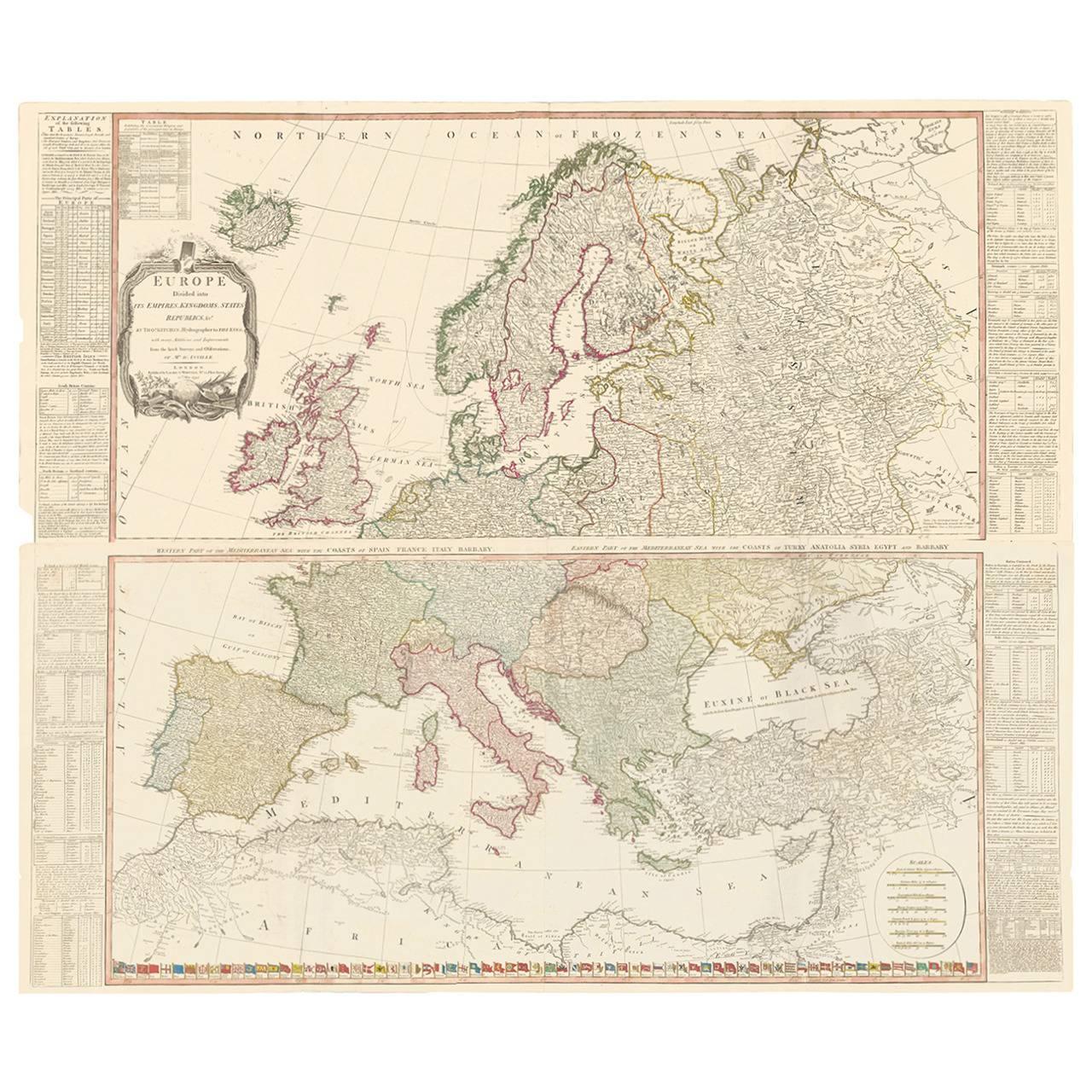
Two-Part Large Hand-Colored Map of Europe from 1798
By Thomas Kitchin
Located in New York, NY
Map of Europe printed on two separate sheets from A New Universal Atlas by Thomas Kitchin. Published in London by Laurie & Whittle, 1798. Original engravings hand-colored at publicat...
Category
1790s More Art
Materials
Paper

$1,700 Sale Price
33% Off
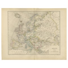
Antique Map of Europe by Balbi '1847'
Located in Langweer, NL
Antique map titled 'Europe'. Original antique map of Europe. This map originates from 'Abrégé de Géographie (..)' by Adrien Balbi. Published 1847.
Category
Antique Mid-19th Century Maps
Materials
Paper

$143 Sale Price
20% Off
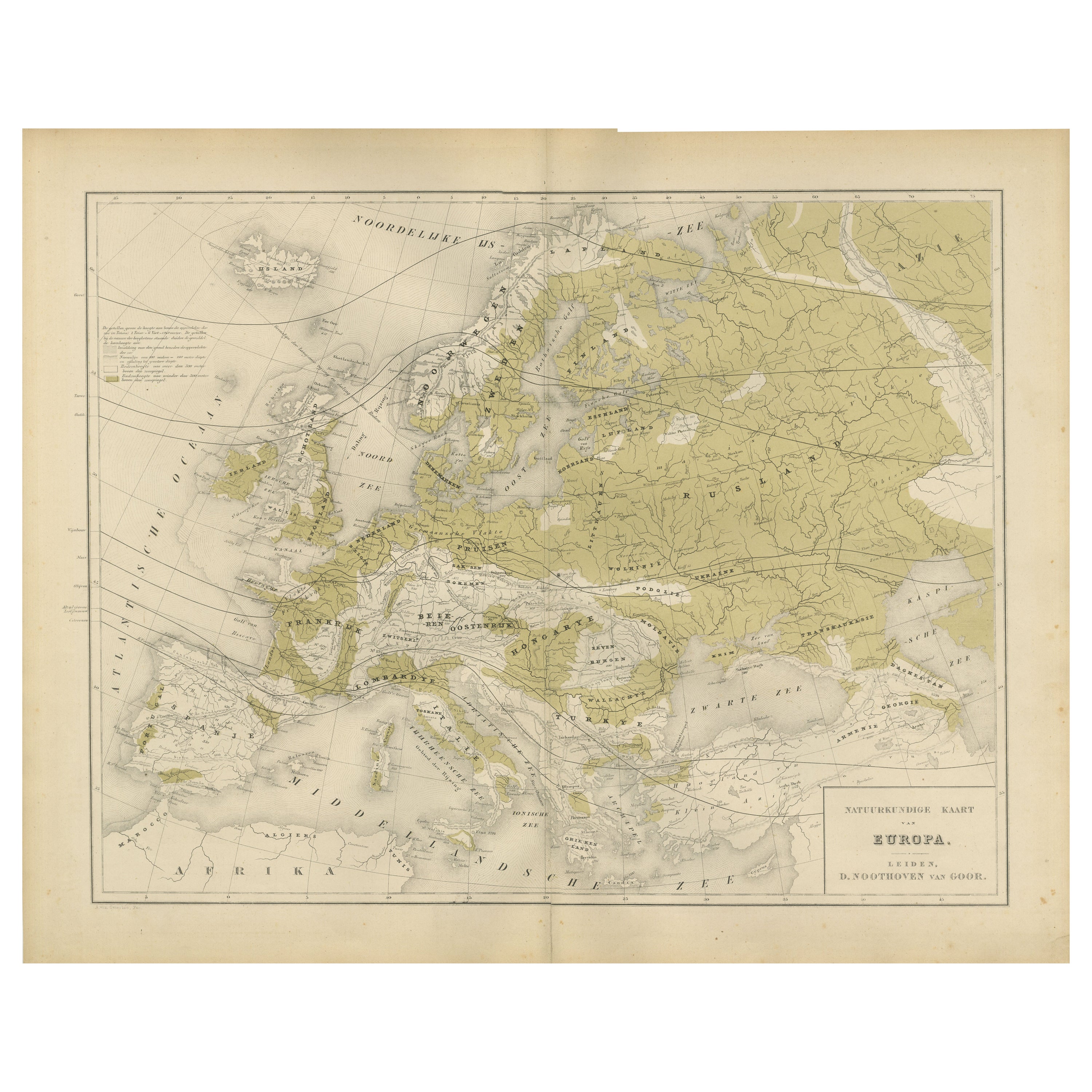
Physical Map of Europe – Nieuwe Hand-Atlas by Frijlink & van Otterloo, 1876
Located in Langweer, NL
Title: Northern Hemisphere Map Centered on the North Pole, Leiden 1876
Description:
This 19th-century Dutch map titled “Noordpoolkaart” (Map of the North Pole) was published in 1876...
Category
Antique 1870s Dutch Maps
Materials
Paper
Political Map of Europe: Early 19th Century, from the 1802 Tardieu Atlas
Located in Langweer, NL
Antique Map Description
Title: Carte Générale et Politique de l'Europe
Publication Details:
- **Atlas Title:** Nouvel Atlas Universel de Géographie Ancienne et Moderne
- **Purpose...
Category
Antique Early 1800s French Maps
Materials
Paper

$458 Sale Price
20% Off
More Ways To Browse
Map Of Europe
Antique Maps Of Europe
Prussia Map
Poster Vintage Italie
Radar Rat
Railways Trains Ussr
Red Grooms Elvis
Redoute Rose Prints
Redoute Roses
Regatta Poster
Retro Basketball Poster
Retro Pin Up Girl Poster
Rolls Royce Poster
Salvador Dali Fantastic Voyage
Salvador Dali Pencil Signed
Sevilla Poster
Sevilla Vintage Poster
Shepard Fairey Vote