Items Similar to A Map Of Western Long Island Sound Showing Yacht Clubs, Aids To Navigation...
Want more images or videos?
Request additional images or videos from the seller
1 of 12
UnknownA Map Of Western Long Island Sound Showing Yacht Clubs, Aids To Navigation...
$925
£720.75
€817.67
CA$1,329.43
A$1,463.83
CHF 759.06
MX$17,335.82
NOK 9,635.80
SEK 9,005.75
DKK 6,107.06
About the Item
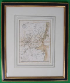
Classic color map/ nautical chart (by Nolf Klep '39) of the North Shore of Long Island Sound
for members of the Larchmont Yacht Club (see verso)
Map Sz: 13 3/8"H x 21 1/2"W
Frame Sz: 18 1/2" x 26 5/8"
w/ custom yellow lacquer wood frame w/ nautical red matte
Map, Long Island Sound, Yachting Club, Vintage Print, 1939
Rolf Klep (b. 1904)
A Map of Western Long Island Sound — Showing Yacht Clubs, Aids to Navigation and Principal Larchmont Race Courses
Fortune, Vol. 20, No. 2, August 1939
Photo-process print
14 x 22 inches
Decorative map of Long Island Sound, showing parts of Westchester County, Fairfield County, New York City, and the North Shore of Long Island. Yacht clubs indicated by flags. Lighthouses, buoys, radio beacons, currents indicated. Principal Larchmont Race Courses indicated by numbered white lines. According to the legend, “based on U.S. Coast and Geodetic Survey and Texaco Cruising Charts.” Issued in Fortune magazine to illustrate an article about the Larchmont Yacht Club.
About the Seller
4.8
Vetted Professional Seller
Every seller passes strict standards for authenticity and reliability
Established in 2000
1stDibs seller since 2019
135 sales on 1stDibs
Typical response time: 1 hour
- ShippingRetrieving quote...Shipping from: Bristol, CT
- Return Policy
More From This Seller
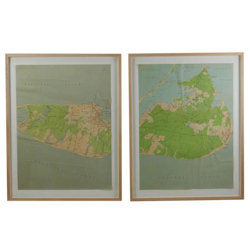
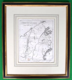
View AllMaps of Nantucket Sound and Harbor Provenance: The Susie Hilfiger Collection
Located in Bristol, CT
Map Sz: 22 1/2"H x 17"W
Frame Sz: 26 1/2"H x 20 3/4"W
*w/ age toning/ slight creasing/ waving to mounted maps*
Provenance: The Susie Hilfiger Collection
From "Point of View", the...
Category
20th Century Drawings and Watercolor Paintings
Materials
Paper
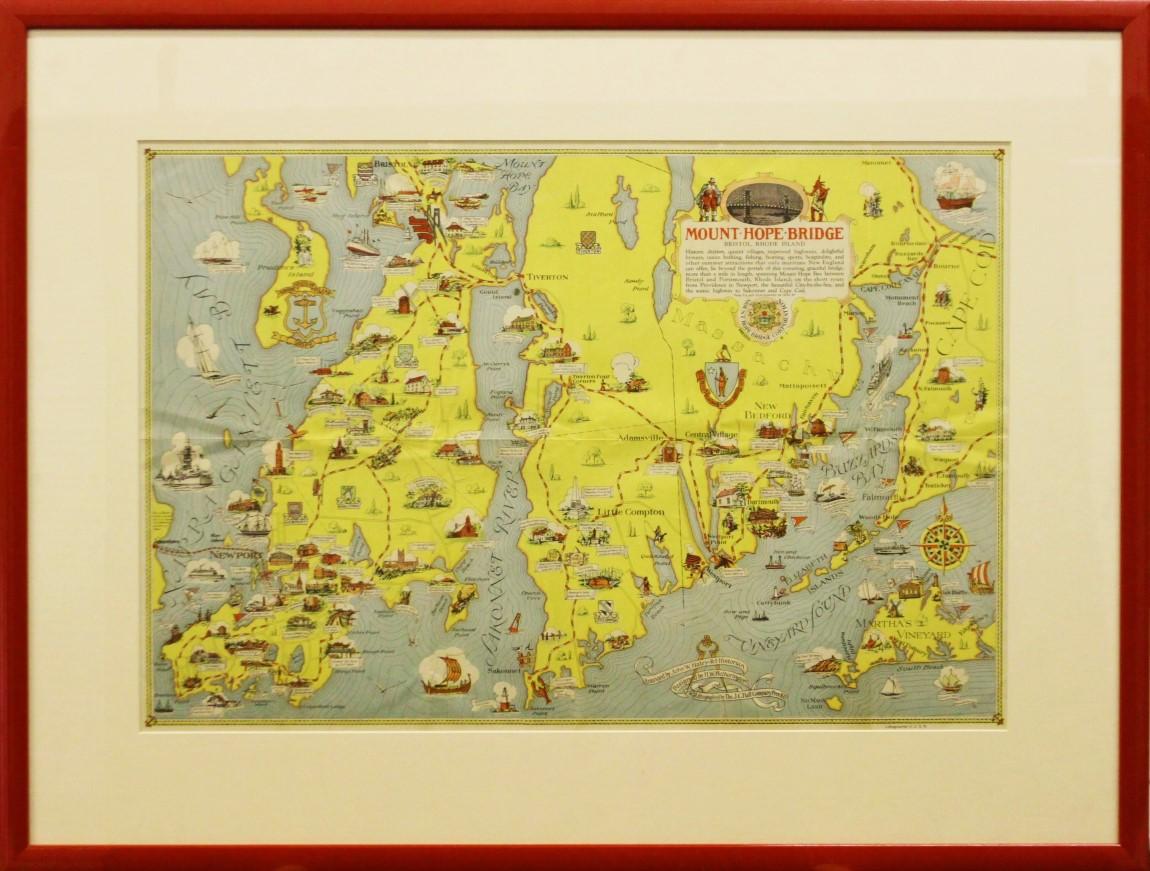
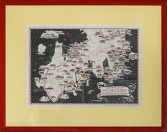
"Rhode Island Map, 1933"
Located in Bristol, CT
Classic c1933 colour (12 fold) red framed map of Rhode Island designed by H.W. Hetherington from Narragansett Bay to Buzzard's Bay
Map Sz: 17 3/8"...
Category
1930s Prints and Multiples
Materials
Lithograph
Plan Of The Northern Part Of New Jersey Showing The Positions Of The American &
By Richard Phillips
Located in Bristol, CT
After Crossing The North River in 1776
Map Sz: 9 7/8"H x 7 1/4"W
Frame Sz: 18 5/8"H x 15 3/4"W
Engraved by J Yeagen
Uncolored map of Northern New Jersey, Staten Island and the lo...
Category
Early 1800s Prints and Multiples
Materials
Lithograph
American Revolution Map Drawn For John Marshall's "Life Of Washington" First Acc
Located in Bristol, CT
A Map Of The Country Which Was The Scene Of Operations Of The Northern Army: Including The Wilderness Through Which Gerneral Arnold Marched To Attack Plate VI
Map Sz: 11"H x 9 1/4"W...
Category
Early 1800s Prints and Multiples
Materials
Paper, Engraving
"Newport's Famous Ten Mile Drive" c1939 Map
Located in Bristol, CT
c1939 map of Newport's famous 'Ten Mile Drive' along the ocean front showing the locations of the beautiful summer residences of many prominent people
Map Sz: 12 1/2"H x 17 1/4"
Fr...
Category
1930s Other Art Style Landscape Prints
Materials
Lithograph
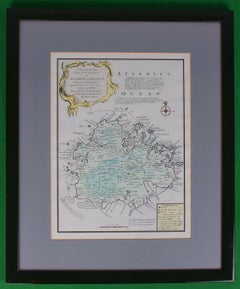
Map Of The Island Of Antigua
Located in Bristol, CT
Classic colour plate depicting a 'Map of the Island of Antigua' by Eman Bowen
Print Sz: 13 1/2"H x 10"W
Frame Sz: 20"H x 16 1/2"W
w/ grey mat & green lacquer frame
Emanuel Bowen ...
Category
19th Century Prints and Multiples
Materials
Lithograph
You May Also Like
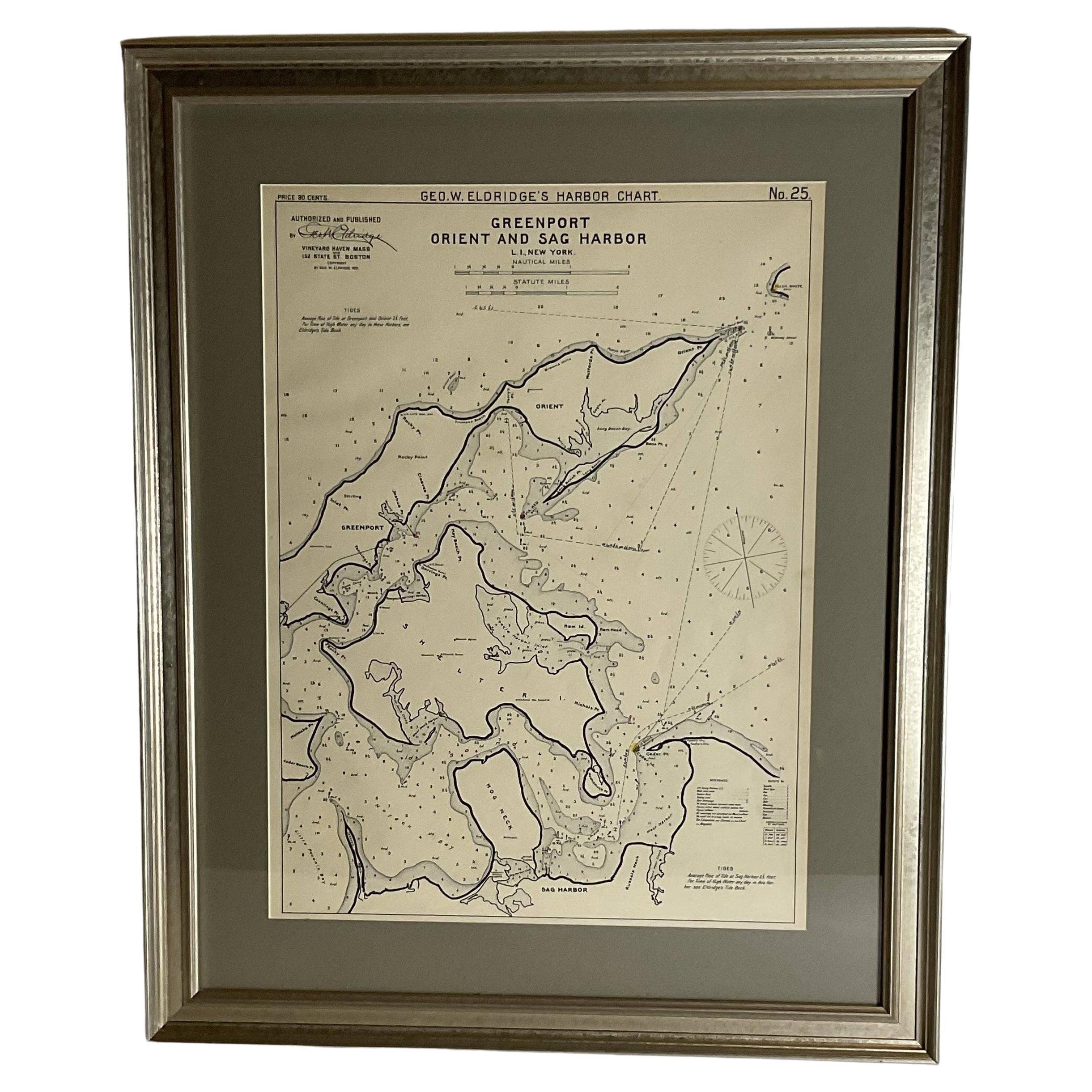
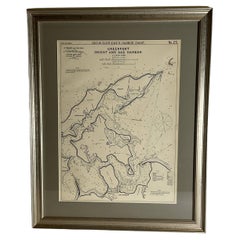
Sag Harbor Nautical Chart
Located in Norwell, MA
Marine chart of Greenport, Orient, and Sag Harbor New York published by George Eldridge in 1901. Details include the areas of Greenport, Orient, Shelter ...
Category
Antique Early 1900s Prints
Materials
Paper
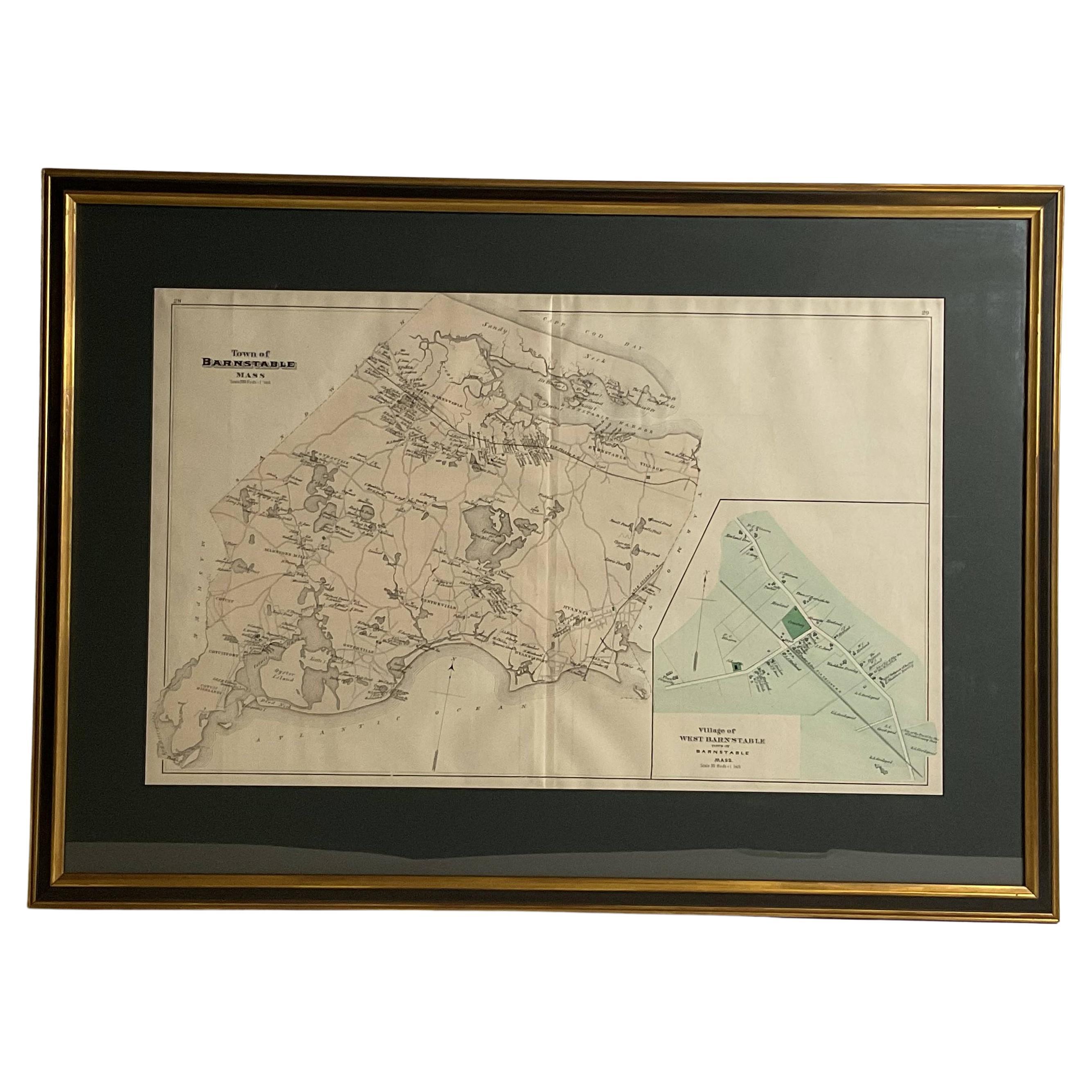
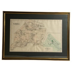
Oyster Harbors Osterville Centerville Cotuit Sandy Neck Map
Located in Norwell, MA
Barnstable country map from the nineteenth century. The map shows the Atlantic coast from Cotuit Highlands past Hyannisport, Hyannis, Sandy Neck, Marstons, Mills, etc., This map is a...
Category
Antique 1890s North American Prints
Materials
Paper
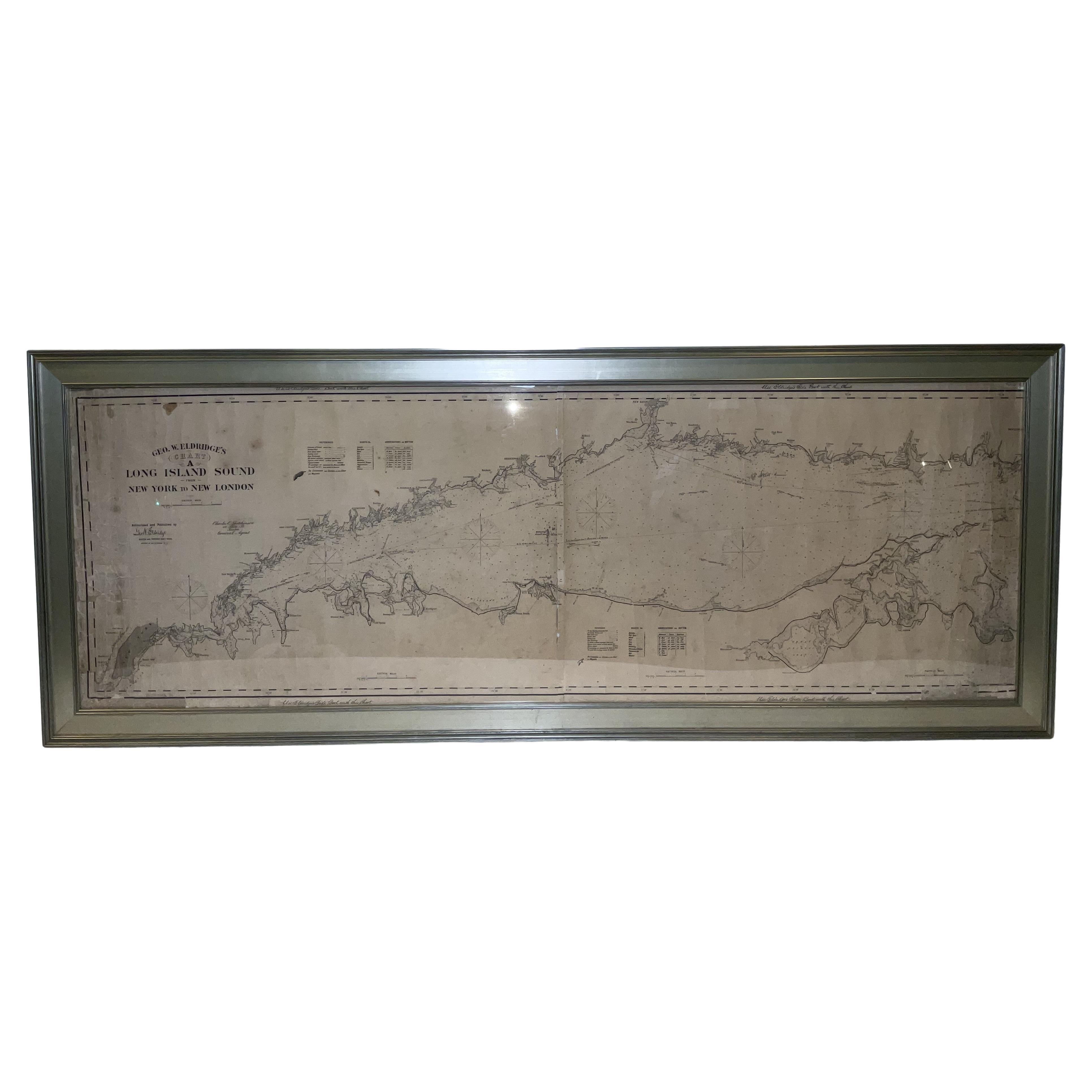
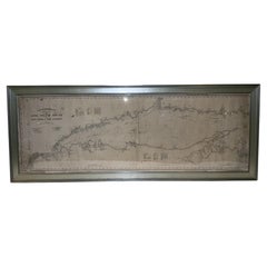
1905 Chart of Long Island Sound by Eldridge
Located in Norwell, MA
Original chart of Long Island Sound by George Eldridge, date-stamped 1905. Also includes the seller's name, Ships Chandler Charles C. Hutchinson, 152 State St., Boston, General Agent...
Category
Antique Early 1900s North American Prints
Materials
Paper
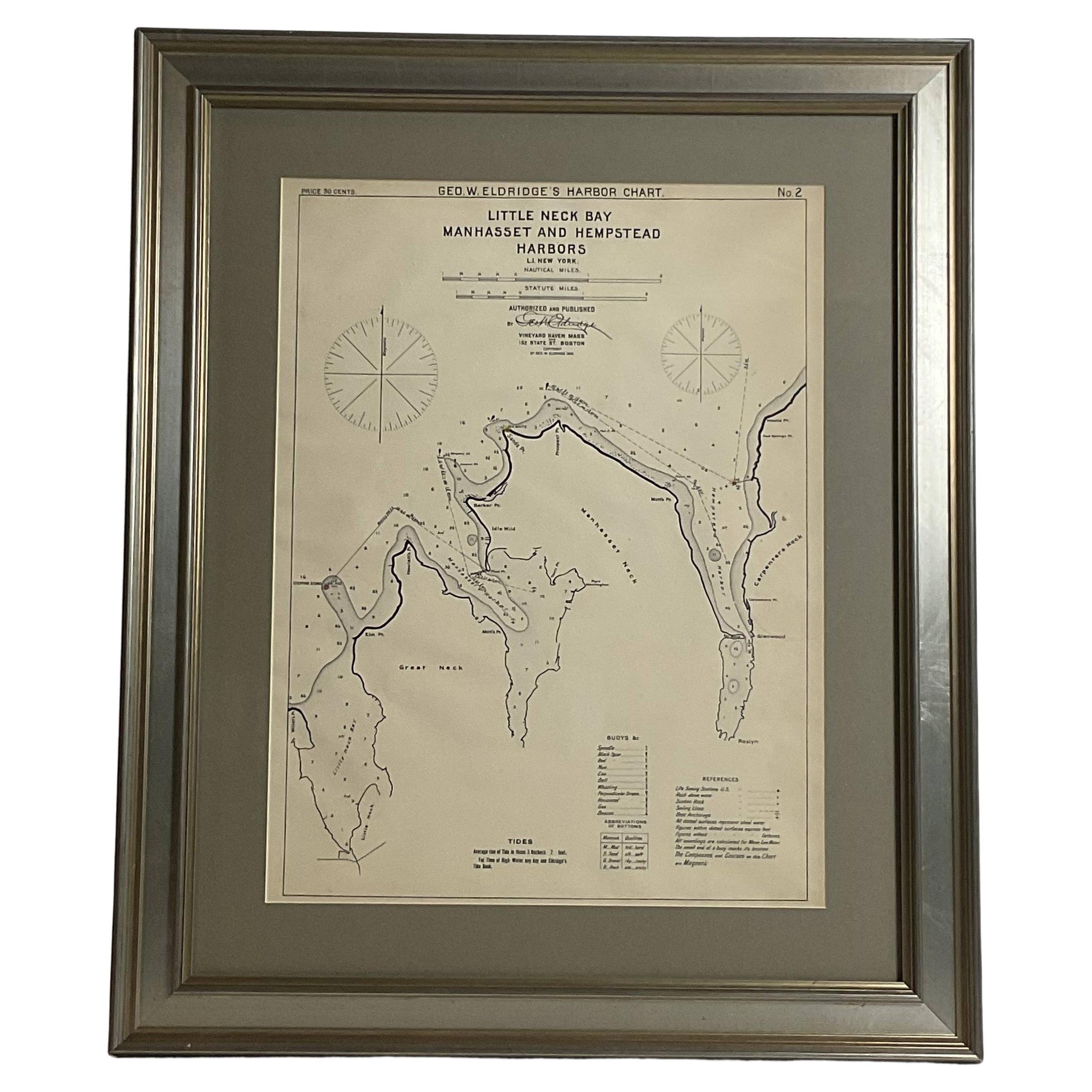
Mariners charts of Massachusett Long Island by George Eldridge 1901
Located in Norwell, MA
Nautical Chart showing the harbor and local waters of the Little Neck Bay, Manhasset and Hempstead Harbors. The chart displays depths, buoys, lighthouses, etc., Shown is Manhasset Ne...
Category
Antique Early 1900s North American Prints
Materials
Paper

1776 Navigational chart/map of the Delaware bay and river including Philadelphia
Located in Philadelphia, PA
JOSHUA FISHER
(AMERICAN, EIGHTEENTH CENTURY)
A Chart of Delaware Bay and River, 1776
Printed for John Bennet and Robert Sayer, London
Engraving on pape...
Category
1770s Realist Landscape Prints
Materials
Paper, Engraving

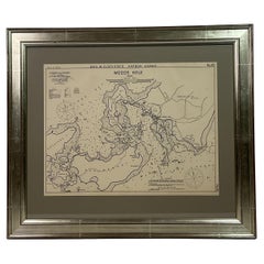
1901 Nautical Chart Showing Woods Hole, Mass
Located in Norwell, MA
Rare 1901 chart of Woods Hole, Mass., showing Buzzards Bay, Penzance Point, Nonamesset Island, Downtown Woods Hole, Parker Neck, Nobska Head, Vineyard Sound, Woods Hole Golf Club, Ra...
Category
Antique Early 1900s North American Maps
Materials
Paper
More Ways To Browse
Yacht Club
Used Nautical Charts
Nautical Maps
Yacht Flag
Vintage Long Island Map
Stanley Mouse
Thai Retro Poster
Tomato Soup
Vintage Bovril Posters
Vintage Science Fiction Art
Ceylon Poster
Constructivism Poster
Dangerfield Print
Horizontal Vintage Art Poster
Horizontal Vintage Posters
London Map Vintage
London Underground Map Vintage
Olympic Bear