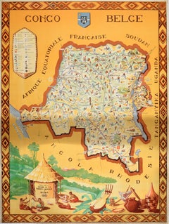
Original Vintage Africa Travel Poster Belgian Congo Congo Belge Illustrated Map
View Similar Items

1 of 6
UnknownOriginal Vintage Africa Travel Poster Belgian Congo Congo Belge Illustrated Map1949
1949
$1,660.39List Price
About the Item
Authenticity Guarantee
In the unlikely event there’s an issue with an item’s authenticity, contact us within 1 year for a full refund. DetailsMoney-Back Guarantee
If your item is not as described, is damaged in transit, or does not arrive, contact us within 7 days for a full refund. Details24-Hour Cancellation
You have a 24-hour grace period in which to reconsider your purchase, with no questions asked.Vetted Professional Sellers
Our world-class sellers must adhere to strict standards for service and quality, maintaining the integrity of our listings.Price-Match Guarantee
If you find that a seller listed the same item for a lower price elsewhere, we’ll match it.Trusted Global Delivery
Our best-in-class carrier network provides specialized shipping options worldwide, including custom delivery.You May Also Like
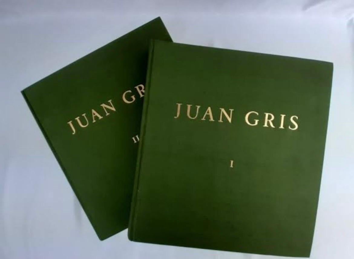
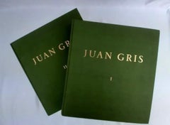
Juan Gris: Catalogue Raisonné
By Douglas Cooper
Located in Beverly Hills, CA
Published in a limited edition of 750.
Author: Douglas Cooper
Format: Hard Copy
Publisher: Berggruen Éditeur
Publisher Location: Paris, France
Total Pag...
Category
Early 20th Century Cubist More Prints
Materials
Paper
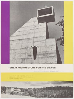
Great Architecture for the Sixties – La Tourette by Le Corbusier
By Walter Allner
Located in Zurich, CH
Original Vintage Poster depicting Le Corbusier's Convent of La Tourette, published 1962 by the Architectural Forum to promote Modern Architecture –...
Category
Mid-20th Century Modern More Prints
Materials
Paper
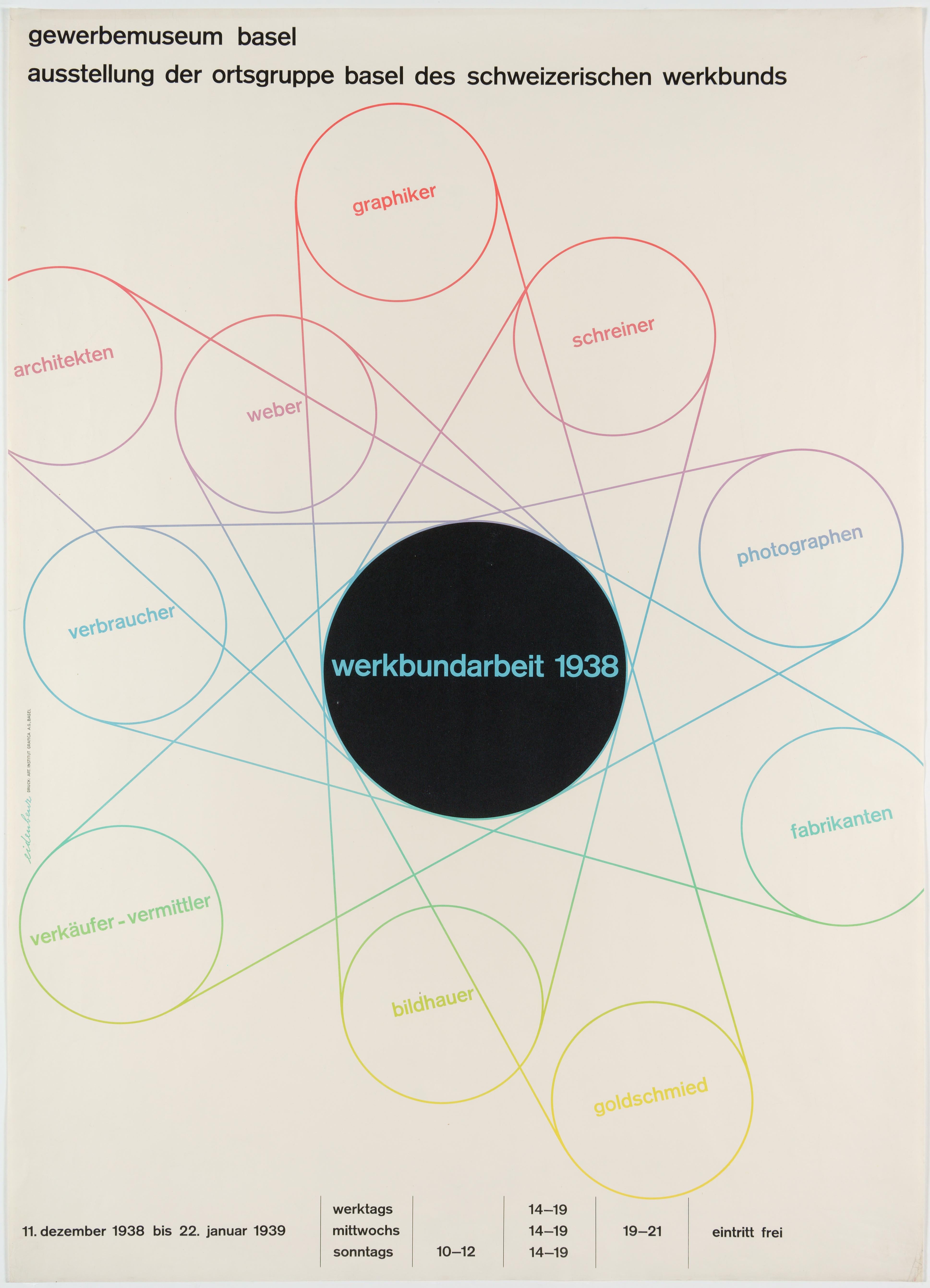
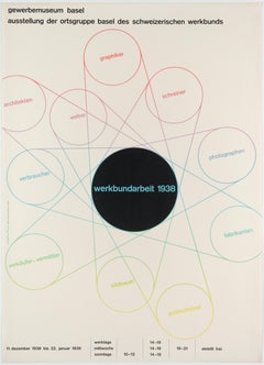
Werkbund – Original Swiss Exhibition Poster
Located in Zurich, CH
Original Swiss Exhibition poster by Hermann Eidenbenz (lithograph, printed by Art. Institut Grafica in Basel) advertising a show of the Basel section ...
Category
1930s Modern Abstract Prints
Materials
Paper
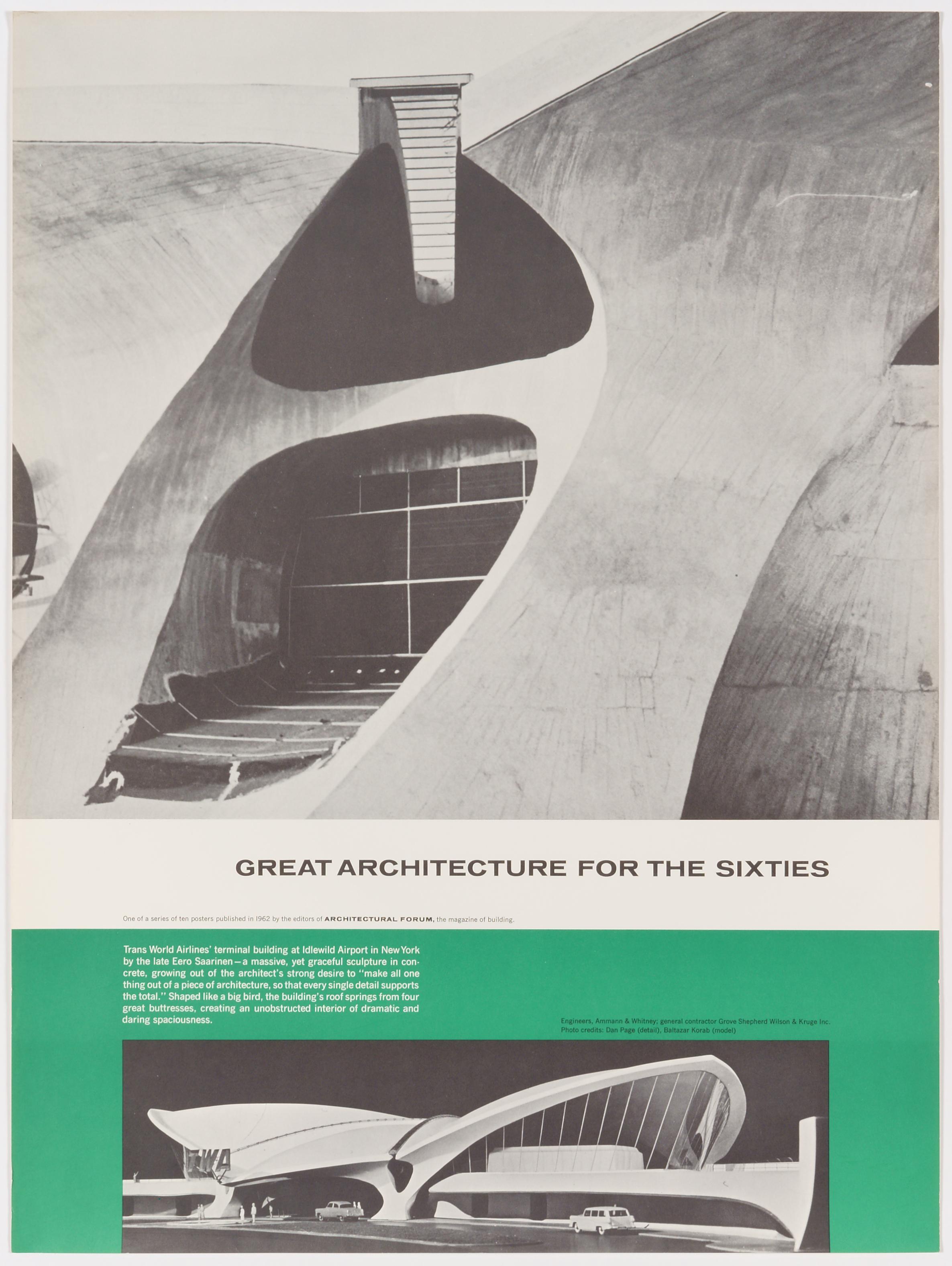
Great Architecture for the Sixties – TWAs Terminal Building by Eero Saarinen
By Walter Allner
Located in Zurich, CH
Original Vintage Poster depicting Eero Saarinen's TWA Terminal, published 1962 by the magazine Architectural Forum to promote Modern Architecture – one of...
Category
Mid-20th Century Modern More Prints
Materials
Paper

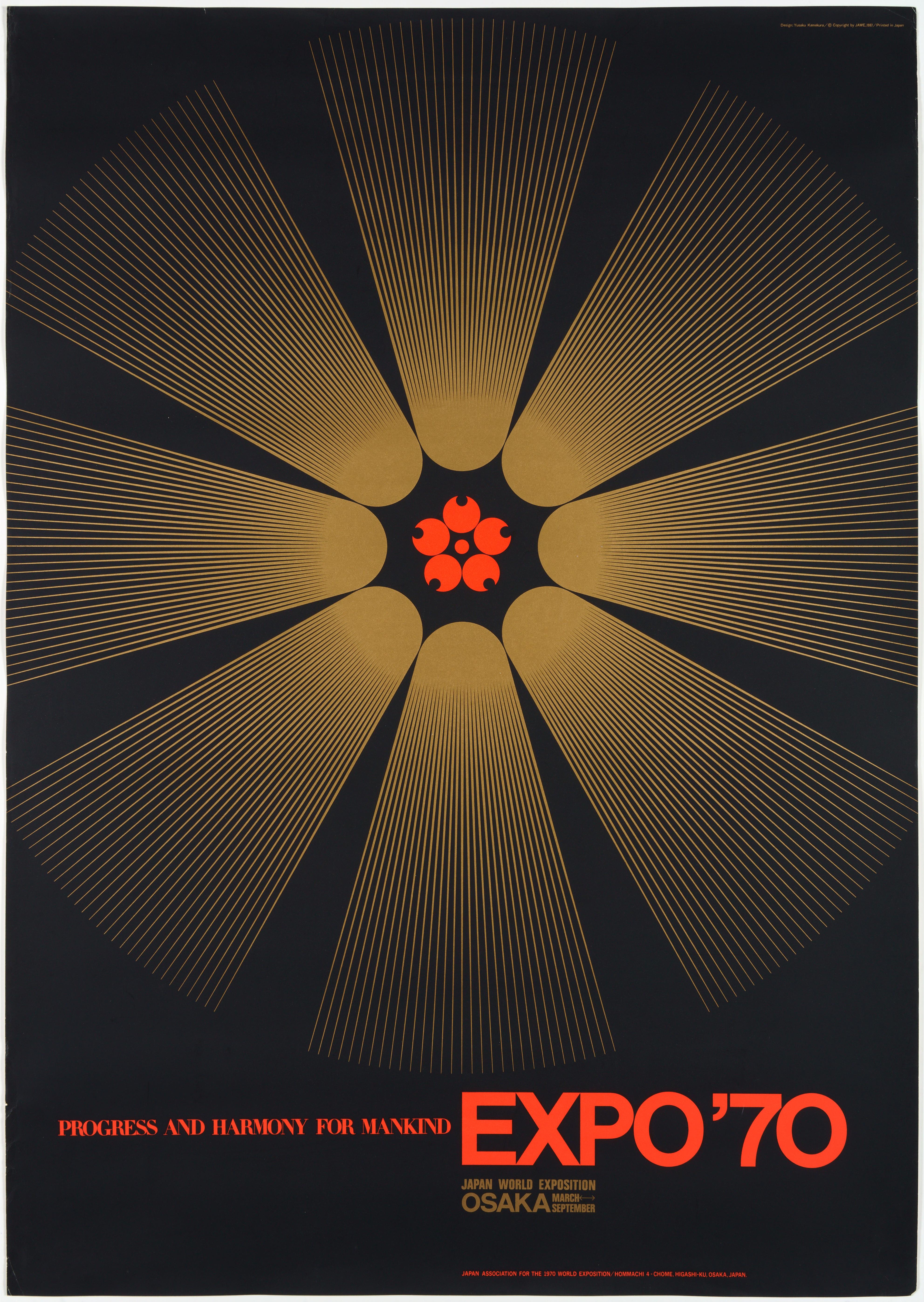
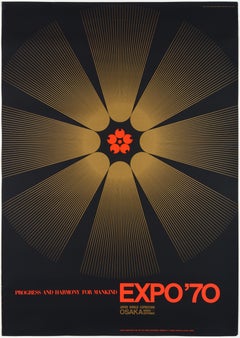
Expo 1970 World Exhibition in Osaka – Original Vintage Japanese Poster
By Yusaku Kamekura
Located in Zurich, CH
Original Vintage Event Poster created 1967 by one of the best known Japanese graphic artists, Yusaku Kamekura; in 1960 he was a founding member, then ...
Category
Mid-20th Century Abstract Geometric Abstract Prints
Materials
Paper
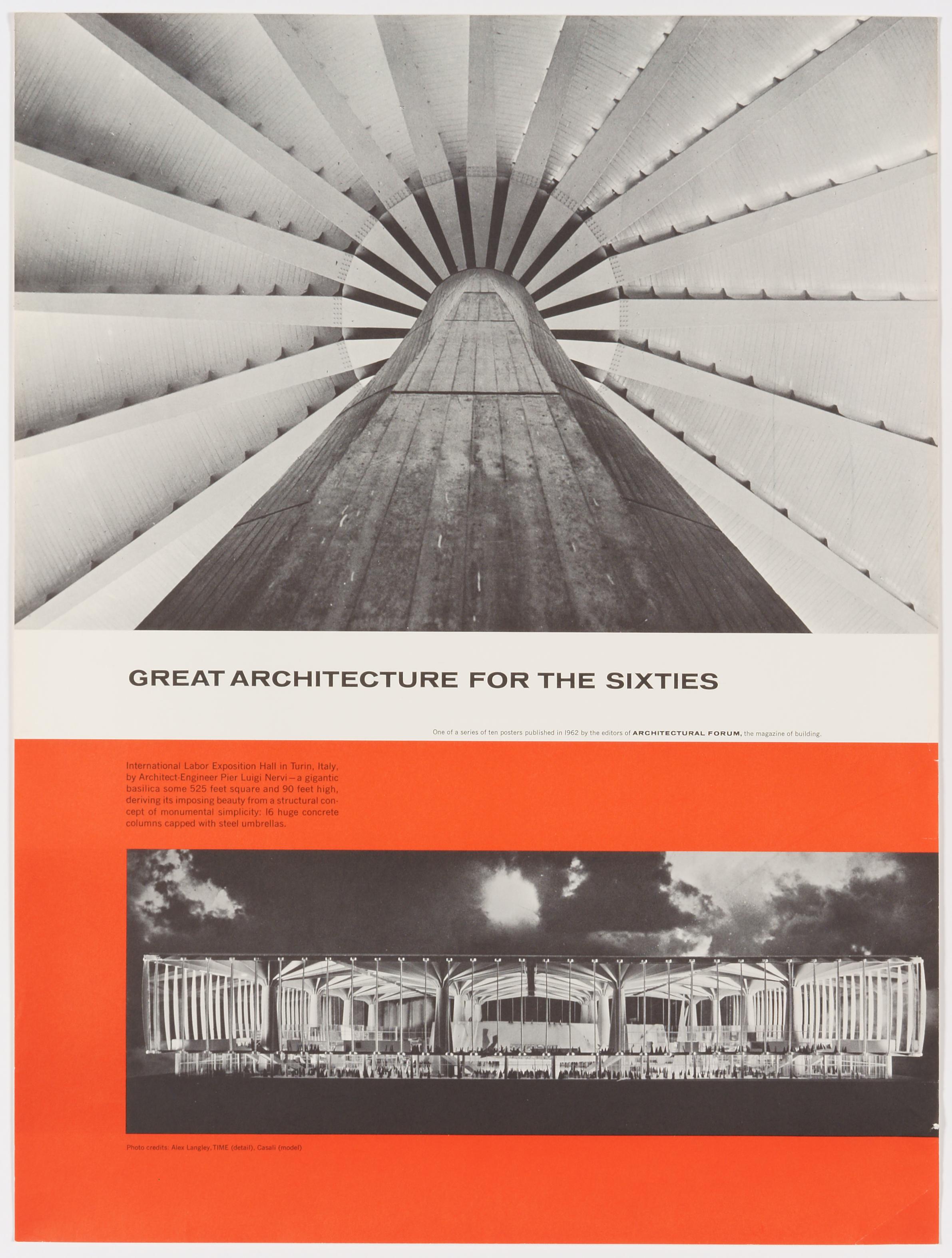
Great Architecture for the Sixties – Pier Luigi Nervi's Exposition Hall in Turin
By Walter Allner
Located in Zurich, CH
Original Vintage Poster depicting Piero Luigi Nervi's International Labor Exposition Hall in Turin, published 1962 by the magazine Architectural Forum to p...
Category
Mid-20th Century Modern More Prints
Materials
Paper
