Items Similar to 17th Century Dutch Map of Italy, Sicily, Sardinia, Corsica and Dalmatian Coast

Want more images or videos?
Request additional images or videos from the seller
1 of 13
Theodorus Danckerts17th Century Dutch Map of Italy, Sicily, Sardinia, Corsica and Dalmatian Coast1690
1690
About the Item
This hand colored 17th century Dutch map entitled "Novissima et Accuratissima totius Italiae Corsicae et Sardiniae Descriptio" by Theodore Danckerts depicts the Italian Peninsula in its entirety. It also includes the Dalmatian coast, which at the time was controlled by the Republic of Venice. The islands of Corsica and Sardinia and part of Sicily are also represented. At the time this map was made, most of Italy was under Spanish control. Following the War of Spanish Succession (1701-14), Spain would lose many of its territories to the Habsburg Empire of Austria, and then as a result controlled Italy.
A colorful title cartouche in the top right quadrant depicts two cherubs and an emperor. The scale in the bottom left is also illustrated with a cherub with measuring instruments. Various ships can be seen sailing in the waters as a naval battle rages in the Tyrrhenian Sea.
The map is presented in a tan colored wood frame with light gold colored inner and outer trim, with a double mat; the outer mat is cream-color and the inner mat is dark brown. There are focal areas of discoloration in the lower portion of the map, but the map is otherwise in very good condition.
The Danckerts were a prominent 17th and early 18th century Dutch cartographic, engraver and printing family. Cornelis Danckerts I (1603-1656) began the family business in Amsterdam. The skill and the trade was passed to his son, Justus Danckerts (1635-1701 and subsequently to his sons, Theodorus Danckerts I (1663-1727) and Cornelis Danckerts II (1664-1717)
- Creator:Theodorus Danckerts (1663 - 1727, Dutch)
- Creation Year:1690
- Dimensions:Height: 18.13 in (46.06 cm)Width: 31.25 in (79.38 cm)Depth: 1.38 in (3.51 cm)
- Medium:
- Period:1690-1699
- Condition:
- Gallery Location:Alamo, CA
- Reference Number:
About the Seller
5.0
Vetted Seller
These experienced sellers undergo a comprehensive evaluation by our team of in-house experts.
Established in 2011
1stDibs seller since 2019
233 sales on 1stDibs
Typical response time: 1 hour
- ShippingRetrieving quote...Ships From: Alamo, CA
- Return PolicyA return for this item may be initiated within 7 days of delivery.
More From This SellerView All
- Cartusia Bruxellensis Monastery in Brussels: A 17th C. Hand-colored EngravingBy Lucas Vorsterman the YoungerLocated in Alamo, CAThis is a 17th century hand-colored copperplate engraving entitled "Cartusia Bruxellensis" by Lucas Vorsterman, the Younger, after a drawing by Jacob van Werden or Jacques van Weerden, published in 1659 in Antonius Sanderus' book 'Chorographia sacra Brabantiae sive celebrium aliquot in ea provincia ecclesiarum et coenobiorum descriptio . . . Brussel' (A sacred chorography of Brabant, or a description of several famous churches and convents in that province). It also appeared in other publications by Sanderus. In the 17th century, Brussels was within the Duchy of Brabant. This engraving depicts a bird's-eye view of the Scheut Carthusian Monastery in Brussels. Scheut is a district of Anderlecht, a municipality of Brussels, Belgium. The monastery housed monks, who took a vow of silence, in 20 rooms. There is a central courtyard with trees and shrubs. Monks are depicted strolling along its pathways. The cells for the friars are in the middle the cloister. There are people along the streets in the foreground and to the right of the large, imposing monastery. Some are on horseback, others are walking. In the lower right, what appears to be a dog pulls a small cart containing barrels, possibly of beer or wine. Districts and neighborhoods are labelled in the background, including Scheut, Anderlecht and Ransfort. A very ornate cartouche in the lower left contains Latin and the artist's attribution. Another decorative cartouche in the upper central area contains the title. This beautifully hand-colored and detailed engraving is printed on laid, chain-linked paper with wide, full margins. The sheet measures 17.25" high and 21.25" wide. It has Latin text on the verso. It has a central vertical fold, as issued, which is reinforced on the verso. Two small spots in the lower margin may actually represent drops of watercolor paint used to color the engraving. It is otherwise in very good condition. Antonius Sanderus (1586-1664) was a Flemish Catholic cleric and historian. He was born "Antoon Sanders", but Latinized his name like many writers and scholars of his time. He was the author of several books, including 'Chorographia Sacra Brabantiae', which was illustrated with this engraving. Lucas Vorsterman the Younger (1624-between 1666 & 1676) was a Flemish Baroque engraver and draughtsman. He produced engravings after the work of contemporary painters and for books by Antwerp publishers. Jacob van Werden or Jacques van Weerden (active 1643-1669), was a Flemish draughtsman, cartographer, military engineer and archer who was active in the Habsburg Netherlands. His drawings were used as designs for prints executed by various printmakers. He worked on maps, topographical views, historical scenes, portraits and book illustrations. He had a career as a military engineer and a member of the guard of the Spanish King. He advised on various military engineering projects and was an engineer of the Spanish army...Category
Mid-17th Century Old Masters Landscape Prints
MaterialsEngraving
- Bermuda: An Early 17th Century Hand-colored Map by Henricus HondiusBy Henricus HondiusLocated in Alamo, CAThis attractive and interesting map of Bermuda by Henricus Hondius in 1633 is entitled "Mappa Aestivarum Insularum, Alias Barmudas". It is based on a ...Category
Early 17th Century Old Masters Landscape Prints
MaterialsEngraving
- L'Isle de France: A Hand-colored 17th Century Map by De WitBy Frederick de WitLocated in Alamo, CAThis colorful and detailed 17th century hand-colored copperplate map by Frederick De Wit was published in Amsterdam between 1666 and 1760. The map depicts the Île-de-France, which is one of the ancient provinces of France. Paris is located in the center of the map, with Versailles to the southwest The map extends from Rouen in the west to Reims in the east. The area around Paris, the Véxin Français, was the original domain of the king of France. Other areas were ruled by French feudal lords. For example, the Véxin Normand area was the domain of the Duke of Normandy...Category
Early 18th Century Old Masters More Prints
MaterialsEngraving
- Map of the Russian Empire: An Original 18th Century Hand-colored Map by E. BowenLocated in Alamo, CAThis is an original 18th century hand-colored map entitled "A New & Accurate Map of The Whole Russian Empire, As Contain'd Both In Europe and Asia, Drawn from Authentic Journals, Sur...Category
Mid-18th Century Old Masters Landscape Prints
MaterialsEngraving
- Ulysses Deriding Polyphemus: A Framed 19th C. Engraving After J. M. W. TurnerBy J.M.W. TurnerLocated in Alamo, CAThis beautiful 19th century framed hand-colored engraving/etching entitled "Ullyses Deriding Polyphemus" by Edward Goodall is based on an original 1829 painting by the renowned Briti...Category
Mid-19th Century Romantic Landscape Prints
MaterialsEngraving, Etching
- Marquis de Marigny: An 18th C. Wille Engraved Portrait after a Tocque PaintingBy Louis TocquéLocated in Alamo, CAThis is a mid 18th century engraved portrait of Abel François Poisson de Vandières, Marquis de Marigny by Jean Georges Wille after a painting by Louis Tocque...Category
Mid-18th Century Portrait Prints
MaterialsEngraving


You May Also Like
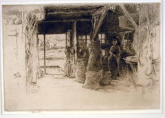
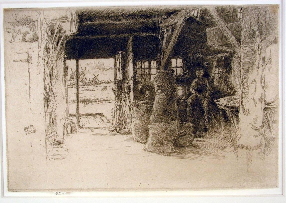
- The Mill, Amsterdam, 1889By James Abbott McNeill WhistlerLocated in New York, NYJames Whistler (1834-1903), The Mill, 1889, etching and drypoint, signed in pencil with the butterfly on the tab and inscribed “imp”, and inscribed “first state” (twice) and annotated “Wunderlich” and signed again with the butterfly verso. Reference: Kennedy 413, first state (of 5). Glasgow 457, second state (of 6; see discussion below) (cf. Margaret F. MacDonald, Grischka Petri, Meg Hausberg, and Joanna Meacock, James McNeill Whistler: The Etchings, a catalogue raisonné, University of Glasgow, 2011) On laid paper, in very good condition, trimmed just outside of the platemark all around except for the tab by the artist, 6 1/4 x 9 3/8 inches. A very fine impression of this great rarity, printed in black/brown ink with a slight veil of plate tone. provenance: H. Wunderlich & Co., New York Louis B. Dailey, New York (Lugt 4500) sale, Sotheby’s, New York, October 31, 2003, lot 69 literature; Neue Lagerliste 122: James McNeill Whistler – Etchings...Category
1880s Impressionist Landscape Prints
MaterialsDrypoint, Etching
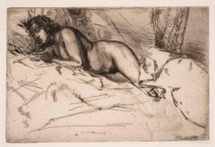
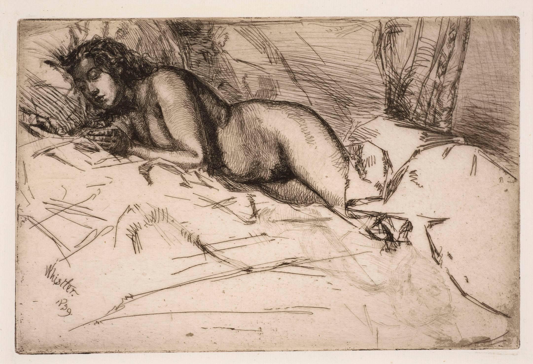
- VenusBy James Abbott McNeill WhistlerLocated in New York, NYJames Whistler (1834-1903), Venus, 1859. Etching and drypoint, printed in black ink on laid paper, an impression in the second (final) state: there was no published edition. 6 x 9 inches (15 x 22.6 cm) sheet 73/8 x 117/8 inches (18.8 x 30.3 cm) Reference: Kennedy 59; Glasgow 60 A very fine impression. A study of Héloïse, ‘Fumette’, asleep in bed, her head pressed into the pillow and the bedclothes covering her lower legs. This is one of three portraits Whistler made of Fumette in 1859: one of the others shows her standing and in the third only her head and shoulders are depicted. Venus is a work in the Realist tradition, and may be compared with Courbet’s nudes of the same period. The artist may also have had in mind Rembrandt’s study of Antiope in his etching Jupiter and Antiope. Venus was never published and there is no record of it being shown until 1898 when it was included in an Exhibition of Etchings, Drypoints and Lithographs by Whistler at H. Wunderlich & Co., New York. To have been overlooked for exhibition until so late in Whistler’s life might suggest that the subject was considered improper. Frederick Wedmore, whose catalogue of Whistler’s etchings...Category
1850s Impressionist Nude Prints
MaterialsDrypoint, Etching
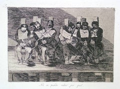
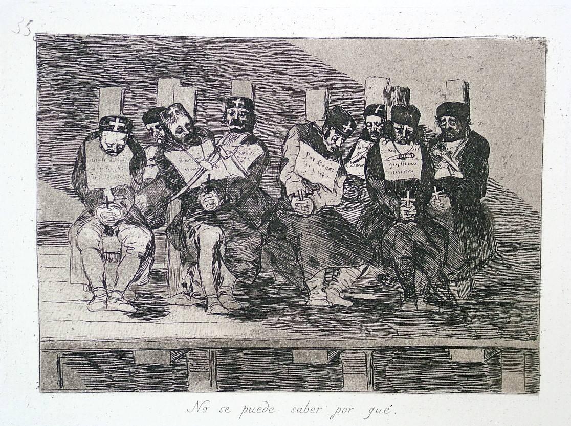
- One Can't Tell Why - Proof from the Disasters of WarBy Francisco GoyaLocated in New York, NYFrancisco José de Goya y Lucientes (1746 Fuendetodos – Bordeaux 1828), No se puede saber por qué – One can’t tell why ca. 1808–1814, etching, burnished aquatint, drypoint, an...Category
1810s Old Masters Figurative Prints
MaterialsDrypoint, Etching, Aquatint
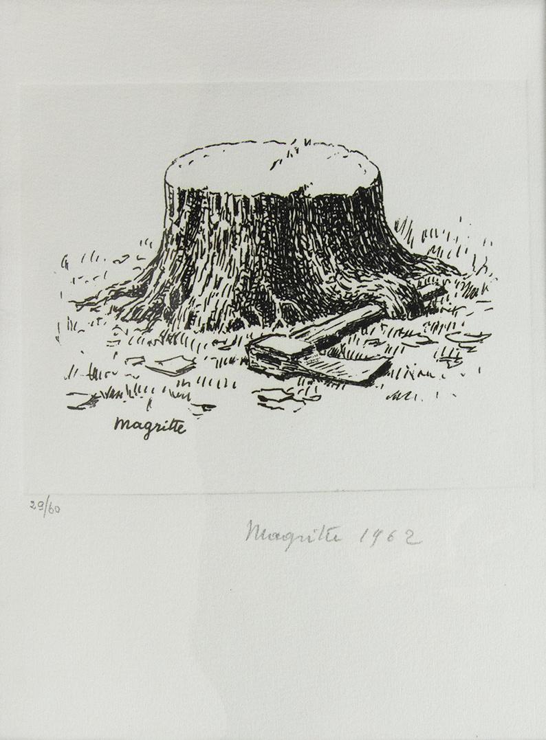
- Surrealism between two wars, International Anthology of Contemporary EngravingBy Marcel DuchampLocated in London, GBThe complete set of eleven engravings by Jean Arp, Hans Bellmer, Victor Brauner, Paul Delvaux, Marcel Duchamp, Wilhelm Freddie, Wifredo Lam, René Magritte, André Masson, Roberto Matt...Category
1960s Surrealist Figurative Prints
MaterialsEngraving
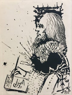
- Dali 33 Vertical Portrait de Calderon engraving paintingBy Salvador DalíLocated in CORAL GABLES - MIAMI, FLWork of the Spanish artist SALVADOR DALI. Engraving of the series LA VIDA ES SUEÑO. Printed signature and date, as issued Catalog. OFFICIAL CATALOG GRAPHYC WORKS BY ALBERT FIELD Page...Category
Late 20th Century Surrealist Abstract Prints
MaterialsEngraving
- 8-foot "Thank You" monoprint in oil with collage, engraving and embossmentBy Mel BochnerLocated in Boca Raton, FL8-foot "Thank You" monoprint in oil with collage, engraving and embossment on handmade paper by artist Mel Bochner from Two Palms Publishing . Signed and dated in graphite on front l...Category
2010s Contemporary More Prints
MaterialsOil, Handmade Paper, Engraving, Monoprint