Items Similar to The Dole Map of the Hawaiian Islands.
Want more images or videos?
Request additional images or videos from the seller
1 of 8
UnknownThe Dole Map of the Hawaiian Islands.
$1,275
£992.88
€1,129.40
CA$1,836.21
A$2,015.01
CHF 1,052.45
MX$24,091.73
NOK 13,331.17
SEK 12,433.82
DKK 8,435.06
About the Item
Original color lithograph. Honolulu. Hawaiian Pineapple Company, 1950.
About the Seller
4.9
Recognized Seller
These prestigious sellers are industry leaders and represent the highest echelon for item quality and design.
Gold Seller
Premium sellers maintaining a 4.3+ rating and 24-hour response times
Established in 1972
1stDibs seller since 2016
191 sales on 1stDibs
Typical response time: <1 hour
Associations
International Fine Print Dealers Association
- ShippingRetrieving quote...Shipping from: New York, NY
- Return Policy
More From This Seller
View AllMap of Biblical Jerusalem
Located in New York, NY
Original copper engraving hand-colored at the time of publication. Nuremberg, 1720.
Category
1720s Prints and Multiples
Materials
Paper
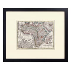
Hand-Colored Map of Africa, circa 1744
By Matthew Seutter
Located in New York, NY
Seutter, Matthew.
Africa.
From Atlas minor praecipua Terrarum Imperia...
Augsburg, circa 1744.
Original engraving with old hand-coloring.
Image size: 7 5/8 x 10 1/8 inches.
Materials
Paper
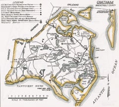
Map of Chatham, Cape Cod
Located in New York, NY
Original map of Chatham, Cape Cod, with recent hand-coloring, 1938. Light toning to edges; has original holes punched in left edge. From "Massachusetts Cit...
Category
1930s Prints and Multiples
Materials
Paper
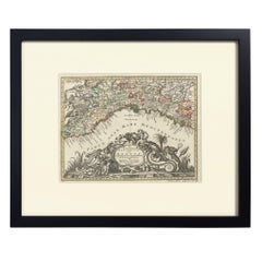
Hand-Colored Map of Genoa, circa 1744
By Matthew Seutter
Located in New York, NY
Seutter, Matthew.
Genova [Genoa].
From Atlas minor praecipua Terrarum Imperia...
Augsburg, circa 1744.
Original engraving with old hand-coloring.
Image size: 7 5/8 x 10 inches.
Materials
Paper
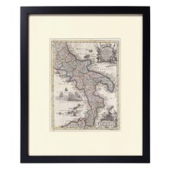
Hand-Colored Map of Southern Italy, circa 1744
By Matthew Seutter
Located in New York, NY
Seutter, Matthew.
Neapolis Regnum...
From Atlas minor praecipua Terrarum Imperia...
Augsburg, circa 1744.
Original engraving with old hand-coloring.
Image size: 10 3/16 x 7 11...
Materials
Paper
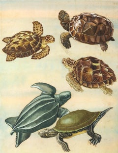
Gopher Tortoise, Hawksbill, Loggerhead, Leatherback and Map Turtles.
Located in New York, NY
Original gouache illustrations collaged onto watercolored board. Original art for "Treasure Book Anual #3." London, 1972.
Category
1970s Animal Paintings
Materials
Gouache, Illustration Board
You May Also Like
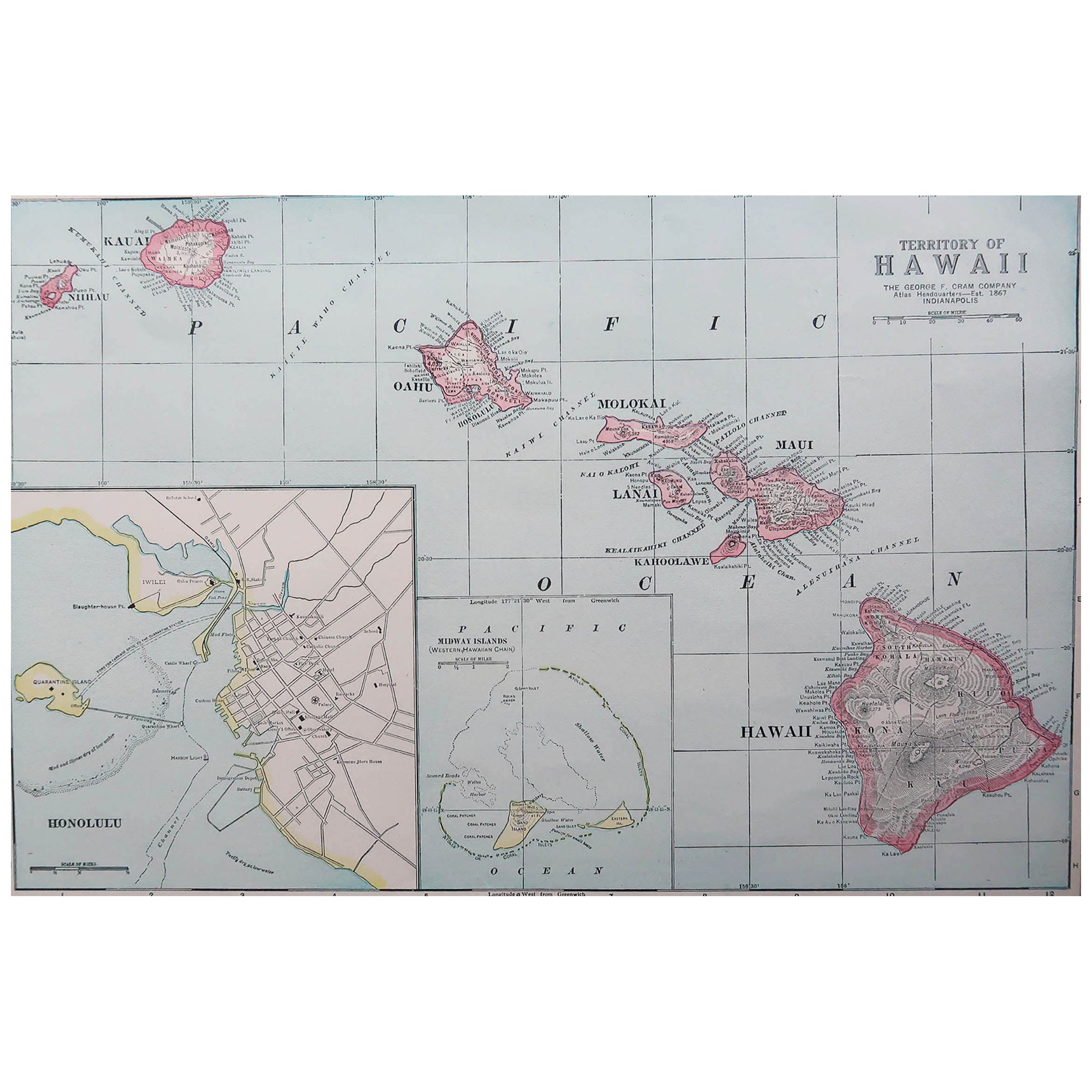
Original Antique Map of Hawaii And Adjacent Islands. C.1900
Located in St Annes, Lancashire
Fabulous map of Hawaii. With a vignette of Honolulu
Original color.
Engraved and printed by the George F. Cram Company, Indianapolis.
Published, C.1900.
Unframed.
Free shipping.
Category
Antique 1890s American Maps
Materials
Paper

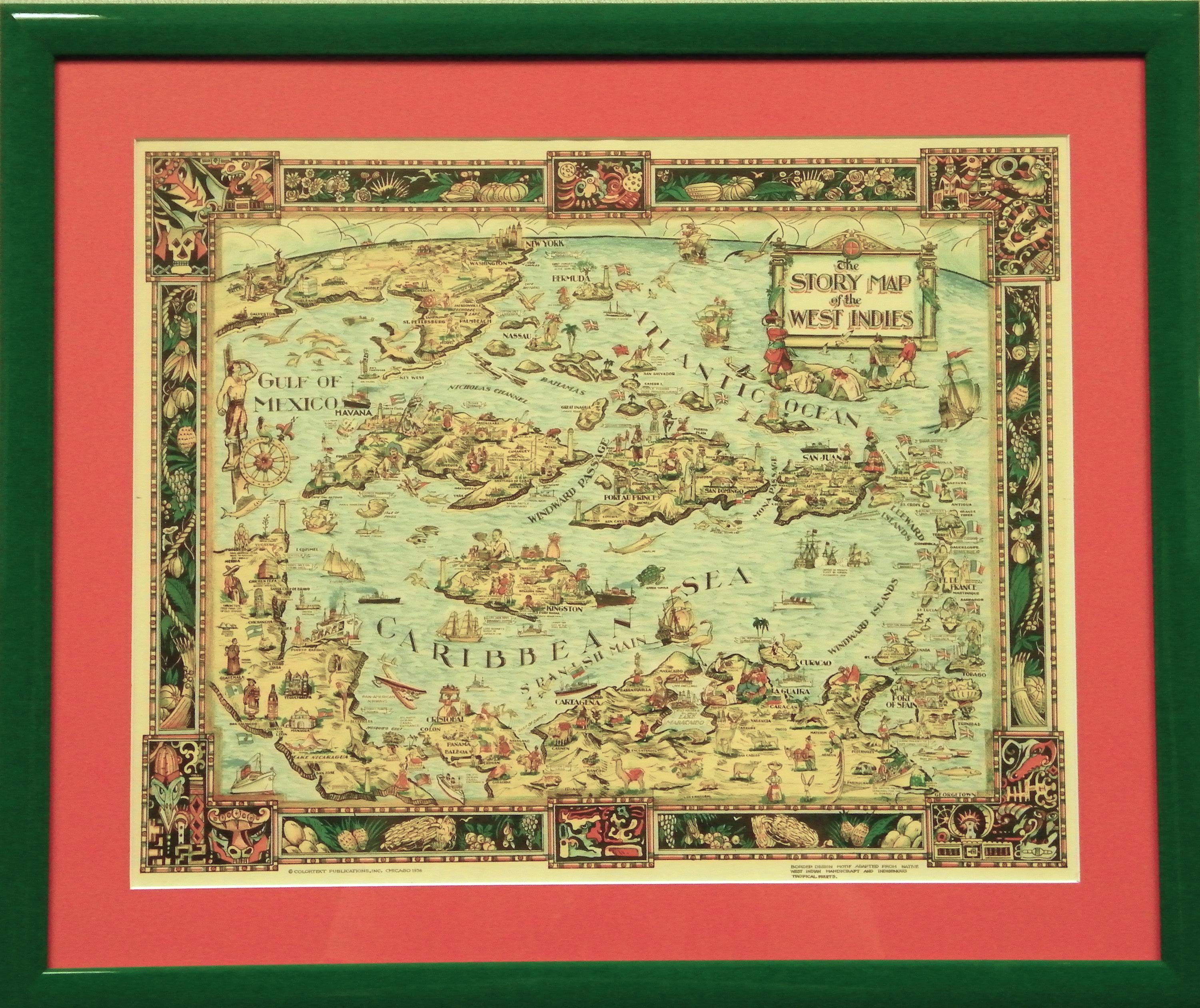
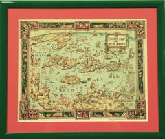
"The Story Map Of The West Indies" 1936
Located in Bristol, CT
Framed colour map of the West Indies published 1936 w/ border design motif adapted from native West Indian handicraft and indigenous tropical fruits
Colorte...
Category
1930s More Prints
Materials
Paper
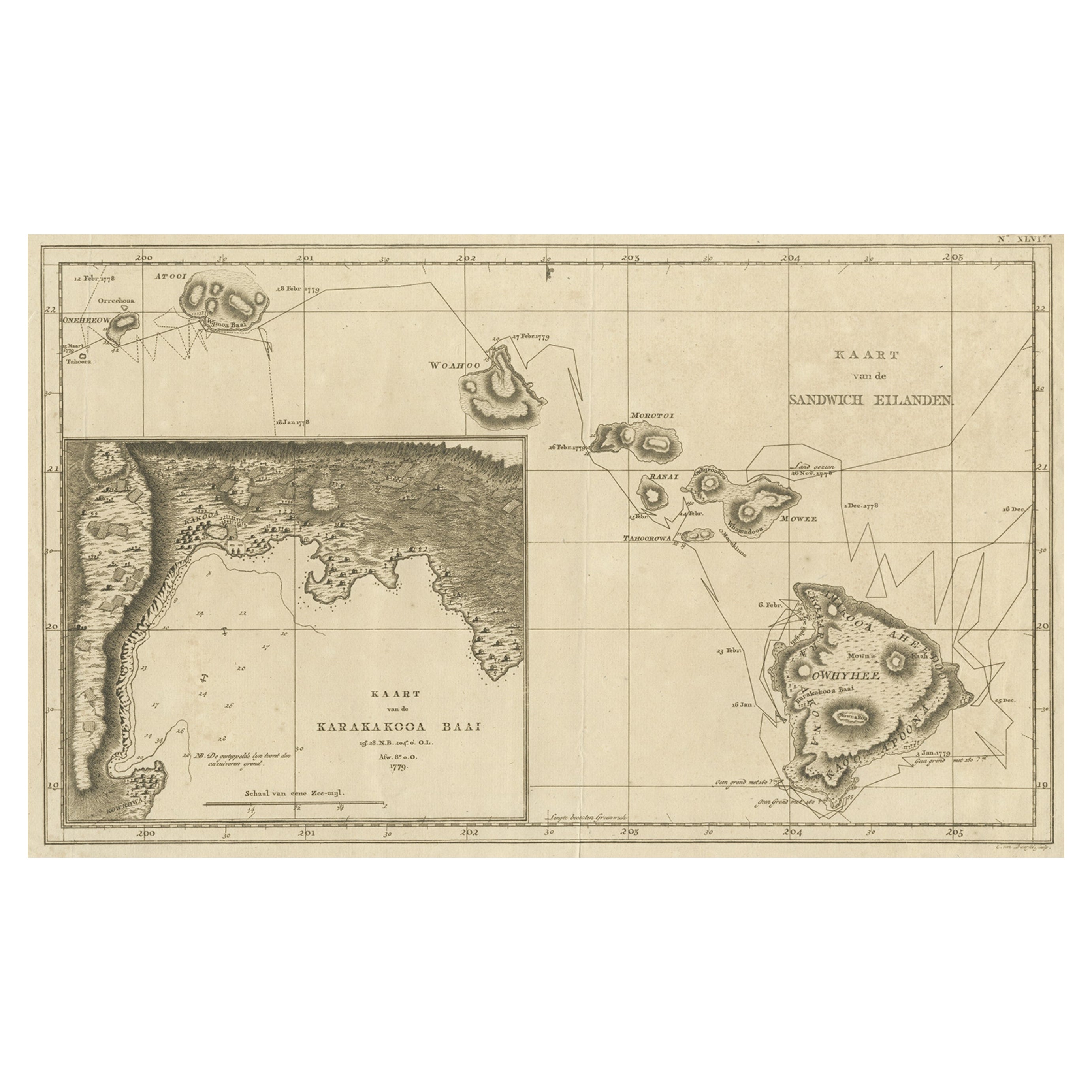
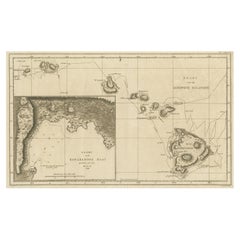
Map of the Hawaiian Islands with a Large Inset of Karakakooa Bay, 1803
Located in Langweer, NL
Antique map titled 'Kaart van de Sandwich Eilanden'.
Map of the Hawaiian Islands with a large inset of Karakakooa Bay, including soundings and anchorages. Originates from 'Reizen R...
Category
Antique Early 1800s Maps
Materials
Paper
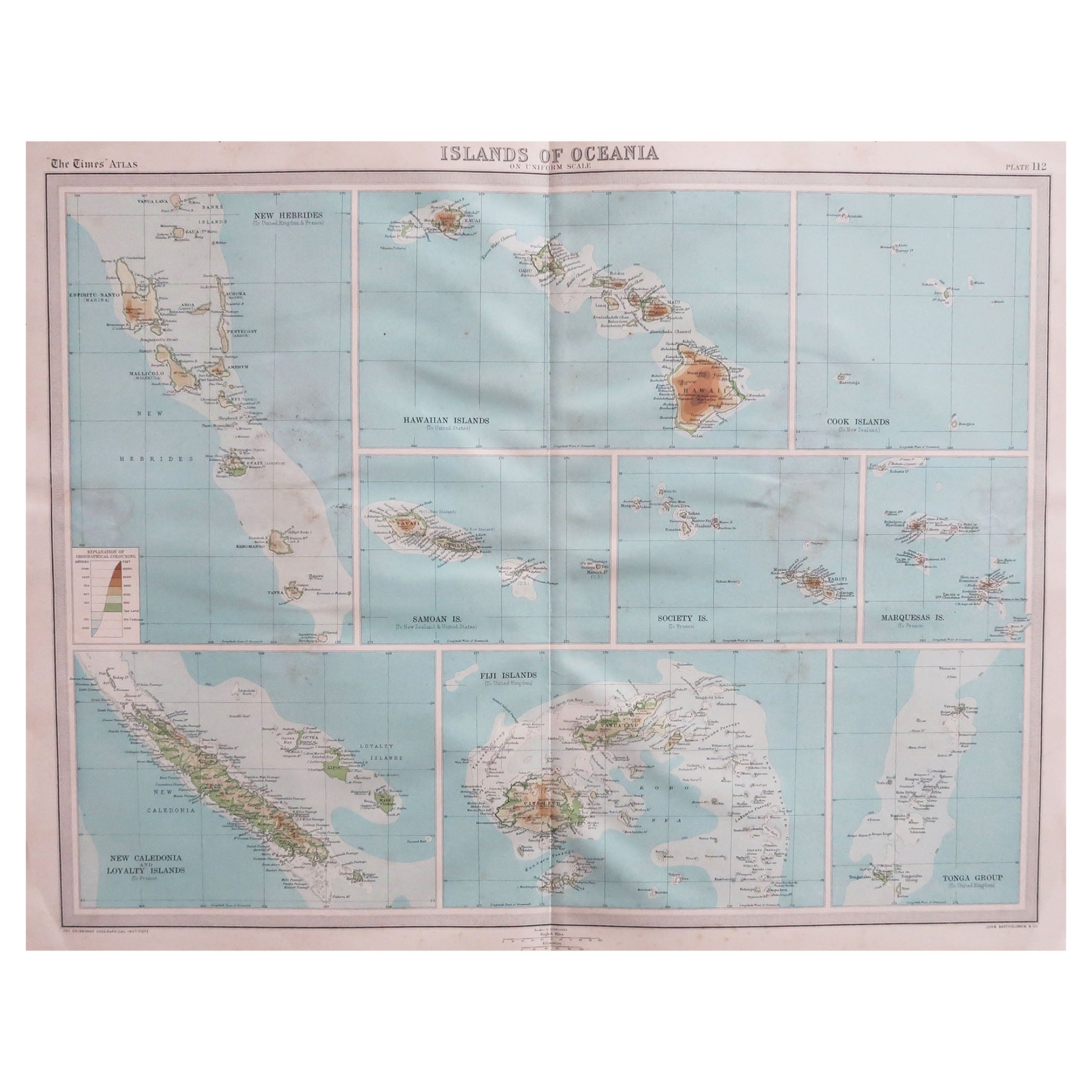
Large Original Vintage Map of The Pacific Islands Including Hawaii
Located in St Annes, Lancashire
Great map of The Pacific Islands
Unframed
Original color
By John Bartholomew and Co. Edinburgh Geographical Institute
Published, circa 1...
Category
Vintage 1920s British Maps
Materials
Paper

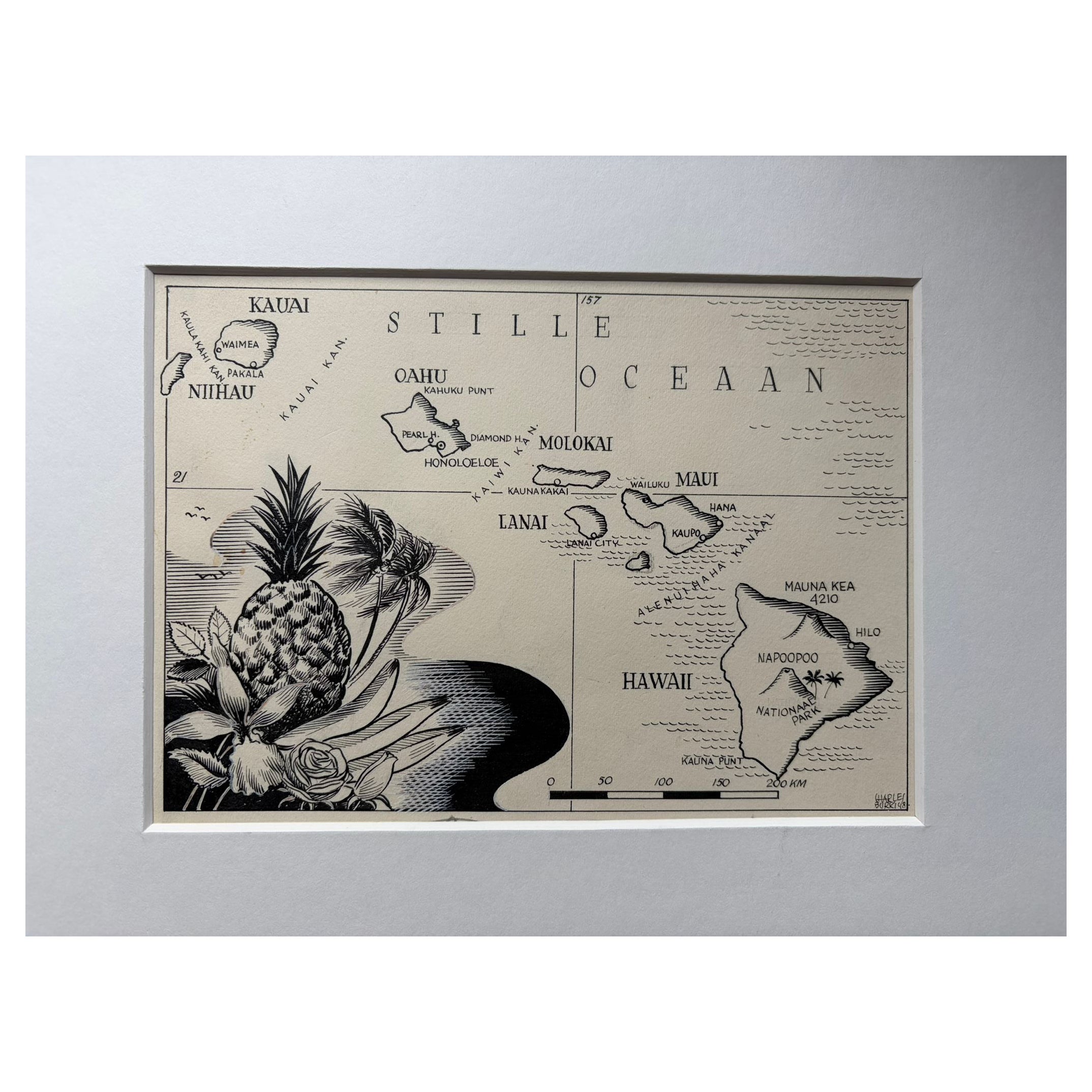
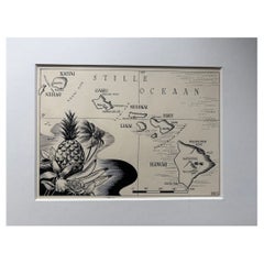
Original Illustration Map of Hawaii by Charles Burki, ca. 1948 – Ink Drawing
Located in Langweer, NL
Original Illustration Map of Hawaii by Charles Burki, ca. 1945 – Ink Drawing
Original pen-and-ink illustration of the Hawaï-Eilanden (Hawaiian Islands) by Dutch artist Charles Burki...
Category
Vintage 1940s Dutch Drawings
Materials
Paper
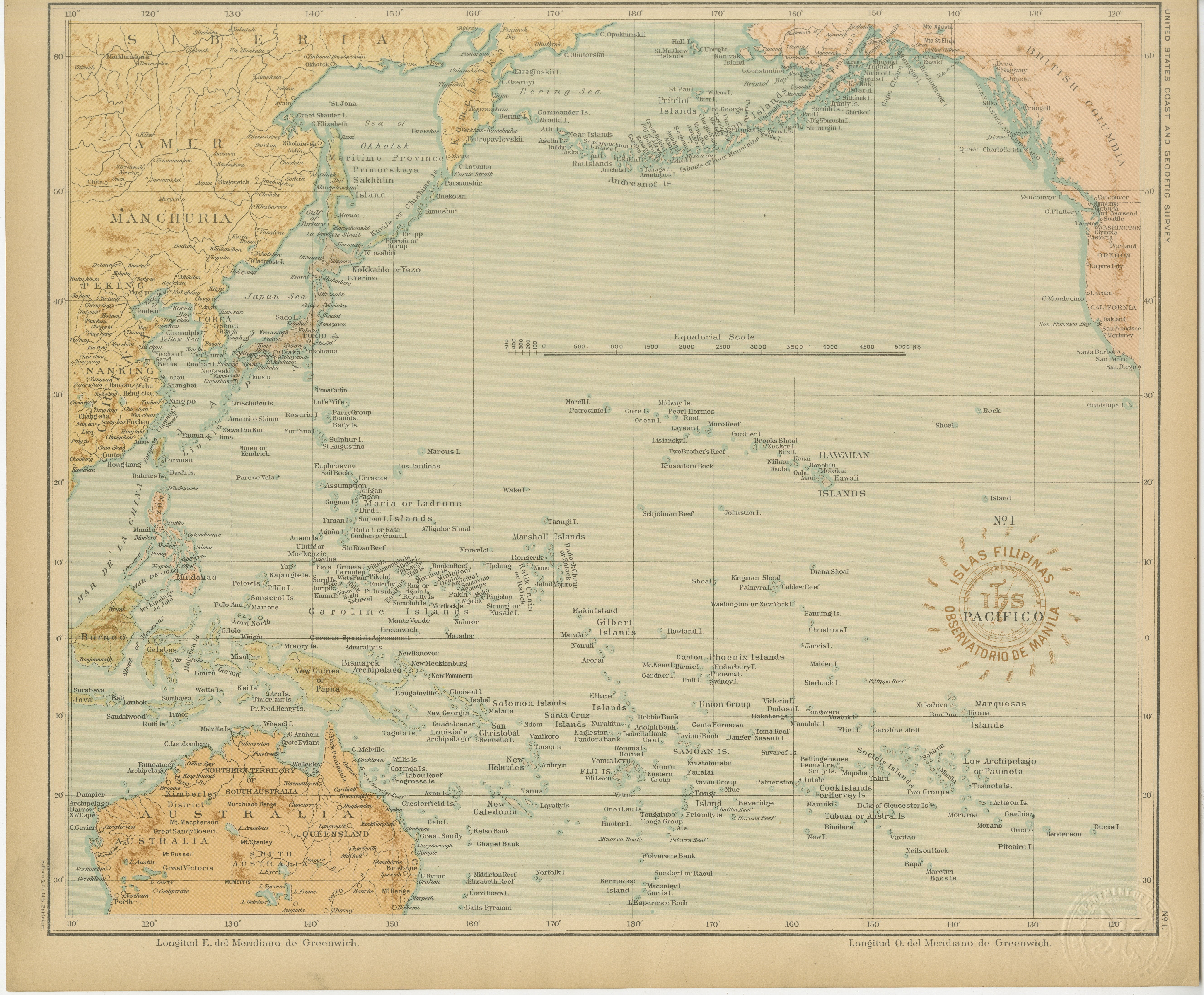
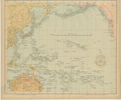
Map of the Pacific Ocean and Philippine Archipelago – Manila Observatory, 1899
Located in Langweer, NL
Title: Pacific Ocean and the Philippine Archipelago – Observatorio de Manila, 1899
Description:
This finely detailed chromolithographed map titled “Islas Filipinas – Océano Pacífico...
Category
Antique 1890s Philippine Maps
Materials
Paper
More Ways To Browse
Plaza De Toros
Pop Art Palm Springs
Queen Beatrix
Roy Lichtenstein As I Opened Fire
Thorntons Temple Of Flora
Vintage Concert Posters Art Posters
Vintage Lido Posters
Vintage Pin Up Posters
Wallpaper Friezes
Watercolor Prints Trees
80s Pop Art
Alex Katz Vivien
Alex Katz Yellow Flags
Andrew Wyeth Lithograph
Andrew Wyeth Poster
Antique Prints Sydney
Antique Stone Grinder
Art Deco Exhibition Posters