Belgrade Design Market
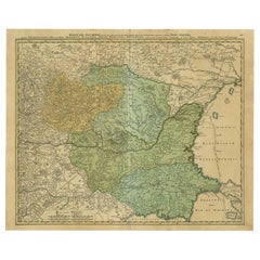
Antique Map of the Danube River by Homann, c.1720
By Homann Heirs
Located in Langweer, NL
from Belgrade in Serbia, along the border between Romania and Bulgaria up to the mouth in the Black Sea
Category
Antique 18th Century Maps
Materials
Paper
People Also Browsed
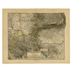
Antique Map of Eastern Europe by Stieler, 1890
Located in Langweer, NL
Antique map titled 'Osterreich-Ungarn in 4 Blattern, Blatt 4.' Map of Eastern Europe, with Montenegro in the lower left corner, the southern edge of Hungary (area Baja and Szeged) an...
Category
Antique 19th Century Maps
Materials
Paper
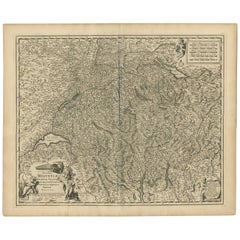
Antique Map of Switzerland by N. Visscher, circa 1690
Located in Langweer, NL
Beautifully detailed map of Switzerland and surrounding regions in present-day France, Germany, and Italy. This map features two decorative cartouches: the larger is flanked by two p...
Category
Antique Late 17th Century Maps
Materials
Paper
Original Antique World War One Poster Hark The Dogs Do Bark WWI Dogs Of War
Located in London, GB
Original Antique World War One poster - Hark! Hark! The dogs do bark! With note by Walter Emanuel - featuring a serio-comic map of Europe at war with military soldier caricature port...
Category
Vintage 1910s British Posters
Materials
Paper
H 22.05 in W 29.93 in D 0.04 in
Old Map of the Balkans Incl Greece, Turkey, Serbia, Montenegro, Bulgaria, C.1900
Located in Langweer, NL
Antique map titled 'Carte de la presqu-île du Balcan - Karte der Balkan Halbinsel'.
Original antique map of the Balkans including Greece, Turkey, Serbia, Montenegro, Bulgaria and...
Category
Antique Early 1900s Maps
Materials
Paper
H 45 in W 49 in D 0.002 in
Original Antique World War One Poster Hark The Dogs Do Bark WWI Dogs Of War
Located in London, GB
Original antique World War One poster - Hark! Hark! The dogs do bark! With note by Walter Emanuel - featuring a serio-comic map of Europe at war with military soldier caricature port...
Category
1910s More Prints
Materials
Paper
H 22.05 in W 29.93 in
18th Century Map of the Southern Balkans by Giovanni Maria Cassini
By Giovanni Maria Cassini
Located in Hamilton, Ontario
18th century map by Italian engraver Giovanni Maria Cassini (Italy 1745-1824).
Map of the Southern Balkans: Rome. Hand colored and copper engraved print done in the year 1788. It in...
Category
Antique 18th Century Italian Maps
Materials
Paper
Antique Map of Moldova to Thessaly and from the Adriatic to the Black Sea, 1880
Located in Langweer, NL
Antique map titled 'Turquie d'Europe'.
Map of the european parts of Turkey. The map covers from Moldova to Thessaly and from the Adriatic to the Black Sea. Greece and the island ...
Category
Antique 1880s Maps
Materials
Paper
H 18.71 in W 13.59 in D 0 in
Southern & Eastern Europe: A Large 17th C. Hand-colored Map by Sanson & Jaillot
By Nicholas Sanson d'Abbeville
Located in Alamo, CA
This large hand-colored map entitled "Estats de L'Empire des Turqs en Europe, ou sont les Beglerbeglicz our Gouvernements" was originally created by Nicholas Sanson d'Abbeville and t...
Category
1690s Landscape Prints
Materials
Engraving
Old Eastern Balkans Map, with Dalmatia, Croatia, Slavonia, Bosnia, Serbia, 1633
Located in Langweer, NL
Antique map titled 'Sclavonia, Croatia, Bosnia cum Dalmatiae Parte'. Old map of the Eastern Balkans with the geographical & political divisions of Dalmatia, Croatia, Slavonia, Bosnia...
Category
Antique 1630s Maps
Materials
Paper
H 16.15 in W 20.87 in D 0 in
Detailed Antique Map of the Black Sea, Balkans and Asia Minor
Located in Langweer, NL
Antique map titled 'Nuova Carta del Europa Turchesca (..)'. This is an Italian version of Tirion's detailed map of the Black Sea, Balkans, and Asia Minor. It is embellished with a si...
Category
Antique Mid-18th Century Maps
Materials
Paper
Antique Map of the Saxony Region 'Germany' by F. de Wit, circa 1680
Located in Langweer, NL
A detailed map of a region in eastern Germany. Cartouches depict coat of arms surrounded by cherubs. The map is fully engraved with towns, political boundaries, rivers and forests. P...
Category
Antique Late 17th Century Maps
Materials
Paper
Southern & Eastern Europe: A Large 17th C. Hand-colored Map by Sanson & Jaillot
By Nicolas Sanson
Located in Alamo, CA
This large hand-colored map entitled "Estats de L'Empire des Turqs en Europe, ou sont les Beglerbeglicz our Gouvernements" was originally created by Nicholas Sanson d'Abbeville and t...
Category
Antique 1690s French Maps
Materials
Paper
H 24.88 in W 38 in D 0.13 in
Hungary & Eastern Europe: A Large 17th C. Hand-colored Map by Sanson & Jaillot
By Nicholas Sanson d'Abbeville
Located in Alamo, CA
This large hand-colored map entitled "Le Royaume De Hongrie et les Estats qui en ont este sujets et qui font presentement La Partie Septentrionale de la Turquie en Europe" was origin...
Category
1690s Landscape Prints
Materials
Engraving
Antique Map of Eastern Europe, Incl Montenegro & Serbia & a Budapest Map, 1890
Located in Langweer, NL
Antique map titled 'Osterreich-Ungarn in 4 Blattern, Blatt 4.'
Map of Eastern Europe, with Montenegro in the lower left corner, the southern edge of Hungary (area Baja and Szeged...
Category
Antique 1890s Maps
Materials
Paper
H 15.63 in W 19.22 in D 0 in
Antique Map of Bavaria with many details, Germany
Located in Langweer, NL
Antique map titled 'Bavariae Circulus atq Electoratus tam cum Adiacentibus quam insertis Regionibus (..)'. Dutch map of Bavaria, showing the many cities, towns, and other features of...
Category
Antique Late 17th Century Maps
Materials
Paper
Danube River Incl Serbia, Moldavia, Transylvania, Romania, Bulgaria Etc, ca.1720
Located in Langweer, NL
Antique map titled 'Danubii Fluminis (..)'.
Regional map of the Donau river, Shows the Danube river from Belgrade in Serbia, along the border between Romania and Bulgaria up to t...
Category
Antique 1720s Maps
Materials
Paper
H 20.08 in W 24.41 in D 0 in
Get Updated with New Arrivals
Save "Belgrade Design Market", and we’ll notify you when there are new listings in this category.
More Ways To Browse
Map Of Constantinople
Constantinople Map
Romania Map
Hand Painted In France For Tiffany And Co
Serbia Antique Map
Portland Tiffany And Co
Tiffany Pompidou
Tiffany And Co Graduation
Zhang Chunyang
Tiffany Engage
Pavel Kuragin
Binyamin Basteker
Absrtact Art
Alan Fenton
Delna Dastur
Elva Vintage
Irina Spakova
Cedric Bouteiller


