Europe Map Antique

to
211
392
100
258
193
155
86
85
44
43
43
42
37
37
32
20
20
14
13
12
10
9
9
8
8
8
7
7
6
6
6
5
5
5
4
4
4
3
3
3
3
3
3
3
2
2
2
2
1
1
1
1
1
19
3
3
3
3
Sort By
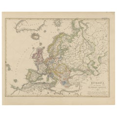
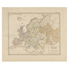
Europe Map – Rivers, Watersheds and Elevation, Published in 1857
Located in Langweer, NL
Europe Map – Rivers, Watersheds and Elevation 1857 This beautiful antique print shows Europe with
Category

Mid-19th Century German Europe Map Antique

Materials

Paper

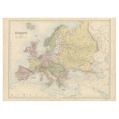
Europe Map – Political Divisions and Borders, Published in 1858
Located in Langweer, NL
Europe Map – Political Divisions and Borders 1858 This fine antique print shows Europe with its
Category

Mid-19th Century German Europe Map Antique

Materials

Paper

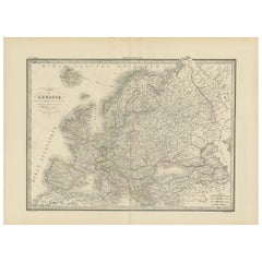
Antique Map of Europe by Lapie, 1842
Located in Langweer, NL
Antique map titled 'Carte de l'Europe'. Map of Europe. This map originates from 'Atlas universel de
Category

Mid-19th Century Europe Map Antique

Materials

Paper

Antique Map of Europe by Lapie, 1842
$477 Sale Price
20% Off
H 19.89 in W 26.78 in D 0.02 in
Antique Map of Russia in Europe by Tallis, '1851'
Located in Langweer, NL
Antique map titled 'Russia in Europe'. Map of European Russia. Showing vignettes of the Neoskoi
Category

Mid-19th Century Europe Map Antique

Materials

Paper

Antique Map of Russia in Europe by Tallis, '1851'
$238 Sale Price
20% Off
H 14.57 in W 10.44 in D 0.02 in
1790 Thomas Stackhouse Map, Entitled "Russia in Europe, " , Ric.a004
Located in Norton, MA
1790 Thomas Stackhouse map, entitled "Russia in Europe" Ric.a004 Stackhouse, Thomas Russia
Category

17th Century Unknown Europe Map Antique

Materials

Paper

Antique Map of Russia in Europe, 1842
Located in Langweer, NL
Antique map titled 'Carte de la Russie d'Europe'. Map of Russia in Europe. This map originates from
Category

19th Century Europe Map Antique

Materials

Paper

Antique Map of Russia in Europe, 1842
$228 Sale Price
20% Off
H 26.78 in W 19.89 in D 0 in
Original Antique Poster French Infantry In Battle WWI Hindenburg Line Europe Map
Located in London, GB
bayonet rifle gun in front of a map of Europe showing the Hindenburg Line in red with the title text below
Category

1910s French Europe Map Antique

Materials

Paper

Original Hand-Colored Antique Regional Map of Switzerland, 1753
Located in Langweer, NL
enjoyed a major place in the European map market throughout the eighteenth century. Founded in 1702 by
Category

1750s Europe Map Antique

Materials

Paper

Original Hand-Colored Antique Regional Map of Switzerland, 1753
$563 Sale Price
20% Off
H 19.3 in W 23.43 in D 0 in
Antique Map of Central Europe Showing The Railways and The Political Bounderies
Located in Langweer, NL
Explore the Heart of Europe with the 'Central Europe' Map, Featuring Principal Railways and
Category

1880s Europe Map Antique

Materials

Paper

Antique Map of Switzerland by Homann, 1753
Located in Langweer, NL
a major place in the European map market throughout the eighteenth century. Founded in 1702 by
Category

18th Century Europe Map Antique

Materials

Paper

Antique Map of Switzerland by Homann, 1753
$284 Sale Price
20% Off
H 19.3 in W 23.43 in D 0 in
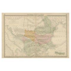
Antique Map of Moldova to Thessaly and from the Adriatic to the Black Sea, 1880
Located in Langweer, NL
Antique map titled 'Turquie d'Europe'. Map of the european parts of Turkey. The map covers from
Category

1880s French Europe Map Antique

Materials

Paper

Antique Map of Russia 'in Europe' by W. & A.K. Johnston, circa 1850
By W. & A.K. Johnston
Located in Langweer, NL
Antique Map: Russia in Europe by W. & A.K. Johnston, Circa 1850 This highly detailed antique map
Category

Mid-19th Century Europe Map Antique

Materials

Paper

Antique Map of Russia 'in Europe' by W. & A.K. Johnston, circa 1850
$229 Sale Price
34% Off
H 25.79 in W 21.07 in D 0.02 in
Homann Heirs Map of France – Antique Hand-Colored, circa 1745
Located in Langweer, NL
a major place in the European map market throughout the eighteenth century. Founded in 1702 by
Category

Mid-18th Century German Europe Map Antique

Materials

Paper

Homann Heirs Map of France – Antique Hand-Colored, circa 1745
$382 Sale Price
20% Off
H 20.48 in W 23.43 in D 0 in
Antique Map of France by Homann, 1738
Located in Langweer, NL
Engravers: Homann Heirs was a German publishing firm that enjoyed a major place in the European map market
Category

18th Century Europe Map Antique

Materials

Paper

Antique Map of France by Homann, 1738
$716 Sale Price
20% Off
H 19.69 in W 24.02 in D 0 in
1627 Map Entitled "Loudunois, " Signed on the Back, Ric.a013
Located in Norton, MA
geographical 17th century increased artist European map · 17th-century · geography · double-page · artist
Category

17th Century Dutch Europe Map Antique

Materials

Paper

Detailed Antique Map of Hungary and Transylvania by Tirion, 1753
Located in Langweer, NL
Beknopte Hand-Atlas* (New and Concise Hand Atlas) series, which included a wide range of maps of Europe and
Category

1750s Europe Map Antique

Materials

Paper

Detailed Antique Map of Hungary and Transylvania by Tirion, 1753
$576 Sale Price
30% Off
H 16.54 in W 19.49 in D 0 in
Antique Map and Views of Batavia by Homann Heirs, '1733'
Located in Langweer, NL
German publishing firm that enjoyed a major place in the European map market throughout the 18th century
Category

Mid-18th Century Europe Map Antique

Materials

Paper

Antique Map and Views of Batavia by Homann Heirs, '1733'
$2,238 Sale Price
25% Off
H 20.08 in W 24.02 in D 0.02 in
Rare Antique Map of Southwestern Europe and West Africa by V.M. Coronelli, 1692
By Vincenzo Coronelli
Located in Langweer, NL
: Coronelli globe gore, Southwestern Europe map, West Africa map, antique map, 17th-century cartography
Category

Late 17th Century Europe Map Antique

Materials

Paper

Rare Antique Map of Southwestern Europe and West Africa by V.M. Coronelli, 1692
$2,339 Sale Price
20% Off
H 19.3 in W 13.59 in D 0.02 in
Map of Russia with Vignettes of the Neoskoi Prospect, St. Petersburg, ca.1851
Located in Langweer, NL
Antique map titled 'Russia in Europe'. Map of European Russia. Showing vignettes of the Neoskoi
Category

1850s Europe Map Antique

Materials

Paper

Antique Map of Prussia, Hanover, Netherlands & Belgium – 1858
Located in Langweer, NL
European maps of the period. Technique: Copperplate engraving with original hand-coloring Maker: Justus
Category

Mid-19th Century German Europe Map Antique

Materials

Paper

Antique Map of the Region of Namen by Homann, 1746
By Johann Baptist Homann
Located in Langweer, NL
in the European map market throughout the eighteenth century. Founded in 1702 by Johann Baptist
Category

18th Century Europe Map Antique

Materials

Paper

Antique Map of the Region of Namen by Homann, 1746
$243 Sale Price
20% Off
H 20.28 in W 23.63 in D 0 in
Antique 1830 Map of Scotland with Counties Renfrew, Stirling, Dumbarton and Bute
Located in Langweer, NL
-published 19th-century cartography, ideal for collectors of Scottish and European maps.
Category

1830s Europe Map Antique

Materials

Paper

Antique 1830 Map of Eastern England with Suffolk, Norfolk Cambridge, Huntingdon
Located in Langweer, NL
European maps.
Category

1830s Europe Map Antique

Materials

Paper

1830 Map of Northern England and Durham, Cumberland, Westmorland, Northumberland
Located in Langweer, NL
clearly defined at the top of the map. This map exemplifies early 19th-century European cartographic
Category

1830s Europe Map Antique

Materials

Paper

Antique 1830 Map of Southern Scotland with Edinburgh, Berwick, Ayr, and Dumfries
Located in Langweer, NL
example of German-published 19th-century cartography, ideal for collectors of Scottish and European maps.
Category

1830s Europe Map Antique

Materials

Paper

Antique 1830 Map of Ulster, Ireland with Armagh, Down, Antrim, Donegal, Tyrone
Located in Langweer, NL
Irish and European maps.
Category

1830s Europe Map Antique

Materials

Paper

Antique Map of the Danube River by Homann, c.1720
By Homann Heirs
Located in Langweer, NL
German publishing firm that enjoyed a major place in the European map market throughout the eighteenth
Category

18th Century Europe Map Antique

Materials

Paper

Antique Map of the Danube River by Homann, c.1720
$883 Sale Price
20% Off
H 20.08 in W 24.41 in D 0 in
Detailed 18th-Century Map of Paris and Its Surrounding Regions by Johann Homann
Located in Langweer, NL
Geographer to the Holy Roman Emperor, and his firm was among the most prominent European map publishers of
Category

1720s Europe Map Antique

Materials

Paper

Antique Map of the Provinces of Madrid, Toledo and La Mancha by Homann, 1781
Located in Langweer, NL
major place in the European map market throughout the eighteenth century. Founded in 1702 by Johann
Category

18th Century Europe Map Antique

Materials

Paper

Antique Map of Germany c.1830 by Thomas Kelly – Hand-Coloured Copper Engraving
Located in Langweer, NL
, engraved map, copperplate engraving, historical map, European map, collectible antique, gift for historian
Category

1830s Europe Map Antique

Materials

Paper

Antique Map of Tartary, Siberia & China – Tirion, Amsterdam c.1730
Located in Langweer, NL
exploratory uncertainty and cartographic curiosity of the era—typical of early 18th-century European maps when
Category

Mid-18th Century Dutch Europe Map Antique

Materials

Paper

Antique Map: Estuaries of the Somme & Bresle, Northern France & Netherlands
By Jacobus Harrewijn
Located in Langweer, NL
political and geographical change in Europe. Such maps were invaluable tools for navigation, trade, and
Category

Early 18th Century Europe Map Antique

Materials

Paper

Antique Map: Estuaries of the Somme & Bresle, Northern France & Netherlands
$573 Sale Price
43% Off
H 19.89 in W 24.22 in D 0.02 in
Danube River Incl Serbia, Moldavia, Transylvania, Romania, Bulgaria Etc, ca.1720
Located in Langweer, NL
Heirs was a German publishing firm that enjoyed a major place in the European map market throughout the
Category

1720s Europe Map Antique

Materials

Paper

Rare Hand-colored Map of the British Isles by Gerard Valk, Published circa 1700
Located in Langweer, NL
provincial divisions and county boundaries. This map is printed in French and reflects the growing European
Category

Early 1700s Dutch Europe Map Antique

Materials

Paper

Old Map of the Overland Route to California – Early Exploration Pathways, 1701
Located in Langweer, NL
California’s connection to the mainland, contradicting earlier European maps that depicted it as insular
Category

Early 18th Century French Europe Map Antique

Materials

Paper

Antique Map of Spain and Portugal – Hand-Colored Engraving by Stülpnagel, 1857
Located in Langweer, NL
alongside other antique European maps. Technique: Engraving with original hand-coloring Maker: F. von
Category

Mid-19th Century German Europe Map Antique

Materials

Paper

Benedictus Goes’ Route – Antique Map of Tartary to China by Van der Aa, 1714
Located in Langweer, NL
Southeast Asia. Though now disproven, Lake Chiamay was frequently included in European maps from the 16th to
Category

Early 18th Century Dutch Europe Map Antique

Materials

Paper

Relief Atlas Map of Europe by Hachette – Antique French Map c.1883
Located in Langweer, NL
Antique Map of Europe – Physical Relief Map by Hachette, circa 1883 Description: This antique map
Category

Late 19th Century French Europe Map Antique

Materials

Paper

Original Antique Blaeu Map of Karst, Carniola, Istria, and Trieste, circa 1640
Located in Langweer, NL
antique map, croatia antique map, istria peninsula, gulf of trieste, windic march, historic european map
Category

17th Century Dutch Europe Map Antique

Materials

Paper

Antique Map of Europe by Balbi '1847'
Located in Langweer, NL
Antique map titled 'Europe'. Original antique map of Europe. This map originates from 'Abrégé de
Category

Mid-19th Century Europe Map Antique

Materials

Paper

Antique Map of Europe by Balbi '1847'
$143 Sale Price
20% Off
H 9.06 in W 11.23 in D 0.02 in
Map of Zurich and Basel Region by Mercator, Uncolored Engraving c.1600
Located in Langweer, NL
Mercator’s work, dominating European map publishing well into the mid-17th century. This sheet is a fine
Category

Early 17th Century Europe Map Antique

Materials

Paper

Antique Map of Europe by Lapie, '1809'
Located in Langweer, NL
Antique map titled 'Europe'. Original antique map of Europe by P. Lapie, published 1809. Frame
Category

Early 19th Century Europe Map Antique

Materials

Paper

Antique Map of Europe by Lapie, '1809'
$286 Sale Price
20% Off
H 15.75 in W 17.72 in D 0.4 in
Antique Map of Europe by Wyld '1845'
Located in Langweer, NL
Antique map titled 'Europe'. Original antique map of Europe. This map originates from 'An Atlas of
Category

Mid-19th Century Europe Map Antique

Materials

Paper

Antique Map of Europe by Wyld '1845'
$143 Sale Price
20% Off
H 10.24 in W 14.18 in D 0.02 in
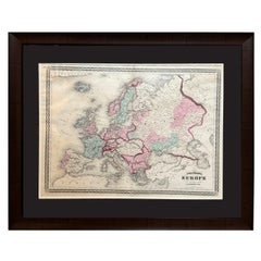
Antique Map of Europe by Johnson, '1872'
Located in Langweer, NL
Antique map titled 'Johnson's Europe'. Original map of Europe. This map originates from 'Johnson's
Category

Late 19th Century Europe Map Antique

Materials

Paper

Antique Map of Europe by Johnson, '1872'
$334 Sale Price
20% Off
H 18.12 in W 26.38 in D 0.02 in
Antique Map of Europe by Lowry, 1852
Located in Langweer, NL
Antique map titled 'Europe'. Original map of Europe. This map originates from 'Lowry's Table Atlas
Category

Mid-19th Century Europe Map Antique

Materials

Paper

Antique Map of Europe by Lowry, 1852
$143 Sale Price
20% Off
H 9.65 in W 12.21 in D 0.02 in
Antique Map of Europe by Levasseur, '1875'
Located in Langweer, NL
Antique map titled 'Carte générale de l'Europe'. Large map of Europe. This map originates from
Category

Late 19th Century Europe Map Antique

Materials

Paper

Antique Map of Europe by Levasseur, '1875'
$358 Sale Price
40% Off
H 18.71 in W 24.02 in D 0.02 in
Antique Map of Germany and Central Europe
Located in Langweer, NL
Königreichen und Provincien'. Original antique map of Germany covering the central part of Europe with Germany
Category

Late 17th Century Europe Map Antique

Materials

Paper

Antique Map of Germany and Central Europe
$1,050 Sale Price
20% Off
H 20.67 in W 24.22 in D 0.02 in
Antique Map of the Europe Continent, 1880
Located in Langweer, NL
Antique map titled 'Europe'. Old map of the European continent. This map originates from
Category

19th Century Europe Map Antique

Materials

Paper

Antique Map of the Europe Continent, 1880
$171 Sale Price
20% Off
H 13.59 in W 18.71 in D 0 in
Original Antique Map of Europe, Arrowsmith, 1820
Located in St Annes, Lancashire
Great map of Europe Drawn under the direction of Arrowsmith. Copper-plate engraving
Category

1820s English Europe Map Antique

Materials

Paper

Antique Map of Old European Russia, 1846
Located in Langweer, NL
Antique map titled 'Russia in Europe'. Old map of European Russia. This map originates from 'A New
Category

19th Century Europe Map Antique

Materials

Paper

Antique Map of Old European Russia, 1846
$267 Sale Price
20% Off
H 17.13 in W 13.78 in D 0 in
Antique Map of the European Continent, 1882
Located in Langweer, NL
Antique map titled 'Europe'. Old map of the European continent. This map originates from 'The Royal
Category

19th Century Europe Map Antique

Materials

Paper

Antique Map of the European Continent, 1882
$128 Sale Price
20% Off
H 19.49 in W 24.18 in D 0 in
Antique European War Folding Map, ‘circa 1915’
Located in Langweer, NL
Antique folding map of the European War (1914-1915) titled 'The Eastern Campaign '. From Petrograd
Category

Early 20th Century Europe Map Antique

Materials

Paper

Antique European War Folding Map, ‘circa 1915’
$716 Sale Price
20% Off
H 39.38 in W 28.94 in D 0.02 in
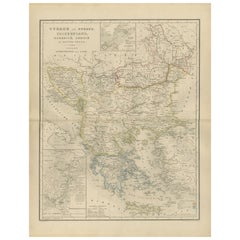
European Turkey Map – Detailed Balkan Ottoman Provinces 1858
Located in Langweer, NL
European Turkey and Greece Map – Balkans and Ionian Islands 1857 This detailed antique print shows
Category

Mid-19th Century German Europe Map Antique

Materials

Paper

1849 Map of "Europaische Russland", 'Meyer Map of European Russia', Ric. R017
Located in Norton, MA
1849 Map of "Europaische Russland" ( Meyer Map of European Russia) Ric.r017 A lovely map of
Category

19th Century Unknown Europe Map Antique

Materials

Paper

Antique Map of Eastern Europe, Incl Montenegro & Serbia & a Budapest Map, 1890
Located in Langweer, NL
Antique map titled 'Osterreich-Ungarn in 4 Blattern, Blatt 4.' Map of Eastern Europe, with
Category

1890s Europe Map Antique

Materials

Paper

Original Antique Map of Russia in Europe, 1882
Located in Langweer, NL
Embark on an enthralling journey with an original Antique Map of European Russia from the esteemed
Category

1880s Europe Map Antique

Materials

Paper

Original Antique Map of Russia in Europe, 1882
$181 Sale Price
20% Off
H 22.45 in W 14.97 in D 0 in
Old Original Map of Russia in Europe, 1849
Located in Langweer, NL
Antique map titled 'Russia in Europe'. Old map of Russia in Europe. This map originates from
Category

1840s Europe Map Antique

Materials

Paper

Old Original Map of Russia in Europe, 1849
$171 Sale Price
20% Off
H 18.31 in W 13.98 in D 0 in
Antique Rain Map of Europe by Johnston '1850'
Located in Langweer, NL
Antique map titled 'Hyetographic or Rain Map of Europe'. Original antique rain map of Europe. This
Category

Mid-19th Century Europe Map Antique

Materials

Paper

Antique Rain Map of Europe by Johnston '1850'
$191 Sale Price
20% Off
H 11.03 in W 14.18 in D 0.02 in
  • 1
Get Updated with New Arrivals
Save "Europe Map Antique", and we’ll notify you when there are new listings in this category.

Europe Map Antique For Sale on 1stDibs

With a vast inventory of beautiful furniture at 1stDibs, we’ve got just the Europe map antique you’re looking for. Each Europe map antique for sale was constructed with extraordinary care, often using paper, wood and fabric. There are many kinds of the Europe map antique you’re looking for, from those produced as long ago as the 18th Century to those made as recently as the 20th Century. A Europe map antique is a generally popular piece of furniture, but those created in Baroque, Georgian and Industrial styles are sought with frequency. Jacques-Nicolas Bellin, Emanuel Bowen and Frederick de Wit each produced at least one beautiful Europe map antique that is worth considering.

How Much is a Europe Map Antique?

Prices for a Europe map antique start at $50 and top out at $12,500 with the average selling for $441.

Read More

Patchwork Quilts Are the Latest Nostalgic Design Trend

New or old, the coverlets add old-time charm to any space.

Medal-Worthy Memorabilia from Epic Past Olympic Games

Get into the games! These items celebrate the events, athletes, host countries and sporting spirit.

Ahoy! You’ve Never Seen a Collection of Sailor Art and Kitsch Quite Like This

French trendsetter and serial collector Daniel Rozensztroch tells us about his obsession with objects related to seafaring men.

39 Incredible Swimming Pools

It's hard to resist the allure of a beautiful pool. So, go ahead and daydream about whiling away your summer in paradise.

Pamela Shamshiri Shares the Secrets behind Her First-Ever Book and Its Effortlessly Cool Interiors

The sought-after designer worked with the team at Hoffman Creative to produce a monograph that beautifully showcases some of Studio Shamshiri's most inspiring projects.

Moroccan Artworks and Objects Take Center Stage in an Extraordinary Villa in Tangier

Italian writer and collector Umberto Pasti opens the doors to his remarkable cave of wonders in North Africa.

Montecito Has Drawn Royalty and Celebrities, and These Homes Are Proof of Its Allure

Hollywood A-listers, ex-pat aristocrats and art collectors and style setters of all stripes appreciate the allure of the coastal California hamlet — much on our minds after recent winter floods.
Whaam! Blam! Pow! — a New Book on Pop Art Packs a Punch

Publishing house Assouline and writer Julie Belcove have teamed up to trace the history of the genre, from Roy Lichtenstein, Andy Warhol and Yayoi Kusama to Mickalene Thomas and Jeff Koons.