Gibraltar Antique Map
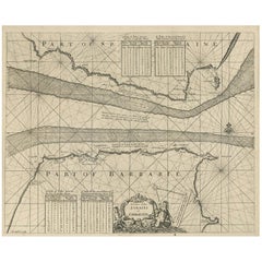
Antique Map of the Straits of Gibraltar by J. Gascoyne, circa 1716
Located in Langweer, NL
Antique map titled 'A Chart of the Straits of Gibraltar'. This chart shows the tides running
Category
Early 18th Century Gibraltar Antique Map
Materials
Paper
$620 Sale Price
20% Off
H 17.92 in W 21.66 in D 0.02 in
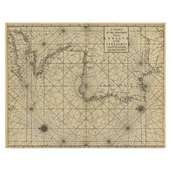
Original Antique Sea Chart of the Coastline from England to Gibraltar, ca.1700
Located in Langweer, NL
Antique map titled 'A Chart of the Sea-Coast from England to the Streights.'
Original antique map
Category
Early 1700s Gibraltar Antique Map
Materials
Paper
$906 Sale Price
20% Off
H 18.47 in W 23.55 in D 0 in
Antique Map of France, Spain and Portugal by Johnson, 1872
Located in Langweer, NL
inset maps of Corsica and Gibraltar Rock. This map originates from 'Johnson's New Illustrated Family
Category
Late 19th Century Gibraltar Antique Map
Materials
Paper
$238 Sale Price
20% Off
H 26.38 in W 18.12 in D 0.02 in
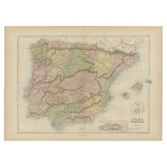
Antique Map of Spain and Portugal by A & C. Black, 1870
Located in Langweer, NL
with inset map of Gibraltar. This map originates from ‘Black's General Atlas of The World’. Published
Category
Late 19th Century Gibraltar Antique Map
Materials
Paper
$196 Sale Price
40% Off
H 17.52 in W 23.63 in D 0.02 in
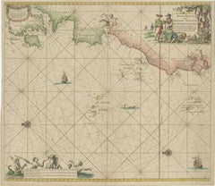
1717 Johannes Van Keulen Sea Chart of the Eastern Atlantic - Amsterdam to Gambia
Located in Langweer, NL
important geographic points:
1. strait of gibraltar
- the map prominently shows the strait of gibraltar
Category
1710s Gibraltar Antique Map
Materials
Paper
$2,684
H 20.87 in W 23.82 in D 0.01 in
Recent Sales
Carte reduite des costes d'Espagne et de Portugal [...].
By Jacques-Nicolas Bellin
Located in Zeeland, Noord-Brabant
[...]' - (Detailed map of the coasts of Spain and Portugal from Cape Pinas to the Strait of Gibraltar.) Highly
Category
Mid-18th Century Gibraltar Antique Map
Materials
Engraving
H 23.82 in W 35.83 in
Carte generale des costes de l'Europe sur l'ocean [...].
By Alexis Hubert Jaillot
Located in Zeeland, Noord-Brabant
Detroit de Gibraltar.' - (General coastal map of Europe and the oceans from Dronthem in Norway to the
Category
Late 17th Century Gibraltar Antique Map
Materials
Engraving
H 24.41 in W 36.03 in
Antique Map of the Strait of Gibraltar by Homann Heirs, circa 1730
By Homann Heirs
Located in Langweer, NL
Highly decorative antique map of the Strait of Gibraltar by Homann Heirs. This map was a
Category
Mid-18th Century Gibraltar Antique Map
Antique Map of the Strait of Gibraltar by Van Keulen, circa 1705
By Johannes van Keulen
Located in Langweer, NL
Antique map titled 'Nieuwe Paskaart Van de Kust van Hispania. Van ‘t Klif tot aan Velez Malaga als
Category
Early 18th Century Gibraltar Antique Map
Materials
Paper
Get Updated with New Arrivals
Save "Gibraltar Antique Map", and we’ll notify you when there are new listings in this category.
Gibraltar Antique Map For Sale on 1stDibs
Find many varieties of an authentic gibraltar antique map available at 1stDibs. Frequently made of paper, every gibraltar antique map was constructed with great care. You’ve searched high and low for the perfect gibraltar antique map — we have versions that date back to the 18th Century alongside those produced as recently as the 20th Century are available. Johannes van Keulen each produced at least one beautiful gibraltar antique map that is worth considering.
How Much is a Gibraltar Antique Map?
A gibraltar antique map can differ in price owing to various characteristics — the average selling price 1stDibs is $383, while the lowest priced sells for $85 and the highest can go for as much as $1,418.
More Ways To Browse
Casablanca Clothing
Alexander Roux
Buccellati Silver Furry Animals
Burmese Hintha Bird
C A B Primavera
Cabat Feelie
Cabat Pottery
Cake Crock
Cake Trolley
Camark Pottery
Capitello Gufram
Capodimonte Birds
Carlo Alberto Rossi
Carlo Bartoli Gaia
Carlo Moretti Wine Glasses
Carlo Nason Lt216
Carlotta Lounge Chair
Carole Stupell Crystal


![nicolas costes Antique Carte reduite des costes d'Espagne et de Portugal [...].](https://a.1stdibscdn.com/archivesE/upload/a_5923/1508838060305/cb3804_master.jpg?width=240)
![hubert jaillot Antique Carte generale des costes de l'Europe sur l'ocean [...].](https://a.1stdibscdn.com/archivesE/upload/a_5923/1508837429054/cb3798_master.jpg?width=240)