Isle Of Man Antique Map
Northwest Coast and Isle of Man Map
Located in Cheshire, GB
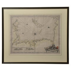
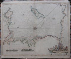
Greenville Collins Northwest Coast and Isle of Man. hand coloured chart, encased in an ebonised
Category
Early 20th Century British Isle Of Man Antique Map
Materials
Paper
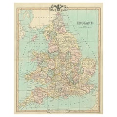
Antique Map of England and Wales, Also Including the Isle of Man
Located in Langweer, NL
Cornwall from the St. George Channel east as far as the Strait of Dover. The Isle of Man is also included
Category
Mid-19th Century Isle Of Man Antique Map
Materials
Paper
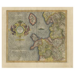
Antique Map of England by Mercator/Hondius, circa 1600
Located in Langweer, NL
England, the Isle of Man, Anglesey and part of Wales.
From Mercator's Atlas Sive Cosmographia
Category
16th Century Isle Of Man Antique Map
Materials
Paper
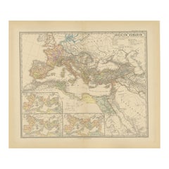
Imperium Romanum: A Detailed Map of the Roman Empire in its Zenith, 1880
Located in Langweer, NL
This original antique map, titled "IMPERIVM ROMANVM", is a detailed depiction of the Roman Empire
Category
1880s Isle Of Man Antique Map
Materials
Paper
Free Shipping
H 15.56 in W 18.51 in D 0 in
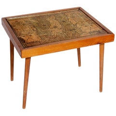
Table Low Sofa Vintage 1950s Map Isle of Man John Speed 1610 Thomas Durham 1595
Located in BUNGAY, SUFFOLK
conversation piece
- This is the first map featuring the Isle of Man on its own.
- It is also the first map
Category
1610s English Mid-Century Modern Isle Of Man Antique Map
Materials
Paper
H 16.54 in W 20.24 in D 16.54 in
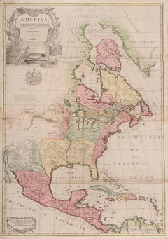
one of the earliest large-scale English maps of North America
By John Senex
Located in London, GB
one of the earliest large-scale English maps of North America
SENEX, John.
North America Corrected
Category
1710s Naturalistic Isle Of Man Antique Map
Materials
Watercolor, Engraving
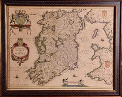
Ireland: A Framed 17th Century Hand-colored Map by Jan Jannson
By Johannes Janssonius
Located in Alamo, CA
Janssonius's (Jan Jansson), published in Amsterdam in 1640. This highly detailed map depicts the Emerald Isle
Category
Mid-17th Century Old Masters Isle Of Man Antique Map
Materials
Engraving
H 17.88 in W 22 in D 0.75 in
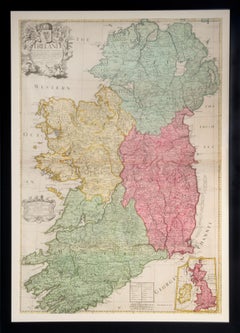
Ireland
By John Senex
Located in London, GB
, with full contemporary hand-colouring. Inset map of the British Isles, decorative title cartouche
Category
1710s Isle Of Man Antique Map
Materials
Engraving
People Also Browsed
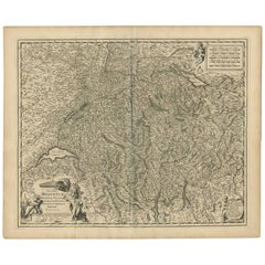
Antique Map of Switzerland by N. Visscher, circa 1690
Located in Langweer, NL
Beautifully detailed map of Switzerland and surrounding regions in present-day France, Germany, and Italy. This map features two decorative cartouches: the larger is flanked by two p...
Category
Late 17th Century Isle Of Man Antique Map
Materials
Paper
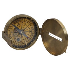
Antique Stanley London Brass Surveyors Nautical Maritime Navigation Compass
By Stanley
Located in Dayton, OH
Antique Stanley London surveyors / nautical compass with brass case and face, leveling bubble, folding sightline, and pedestal base for attaching compass to a tripod.
"A surveyor’s ...
Category
Early 20th Century Isle Of Man Antique Map
Materials
Brass
H 1.75 in W 3.75 in D 4 in
Large Oil on Canvas Winter Landscape by Peter Adolf Persson in Gilded Wood Frame
By Peter Adolf Persson
Located in Miami, FL
Peter Adolf Persson, born 25th September, 1862 in Kvistoftavägen, Scania, died January 15, 1914 in Tyringegatan, Skåne, was a Swedish artist. Persson studied at the Academy of Arts i...
Category
19th Century Swedish Romantic Isle Of Man Antique Map
Materials
Wood, Gesso, Canvas, Giltwood
H 46 in W 62.25 in D 4 in
Unusual Antique English Folding Compass In Brass Case c.1900
Located in Bath, GB
An unusual English compass which folds into it's own brass case. Marked "England" and dating to c.1900.
2" x 1 3/4" x 1/2". Excellent condition.
Item: 44415
FREE Worldwide Regist...
Category
Early 1900s British Edwardian Isle Of Man Antique Map
Materials
Brass
Antique English Pocket Magnifying Glass / Loop With Compass c.1920
Located in Bath, GB
A charming little folding loop or magnifying glass made from brass, dating to the early twentieth century, c.1920.
What of course makes it highly collectable is the inset working co...
Category
1920s British Isle Of Man Antique Map
Materials
Brass
Free Shipping
H 1.88 in W 1 in D 0.5 in
American Primitive Oil Painting Child Portrait 1840 Folk Art
Located in Potters Bar, GB
You are viewing a gorgeous American primitive oil painting of two girls
This quirky portrait is a wonderful piece of folk art
Circa 1840
Wonderful effect of craquelure from the age o...
Category
1840s Isle Of Man Antique Map
Materials
Tapestry
Antique English Folding Brass Compass c.1910
Located in Bath, GB
A brass folding pocket compass which is made also to be added to a chain or ribbon to be worn around the neck.
The lens has a good magnification and in lovey condition.
Dating to c...
Category
1910s British Edwardian Isle Of Man Antique Map
Materials
Brass
Antique Technical Drawing Set, German, Architect, Cartography, Wichmann
Located in Hele, Devon, GB
This is an antique technical drawing set. A German, architect's or cartographer's instrument case by Wichmann, dating to the early 20th century, circa 1920.
Quality, 14-piece inst...
Category
Early 20th Century German Edwardian Isle Of Man Antique Map
Materials
Nickel
H 0.99 in W 11.03 in D 4.53 in
Antique English Brass Cased Compass Reg. No. For 1903
Located in Bath, GB
A handsome cased late Victorian or Edwardian compass with hinged lid, the little button on the top used to open; just like a pocket watch.
The dial is lucky enough to have an Englis...
Category
Early 1900s British Edwardian Isle Of Man Antique Map
Materials
Brass
Antique Print of the Fortress Cranganor near Kodungallur in India, 1757
Located in Langweer, NL
Antique print of the Fortress Cranganor, nowadays known by the name Kodungallor. French and Dutch title including scale and compass rose. This print originates from 'L'Histoire génér...
Category
Mid-18th Century Isle Of Man Antique Map
Materials
Paper
Free Shipping
H 13.39 in W 16.54 in D 0 in
Antique Map of Herefordshire 'England' by R. Morden, 1708
Located in Langweer, NL
This antique County map of Herefordshire by Robert Morden was first published in 1701 in a work entitled 'The New Description and State of England', however, a subsequent edition by ...
Category
Early 18th Century Isle Of Man Antique Map
Materials
Paper
Late 19th Century Rustic European Pine Cabinet or Ice Box
Located in Miami, FL
A rare precursor to our modern refrigerator and freezer, this rustic cabinet in pine has an interior that is lined with zinc and a central compartment where the ice was kept, Norther...
Category
Late 19th Century German Rustic Isle Of Man Antique Map
Materials
Zinc
Victorian Sterling Silver Travelling Clock or Compass
Located in Jesmond, Newcastle Upon Tyne
An exceptional, fine and impressive, large antique Victorian English sterling silver travelling clock or compass; an addition to our silver timepiece collection.
This exceptional ...
Category
1890s English Victorian Isle Of Man Antique Map
Materials
Silver, Sterling Silver
18th Century Antique Georgian Satinwood Precision Barometer
Located in Devon, GB
A rare late 18th century George III period antique cross-banded satinwood wheel barometer. The nine inch circular silvered and engraved main scale has elaborate compass point central...
Category
18th Century English George III Isle Of Man Antique Map
Materials
Satinwood
18th Century Chinese Export Porcelain Punch Bowl
Located in Fort Lauderdale, FL
A mid-18th century Chinese export porcelain punch bowl, hand-painted with "The Judgement of Paris" after Rubens.
European ceramicists borrowed motifs from Chinese porcelains through...
Category
1760s Chinese Chinese Export Isle Of Man Antique Map
Materials
Porcelain
An oil painting on Paesina, genre scene in a port, Italy 1st end of 18th century
Located in Milan, IT
An oil painting of Paesena. The frame, made of ebonized walnut wood finished in wax, has a rectangular shape with an internal signature that flares out towards the inside to accommod...
Category
Late 18th Century Italian Isle Of Man Antique Map
Materials
Stone
H 10.25 in W 14.5 in D 2 in
Recent Sales
To the Honble. Sr. Iohn Lowther.
By Captain Greenvile Collins
Located in Zeeland, Noord-Brabant
A map of the Northern Irish Sea, with the Isle of Man as its main focus. The coasts of Scotland
Category
Late 17th Century Isle Of Man Antique Map
Materials
Engraving
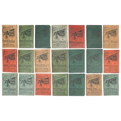
Pattisons' Cycling Maps
Located in Oxfordshire, GB
of Scotland - sold
9, North Wales
10, South Wales
11, Lancashire & Isle of Man
12
Category
Early 1900s British Isle Of Man Antique Map
19th Century The Isle of Man
By Thomas Moule
Located in Soquel, CA
. Early Thomas Moule steel engraved map of the Isle of Man published by George Virtue 1833 and engraved by
Category
1830s Realist Isle Of Man Antique Map
Materials
Watercolor, Ink, Paper
Map Isle of Man and D'Anglesey (Wales)
By Alain Manesson Mallet
Located in New York, NY
Published in 1683, this map of Map Isle of Man and D'Anglesey Islands, Wales was created by French
Category
1680s Naturalistic Isle Of Man Antique Map
Materials
Engraving
Get Updated with New Arrivals
Save "Isle Of Man Antique Map", and we’ll notify you when there are new listings in this category.
More Ways To Browse
Antique Maps Hampshire
Antique Maps Essex
Antique Map Norfolk
Antique Maps Norfolk
Map Oxford England
Isle Of Man Table
Northumberland Map
Durham Antique Map
Antique Map Sydney
Antique Maps Sydney
Antique Maps Cornwall
Antique Map Of Cornwall
Used Low Rider S
Antique Map Cornwall
James Hd Brown
Cornwall Map
Essex Golf
Manchester Antique Map
