Liege Map
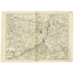
Antique Map of the Region of Liege by Coronelli, 1690
By Vincenzo Coronelli
Located in Langweer, NL
Antique map titled 'Vescovato di Liege (..)'. Map of the Belgium area centered on Liege and the
Category
Antique 17th Century Maps
Materials
Paper
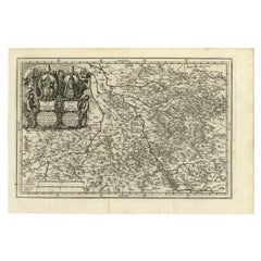
Antique Map of the Region of Cologne and Liege by Scherer, 1699
Located in Langweer, NL
uncommon map of the Archbishopric of Cologne and the Bishopric of Liege/Luik. Source unknown, to be
Category
Antique 17th Century Maps
Materials
Paper
17th Century Hand Colored Map of the Liege Region in Belgium by Visscher
By Nicolaes Visscher II
Located in Alamo, CA
. The map is centered on Liege, Belgium, includes the area between Antwerp, Turnhout, Roermond, Cologne
Category
Antique Late 17th Century Dutch Maps
Materials
Paper
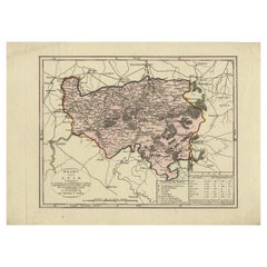
Antique Map of the Region of Luik by Veelwaard, c.1840
Located in Langweer, NL
Antique map titled 'Kaart van Luik'. Original antique map of the region of Luik (Liege), Belgium
Category
Antique 19th Century Maps
Materials
Paper
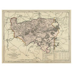
Antique Map of the Region of Luik by Veelwaard, C.1840
Located in Langweer, NL
Antique map titled 'Kaart van Luik'. Original antique map of the region of Luik (Liege), Belgium
Category
Antique 19th Century Maps
Materials
Paper
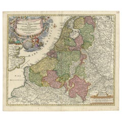
Antique Map of the Netherlands and Belgium by Homann, circa 1710
By Johann Baptist Homann
Located in Langweer, NL
Antique map titled 'Tabula Generalis Totius Belgii Provinciae XVII. Infer. Germaniae (..)'. Map of
Category
Antique Early 18th Century German Maps
Materials
Paper
Free Shipping
H 20.87 in W 24.02 in D 0.02 in
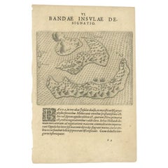
Antique Map of the Banda Islands by De Bry, c.1600
Located in Langweer, NL
Antique map Indonesia titled 'Bandae Insulae designatio'. Antique map depicting the Banda Islands
Category
Antique 17th Century Maps
Materials
Paper
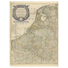
Rare and Early Map of the Seventeen Provinces, Published in circa 1640
Located in Langweer, NL
Antique map titled 'Carte Generale des Dixsept Provinces des Pais Bas'. Rare and Early map of the
Category
Antique Mid-17th Century Maps
Materials
Paper
Free Shipping
H 23.08 in W 16.93 in D 0.02 in
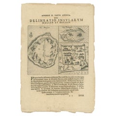
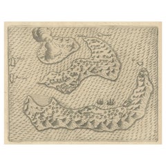
Antique Map of the Islands of Macian and Bacian by De Bry, 1619
Located in Langweer, NL
Antique map titled 'Delineatio Insularum Macian et Bacian'. Depicts the islands Macian and Bacian
Category
Antique 17th Century Maps
Materials
Paper
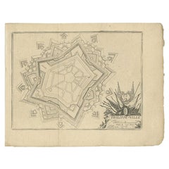
Antique Plan of Philippeville in Wallonia, Belgium, 1769
Located in Langweer, NL
Antique map titled 'Philippe-Ville'. Plan of Philippeville in Wallonia, Belgium. This print
Category
Antique 18th Century Maps
Materials
Paper
Rare Antique Pap Depicting the Banda Islands or Spice Islands, Indonesia, c.1600
Located in Langweer, NL
Antique map Indonesia titled 'Bandae Insulae designatio'. Antique map depicting the Banda Islands
Category
Antique Early 1600s Maps
Materials
Paper
H 11.82 in W 7.88 in D 0 in
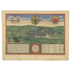
Antique Print of Liège / Luik in Belgium by Braun & Hogenberg, 1575
Located in Langweer, NL
Antique print titled 'Leodium'. View of Liège / Luik, Belgium with surrounding hills and the city
Category
Antique 16th Century Prints
Materials
Paper
Antique Print of Bantam, Java, Indonesia by De Bry, c.1610
Located in Langweer, NL
de Bry (1561 - 1623) was born in Liege in 1561, the eldest son of the engraver and publisher Theodor
Category
Antique 17th Century Prints
Materials
Paper
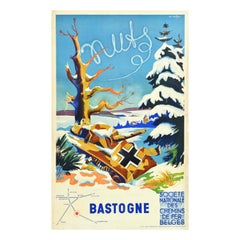
Original Vintage Post-WWII Travel Poster Bastogne Belgian National Railway Tank
Located in London, GB
distance, and a route map below marking Bastogne Anvers Ostende Brussels Namur Liege Cologne Paris and
Category
Vintage 1940s Belgian Posters
Materials
Paper
H 39.38 in W 24.81 in D 0.04 in
La Port De Cannes, 1930. Vieux Port, French Riviera. Côte d'Azur. Paul Delvaux.
By Paul Delvaux
Located in Sutton Poyntz, Dorset
Anheit, a small village in the province of Liège, in Belgium. He grew up in Brussels in comfortable
Category
Early 20th Century Romantic Landscape Drawings and Watercolors
Materials
Paper, Watercolor
H 23.82 in W 33.27 in D 0.79 in
Dusk
By Ross Racine
Located in New York, NY
drawn and rendered on the computer, the artist references google maps and aerial views of buildings, but
Category
2010s New Media Landscape Prints
Materials
Inkjet
Breeze
By Ross Racine
Located in New York, NY
drawn and rendered on the computer, the artist references google maps and aerial views of buildings, but
Category
2010s New Media Landscape Prints
Materials
Inkjet
New Morning
By Ross Racine
Located in New York, NY
drawn and rendered on the computer, the artist references google maps and aerial views of buildings, but
Category
2010s New Media More Prints
Materials
Inkjet
East Hollowburn Fields
By Ross Racine
Located in New York, NY
on the computer, the artist references google maps and aerial views of buildings, but the actual
Category
21st Century and Contemporary Contemporary Landscape Prints
Materials
Archival Pigment, Archival Paper
Elmwood and Oaklawn
By Ross Racine
Located in New York, NY
on the computer, the artist references google maps and aerial views of buildings, but the actual
Category
2010s Conceptual Landscape Prints
Materials
Archival Pigment
Abstract Aerial Landscape Limited Edition Print "Walking"
By Ross Racine
Located in New York, NY
do with Google maps. They tell a story.
Ross Racine is an artist living in Montreal (Quebec), Canada
Category
2010s Contemporary Landscape Prints
Materials
Archival Pigment
"Substructure" Abstract Aerial Landscape Limited Edition Print
By Ross Racine
Located in New York, NY
do with Google maps. They tell a story.
Ross Racine is an artist living in Montreal (Quebec), Canada
Category
2010s Contemporary Landscape Prints
Materials
Inkjet
Abstract Aerial Landscape "Jumping" Black and White Limited Edition Print
By Ross Racine
Located in New York, NY
on paper have as much in common with oriental rugs or quilted blankets as they do with Google maps
Category
2010s Contemporary Abstract Prints
Materials
Archival Pigment
Original Vintage Post-WWII Travel Poster Bastogne Belgian National Railway Tank
Located in London, GB
distance, and a route map below marking Bastogne Anvers Ostende Brussels Namur Liege Cologne Paris and
Category
1940s More Prints
Materials
Paper
People Also Browsed
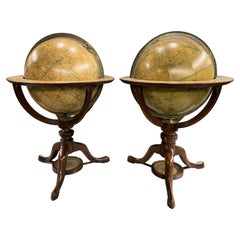
Pair of Early 19th C Cary Celestial & Terrestrial Tabletop Globes
By George & John Cary, John & William Cary
Located in Milford, NH
A fine pair of tabletop globes on stands, the left hand colored Celestial globe with cartouche which reads “Cary's New Celestial Globe on which are correctly laid down upwards of 350...
Category
Antique Early 19th Century English Globes
Materials
Mahogany
Woman on the beach of Valencia Spain oil on board painting impressionist
By Joan Vives Maristany
Located in Barcelona, Barcelona
Joan Vives Maristany (XX) - Woman on the beach Valencia - Oil on panel
Oil measures 24x26 cm.
Frameless.
Category
1990s Impressionist Landscape Paintings
Materials
Oil, Board
Rex Valencia Porcelain Figurine Of An English Setter Dog
Located in Guaynabo, PR
This is a Rex Valencia porcelain figurine of a dog. It depicts a hand painted grey and white color astute English Setter dog standing up over a base adorned with a cut trunk and soil...
Category
20th Century Spanish Animal Sculptures
Materials
Porcelain
Midcentury Vintage Red Black and Gold Decorative Metal Plate, Poland, 1960s
Located in 05-080 Hornowek, PL
Decorative metal plate from Poland. The plate is hand painted. Plate is in very good vintage condition, no damage or cracks. Original metal. Beautiful piece for every interior! Only ...
Category
Mid-20th Century Polish Mid-Century Modern Platters and Serveware
Materials
Metal
H 0.79 in W 9.85 in D 9.85 in
17th Century Spanish Hispano Moresque Copper Lustre Ceramic Bowl
Located in Bradenton, FL
Early 17th century Hispano Moresque bowl with copper glaze, from Spain. Hispanic Moresque earthenware has an Islamic style created by the Moors produced under Christian rule, merging...
Category
Antique 17th Century Spanish Moorish Pottery
Materials
Ceramic
18th Century Hand Colored Map of Spain and Portugal by Visscher
By Nicolaes Visscher II
Located in Alamo, CA
This is an early 18th century map of Spain and Portugal, with attractive original hand-coloring, entitled "Hispaniae et Portugalliae Regna per Nicolaum Visscher cum Privilegio Ordinu...
Category
Antique Early 18th Century Dutch Maps
Materials
Paper
Souvenir of the War 1914-15-16-17-18 Banner
Located in Colorado Springs, CO
Presented is a stunning textile banner from the first World War, dating to 1918. The square tan cotton cloth is embroidered with two crossed flags, the Royal Indian Marine Ensign and...
Category
Vintage 1910s Australian Political and Patriotic Memorabilia
Materials
Cotton
Compass with Pocket Sundial, with Case, Bronze, Butterfield, Michael '1635-1724'
Located in Madrid, ES
Compass with pocket sundial, with case. Bronze. BUTTERFIELD, Michael (1635-1724). Paris, circa 1700.
Pocket sundial made of engraved metal, with a gnomon in the shape of a bird wit...
Category
Antique Early 18th Century French Neoclassical Scientific Instruments
Materials
Metal, Bronze, Other
H 2.96 in W 3.35 in D 0.79 in
"Africa Vetus": a 17th Century Hand-Colored Map by Sanson
By Nicolas Sanson
Located in Alamo, CA
This original hand-colored copperplate engraved map of Africa entitled "Africa Vetus, Nicolai Sanson Christianiss Galliar Regis Geographi" was originally created by Nicholas Sanson d...
Category
Antique Late 17th Century French Maps
Materials
Paper
Chinese Export Porcelain Dish with Dutch Decoration of a Voc Ship
Located in Amsterdam, NL
A Chinese export porcelain dish with Dutch decoration of a VOC ship
Circa 1700-1710, the Dutch decoration circa 1720-1730
Diam. 21.5 cm
?
Originally left white, this Chinese ...
Category
Antique Early 18th Century Chinese Chinese Export Ceramics
Materials
Porcelain
Original Antique Scenic London Underground Poster Ft the River Thames Teddington
By Anthony R. Barker
Located in London, GB
Original antique travel advertising poster for London Underground featuring a scenic riverside landscape in Teddington showing smartly dressed people enjoying a picnic break on saili...
Category
Vintage 1910s British Posters
Materials
Paper
H 38.98 in W 58.27 in D 0.04 in
19th Century Sailor's Woolie with Ship at Anchor Within Oval Cartouche, ca 1850
Located in Nantucket, MA
19th Century Sailor's Folk Art Woolie with Ship at Anchor Within Oval Cartouche, ca 1850, depicting a square-rigged single decker warship under furled sails, anchor chain leading off...
Category
Antique Mid-19th Century English Folk Art Nautical Objects
Materials
Wool
H 21.13 in W 26.13 in D 1.25 in
Prussia, Poland, N. Germany, Etc: A Hand-colored 17th Century Map by Janssonius
By Johannes Janssonius
Located in Alamo, CA
This is an attractive hand-colored copperplate engraved 17th century map of Prussia entitled "Prussia Accurate Descripta a Gasparo Henneberg Erlichensi", published in Amsterdam by Jo...
Category
Antique Mid-17th Century Dutch Maps
Materials
Paper
H 21.25 in W 24.63 in D 0.07 in
Fez
Located in Greenwich, CT
Born 1978, Jerusalem
Lives and works in Tel Aviv and Brussels
Education
2005 MFA Bezalel Academy of Art & Design, Tel Aviv
2001 Slade School of fine art, U.C.L, London, pai...
Category
2010s Realist Figurative Paintings
Materials
Panel, Oil
Road Map Britannia 1675/6 No 5 Road London to Barwick, London Stilton Grey Frame
By John Ogilby
Located in BUNGAY, SUFFOLK
John Ogilby (British 1600-1676) cosmographer and geographick printer to Charles II.
A road map from Britannia, 1675/6. No 5, The road from London to Barwick: London to Stilton
In a g...
Category
Antique Late 17th Century British Charles II Maps
Materials
Paper
H 22.84 in W 25.99 in D 0.4 in
Casablanca
Located in Greenwich, CT
Born 1978, Jerusalem
Lives and works in Tel Aviv and Brussels
Education
2005 MFA Bezalel Academy of Art & Design, Tel Aviv
2001 Slade School of fine art, U.C.L, London, painting de...
Category
2010s Realist Figurative Paintings
Materials
Oil, Canvas
Recent Sales
Ducatus Limburg.
By Hendrik Hondius the Elder
Located in Zeeland, Noord-Brabant
Handcoloured engraving on hand laid (verge) paper.
Ducatus Limburg. Attractive map of the Duchy of
Category
1630s More Prints
Materials
Engraving
Original Vintage Post-WWII Travel Poster Bastogne Belgian National Railway Tank
Located in London, GB
distance, and a route map below marking Bastogne Anvers Ostende Brussels Namur Liege Cologne Paris and
Category
Vintage 1940s Belgian Posters
Materials
Paper
H 39.38 in W 24.81 in D 0.04 in
Antique View of the Palace of the Prince-Bishops in Luik / Liege, Belgium, c1650
Located in Langweer, NL
Luik / Liege, Belgium. Dutch text on verso. This print originates from 'Novum Ac Magnum Theatrum Urbium
Category
Antique 1650s Prints
Materials
Paper
H 19.06 in W 23.43 in D 0 in
Get Updated with New Arrivals
Save "Liege Map", and we’ll notify you when there are new listings in this category.
Liege Map For Sale on 1stDibs
At 1stDibs, there are many versions of the ideal liege map for your home. A liege map — often made from paper — can elevate any home. There are many kinds of the liege map you’re looking for, from those produced as long ago as the 18th Century to those made as recently as the 20th Century. Johann Baptist Homann, Nicolaes Visscher II and Vincenzo Coronelli each produced at least one beautiful liege map that is worth considering.
How Much is a Liege Map?
Prices for a liege map can differ depending upon size, time period and other attributes — at 1stDibs, they begin at $138 and can go as high as $2,500, while the average can fetch as much as $1,200.
More Ways To Browse
Johann Baptist Homann On Sale
Map Of Th World
Antique Map Cleveland
Antique Maps Washington Dc
Daniel Bautista
Map Cleveland
1681 Moses Pitt
Antique Cabbage Cutter
Antique Chesapeake Bay Map
Antique Handcrafted Model Sailboat
Antique Map Of Chesapeake Bay
Cartier 1730
Devonia Antique
Eso Antique Map
Eso Antique Maps
Formosa Vintage Map
M S Merian
Union Pacific Map
