Map Of Poland
to
3
20
3
11
11
7
4
4
3
3
2
2
2
1
1
1
1
1
1
1
1
1
1
1
1
1
1
1
1
Sort By
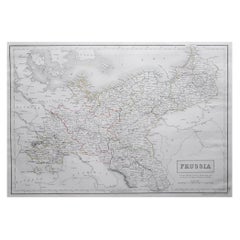
Large Original Antique Map of Poland by Sidney Hall, 1847
Located in St Annes, Lancashire
Great map of Poland
Drawn and engraved by Sidney Hall
Steel engraving
Original colour
Category
Antique 1840s Scottish Maps
Materials
Paper
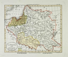
Map of Poland - Etching - Early 20th Century
Located in Roma, IT
Map of Poland is an etching map realized in the early 20th century.
Good conditions.
Category
Early 20th Century Modern Figurative Prints
Materials
Etching
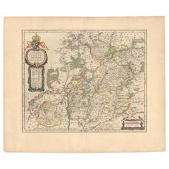
Circa 1659 Blaeu Family Map: Glogau and the Odra River Valley, Silesia
Located in Langweer, NL
view of the Odra River valley in western Poland, centered around the city of Glogau.
The map, based
Category
Antique 1650s Maps
Materials
Paper
H 16.4 in W 19.9 in D 0.002 in
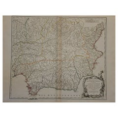
1751 Map of Spain Castilla Robert De Vaugondy 1st Edition, Ric.a001
Located in Norton, MA
(1752).
He is credited with a map of Poland, a map test of the Arctic Polar Sea. Father and son
Category
Antique 18th Century Unknown Maps
Materials
Paper
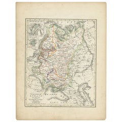
Antique Map of Russia and Poland by Petri, 1852
Located in Langweer, NL
Antique map titled 'Europeesch Rusland en Polen'. Map of Russia in Europe and Poland. This map
Category
Antique 19th Century Maps
Materials
Paper
1853 Map of "Russia in Europe Including Poland" Ric.r016
Located in Norton, MA
Description
Russia in Europe incl. Poland by J Wyld c.1853
Hand coloured steel engraving
Category
Antique 19th Century Unknown Maps
Materials
Paper
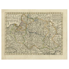
Antique Map of the Kingdom of Poland by Keizer & de Lat, 1788
Located in Langweer, NL
Antique map titled 't Koninkryk Polen (..)'. Uncommon original antique map of the Kingdom of Poland
Category
Antique Late 18th Century Maps
Materials
Paper
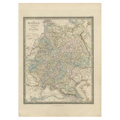
Antique Map of Russia in Europe and Poland by Wyld '1845'
Located in Langweer, NL
Antique map titled 'Russia in Europe including Poland'. Original antique map of Russia in Europe
Category
Antique Mid-19th Century Maps
Materials
Paper
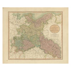
Antique Map of the Eastern Part of Germany, with Parts of Poland and Slovakia
Located in Langweer, NL
parts of Poland and Slovakia. This map originates from Cary's 'New Universal Atlas'. Published 1811
Category
Antique Early 19th Century Maps
Materials
Paper
H 21.46 in W 24.81 in D 0.02 in
Old Map of Southern Russia, Incl the Extent of the Kingdom of Poland, 1882
Located in Langweer, NL
the Kingdom of Poland. This map originates from 'The Royal Atlas of Modern Geography, Exhibiting, in a
Category
Antique 1880s Maps
Materials
Paper
H 19.53 in W 24.1 in D 0 in
Antique Map of Silesia, Southwest Poland and a City View of Wroclaw, c 1720
By Johann Baptist Homann
Located in Langweer, NL
Antique map titled 'Superioris et Inferioris ducatus Silesiae (..)'.
Detailed map of Silesia by
Category
Antique Early 18th Century Maps
Materials
Paper
H 21.66 in W 24.81 in D 0.02 in
Antique Map of Germany, Bohemia, Hungary and Part of Poland by R. Bonne ‘1780’
Located in Langweer, NL
Antique map titled "L'Allemagne, La Bohême, et la Hongrie avec une partie de la Pologne" by
Category
Antique Late 18th Century Maps
Materials
Paper
H 10.24 in W 15.04 in D 0.02 in
Antique Map of Russia in Europe and Poland from an d Old Dutch Atlas, 1852
Located in Langweer, NL
Poland. This map originates from 'School-Atlas van alle deelen der Aarde' by Otto Petri.
Artists and
Category
Antique 1850s Maps
Materials
Paper
H 13.59 in W 10.63 in D 0 in
Antique Map of Southern Russia by Johnston, 1882
Located in Langweer, NL
Kingdom of Poland. This map originates from 'The Royal Atlas of Modern Geography, Exhibiting, in a Series
Category
Antique 19th Century Maps
Materials
Paper
A Hand Colored 17th Century Janssonius Map of Prussia: Poland, N. Germany, etc.
By Johannes Janssonius
Located in Alamo, CA
. This very detailed map from the golden age of Dutch cartography includes present-day Poland, Latvia
Category
Mid-17th Century Old Masters Landscape Prints
Materials
Engraving
Antique Map of Poland and Lithuania, c.1744
Located in Langweer, NL
Antique map titled 'A New and Accurate Map of Poland, Lithuania & c'. Old map of Poland and
Category
Antique 18th Century Maps
Materials
Paper
Decorative Antique Map of Pomerania, in Germany and Poland, ca.1730
Located in Langweer, NL
Antique map titled 'Ducatus Pomeraniae'.
Decorative map of the area of Pomerania, in present
Category
Antique 1730s Maps
Materials
Paper
Original Antique Map of Poland by Thomas Clerk, 1817
Located in St Annes, Lancashire
Great map of Poland
Copper-plate engraving
Drawn and engraved by Thomas Clerk, Edinburgh
Category
Antique 1810s English Maps
Materials
Paper
Original Antique Map of Poland by Tallis, circa 1850
Located in St Annes, Lancashire
Great map of Poland.
Steel engraving.
Many lovely vignettes.
Published by London Printing
Category
Antique 1850s English Maps
Materials
Paper
Original Antique Map of Poland, Engraved by Barlow, Dated 1807
Located in St Annes, Lancashire
Great map of Poland
Copper-plate engraving by Barlow
Published by Brightly & Kinnersly
Category
Antique Early 1800s English Maps
Materials
Paper
Miniature Map of Swabia, a Medieval Duchy in South-West Germany and Poland, 1685
Located in Langweer, NL
Antique map titled 'Sueviae quae cis Codanum fuit finum Antiqua defcriptio.'
Miniature map of
Category
Antique 1680s Maps
Materials
Paper
H 5.12 in W 5.79 in D 0 in
Antique Engraving of Szczecinity in Poland, near the Baltic Sea, ca.1652
Located in Langweer, NL
West Pomeranian Voivodeship in northwestern Poland. This print originates from 'Topographia Electorat
Category
Antique Mid-17th Century Maps
Materials
Paper
H 12.8 in W 15.75 in D 0.02 in
1763 Nautical Portolano Chart of Guascogna Bay from Le Petit Neptune François
By G. A. Rizzi-zannoni
Located in Milan, IT
began his career as a cartographer in 1753 in Poland, called by King Augustus III, where he made a map
Category
Antique 1760s French Nautical Objects
Materials
Paper
H 12.21 in W 14.18 in D 0.79 in
Get Updated with New Arrivals
Save "Map Of Poland", and we’ll notify you when there are new listings in this category.
Map Of Poland For Sale on 1stDibs
Find many varieties of an authentic map of poland available at 1stDibs. Each map of poland for sale was constructed with extraordinary care, often using paper. There are many kinds of the map of poland you’re looking for, from those produced as long ago as the 18th Century to those made as recently as the 19th Century. You’ll likely find more than one map of poland that is appealing in its simplicity, but Johann Baptist Homann and Johannes Janssonius produced versions that are worth a look.
How Much is a Map Of Poland?
Prices for a map of poland start at $105 and top out at $1,449 with the average selling for $330.
