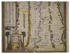
Abraham Ortelius Landscape Prints

Dutch, 1527-1598

Abraham Ortelius is widely recognized as the inventor of the atlas and one of the most prominent geographers in history. He is one of the best known and most frequently collected of all sixteenth-century mapmakers, and today, hand-colored, copperplate-printed Abraham Ortelius maps continue to command avid interest.

Ortelius was the eldest of the three children of an Antwerp merchant. After his father's death when he was ten, he was raised by his uncle Jacob Van Meteren — a financier and printer of early English versions of the Bible. Ortelius entered the Guild of Saint Luke in 1547 to become a map copier and colorist, but his hobbies overshadowed his studies. 

Ortelius was better known as a student of history and a collector of books and old coins than a cartographer — only initially garnering modest praise for his skills at mapmaking. Gleaning what he learned from his uncle, he became a dealer in books and prints. In 1554 he attended the annual Frankfurt Book Fair, where he met the highly respected cartographer Gerardus Mercator.

Ortelius refocused his work in mapmaking after that fateful encounter. He eventually published Theatrum Orbis Terrarum (Theater of the World) — a comprehensive collection of maps that he bound into a book. It was the first of its kind and is now recognized as the first modern-day atlas. While creating his atlas, Ortelius observed that the coast of America shared geometrical similarities with the shores of Europe and Africa. When he lined up maps of the coastlines of the continents, they matched — much like pieces in a jigsaw puzzle. 

Some have argued that the concept of continental drift is at least partly rooted in Ortelius’s 16th-century-era suggestion that the continents had once been joined together as a single mass of land before the Americas were pulled away from Europe and Africa. Much later, in 1912, German meteorologist Alfred Wegener proposed in a lecture and an article that the continents had once been locked together based on data he collected. Wegener was widely ridiculed at the time, but the foundation of modern-day science of plate tectonics has its origins in his work.

On May 18, 2008, a Google Doodle celebrated the 300th anniversary of Ortelius’s atlas.

On 1stDibs, find original Abraham Ortelius prints, landscape prints and more.

to
1
1
1
Overall Width
to
Overall Height
to
2
7
182
169
146
131
2
2
1
1
1
1
1
2
1
2
Artist: Abraham Ortelius
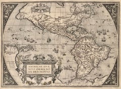
AMERICAE - Sive Novi Orbis, Nova Descriptio
By Abraham Ortelius
Located in Santa Monica, CA
ABRAHAM ORTELIUS (1527 - 1598) AMERICAE SIVE NOVI ORBIS, NOVA DESCRIPTIO, 1587 (1603) (Van Den Broecke 11, Burden 64; Schwartz & Ehrenberg 69) Engraving. A very good, well printed...
Category

16th Century Old Masters Abraham Ortelius Landscape Prints

Materials

Engraving

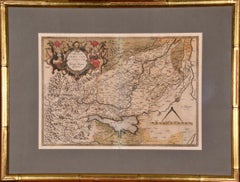
Northern Italy: A 16th Century Hand-colored Map by Abraham Ortelius
By Abraham Ortelius
Located in Alamo, CA
This is a framed 16th century hand-colored copperplate map of northern Italy entitled "Veronae Urbis Territorium a Bernardo Bragnolo Descriptium" by Abraham Ortelius from his atlas "Theatrum Orbis Terrarum", which was the first modern atlas of the world, with the first volume published in 1570. This map was part of a subsequent volume, published in Antwerp in 1584. It was based on an earlier map by Bernardo Brognoli. This beautiful map of northern Italy is focussed on Verona and its environs, including Mantua. Lake Garda and the South Tyrol mountains are prominently depicted. There is a very large striking cartouche in the upper left and a decorative distance scale in the lower right. This striking hand-colored map of northern Italy is presented in a gold-colored wood frame and an olive green-colored mat. It is glazed with UV conservation glass. All mounting materials used are archival. The frame measures 21.5" high by 28" wide by 0.75" deep. There is a central vertical fold, as issued, with slight separation of the lower portion of the fold. There are faint spots in the upper and right margins, but the map is otherwise in very good condition. Abraham Ortelius (also known as Ortels, Orthellius, and Wortels) (1527-1598) was a Dutch cartographer, geographer, and cosmographer. He began his career as a map colorist. In 1547 he entered the Antwerp guild of St Luke as an "illuminator of maps". He had an affinity for business from an early age and most of his journeys before 1560, were for business. He was a dealer in antiques, coins, maps, and books. 
His business income allowed him to acquire an extensive collection of medals, coins, and antiques, as well as a large library of books...
Category

16th Century Old Masters Abraham Ortelius Landscape Prints

Materials

Engraving

Related Items
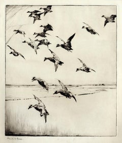
Here They Come !
By Frank W. Benson
Located in New York, NY
This impression of "Here They Come !" is from the fourth state of eight. There are six known impressions of the fourth state. Edition 150 (final state). It is signed in pencil in the lower left and inscribed "D-1". The image size 13 7/8 x 11 3/4" (34.6 x 28.8 cm) and sheet size 16 3/4 x 14 5/8" (42.8 x 37.1 cm). FRANK W. BENSON (1862-1951) Frank Weston Benson, well known for his American impressionist paintings, also produced an incredible body of prints - etchings, drypoints, and a few lithographs. Born and raised on the North Shore of Massachusetts, Benson, a natural outdoorsman, grew up sailing, fishing, and hunting. From a young age, he was fascinated with drawing and birding – this keen interest continued throughout his life. His first art instruction was with Otto Grundman at the Museum of Fine Arts in Boston, and then in 1883 in Paris at the Academie Julian where he studied the rigorous ‘ecole des beaux arts’ approach to drawing and painting for two years. During the early 1880’s Seymour Haden visited Boston giving a series of lectures on etching. This introduction to the European etching...
Category

1920s American Impressionist Abraham Ortelius Landscape Prints

Materials

Drypoint

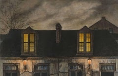
Lafitte's Blacksmith House (a bar named for a pirate on Bourbon St, New Orleans)
By Frederick Mershimer
Located in New Orleans, LA
Lafitte's Blacksmith Shop is a New Orleans landmark at 941 Bourbon St. Like most New Orleans legends, history of Lafitte's Blacksmith Shop is a gumbo of tru...
Category

Early 2000s Contemporary Abraham Ortelius Landscape Prints

Materials

Mezzotint, Aquatint

The West Prospect of the Cathedral of York /// "Britannia Illustrata" Engraving
By Johannes Kip
Located in Saint Augustine, FL
Artist: Johannes "Jan" Kip (Dutch, 1652/3-1722) Title: "The West Prospect of the Cathedral of York" (Vol. 3, Plate 31) Portfolio: Britannia Illustrata / Le Nouveau Théâtre de la Grande Bretagne Year: 1715-1724 (Third edition) Medium: Original Engraving and Etching on cream laid paper Limited edition: Unknown Printer: Joseph Smith, London, UK Publisher: Joseph Smith, London, UK Reference: "London Illustrated 1604-1850" - Adams No. 22; Crace No. 201; Brunet IV No. 114; Lowndes No. 1277; Lewine page 263-264 Sheet size: 19.25" x 24.19" Image size: 16.75" x 22.5" Condition: With centerfold as issued. Some light toning and foxing mainly in margins, and some light edgewear. Has been professionally stored away for decades. It is otherwise a strong impression in very good condition Rare Notes: Provenance: private collection - Ross-on-Wye, UK. Engraved by Dutch artist Johannes "Jan" Kip (1652/3-1722) after a drawing by Dutch artist Leonard Knyff or Leendert Knijff (1650-1722). Comes from Kip's six volume (including Supplement and 'Atlas Anglois') "Britannia Illustrata" / Le Nouveau Théâtre de la Grande Bretagne", (1724-1728) (Third edition), which consists of 394 engravings and etchings. Printed in one color from one copper plate: black. Biography: Johannes "Jan" Kip (1652/53 in Amsterdam - 1722 in Westminster) was a Dutch draftsman, engraver and print dealer. Together with Leonard Knyff, he made a speciality of engraved views of English country houses. Kip was a pupil of Bastiaen Stopendaal (1636–1707), from 1668 to 1670, before setting up on his own; his earliest dated engravings are from 1672. In April 1680, at the age of 27, he married Elisabeth Breda in Amsterdam. After producing works for the court of William of Orange in Amsterdam, Kip followed William and Mary to London and settled in St. John Street in Farringdon, where he conducted a thriving printselling business. He also worked for various London publishers producing engravings after such artists as Francis Barlow (c. 1626–1704) and Caius Gabriel Cibber (1630–1700), largely for book illustrations. He made several engraved plates for Awnsham & John Churchill's "A Collection of Voyages & Travels" (first published 1704). He signed the African scenes in volume V of the 1732 edition as "J. Kip". His most important works were the large fold-out folio illustrations for "Britannia Illustrata", 1708; for the 65 folio plates he engraved for the antiquary Sir Robert Atkyns, "The Ancient and Present State of Glostershire", 1712 (1st edition); and for "Le Nouveau Théâtre de la Grande Bretagne ou description exacte des palais de la Reine, et des Maisons les plus considerables des des Seigneurs & des Gentilshommes de la Grande Bretagne", 1715, an extended reprint in collaboration with other artists. The linked careers of Jan Kip and Leonard Knyff made a specialty of engraved views of English country houses, represented in detail from the bird's-eye view, a pictorial convention for topography. Their major work was "Britannia Illustrata: Or Views of Several of the Queens Palaces, as Also of the Principal seats of the Nobility and Gentry of Great Britain, Curiously Engraven on 80 Copper Plates", London (1707, published in the winter of 1708–9). The volume is among the most important English topographical publications of the 18th century. Architecture is rendered with care, and the settings of parterres and radiating avenues driven through woods or planted across fields, garden paths, gates and toolsheds are illustrated in detail. The images are staffed with figures and horses, coaches pulling into forecourts, water...
Category

1720s Old Masters Abraham Ortelius Landscape Prints

Materials

Laid Paper, Engraving, Etching, Intaglio

Set of Four Engravings from Nash's "History of Worcestershire" /// Landscape Art
By Treadway Russell Nash
Located in Saint Augustine, FL
Artist: Treadway Russell Nash (English, 1724-1811) Title: "A View of Stourbridge", "A View of Upton upon Severn, from Ryal Hill", "Bewdley", and "Tenbury" Portfolio: Collections for the History of Worcestershire Year: 1781-1782 (First edition) Medium: Set of Four Original Engravings on watermarked laid paper Limited edition: Unknown Printer: John Nichols, London, UK Publisher: T. Payne and Son, J. Robson, B. White, Leigh and Sotheby, London, UK; Fletcher, Oxford, UK; and Lewis, Worcester, UK Reference: Upcott III, page 1330 Sheet size (each): approx. 10" x 16.5" Image size (each): approx. 6.88" x 11.75" Condition: A few light handling creases. Have been professionally stored away for decades. They are all strong impressions in excellent condition Notes: Provenance: private collection - Aspen, CO. All four works were engraved by English artist Thomas Sanders (Active: Mid-Late 18th Century) after drawings by himself. Comes from Nash's two volume "Collections for the History of Worcestershire", (1781-1782) (First edition), which consists of 75 engravings. Each work is printed from one copper plate in one color: black. There was a (Second edition) "with Additions" bound in with Volume II of this portfolio published by John White in 1799. And, both the First and Second editions of "Collections for the History of Worcestershire" are based off Thomas Sanders' 1779-1781 "Perspective Views of the Market Towns within the County of Worcester". Both "A View of Stourbridge" and "A View of Upton upon Severn, from Ryal Hill" have unidentified fleur-de-lis watermarks in the center of their sheets. "Bewdley" has an unidentified watermark in the center of its sheet resembling "XV" and "Tenbury" has no watermark. Biography: Treadway Russell Nash (24 June 1724 – 26 January 1811) was an English clergyman, now known as an early historian of Worcestershire and the author of Collections for the History of Worcestershire, an important source document for Worcestershire county histories. He was a fellow of the Society of Antiquaries of London. Treadway Russell Nash was born on 24 June 1724 born at Clerkenleap, in Kempsey, Worcestershire. His family were from Ombersley. They had lands there and at Claines, and had later bought lands in the Reformation around St Peter's, Droitwich. He was related to James Nash and John Nash, both MPs for Worcester. His father Richard, a grandson of Sir Rowland Berkeley, died in 1740, and Richard's eldest son in 1757. As a result, Treadway Russell Nash inherited the Russells' Strensham estates from his brother, as well as the Nash estates, and took both names. He was educated from the age of twelve at King's School, Worcester, and became a scholar at Worcester College, Oxford aged fifteen. In March 1749, he accompanied his brother on a trip to the continent, to aid Richard's health. They visited Paris for about six weeks, before spending the summer "on the banks of the Loire". They then visited "Bourdeaux, Thoulouse, Montpelier, Marseilles, Leghorn, Florence, Rome, Naples, Bologna, Venice, Padua, Verona, Milan, Lyons, and again Paris"; such expeditions are often known as the Grand Tour. On his return in late summer 1751, Nash took up a post as Vicar of Eynsham through his friend and future brother-in-law, John Martin. He also had an income as a tutor at Oxford. He took his Doctor of Divinity degree and left Oxford, having "gone out grand compounder", following the death of his brother. He also left his benefice at Eynsham in 1757. While at Oxford he had proposed a road from there to Witney (now the A40 and B4022), and also stood for Parliament. Nash married Margaret Martin...
Category

1780s Old Masters Abraham Ortelius Landscape Prints

Materials

Laid Paper, Engraving

Carte Particuliere Des Coste De Bretagne qui Comprend Morlaix
By Pierre Mortier
Located in Paonia, CO
Carte Particuliere Des Costes De Bretagne qui Comprend Morlaix, Saint Paul de Leon, les Sept Isles, et L’Isle. Faite par ordre Exprez Du Roy de France is from the collection of ch...
Category

1690s Abraham Ortelius Landscape Prints

Materials

Engraving

Carte Particular Des Costes De Bretagne Depuis le Cap de Frehel, Jusques a Perros
By Pierre Mortier
Located in Paonia, CO
Carte Particulaire Des Costes De Bretagne Depuis Le Cap de Frehel, Jusques a Perros, & L’Isle Tome. This large sea scale chart shows part of the northwestern co...
Category

1690s Abraham Ortelius Landscape Prints

Materials

Engraving

St Peters Church at Rome /// "Vitruvius Britannicus" Architecture Engraving Art
By Colen Campbell
Located in Saint Augustine, FL
Artist: Colen Campbell (Scottish, 1676-1729) Title: "St Peters Church at Rome" (Vol. 1, Plate 6) Portfolio: Vitruvius Britannicus; or The British Architect, Containing the Plans, Ele...
Category

1710s Old Masters Abraham Ortelius Landscape Prints

Materials

Laid Paper, Engraving, Etching, Intaglio

A View at Bolcheretzko (Russia) 1784 Captains Cook Final Voyage by John Webber
By John Webber
Located in Paonia, CO
A View at Bolcheretzko (Russia) is from the 1784 First Edition Atlas Accompanying Capt. James Cook and King; Third and Final Voyage of Captain James Cook.John Webber (1752-1793) was ...
Category

1780s Realist Abraham Ortelius Landscape Prints

Materials

Engraving

LITHOGRAPHS Greenwich Village NYC, Signed Mezzotint, Art Gallery, Photorealism
By John Baeder
Located in Union City, NJ
LITHOGRAPHS Greenwich Village NYC by the American photorealist artist John Baeder is a limited edition mezzotint printed using hand printmaking techniques on archival, cream colored ...
Category

1970s Photorealist Abraham Ortelius Landscape Prints

Materials

Mezzotint

Restaurant in Mott Street
By Charles Frederick William Mielatz
Located in New Orleans, LA
The image depicts a restaurant on New York's Mott Street with ornamental iron work on the balconies. There are six figures in the scene in various stages of contrast. Mott Street is considered the unofficial Main Street of New York's Chinatown. Ella Fitzgerald sang it best: “And tell me what street compares with Mott Street in July? Sweet pushcarts gently gliding by.” CFW Mielatz was an early influence on the drypoints and etchings of Martin Lewis. This piece was created in 1906 and it is signed in pencil. It is part of the collection of New York's Metropolitan Museum of Art C.F.W. Mielatz American, 1860-1919 Born in Bredding, Germany in 1864, Mielatz emigrated to the United States as a young boy and studied at the Chicago School of Design. Mostly self-taught, his first prints were large New England landscapes reminiscent of the painter-etcher school of American Art. Around 1890 he started to produce prints of New York City and by the time of his death, the number totaled over ninety images. He was a master technician in the field of etching, reworking many of his plates to get the exact feeling he was seeking. Mielatz was a member of the New York Etching...
Category

Early 20th Century American Modern Abraham Ortelius Landscape Prints

Materials

Drypoint, Etching

Plan of the Park, Garden and Plantations of Goodwood, 18th century engraving
By Colen Campbell
Located in Melbourne, Victoria
Plan of the Park, Garden and Plantations of Goodwood in Sussex the Seat of his Grace the Duke of Richmond and Lenox &c Copper-line engraving with later hand-colouring by Hendrik Hul...
Category

18th Century English School Abraham Ortelius Landscape Prints

Materials

Engraving

Column of Antoninus Pius, Rome Italy. Jacobs Lauro 17th century engraving
Located in Melbourne, Victoria
Lauro produced a series of engravings of the ancient monuments of Classical Rome with detailed descriptions in Latin below. 180mm by 240mm (plate mark)...
Category

Early 17th Century Old Masters Abraham Ortelius Landscape Prints

Materials

Engraving, Etching

Previously Available Items
Aegypti Map - Original Etching by Abraham Ortelius - 1584
By Abraham Ortelius
Located in Roma, IT
Aegypti Map (Map of Egypt) is an original Artwork realized in 1584 by Abraham Ortelius (also Ortels, Orthellius, Wortels; Antwerp, 4 or 14 April 1527 – Antwerp, 28 June 1598). Origi...
Category

16th Century Old Masters Abraham Ortelius Landscape Prints

Materials

Watercolor, Etching

HOLY LAND Original Engraved Map
By Abraham Ortelius
Located in Santa Monica, CA
ABRAHAM ORTELIUS (1527 – 1598) ABRAHAMI PATRIAR:CHAE PEREGRINATIO, ET VITA. - 1608-12 Abrahamo Ortelio Antverpiano auctore (Van den Broecke 183 1608/1612Iv) ...
Category

16th Century Old Masters Abraham Ortelius Landscape Prints

Materials

Engraving

TYPUS ORBIS TERRARUM
By Abraham Ortelius
Located in Santa Monica, CA
ABRAHAM ORTELIUS (1527 – 1598) TYPUS ORBIS TERRARUM 1570-5 (Shirley 122: Van Den Beck 1.2) First plate of 3 as published in 1575 - showing repairs to the crac...
Category

16th Century Old Masters Abraham Ortelius Landscape Prints

Materials

Engraving

Abraham Ortelius landscape prints for sale on 1stDibs.

Find a wide variety of authentic Abraham Ortelius landscape prints available for sale on 1stDibs. You can also browse by medium to find art by Abraham Ortelius in engraving and more. Much of the original work by this artist or collective was created during the 18th century and earlier and is mostly associated with the Old Masters style. Not every interior allows for large Abraham Ortelius landscape prints, so small editions measuring 20 inches across are available. Customers who are interested in this artist might also find the work of Frans Hogenberg, Gerard Mercator, and Giovanni Battista Piranesi. Abraham Ortelius landscape prints prices can differ depending upon medium, time period and other attributes. On 1stDibs, the price for these items starts at $1,580 and tops out at $4,500, while the average work can sell for $3,040.

Recently Viewed

View All