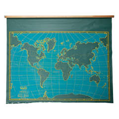
Denoyer-Geppert Maps
to
1
1
1
1
1
1
1
1
1
1
1
1
3
104
63
29
24
Creator: Denoyer-Geppert
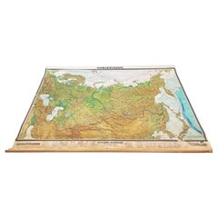
Massive Vintage Wall Map of the Soviet Union 'Sowjetunion' by Karl Wenschow
By Denoyer-Geppert
Located in San Diego, CA
A massive vintage wall map of the Soviet Union (Sowjetunion) published by Karl Wenschow in Munich, Germany, circa 1950s. The map was distributed by De...
Category
Mid-20th Century American Denoyer-Geppert Maps
Materials
Paper, Wood
Related Items
Vintage Map of the Greater Antilles and Lesser Antilles
Located in Langweer, NL
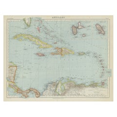
Vintage map titled 'Antilles'. Original map of the Antilles. Shows the Cayman Islands, Cuba, Hispaniola (subdivided into the nations of the Dominican Republic and Haiti), Jamaica, and Puerto Rico. Also shows the Lesser Antilles...
Category
20th Century Denoyer-Geppert Maps
Materials
Paper
Antique Map of Tartary, Also Showing the Great Wall of China
Located in Langweer, NL
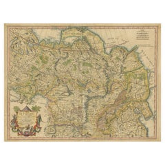
Antique map titled 'Carte de Tartarie'. Detailed map of Tartary, consisting of the Eastern part of Russia, Central Asia, China and Korea, first published by Guillaume De L'Isle in 1706. The map extends from the Peninsula of Korea in the east to the Caspian and Black Seas. The Great Wall of China...
Category
Early 18th Century Antique Denoyer-Geppert Maps
Materials
Paper
Large Original Vintage Map of The World, circa 1920
Located in St Annes, Lancashire
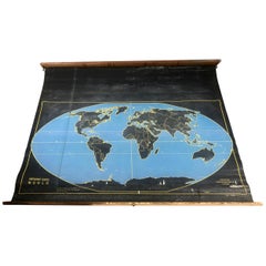
Great map of The World
Original color.
Good condition / minor foxing
Published by Alexander Gross
Unframed.
Category
1920s English Vintage Denoyer-Geppert Maps
Materials
Paper
A Day in the Life of the Soviet Union Book by David Elliot Cohen Hardcover Book
Located in North Hollywood, CA
A Day in the Life of the Soviet Union Book by David Elliot Cohen.
More than three hundred photographs visually survey the diversity of Russian landscapes and cityscapes and depict r...
Category
20th Century Asian Balkan Denoyer-Geppert Maps
Materials
Paper
H 14.5 in W 10 in D 1 in
1842 Wall Map of the United States by J. H. Young, Published by S. A. Mitchell
Located in Colorado Springs, CO
Presented is an 1842 hanging “Map of the United States,” engraved by J. H. Young and published by Samuel Augustus Mitchell, Philadelphia. This is a beautiful example of the rare 1842...
Category
1840s American Antique Denoyer-Geppert Maps
Materials
Paper
H 45 in W 38 in D 1 in
Colored wall map of the WORLD
By Chambon
Located in ZWIJNDRECHT, NL
“Mappe Monde, contenant les Parties Connues du Globe Terrestre”
CHAMBON, Gobert-Denis (France, 17.. - 1781)
Paris, Longchamps et Janvier, 1754
Size H. 115 x W. 145 cm.
Gobert-Denis Chambon made copper engraving after the work of Guillaume De L’Isle, published in 1754 by Jean Janvier and S.G. Longschamps.
A huge wall map of the world in two hemispheres printed on two sheets, depicting the Eastern and Western hemispheres supported by two male figures, decorated at the bottom right and left with two celestial hemispheres (boreal and southern) and at the bottom in the middle with an armillary sphere, in addition.
This map is most notable for its depiction of the Sea of Japan labeled "Mer de Corée" and of "Mer de L'Ouest" or Sea of the West - a great sea, easily the size of the Mediterranean, to flow from the then-known Strait of Juan de Fuca...
Category
Mid-18th Century French French Provincial Antique Denoyer-Geppert Maps
Materials
Wood, Paper
Antique Map of the Basin of the Mediterranean by Johnston '1909'
Located in Langweer, NL
Antique map titled 'Basin of the Mediterranean'. Original antique map of the basin of the Mediterranean. With inset maps of the Strait of Gibraltar, Morocco, Maltese Islands, Valetta...
Category
Early 20th Century Denoyer-Geppert Maps
Materials
Paper
Antique Map of the Islands of the Atlantic by J. Tallis
Located in Langweer, NL
A highly decorative and detailed mid-19th century map of the Islands of the Atlantic -- including the Azores, Madeira, Bermuda, the Canary Islands and the Cape Verde Islands -- which...
Category
Mid-19th Century Antique Denoyer-Geppert Maps
Materials
Paper
Antique Map of the Antilles by Lapie, '1842'
Located in Langweer, NL
Antique map titled 'Carte des Antilles du Golfe du Méxique'. Map of the Antilles. This map originates from 'Atlas universel de géographie ancienne et moderne (..)' by Pierre M. Lapie...
Category
Mid-19th Century Antique Denoyer-Geppert Maps
Materials
Paper
Antique Map of the Netherlands by Brugsma, c.1870
Located in Langweer, NL
Antique map titled 'Het Koningrijk der Nederlanden'. Map of the Netherlands. This map originates from 'F. C. Brugsma's Atlas van het Koninkrijk der Nederlanden (..)'.
Artists and...
Category
19th Century Antique Denoyer-Geppert Maps
Materials
Paper
Antique Map of the World by Johnson, '1872'
Located in Langweer, NL
Antique map titled 'Johnson's World. Original world map. This map originates from 'Johnson's New Illustrated Family Atlas of the World' by A.J. John...
Category
Late 19th Century Antique Denoyer-Geppert Maps
Materials
Paper
Vintage Soviet Book: 'Erotic of the East' and Soviet Erotic Horoscope, 1J53
Located in Bordeaux, FR
Delve into the fascinating world of human sexuality with this vintage book from the Soviet era. Titled "Erotic of the East," written by Nick Douglas and Renni Slinger, this book offe...
Category
1990s Denoyer-Geppert Maps
Materials
Paper
H 0.12 in W 5.52 in D 8.27 in
Previously Available Items
1920s Double Sided Cartocraft Slated School Map, U.S.A. & World Denoyer Geppert
By Denoyer-Geppert
Located in Buffalo, NY
1920s Double Sided Cartocraft Slated School Map, One side depecting the United States, other side depecting the World, Made by Denoyer Geppert ,Pull down retractable, Slated material...
Category
1920s American Industrial Vintage Denoyer-Geppert Maps
Materials
Canvas, Wood
H 62 in W 68 in D 1 in
Vintage Roll Up Map by Denoyer Geppart
By Denoyer-Geppert
Located in New York, NY
Vintage canvas roll up map by Denoyer Geppart. USA, circa 1950. Two-sided, with the world map on one side, and the U.S.A on the second side. Includes origina...
Category
1950s American Mid-Century Modern Vintage Denoyer-Geppert Maps
Materials
Wood
Denoyer Geographical Terms School Wall Map
By Denoyer-Geppert
Located in San Mateo, CA
Large wall map by Denoyer that illustrates geographical terms. This is a pull down map of the type used in schools.
Category
1950s American Schoolhouse Vintage Denoyer-Geppert Maps
Materials
Metal
Denoyer-geppert maps for sale on 1stDibs.
Denoyer-Geppert maps are available for sale on 1stDibs. These distinctive items are frequently made of wood and are designed with extraordinary care. If you’re looking for additional options, many customers also consider maps by and Rand McNally & Co.. Prices for Denoyer-Geppert maps can differ depending upon size, time period and other attributes — on 1stDibs, these items begin at $675 and can go as high as $675, while a piece like these, on average, fetch $675.
