Johannes Bleau Wall Decorations
to
1
1
Height
to
Width
to
1
1
1
1
1
1
1
1
435
301
286
282
Creator: Johannes Bleau
Johannes Bleau C 1654 Engraved Map of Levinia Vice Comitatus Province of Lennox
By Johannes Bleau
Located in Los Angeles, CA
Artist: Johannes Bleau
Age: 1650 - 1700
Medium: Print on Paper
Unframed Dimensions: 19 1/2" x 23"
Overall Dimensions:
TITLE: Circa 1654 Map of Levinia Vice Comitatus the Provin...
Category
Mid-17th Century Austrian Antique Johannes Bleau Wall Decorations
Materials
Paper
Related Items
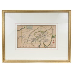
Antique 18th Century Map of the Province of Pensilvania 'Pennsylvania State'
Located in Philadelphia, PA
A fine antique of the colony of Pennsylvania.
Noted at the top of the sheet as a 'Map of the province of Pensilvania'.
This undated and anonymous map is thought to be from the Gentleman's Magazine, London, circa 1775, although the general appearance could date it to the 1760's.
The southern boundary reflects the Mason-Dixon survey (1768), the western boundary is placed just west of Pittsburgh, and the northern boundary is not marked.
The map has a number of reference points that likely refer to companion text and appear to be connected to boundaries. The western and southern boundaries are marked Q, R, S, for example. A diagonal line runs from the Susquehanna R to the Lake Erie P. A broken line marked by many letters A, B, N, O, etc., appears in the east.
There are no latitude or longitude markings, blank verso.
Framed in a shaped contemporary gilt wooden frame and matted under a cream colored matte.
Bearing an old Graham Arader Gallery...
Category
18th Century British American Colonial Antique Johannes Bleau Wall Decorations
Materials
Paper
$1,250
H 10.25 in W 13.25 in D 0.5 in
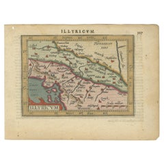
Antique Miniature Map of the Roman Province of Illyricum 'Dalmatia', 1612
By Abraham Ortelius
Located in Langweer, NL
Antique miniature map titled 'Illyricum'. Original small map of Illyricum. The Roman province of Illyricum stretched from the Drilon River (the Drin, in...
Category
Early 17th Century Belgian Antique Johannes Bleau Wall Decorations
Materials
Paper
$402
H 4.97 in W 6.62 in D 0.02 in
Antique Map of the Province Groningen in The Netherlands, c.1680
Located in Langweer, NL
Antique map titled 'Groningae et Omlandiae Dominium vulgo de Provincie van Stadt en Lande'.
Old map of the province of Groningen, the Netherlands. This map originates from 'Germani...
Category
17th Century Antique Johannes Bleau Wall Decorations
Materials
Paper
$464 Sale Price
20% Off
H 20.48 in W 24.61 in D 0 in
Antique Map of the Province of Canada 'East' by A.K. Johnston, 1865
Located in Langweer, NL
Antique map titled 'Province of Canada (Eastern Sheet)'. Depicting New Brunswick, Newfoundland, Cape Breton Island, Prince Edward Island, Nova Scotia and m...
Category
Mid-19th Century Antique Johannes Bleau Wall Decorations
Materials
Paper
$246 Sale Price
20% Off
H 19.1 in W 24.41 in D 0.02 in
Original Antique Map of the Province of Utrecht, the Netherlands, ca.1720
Located in Langweer, NL
Antique map titled ‘Tabula Nova Provinciae Ultrajectinae (..)’.
Original antique map of the province of Utrecht, the Netherlands. It shows the region of Amsterdam, Utrecht, Gouda, ...
Category
1720s Antique Johannes Bleau Wall Decorations
Materials
Paper
$749 Sale Price
20% Off
H 20.48 in W 35.44 in D 0 in
Antique Map of the Province of Zeeland, The Netherlands by Coronelli, 1692
Located in Langweer, NL
Antique map titled 'Contado di Zelanda'. Beautiful map of the Dutch province of Zeeland. With the islands of Walcheren, Schouwen-Duiveland, Noord-Beveland, Zuid-Beveland, Tholen and ...
Category
17th Century Antique Johannes Bleau Wall Decorations
Materials
Paper
$635 Sale Price
20% Off
H 18.9 in W 26.78 in D 0 in
Antique Map of Drenthe, Province of the Netherlands, C.1870
Located in Langweer, NL
Antique map titled 'De Provincie Drenthe'. Map of the province of Drenthe, the Netherlands. This map originates from 'F. C. Brugsma's Atlas van het Koninkrijk der Nederlanden (..)'. ...
Category
19th Century Antique Johannes Bleau Wall Decorations
Materials
Paper
Antique Map of Cities of the Province of Shanxi in China, 1749
By Jacques-Nicolas Bellin
Located in Langweer, NL
Antique print titled: 'Lan-Tcheou ou Lan-Chew dan la province Chensi; Can Tcheou ou Kan-Chew dan la province de Chensi; Tchin-Ywe-Fou ou Chin-Ywen-Fu dans la province de Koei-Tcheou ...
Category
18th Century Antique Johannes Bleau Wall Decorations
Materials
Paper
$237 Sale Price
20% Off
H 10.44 in W 15.75 in D 0 in
Steel Engraved Map of Ancient Britain
Located in Langweer, NL
Antique map titled 'Angleterre Ancienne'. Original old map of Ancient Britain. Source unknown, to be determined. Published circa 1880.
Category
Late 19th Century Antique Johannes Bleau Wall Decorations
Materials
Paper
Steel Engraved Antique Map of England
Located in Langweer, NL
Antique map titled 'Angleterre'. Original antique map of England. Engraved by Th. Duvotenay. Originates from 'Complement de L'Encyclopedie Mode...
Category
Late 19th Century Antique Johannes Bleau Wall Decorations
Materials
Paper
Steel Engraved Map of the United States with Inset Map of Florida
Located in Langweer, NL
Antique map titled 'United States'. Steel engraved map of the United States. With small inset map of the continuation of Florida. Source unknown, to be determined. Published circa 1843.
Category
Mid-19th Century Antique Johannes Bleau Wall Decorations
Materials
Paper
$151 Sale Price
20% Off
H 8.15 in W 10.44 in D 0.02 in
Antique Map of the Province Limburg, The Netherlands, 1864
Located in Langweer, NL
Antique map titled 'De Provincie Limburg'. Map of the province of Limburg, the Netherlands. This map originates from 'F. C. Brugsma's Atlas van het Koninkrijk der Nederlanden (..)'. ...
Category
19th Century Antique Johannes Bleau Wall Decorations
Materials
Paper
$123 Sale Price
20% Off
H 10.04 in W 12.01 in D 0 in
Johannes Bleau wall decorations for sale on 1stDibs.
Johannes Bleau wall decorations are available for sale on 1stDibs. These distinctive items are frequently made of paper and are designed with extraordinary care. If you’re looking for additional options, many customers also consider wall decorations by Hundertwasser, Ernst Fuchs, and Walter Bosse. Prices for Johannes Bleau wall decorations can differ depending upon size, time period and other attributes — on 1stDibs, these items begin at $2,850 and can go as high as $2,850, while a piece like these, on average, fetch $2,850.


