John Webber Landscape Prints
to
9
2
8
1
1
6
2
Overall Height
to
Overall Width
to
9
5
5
4
3
2
2
2
2
1
1
1
8
1
8
18
139
132
128
113
9
Artist: John Webber
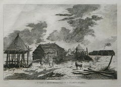
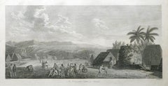
A View at Bolcheretzko (Russia) 1784 Captains Cook Final Voyage by John Webber
By John Webber
Located in Paonia, CO
A View at Bolcheretzko (Russia) is from the 1784 First Edition Atlas Accompanying Capt. James Cook and King; Third and Final Voyage of Captain James Cook.John Webber (1752-1793) was ...
Category
1780s Realist John Webber Landscape Prints
Materials
Engraving
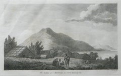
The Inside of a Hippah in New Zealand from Captain Cooks Travels
By John Webber
Located in Paonia, CO
The Inside of a Hippah in New Zealand is from the 1784 First Edition Atlas Accompanying Capt. James Cook and King; Third and Final Voyage of Captain James Cook John...
Category
1780s Realist John Webber Landscape Prints
Materials
Engraving
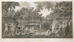
A Human Sacrifice, in a Morai, in Otaheite (Tahiti) 1784 James Cook Final Voyage
By John Webber
Located in Paonia, CO
A Human Sacrifice in a Morai in Otaheite (Tahiti) 1784 by John Webber is from the First Edition Atlas Accompanying Capt. James Cook and King; Third and Final Voyage of Captain...
Category
1780s Realist John Webber Landscape Prints
Materials
Engraving
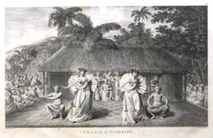
A Dance in Otaheite (Tahiti) 1784 James Cook Final Voyage by John Webber
By John Webber
Located in Paonia, CO
A Dance in Otaheite ( Tahiti ) is from the 1784 First Edition Atlas Accompanying Capt. James Cook and King; Third and Final Voyage of Captain James Cook. John Webber (1752-1793) who...
Category
1780s Realist John Webber Landscape Prints
Materials
Engraving
An Inland View; in Atooi ( Hawaii ) 1784 Captain Cook engraving by John Webber
By John Webber
Located in Paonia, CO
An Inland View in Atooi ( Hawaii ) is from the 1784 First Edition Atlas Accompanying Capt. James Cook and King; Third and Final Voyage of Captain James Cook. This engraving depicts ...
Category
1780s Realist John Webber Landscape Prints
Materials
Engraving
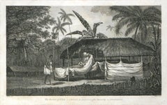
The Body of Tee, a Chief, as preferred after Death, in Otaheite (Tahiti)
By John Webber
Located in Paonia, CO
The Body of Tee a chief as preferred after Death in Otaheite (Tahiti) is from the 1784 First Edition Atlas Accompanying Capt. James Cook and King; Third and Final Voyage of Capt...
Category
1870s Realist John Webber Landscape Prints
Materials
Engraving
"Canoe of the Sandwich Islands" (Hawaii), Engraving of Captain Cook's 3rd Voyage
By John Webber
Located in Alamo, CA
"A Canoe of the Sandwich Islands, the Rowers Masked" is an engraving created by Charles Grignion, from a drawing by John Webber (1752-1793), who was the artist on Captain James Cook's 3rd and final voyage of discovery. It is Plate 65 in the atlas of "A Voyage to the Pacific Ocean Undertaken by the Command of His Majesty, for Making Discoveries in the Northern Hemisphere", the official British Admirality sanctioned journal published upon completion of the voyage in London in 1784 by Strahan & Cadell.
This famous image of ten Hawaiian rowers transporting a priest who is carrying a feather-covered image of Kukailimoku, the Hawaiian god of war. The priests and paddlers are all wearing gourd masks in their double-hulled canoe with an upright lateen woven sail. Each hull was shaped from a single large Koa log harvested from island rainforests, where they were carved before being transported to the coast.
This engraving is presented in a Koa wood frame and a white mat. There are occasional faint spots, but the print is otherwise in very good condition. Koa is the same wood as was used to make the canoe. Koa wood is legendary in Hawaii. Not only is this amazing wood native to Hawaii, but it is known for the deep rich colors and varied grain pattern. Koa has an honored heritage in Hawaii and is highly revered and sacred. The word “koa” means “warrior” in Hawaiian. The warriors of King Kamehameha the Great, created canoes and weapons from a wood plentiful on the Big Island of Hawaii. This wood became synonymous with the warriors themselves, and it became known as koa. The frame measures 20.75" high, 26.75" wide and 0.88" deep.
There are three other engravings listed from the official journal of Captain Cook's 3rd voyage available that are presented in identical Koa wood frames and mat (LU117324682022, LU117324684052, LU117324684062). They would make a wonderful grouping for a display of 2, 3 or 4 prints. A discount is available for a grouping depending on the number of items included.
Hawaii was discovered by Captain Cook (1728-1779) during this voyage. Hawaii was originally called The Sandwich Islands in honor of The Earl of Sandwich...
Category
1780s John Webber Landscape Prints
Materials
Engraving
"A Dance in Otaheite" (Tahiti), Engraving from Captain Cook's 3rd Voyage
By John Webber
Located in Alamo, CA
"A Dance in Otaheite" (Tahiti) is an engraving created by William Sharp (1749-1824), from a drawing by John Webber (1752-1793), who was the artist on Captain James Cook's 3rd and final voyage of discovery. It is a plate in the atlas of "A Voyage to the Pacific Ocean Undertaken by the Command of His Majesty, for Making Discoveries in the Northern Hemisphere", the official British Admirality sanctioned journal published upon completion of the voyage in London in 1784 by Strahan & Cadell.
Two women and two men wearing ceremonial costumes, performing a dance outdoors standing on a mat. Three men are playing the drums in the background, in front of a thatched roof building. An audience of men are sitting on both sides of the stage. By the time Webber arrived in Tahiti, 'south sea' imagery had become familiar. Webber gave concentrated attention to dance. He had the opportunity to distinguish the Tahitian dance from the more formalized dancing of Tonga. Whereas they seem to have called to mind the more formal dances of antiquity, the Tahitian dancing aroused memories of peasant and folk dancing.
This engraving is professionally framed in Koa wood. Koa wood is legendary in Hawaii. Not only is this amazing wood native to Hawaii, but it is known for the deep rich colors and varied grain pattern. Koa has an honored heritage in Hawaii and is highly revered and sacred. The word “koa” means “warrior” in Hawaiian. The warriors of King Kamehameha the Great, created canoes and weapons from a wood plentiful on the Big Island of Hawaii. This wood became synonymous with the warriors themselves, and it became known as koa.
There are three other engravings listed from the official journal of Captain Cook's 3rd voyage available that are presented in identical Koa wood frames and double mats (LU117324682432, LU117324684052, LU117324684062). They would make a wonderful grouping for a display of 2, 3 or 4 prints. A discount is available for a grouping depending on the number of items included.
Hawaii was discovered by Captain Cook during this voyage. Hawaii was originally called The Sandwich Islands in honor of The Earl of Sandwich...
Category
1780s Realist John Webber Landscape Prints
Materials
Engraving
A Group of Four 18th Century Engravings from Captain Cook's 3rd Voyage Journal
By John Webber
Located in Alamo, CA
A grouping of four framed engravings from the atlas of the official British Admirality sanctioned journal of Captain Cook's 3rd Voyage entitled "A Voyage to the Pacific Ocean Undertaken by the Command of His Majesty, for Making Discoveries in the Northern Hemisphere", published upon completion of the voyage in London in 1784 by Strahan & Cadell. These engravings were made from drawings by John Webber (1752-1793), who was the artist on Captain James Cook's 3rd and final voyage of discovery. The set of engravings includes: "A Canoe of the Sandwich Islands, the Rowers Masked", Plate 65 in the atlas; "A Dance in Otaheite" (Tahiti), Plate 28; "King of the Friendly Islands" (Tonga), plate 20; "Inside of a House in Nootka Sound" (Canada), plate 42.
These engravings are professionally framed in Koa wood, the same wood as was used to make the canoes of the ancient Hawaiians. Koa wood is legendary in Hawaii. Not only is this amazing wood native to Hawaii, but it is known for the deep rich colors and varied grain pattern. Koa has an honored heritage in Hawaii and is highly revered and sacred. The word “koa” means “warrior” in Hawaiian. The warriors of King Kamehameha the Great, created canoes and weapons from a wood plentiful on the Big Island of Hawaii. This wood became synonymous with the warriors themselves, and it became known as koa.
These four engravings would make a wonderful grouping for a display of 2, 3 or 4 prints. They may be purchased separately or in groups on 1stDibs. Their listing Reference #'s are: LU117324682432, LU117324682022, LU117324684052 and LU117324684062. A discount is available for a grouping depending on the number of items included.
Hawaii was discovered by Captain Cook (1728-1779) during this voyage. Hawaii was originally called The Sandwich Islands in honor of The Earl of Sandwich...
Category
1780s Other Art Style John Webber Landscape Prints
Materials
Engraving
Related Items
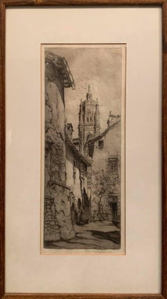
Black and White Etching -- Rodez
By John Taylor Arms
Located in Troy, NY
This detailed etching depicts Notre Dame in France. The foreground shows an alleyway, with cracking and peeling buildings, plants climbing the walls, and a shifting stone road. Each ...
Category
1920s Realist John Webber Landscape Prints
Materials
Etching, Paper
Three 19th C. Hand Colored Engravings of London Architecture by T. Shepherd
By Thomas Hosmer Shepherd
Located in Alamo, CA
A set of three hand-colored engravings from "Metropolitan Improvements; or London in the Nineteenth Century", published in London, England in 1828. The scenes were drawn by Thomas Ho...
Category
1820s Realist John Webber Landscape Prints
Materials
Engraving
H 12.5 in W 13.75 in D 0.63 in
David Roberts' 19th Century Hand Colored Lithograph, St. Jean D'Acre
By David Roberts
Located in Alamo, CA
"St. Jean D'Acre" is a 19th century folio sized hand-colored lithograph from the "The Holy Land, Syria, Idumea, Arabia, Egypt and Nubia" volume of David Roberts’ large folio edition,...
Category
1840s Realist John Webber Landscape Prints
Materials
Lithograph
H 24.25 in W 32 in D 1.25 in
Five Framed Views of Egypt & Petra: Original 19th C. Lithographs by D. Roberts
By David Roberts
Located in Alamo, CA
This is a set of five framed original 19th century duo-tone lithographs by David Roberts, from his Egypt, The Holy Land and Nubia volumes of the quarto edition, published in London b...
Category
Mid-19th Century Realist John Webber Landscape Prints
Materials
Lithograph
H 16 in W 12.25 in D 0.75 in
The Fighting Temeraire: A Framed 19th C. Engraving After J. M. W. Turner
By J.M.W. Turner
Located in Alamo, CA
This beautiful 19th century framed engraving "The Fighting Temeraire" by James Tibbetts Willmore is based on an original painting by the renowned British artist J.M.W. Turner. It was published by James S. Virtue & Co. in London between 1859-1875. It depicts the once mighty British warship the HMS Temeraire being towed away down the river Thames by a much smaller steamboat to a ship-breaking yard to be broken up for scrap. The Temeraire was first launched in 1798 and represented the pinnacle of British ship-building. 180-feet long, constructed of English oak and armed with 98 guns, she was one of the largest warships of the period. The Temeraire became a symbol of British pride and military power that endured throughout the 19th century. The man-of-war served during the French Revolutionary and Napoleonic Wars and was among the last serving ships to have been at the Battle of Trafalgar in 1805. It became one of the many older ships put out of service in the 1830s and 1840s. The once mighty and feared ship symbolizes a once magnificent, but now obsolete, technology. Turner seems to lament her inglorious final journey, being towed by a less magnificent, but modern steam powered tugboat.
The Turner painting was created in 1838 and is now held in the National Gallery in London. Willmore's engraving, created in 1859, captures the dramatic scene with great detail and skill. The image has become an iconic representation of the decline of Britain's naval power and the transition from sail to steam in the 19th century. The sunset in the background is symbolic of the sun going down on British naval power and tradition. The painting conveys profound and diverse themes that are central to the human experience: those of mortality and change, technology and progress, heroism and brutality. The painting demonstrates Turner’s skill as an artist. His ability to produce scenes of great beauty that are dramatic, but are also symbolic, stimulating both thoughtful analysis, as well as emotion. Turner's painting was voted by the British public in a 2005 BBC radio sponsored survey to be the British people's favorite painting of all time. In 2020 it was included on a new British banknote...
Category
Mid-19th Century Romantic John Webber Landscape Prints
Materials
Engraving
H 18 in W 20.5 in D 1 in
View of Emden, Germany: A 16th Century Hand-colored Map by Braun & Hogenberg
By Franz Hogenberg
Located in Alamo, CA
This is a 16th century original hand-colored copperplate engraved map of a bird's-eye View of Embden, Germany entitled " Emuda, vulgo Embden vrbs Frisia orientalis primaria" by Georg Braun & Franz Hogenberg, in volume II of their famous city atlas "Civitates Orbis Terrarum", published in Cologne, Germany in 1575.
This is a beautifully colored and detailed map of Emden, a seaport in northwestern Germany, along the Ems River and perhaps portions of over Dollart Bay, near the border with the Netherland. The map depicts a bird's-eye view of the city from the southwest, as well as a view of the harbor and an extensive system of canals. Numerous ships of various sizes, as well as two rowboats containing numerous occupants are seen in the main waterway in the foreground and additional boats line two canals in the center of the city. Two men and two women are shown on a hill in the foreground on the right, dressed in the 16th century style of nobility. Two ornate crests are included in each corner. A title strap-work cartouche is in the upper center with the title in Latin. The crest on the right including Engelke up de Muer (The Little Angel on the Wall) was granted by Emperor Maximilian I in 1495.
This is an English translation of an excerpt of Braun's description of Embden: "In Emden, the capital of East Frisia, rich merchants live in very fine houses. The city has a broad and well-situated harbour, which in my opinion is unique in Holland. Frisia and the whole of the Netherlands, for the ships can anchor here right under the city walls. They have also extended the harbour as far as the New Town, so that up to 400 ships can now find shelter here when the sea is rough."
The emphasis on the harbor and waterways within the city highlights the importance of Emden's place as a seaport at this time. Embden developed from a Dutch/Flemish trading settlement in the 7th-8th centuries into a city as late as late 14th century. In 1494 it was granted staple rights, and in 1536 the harbour was extended. In the mid-16th century Emden's port was thought to have the most ships in Europe. Its population then was about 5,000, rising to 15,000 by the end of the 16th century. The Ems River flowed directly under the city walls, but its course was changed in the 17th century by the construction of a canal. Emden has canals within its city limits, a typical feature of Dutch towns, which also enabled the extension of the harbor. In 1744 Emden was annexed by Prussia and is now part of Germany. It was captured by French forces in 1757 during the Seven Years' War, but recaptured by Anglo-German forces in 1758. During the Napoleonic French era, Emden and the surrounding lands of East Frisia were part of the short-lived Kingdom of Holland.
References:Van der Krogt 4, 1230, State 2; Taschen, Braun and Hogenberg...
Category
16th Century Old Masters John Webber Landscape Prints
Materials
Engraving
St. Michael's Mount, Cornwall: A Framed 19th C. Engraving After Myles Foster
By Myles Birket Foster
Located in Alamo, CA
This beautiful 19th century framed hand-colored engraving is entitled "St. Michael's Mount, Cornwall" by J. Saddler after an original painting by the British artist Myles Birket Fost...
Category
Mid-19th Century Romantic John Webber Landscape Prints
Materials
Engraving
H 14.38 in W 17.88 in D 1.5 in
Ulysses Deriding Polyphemus: A Framed 19th C. Engraving After J. M. W. Turner
By J.M.W. Turner
Located in Alamo, CA
This beautiful 19th century framed hand-colored engraving/etching entitled "Ullyses Deriding Polyphemus" by Edward Goodall is based on an original 1829 painting by the renowned Briti...
Category
Mid-19th Century Romantic John Webber Landscape Prints
Materials
Engraving, Etching
H 13.88 in W 17.25 in D 1.5 in
View of Pisaro, Italy: A 16th Century Hand-colored Map by Braun & Hogenberg
By Franz Hogenberg
Located in Alamo, CA
This is a 16th century original hand-colored copperplate engraved map of View of Pezaro (Pisaro), Italy entitled "Pisaurum vulgo Pezaro" by Georg Braun & Franz Hogenberg, from their famous city atlas "Civitates Orbis Terrarum", published in Augsberg, Germany in 1575.
The map depicts a view of Pesaro, Italy from the west looking over the town to the Adriatic Sea. The River Foglia flows into the Adriatic in the foreground. The only identifiable building is the cathedral of San Domenico, which rises above the other roofs with its tall spire. Two women, dressed in styles of the 16th century are in conversation on a hill in the foreground on the left. Pesaro is in the province of Pesaro and Urbino and lies on the Adriatic and east of Florence. The city, which was founded by the Etruscans and named Pisaurum by the Romans, belonged from AD 754 onwards to the Papal States, and after 1285 was controlled by the princely families of Malatesta, Sforza and della Rovere. Today it is the capital of the province of Pesaro and Urbino and has a population of about 92,000. Pesaro's most famous resident, composer Gioacchino Rossini, was born here in 1792.
The following is an English translation of an excerpt from Braun's description of the city: "We believe that the astonishingly short life of the inhabitants of Pesaro comes not only from the insalubrious air, but also from the great quantity of delectable and delicious fruits which they consume to excess. For this causes the production in their bodies of evil humours, which then lead to incurably fatal diseases. The area around the city is most charming and well planted with vineyards, fig trees, olive trees and other fruit-bearing trees."
References: Van der Krogt 4, 3369, state 1; Taschen, Braun and Hogenberg...
Category
16th Century Old Masters John Webber Landscape Prints
Materials
Engraving
A View of Scarborough, England: A Framed 19th C. Engraving After J. M. W. Turner
By J.M.W. Turner
Located in Alamo, CA
This beautiful 19th century framed engraving "Scarborough" by W. Chapman is based on an original painting by the renowned British artist J.M.W. Turner. It was published in London by ...
Category
Mid-19th Century Romantic John Webber Landscape Prints
Materials
Engraving
H 18.25 in W 20.88 in D 1 in
The Citadel of Cairo: 19th C. Hand-colored Roberts Lithograph
By David Roberts
Located in Alamo, CA
This is an original 19th century hand-colored lithograph entitled "Petra, Shewing the Upper or Eastern End of the Valley" by David Roberts, from his Egypt, The Holy Land and Nubia volumes of the large folio edition, published in London by F. G. Moon in 1849. The lithographs were prepared by Louis Haghe (1806-1885) from drawings and paintings by Roberts. The resultant large folio editions of 'The Holy Land' and 'Egypt & Nubia' are considered the greatest lithographically illustrated works issued in the 19th century.
This is one of Roberts' most famous and collectible works. The scene captures a view of the magnificent ruins of Petra in what is Jordan today, as it appeared on March 8, 1839, on the day of Roberts' visit. Multiple Arab men are approaching Petra; some on foot and others riding camels. They are dressed in their colorful local costumes. Roberts' signature and hand written date are reproduced in the plate on the left.
This hand-colored lithograph is printed on wove paper with wide margins. There is some loss of color in the text in the title and a faint dark curvilinear area in the upper right. The print is otherwise in very good condition. It is presented in a gold-colored wood frame with a tan mat. It is glazed with UV protected conservation glass. All framing materials used are archival museum quality. The frame measures 23.63" high and 29" wide.
There are two additional iconic David Roberts hand-colored lithographs for sale on 1stdibs that are matted and framed in identical styles, although slightly different sizes. They are scenes of Approach of Simoon, Desert of Gizeh and the Petra. They can be viewed by typing their reference #'s, LU1173211955452 and LU1173211969422, into the 1stdibs search field or typing Timeless Intaglio in the search field and tapping on the drop down name to be taken to our storefront. Two or all three of these pieces would make for a striking display grouping. A discount is available for the purchase of multiple pieces.
David Roberts (1796-1864) was a Scottish painter who specialized in landscapes, architectural subjects, and scenes from the Middle East and Europe. Born in Edinburgh, Roberts began his career at age ten as an apprentice to a house painter and eventually became a scene painter for theater companies in Edinburgh and London. In the 1820s, J. M. W. Turner recognized his artistic talent and encouraged him to become a full-time artist. He began to focus on painting landscapes and architecture. In 1838 he traveled to Egypt and soon after to the Holy Land, concluding in Jerusalem. Roberts' travels in the Middle East had a profound impact on his art, and he produced a series of highly detailed and realistic paintings and sketches of the region's famous ruins and other landmarks, including the Pyramids of Giza, the Sphinx, the Temple of Abu Simbel...
Category
Mid-19th Century Realist John Webber Landscape Prints
Materials
Lithograph
View of Seravalle, Italy: A 16th Century Hand-colored Map by Braun & Hogenberg
By Franz Hogenberg
Located in Alamo, CA
This is an original 16th century copperplate originally hand-colored engraved map of View of Seravalle, Italy entitled "Seravallum Celeberrimum Marchiae Tarvisiniae in Agro Foro Juliensi Opp. - Seravalli, quam vides, Spectator, iconem, operi huic nostro suis sumptib. . . ." by Georg Braun & Franz Hogenberg, from their famous city atlas "Civitates Orbis Terrarum", published in Augsberg, Germany in 1575.
The map depicts a view of Seravalle, now Vittorio Veneto, in San Marino, Italy, north of Venice, in a topographically accurate bird's-eye view from the south. A water-filled moat is seen to the south of the city walls and farmland to the east. Two men are depicted standing on a hill in the lower right in conversation next to grain sacks and a grazing horse, while a younger man behind them to the right herds a mule carrying presumably pigs. A very colorful and ornate title cartouche is in the upper center and coat-of-arms are in the right and left upper corners. Serravalle lies in an idyllic setting in the foothills and surrounded by orchards. St Mary's Cathedral with its tall bell tower is prominent in the center of the town. The marketplace and town hall with a bell tower in the square are depicted. Houses and shops are around the main square. Serravalle's importance as an agricultural centre is emphasized by the figures in the foreground. In 1337 Serravalle was conquered by the Republic of Venice. In 1866 the town was united with neighbouring Ceneda to form the town of Vittorio Veneto.
The following is an English translation of an excerpt from the French description of the city on the back of the map: "Serravalle, a market town renowned for cloth, wine and grain, is in such a beautiful situation that the number of its inhabitants, attracted by the loveliness of the place, has grown so much at times that the wall encircling it has had to be enlarged for the third time. The city with the surrounding town once belonged to the Church in Ceneda as an imperial fief. It subsequently became the seat of the Da Camino family (a princely house that at that time was one of the five most noble in all Italy). Now the city is under the sway of the Venetians but is prudently governed by them. For they send only one city councillor with instructions to ensure that justice prevails and to collect duties. In all else, power lies in the hands of the noble families."
This is a translation of the Latin in the title cartouche on the front: "The picture of the town of Serravalle, which you see, viewer, has been contributed to our work entirely at his own expense by Minutius, son of Hieronymus Minutius, a noble gentleman and one renowned for the far-reaching competence of his jurisdiction. We saw him sojourning in Cologne, where he was on business for Gregory XIII; while our good wishes accompany him, we should also like to accompany him on his way with this remembrance, even though it might be against his will, so that even those who have not seen him may learn of his excellence. However, those who do not yet know him will also see his excellence if God the Almighthy does not summon erring souls too soon back to the eternal seat of the Blessed."
References: Van der Krogt 4, 4728, State 1; Taschen, Braun and Hogenberg, p.331; Fauser, #14960
This striking hand-colored city view is printed on laid, chain-linked paper with wide margins. The sheet measures 16" high by 21" wide. There is a central vertical fold as issued and French text on the verso, with Latin on the front. There is some discoloration in the upper and right margins which may represent some watercolor paint from the time of the original hand-coloring of the map. There is a small hole to the right of the upper portion of the vertical fold, which is only visible when held up to light and an area of reinforcement on the verso of the lower vertical fold. The map is otherwise in very good to excellent condition.
Braun and Hogenberg's 'The Civitates Orbis Terrarum' was the second atlas of maps ever published and the first atlas of cities and towns of the world. It is one of the most important books published in the 16th century. Most of the maps in the atlas were engraved by Franz Hogenberg and the text, with its descriptions of the history and additional factual information of the cities, was written by a team of writers and edited by Georg Braun. The work contained 546 bird-eye views and map views of cities and towns from all over the world. It gave graphic representation of the main features of the illustrated cities and towns, including the buildings and streets. Although the ordinary buildings are stylized, the principal buildings are reproduced from actual drawings created on location. The principal landmarks and streets can still be recognized today. In addition, the maps often include the heraldic arms of the city, the nature of the surrounding countryside, the important rivers, streams and harbors, even depicting stone bridges, wooden pontoons, flat-bottomed ferries, ships and working boats, wharves and jetties, as well as land-based activities, including horsemen, pedestrians, wagons, coaches, and palanquins. Small vignettes are often included which illustrate the trade, occupations and habits of the local inhabitants, such as agriculture, paper-making and textiles, as well as local forms of punishment, such as gibbets, wheels, floggings etc. Large figures dressed in their local costume are often presented out of proportion in the foreground. The aim of the authors was to give as much information as possible in a pleasing visual form. They succeeded in creating maps that were both informative and decorative works of art. The atlas is a wonderful glimpse of life in medieval Europe.
Georg Braun (1541-1622) was German Catholic...
Category
16th Century Old Masters John Webber Landscape Prints
Materials
Engraving
John Webber landscape prints for sale on 1stDibs.
Find a wide variety of authentic John Webber landscape prints available for sale on 1stDibs. You can also browse by medium to find art by John Webber in engraving and more. Not every interior allows for large John Webber landscape prints, so small editions measuring 24 inches across are available. Customers who are interested in this artist might also find the work of Auguste Louis Lepère, David Loggan, and David Roberts. John Webber landscape prints prices can differ depending upon medium, time period and other attributes. On 1stDibs, the price for these items starts at $1,900 and tops out at $7,660, while the average work can sell for $2,060.
