Arnoldus Montanus On Sale
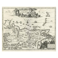
Antique Map of Venezuela by Montanus, 1671
By Arnoldus Montanus
Located in Langweer, NL
Antique map titled 'Venezuela cum parte Australi Novae Andalusiae'. The map extends from Coquibocoa to the Orinoque River, centered on Bariquicemento and Cape de Curiacao. Large cart...
Category
Antique Mid-17th Century English Maps
Materials
Paper
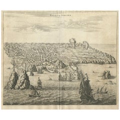
Antique Print of Angra 'Azores' by A. Montanus, 1671
By Arnoldus Montanus
Located in Langweer, NL
Antique print titled 'Angra op Tercera'. Antique print of Angra, Azores, in Portugal, during the mid-17th century. Shows roadways buildings, fortifications and geographical features;...
Category
Antique Mid-17th Century Prints
Materials
Paper
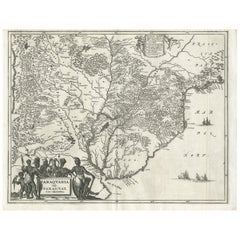
Antique Map of Paraguay by A. Montanus, circa 1671
By Arnoldus Montanus
Located in Langweer, NL
Antique map titled 'Paraquaria Vulgo Paraguay Cum adjacentibus'. Antique map extending from Rio de Janiero to the Rio de la Plata basin. The map includes Uruguay, Paraguay, part of n...
Category
Antique Mid-17th Century Maps
Materials
Paper
People Also Browsed
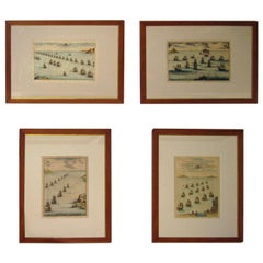
18th century Set Hand Colored Nautical Engravings
By M. Ogier
Located in Savannah, GA
Signed M. Ogier (Fecit:by), this set of four hand colored engravings is part of a larger edition of plates. These plates are numbered PL 16, 347, 365 and 386. The subject is probably...
Category
Antique 18th Century Unknown Elizabethan Prints
Materials
Glass, Wood, Paper
Emperors Caesar Octavian Tiziano Paint Oil on canvas Old master 17/18th Century
By Tiziano Vecellio (Pieve di Cadore 1490 - Venice 1576)
Located in Riva del Garda, IT
Tiziano Vecellio (Pieve di Cadore 1490 - Venice 1576) follower of
Portrait of the emperor Julius Caesar (Rome 100 BC - 44 BC), inscribed above C. IVLIVS. CAESAR
Portrait of the Emper...
Category
Late 17th Century Old Masters Paintings
Materials
Oil
Large English nautical magnetic compass in brass and glass early 1900s
Located in Milan, IT
Large brass and glass nautical magnetic compass from the early 1900s, mounted on custom-made oak and brass board. Compass diameter cm 24.5 - inch 9.4, height with base cm 21 - inch 8...
Category
Antique Early 1900s Nautical Objects
Materials
Brass
North African Sword (Nimcha), Morocco, Early 19th Century
Located in Madrid, ES
North African Sword (Nimcha), Morocco, Early 19th Century
This North African sword, known as a "Nimcha," is a remarkable piece originating from Morocco, dating back to the early 19th...
Category
Antique Late 19th Century Arms, Armor and Weapons
Materials
Wrought Iron
Antique Print of the Fortress Cranganor near Kodungallur in India, 1757
Located in Langweer, NL
Antique print of the Fortress Cranganor, nowadays known by the name Kodungallor. French and Dutch title including scale and compass rose. This print originates from 'L'Histoire génér...
Category
Antique Mid-18th Century Prints
Materials
Paper
Free Shipping
H 13.39 in W 16.54 in D 0 in
Jan Luyken, Defeat of the Spanish Armanda in 1588
By Matthäus Merian the Elder
Located in Norwich, GB
"Vertooninge van de ontsachlyke Spaansche Krygs vloot, in den Jaare 1588."
Issued in:
Bor, Pieter: "Nederlandsche Oorlogen", Amsterdam (ca 1680)
Measures: Leaf: ca. 28,5 x 3...
Category
Antique 1680s Dutch Baroque Prints
Materials
Paper
Antique Queen Anne Walnut Secretaire Chest / Escritoire, 18th Century
Located in London, GB
A beautiful Queen Anne walnut secretaire chest / escritoire, circa 1710 in date.
The upper section features a moulded cornice above a secret bulge front frieze drawer, this is above ...
Category
Antique 1710s Queen Anne Cabinets
Materials
Walnut
H 69.3 in W 40.16 in D 23.23 in
Antique Map of the Spice Islands 'Moluccas', Indonesia by W. Blaeu, circa 1640
By Willem Blaeu
Located in Langweer, NL
Antique map titled 'Moluccae Insulae Celeberrimae'. Highly decorative antique map of the Spice Islands (Moluccas) published by W. Blaeu (circa 1640). This map features a large inset ...
Category
Antique Mid-17th Century Maps
Materials
Paper
H 19.69 in W 23.04 in D 0.02 in
2 Antique Nautical Marine Brass Gimbal Swivel Hurricane Candle Holder Sconces
Located in Dayton, OH
Pair of 19th century brass nautical / maritime / marine / railway / sailing ship's swiveling / gimbal wall sconce pair. Simple column design with pointed / weighted bases that can be...
Category
Antique 19th Century Victorian Candle Sconces
Materials
Brass
H 13.75 in W 5.75 in D 3.5 in
Tempesta Battle Paint Oil on canvas 16/17th Century Old master Landscape Italy
Located in Riva del Garda, IT
Antichità Castelbarco SRLS is proud to present:
Antonio Tempesta (Florence 1555 - Rome 1630)
Battle scene with castle in the background
Oil on canvas
81 x 130 cm
Framed 99 x 130
E...
Category
16th Century Old Masters Paintings
Materials
Oil
Engraving of the British Victory over the Spanish Armada in 1588, Published 1787
Located in Langweer, NL
Antique print titled 'Grand Victory over the formidable Spanish Armada by Lord Loward (..)'.
Engraving of the victory of the Spanish Armada in the year 1588. This print originates ...
Category
Antique 1780s Arms, Armor and Weapons
Materials
Paper
H 13.78 in W 8.67 in D 0 in
Set of Twelve Colored Engravings of the Defeat of the Spanish Armada by J. Pine
Located in Essex, MA
By John Pine considered the foremost heraldic and decorative engraver of his generation. Depicting the defeat of the Spanish by the English Fleet in 1588. These are after a set of ta...
Category
Antique 1740s English Prints
Materials
Paper
H 19.75 in W 28.75 in D 1.25 in
Robert Merill & Sons Ship's Compass
Located in Norwell, MA
Mid-19th century ship's compass with dry card from Robert Merrrill and Sons, New York. Fitted to a timber box with sliding lid. Ornate axis. Dimensions: 10" L x 10" W x 6.5...
Category
Antique Mid-19th Century Scientific Instruments
Mercator's Ptolemaic map of Taprobana, (Ceylon) Sri Lanka
Located in Langweer, NL
Antique map titled 'Asiae XII Tab'. Mercator's Ptolemaic map of Taprobana. The map shows Ptolemy's erroneous location of the island of Sri Lanka near the equator, with a bit of India...
Category
Antique 16th Century Maps
Materials
Paper
Christmas Turkey & the General's Daughter painting by Julio De Diego
By Julio de Diego
Located in Hudson, NY
The artwork measures 18" x 24", and the frame 25" x 29.5" x 1.75". Upon request a video clip of this work may be provided.
About this artist:
Julio De Diego crafted a formidable per...
Category
1960s Surrealist Interior Paintings
Materials
Watercolor, Tempera, Paper
Antique Map of Greece by Allard (c.1698)
Located in Langweer, NL
Antique map titled 'Hellas seu Graecia Universa' Detailed map of Greece, with Crete, the Aegean Islands, and part of Turkey. With two cartouches, compass rose and scale. Carolus Alla...
Category
Antique Late 17th Century Maps
Materials
Paper
Get Updated with New Arrivals
Save "Arnoldus Montanus On Sale", and we’ll notify you when there are new listings in this category.
More Ways To Browse
Argentina Map
Paraguay Antique Map
Antique Map Of Argentina
Antique Map Argentina
Uruguay Antique Map
Cassina Pony Corbusier
Carl Aubock Bottle Holder
Cast Iron Bottle Opener
Rowac Stools
Rolf Benz Ego
Antique Suzani Fabric
Vintage Leather Chesterfield Sofa 2 Seater Sofas
Wegner Keyhole
17th Century Oak Joint Stool
Bean Bench
Bennett Sled
Bjorn Wiinblad Woman
Willy Guhl Elephant Ear Planter


