Items Similar to Antique Map of East Canada 'Quebec and New Brunswick' by Tallis 'c.1850'


Want more images or videos?
Request additional images or videos from the seller
1 of 5
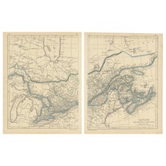
Antique Map of East Canada 'Quebec and New Brunswick' by Tallis 'c.1850'
About the Item
Antique map titled 'East Canada, and New Brunswick'. Decorative regional map of East Canada or what is now Quebec and New Brunswick. With decorative vignettes of Quebec, North American Indians and a bison. This map originates from 'The History and Topography of the United States of America: edited by John Howard Hinton, A.M'. Printed and published by John Tallis and Company, London and New York. Published circa 1850.
- Dimensions:Height: 10.44 in (26.5 cm)Width: 13.78 in (35 cm)Depth: 0.02 in (0.5 mm)
- Materials and Techniques:
- Period:
- Date of Manufacture:circa 1850
- Condition:General age-related toning, original folding line. Minor wear, blank verso. Please study image carefully.
- Seller Location:Langweer, NL
- Reference Number:Seller: BG-13016-2-71stDibs: LU3054324586402
About the Seller
5.0
Platinum Seller
These expertly vetted sellers are 1stDibs' most experienced sellers and are rated highest by our customers.
Established in 2009
1stDibs seller since 2017
1,933 sales on 1stDibs
Typical response time: <1 hour
- ShippingRetrieving quote...Ships From: Langweer, Netherlands
- Return PolicyA return for this item may be initiated within 14 days of delivery.
More From This SellerView All
- Antique Map of West Canada by Tallis 'c.1850'Located in Langweer, NLAntique map titled 'West Canada'. Original antique map of West Canada, with decorative vignettes titled Kingston and Falls of Niagara. This map originates from 'The History and Topog...Category
Antique Mid-19th Century Maps
MaterialsPaper
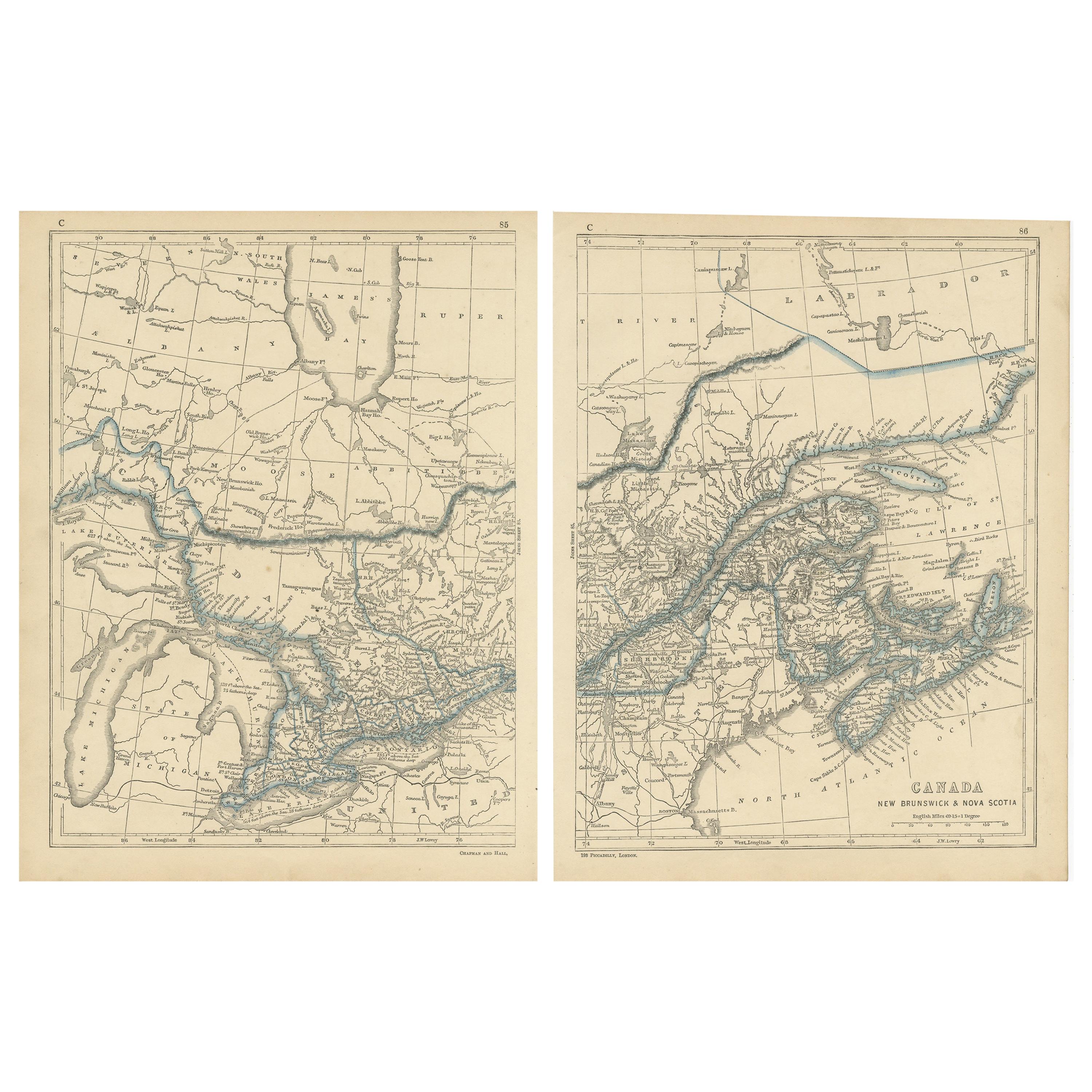
- Antique Map of Canada, New Brunswick and Nova Scotia by Lowry, 1852Located in Langweer, NLAntique map titled 'Canada, New Brunswick & Nova Scotia'. Two individual sheets of Canada, New Brunswick and Nova Scotia. This map originates from 'Lowry...Category
Antique Mid-19th Century Maps
MaterialsPaper
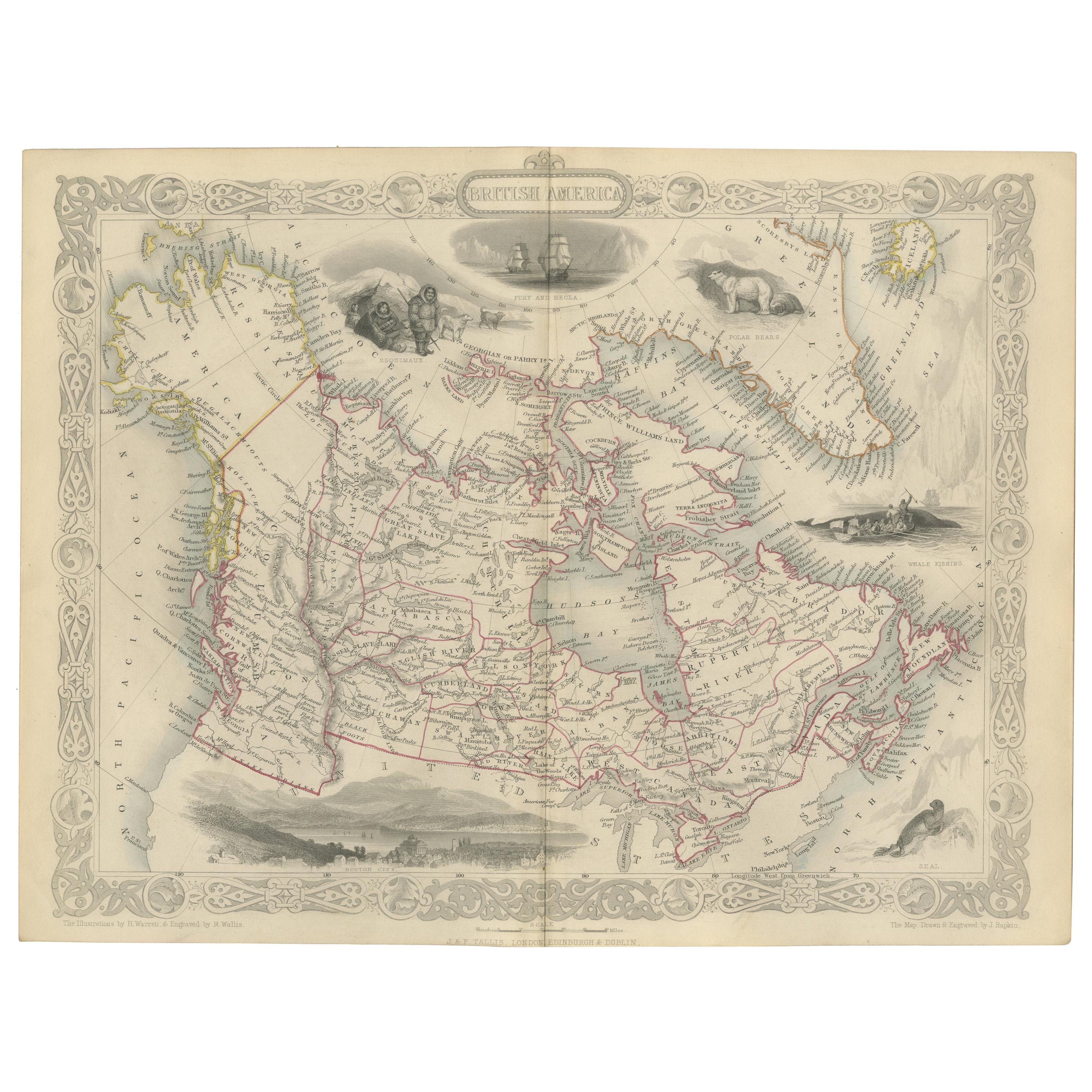
- Antique Map of British America by Tallis 'c.1850'Located in Langweer, NLAntique map titled 'British America'. Decorative map of British America, with vignettes showing Whale Fishing, Montreal, Fury and Hecla ships asail. Thi...Category
Antique Mid-19th Century Maps
MaterialsPaper
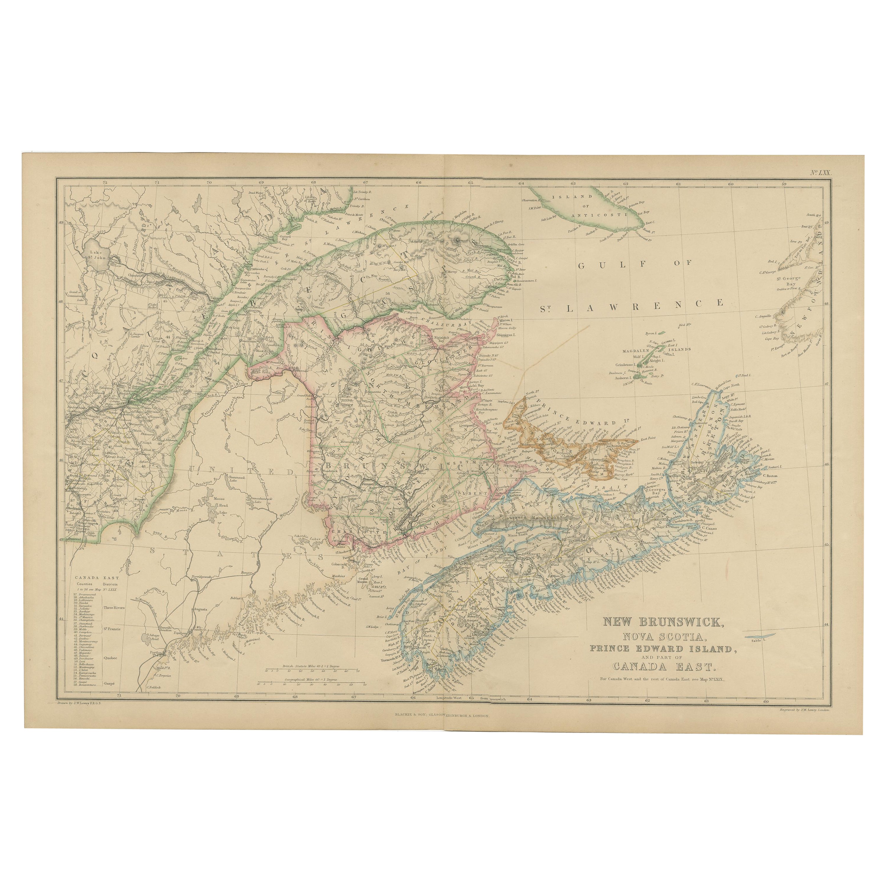
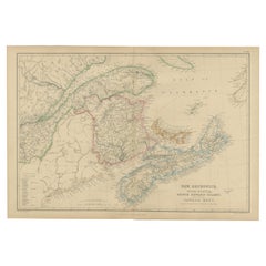
- Antique Map of New Brunswick by W. G. Blackie, 1859Located in Langweer, NLAntique map titled 'New Brunswick, Nova Scotia, Prince Edward Island and Part of Canada east'. Original antique map of New Brunswick, Nova Scotia,...Category
Antique Mid-19th Century Maps
MaterialsPaper
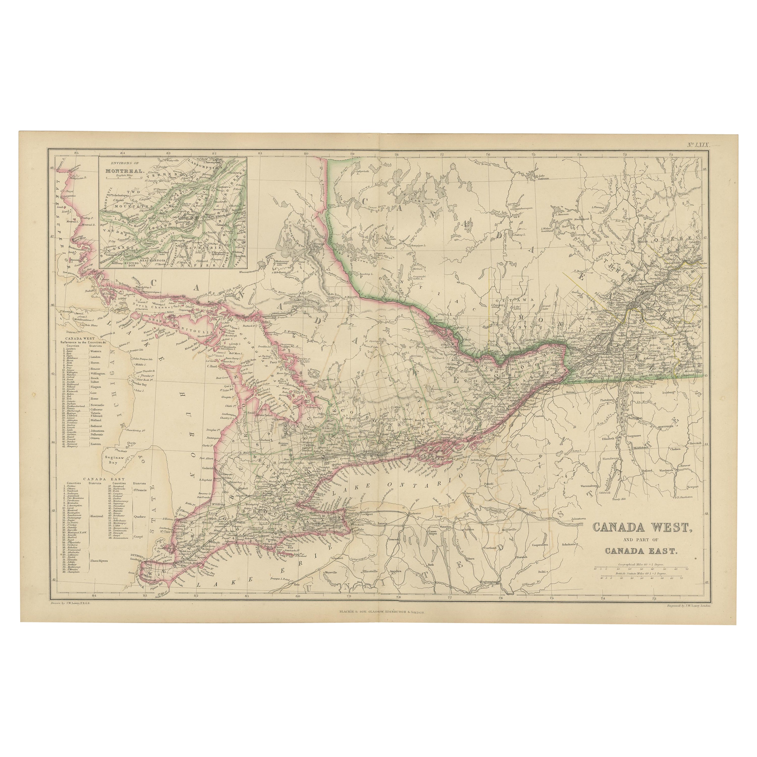
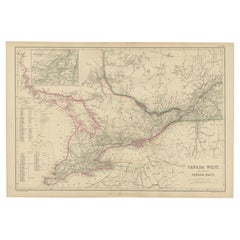
- Antique Map of Canada West and Part of Canada East by W. G. Blackie, 1859Located in Langweer, NLAntique map titled 'Canada West and Part of Canada East'. Original antique map of Canada West and Part of Canada East with inset map of Montreal. This ...Category
Antique Mid-19th Century Maps
MaterialsPaper
- Antique Map of New South Wales by Tallis, circa 1851Located in Langweer, NLAntique map titled 'New South Wales'. Decorative and detailed map of New South Wales which was drawn and engraved by J. Rapkin (vignettes by H. Warren ...Category
Antique Mid-19th Century Maps
MaterialsPaper


You May Also Like
- Original Antique Map of Belgium by Tallis, Circa 1850Located in St Annes, LancashireGreat map of Belgium Steel engraving Many lovely vignettes Published by London Printing & Publishing Co. ( Formerly Tallis ), C.1850 Origin...Category
Antique 1850s English Maps
MaterialsPaper
- Original Antique Map / City Plan of Brussels by Tallis, circa 1850Located in St Annes, LancashireGreat map of Brussels. Steel engraving. Published by London Printing & Publishing Co. (Formerly Tallis), C.1850 Free shipping.Category
Antique 1850s English Maps
MaterialsPaper
- Original Antique Map of Canada, Arrowsmith, 1820Located in St Annes, LancashireGreat map of Canada. Drawn under the direction of Arrowsmith. Copper-plate engraving. Published by Longman, Hurst, Rees, Orme and Brown, 1820 ...Category
Antique 1820s English Maps
MaterialsPaper
- Original Antique Map of South East Asia by Thomas Clerk, 1817Located in St Annes, LancashireGreat map of South East Asia Copper-plate engraving Drawn and engraved by Thomas Clerk, Edinburgh. Published by Mackenzie And Dent, 1817 Unframed.Category
Antique 1810s English Maps
MaterialsPaper
- Original Antique Map of South East Asia by Becker, circa 1840Located in St Annes, LancashireGreat map of South East Asia Steel engraving with original color outline Engraved by Becker Published by Virtue, circa 1840. Unframed.Category
Antique 1840s English Other Maps
MaterialsPaper
- Original Antique Map of South East Asia, Arrowsmith, 1820Located in St Annes, LancashireGreat map of South East Asia Drawn under the direction of Arrowsmith Copper-plate engraving Published by Longman, Hurst, Rees, Orme and Brown, 1820 Unframed.Category
Antique 1820s English Maps
MaterialsPaper


Recently Viewed
View AllMore Ways To Browse
Quebec 19th
Antique Maps Canada
Antique Map Canada
Antique Maps Of Canada
Antique New Brunswick
Canada Antique Map
Maps Tallis
Antique Canadian Maps
Antique Furniture New Brunswick Furniture
Antique Furniture New Brunswick
Antique Map Of Canada
Antique Quebec
Map Of Quebec
American Bison Print
Vans Authentics
Antique Island Map
Antique Furniture South East
Ocean Antiques