Items Similar to Antique Map of Southeast Asia and China by Kiepert, c.1870


Want more images or videos?
Request additional images or videos from the seller
1 of 5
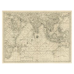
Antique Map of Southeast Asia and China by Kiepert, c.1870
About the Item
Antique map titled 'Ostindien und China'. Old map of Southeast Asia and China. This map originates from 'H. Kiepert's Kleiner Atlas der Neueren Geographie für Schule und Haus'. Artists and Engravers: Kiepert, Heinrich (1818-1899), was a German geographer, and the son of a wealthy businessman.
Artist: Kiepert, Heinrich (1818-1899), was a German geographer, and the son of a wealthy businessman.
Antique prints have long been appreciated for both their aesthetic and investment value. They were the product of engraved, etched or lithographed plates. These plates were handmade out of wood or metal, which required an incredible level of skill, patience and craftsmanship. Whether you have a house with Victorian furniture or more contemporary decor an old engraving can enhance your living space. We offer a wide range of authentic antique prints for any budget.
- Creator:Thomas Kitchin (Author)
- Dimensions:Height: 13.78 in (35 cm)Width: 17.84 in (45.3 cm)Depth: 0 in (0.01 mm)
- Materials and Techniques:
- Period:
- Date of Manufacture:circa 1870
- Condition:Condition: Good, general age-related toning. Split on folding line, please study image carefully.
- Seller Location:Langweer, NL
- Reference Number:
About the Seller
5.0
Platinum Seller
These expertly vetted sellers are 1stDibs' most experienced sellers and are rated highest by our customers.
Established in 2009
1stDibs seller since 2017
1,947 sales on 1stDibs
Typical response time: <1 hour
- ShippingRetrieving quote...Ships From: Langweer, Netherlands
- Return PolicyA return for this item may be initiated within 14 days of delivery.
More From This SellerView All
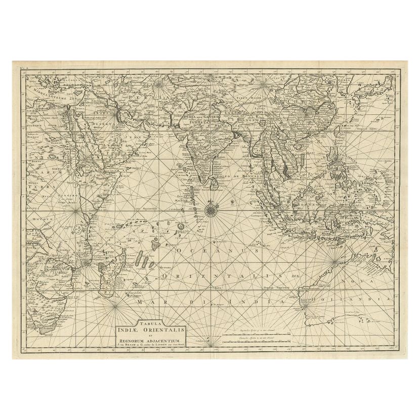
- Antique Map of Southeast Asia and the Indian Ocean by Valentijn, 1726By Thomas KitchinLocated in Langweer, NLAntique map titled 'Tabula Indiae Orientalis'. Beautiful detailed map of Australia, Southeast Asia and the Indian Ocean. The map features a fine depiction of the outlines of the western two-thirds of Australia, based on the discoveries of explorers working for the Dutch East India Company (the VOC). These include Willem Jansz's discoveries in the Gulf of Carpentaria in 1606; the encounters of Dirk Hartog...Category
Antique 18th Century Maps
MaterialsPaper
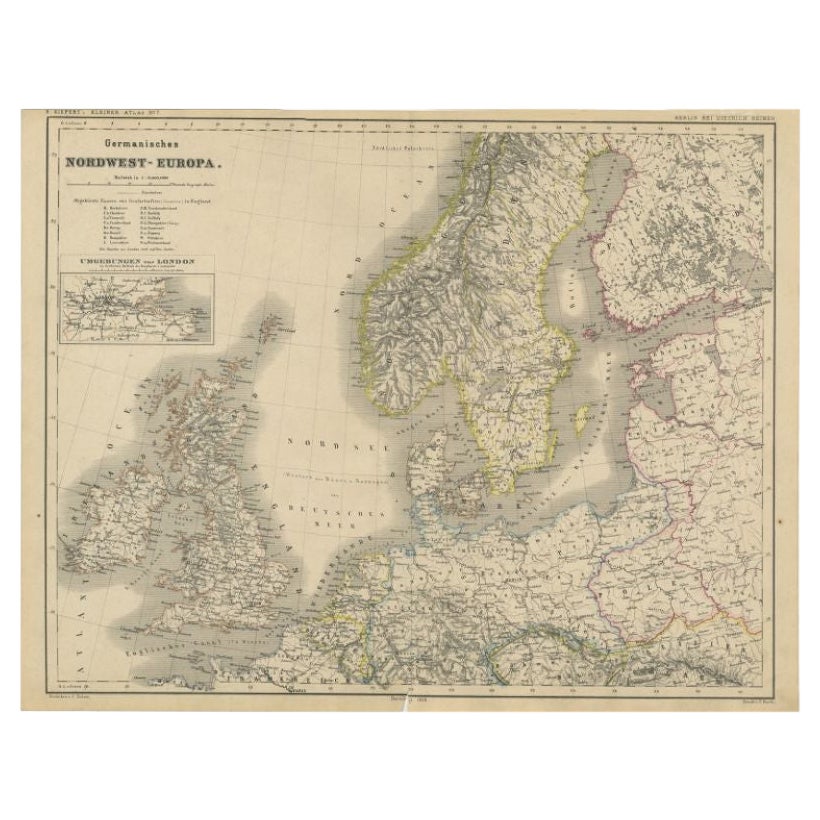
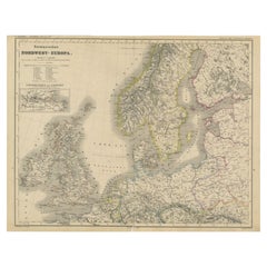
- Antique Map of Northwest Europe by Kiepert, c.1870Located in Langweer, NLAntique map titled 'Germanisches Nordwest-Europa'. Old map of North-West Europe depicting the United Kingdom, Ireland, the Netherlands, Germany, Scandinavia and surroundings. This ma...Category
Antique 19th Century Maps
MaterialsPaper
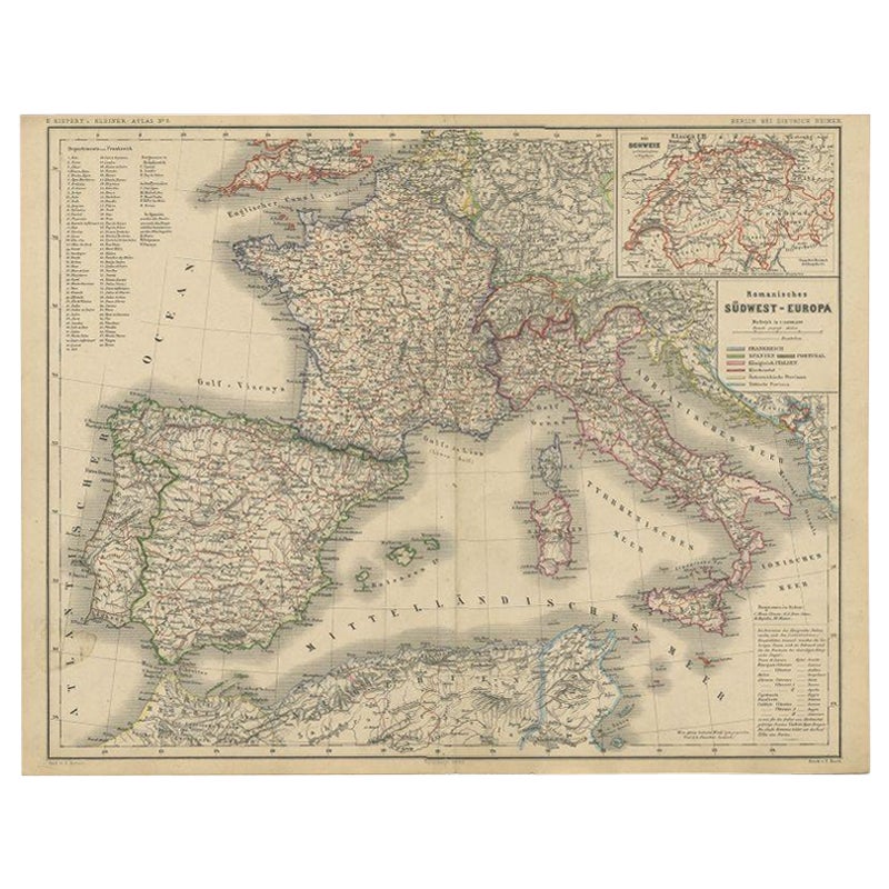
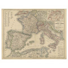
- Antique Map of Southwest Europe by Kiepert, c.1870Located in Langweer, NL"Antique map titled 'Romanisches Südwest-Europa'. Old map of Southwest Europe. This map originates from 'H. Kiepert's Kleiner Atlas der Neueren Geographie für Schule und Haus'. Artis...Category
Antique 19th Century Maps
MaterialsPaper
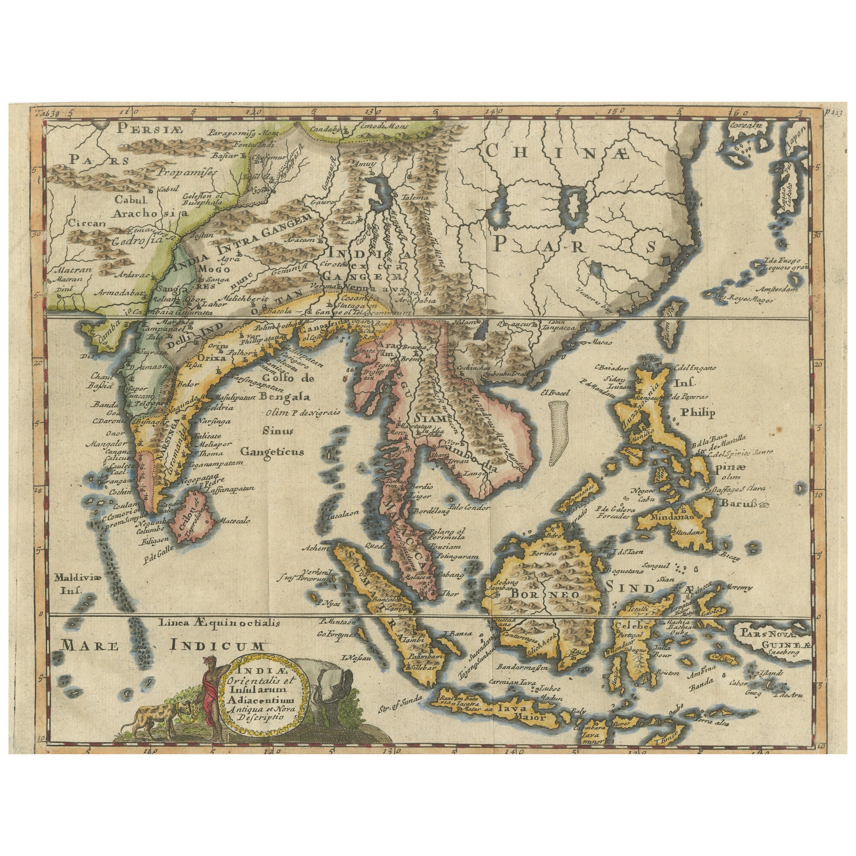
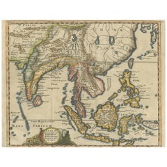
- Antique Map of Southeast Asia, China, Philippines and IndiaLocated in Langweer, NLAntique map titled 'Indiae Orientalis et Insularum Adiacentium'. Decorative map of Southeast Asia, China, Philippines, and India. A native holds a wild dog or hyena on a chain, while...Category
Antique Early 18th Century Maps
MaterialsPaper
- Antique Map of Italy and Greece by H. Kiepert, circa 1870By Heinrich KiepertLocated in Langweer, NLAntique map titled 'Italiae pars media'. This map originates from 'Atlas Antiquus. Zwölf Karten zur Alten Geschichte' by H. Kiepert. Published in Berlin, circa 187.Category
Antique Late 19th Century Maps
MaterialsPaper
- Antique Map of Egypt and Palestina by H. Kiepert 'circa 1870'By Heinrich KiepertLocated in Langweer, NLAntique map titled 'Aegyptus, Phoenice et Palestina'. With inset maps of Tyrus, Alexandria and Hierosolyma. This map originates from 'Atlas Antiquus. Zwölf Karten zur Alten Geschicht...Category
Antique Late 19th Century Maps
MaterialsPaper


You May Also Like
- Large Original Antique Map of China, Fullarton, C.1870Located in St Annes, LancashireGreat map of China From the celebrated Royal Illustrated Atlas Lithograph by Swanston. Original color. Published by Fullarton, Edinburgh. C.1870 Repairs to minor edge te...Category
Antique 1870s Scottish Maps
MaterialsPaper
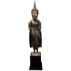
- Antique Giltwood Buddha Statue Southeast AsiaLocated in Atlanta, GAA delicately carved wood Buddha in an upright standing posture with a double Abhaya mudra. The statue displays a gilt surface with beautiful patina and some minor wear. The face was ...Category
Antique 19th Century Thai Other Sculptures and Carvings
MaterialsGold Leaf
- Antique French Map of Asia Including China Indoneseia India, 1783Located in Amsterdam, Noord HollandVery nice map of Asia. 1783 Dedie au Roy. Additional information: Country of Manufacturing: Europe Period: 18th century Qing (1661 - 1912) Condition: Overall Condition B (Good Used)...Category
Antique 18th Century European Maps
MaterialsPaper
- Antique 1803 Italian Map of Asia Including China Indoneseia IndiaLocated in Amsterdam, Noord HollandAntique 1803 Italian Map of Asia Including China Indoneseia India Very nice map of Asia. 1803. Additional information: Type: Map Country of Manufacturing: Europe Period: 19th centu...Category
Antique 19th Century European Maps
MaterialsPaper
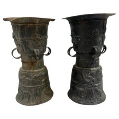
- Pair of Southeast Asian Ceremonial Rain DrumsLocated in Houston, TXPair of Southeast Asian ceremonial rain drums. Estimated that the bronze drums dates to the early 19th century. The top surface is adorned with a ceremonial star and tops are not tha...Category
Antique Early 1800s Indonesian Chinese Export Musical Instruments
MaterialsBronze
- Large Original Antique Map of Java and Borneo, Fullarton, C.1870Located in St Annes, LancashireGreat map of Java and Borneo Wonderful figurative borders From the celebrated Royal Illustrated Atlas Lithograph. Original color. Published by Fullarton, Edinburgh. C.1870 Unfr...Category
Antique 1870s Scottish Maps
MaterialsPaper


Recently Viewed
View AllMore Ways To Browse
Antique Decor And More
1870 German
Thomas China
Thomas Germany
Antique Germany China
German Antique China
Antique German China
Southeast Asian Wood
Antique Thomas China
Chinese Metal Plate
Older Chinese Plates
Chinese Old Plates
Victorian China Plate
German China Plates
Thomas Toner
Antique China Map
Antique Map China
Antique Chinese Maps