Items Similar to Antique Map of Spain and Portugal by Barlow, 1809


Want more images or videos?
Request additional images or videos from the seller
1 of 5
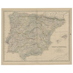
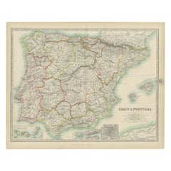
Antique Map of Spain and Portugal by Barlow, 1809
About the Item
"Antique map titled 'Spain and Portugal from the best Authorities'. Detailed antique map of Spain and Portugal. This map originates from 'The General Gazetteer'. Artists and Engravers: Engraved by Barlow. Published by Brightly and Kennersly.
Artist: Engraved by Barlow. Published by Brightly and Kennersly.
Condition: Very good, original/contemporary hand coloring. Please study image carefully.
Date: 1809
Overall size: 25 x 20 cm.
Image size: 0.001 x 22 x 19 cm.
Antique prints have long been appreciated for both their aesthetic and investment value. They were the product of engraved, etched or lithographed plates. These plates were handmade out of wood or metal, which required an incredible level of skill, patience and craftsmanship. Whether you have a house with Victorian furniture or more contemporary decor an old engraving can enhance your living space. We offer a wide range of authentic antique prints for any budget.".
- Dimensions:Height: 7.88 in (20 cm)Width: 9.85 in (25 cm)Depth: 0 in (0.01 mm)
- Materials and Techniques:
- Period:
- Date of Manufacture:1809
- Condition:
- Seller Location:Langweer, NL
- Reference Number:
About the Seller
5.0
Platinum Seller
These expertly vetted sellers are 1stDibs' most experienced sellers and are rated highest by our customers.
Established in 2009
1stDibs seller since 2017
1,933 sales on 1stDibs
Typical response time: <1 hour
- ShippingRetrieving quote...Ships From: Langweer, Netherlands
- Return PolicyA return for this item may be initiated within 14 days of delivery.
More From This SellerView All
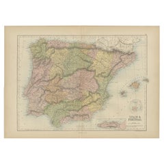
- Antique Map of Spain and Portugal, 1882Located in Langweer, NL"Antique map titled 'Spain & Portugal'. Old map of Spain and Portugal. This map originates from 'The Royal Atlas of Modern Geography, Exhibiting, in a S...Category
Antique 19th Century Maps
MaterialsPaper
- Antique Map of Spain and Portugal by Levasseur, '1875'Located in Langweer, NLAntique map titled 'Carte générale de l'Espagne et du Portugal (..)'. Large map of Spain and Portugal. This map originates from 'Atlas de Géographie Moder...Category
Antique Late 19th Century Maps
MaterialsPaper
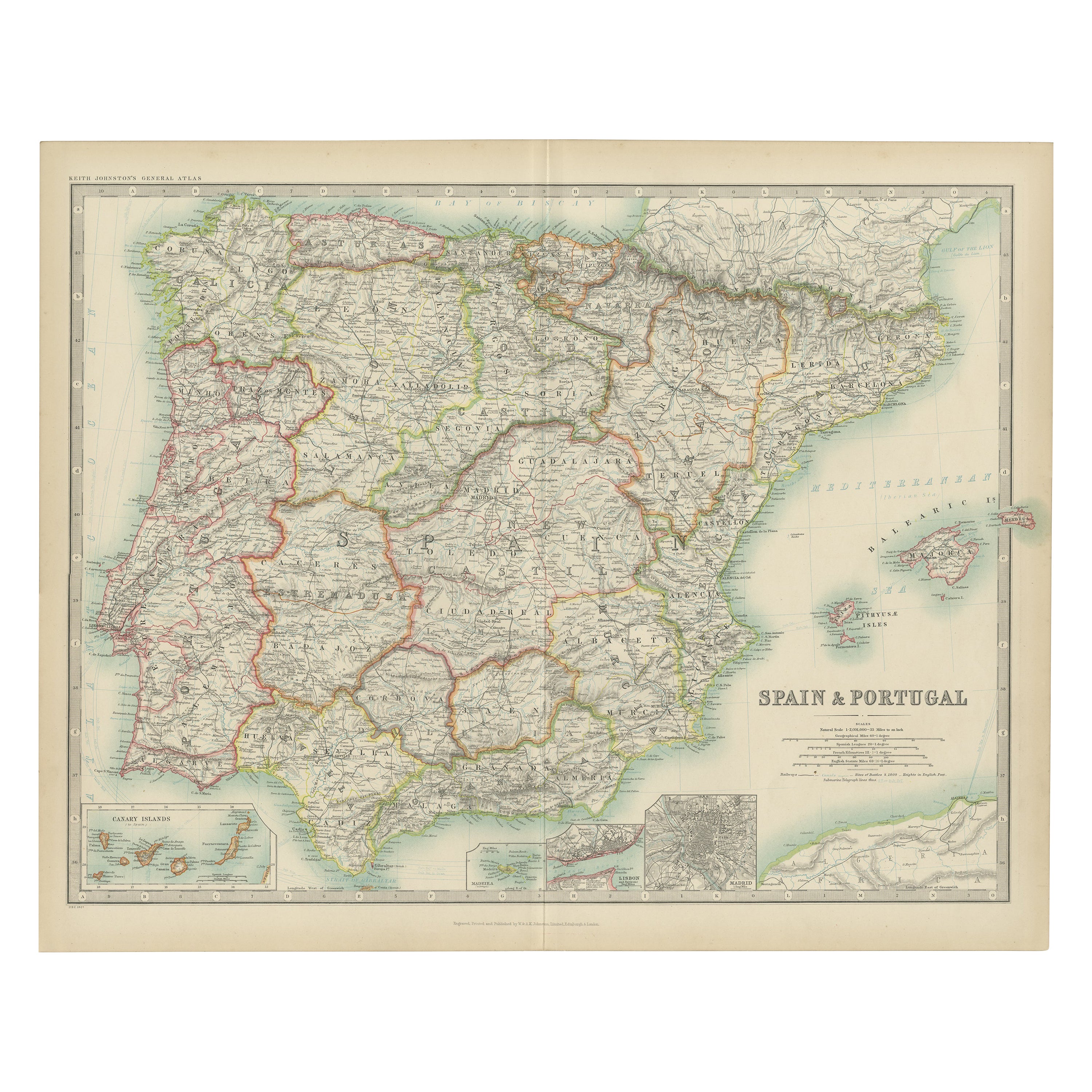
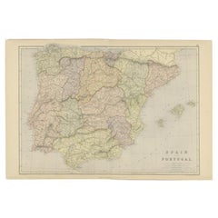
- Antique Map of Spain and Portugal by Johnston, '1909'Located in Langweer, NLAntique map titled 'Spain and Portugal'. Original antique map of Spain and Portugal. With inset maps of the Canary Islands, Madeira, Lisbon and Ma...Category
Early 20th Century Maps
MaterialsPaper
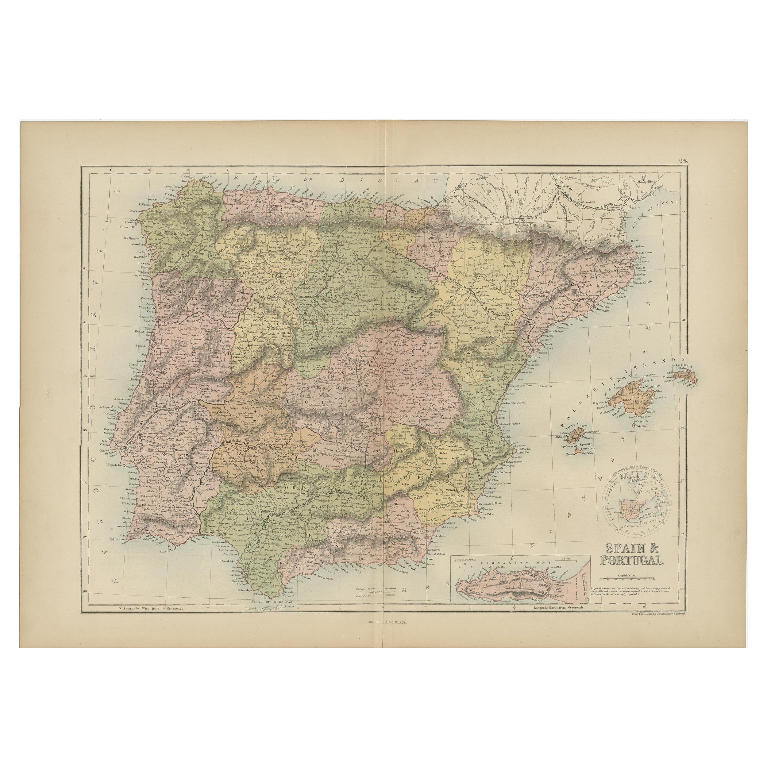
- Antique Map of Spain and Portugal by A & C. Black, 1870Located in Langweer, NLAntique map titled 'Spain and Portugal'. Original antique map of General map of Spain and Portugal with inset map of Gibraltar. This map originates from ‘Black's General Atlas of The...Category
Antique Late 19th Century Maps
MaterialsPaper
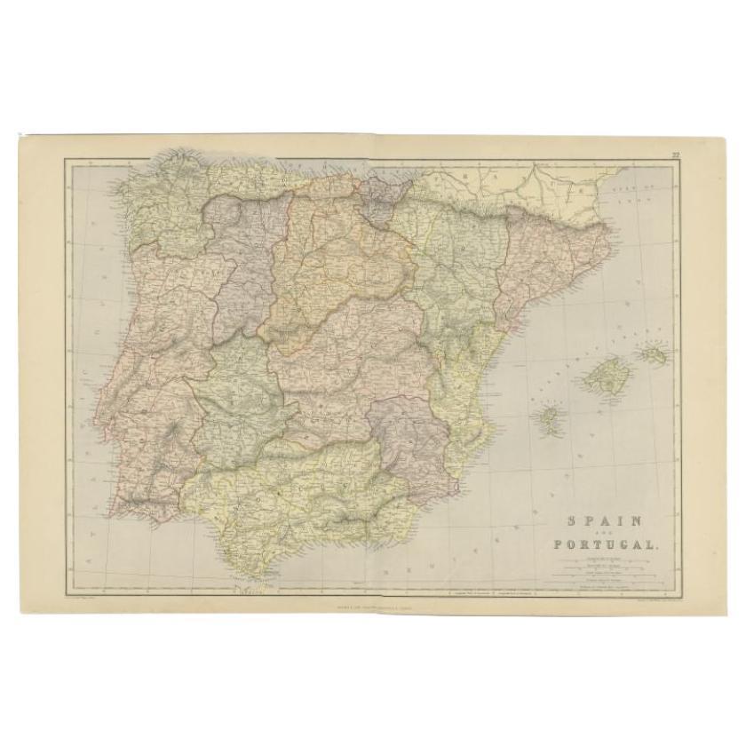
- Antique Map of Spain and Portugal by Weller, c.1890Located in Langweer, NLAntique map titled 'Spain and Portugal.' Map of Spain and Portugal, with the Balearic Islands (Mallorca, Menorca, Ibiza and Formentera). Sheet 22 from an unidentified British atlas p...Category
Antique 19th Century Maps
MaterialsPaper
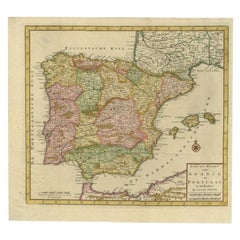
- Antique Map of Spain and Portugal by Tirion, c.1760Located in Langweer, NLAntique map titled 'Nieuwe Kaart van Spanje en Portugal.' Attractive detailed map showing Spain and Portugal. Including Majorca, Minorca and Ibiza. Title in block-style cartouche wit...Category
Antique 18th Century Maps
MaterialsPaper

You May Also Like
- Original Antique Map of Spain and Portugal, Engraved By Barlow, 1806Located in St Annes, LancashireGreat map of Spain And Portugal Copper-plate engraving by Barlow Published by Brightly & Kinnersly, Bungay, Suffolk. 1806 Unframed.Category
Antique Early 1800s English Maps
MaterialsPaper
- Original Antique Map of Spain and Portugal, circa 1790Located in St Annes, LancashireSuper map of Spain and Portugal Copper plate engraving by A. Bell Published, circa 1790. Unframed.Category
Antique 1790s English Other Maps
MaterialsPaper
- Original Antique Map of Sweden, Engraved by Barlow, 1806Located in St Annes, LancashireGreat map of Sweden Copper-plate engraving by Barlow Published by Brightly & Kinnersly, Bungay, Suffolk. 1806 Unframed.Category
Antique Early 1800s English Maps
MaterialsPaper
- Original Antique Map of Switzerland, Engraved By Barlow, Dated 1807Located in St Annes, LancashireGreat map of Switzerland Copper-plate engraving by Barlow Published by Brightly & Kinnersly, Bungay, Suffolk. Dated 1807 Unframed.Category
Antique Early 1800s English Maps
MaterialsPaper
- Original Antique Map of The Netherlands, Engraved by Barlow, Dated 1807Located in St Annes, LancashireGreat map of Netherlands Copper-plate engraving by Barlow Published by Brightly & Kinnersly, Bungay, Suffolk. Dated 1807 Unframed.Category
Antique Early 1800s English Maps
MaterialsPaper
- 18th Century Hand Colored Map of Spain and Portugal by VisscherBy Nicolaes Visscher IILocated in Alamo, CAThis is an early 18th century map of Spain and Portugal, with attractive original hand-coloring, entitled "Hispaniae et Portugalliae Regna per Nicolaum Visscher cum Privilegio Ordinu...Category
Antique Early 18th Century Dutch Maps
MaterialsPaper


Recently Viewed
View AllMore Ways To Browse
Antique Decor And More
Spanish Furniture And Decor
Spanish Decor
Spanish Antiques Metal
19 Century Spanish
Portuguese 19
Antique Spanish Plates
Antique Map Spain
Antique Maps Spain
Antique Spain Map
Spain Antique Map
Antique Maps Of Spain
Antique Map Of Spain
Spanish Decor Antique
Portugal Map
Map Of Portugal
Antique Map Of Portugal
Antique Map Portugal