Items Similar to The Jay Hoffman Collection of United States Stamps: by Robert A. Siegel Auction


Want more images or videos?
Request additional images or videos from the seller
1 of 7
The Jay Hoffman Collection of United States Stamps: by Robert A. Siegel Auction
About the Item
The Jay Hoffman Collection of United States Stamps: Sale 956, Thursday & Friday, May 8-9, 2008, by Robert A. Siegel Auction Galleries, Inc. One of the most important collections to come on the market. Hubert N. (Jay) Hoffman III, the CEO of the Hoffman Co., has donated $1 million to support the National Postal Museum’s expansion to create the William H. Gross Stamp Gallery. The Smithsonian and the U.S. Postal Service recently signed a lease agreement for the additional space to build the William H. Gross Stamp Gallery. This new space will be added to the museum’s existing 65,000 square feet and is scheduled to open in the next couple of years.
- Dimensions:Height: 11.25 in (28.58 cm)Width: 8.75 in (22.23 cm)Depth: 0.75 in (1.91 cm)
- Materials and Techniques:
- Place of Origin:
- Period:
- Date of Manufacture:2008
- Condition:
- Seller Location:valatie, NY
- Reference Number:
NPT Books
NPT Books, a division of N. P. Trent Antiques, was established in 1982 and serves clients in the US and around the world. We offer a large selection of used and out of print books mainly concentrating on art, architecture, decoration and antiques with a large focus on 1st editions, signed and rare limited editions. Member of The Art and Antique Dealers League of America since 1996.
About the Seller
5.0
Gold Seller
These expertly vetted sellers are highly rated and consistently exceed customer expectations.
Established in 1980
1stDibs seller since 2017
1,223 sales on 1stDibs
Typical response time: 1 hour
- ShippingRetrieving quote...Ships From: valatie , NY
- Return PolicyA return for this item may be initiated within 3 days of delivery.
More From This SellerView All
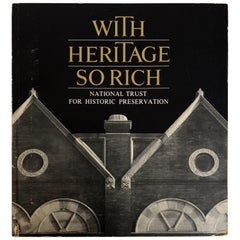
- With Heritage So Rich by United States Conference of MayorsLocated in valatie, NYWith Heritage So Rich by United States Conference of Mayors. National Trust for Historic Preservation, 1983. Landmark Reprint series softcover. In 1966, the seminal report With Heritage So Rich issued a call to action...Category
Vintage 1980s Books
MaterialsPaper
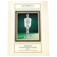
- Sotheby's Auction Catalogue for The Krug Collection of Glass Part ILocated in valatie, NYSotheby's, The Krug Collection of Glass Part I. London: Sotheby's Parke Bernet and Co., 1981. First edition hardcover with dust jacket. 185 pp. An auction catalogue for the Krug Coll...Category
20th Century English Books
MaterialsPaper
- Sotheby's, The Collection of Craig Wright, New York Auction Catalog Sept, 2011Located in valatie, NYSotheby's: The Collection of Craig Wright, New York Auction Catalog Sept. 2011. 234 lots on 151 pp., Illustrated in color and fully described. "Craig Wrig...Category
21st Century and Contemporary American Books
MaterialsPaper
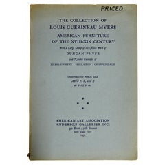
- Auction, Private Collection of Louis Myers, Featuring Duncan Phyfe FurnitureLocated in valatie, NYThe Collection of Louis Guerineau Myers. Catalogue of the auction/exhibition held at American Art Association, April 2-9, 1932, featuring "Duncan Phyfe: Characteristic examples in hi...Category
Vintage 1930s American Books
MaterialsPaper
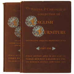
- Auction Catalogues from Walter Chrysler Jr. Collection of English FurnitureLocated in valatie, NYAuction catalogues from the Walter Chrysler Jr. Collection of English Furniture in two volumes. New York: Parke-Bernet Galleries, Inc., 1960. First edi...Category
20th Century American Books
MaterialsPaper
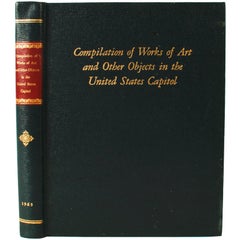
- Compilation of Works of Art and Other Objects, United States Capitol, 1st EdLocated in valatie, NYCompilation of Works of Art and other Objects in the United States Capitol by Joint Committee on the Library. U.S. Government Printing Office, Washington, 1965. 1st Ed hardcover no d...Category
Vintage 1960s American Books
MaterialsPaper

You May Also Like
- Small Map of the United StatesLocated in Langweer, NLAntique map titled 'Amérique septe. Physique'. Small map of the United States. lithographed by C. Callewaert brothers in Brussels circa 1870.Category
Antique Mid-19th Century Maps
MaterialsPaper
- Antique Map of the United States by Lowry, '1852'Located in Langweer, NLAntique map titled 'United States'. Four individual sheets of the United States. This map originates from 'Lowry's Table Atlas constructed and engraved from the most recent Authoriti...Category
Antique Mid-19th Century Maps
MaterialsPaper
- Antique Map of the United States by Balbi '1847'Located in Langweer, NLAntique map titled 'Etats-Unis'. Original antique map of the United States. This map originates from 'Abrégé de Géographie (..)' by Ad...Category
Antique Mid-19th Century Maps
MaterialsPaper
- Antique Map of the United States by Titus '1871'Located in Langweer, NLAntique map titled 'The United States of America'. Original antique map of the United States. This map originates from 'Atlas of Prebl...Category
Antique Late 19th Century Maps
MaterialsPaper
- 1859 "Map of the United States of America..." by J. H. ColtonBy J.H. ColtonLocated in Colorado Springs, COPresented is an 1859 “Map of the United States of America, the British Provinces, Mexico, the West Indies and Central America with Part of...Category
Antique 1850s American Maps
MaterialsPaper
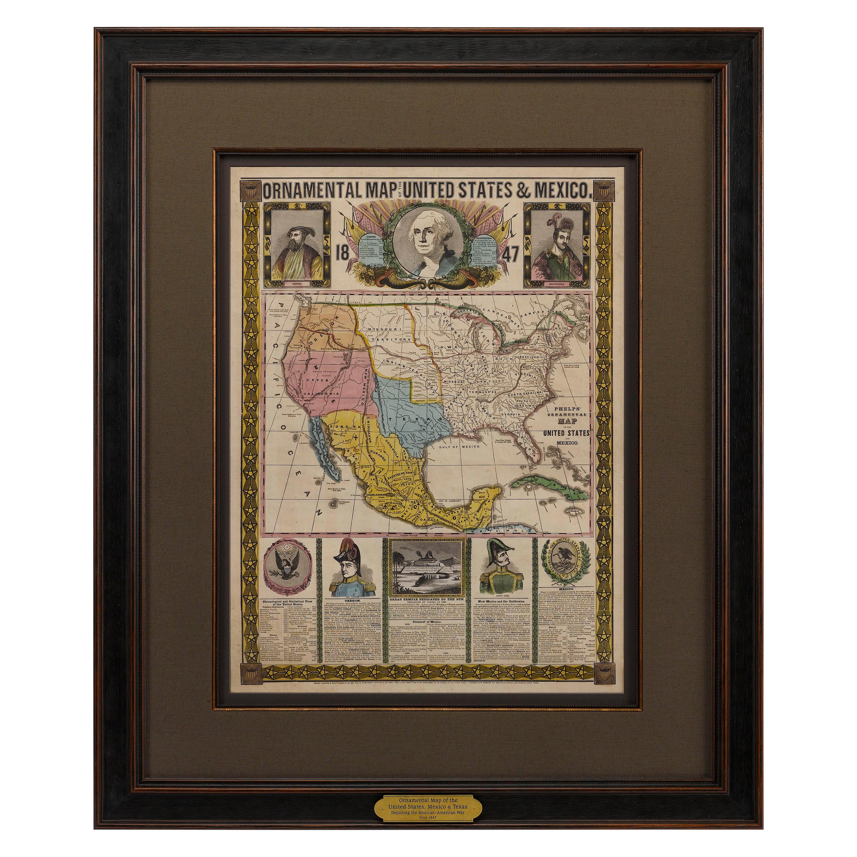
- 1847 Ornamental Map of the United States & Mexico by H. PhelpsLocated in Colorado Springs, COOffered is an original 1847 ornamental map of the U.S. entitled "Ornamental Map of the United States & Mexico" by Humphrey Phelps. The map was issued as an act of Congress by Phelps on Fulton Street, New York. The broadside is elaborately hand-colored. This is a very detailed and graphic propaganda map of the United States expressing U.S. dominance of the North American continent. The hand-colored map proclaims the Manifest Destiny, with the recent acquisition of Upper California and Texas at the conclusion of the Mexican-American War. The newly acquired land is boldly colored, standing in stark contrast to the rest of the U.S. The map details a potential route for a railroad running from New York City, to Buffalo, to Chicago, then west along the Oregon Trail to Oregon City. This route anticipates the construction of the transcontinental railroad by nearly 20 years. The map includes elaborately detailed renderings of George Washington, Hernan Cortez, and Montezuma at top to represent European expansion to the Americas. At bottom are four inset designs with text showing the following: a chronological history of the U.S. beginning from settlement to the U.S. victory in the Mexican-American war; an illustration of General Zachary Taylor with details on the Oregon Territory; an illustration of the Aztec Temple of the Sun in Tenochtitlan and a chronology of the Conquest of the Aztec Empire under Cortez; a portrait of General Antonio Lopez de Santa Anna...Category
Antique 1840s American Maps
MaterialsPaper


