Items Similar to 1574 Sebastian Münster Woodcut Map of Europe: Early View of the Continent

Want more images or videos?
Request additional images or videos from the seller
1 of 6
1574 Sebastian Münster Woodcut Map of Europe: Early View of the Continent
About the Item
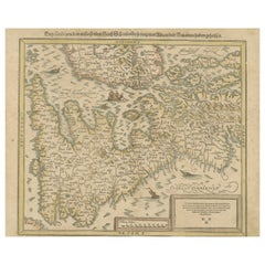
Title: Early Woodcut Map of Europe from Münster's Cosmographia, 1574
This is an original early woodcut map of Europe by the famed cartographer Sebastian Münster, printed in 1574 by Heinrich Petri in Basel. The map forms part of Münster's monumental *Cosmographia*, one of the most significant works of the 16th century that sought to describe all known regions of the world. It offers a detailed and fascinating depiction of Europe, portraying major regions such as Hispania, Germania, and Gallia, while providing insightful commentary in German.
The woodcut, though small, provides a striking snapshot of Europe as seen through the eyes of one of history's most influential geographers. The accompanying text illustrates Münster's vivid account of Europe’s physical characteristics, its relation to Asia and Africa, and notes on notable territories under Christian rule, along with references to the "Türckey" or Ottoman Empire. Münster, originally a Franciscan who became a Protestant theologian and professor, was among the first to attempt to map each continent separately.
The condition is very good, with sharp printing and crisp lines, displaying the craftsmanship typical of the Basel print houses of the time. This rare sheet remains an important piece for collectors of historical maps, especially those focusing on early cartography of Europe.
Here is the translation of the German text provided:
First Block (Title and Introduction):
The Second Book
They have become well-known, and from those we want to describe some specific tables here below and explain the situation of such countries.
*Of Europe, which in our time is under Christian rule and something about Turkey, Chapter 2.*
Second Block (Main Text):
Europe, among the world's parts, is the first in terms of its division, though it is smaller than either Africa or Asia in both breadth and length, yet it is a mighty large land. In length, it stretches from Spain to Constantinople, covering in total, according to Ptolemy's calculation, about 550 German miles, including part of Greece. But in width, it is slightly narrower compared to its length, which you can see in the two general tables or the new map showing all of Europe on one sheet.
One can imagine that Europe has many large areas and lands: As Ptolemy calls it a fruitful and quite extensive land, in some places equal to Africa in size, although Africa has many more wastelands or desolate deserts, whereas Europe is mostly fertile.
This is because of the good land Europe has, mostly lying in high mountains and elevated regions such as the Alps or Switzerland, where people have nourished themselves for many years.
There are also islands that belong to Europe: Sicily and Sardinia are particularly notable, and others such as Peloponnesus/Candia, among others, are mentioned briefly here.
---
- Dimensions:Height: 13.59 in (34.5 cm)Width: 8.04 in (20.4 cm)Depth: 0.01 in (0.2 mm)
- Materials and Techniques:Paper,Engraved
- Period:
- Date of Manufacture:1574
- Condition:Good condition, with sharp printing and crisp lines, displaying the craftsmanship typical of the Basel print houses of the time. Light browning around the edges. This rare sheet remains an important piece for collectors of historical maps.
- Seller Location:Langweer, NL
- Reference Number:Seller: BG-13840-31stDibs: LU3054342583572
About the Seller
5.0
Recognized Seller
These prestigious sellers are industry leaders and represent the highest echelon for item quality and design.
Platinum Seller
Premium sellers with a 4.7+ rating and 24-hour response times
Established in 2009
1stDibs seller since 2017
2,439 sales on 1stDibs
Typical response time: 1 hour
- ShippingRetrieving quote...Shipping from: Langweer, Netherlands
- Return Policy
Authenticity Guarantee
In the unlikely event there’s an issue with an item’s authenticity, contact us within 1 year for a full refund. DetailsMoney-Back Guarantee
If your item is not as described, is damaged in transit, or does not arrive, contact us within 7 days for a full refund. Details24-Hour Cancellation
You have a 24-hour grace period in which to reconsider your purchase, with no questions asked.Vetted Professional Sellers
Our world-class sellers must adhere to strict standards for service and quality, maintaining the integrity of our listings.Price-Match Guarantee
If you find that a seller listed the same item for a lower price elsewhere, we’ll match it.Trusted Global Delivery
Our best-in-class carrier network provides specialized shipping options worldwide, including custom delivery.More From This Seller
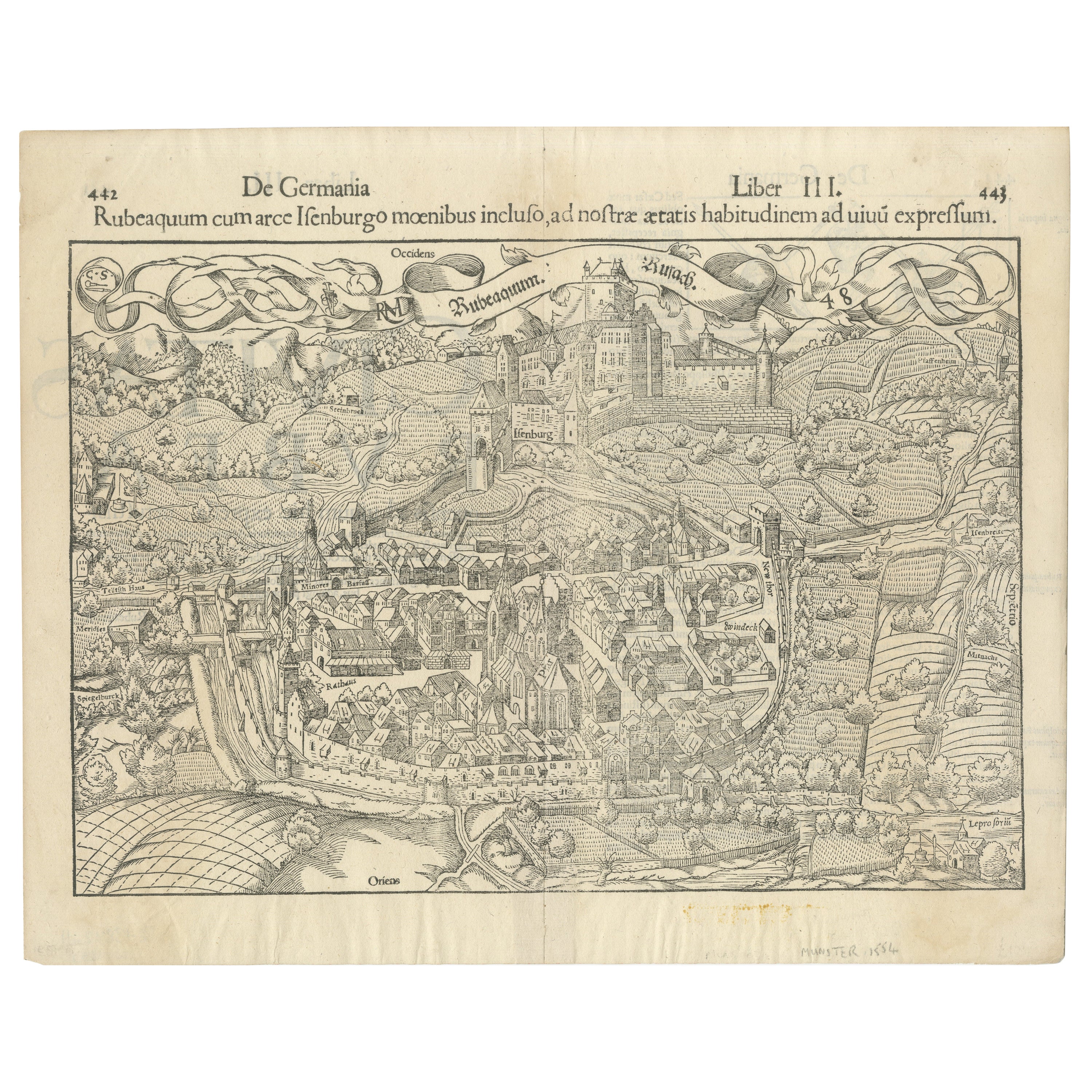
View AllEarly Woodcut Bird's Eye View of Rouffach, France, by Sebastian Münster, 1554
Located in Langweer, NL
Early Woodcut Bird's Eye View of Rouffach, France, by Sebastian Münster, 1554
Description: This rare 1554 woodcut is a bird's eye view of Rouffach, a town in the Haut-Rhin departmen...
Category
Antique 16th Century Maps
Materials
Paper
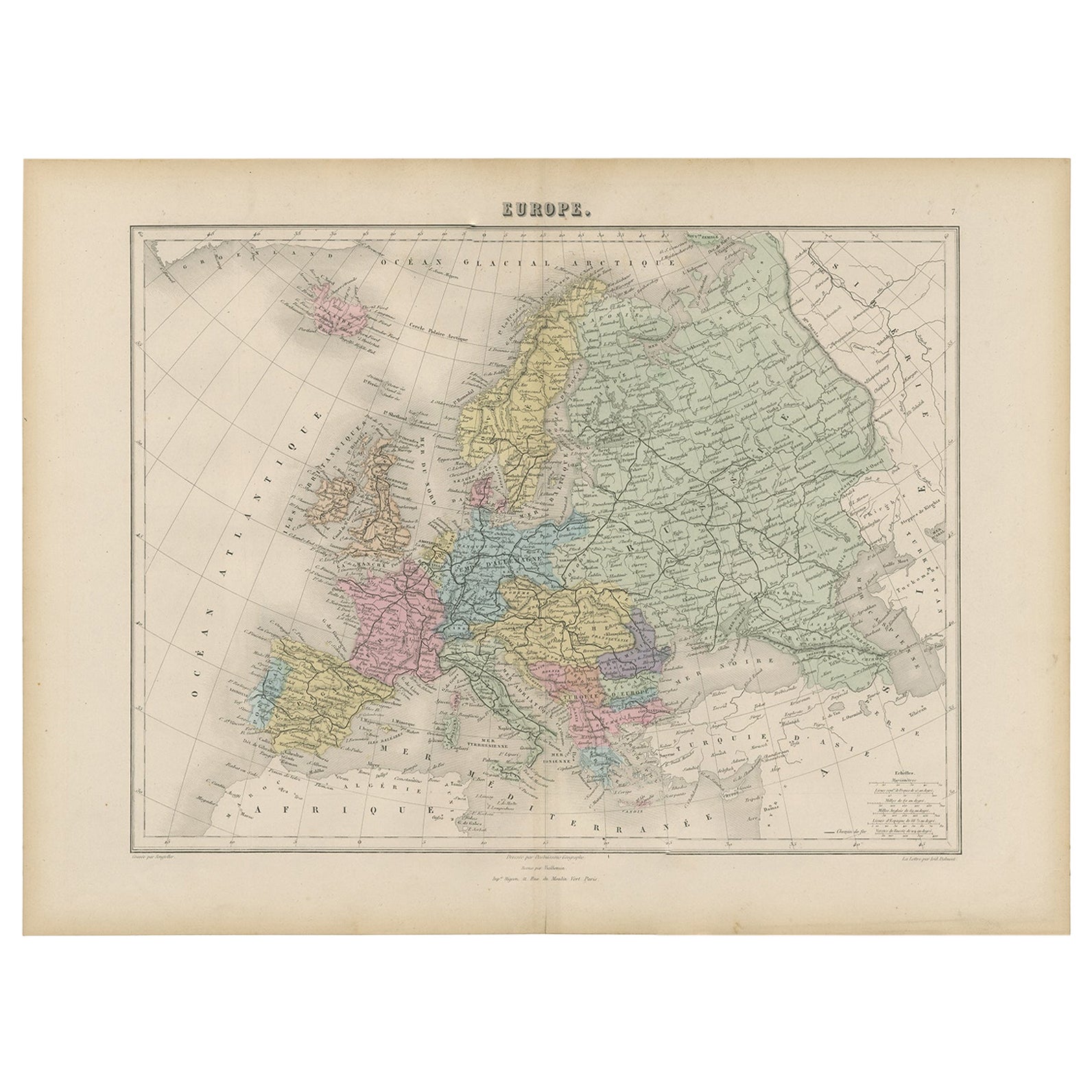
Antique Map of the Europe Continent, 1880
Located in Langweer, NL
Antique map titled 'Europe'. Old map of the European continent. This map originates from 'Géographie Universelle Atlas-Migeon' by J. Migeon.
Artists an...
Category
Antique 19th Century Maps
Materials
Paper

$166 Sale Price
20% Off
Antique Map of the European Continent, 1882
Located in Langweer, NL
Antique map titled 'Europe'. Old map of the European continent. This map originates from 'The Royal Atlas of Modern Geography, Exhibiting, in a Series of ...
Category
Antique 19th Century Maps
Materials
Paper

$125 Sale Price
20% Off
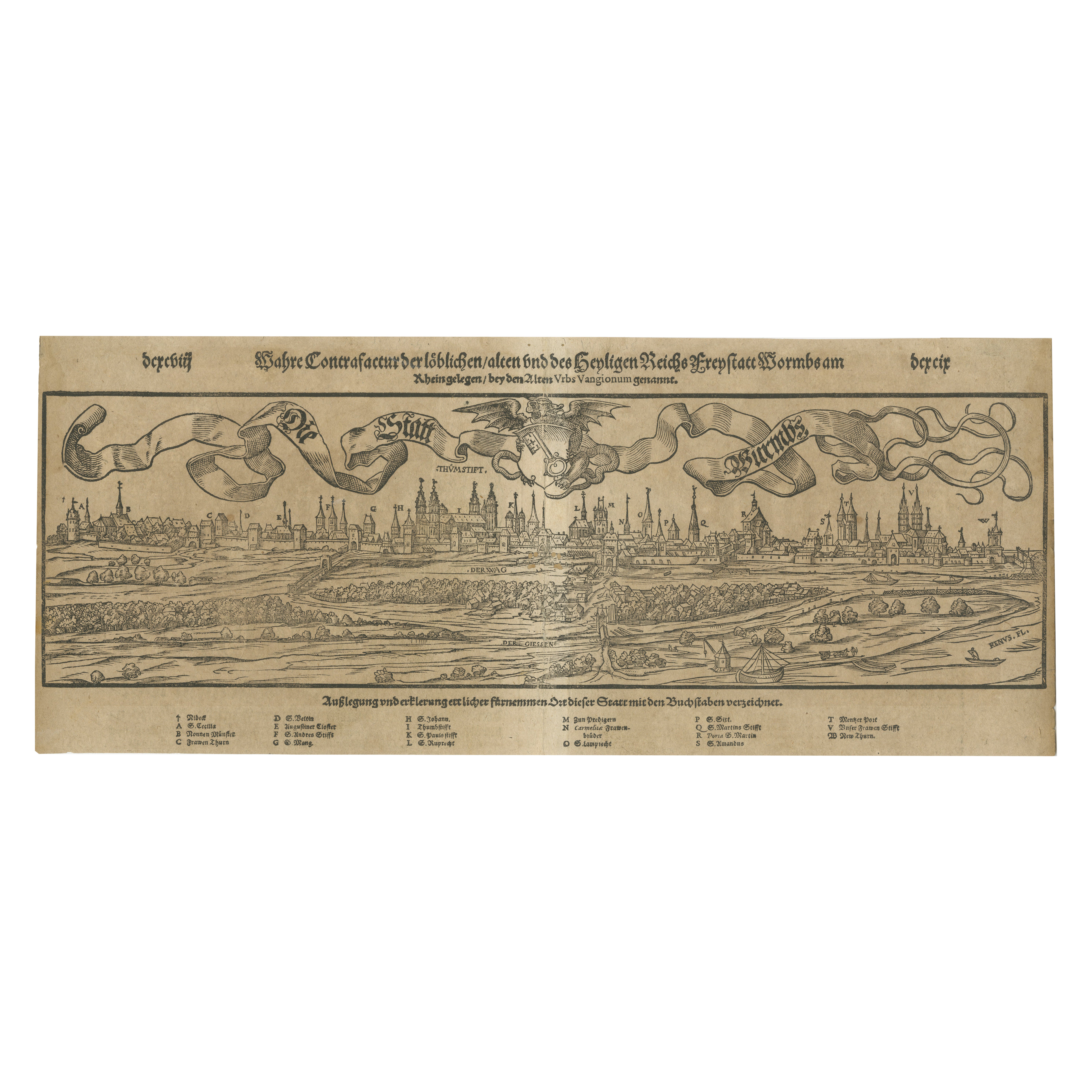
16th-Century Panoramic View of Worms: A Woodcut from Sebastian Münster's
Located in Langweer, NL
This is a woodcut city view of Worms, published in Sebastian Münster's *Cosmographia* around 1578. The image depicts a bird's-eye view of the city of Worms, located in Rheinland-Pfal...
Category
Antique 16th Century Maps
Materials
Paper
$203 Sale Price
20% Off
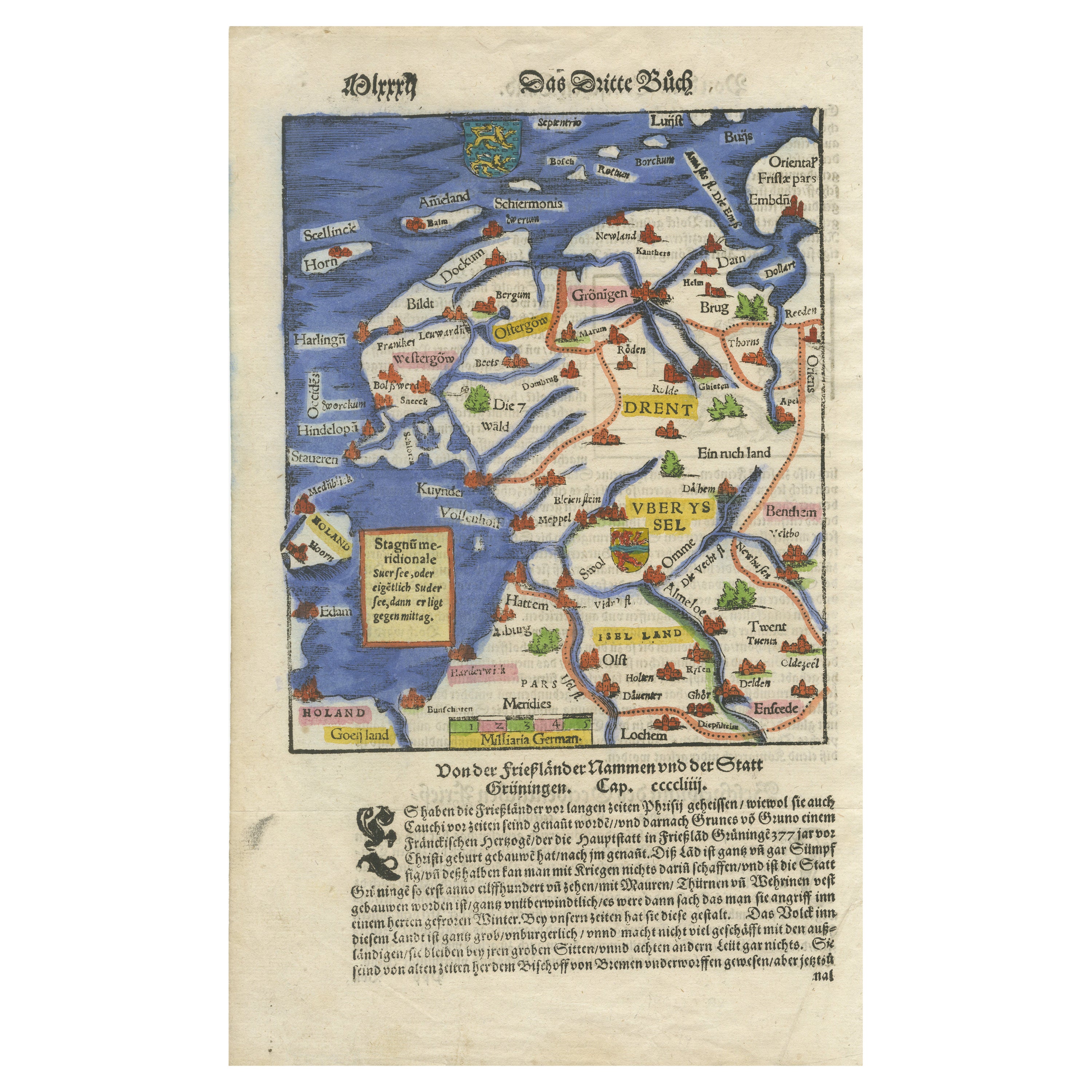
Friesland, Groningen, Drenthe, Overijssel – Antique Map by Seb. Münster, 1574
Located in Langweer, NL
Friesland, Groningen, Drenthe, Overijssel – Antique Map by Sebastian Münster, 1574
This rare and finely colored woodcut map of Northern Netherlands depicts the provinces of Friesl...
Category
Antique 16th Century Maps
Materials
Paper

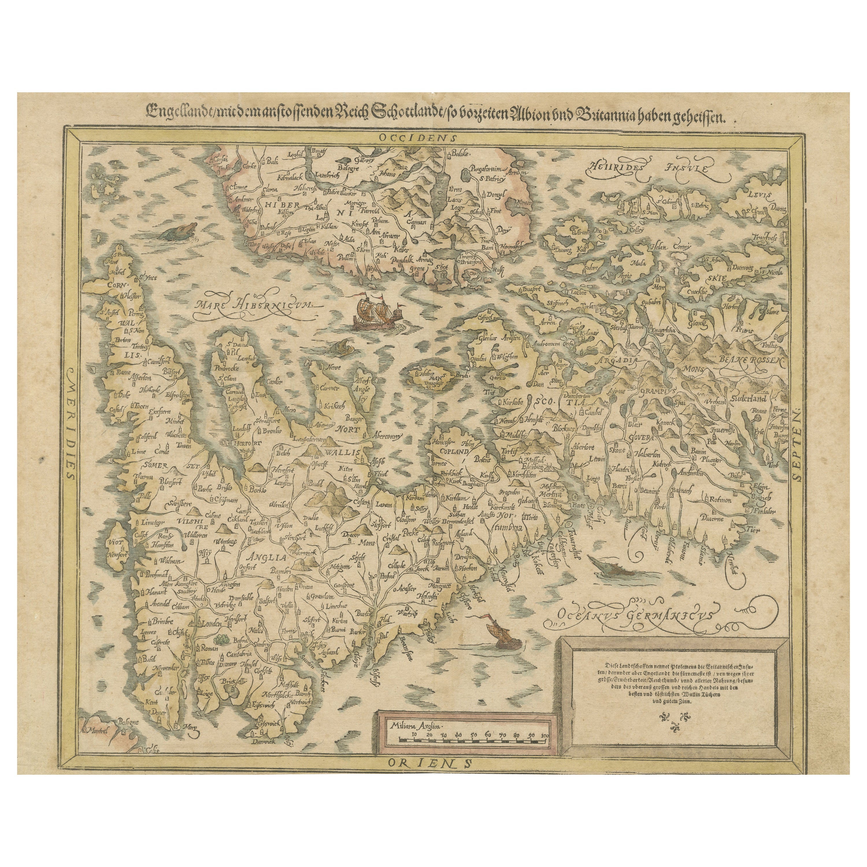
Sebastian Münster's 16th Century Map of the British Isles, ca.1590
Located in Langweer, NL
GREAT BRITAIN -- "ENGELLANDT mit dem anstossenden Reich Schottlandt so vorzeiten Albion und Britannia haben geheissen". (Basel, c. 1590).
Partly handcolored woodcut double-page map from S. Munster's 'Cosmographey'. 330 x 408 mm. (Lower margin cut short (touching the line), tiny hole in upper margin, sl. foxed/browned, lower right corner a bit thumbed).
Sebastian Münster's 16th Century Map of the British Isles from 'Cosmographia Universalis...
Category
Antique 16th Century Maps
Materials
Paper
$592 Sale Price
20% Off
Free Shipping
You May Also Like
Vintage "View of the Center of Paris Taken from the Air" Lithograph Map
Located in San Diego, CA
A very stylish "View of the Center of Paris Taken from the Air" lithograph map published by the Paris Ministry of Tourism, circa early 1950s. The piece measures 27" x 43" and shows...
Category
20th Century French Mid-Century Modern Prints
Materials
Paper

$680 Sale Price
20% Off
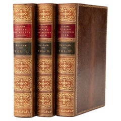
3 Volumes. Henry Hallam, View of the State of Europe During the Middle Ages.
Located in New York, NY
3 Volumes. Henry Hallam, View of the State of Europe During the Middle Ages. Bound in full tree calf. The covers and raised band spines display gilt-tooling with red and green morocc...
Category
Antique Mid-19th Century English Books
Materials
Leather
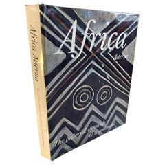
Africa Aeterna the Pictorial Chronicle of a Continent Hardcover Book
Located in North Hollywood, CA
Africa Aeterna The Pictorial Chronicle of a Continent
New York: International Book Society Time Life Books, 1965.
Henry, Paul Marc; Carmichael, Joel (translator)
Published by Sed...
Category
Mid-20th Century African Tribal Books
Materials
Paper
Original Antique Map of Europe, Arrowsmith, 1820
Located in St Annes, Lancashire
Great map of Europe
Drawn under the direction of Arrowsmith.
Copper-plate engraving.
Published by Longman, Hurst, Rees, Orme and Brown, 1820
...
Category
Antique 1820s English Maps
Materials
Paper

1849 Map of "Europaische Russland", 'Meyer Map of European Russia', Ric. R017
Located in Norton, MA
1849 Map of
"Europaische Russland"
( Meyer Map of European Russia)
Ric.r017
A lovely map of European Russia dating to 1849 by Joseph Meyer. It covers the European portions of...
Category
Antique 19th Century Unknown Maps
Materials
Paper

Map of the Republic of Genoa
Located in New York, NY
Framed antique hand-coloured map of the Republic of Genoa including the duchies of Mantua, Modena, and Parma.
Europe, late 18th century.
Dimension: 25...
Category
Antique Late 18th Century European Maps

Recently Viewed
View AllMore Ways To Browse
Constantinople Antique
Mountain Ottoman
Antique African Table
Printing Block Asian
World Map Table
Antique Turkey Table
Antique Turkish Table
Antique Gallia
Ottoman Empire Table
Antique Japanese Carpets
Antique Meissen Patterns
Antique Side Table With Claw Feet
Antique Silver And Glass Jewelry Box
Antique Silver Glass Jewelry Box
Antique Spiral Leg Table
Antique Table 4 Chairs
Arabia 1970
Ashtray Italy Crystal