Items Similar to 1675 Map of the Kingdom of the Black People (Nigritarum Regnum) by Janssonius


Want more images or videos?
Request additional images or videos from the seller
1 of 7
1675 Map of the Kingdom of the Black People (Nigritarum Regnum) by Janssonius
About the Item
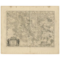
This original antique map, titled 'Nigritarum Regnum' (The Kingdom of the Black People), was produced by the renowned Dutch cartographer Johannes Janssonius and published in 'Joannis Janssonii Atlantis Majoris, sive Cosmographiae Universalis. Tomus Octavus' in 1675 by his heirs in Amsterdam.
Known for his influential contributions during the Golden Age of Dutch cartography, Janssonius’s works were celebrated for their meticulous detail and artistry. This map appears in the eighth volume of *Atlantis Majoris*, a comprehensive atlas that covered regions such as Spain, Asia, Africa, and the Americas.
The map focuses on West Africa, depicting territories, rivers, and coastal regions from Nubia to the Congo, including notable areas like Guinea and Angola. Major African cities and kingdoms of the period, such as Tombouctou (Timbuktu), Gao, and the Mandinga regions, are marked, reflecting European interest in African geography and trade routes. The rich decorative elements on the map include an elaborate cartouche featuring African figures and wildlife, symbolizing the continent’s diversity and the exoticized view held by Europeans at the time. A detailed coat of arms in the lower-left corner, dedicated to Otto von Schwerin—a distinguished figure of the era—accompanies a Latin dedication text honoring him. Sailing ships are illustrated in the *Oceanus Aethiopicus* (Atlantic Ocean), representing the period's exploration and mercantile ambitions along Africa’s west coast.
Following Janssonius’s death in 1664, his heirs continued his legacy, reissuing his atlases with updated information and new decorative elements. Maps like this one from *Atlantis Majoris* served both as geographical references and as luxury items that catered to the educated and affluent, symbolizing wealth and curiosity about the wider world. The map stands as a testament to Janssonius’s lasting impact on cartography, blending scientific precision with visual opulence to capture the European perspective on Africa during the 17th century.
The Latin text in the coat of arms cartouche on Janssonius’s *Nigritarum Regnum* map is a dedication to Otto von Schwerin, a prominent figure of the time. The text reads:
*“Reverendissimo, Perillustri et Excellentissimo Domino Dno Ottoni L.B. a Schwerin Electoratus ac Marchiae Brandenburgensis Camerario Hereditario, Serenissimi ac Potentissimi Electori Brandenburgico a Consiliis Secretioribus, et Status, omniumque Judiciorum summo Praesidi, Ecclesiae Cathedralis quae Brandeburgi est Decano, Dno in Landsberg, Oldenbergshagen et Zachan.”*
Translated, this dedication honors Otto von Schwerin as a highly distinguished, illustrious, and excellent lord. It lists his titles and roles: hereditary chamberlain of the Electorate and the Margraviate of Brandenburg, senior advisor and president of the council and judiciary for the Elector of Brandenburg, dean of the Brandenburg Cathedral, and lord of Landsberg, Oldenbergshagen, and Zachan. This type of dedication was common in 17th-century maps, adding prestige to the work by associating it with notable patrons or figures of influence and authority.
By including this dedication, Janssonius and his heirs were paying homage to Schwerin, likely recognizing him as a supporter of their work or a respected figure in cartographic circles or political affairs.
This 1675 map *Nigritarum Regnum* by Johannes Janssonius depicts various regions and significant locations in West and Central Africa, reflecting European perspectives of African geography during the 17th century. Key regions, kingdoms, and cities on the map include:
1. **Guinea** – Highlighted as a prominent coastal region, historically known for gold and other trade goods.
2. **Congo** – A central African kingdom, recognized for its substantial influence and interactions with Portuguese traders.
3. **Melli** – Refers to the historical Mali Empire, known for its wealth, trade networks, and Islamic culture.
4. **Mandinga (Mandingo)** – Associated with the Mandinka people, an influential ethnic group spread across West Africa.
5. **Tombouctou (Timbuktu)** – A renowned city in present-day Mali, famous for its historical significance as a center of learning and trade.
6. **Gambia** – Marked with reference to the Gambia River, an important route for trade.
7. **Cano Regn.** – Likely a reference to the Kano Kingdom in present-day Nigeria, historically part of the Hausa states.
8. **Nubia** – Representing a northeastern region, historically part of Sudan and southern Egypt, known for its ancient kingdoms and connection to the Nile.
9. **Borno (Bornu)** – An important kingdom in what is now northeastern Nigeria, associated with the Kanem-Bornu Empire, known for its Islamic scholarship.
10. **Zanfara (Zamfara)** – Referring to the historical Zamfara region, located in present-day northern Nigeria.
11. **Gaoga (Gao)** – An important trading city on the Niger River in present-day Mali, once part of the Songhai Empire.
12. **Gorhan (Gorham or possibly a misspelling of Gorhan)** – The exact historical location is unclear, but it may refer to a region or local name in the area.
Additional notable features include:
- **Oceanus Aethiopicus** – The Atlantic Ocean is labeled as the "Oceanus Aethiopicus" or "Ethiopian Ocean," a common term in early modern European maps for the waters off the coast of Africa.
- **Lacus Guarde** – Likely a reference to Lake Chad, which was known to Europeans as a prominent inland lake.
- **Zaire Lacus** – Refers to a lake or water source in the Congo Basin, possibly a European interpretation of an important river system.
The map is enriched with symbolic illustrations, such as ships in the ocean, representing European exploration and trade. The decorative cartouche at the bottom right includes African figures, animals like a lion, and cultural symbols, emphasizing Africa’s exoticized image in European cartography. These place names reflect the blend of geographic knowledge and mythologized perspectives typical of European maps of Africa during this period.
- Dimensions:Height: 20.08 in (51 cm)Width: 23.43 in (59.5 cm)Depth: 0 in (0.02 mm)
- Materials and Techniques:Paper,Engraved
- Period:1670-1679
- Date of Manufacture:1675
- Condition:The map is in good condition with minor age-toning. Edges may have light wear, and there are occasional small stains. Colors are well-preserved, enhancing decorative elements. Original centerfold intact with minimal handling marks or creasing.
- Seller Location:Langweer, NL
- Reference Number:Seller: BG-13647-11stDibs: LU3054342043892
About the Seller
5.0
Recognized Seller
These prestigious sellers are industry leaders and represent the highest echelon for item quality and design.
Gold Seller
Premium sellers maintaining a 4.3+ rating and 24-hour response times
Established in 2009
1stDibs seller since 2017
2,464 sales on 1stDibs
Typical response time: 1 hour
- ShippingRetrieving quote...Shipping from: Langweer, Netherlands
- Return Policy
Authenticity Guarantee
In the unlikely event there’s an issue with an item’s authenticity, contact us within 1 year for a full refund. DetailsMoney-Back Guarantee
If your item is not as described, is damaged in transit, or does not arrive, contact us within 7 days for a full refund. Details24-Hour Cancellation
You have a 24-hour grace period in which to reconsider your purchase, with no questions asked.Vetted Professional Sellers
Our world-class sellers must adhere to strict standards for service and quality, maintaining the integrity of our listings.Price-Match Guarantee
If you find that a seller listed the same item for a lower price elsewhere, we’ll match it.Trusted Global Delivery
Our best-in-class carrier network provides specialized shipping options worldwide, including custom delivery.More From This Seller
View AllAntique Map of the Maine Region by Janssonius, 1657
By Johannes Janssonius
Located in Langweer, NL
Antique map of France titled 'Diocese du Mans vulgo le Mains'. Decorative map of the region of Maine, France. This map originates from 'Atlas Novus, Sive Theatrum Orbis Orbis Terraru...
Category
Antique 17th Century Maps
Materials
Paper

Antique Map of the East Indies by Janssonius, c.1644
By Johannes Janssonius
Located in Langweer, NL
Antique map titled 'India quae Orientalis dicitur, et Insulae adiacentes'. Old map of the East Indies and Southeast Asia showing the area between India in the West and parts of Japan...
Category
Antique 17th Century Maps
Materials
Paper
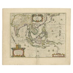
$2,465 Sale Price
20% Off
Antique Map of the Region of Picardy by Janssonius, 1657
By Johannes Janssonius
Located in Langweer, NL
Antique map of France titled 'Picardia vera et inferior'. Detailed map of the Picardy region of France. This map originates from 'Atlas Novus, Sive Theatrum Orbis Orbis Terrarum: In ...
Category
Antique Mid-17th Century Maps
Materials
Paper

$465 Sale Price
20% Off
Antique Map of the Region of Limoge by Janssonius, '1657'
By Johannes Janssonius
Located in Langweer, NL
Antique map 'Totius Lemovici et consinium provinciaru quantum ad dioecesin Lemovicensen spectant'. Decorative map of the province of Limoge based on the important map of Antoin-Jean ...
Category
Antique Mid-17th Century Maps
Materials
Paper
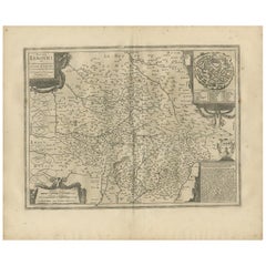
$558 Sale Price
20% Off
Antique Map of the Region of Saintonge by Janssonius, 1657
By Johannes Janssonius
Located in Langweer, NL
Antique map 'La Saintonge vers le Midy avecq le Brovageais'. Decorative map of the Saintonge region, a former province of France located on the west central Atlantic coast. This map ...
Category
Antique Mid-17th Century Maps
Materials
Paper

$558 Sale Price
20% Off
Antique Map of the Region of Charolais by Janssonius, 1657
By Johannes Janssonius
Located in Langweer, NL
Antique map 'Les environs de L'Estang de Longpendu, comprenant une grande partie du Comté de Charolois'. Decorative map of the Charolais region. This map originates from 'Atlas Novus...
Category
Antique Mid-17th Century Maps
Materials
Paper
$488 Sale Price
20% Off
You May Also Like
Map of the Kingdom of Sardinia and Part of the Kingdom of Genoa, Rome
By Giovanni Maria Cassini
Located in Hamilton, Ontario
18th century map by Italian engraver Giovanni Maria Cassini (Italy 1745-1824). Map of Part of the Kingdom of Sardinia and Part of the Kingdom of Genoa: Rome. This is a hand colored a...
Category
Antique 18th Century Italian Maps
Materials
Paper

$795 Sale Price
36% Off
Large Original Vintage Map of the United Kingdom, circa 1920
Located in St Annes, Lancashire
Great map of The United Kingdom
Unframed
Original color
By John Bartholomew and Co. Edinburgh Geographical Institute
Published, circa 1920
Free shipping.
Category
Vintage 1920s British Maps
Materials
Paper

1657 Janssonius Map of Vermandois and Cappelle, Ric. A-004
Located in Norton, MA
1657 Janssonius map of
Vermandois and Cappelle
Ric.a004
Description: Antique map of France titled 'Descriptio Veromanduorum - Gouvernement de la Cappelle'. Two detailed maps o...
Category
Antique 17th Century Unknown Maps
Materials
Paper

Antique County Map of Cheshire, Dutch, Framed, Cartography, Janssonius, C.1660
Located in Hele, Devon, GB
This is an antique county map of Cheshire. A Dutch, framed atlas engraving by Johannes Janssonius, dating to the 17th century and later.
A treat for the collector or county native,...
Category
Antique Mid-17th Century Dutch Charles II Maps
Materials
Glass, Wood, Paper

Antique County Map, Buckinghamshire, Bedfordshire, Dutch, Framed, Janssonius
Located in Hele, Devon, GB
This is an antique county map of Buckinghamshire and Bedfordshire. A Dutch, framed atlas engraving by Johannes Janssonius, dating to the 17th century and later.
A treat for the col...
Category
Antique Mid-17th Century Dutch Maps
Materials
Paper

17th Century Hand-Colored Map of a Region in West Germany by Janssonius
By Johannes Janssonius
Located in Alamo, CA
This attractive highly detailed 17th century original hand-colored map is entitled "Archiepiscopatus Maghdeburgensis et Anhaltinus Ducatus cum terris adjacentibus". It was published ...
Category
Antique Mid-17th Century Dutch Maps
Materials
Paper

Recently Viewed
View AllMore Ways To Browse
Art Deco Mobel
Art Deco Shutter
Art Deco Speed Chair
Art Deco Tea Cart
Art Nouveau Flask
Art Nouveau Ice Bucket
Art Nouveau Metal Armchairs
Art Nouveau Wooden Pedestal
Arte And Cuoio
Arte Vetraria Muranese (AVEM) On Sale
Arthur Armour
Artona Afra E Tobia Scarpa
Ashford Marble
Asian Demilune
Asparagus Tureen
Atomic Coat Rack
Australian Daybill Movie Posters
Austrian Majolica Plates