Items Similar to 1851 Tallis Map of China with Tibet, Formosa, and Burma – Engraved by J. Rapkin

Want more images or videos?
Request additional images or videos from the seller
1 of 13
1851 Tallis Map of China with Tibet, Formosa, and Burma – Engraved by J. Rapkin
$326.06
$407.5820% Off
£242.22
£302.7720% Off
€272
€34020% Off
CA$452.77
CA$565.9620% Off
A$494.08
A$617.6020% Off
CHF 259.15
CHF 323.9420% Off
MX$6,000.76
MX$7,500.9520% Off
NOK 3,236.96
NOK 4,046.2020% Off
SEK 3,059.09
SEK 3,823.8620% Off
DKK 2,070.71
DKK 2,588.3820% Off
About the Item
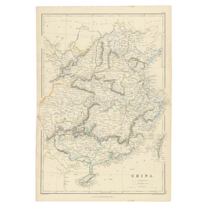
Title: 1851 Tallis Map of China with Tibet, Formosa, and Burma – Engraved by J. Rapkin
Description: This is a finely engraved and delicately hand-colored map of China, published around 1851 by The London Printing and Publishing Company. It was drawn and engraved by J. Rapkin, with illustrations by A.H. Wray, and issued as part of John Tallis’s Illustrated Atlas, one of the last great decorative atlases of the 19th century.
The map shows the territories of imperial China during the mid-19th century, including the provinces of Yunnan, Canton, Szechwan, and Shantung, as well as Tibet, Bhutan, parts of Burma, and the island of Formosa (modern-day Taiwan). The geography is detailed, with rivers, mountain ranges, major towns, and cities clearly labeled. The borders of regions are highlighted with original hand coloring.
While many maps from Tallis’s series include vignette illustrations of local scenes or people, this particular plate focuses solely on cartography and features an ornate floral and scrollwork border typical of the period. The coastlines and interior features are finely engraved with great precision, reflecting the style and craftsmanship for which Tallis maps are known.
The map retains its original centerfold as issued. Condition is generally good, with some minor toning, small edge wear, and faint creases in the margins. There is no major staining, and the hand coloring remains clear and well-preserved.
This map is a valuable example of 19th-century British cartography, appealing to collectors of Asian history, antique maps, and decorative engravings. It offers insight into how China and its surrounding territories were viewed and represented in Europe during a time of growing imperial interest and global exploration.
Here are a few tips for framing this 1851 Tallis map of China:
- Use acid-free, archival-quality mat board and backing to protect the paper from aging and discoloration over time
- A light cream or soft white mat will complement the aged paper and let the hand coloring stand out
- Consider float mounting if you want to show the decorative border and plate mark in full, including the original fold line
- Choose a classic wood frame in black, walnut, or gold-leaf finish for a traditional Victorian-era look
- Use UV-protective glass or acrylic to shield the map from fading due to light exposure
- Ensure the map is not in direct sunlight or humid environments to preserve its condition over the long term
If the map is slightly wrinkled or has minor edge wear, professional conservation mounting can help flatten and stabilize it without damaging the original paper.
Keywords:
Tallis map 1851, China antique map, J. Rapkin, Formosa, Tibet, Victorian atlas, steel engraving, Burmese Empire, illustrated atlas, hand-colored map, London Printing and Publishing Company, Tallis Illustrated Atlas, imperial China, decorative border map, 19th-century cartography
- Dimensions:Height: 11.23 in (28.5 cm)Width: 14.38 in (36.5 cm)Depth: 0.01 in (0.2 mm)
- Materials and Techniques:
- Period:
- Date of Manufacture:1851
- Condition:The map retains its original centerfold as issued. Condition is generally good, with some minor toning, small edge wear, and faint creases in the margins. There is no major staining, and the hand coloring remains clear and well-preserved.
- Seller Location:Langweer, NL
- Reference Number:Seller: BGSH-0251stDibs: LU3054344557222
About the Seller
5.0
Recognized Seller
These prestigious sellers are industry leaders and represent the highest echelon for item quality and design.
Platinum Seller
Premium sellers with a 4.7+ rating and 24-hour response times
Established in 2009
1stDibs seller since 2017
2,641 sales on 1stDibs
Typical response time: <1 hour
- ShippingRetrieving quote...Shipping from: Langweer, Netherlands
- Return Policy
Authenticity Guarantee
In the unlikely event there’s an issue with an item’s authenticity, contact us within 1 year for a full refund. DetailsMoney-Back Guarantee
If your item is not as described, is damaged in transit, or does not arrive, contact us within 7 days for a full refund. Details24-Hour Cancellation
You have a 24-hour grace period in which to reconsider your purchase, with no questions asked.Vetted Professional Sellers
Our world-class sellers must adhere to strict standards for service and quality, maintaining the integrity of our listings.Price-Match Guarantee
If you find that a seller listed the same item for a lower price elsewhere, we’ll match it.Trusted Global Delivery
Our best-in-class carrier network provides specialized shipping options worldwide, including custom delivery.More From This Seller
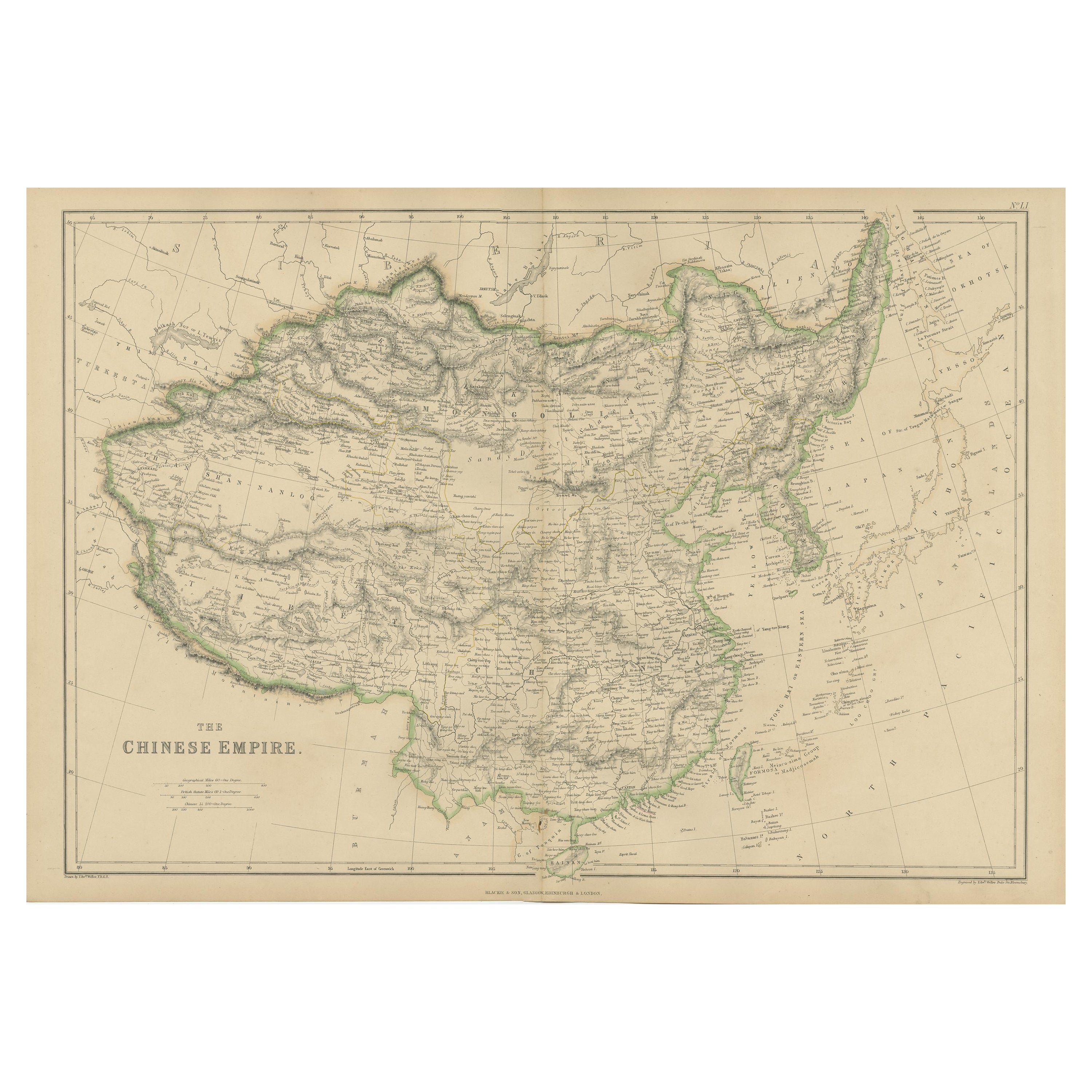
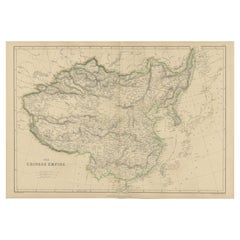
View AllAntique Map of the Chinese Empire by W. G. Blackie, 1859
Located in Langweer, NL
Antique map titled 'The Chinese Empire'. Original antique map of the Chinese Empire. This map originates from ‘The Imperial Atlas of Modern Geography’. Published by W. G. Blackie, 1859.
Category
Antique Mid-19th Century Maps
Materials
Paper
$239 Sale Price
20% Off
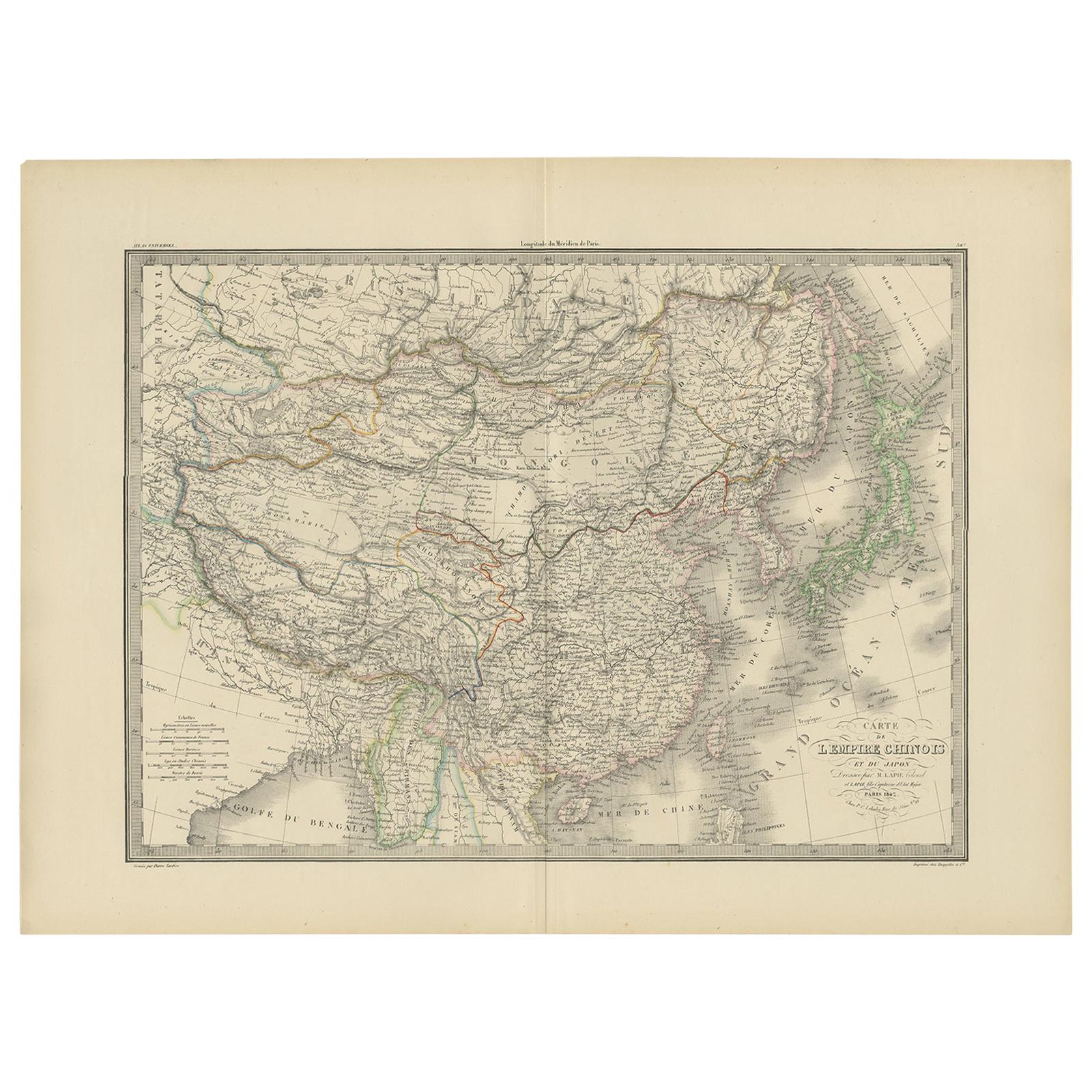
Antique Map of the Chinese Empire and Japan by Lapie, 1842
Located in Langweer, NL
Antique map titled 'Carte de L'Empire Chinois et du Japon'. Map of the Chinese Empire (China) and Japan. This map originates from 'Atlas universel de géographie ancienne et moderne (...
Category
Antique Mid-19th Century Maps
Materials
Paper

$527 Sale Price
20% Off
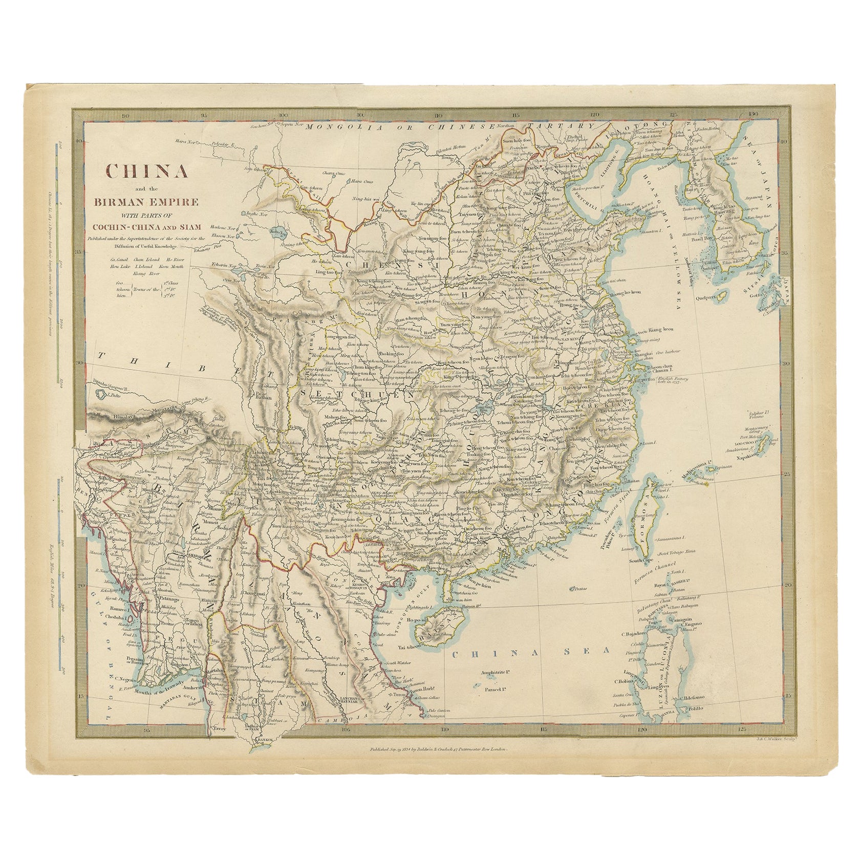
Antique Map of China, Also Depicting Formosa 'Taiwan' and Part of Korea, c.1840
Located in Langweer, NL
Antique map titled 'China'. Old map of China, also depicting Formosa (Taiwan) and part of Korea. Source unknown, to be determined.
Artists and Engravers: Anonymous.
Condition: ...
Category
Antique 19th Century Maps
Materials
Paper

$230 Sale Price
20% Off
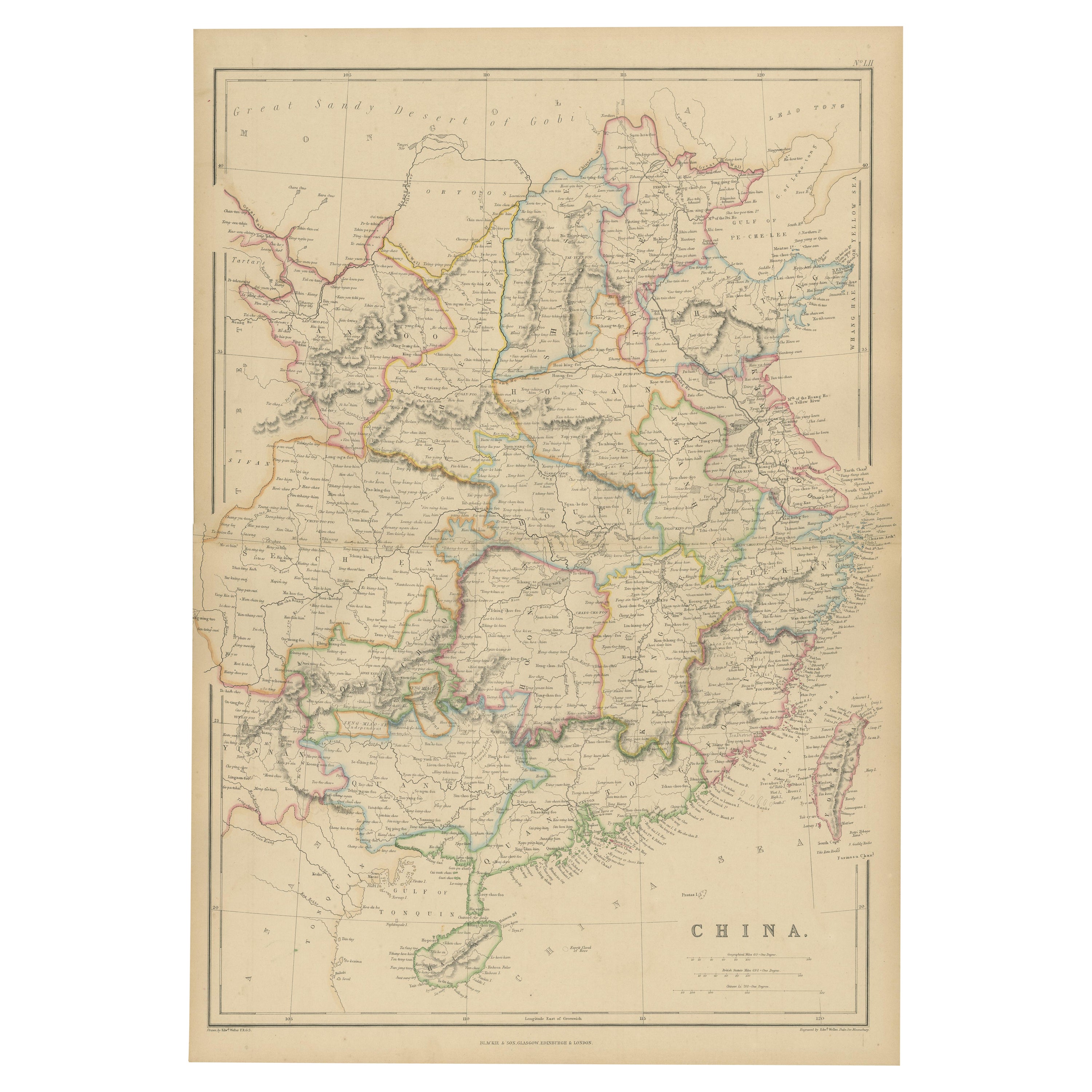
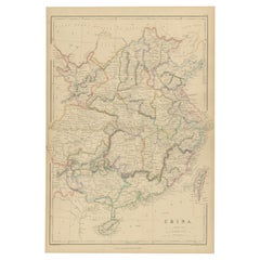
Antique Map of China by A & C, Black, 1870
Located in Langweer, NL
Antique map titled 'China'. Original antique map of China. This map originates from ‘Black's General Atlas of The World’. Published by A & C. Black, 1870.
Category
Antique Late 19th Century Maps
Materials
Paper

$263 Sale Price
20% Off
Antique Map of China by W. G. Blackie, 1859
Located in Langweer, NL
Antique map titled 'China'. Original antique map of China. This map originates from ‘The Imperial Atlas of Modern Geography’. Published by W. G. Blackie, 1859.
Category
Antique Mid-19th Century Maps
Materials
Paper
$239 Sale Price
20% Off
Antique Map of China, 1874
Located in Langweer, NL
Antique map titled 'China'. Detailed map of China originates from Blackie's 'The Comprehensive Atlas & Geography of the World'.
Artists and Engravers: ...
Category
Antique 19th Century Maps
Materials
Paper

$239 Sale Price
20% Off
You May Also Like
Super Rare Antique French Map of Chine and the Chinese Empire, 1780
Located in Amsterdam, Noord Holland
Super Rare Antique French Map of Chine and the Chinese Empire, 1780
Very nice map of Asia. 1780 Made by Bonne.
Additional information:
Type: Map
...
Category
Antique 18th Century European Maps
Materials
Paper

$584 Sale Price
33% Off
Original Antique Map of China, Arrowsmith, 1820
Located in St Annes, Lancashire
Great map of China
Drawn under the direction of Arrowsmith
Copper-plate engraving
Published by Longman, Hurst, Rees, Orme and Brown, 1820
Unfr...
Category
Antique 1820s English Maps
Materials
Paper

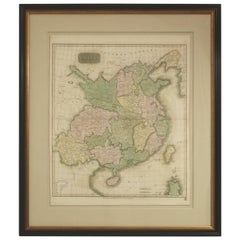
Framed Early 19th Century Drawn and Engraved Map of China
By John Knighton Thomson
Located in San Francisco, CA
Hand drawn and tinted engraved map of China dated 1815
Created for Thomson's New General Atlas
Edinburgh
Beautifully framed with a linen covered mat.
Category
Antique Early 19th Century European Prints
Materials
Paper
$862 Sale Price
25% Off
Antique 1803 Italian Map of Asia Including China Indoneseia India
Located in Amsterdam, Noord Holland
Antique 1803 Italian Map of Asia Including China Indoneseia India
Very nice map of Asia. 1803.
Additional information:
Type: Map
Country of Manufacturing: Europe
Period: 19th centu...
Category
Antique 19th Century European Maps
Materials
Paper

$584 Sale Price
20% Off
Large Original Antique Map of Asia by Sidney Hall, 1847
Located in St Annes, Lancashire
Great map of Asia
Drawn and engraved by Sidney Hall
Steel engraving
Original colour outline
Published by A & C Black. 1847
Unframed
Free shipping
Category
Antique 1840s Scottish Maps
Materials
Paper

Large Original Vintage Map of China, circa 1920
Located in St Annes, Lancashire
Great map of China.
Original color. Good condition.
Published by Alexander Gross
Unframed.
Category
Vintage 1920s English Edwardian Maps
Materials
Paper

More Ways To Browse
Imperial China
Imperial Mid
Leather Pouf And Ottomans
Low Side Tables
Set Of Four Italian Dining Chairs
Silk Runner Carpet
3x5 Rugs
Italian Lacquer Dining Room Sets
Round Brass Table
Round Table Base
Belgian Antiques
Cream Soup
Early English Silver
James Bond
Paisley Rugs and Carpets
Antique Pagoda
Black And Chrome Lounge Chair
Ceramic 1960s Italy