Items Similar to 19th Century Reprint of 16th Century Harbor Map of Copenhagen

Video Loading
Want more images or videos?
Request additional images or videos from the seller
1 of 22
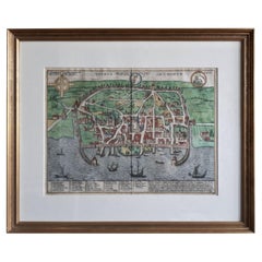
19th Century Reprint of 16th Century Harbor Map of Copenhagen
$450
£339.89
€392.81
CA$631.19
A$702.05
CHF 367.44
MX$8,562.69
NOK 4,616.99
SEK 4,342.87
DKK 2,931.95
About the Item
This reprint of 1587 antique map of Copenhagen, Denmark retains its original mid-century mat and has been recently reframed in classic wood frame. The muted sepia colored map is a wonderful addition to a gallery wall or also fitting as a stand alone piece in a living room, family room or library setting.
- Dimensions:Height: 18 in (45.72 cm)Width: 23.5 in (59.69 cm)Depth: 1 in (2.54 cm)
- Style:Baroque (In the Style Of)
- Materials and Techniques:
- Place of Origin:
- Period:
- Date of Manufacture:Late 19th Century
- Condition:Wear consistent with age and use.
- Seller Location:Haddonfield, NJ
- Reference Number:Seller: 372231stDibs: LU943443726382
About the Seller
5.0
Platinum Seller
Premium sellers with a 4.7+ rating and 24-hour response times
Established in 2010
1stDibs seller since 2012
2,025 sales on 1stDibs
Typical response time: <1 hour
- ShippingRetrieving quote...Shipping from: Haddonfield, NJ
- Return Policy
Authenticity Guarantee
In the unlikely event there’s an issue with an item’s authenticity, contact us within 1 year for a full refund. DetailsMoney-Back Guarantee
If your item is not as described, is damaged in transit, or does not arrive, contact us within 7 days for a full refund. Details24-Hour Cancellation
You have a 24-hour grace period in which to reconsider your purchase, with no questions asked.Vetted Professional Sellers
Our world-class sellers must adhere to strict standards for service and quality, maintaining the integrity of our listings.Price-Match Guarantee
If you find that a seller listed the same item for a lower price elsewhere, we’ll match it.Trusted Global Delivery
Our best-in-class carrier network provides specialized shipping options worldwide, including custom delivery.More From This Seller
View All19th Century Lithograph Map of Lower Manhattan, New York
Located in Haddonfield, NJ
1859 hand colored map of Lower Manhattan or New Amsterdam by George H. Moore.
Category
Antique 19th Century English Folk Art Maps
Materials
Paper

$620 Sale Price
20% Off
18th Century Map of French Pyrenees Region of France
Located in Haddonfield, NJ
An antique map titled "Principatus Benearnia, La Principaute De Bearn" created by the renowned Dutch cartographer Willem Janszoon Blaeu.
It depicts the Principality of Bearn, a histo...
Category
Antique 1880s Danish Baroque Maps
Materials
Wood, Paper

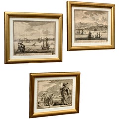
18th C. Set of 3 Etchings of Harbor Scenes in Gilt Frames
By Pierre Mortier, Pieter Schenk the Elder
Located in Haddonfield, NJ
A set of three antique Dutch engravings and etchings from the 18th Century. This set has been professionally framed in newer gilt frames and feature acid-free paper to protect these...
Category
Antique 18th Century Dutch Baroque Prints
Materials
Paper, Boxwood, Paint
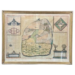
16th Century Antique Map of Ven Framed in Gold
Located in Haddonfield, NJ
Ven (older Swedish spelling Hven), is a Swedish island in the Öresund strait laying between Skåne, Sweden and Zealand and Denmark. The island was historically under Danish rule. Dani...
Category
Antique 16th Century Danish Baroque Maps
Materials
Wood, Paper
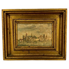
Mid-Century Framed Print of View of Innsbruck from Artist Durer
Located in Haddonfield, NJ
View of Innsbruck Harbor, on the river of Inn, Austria in a later print of one Durer's pieces, framed in New York City in the 1960's by Catalda Fine Arts, Inc.
Impressive artwork de...
Category
Mid-20th Century Austrian Renaissance Prints
Materials
Wood, Paper
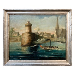
Early 19th Century French Oil Painting of Steamboat in a River Harbor Scene
Located in Haddonfield, NJ
A 19th century oil painting with original silver frame. Most probably representing the big river Garonne in Toulouse, France.
Garonne was famous for its intense traffic of steamboat...
Category
Antique Late 19th Century French Romantic Paintings
Materials
Canvas
You May Also Like
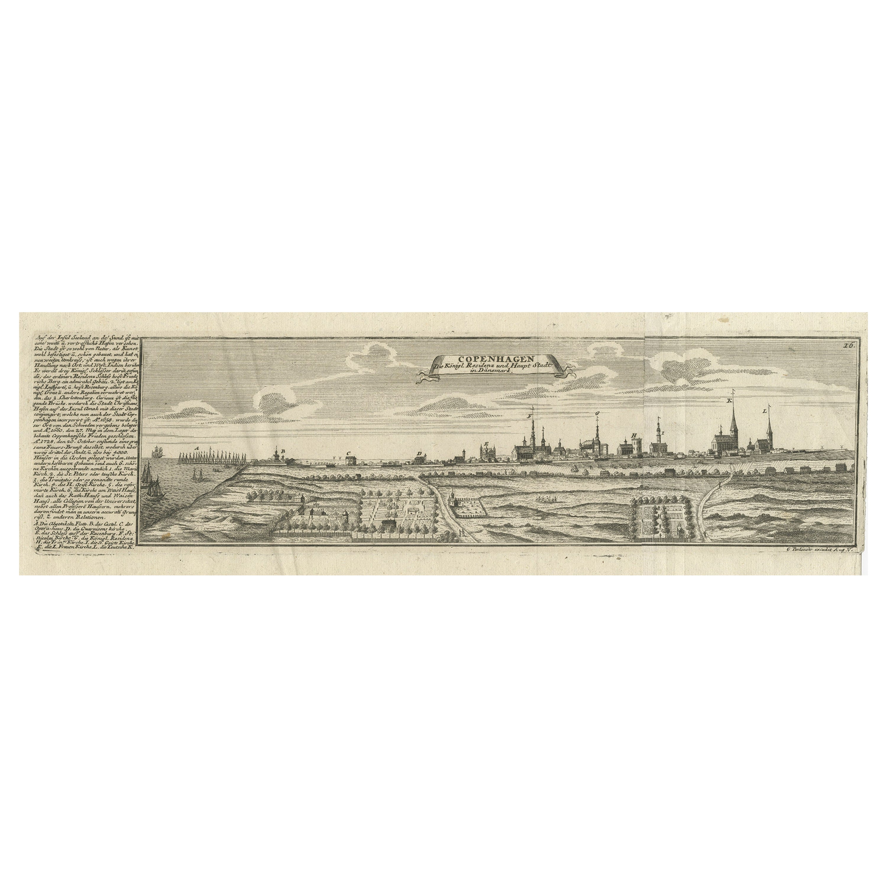
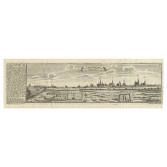
Rare Antique Engraving of the City of Copenhagen, Denmark, ca.1720
Located in Langweer, NL
Antique print titled 'Copenhagen. Die Königl. Residenz und Haupt Stadt in Dänemark'. Panoramic view of the city of Copenhagen, Denmark. This print, most likely, originates from the s...
Category
Antique 18th Century Prints
Materials
Paper
$438 Sale Price
20% Off
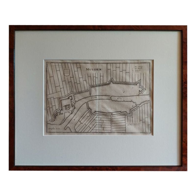
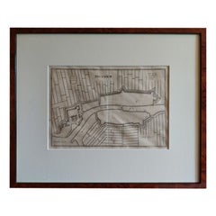
Antique Map of the City of Muiden by Merian, 1659
Located in Langweer, NL
Antique map titled 'Muyden'. Original antique map of the city of Muiden, the Netherlands. This map originates from 'Topographia Germania Inferioris' by C. Merian. Published 1659.
...
Category
Antique 17th Century Maps
Materials
Paper
$147 Sale Price
20% Off
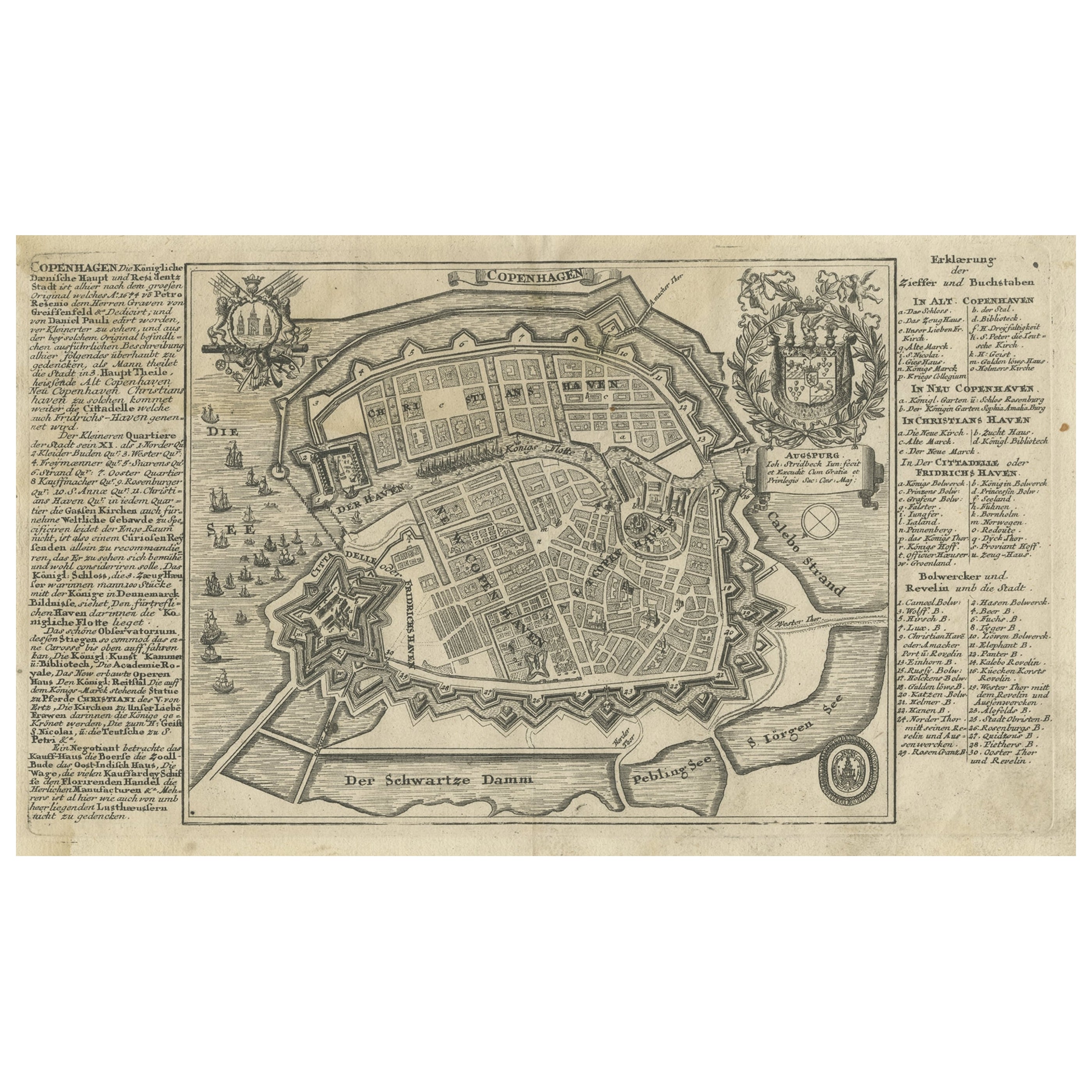
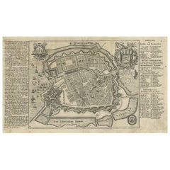
Antique Map of the City of Copenhagen in Denmark c.1720
Located in Langweer, NL
Antique map titled 'Copenhagen'. Original antique map of the city of Copenhagen, Denmark. This map originates from 'Unterschiedliche dieser Zeit Beruffene Laender, Gegenden, Staedte ...
Category
Antique 18th Century Danish Maps
Materials
Paper
Rare 18th C. Newport Map
Located in Sandwich, MA
Rare 18th C, Map titled "A plan of the town of Newport in the province of Rhode Island". Earliest printed plan of Newport, published for the use of the British just prior to their o...
Category
Antique 1770s American Maps
Materials
Paper

$19,500 / item
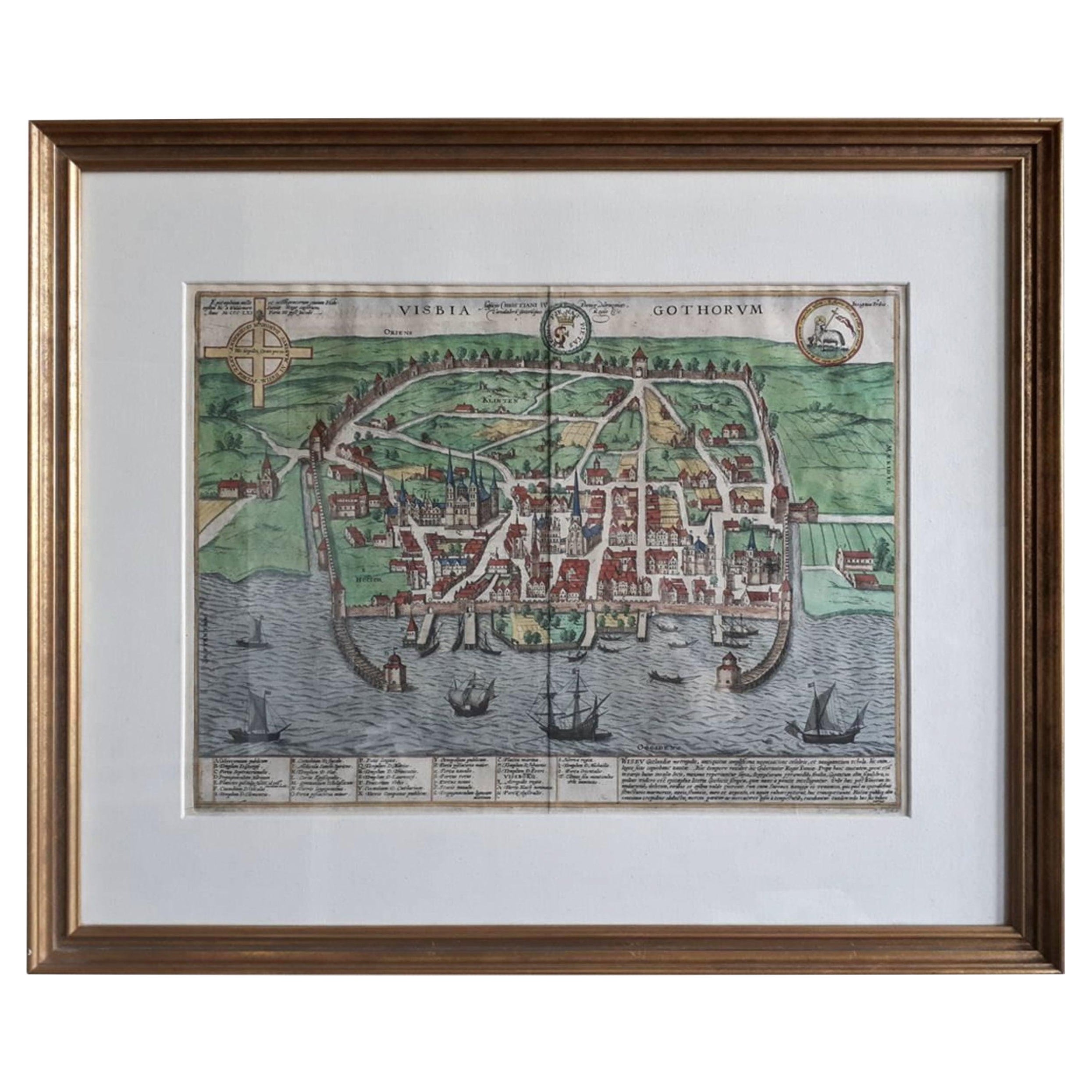
Antique Map of the City of Visby 'Sweden' by F. Hogenberg, 1598
Located in Langweer, NL
This is a wonderful bird's-eye plan/view of the oldest city in Sweden.
Visby, the largest city on the island of Gotland was an important Viking city and the main centre of the Hanseatic League...
Category
Antique 16th Century Maps
Materials
Paper
$2,336 Sale Price
20% Off
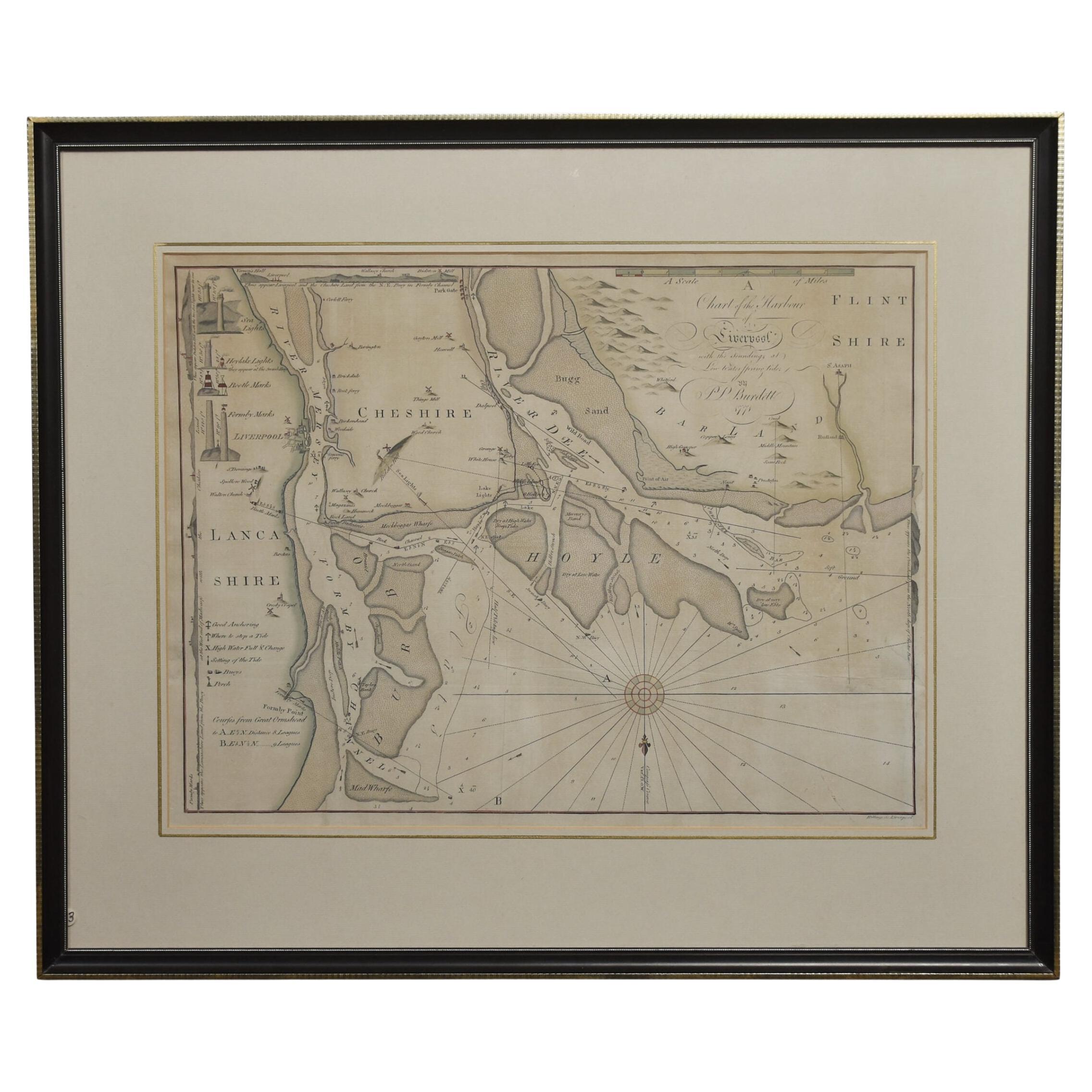
Chart of the Harbour of Liverpool
Located in Cheshire, GB
PL Burdett A Chart of the Harbour of Liverpool hand coloured. Encased in an ebonised frame.
Dimensions
Height 23.5 Inches
Width 28 Inches
Depth 1 Inches
Category
Early 20th Century British Maps
Materials
Paper

$633 Sale Price
20% Off
More Ways To Browse
Antique Library Stand
Silver Metal Chair
Swedish Kilim
Vintage Scandanavian Chairs
Vintage Tropical Furniture
19th Century Red Glass
Antique French Console Table Tables
French 50s
Silver Bowl Large
Antique French Silk
Down Couch
Cobalt Blue Glass
Used Lighter Art
Blue Edge Glass
Mahogany 1950s Furniture
Solid Mahogany Table
Dessert Glasses
Geometric Glass Table