Maps
to
234
418
56
476
16
6
4
4
3
2
2,926
2,181
476
3
289
34
10
127
7
35
9
2
5
3
4
2
436
27
21
18
12
108
85
69
42
32
476
476
476
5
2
2
1
1
Maps For Sale
Period: 20th Century
Period: Early 1900s
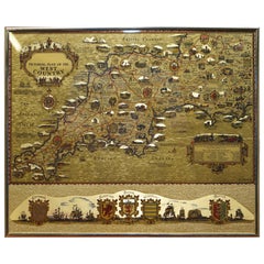
Gold Leaf Foil Pictorial Plan Map of the West Country of England Antique Style
Located in West Sussex, Pulborough
We are delighted to offer for sale this lovely Antique style pictorial plan map of the West Country of England etched in gold leaf foil
This is a very interesting and decorative p...
Category
20th Century English Adam Style Maps
Materials
Gold Leaf
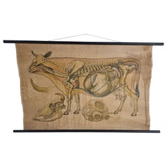
Antique Linen Anatomical School Poster from the Cow, 1950s
Located in Leuven, Vlaams Gewest
1950s didactical anatomical school poster of the cow.
Used to explain and show the anatomical aspect of a cow to the pupils.
Printed on linen.
Cool curio item to decorate a ...
Category
1950s Belgian Vintage Maps
Materials
Linen
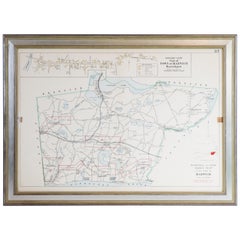
Map of Harwich, Massachusetts
Located in Norwell, MA
Turn of the century map of Harwich, Massachusetts. Plate from a Cape Cod County Map book showing the Barnstable county town of Harwich including Allens Harbor, Pleasant Lake, Harwich...
Category
20th Century Maps
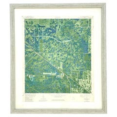
Vintage 50s Topographical Map of the Florida Keys
Located in west palm beach, FL
A fabulous vintage 50 original topographical map. A depiction of the Florida Keys and the surrounding waters. Part of a set of three maps. The other t...
Category
Mid-20th Century American Maps
Materials
Glass, Wood, Paper
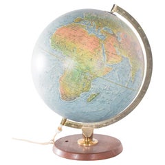
Mid-Century Earth Globe Electrified
Located in Lisboa, Lisboa
Earth globe, electrified. With polished wooden base and golden metal structure. This model presents a physical and political representation of the world, with reliefs that highlight ...
Category
Mid-20th Century Portuguese Mid-Century Modern Maps
Materials
Metal
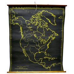
University Chart “Black Map of North America
Located in Godshill, Isle of Wight
University Chart “Black Map of North America
W&A K Johnston’s Charts of Physical Maps By G W Bacon,
This is a Black Physical map of North A...
Category
Early 20th Century Industrial Maps
Materials
Linen
Luminous Earth Globe on a Chrome Base, Italy, 1980
Located in Paris, FR
Unusual luminous globe on a large chromed metal base, made in Italy by Ricoscope Editions in Firenze.
In perfect condition, except for two very small missing pieces at the junction ...
Category
1980s Italian Space Age Vintage Maps
Materials
Chrome
Large University Chart “Political Map of North America” by Bacon
Located in Godshill, Isle of Wight
Large University Chart “Political Map of North America” by Bacon
W&A K Johnston’s Charts of Physical Maps By G W Bacon,
This is colourful Physical map ...
Category
Early 20th Century American Empire Maps
Materials
Linen
Large University Chart “Political Map of North America” by Bacon
Located in Godshill, Isle of Wight
Large University chart “Political Map of North America” by Bacon
W&A K Johnston’s Charts of Political Maps by G W Bacon,
This is colorful Physical ...
Category
Early 20th Century American Empire Maps
Materials
Linen
Large University Chart “Africa Physical ” by Bacon
Located in Godshill, Isle of Wight
Large University chart “Africa Physical ” by Bacon
W&A K Johnston’s charts of physical maps by G W Bacon,
This is a Physical map of Africa, it is lithograph set on Linen mounte...
Category
Early 20th Century Beaux Arts Maps
Materials
Linen
Large University Chart “Physical Map of Africa” by Bacon
Located in Godshill, Isle of Wight
Large university chart “Physical Map of Africa” by Bacon
W&A K Johnston’s Charts of Physical Maps By G W Bacon,
This is colorful Physical map of North America, it is large lithograph set...
Category
Early 20th Century Folk Art Maps
Materials
Linen
FRAME DRIVING SCHOOL 70 S 20th Century
Located in Madrid, ES
Large Globe 50S
THE GLOBE IS IN PLASTIC AND THE FOOT IN WOOD. 1950s. IT HAS LIGHT. GOOD CONDITION WITH CENTURIES OF USE. MEASUREMENTS: 110 CM IN HEIGHT AND 60 CM IN DIAMETER
good con...
Category
20th Century English Modern Maps
Materials
Plastic, Wood
