Items Similar to Cartographic Tapestry: Antique Map of Asia Minor, circa 1640


Want more images or videos?
Request additional images or videos from the seller
1 of 8
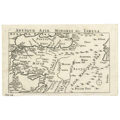
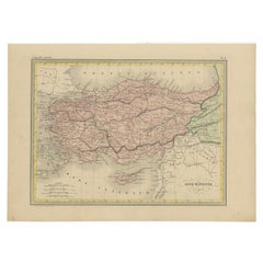
Cartographic Tapestry: Antique Map of Asia Minor, circa 1640
About the Item
Title: "Historical Tapestry: Antique Map of Asia Minor, circa 1640"
Description:
This authentic antique map, created by Willem Blaeu and published in Amsterdam circa 1640, is a captivating depiction of Asia Minor, including Cyprus and the Aegean Islands. It provides a window into the geographical and historical landscape of the region during the 17th century. Here's a detailed description:
- **Title**: The map features a decorative title cartouche at the top, adorned with two cherubs, adding an artistic touch to the map.
- **Geographical Coverage**: Asia Minor, as depicted on this map, extends from the Euphrates River to the Aegean Islands and from the Black Sea to the Mediterranean. Notably, it includes key geographical features such as the islands of Cyprus, Crete, and Rhodes, as well as prominent cities like Antioch, Troy, and Constantinople.
- **Historical Significance**: The region portrayed on this map holds immense historical significance, with a rich history spanning from the Paleolithic Era to various empires, including the Roman, Byzantine, Ottoman, and Armenian Empires. It serves as a testament to the complex tapestry of cultures and events that have shaped present-day Turkey.
- **Decorative Elements**: The map is adorned with decorative elements, making it visually appealing. Vignettes of sailing ships, a sea battle, and sea monsters provide a glimpse into the maritime history of the region. Additionally, a figure holding a distance scale, indicating German miles, graces the lower right corner, adding both practical and artistic elements to the map.
This antique map not only serves as a geographical reference but also as a historical artifact that allows viewers to explore the past and appreciate the artistry of cartography during the 17th century. It captures the allure of Asia Minor and its enduring significance in the annals of history.
- Dimensions:Height: 20.79 in (52.8 cm)Width: 25.28 in (64.2 cm)Depth: 0.02 in (0.5 mm)
- Materials and Techniques:
- Period:Mid-17th Century
- Date of Manufacture:circa 1640
- Condition:Minor fading. Please study image carefully.
- Seller Location:Langweer, NL
- Reference Number:Seller: BG-091971stDibs: LU305439944661
About the Seller
5.0
Recognized Seller
These prestigious sellers are industry leaders and represent the highest echelon for item quality and design.
Platinum Seller
Premium sellers with a 4.7+ rating and 24-hour response times
Established in 2009
1stDibs seller since 2017
2,439 sales on 1stDibs
Typical response time: 1 hour
- ShippingRetrieving quote...Shipping from: Langweer, Netherlands
- Return Policy
Authenticity Guarantee
In the unlikely event there’s an issue with an item’s authenticity, contact us within 1 year for a full refund. DetailsMoney-Back Guarantee
If your item is not as described, is damaged in transit, or does not arrive, contact us within 7 days for a full refund. Details24-Hour Cancellation
You have a 24-hour grace period in which to reconsider your purchase, with no questions asked.Vetted Professional Sellers
Our world-class sellers must adhere to strict standards for service and quality, maintaining the integrity of our listings.Price-Match Guarantee
If you find that a seller listed the same item for a lower price elsewhere, we’ll match it.Trusted Global Delivery
Our best-in-class carrier network provides specialized shipping options worldwide, including custom delivery.More From This Seller
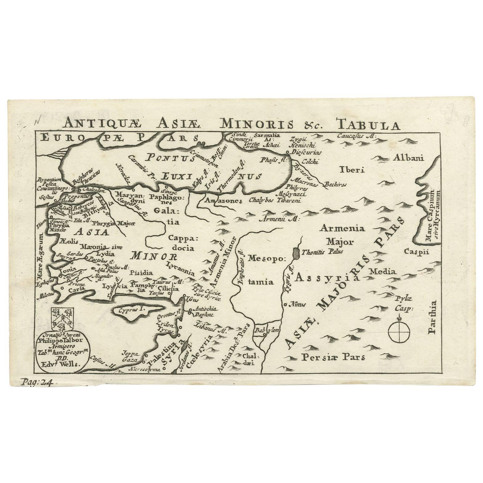
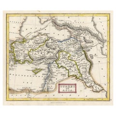
View AllNice Antique Map of Asia Minor, Turkey, circa 1718
Located in Langweer, NL
Antique map titled 'Antiquae Asiae Minoris & C. Tabula' by Philippo Talbor. This rare antique map is published by Edward Wells, circa 1718.
Category
Antique Early 18th Century Maps
Materials
Paper
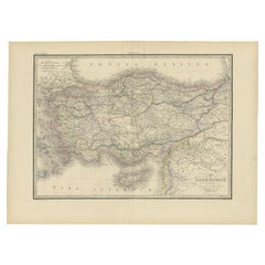
Antique Map of Asia Minor by J. Tallis, circa 1851
Located in Langweer, NL
A highly decorative mid-19th century map of 'Asia Minor' (modern day Turkey) which was drawn and engraved by J. Rapkin and published in John Tallis's Illust...
Category
Antique Mid-19th Century Maps
Materials
Paper

$254 Sale Price
20% Off
Antique Map of Turkey in Asia 'Asia Minor', 1841
Located in Langweer, NL
Antique map titled 'Turkey in Asia'. Original antique map of Asia Minor (Turkey). Source unknown, to be determined.
Artists and Engravers: Published by O...
Category
Antique 19th Century Maps
Materials
Paper
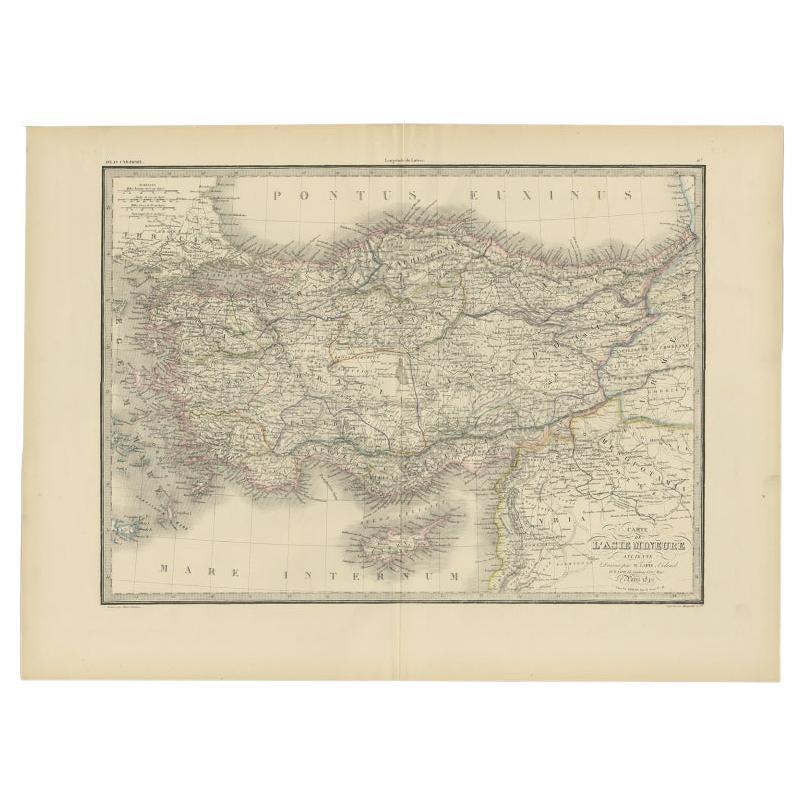
Antique Map of Asia Minor by Lapie, 1842
Located in Langweer, NL
Antique map titled 'Carte de l'Asie Mineure Ancienne (..)'. Map of Asia Minor, also called Anatolia or Turkish Anadolu. This map originates from 'Atlas univ...
Category
Antique 19th Century Maps
Materials
Paper
$361 Sale Price
20% Off
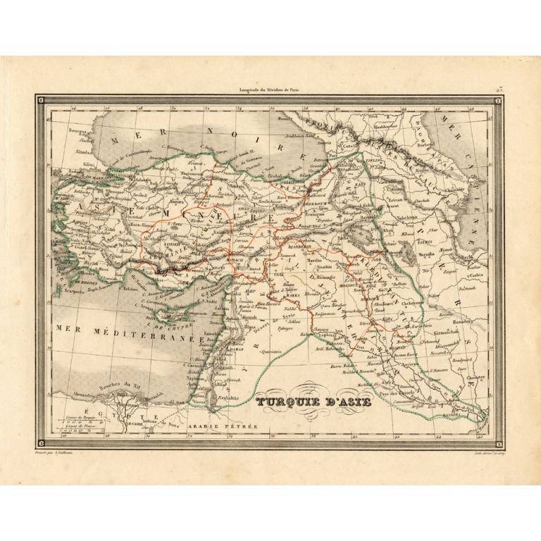
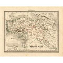
Antique Map of Turkey in Asia 'Asia Minor' by Vuillemin, 1846
Located in Langweer, NL
Antique map titled 'Turqui D'Asie'. Map of Turkey in Asia / Asia Minor. This attractive original old antique print / plate / map originates from: 'Atlas Uni...
Category
Antique 19th Century Maps
Materials
Paper
$69 Sale Price
20% Off
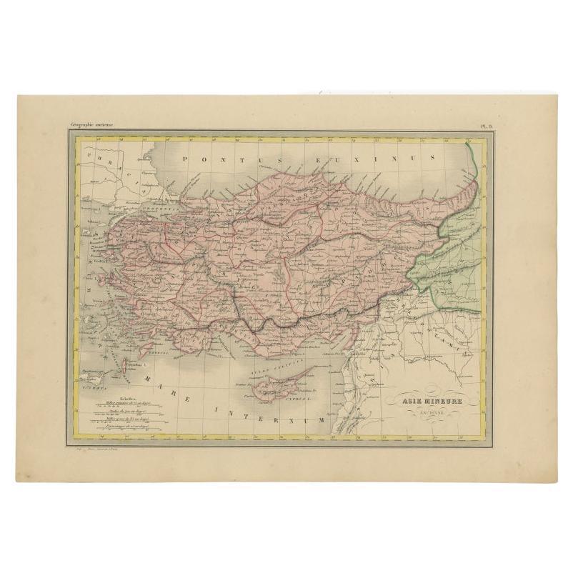
Antique Map of Asia Minor by Malte-Brun, 1847
Located in Langweer, NL
Antique map titled 'Asie Mineure Ancienne'. This is an original antique map of Asia Minor from Malte Brun's "" Atlas de Géographie Universelle"", revised by...
Category
Antique 19th Century Maps
Materials
Paper
$74 Sale Price
20% Off
You May Also Like
Antique Map Of Brabantia Ducantus By Bleau Circa 1640
Located in Brussels, Brussels
map of theBrabantia Ducantus (Belgium) circa 1640 by Bléau. Bléau was well known for antique atlas that he draw during the 17 century
beautiful map, double page folded in the middle,...
Category
Antique 17th Century French Renaissance Maps
Materials
Paper

Antique Town Plan Map, Poole, English, Framed Cartography, Georgian, Circa 1780
Located in Hele, Devon, GB
This is an antique town plan map of Poole in Dorset. An English, framed atlas engraving, dating to the 18th century and later.
Fascinating cartography with annotated streets and pl...
Category
Antique Late 18th Century British George III Maps
Materials
Glass, Wood, Paper

Antique Lithography Map, Isle of Thanet, Kent, English, Cartography, Victorian
Located in Hele, Devon, GB
This is an antique lithography map of The Isle of Thanet in Kent. An English, framed atlas engraving of cartographic interest, dating to the mid 19th century and later.
Superb litho...
Category
Antique Mid-19th Century British Victorian Maps
Materials
Wood

Antique County Map of Cheshire, Dutch, Framed, Cartography, Janssonius, C.1660
Located in Hele, Devon, GB
This is an antique county map of Cheshire. A Dutch, framed atlas engraving by Johannes Janssonius, dating to the 17th century and later.
A treat for the collector or county native,...
Category
Antique Mid-17th Century Dutch Charles II Maps
Materials
Glass, Wood, Paper

Antique Environs of Bath & Bristol Map, English, Framed Cartography, Victorian
Located in Hele, Devon, GB
This is an antique region map of Bath and Bristol. An English, framed atlas engraving of cartographic interest, dating to the mid 19th century and later.
Superb lithography of Bath...
Category
Antique Mid-19th Century British Victorian Maps
Materials
Glass, Wood, Paper
Antique Lithography Map, Cumberland, English, Framed, Cartography, Victorian
Located in Hele, Devon, GB
This is an antique lithography map of Cumberland. An English, framed atlas engraving of cartographic interest, dating to the mid 19th century and la...
Category
Antique Mid-19th Century British Victorian Maps
Materials
Wood

Recently Viewed
View AllMore Ways To Browse
17th Century Ottoman
Antique Tapestry Ottoman
Antique German Tapestry
Ships Maritime Figure
Tapestry With Cherubs
Ottoman Empire Artifacts
Constantinople Tapestry
Distressed Silk Rug
Duo Rug
Early American Wooden Chairs
Eastern European Painted Furniture
Ebonized Side Table End Table
Ebonized Wood French Polish
Embroidered Velvet Pillows
English Mason
English Plates Blue And White
Espresso Cups
Etched Cut Glass Antique