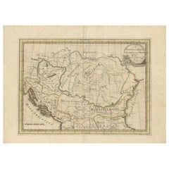
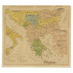
Antique Map of the Balkans by G.M. Cassini, 1801
View Similar Items


Want more images or videos?
Request additional images or videos from the seller
1 of 5
Antique Map of the Balkans by G.M. Cassini, 1801
About the Item
- Dimensions:Height: 17.92 in (45.5 cm)Width: 24.41 in (62 cm)Depth: 0.02 in (0.5 mm)
- Materials and Techniques:
- Period:
- Date of Manufacture:1801
- Condition:Please study image carefully.
- Seller Location:Langweer, NL
- Reference Number:Seller: BG-068351stDibs: LU3054311599981
About the Seller
5.0
Platinum Seller
These expertly vetted sellers are 1stDibs' most experienced sellers and are rated highest by our customers.
Established in 2009
1stDibs seller since 2017
1,933 sales on 1stDibs
More From This SellerView All
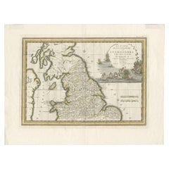
- Antique Map of Northern England and Wales by Cassini, 'circa 1795'By Giovanni Maria CassiniLocated in Langweer, NLAntique map titled 'La Parte Settentrionale dell' Inghilterra e del Principato di Galles'. Engraved map of Northern England and Wales. Shows Northum...Category
Antique Late 18th Century Maps
MaterialsPaper
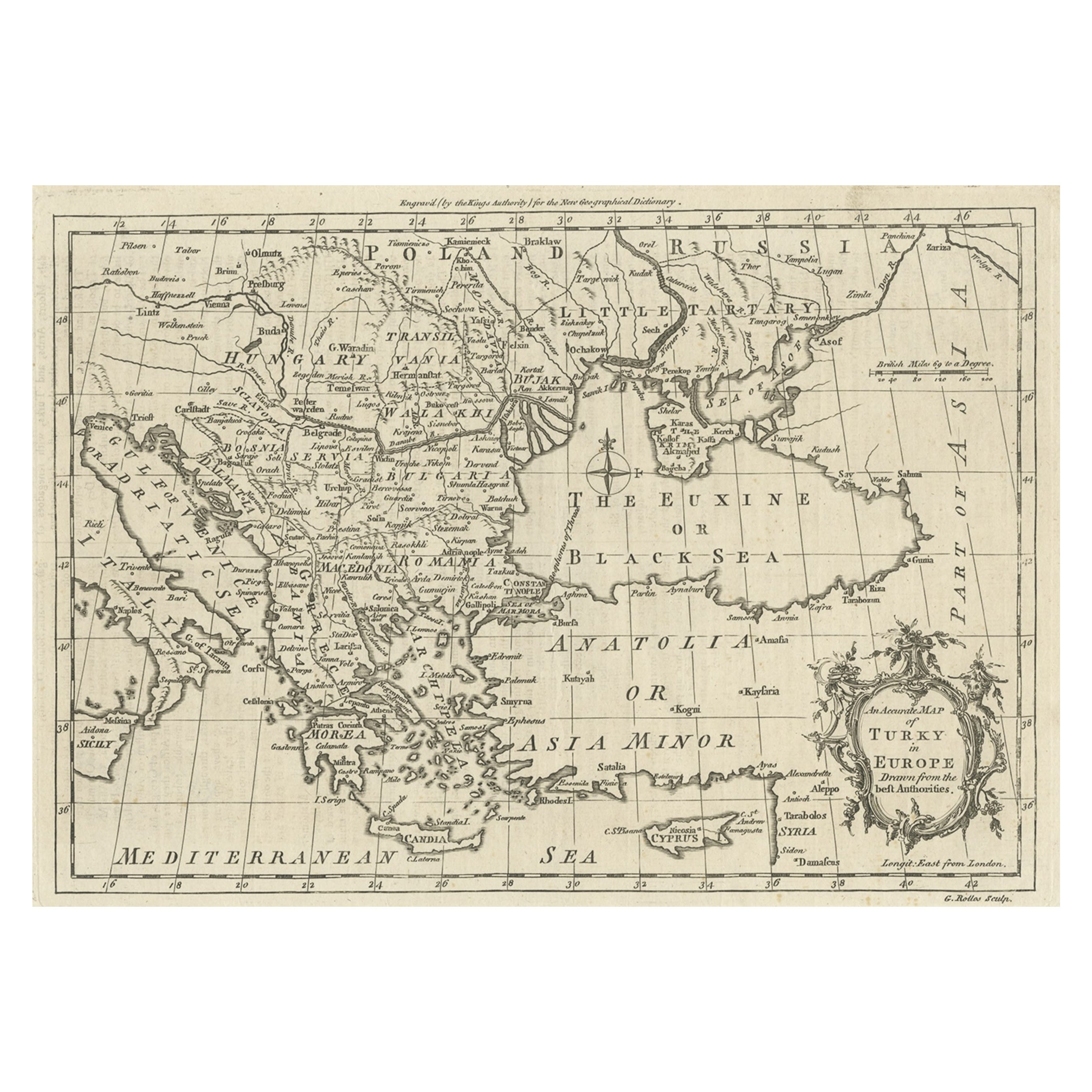
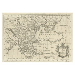
- Map of the Ottoman Empire in Europe, incl. the Balkans, Greece & Turkey, c.1760Located in Langweer, NLAntique map Turkey titled 'An Accurate Map of Turky in Europe drawn from the best Authorities'. Map of the Ottoman Empire in Europe, the Balkans, Greece, and Turkey in Europe. Engr...Category
Antique 1760s Maps
MaterialsPaper
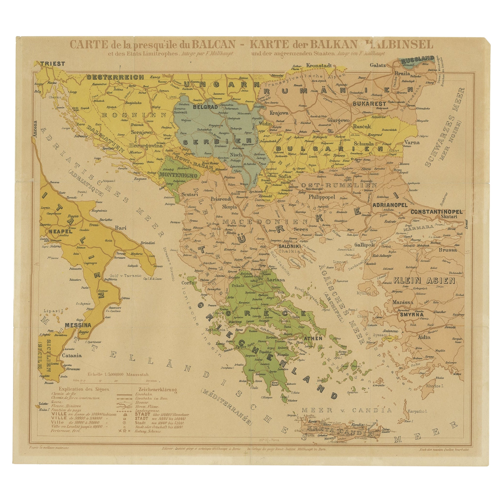
- Old Map of the Balkans Incl Greece, Turkey, Serbia, Montenegro, Bulgaria, C.1900Located in Langweer, NLAntique map titled 'Carte de la presqu-île du Balcan - Karte der Balkan Halbinsel'. Original antique map of the Balkans including Greece, Turkey, Serbia, Montenegro, Bulgaria and...Category
Antique Early 1900s Maps
MaterialsPaper
 $571 Sale Price20% Off
 - Antique Map of the Islands of the Atlantic by J. TallisLocated in Langweer, NLA highly decorative and detailed mid-19th century map of the Islands of the Atlantic -- including the Azores, Madeira, Bermuda, the Canary Islands and the Cape Verde Islands -- which...Category
Antique Mid-19th Century Maps
MaterialsPaper
 $263 Sale Price20% Off
 - Antique Map of the World by Johnson, '1872'Located in Langweer, NLAntique map titled 'Johnson's World. Original world map. This map originates from 'Johnson's New Illustrated Family Atlas of the World' by A.J. John...Category
Antique Late 19th Century Maps
MaterialsPaper
 $411 Sale Price25% Off
 - Antique Map of the Philippines by Anson '1749'Located in Langweer, NLAntique map titled 'Carte du Canal des Iles Philippines - Kaart van het Kanaal in de Filippynsche Eilanden'. Large detailed chart of the islands of the Philippines. One of the most detailed charts of the Philippines of the era. Shows Islands, bays, reefs, soundings tracks of the Manila Galleon route, etc. Includes a large compass...Category
Antique Mid-18th Century Maps
MaterialsPaper

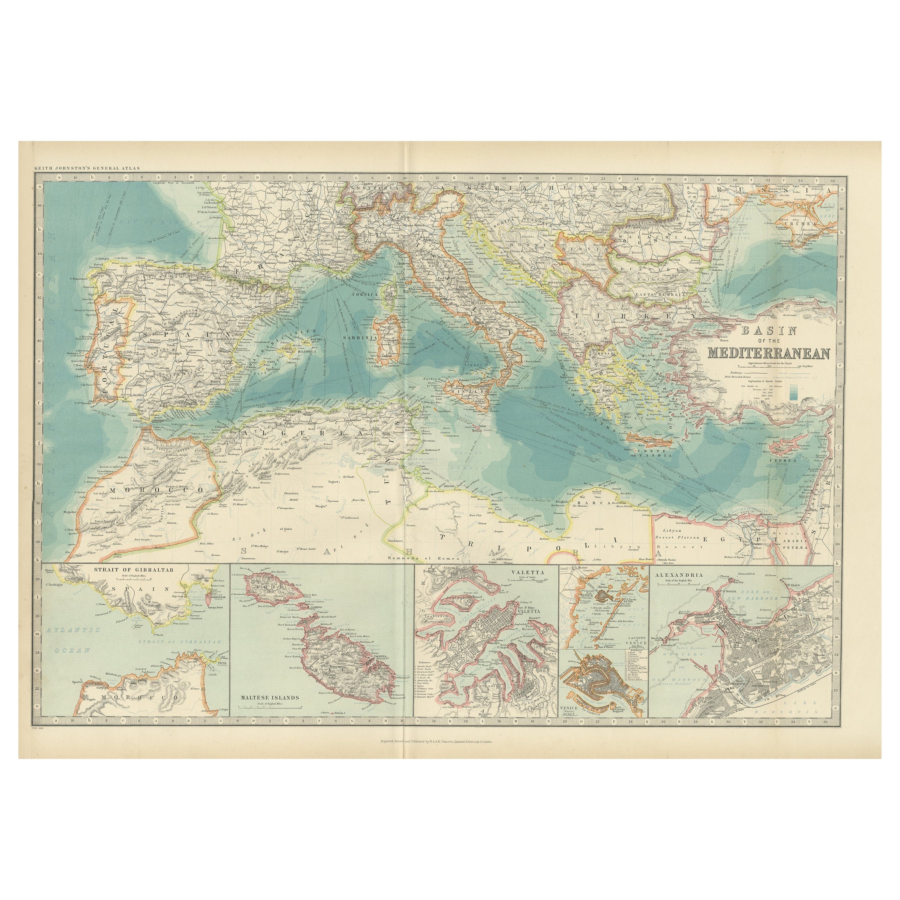
You May Also Like
- Original Antique Map of The World by Thomas Clerk, 1817Located in St Annes, LancashireGreat map of The Eastern and Western Hemispheres On 2 sheets Copper-plate engraving Drawn and engraved by Thomas Clerk, Edinburgh. Published by Mackenzie And Dent, 1817 ...Category
Antique 1810s English Maps
MaterialsPaper
- Original Antique Map of The Netherlands, Engraved by Barlow, Dated 1807Located in St Annes, LancashireGreat map of Netherlands Copper-plate engraving by Barlow Published by Brightly & Kinnersly, Bungay, Suffolk. Dated 1807 Unframed.Category
Antique Early 1800s English Maps
MaterialsPaper
- Map of the Republic of GenoaLocated in New York, NYFramed antique hand-coloured map of the Republic of Genoa including the duchies of Mantua, Modena, and Parma. Europe, late 18th century. Dimension: 25...Category
Antique Late 18th Century European Maps
- Antique Map of Italy by Andriveau-Goujon, 1843By Andriveau-GoujonLocated in New York, NYAntique Map of Italy by Andriveau-Goujon, 1843. Map of Italy in two parts by Andriveau-Goujon for the Library of Prince Carini at Palazzo Carini i...Category
Antique 1840s French Maps
MaterialsLinen, Paper
 $3,350 / set
 - Antique Map of Principality of MonacoBy Antonio Vallardi EditoreLocated in Alessandria, PiemonteST/619 - "Old Geographical Atlas of Italy - Topographic map of ex-Principality of Monaco" - ediz Vallardi - Milano - A somewhat special edition ---Category
Antique Late 19th Century Italian Other Prints
MaterialsPaper
 $228 Sale Price74% Off
 - Original Antique Map of Russia By Arrowsmith. 1820Located in St Annes, LancashireGreat map of Russia Drawn under the direction of Arrowsmith Copper-plate engraving Published by Longman, Hurst, Rees, Orme and Brown, 1820 Unframed.Category
Antique 1820s English Maps
MaterialsPaper


