Items Similar to Antique Map of Cyprus and Asia Minor with Medallions and Vignettes


Want more images or videos?
Request additional images or videos from the seller
1 of 6
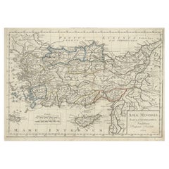
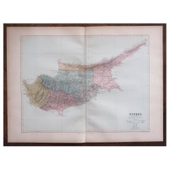
Antique Map of Cyprus and Asia Minor with Medallions and Vignettes
About the Item
Antique map titled 'Asiae Peninsula sive Asia intra Taurum'. Decorative map of Cyprus and Asia Minor, featuring the geographical features known to the ancients and decorated with a vignettes and 27 medallions. Published by Christoph Weigel, circa 1720.
- Dimensions:Height: 15.04 in (38.2 cm)Width: 18.78 in (47.7 cm)Depth: 0.02 in (0.5 mm)
- Materials and Techniques:
- Period:
- Date of Manufacture:c.1720
- Condition:General age-related toning. Original folding line. Shows some staining. Minor wear and soiling. Blank verso. Please study image carefully.
- Seller Location:Langweer, NL
- Reference Number:Seller: BG-135721stDibs: LU3054336143002
About the Seller
5.0
Recognized Seller
These prestigious sellers are industry leaders and represent the highest echelon for item quality and design.
Gold Seller
Premium sellers maintaining a 4.3+ rating and 24-hour response times
Established in 2009
1stDibs seller since 2017
2,446 sales on 1stDibs
Typical response time: 1 hour
- ShippingRetrieving quote...Shipping from: Langweer, Netherlands
- Return Policy
Authenticity Guarantee
In the unlikely event there’s an issue with an item’s authenticity, contact us within 1 year for a full refund. DetailsMoney-Back Guarantee
If your item is not as described, is damaged in transit, or does not arrive, contact us within 7 days for a full refund. Details24-Hour Cancellation
You have a 24-hour grace period in which to reconsider your purchase, with no questions asked.Vetted Professional Sellers
Our world-class sellers must adhere to strict standards for service and quality, maintaining the integrity of our listings.Price-Match Guarantee
If you find that a seller listed the same item for a lower price elsewhere, we’ll match it.Trusted Global Delivery
Our best-in-class carrier network provides specialized shipping options worldwide, including custom delivery.More From This Seller
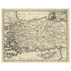
View AllOriginal Antique Map of Turkey, Asia Minor and Cyprus
By Gerard Mercator
Located in Langweer, NL
Antique map titled 'Natoliae sive Asia Minor'. Original old map of Turkey, Asia Minor and Cyprus. Includes a decorative cartouches, sailing ship, sea mon...
Category
Antique Early 17th Century Maps
Materials
Paper

$782 Sale Price
20% Off
Antique Map of Asia Minor, Cyprus, and the Eastern Mediterranean
Located in Langweer, NL
Antique map titled 'Natoliae quae olim Asia Minor nova descriptio'. Original antique map of Asia Minor, Cyprus, and the eastern Mediterranean. Originally published on one sheet toget...
Category
Antique Early 17th Century Maps
Materials
Paper

$408 Sale Price
20% Off
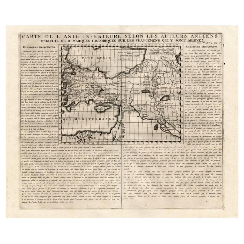
Detailed Antique Map of Asia Minor & Cyprus with Historical Notes, 1732
Located in Langweer, NL
Antique map titled 'Carte De L'Asie Inferieure Selon Les Auteurs Anciens (..)'. Detailed map of Asia Minor & Cyprus. With historical notes. This original old antique print / plate or...
Category
Antique 18th Century Maps
Materials
Paper
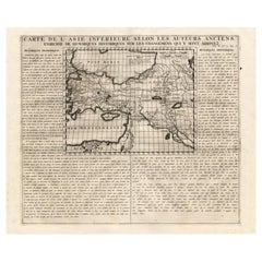
$231 Sale Price
20% Off
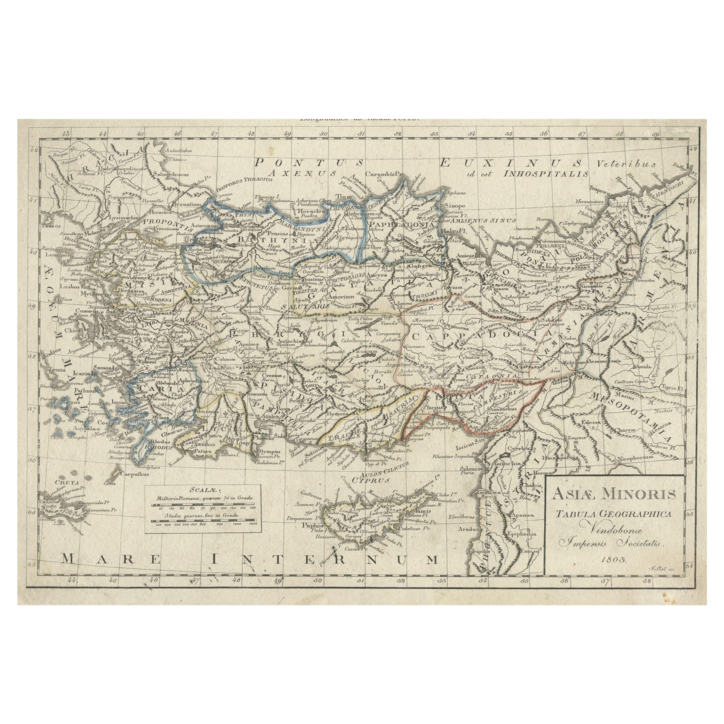
Antique Map of Asia Minor, Present-day Turkey and Cyprus, 1803
Located in Langweer, NL
Antique map titled 'Asiae Minoris Tabula Geographica'. Uncommon antique map of Asia minor, comprising most of what is present-day Turkey. Source unknown, to be determined.
Artists...
Category
Antique 19th Century Maps
Materials
Paper
$166 Sale Price
20% Off
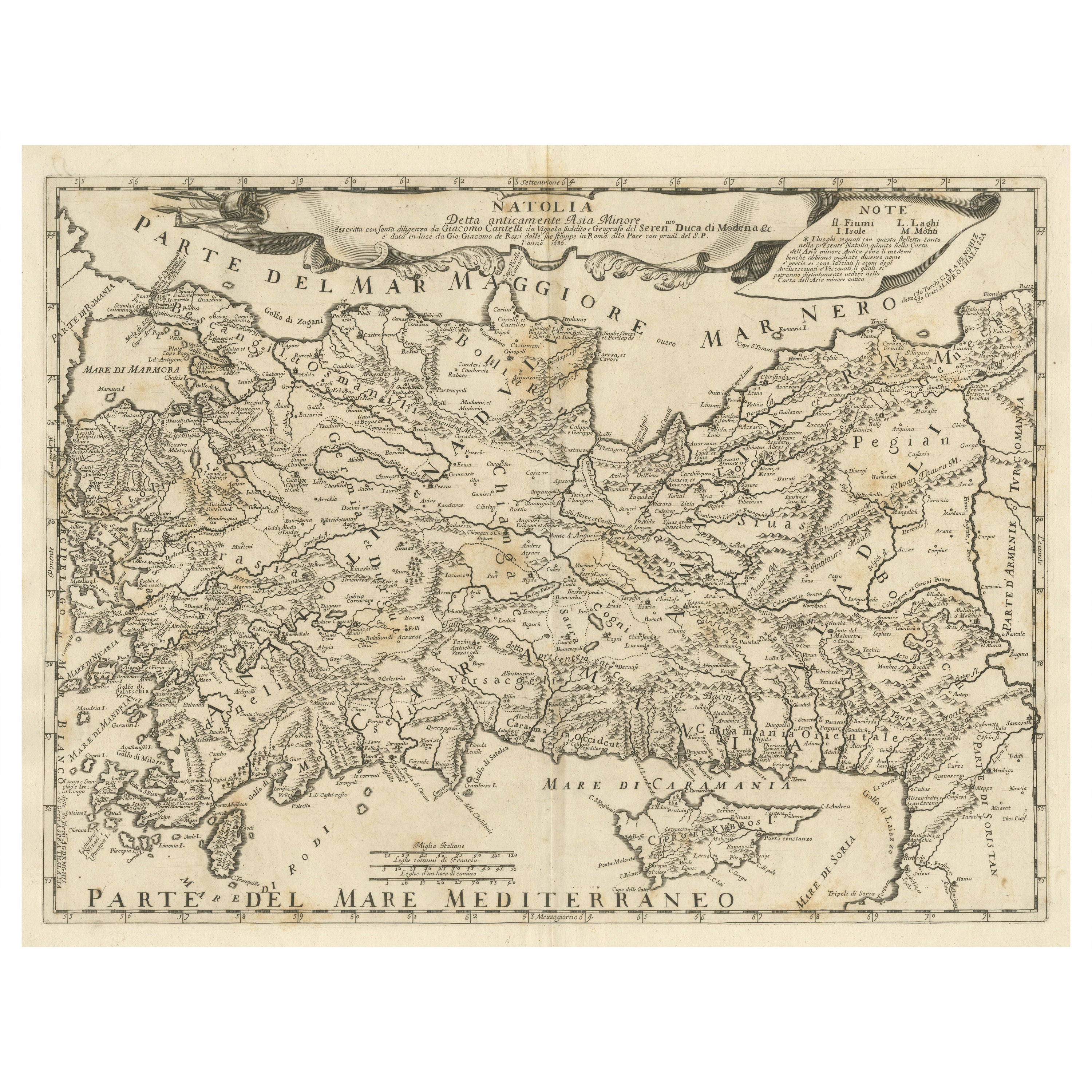
Original Italian Antique Map of Asia Minor and Cyprus and Neighboring Regions
Located in Langweer, NL
Antique map titled 'Natolia detta anticamente Asia Minor (..)'. Rare map of Asia Minor (Turkey) and Cyprus and neighboring regions. The map provides one of the most detailed and up t...
Category
Antique Late 17th Century Maps
Materials
Paper
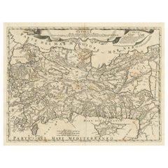
$602 Sale Price
20% Off
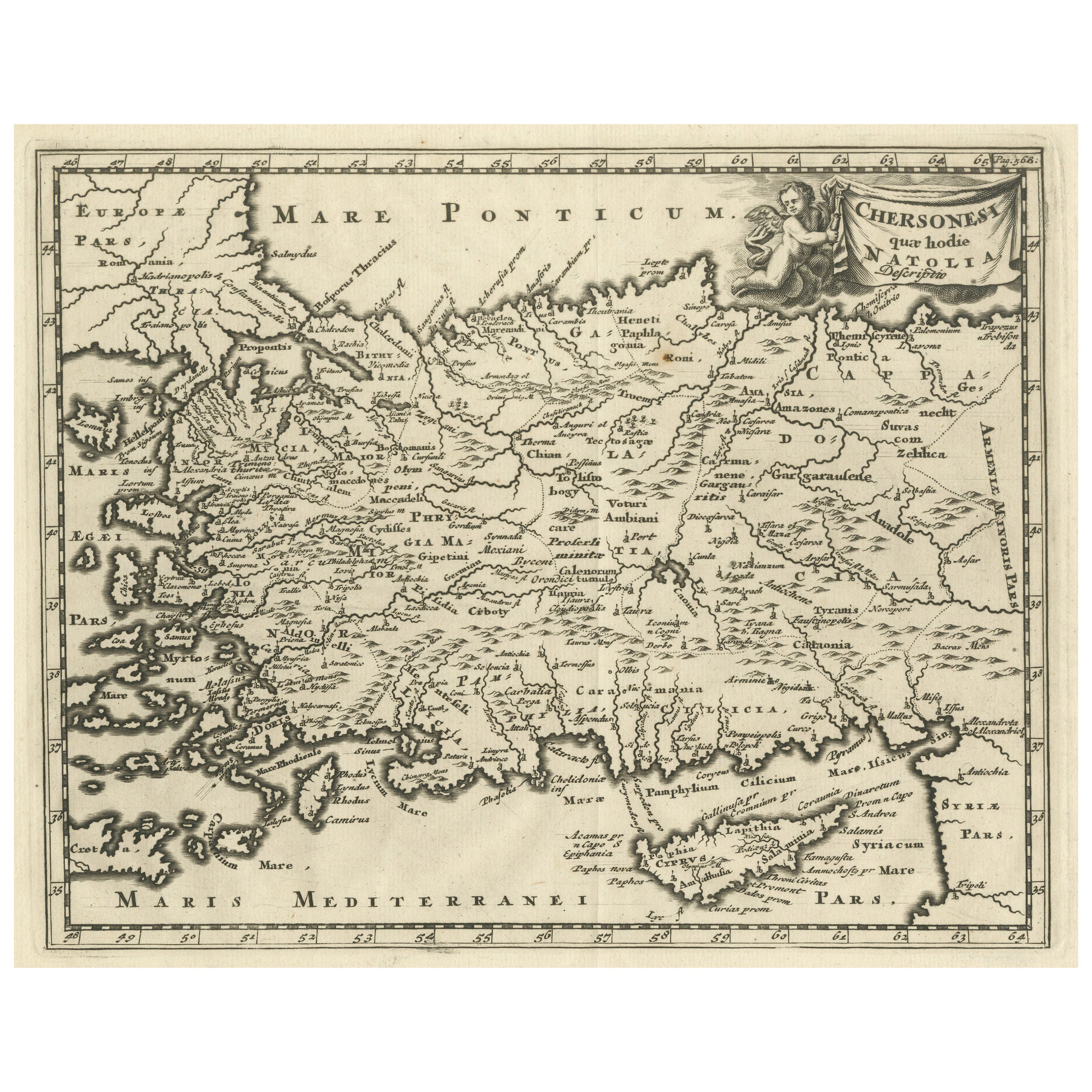
Antique Map of Asia Minor including part of the Greek Archipelago and Cyprus
Located in Langweer, NL
Antique map titled 'Chersonesi quae hodie Natolia Descriptio'. Decorative, smaller map of Asia Minor including part of the Greek Archipelago and Cyprus. The drape-style title cartouc...
Category
Antique Mid-18th Century Maps
Materials
Paper
$316 Sale Price
20% Off
You May Also Like
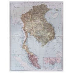
Large Original Vintage Map of S.E Asia, with a Vignette of Singapore
Located in St Annes, Lancashire
Great map of South East Asia
Original color. Good condition
Published by Alexander Gross
Unframed.
Category
Vintage 1920s English Maps
Materials
Paper
Large Original Antique Map of Cyprus. 1894
Located in St Annes, Lancashire
Superb Antique map of Cyprus
Published Edward Stanford, Charing Cross, London 1894
Original colour
Good condition
Unframed.
Free shipping
Category
Antique 1890s English Maps
Materials
Paper
Hand-Colored 18th Century Homann Map of the Black Sea, Turkey and Asia Minor
By Johann Baptist Homann
Located in Alamo, CA
An attractive original early 18th century hand-colored map of the Black Sea and Turkey entitled "Carte de L'Asie Minevre ou de la Natolie et du Pont Evxin Tiree des Voyages et des Ob...
Category
Antique Early 18th Century German Maps
Materials
Paper

Antique Map of American Cities, Vignette of New York City, circa 1920
Located in St Annes, Lancashire
Great maps of American Cities
Unframed
Original color
By John Bartholomew and Co. Edinburgh Geographical Institute
Published, circa 1920
Category
Vintage 1920s British Maps
Materials
Paper

Antique French Map of Asia Including China Indoneseia India, 1783
Located in Amsterdam, Noord Holland
Very nice map of Asia. 1783 Dedie au Roy.
Additional information:
Country of Manufacturing: Europe
Period: 18th century Qing (1661 - 1912)
Condition: Overall Condition B (Good Used)...
Category
Antique 18th Century European Maps
Materials
Paper

$648 Sale Price
20% Off
Antique 1803 Italian Map of Asia Including China Indoneseia India
Located in Amsterdam, Noord Holland
Antique 1803 Italian Map of Asia Including China Indoneseia India
Very nice map of Asia. 1803.
Additional information:
Type: Map
Country of Manufacturing: Europe
Period: 19th centu...
Category
Antique 19th Century European Maps
Materials
Paper

$584 Sale Price
20% Off
Recently Viewed
View AllMore Ways To Browse
Masculine Rug
Matching Curved Sofas
Meditation Carpet
Metal Gio Ponti Chair
Mid Century Denmark Cord Chairs
Mid Century Modern Octagon Dining Table
Mid Century Modern Octagonal Dining Table
Mid Century Spices
Mid Century Wine Rack
Ming Dynasty Table
Modern Creamer Midcentury
Moroccan Game Table
Naive Chair
Needlepoint Seat Chair
Ng Design
Niels Moller Teak Dining Chairs
Off White Cocktail Table
Original Blueprint