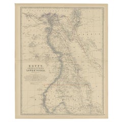
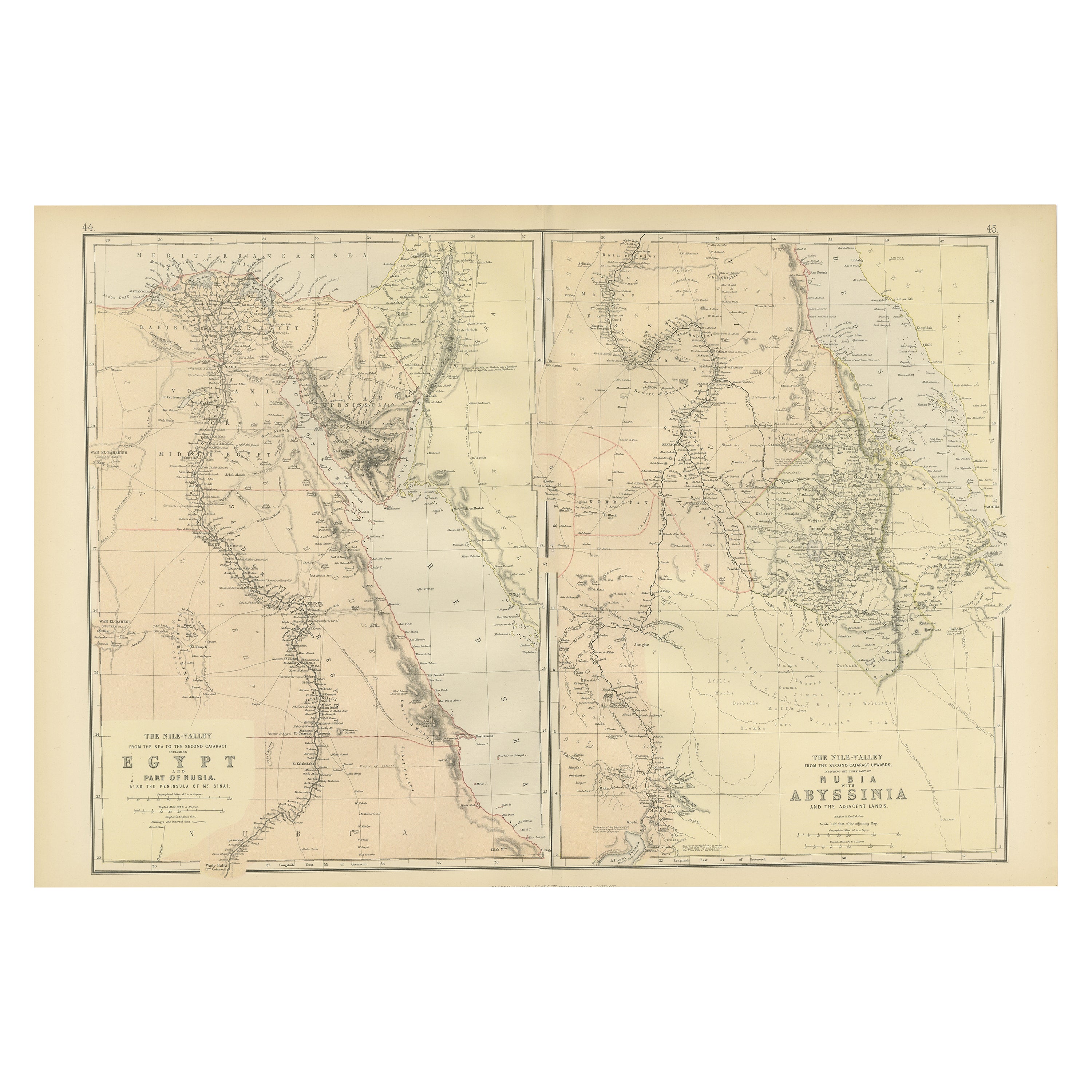
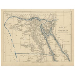
Antique Map of Egypt, Arabia and Lower Nubia, 1882
View Similar Items


Want more images or videos?
Request additional images or videos from the seller
1 of 5
Antique Map of Egypt, Arabia and Lower Nubia, 1882
About the Item
- Dimensions:Height: 24.14 in (61.3 cm)Width: 19.53 in (49.6 cm)Depth: 0 in (0.01 mm)
- Materials and Techniques:
- Period:
- Date of Manufacture:1882
- Condition:
- Seller Location:Langweer, NL
- Reference Number:Seller: BG-11823-411stDibs: LU3054326172492
About the Seller
5.0
Platinum Seller
These expertly vetted sellers are 1stDibs' most experienced sellers and are rated highest by our customers.
Established in 2009
1stDibs seller since 2017
1,933 sales on 1stDibs
More From This SellerView All
- Antique Map of Egypt, Arabia Petraea and Lower Nubia by Johnston '1909'Located in Langweer, NLAntique map titled 'Egypt, Arabia Petraea and Lower Nubia'. Original antique map of Egypt, Arabia Petraea and Lower Nubia. With inset maps of Alexandriam Cairo and the Suez Canal...Category
Early 20th Century Maps
MaterialsPaper
 $206 Sale Price24% Off
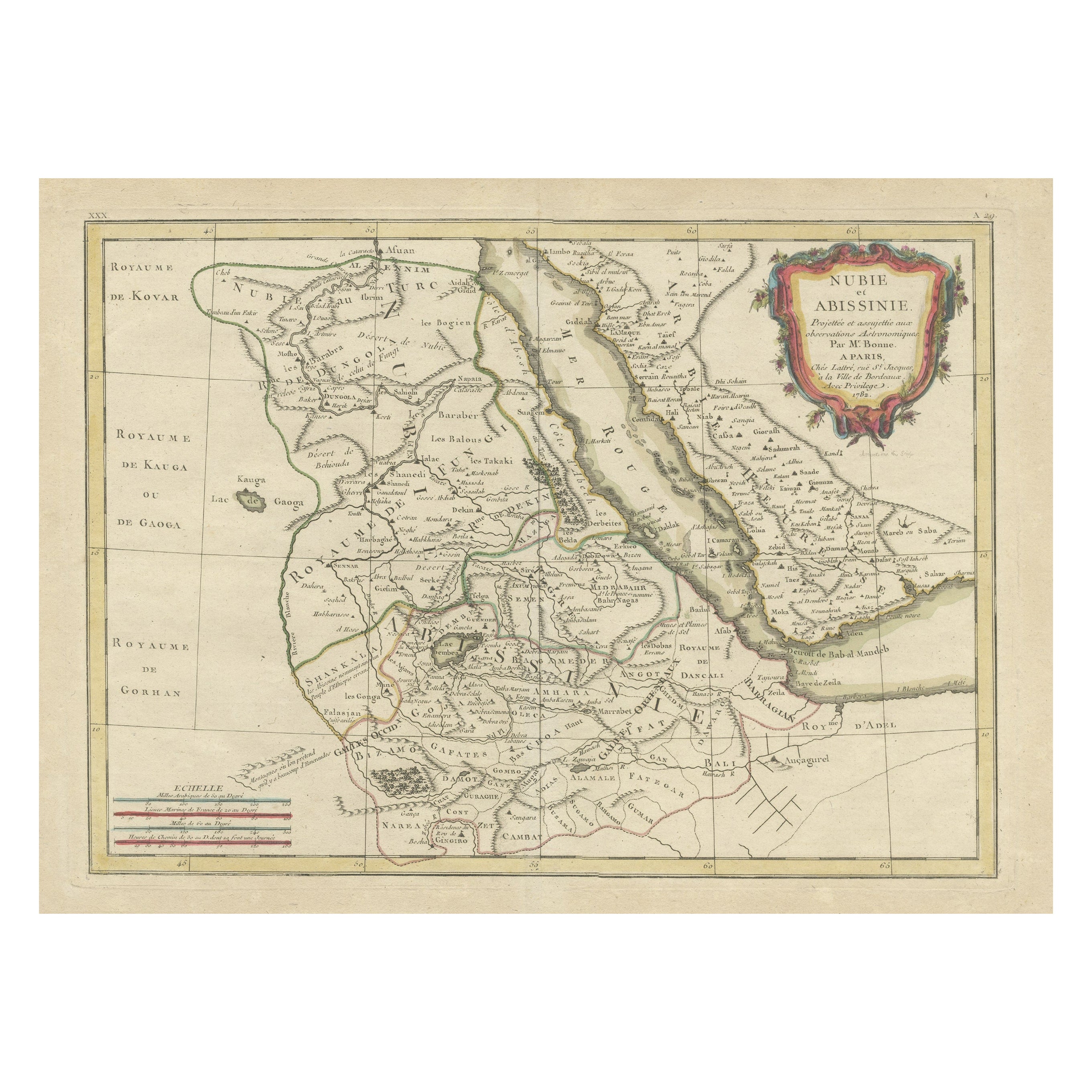
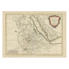
 - Antique Map of Arabia including Nubia and Abyssinia, also shows the Red SeaLocated in Langweer, NLAntique map titled 'Nubie et Abissinie'. Original antique map of Nubia, a region along the Nile river, and Abyssinia or the Ethiopian Empire. This map o...Category
Antique Late 18th Century Maps
MaterialsPaper
- Antique Map of Egypt and Arabia Petraea by Lowry, '1852'Located in Langweer, NLAntique map titled 'Egypt and Arabia Petrea'. Original map of Egypt and Arabia Petraea. This map originates from 'Lowry's Table Atlas constructed and engraved from the most recent Au...Category
Antique Mid-19th Century Maps
MaterialsPaper
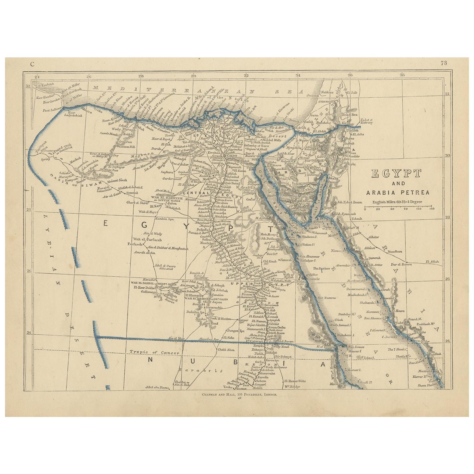
- Antique Map of Egypt and Arabia Petraea by A & C. Black, 1870Located in Langweer, NLAntique map titled 'Egypt and Arabia Petraea'. Original antique map of Egypt and Arabia Petraea. This map originates from ‘Black's General Atlas of The World’. Published by A & C. Bl...Category
Antique Late 19th Century Maps
MaterialsPaper
 $134 Sale Price30% Off
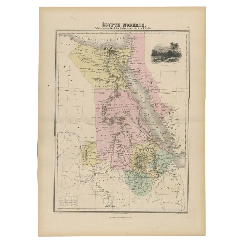
 - Antique Map of The Nile, Egypt, Nubia and Abyssinia and Inset of Jerusalem, 1880Located in Langweer, NLAntique map titled 'Égypte Moderne'. Old map of Egypt, Nubia and Abyssinia (Ethiopia), Kordofan and Darfour (parts of Sudan), as well as part of Arabia. With decorative vignette of J...Category
Antique 19th Century Maps
MaterialsPaper
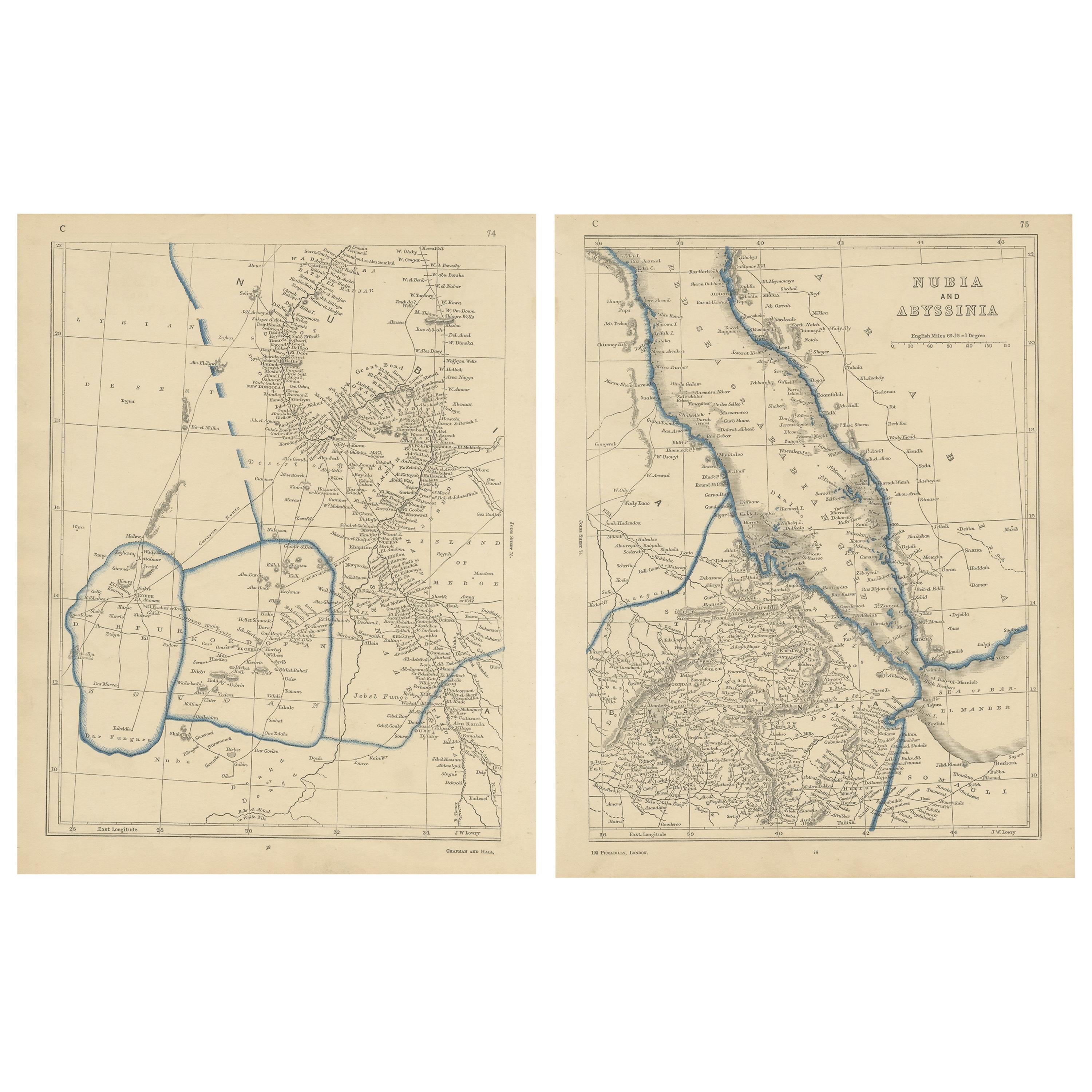
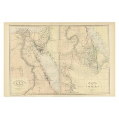
- Antique Decorative Coloured Map Egypt, Nubia, Abyssinia and more, 1882Located in Langweer, NLThis image contains two maps, with the left one being labeled "Egypt" and the right one "Nubia, Abyssinia and the Adjacent Lands." These maps highlight the Nile Valley and surroundin...Category
Antique 1880s Maps
MaterialsPaper

You May Also Like
- Antique Map of Principality of MonacoBy Antonio Vallardi EditoreLocated in Alessandria, PiemonteST/619 - "Old Geographical Atlas of Italy - Topographic map of ex-Principality of Monaco" - ediz Vallardi - Milano - A somewhat special edition ---Category
Antique Late 19th Century Italian Other Prints
MaterialsPaper
 $228 Sale Price74% Off
 - Original Antique Map of Spain and Portugal, circa 1790Located in St Annes, LancashireSuper map of Spain and Portugal Copper plate engraving by A. Bell Published, circa 1790. Unframed.Category
Antique 1790s English Other Maps
MaterialsPaper
- Original Antique Map of Ireland- Tipperary and Waterford. C.1840Located in St Annes, LancashireGreat map of Tipperary and Waterford Steel engraving Drawn under the direction of A.Adlard Published by How and Parsons, C.1840 Unframed.Category
Antique 1840s English Maps
MaterialsPaper
- Original Antique Map of Italy. C.1780Located in St Annes, LancashireGreat map of Italy Copper-plate engraving Published C.1780 Unframed.Category
Antique Early 1800s English Georgian Maps
MaterialsPaper

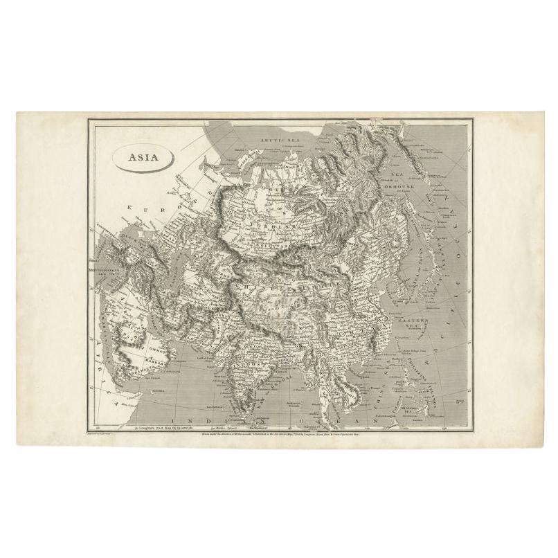
- Original Antique Map of Asia. C.1780Located in St Annes, LancashireGreat map of Asia Copper-plate engraving Published C.1780 Two small worm holes to right side of map Unframed.Category
Antique Early 1800s English Georgian Maps
MaterialsPaper

- Original Antique Map of India. C.1780Located in St Annes, LancashireGreat map of India Copper-plate engraving Published C.1780 Three small worm holes to right side of map and one bottom left corner Unframed.Category
Antique Early 1800s English Georgian Maps
MaterialsPaper


