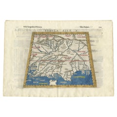
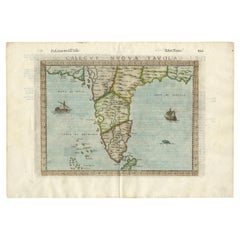
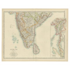
Antique Map of India by Ptolemaeus '1599'
View Similar Items


Want more images or videos?
Request additional images or videos from the seller
1 of 5
Antique Map of India by Ptolemaeus '1599'
About the Item
- Dimensions:Height: 9.45 in (24 cm)Width: 13.78 in (35 cm)Depth: 0.02 in (0.5 mm)
- Materials and Techniques:
- Period:
- Date of Manufacture:1599
- Condition:General age-related toning. Original folding line. Overall creasing. Italian text on verso. Please study image carefully.
- Seller Location:Langweer, NL
- Reference Number:Seller: BG-130631stDibs: LU3054325720342
About the Seller
5.0
Platinum Seller
These expertly vetted sellers are 1stDibs' most experienced sellers and are rated highest by our customers.
Established in 2009
1stDibs seller since 2017
1,947 sales on 1stDibs
More From This SellerView All
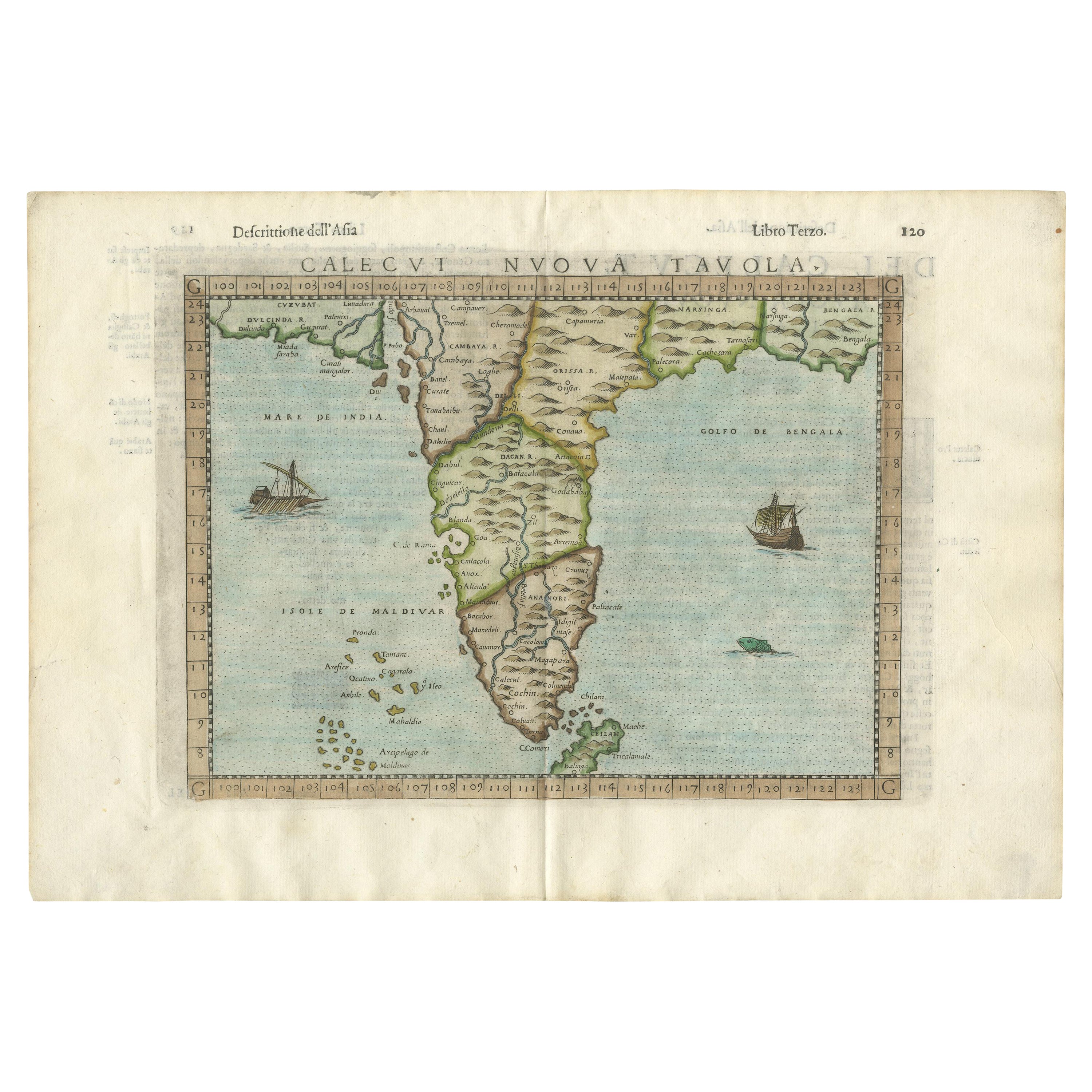
- Rare Attractive Antique Map of Asia, India, Sri Lanka, Maldives, 1599Located in Langweer, NLOriginal Antique map of Asia, India, Ceylon (Sri Lanka), Maldives by Rosaccio / Ruscelli in attractive coloring. Title: Calecut Nuova Tavola Year: 1599 Relief shown pictorially. ...Category
Antique 16th Century European Maps
MaterialsPaper
 $659 Sale Price20% Off
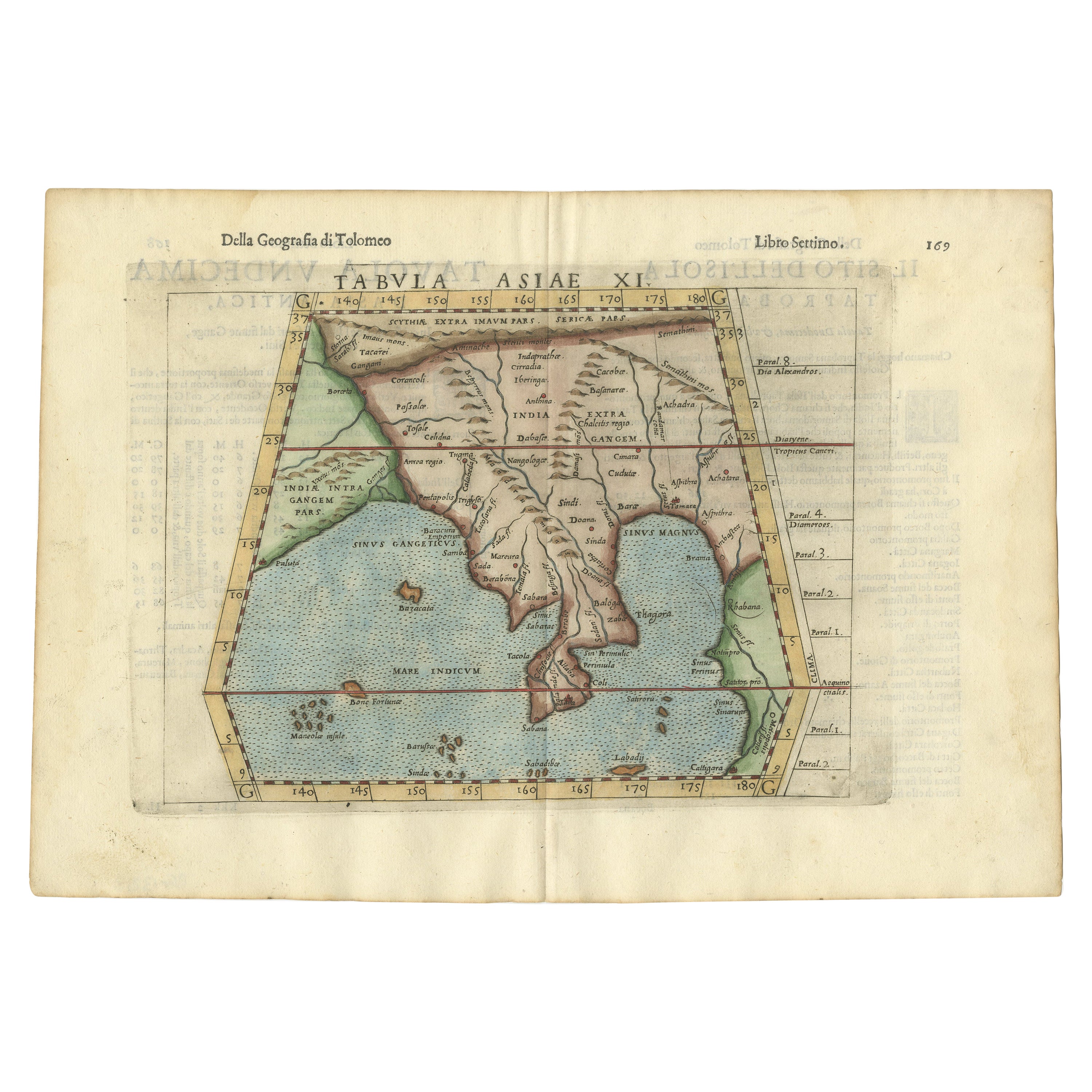
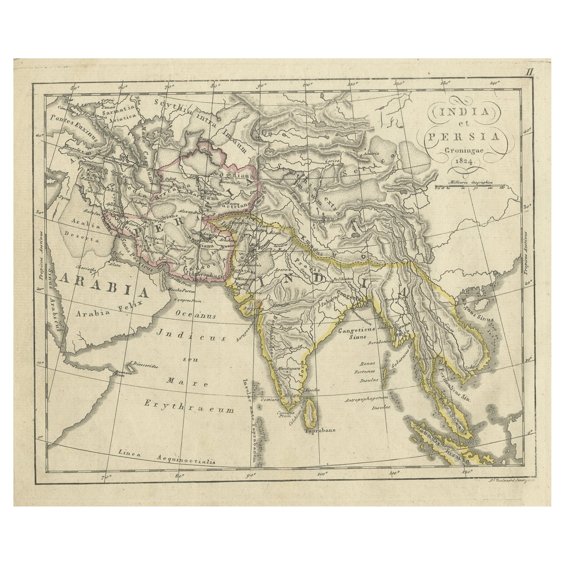
 - Antique Hand-Coloured Map of India, Sri Lanka, Maldives, ca.1599Located in Langweer, NLTitle: Tabula Asiae XI - 1599 Very old and decorative map of India, Sri Lanka and the Maledives. Put this map in a frame on the wall and amaze your visitors. This original engravi...Category
Antique 16th Century Maps
MaterialsPaper
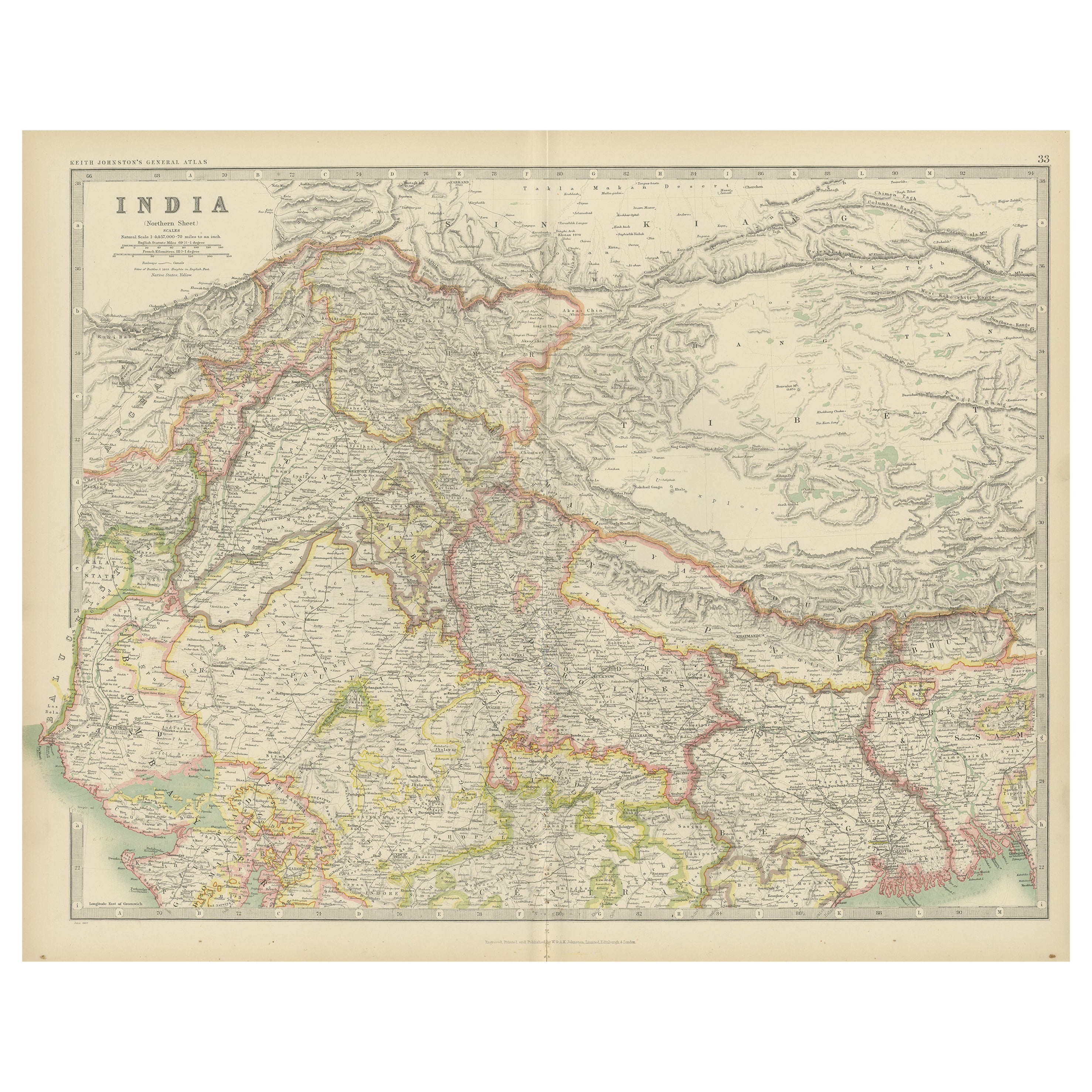
- Antique Map of India 'Northern' by Johnston '1909'Located in Langweer, NLAntique map titled 'India'. Original antique map of India, Northern sheet. This map originates from the ‘Royal Atlas of Modern Geography’. Published by W. & A.K. Johnston, 1909.Category
Early 20th Century Maps
MaterialsPaper
 $219 Sale Price20% Off
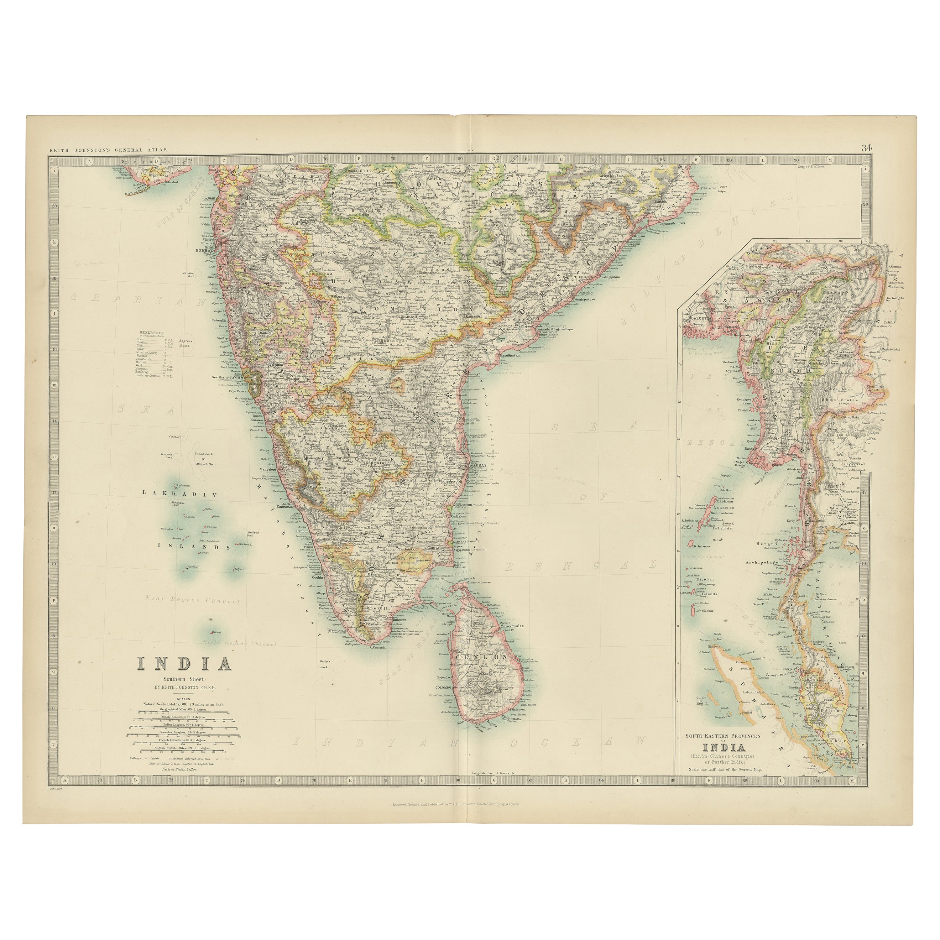
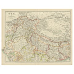
 - Antique Map of India ( Southern ) by Johnston (1909)Located in Langweer, NLAntique map titled 'India'. Original antique map of India Southern sheet. With inset maps of south eastern provinces of India. This map originates from the ‘Royal Atlas of Modern Geo...Category
Early 20th Century Maps
MaterialsPaper
- Original Antique Map of Northern IndiaBy Jakob van der SchleyLocated in Langweer, NLAntique map titled 'Carte de l'Indoustan (..) - Kaart van Hindoestan (..)'. Original antique map of northern India. This map originates from 'His...Category
Antique Mid-18th Century Maps
MaterialsPaper
- Antique Map of India and Ceylon by Lapie, 1842Located in Langweer, NLAntique map titled 'Carte de l'Inde en deca et au dela du Gange'. Map of India and Ceylon (Sri Lanka). This map originates from 'Atlas universel de géographie ancienne et moderne (.....Category
Antique Mid-19th Century Maps
MaterialsPaper


You May Also Like
- Original Antique Map of India. C.1780Located in St Annes, LancashireGreat map of India Copper-plate engraving Published C.1780 Three small worm holes to right side of map and one bottom left corner Unframed.Category
Antique Early 1800s English Georgian Maps
MaterialsPaper

- Antique Map of Italy by Andriveau-Goujon, 1843By Andriveau-GoujonLocated in New York, NYAntique Map of Italy by Andriveau-Goujon, 1843. Map of Italy in two parts by Andriveau-Goujon for the Library of Prince Carini at Palazzo Carini i...Category
Antique 1840s French Maps
MaterialsLinen, Paper
 $3,350 / set
 - Antique Map of Principality of MonacoBy Antonio Vallardi EditoreLocated in Alessandria, PiemonteST/619 - "Old Geographical Atlas of Italy - Topographic map of ex-Principality of Monaco" - ediz Vallardi - Milano - A somewhat special edition ---Category
Antique Late 19th Century Italian Other Prints
MaterialsPaper
 $228 Sale Price74% Off
 - Original Antique Map of Russia By Arrowsmith. 1820Located in St Annes, LancashireGreat map of Russia Drawn under the direction of Arrowsmith Copper-plate engraving Published by Longman, Hurst, Rees, Orme and Brown, 1820 Unframed.Category
Antique 1820s English Maps
MaterialsPaper

- Original Antique Map of China by Thomas Clerk, 1817Located in St Annes, LancashireGreat map of China Copper-plate engraving Drawn and engraved by Thomas Clerk, Edinburgh. Published by Mackenzie And Dent, 1817 Unframed.Category
Antique 1810s English Maps
MaterialsPaper

- Original Antique Map of Sweden, Engraved by Barlow, 1806Located in St Annes, LancashireGreat map of Sweden Copper-plate engraving by Barlow Published by Brightly & Kinnersly, Bungay, Suffolk. 1806 Unframed.Category
Antique Early 1800s English Maps
MaterialsPaper
