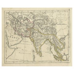
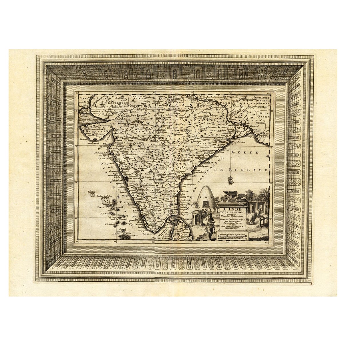
Antique Engraved Map of India and Persia, 1825
View Similar Items


Want more images or videos?
Request additional images or videos from the seller
1 of 6
Antique Engraved Map of India and Persia, 1825
About the Item
- Dimensions:Height: 9.73 in (24.7 cm)Width: 8.59 in (21.8 cm)Depth: 0 in (0.01 mm)
- Materials and Techniques:
- Period:
- Date of Manufacture:1825
- Condition:
- Seller Location:Langweer, NL
- Reference Number:Seller: BG-11204-2-101stDibs: LU3054326359162
About the Seller
5.0
Platinum Seller
These expertly vetted sellers are 1stDibs' most experienced sellers and are rated highest by our customers.
Established in 2009
1stDibs seller since 2017
1,928 sales on 1stDibs
More From This SellerView All
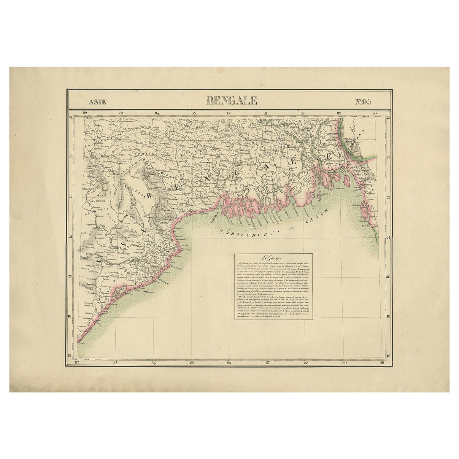
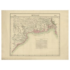
- Detailed Orginal Antique Map of Bengal, India, c.1825Located in Langweer, NLAntique map titled 'No. 95 Bengale'. Detailed map of Bengal, Bangladesh. With text about the Ganges river. Originates from 'Atlas Universel' by P.M. Vand...Category
Antique 19th Century Maps
MaterialsPaper
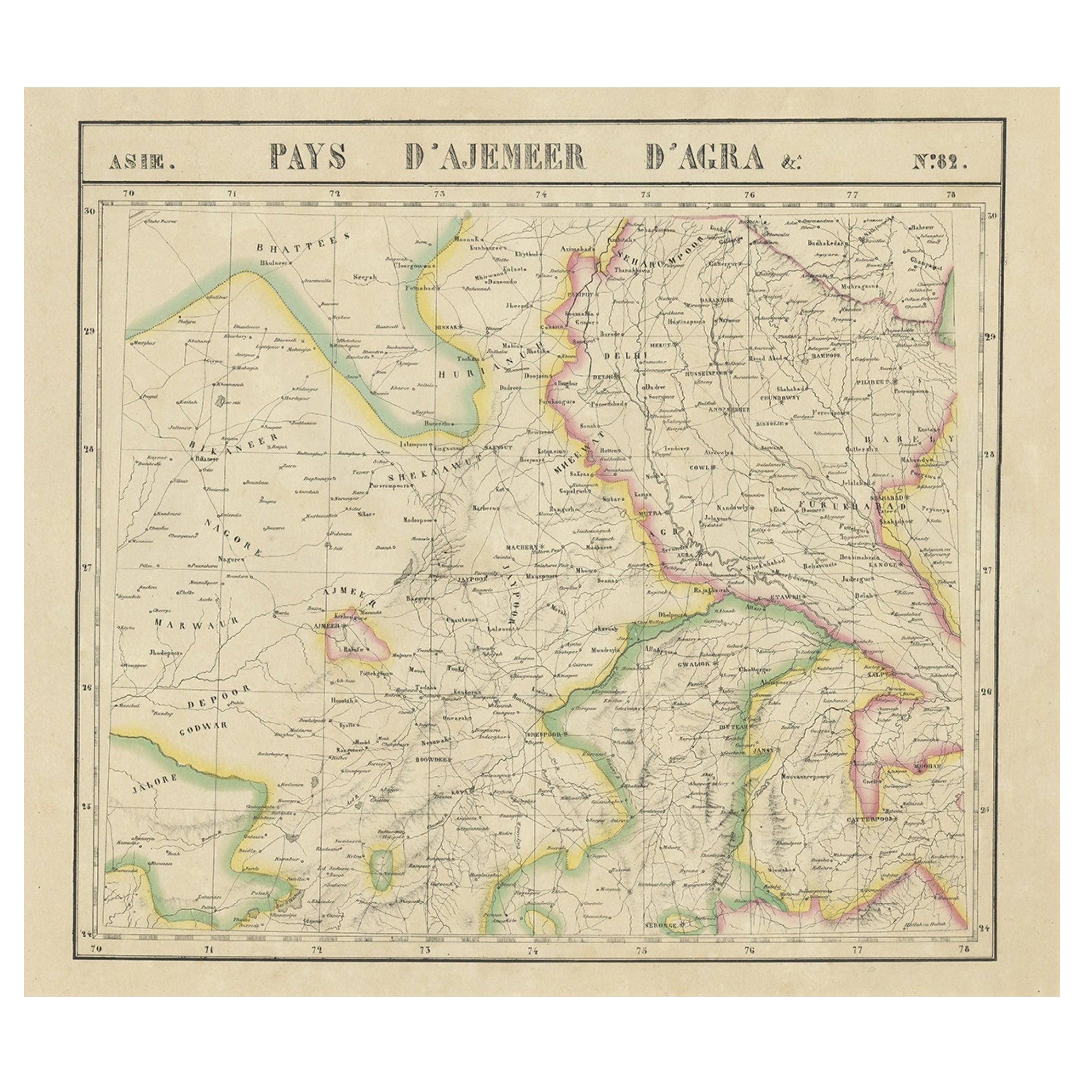
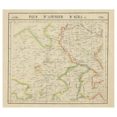
- Large and Rare Antique Map of Northern India in Original Coloring, c.1825Located in Langweer, NLAntique map titled 'No. 82 Pays d'Ajemeer d'Agra'. Detailed map of Northern India. Originates from 'Atlas Universel' by P.M. Vandermaelen. Artists and Engravers: Philippe Marie Van...Category
Antique 19th Century Maps
MaterialsPaper
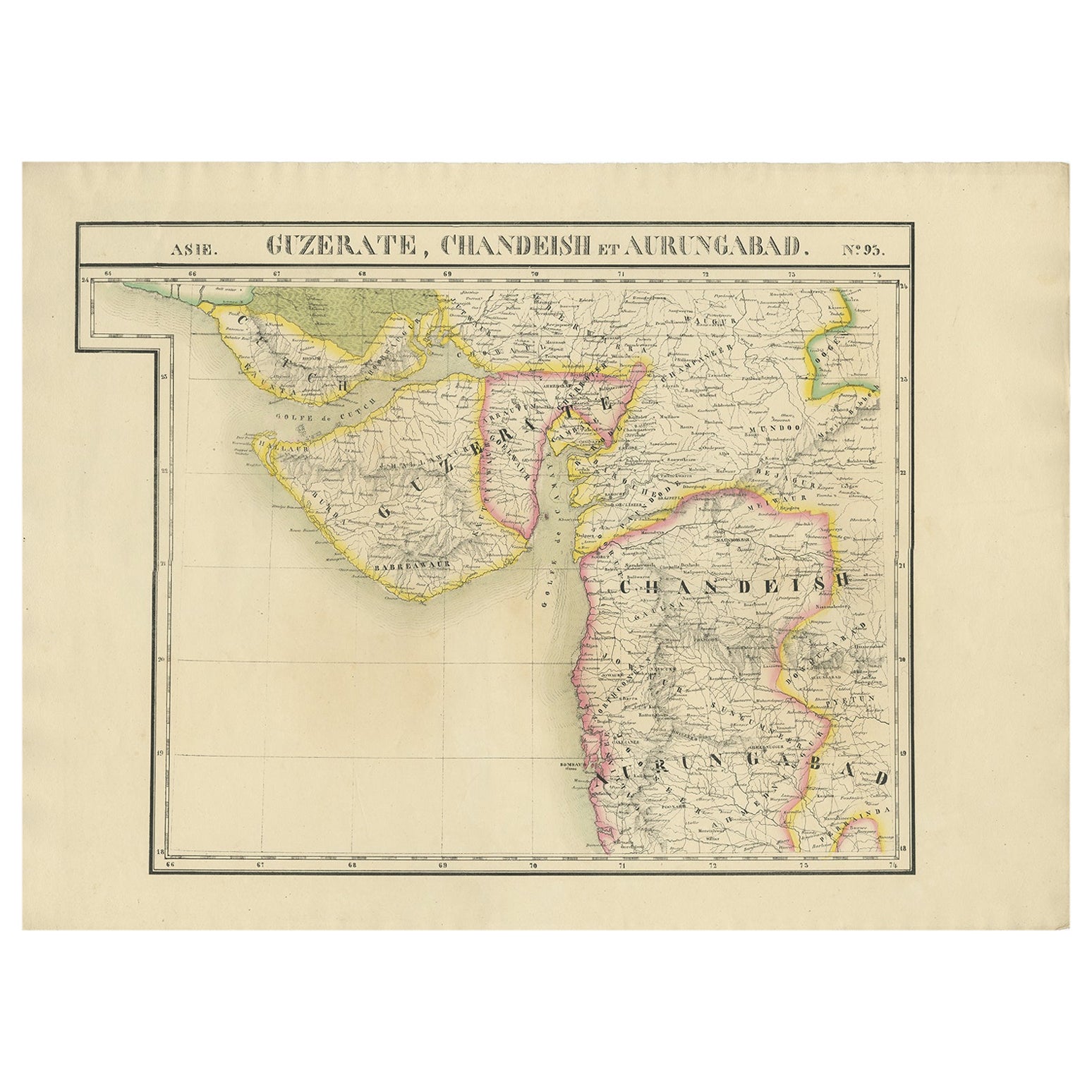
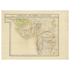
- Detailed Antique Map of the Region of Gujarat and Mumbai in India, C.1825Located in Langweer, NLAntique map titled 'No. 93 Guzerate, Chandeish et Aurungabad'. Detailed map of the region of Gujarat and the region of Mumbay. Originates from 'Atlas Universel' by P.M. Vandermaelen....Category
Antique 19th Century Maps
MaterialsPaper
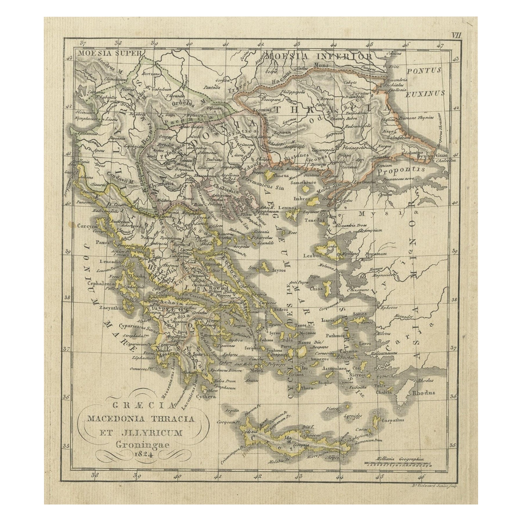
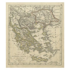
- Antique Map of Greece and Macedonia, 1825Located in Langweer, NLAntique map titled 'Graecia, Macedonia Thracia et Jllyricum'. Old map of Greece and Macedonia originating from 'Atlas der Oude Wereld'. Artists and Engravers: Published by C. Ph. Fun...Category
Antique 19th Century Maps
MaterialsPaper
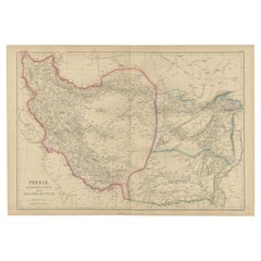
- Antique Map of Eastern Persia, 1852Located in Langweer, NLAntique map titled 'Eastern Persia'. Original map of Eastern Persia. This map originates from 'Lowry's Table Atlas constructed and engraved from the most recent Authorities' by J.W. ...Category
Antique Mid-19th Century Maps
MaterialsPaper
 $87 Sale Price20% Off
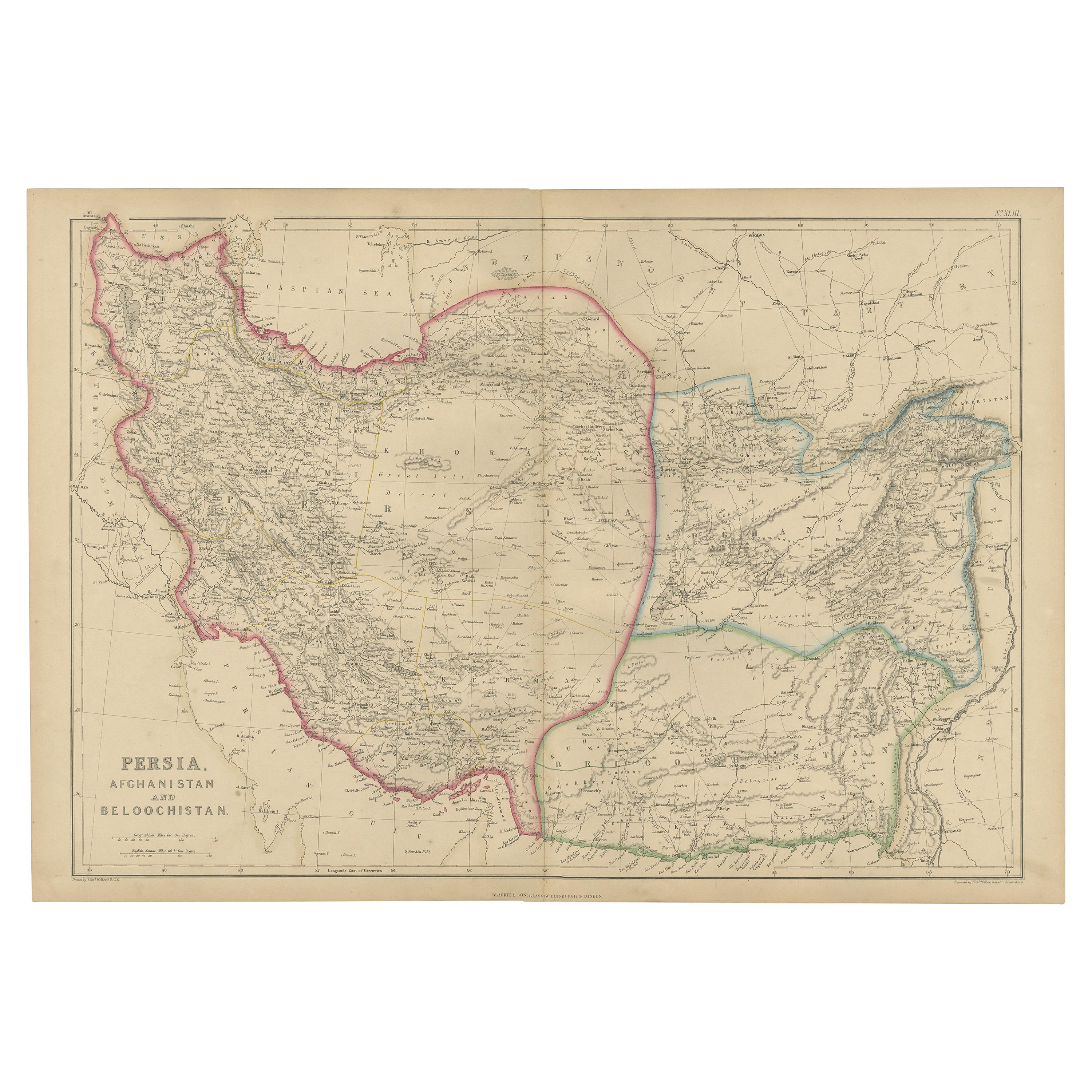
 - Antique Map of Persia, Afghanistan and Balochistan, 1859Located in Langweer, NLThe antique map titled "Persia, Afghanistan and Beloochistan" is a remarkable historical document originating from 'The Imperial Atlas of Modern Geography', published by W. G. Blacki...Category
Antique Mid-19th Century Maps
MaterialsPaper
 $218 Sale Price20% Off
You May Also Like
- Original Antique Map of Spain and Portugal, Engraved By Barlow, 1806Located in St Annes, LancashireGreat map of Spain And Portugal Copper-plate engraving by Barlow Published by Brightly & Kinnersly, Bungay, Suffolk. 1806 Unframed.Category
Antique Early 1800s English Maps
MaterialsPaper
- Original Antique Map of Sweden, Engraved by Barlow, 1806Located in St Annes, LancashireGreat map of Sweden Copper-plate engraving by Barlow Published by Brightly & Kinnersly, Bungay, Suffolk. 1806 Unframed.Category
Antique Early 1800s English Maps
MaterialsPaper
- Original Antique Map of Switzerland, Engraved By Barlow, Dated 1807Located in St Annes, LancashireGreat map of Switzerland Copper-plate engraving by Barlow Published by Brightly & Kinnersly, Bungay, Suffolk. Dated 1807 Unframed.Category
Antique Early 1800s English Maps
MaterialsPaper
- Original Antique Map of The Netherlands, Engraved by Barlow, Dated 1807Located in St Annes, LancashireGreat map of Netherlands Copper-plate engraving by Barlow Published by Brightly & Kinnersly, Bungay, Suffolk. Dated 1807 Unframed.Category
Antique Early 1800s English Maps
MaterialsPaper
- Antique Map of Principality of MonacoBy Antonio Vallardi EditoreLocated in Alessandria, PiemonteST/619 - "Old Geographical Atlas of Italy - Topographic map of ex-Principality of Monaco" - ediz Vallardi - Milano - A somewhat special edition ---Category
Antique Late 19th Century Italian Other Prints
MaterialsPaper
 $227 Sale Price74% Off
 - Original Antique Map of Spain and Portugal, circa 1790Located in St Annes, LancashireSuper map of Spain and Portugal Copper plate engraving by A. Bell Published, circa 1790. Unframed.Category
Antique 1790s English Other Maps
MaterialsPaper


Recently Viewed
View AllMore Ways To Browse
Antique Engrave
Date Engraved
Antiques Of India
Antique Persia
Old India Furniture
Antique Collection India
Antique Old World Map
Old World Antique Map
Old Antique World Map
Old World Antique Maps
India Map
Map Of India
Antique India Map
Antique Maps India
Antique Map India
India Antique Map
Antique Map Of India
Antique Maps Of India