
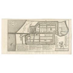
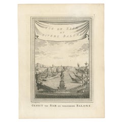
Antique Map of Japan by Van Schley, '1756'
View Similar Items


Want more images or videos?
Request additional images or videos from the seller
1 of 5
Antique Map of Japan by Van Schley, '1756'
About the Item
- Dimensions:Height: 15.16 in (38.5 cm)Width: 18.12 in (46 cm)Depth: 0.6 in (1.5 cm)
- Materials and Techniques:
- Period:
- Date of Manufacture:1756
- Condition:General age-related toning, minor foxing. Frame included, lightly used.
- Seller Location:Langweer, NL
- Reference Number:Seller: BG-117531stDibs: LU3054320814002
About the Seller
5.0
Platinum Seller
These expertly vetted sellers are 1stDibs' most experienced sellers and are rated highest by our customers.
Established in 2009
1stDibs seller since 2017
1,948 sales on 1stDibs
More From This SellerView All
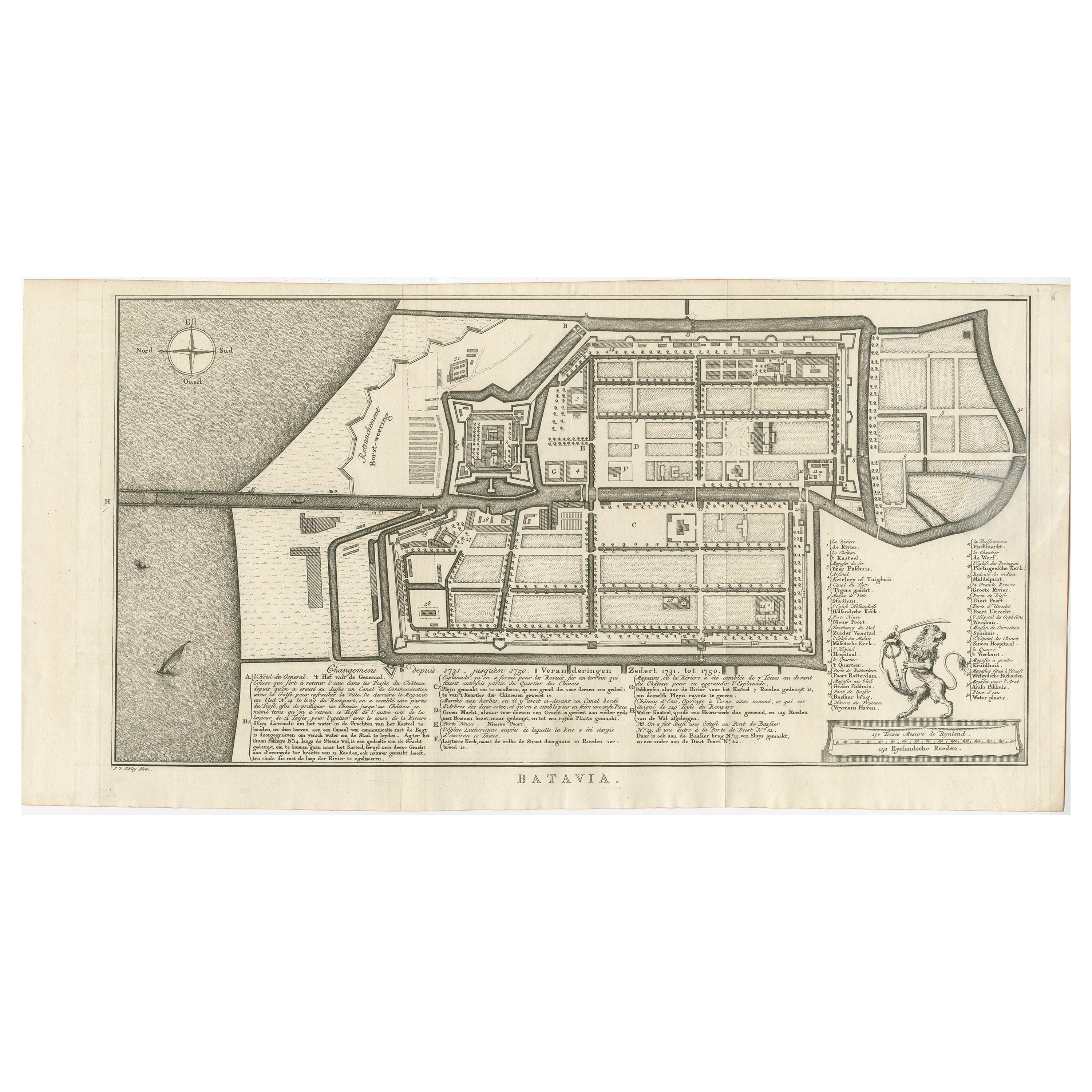
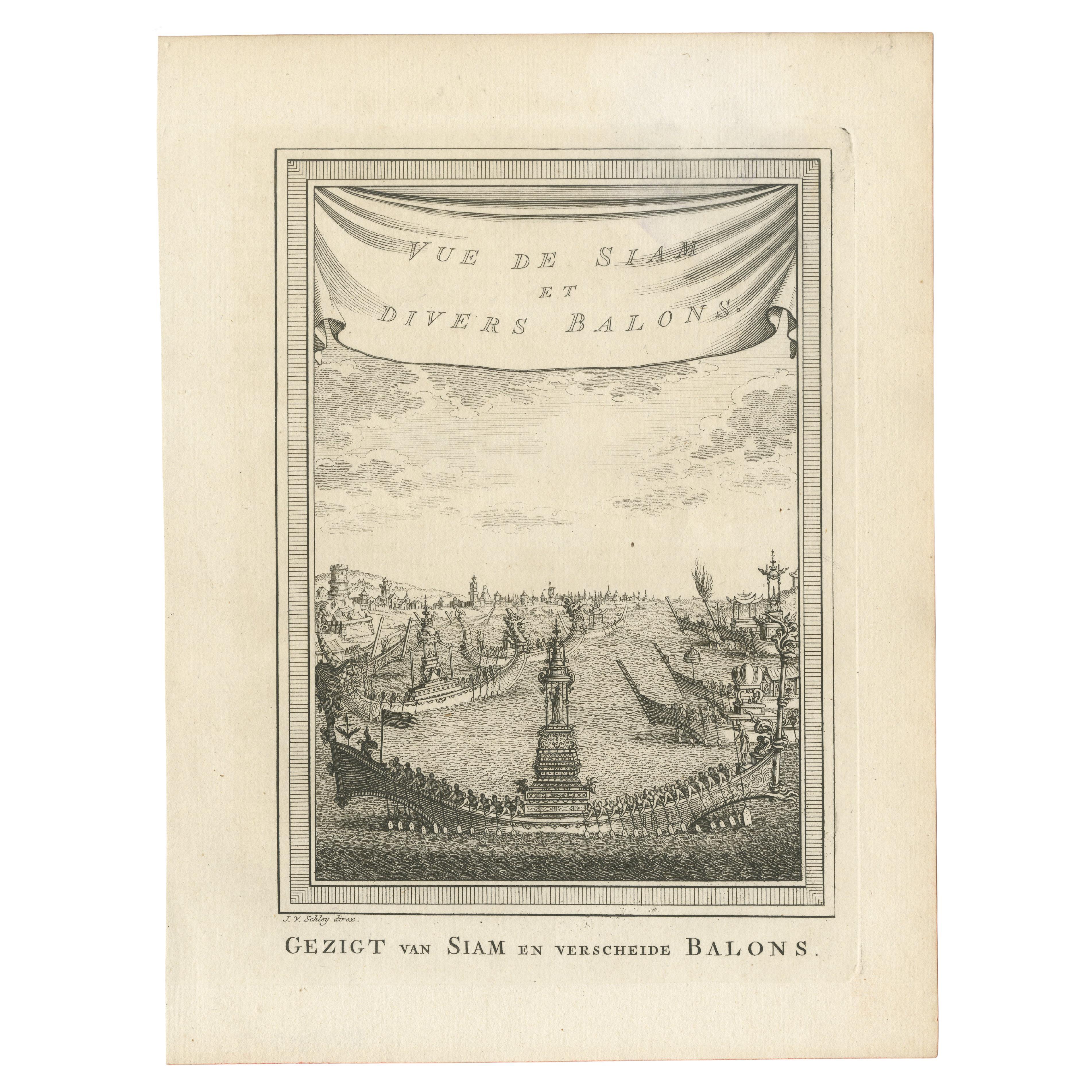
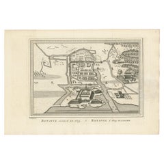
- Antique Map of Batavia by Van Schley 'c.1750'Located in Langweer, NLAntique map titled 'Batavia'. Original antique map of Batavia, Jakarta, Indonesia. This print originates from the Dutch edition of Prevost's 'Histoire Generale des Voyages' (Paris 17...Category
Antique Mid-18th Century Prints
MaterialsPaper
 $396 Sale Price20% Off
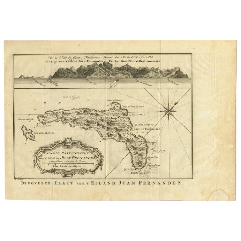
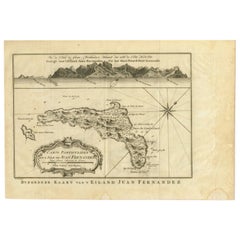
 - Original Antique Map of Juan Fernandez by Van Schley, 1757Located in Langweer, NLAntique map titled 'Carte Particuliere de l'Isle de Juan Fernandez - Byzondere Kaart van 't Eiland Juan Fernandez'. Map of the Chilean Juan Fernandez Island, topped by a view of it...Category
Antique 18th Century Maps
MaterialsPaper
 $191 Sale Price40% Off
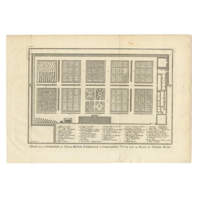
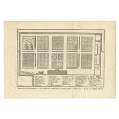
 - Antique Print of the Gardens at Cape of Good Hope by Van Schley, 1756Located in Langweer, NLAntique print titled 'Jardin de la Compagnie au Cap de Bonne Esperance, Compagnies Tuyn aan de Kaap de Goede Hoop'. This print depicts the Gardens at Cape of Good Hope (VOC). This pr...Category
Antique 18th Century Prints
MaterialsPaper
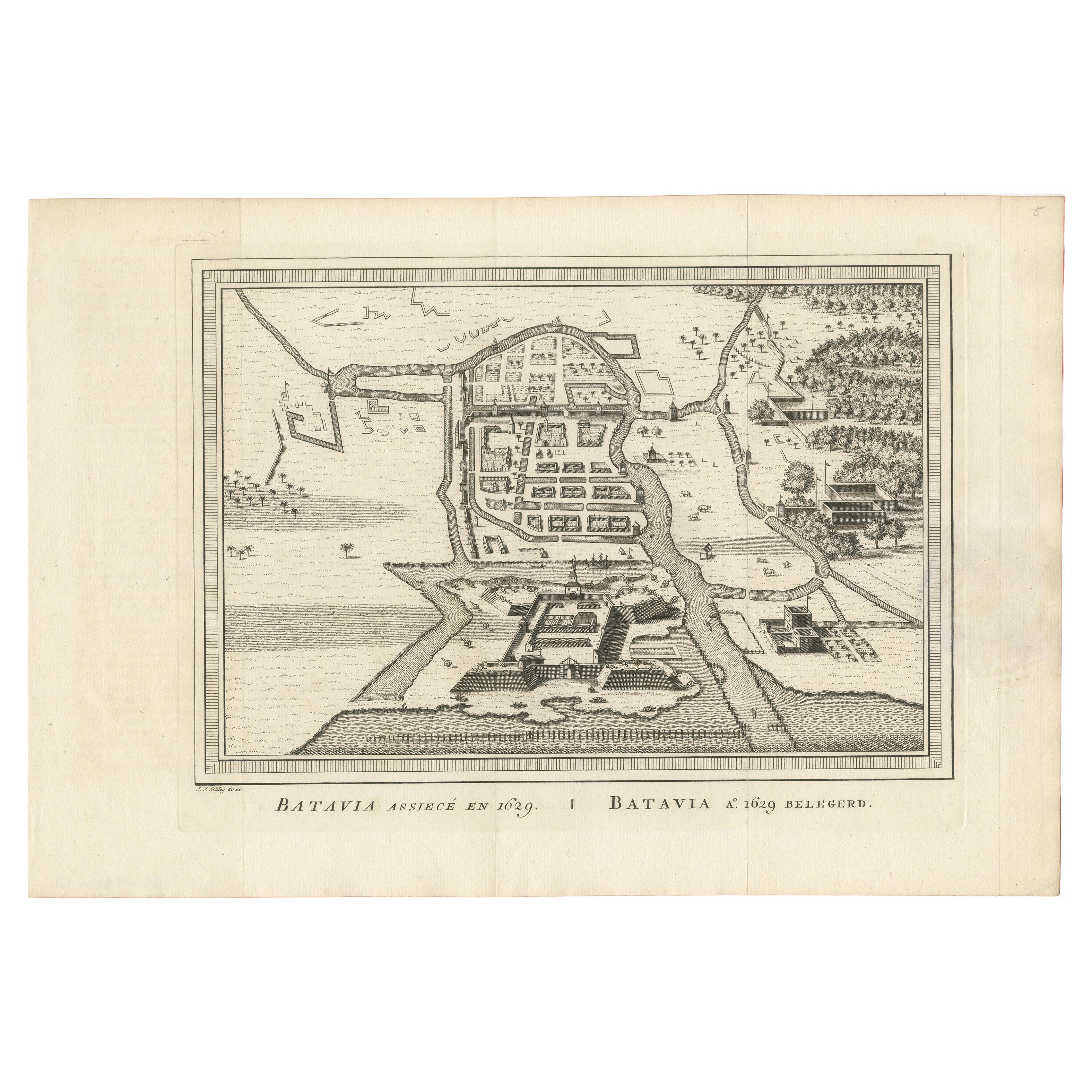
- Antique Map of the Siege of Batavia by Van Schley 'c.1750'Located in Langweer, NLAntique map titled 'Batavia assiecé en 1629 - Batavia 1629 belegerd'. Bird's eye view map of the siege of Batavia in 1629, Jakarta, Indonesia. This print originates from the Dutch ed...Category
Antique Mid-18th Century Prints
MaterialsPaper
- Antique Map of the Gambia River by J. Van Schley, circa 1750Located in Langweer, NL"Carte de la Riviere de Gambra ou Gambie. Depuis son Embouchure Jusqu a Eropina". Orig. copper-engraving after Capt. J. Leach's map of the region from 1732. With ornamental title cartouche and Dutch...Category
Antique Mid-18th Century Maps
MaterialsPaper
 $275 Sale Price31% Off
 - Antique Map of the Tunquin River and Bay by Van Schley 'c.1750'Located in Langweer, NLAntique map titled ‘Kaart van den Loop der Rivier van Tonkin van Cacho tot aan de Zee / Carte du Cours de la Riviere de Tunquin Depuis Cacho jusqu'à la Mer J. v. Schley direx.’ Detai...Category
Antique Mid-18th Century Prints
MaterialsPaper
You May Also Like
- Original Antique Map of Russia By Arrowsmith. 1820Located in St Annes, LancashireGreat map of Russia Drawn under the direction of Arrowsmith Copper-plate engraving Published by Longman, Hurst, Rees, Orme and Brown, 1820 Unframed.Category
Antique 1820s English Maps
MaterialsPaper

- Antique Map of Italy by Andriveau-Goujon, 1843By Andriveau-GoujonLocated in New York, NYAntique Map of Italy by Andriveau-Goujon, 1843. Map of Italy in two parts by Andriveau-Goujon for the Library of Prince Carini at Palazzo Carini i...Category
Antique 1840s French Maps
MaterialsLinen, Paper
 $3,350 / set
 - Antique Map of Principality of MonacoBy Antonio Vallardi EditoreLocated in Alessandria, PiemonteST/619 - "Old Geographical Atlas of Italy - Topographic map of ex-Principality of Monaco" - ediz Vallardi - Milano - A somewhat special edition ---Category
Antique Late 19th Century Italian Other Prints
MaterialsPaper
 $228 Sale Price74% Off
 - Original Antique Map of Belgium by Tallis, Circa 1850Located in St Annes, LancashireGreat map of Belgium Steel engraving Many lovely vignettes Published by London Printing & Publishing Co. ( Formerly Tallis ), C.1850 Origin...Category
Antique 1850s English Maps
MaterialsPaper
- Original Antique Map of China by Thomas Clerk, 1817Located in St Annes, LancashireGreat map of China Copper-plate engraving Drawn and engraved by Thomas Clerk, Edinburgh. Published by Mackenzie And Dent, 1817 Unframed.Category
Antique 1810s English Maps
MaterialsPaper

- Original Antique Map of Sweden, Engraved by Barlow, 1806Located in St Annes, LancashireGreat map of Sweden Copper-plate engraving by Barlow Published by Brightly & Kinnersly, Bungay, Suffolk. 1806 Unframed.Category
Antique Early 1800s English Maps
MaterialsPaper

