Items Similar to Antique Map of the Leeuwarderadeel Township by Behrns, 1861
Want more images or videos?
Request additional images or videos from the seller
1 of 5
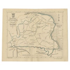
Antique Map of the Leeuwarderadeel Township by Behrns, 1861
$85.70
$107.1220% Off
£62.35
£77.9320% Off
€71.20
€8920% Off
CA$116.96
CA$146.1920% Off
A$130.24
A$162.8020% Off
CHF 67.78
CHF 84.7320% Off
MX$1,605.85
MX$2,007.3120% Off
NOK 863.27
NOK 1,079.0820% Off
SEK 811.39
SEK 1,014.2320% Off
DKK 541.87
DKK 677.3320% Off
Shipping
Retrieving quote...The 1stDibs Promise:
Authenticity Guarantee,
Money-Back Guarantee,
24-Hour Cancellation
About the Item
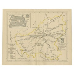
Antique map titled 'Gemeente Leeuwarderadeel'. Old map depicting the Leeuwarderadeel township including cities and villages like Finkum, Hijum, Stiens, Jelsum, Leeuwarden, Wirdum and Goutum. This map orginates from 'Zak-Atlas van Friesland in 36 Kaarten'.
Artists and Engravers: Published by B. Behrns, Franeker.
Condition: Good, general age-related toning. Please study image carefully.
Date: 1861
Overall size: 17.2 x 21.4 cm.
Image size: 15.4 x 18.4 cm.
We sell original antique maps to collectors, historians, educators and interior decorators all over the world. Our collection includes a wide range of authentic antique maps from the 16th to the 20th centuries. Buying and collecting antique maps is a tradition that goes back hundreds of years. Antique maps have proved a richly rewarding investment over the past decade, thanks to a growing appreciation of their unique historical appeal. Today the decorative qualities of antique maps are widely recognized by interior designers who appreciate their beauty and design flexibility. Depending on the individual map, presentation, and context, a rare or antique map can be modern, traditional, abstract, figurative, serious or whimsical. We offer a wide range of authentic antique maps for any budget.
- Dimensions:Height: 8.43 in (21.4 cm)Width: 6.78 in (17.2 cm)Depth: 0 in (0.01 mm)
- Materials and Techniques:
- Period:
- Date of Manufacture:1861
- Condition:
- Seller Location:Langweer, NL
- Reference Number:Seller: BG-05105-201stDibs: LU3054327829172
About the Seller
5.0
Recognized Seller
These prestigious sellers are industry leaders and represent the highest echelon for item quality and design.
Platinum Seller
Premium sellers with a 4.7+ rating and 24-hour response times
Established in 2009
1stDibs seller since 2017
2,482 sales on 1stDibs
Typical response time: <1 hour
- ShippingRetrieving quote...Shipping from: Langweer, Netherlands
- Return Policy
Authenticity Guarantee
In the unlikely event there’s an issue with an item’s authenticity, contact us within 1 year for a full refund. DetailsMoney-Back Guarantee
If your item is not as described, is damaged in transit, or does not arrive, contact us within 7 days for a full refund. Details24-Hour Cancellation
You have a 24-hour grace period in which to reconsider your purchase, with no questions asked.Vetted Professional Sellers
Our world-class sellers must adhere to strict standards for service and quality, maintaining the integrity of our listings.Price-Match Guarantee
If you find that a seller listed the same item for a lower price elsewhere, we’ll match it.Trusted Global Delivery
Our best-in-class carrier network provides specialized shipping options worldwide, including custom delivery.More From This Seller
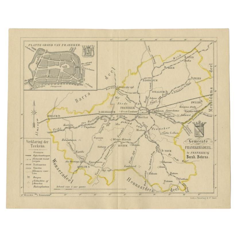
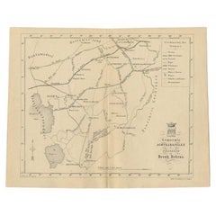
View AllAntique Map of the Franekeradeel Township by Behrns, 1861
Located in Langweer, NL
Antique map titled 'Gemeente Franekeradeel'. Old map depicting the Franekeradeel township including cities and villages like Franeker, Midlum, Hitsum, Schalsum, Dongjum, Peins and Ac...
Category
Antique 19th Century Maps
Materials
Paper
$85 Sale Price
20% Off
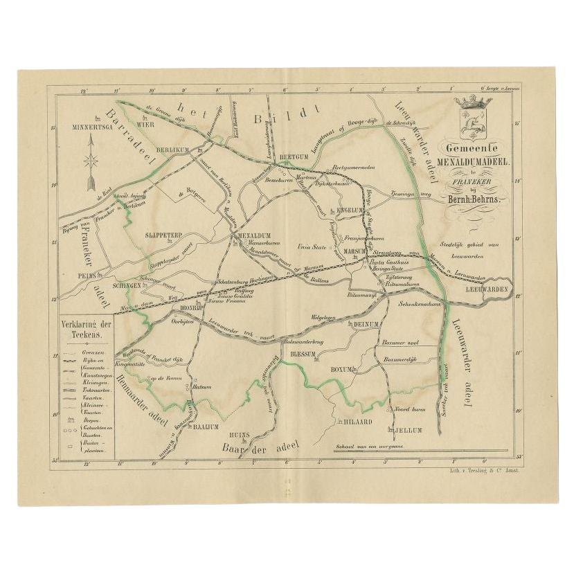
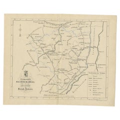
Antique Map of the Menaldumadeel Township by Behrns, 1861
Located in Langweer, NL
Antique map titled 'Gemeente Menaldumadeel'. Old map depicting the Menaldumadeel township including cities and villages like Berlikum, Wier, Menaldum, Dronrijp, Marsum, Engelum, Dein...
Category
Antique 19th Century Maps
Materials
Paper
$85 Sale Price
20% Off
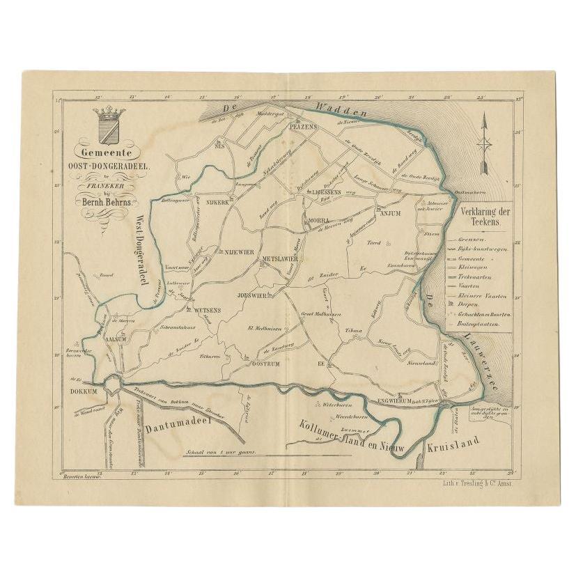
Antique Map of the Oost-Dongeradeel Township by Behrns, 1861
Located in Langweer, NL
Antique map titled 'Gemeente Oost-Dongeradeel'. Old map depicting the Oost-Dongeradeel township including cities and villages like Nijkerk, Morra, Anjum, Metslawier, Aalsum and Engwi...
Category
Antique 19th Century Maps
Materials
Paper
$85 Sale Price
20% Off
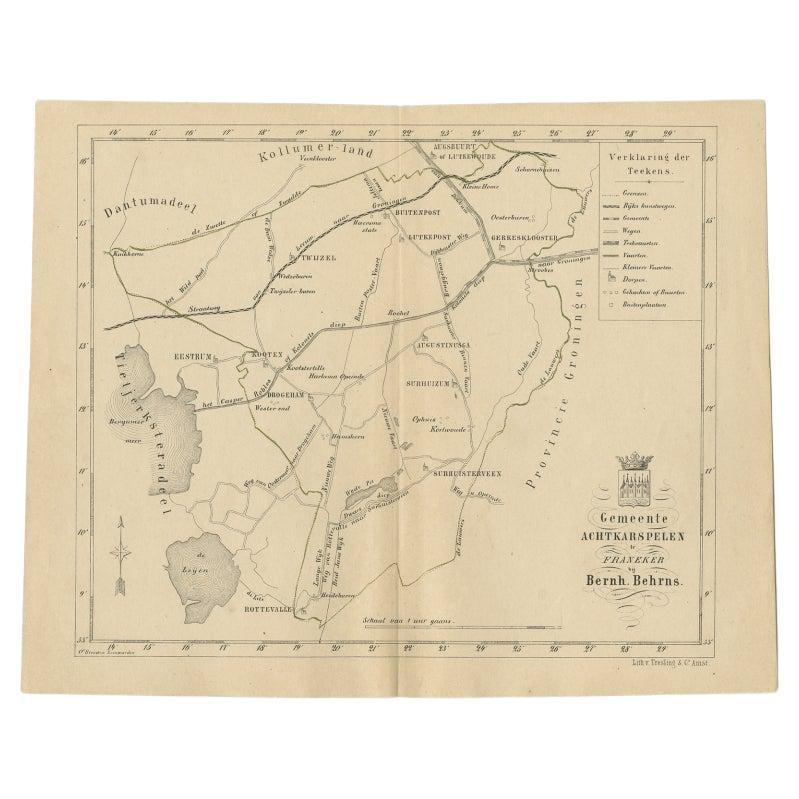
Antique Map of The Dutch Achtkarspelen Township by Behrns, 1861
Located in Langweer, NL
Antique map titled 'Gemeente Achtkarspelen'. Old map depicting the Achtkarspelen township including cities and villages like Buitenpost, Twijzel, Drogeham and Surhuisterveen. This ma...
Category
Antique 19th Century Maps
Materials
Paper
$115 Sale Price
20% Off
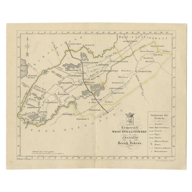
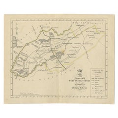
Antique Map of The Dutch West-Stellingwerf Township by Behrns, 1861
Located in Langweer, NL
Antique map titled 'Gemeente West-Stellingwerf'. Old map depicting the West-Stellingwerf township including cities and villages like Noordwolde, Oldeholtwolde and Wolvega. This map o...
Category
Antique 19th Century Maps
Materials
Paper
$115 Sale Price
20% Off
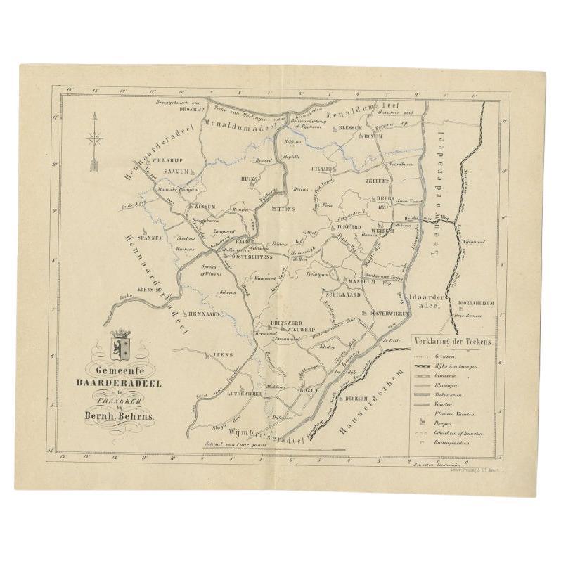
Antique Map of the Dutch Township Baarderadeel, 1861
Located in Langweer, NL
Antique map titled 'Gemeente Baarderadeel'. Old map depicting the Baarderadeel township including cities and villages like Baard, Hilaard, Jorwerd, Oosterlittens and Oosterwierum. Th...
Category
Antique 19th Century Maps
Materials
Paper
$115 Sale Price
20% Off
You May Also Like
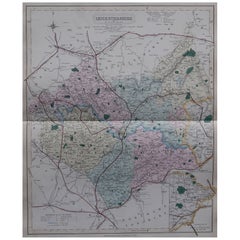
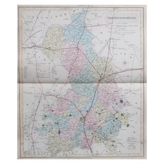
Original Antique English County Map, Leicestershire, J & C Walker, 1851
Located in St Annes, Lancashire
Great map of Leicestershire
Original colour
By J & C Walker
Published by Longman, Rees, Orme, Brown & Co. 1851
Unframed.
Category
Antique 1850s English Other Maps
Materials
Paper
Original Antique English County Map, Derbyshire, J & C Walker, 1851
Located in St Annes, Lancashire
Great map of Derbyshire
Original colour
By J & C Walker
Published by Longman, Rees, Orme, Brown & Co. 1851
Unframed.
Category
Antique 1850s English Other Maps
Materials
Paper
Original Antique English County Map, Buckinghamshire, J & C Walker, 1851
Located in St Annes, Lancashire
Great map of Buckinghamshire
Original colour
By J & C Walker
Published by Longman, Rees, Orme, Brown & Co. 1851
Unframed.
Category
Antique 1850s English Other Maps
Materials
Paper
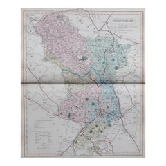
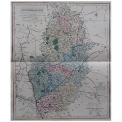
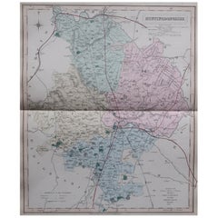
Original Antique English County Map, Nottinghamshire, J & C Walker, 1851
Located in St Annes, Lancashire
Great map of Nottinghamshire
Original colour
By J & C Walker
Published by Longman, Rees, Orme, Brown & Co. 1851
Unframed.
Category
Antique 1850s English Other Maps
Materials
Paper
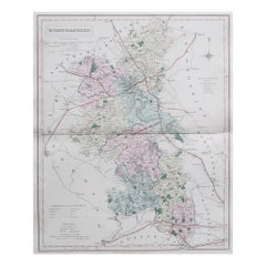
Original Antique English County Map, Cambridgeshire, J & C Walker, 1851
Located in St Annes, Lancashire
Great map of Cambridgeshire
Original colour
By J & C Walker
Published by Longman, Rees, Orme, Brown & Co. 1851
Unframed.
Category
Antique 1850s English Other Maps
Materials
Paper
Original Antique English County Map, Huntingdonshire, J & C Walker, 1851
Located in St Annes, Lancashire
Great map of Huntingdonshire
Original colour
By J & C Walker
Published by Longman, Rees, Orme, Brown & Co. 1851
Unframed.
Category
Antique 1850s English Other Maps
Materials
Paper
More Ways To Browse
Manuel Canovas
Maple Slab Coffee Table
Marcel Breuer B32 Cesca Chairs
Marcel Breuer B34
Marenco Mobilgirgi
Marmo Console
Massage Table
Max Id Ny
Mcguire Bamboo Sofa
Mcguire Ottoman
Mcm Round Coffee Table
Medici Chair
Medieval Cup
Memphis Bar Cart
Memphis Bar Stool
Mendel Furniture
Mendini Proust
Meret Oppenheim Traccia Table