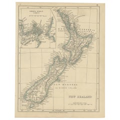
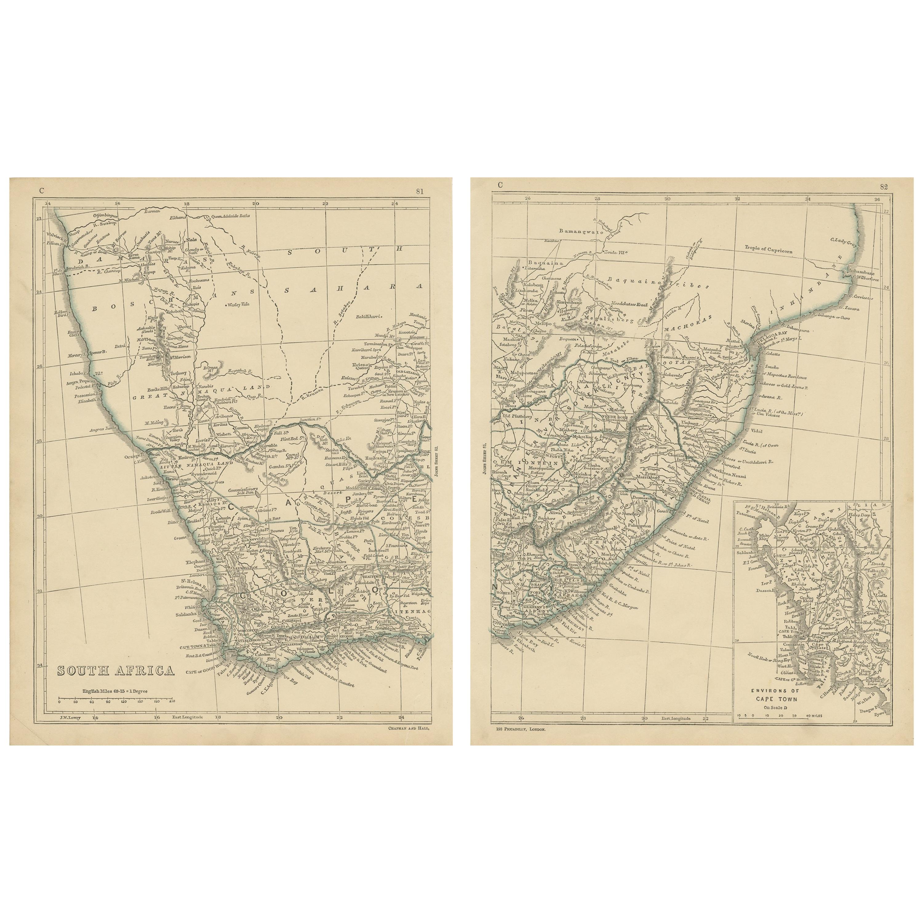
Antique Map of New Zealand by Lowry '1852'
View Similar Items


Want more images or videos?
Request additional images or videos from the seller
1 of 5
Antique Map of New Zealand by Lowry '1852'
About the Item
- Dimensions:Height: 12.21 in (31 cm)Width: 9.65 in (24.5 cm)Depth: 0.02 in (0.5 mm)
- Materials and Techniques:
- Period:
- Date of Manufacture:1852
- Condition:General age-related toning, blank verso. Minor wear, please study image carefully.
- Seller Location:Langweer, NL
- Reference Number:Seller: BG-12593-241stDibs: LU3054321549082
About the Seller
5.0
Platinum Seller
These expertly vetted sellers are 1stDibs' most experienced sellers and are rated highest by our customers.
Established in 2009
1stDibs seller since 2017
1,932 sales on 1stDibs
More From This SellerView All
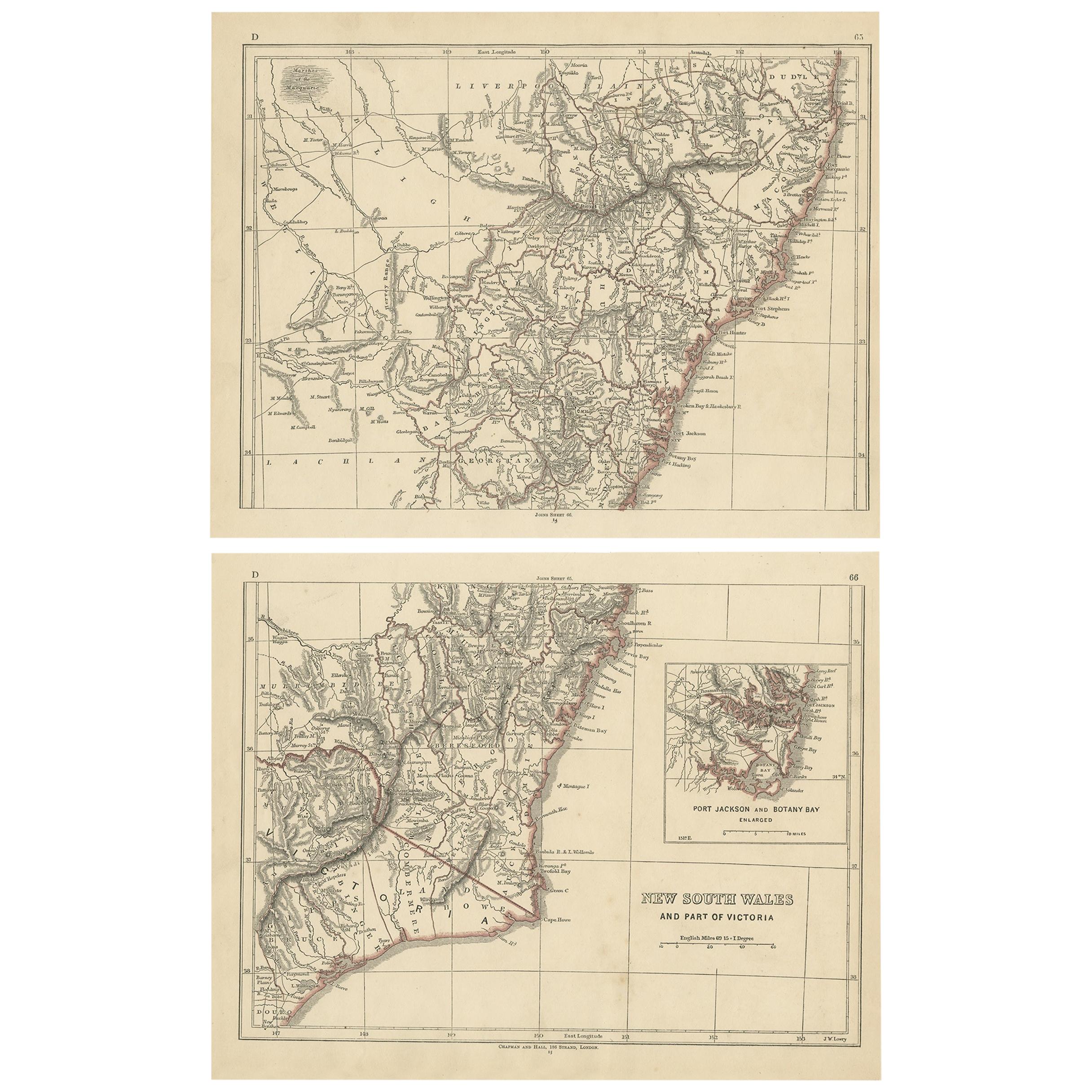
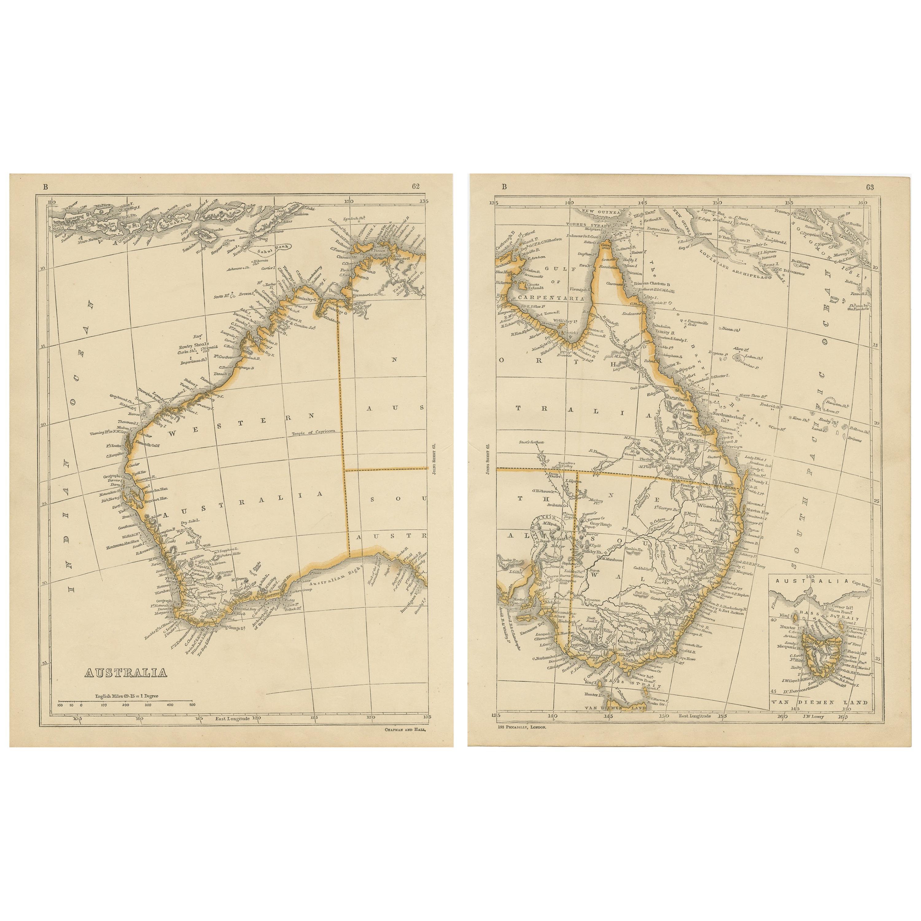
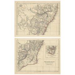
- Antique Map of New South Wales by Lowry, 1852Located in Langweer, NLAntique map titled 'New South Wales and part of Victoria'. Two individual sheets of New South Wales and part of Victoria. This map originates from 'Low...Category
Antique Mid-19th Century Maps
MaterialsPaper
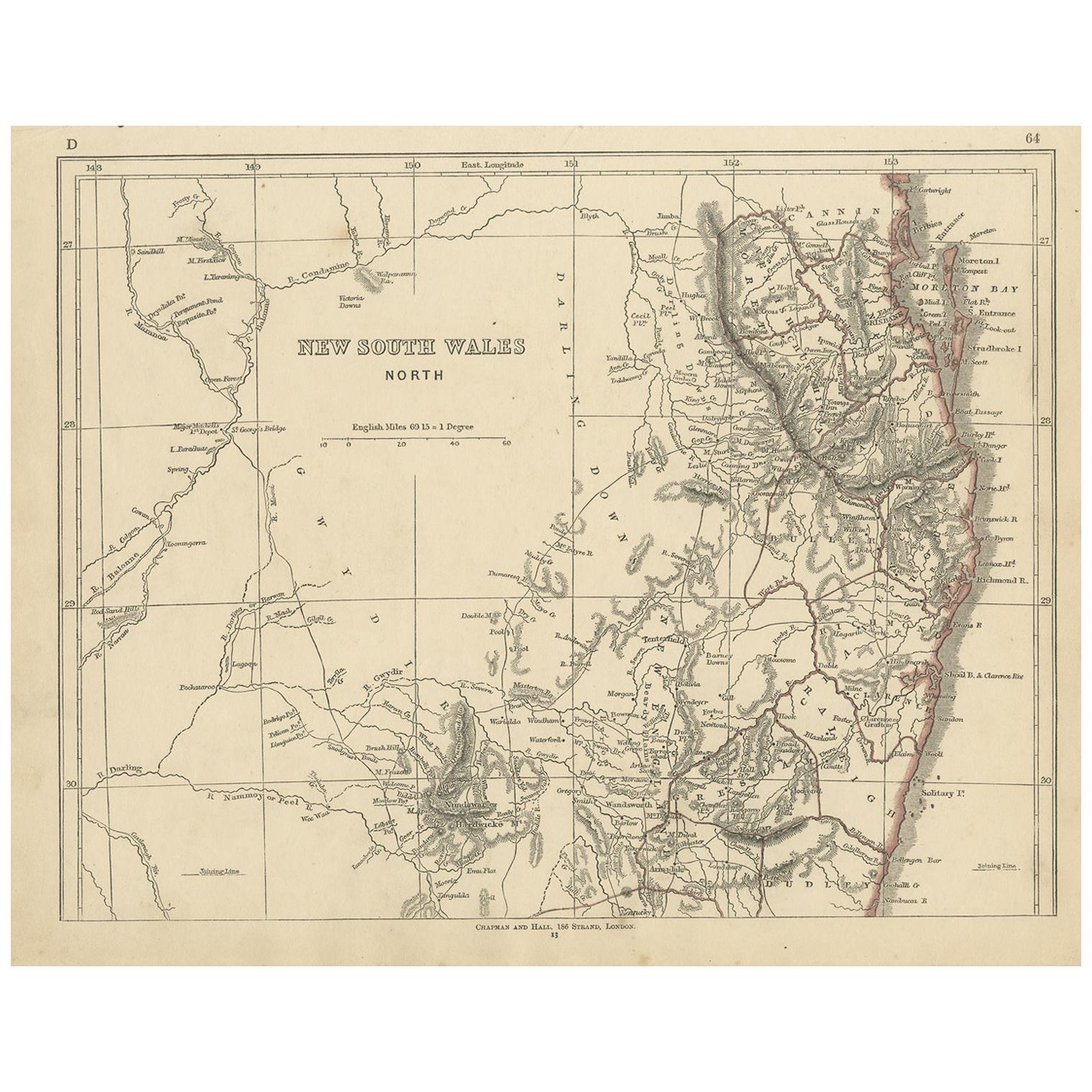
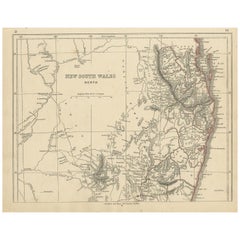
- Antique Map of New South Wales by Lowry, '1852'Located in Langweer, NLAntique map titled 'New South Wales north'. Original map of New South Wales, Australia. This map originates from 'Lowry's Table Atlas constructed and e...Category
Antique Mid-19th Century Maps
MaterialsPaper
- Antique Map of Australasia by Lowry, 1852Located in Langweer, NLAntique map titled 'Australasia'. Original map of Australasia. This map originates from 'Lowry's Table Atlas constructed and engraved from the most recent Authorities' by J.W. Lowry....Category
Antique Mid-19th Century Maps
MaterialsPaper
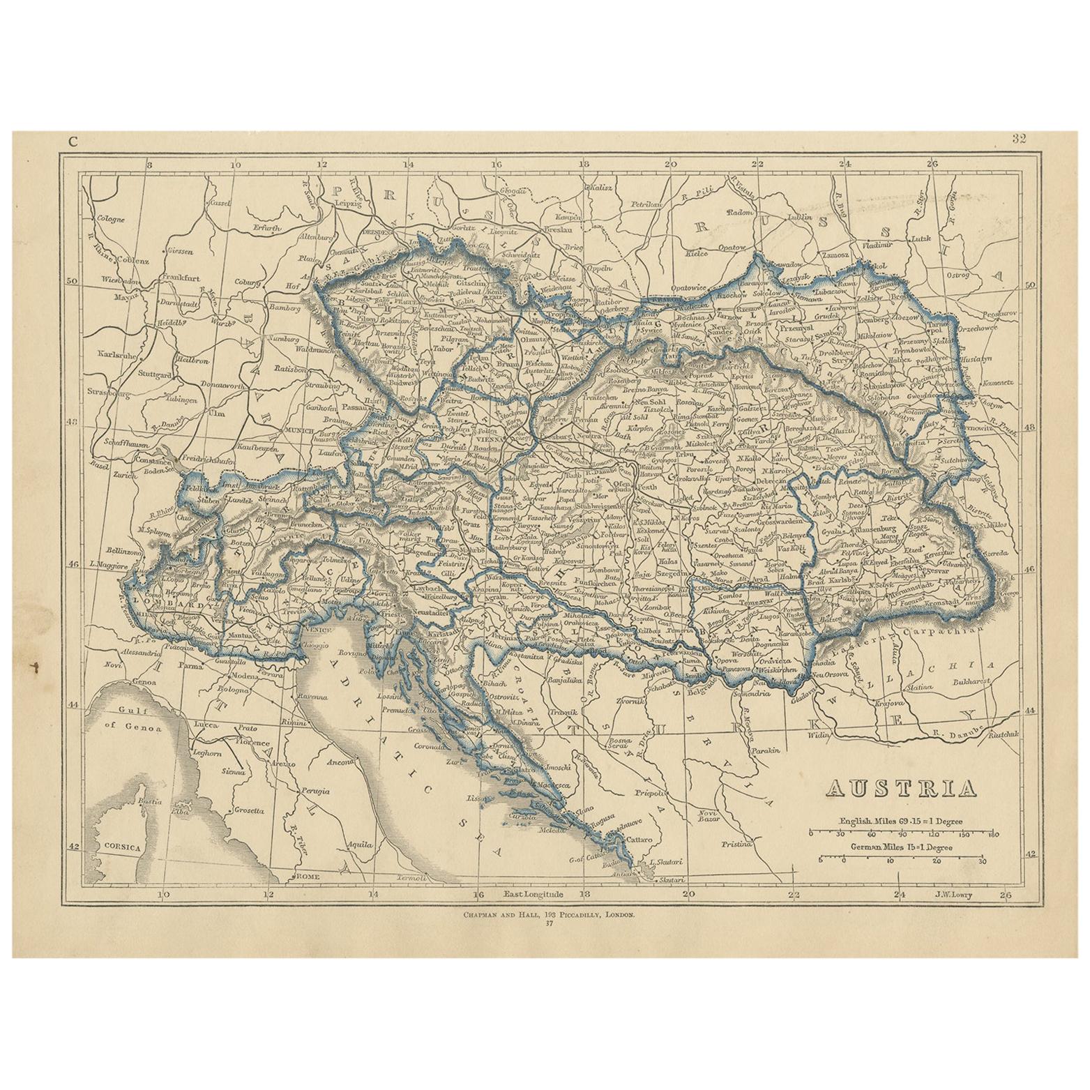
- Antique Map of Europe by Lowry, 1852Located in Langweer, NLAntique map titled 'Europe'. Original map of Europe. This map originates from 'Lowry's Table Atlas constructed and engraved from the most recent authorities' by J.W. Lowry. Published...Category
Antique Mid-19th Century Maps
MaterialsPaper
- Antique Map of Denmark by Lowry, 1852Located in Langweer, NLAntique map titled 'Denmark'. Original map of Denmark. This map originates from 'Lowry's Table Atlas constructed and engraved from the most recent Authorities' by J.W. Lowry. Publish...Category
Antique Mid-19th Century Maps
MaterialsPaper
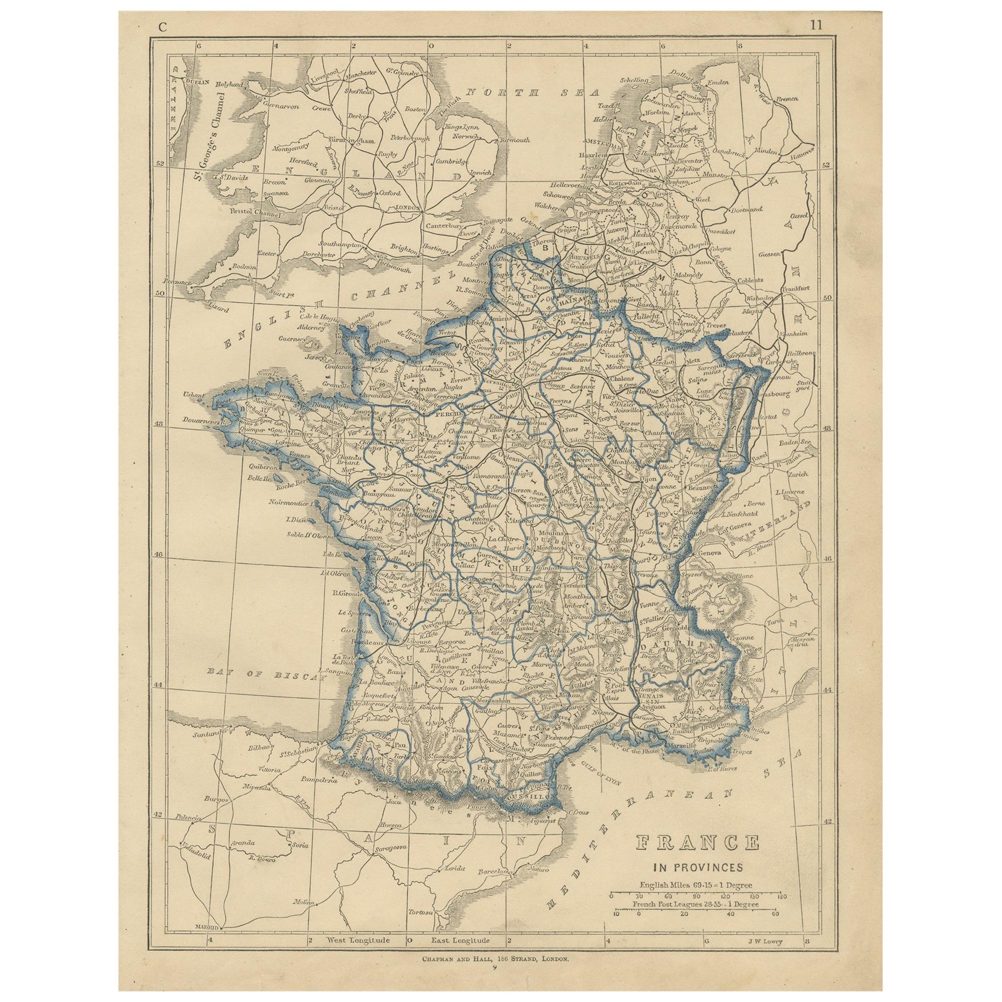
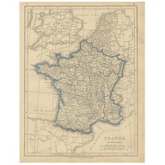
- Antique Map of France by Lowry, '1852'Located in Langweer, NLAntique map titled 'France in Provinces'. Original map of France. This map originates from 'Lowry's Table Atlas constructed and engraved from the most recent Authorities' by J.W. Low...Category
Antique Mid-19th Century Maps
MaterialsPaper


You May Also Like
- Antique Map of Italy by Andriveau-Goujon, 1843By Andriveau-GoujonLocated in New York, NYAntique Map of Italy by Andriveau-Goujon, 1843. Map of Italy in two parts by Andriveau-Goujon for the Library of Prince Carini at Palazzo Carini i...Category
Antique 1840s French Maps
MaterialsLinen, Paper
 $3,350 / set
 - Antique Map of Principality of MonacoBy Antonio Vallardi EditoreLocated in Alessandria, PiemonteST/619 - "Old Geographical Atlas of Italy - Topographic map of ex-Principality of Monaco" - ediz Vallardi - Milano - A somewhat special edition ---Category
Antique Late 19th Century Italian Other Prints
MaterialsPaper
 $228 Sale Price74% Off
 - Antique 1901 National Publishing Company's Road Map of New Jersey GeologicalLocated in Dayton, OHThe National Publishing Company's road map of New Jersey, showing all county and township divisions, cities villages and post-offices, railroads, ste...Category
Antique Early 1900s Victorian Prints
MaterialsPaper
- Original Antique Map of Russia By Arrowsmith. 1820Located in St Annes, LancashireGreat map of Russia Drawn under the direction of Arrowsmith Copper-plate engraving Published by Longman, Hurst, Rees, Orme and Brown, 1820 Unframed.Category
Antique 1820s English Maps
MaterialsPaper

- Original Antique Map of Belgium by Tallis, Circa 1850Located in St Annes, LancashireGreat map of Belgium Steel engraving Many lovely vignettes Published by London Printing & Publishing Co. ( Formerly Tallis ), C.1850 Origin...Category
Antique 1850s English Maps
MaterialsPaper
- Original Antique Map of China by Thomas Clerk, 1817Located in St Annes, LancashireGreat map of China Copper-plate engraving Drawn and engraved by Thomas Clerk, Edinburgh. Published by Mackenzie And Dent, 1817 Unframed.Category
Antique 1810s English Maps
MaterialsPaper


